Siem Reap, Cambodia
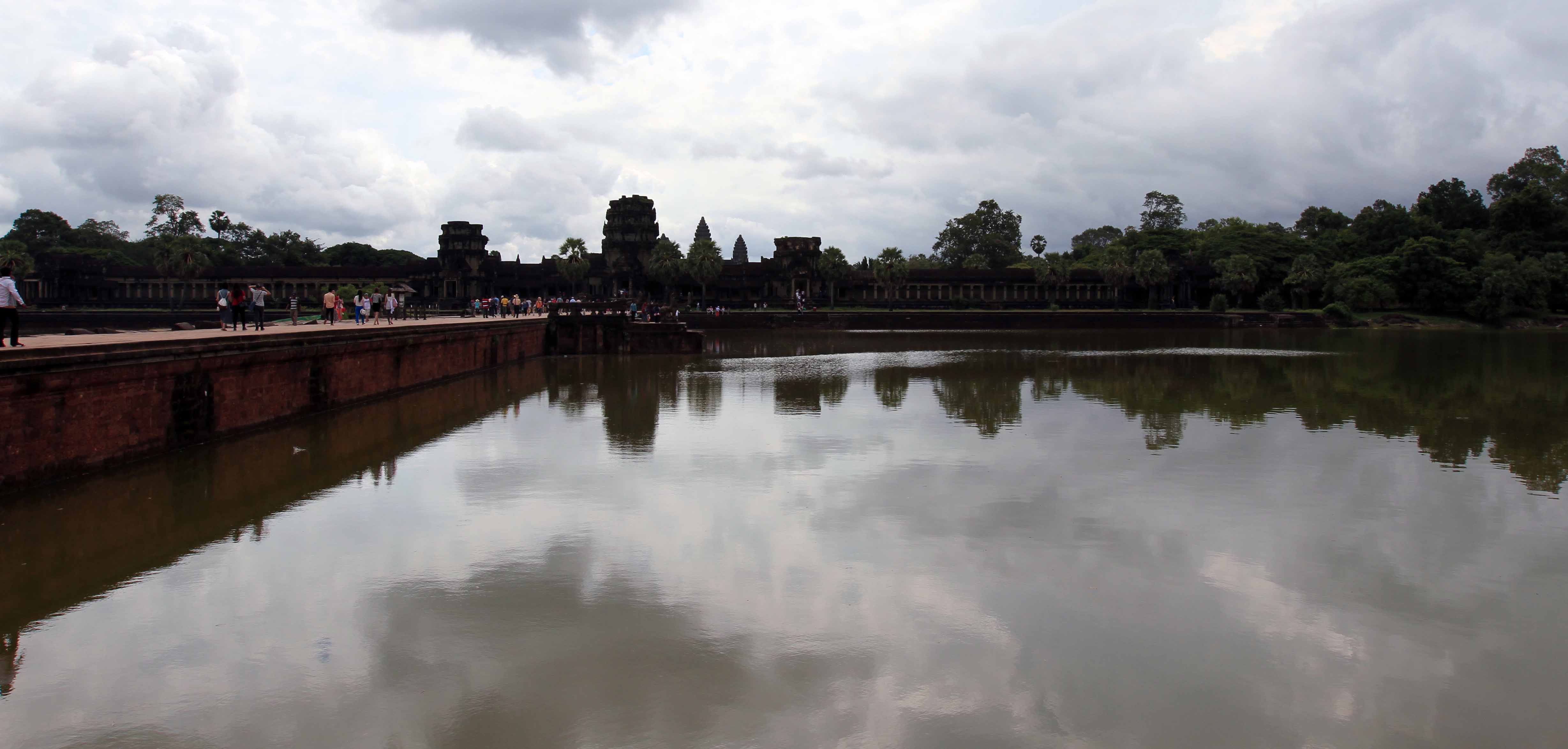
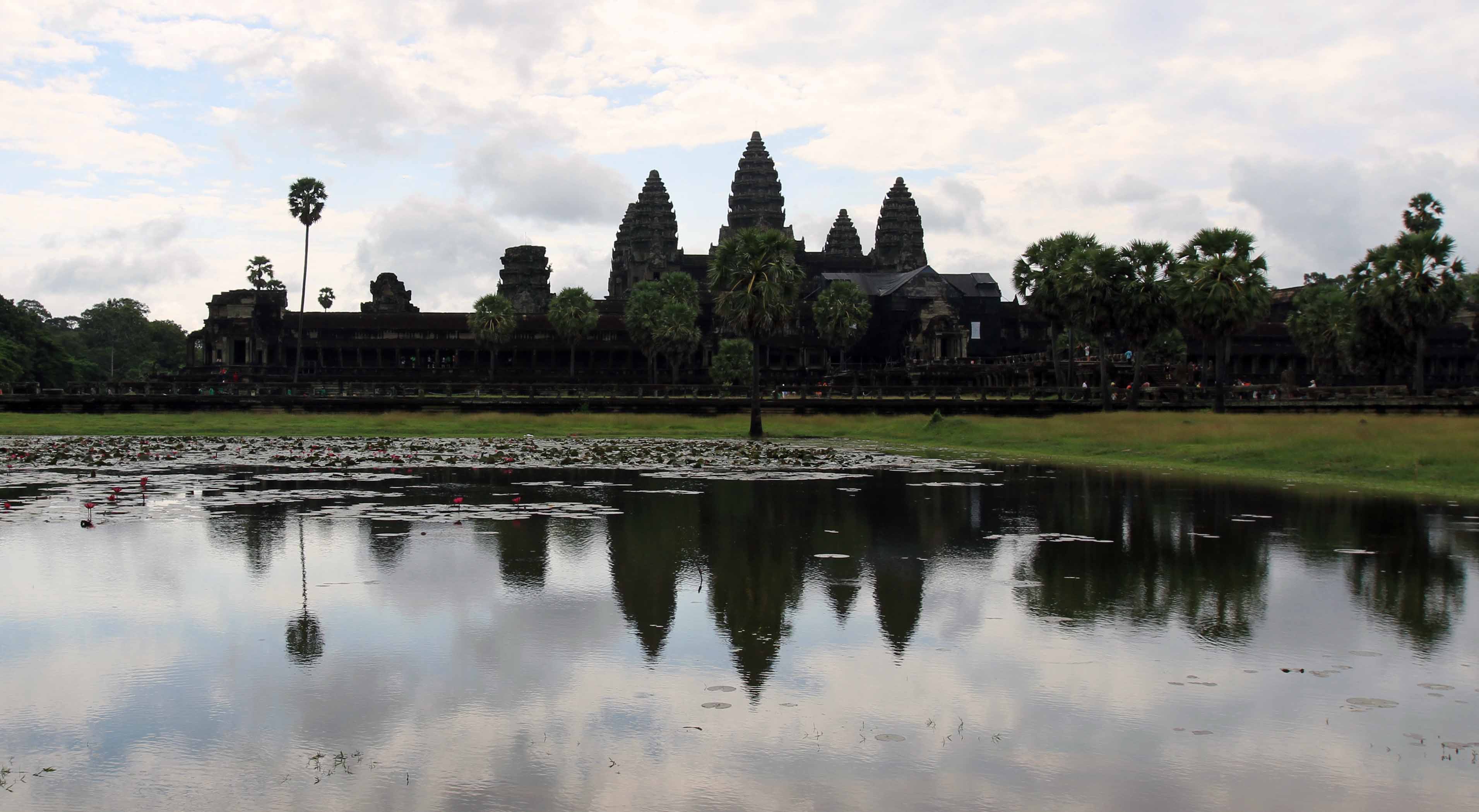
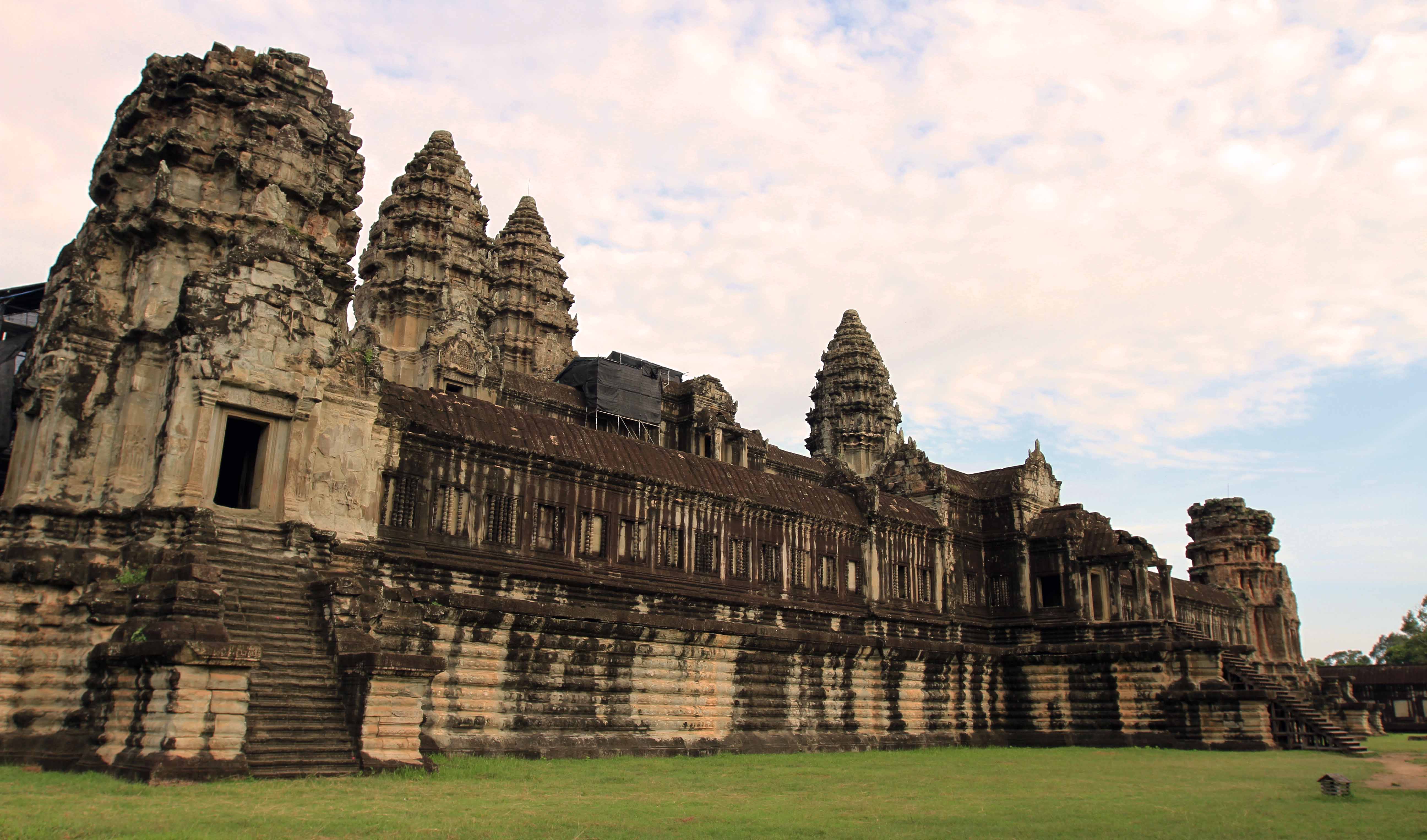
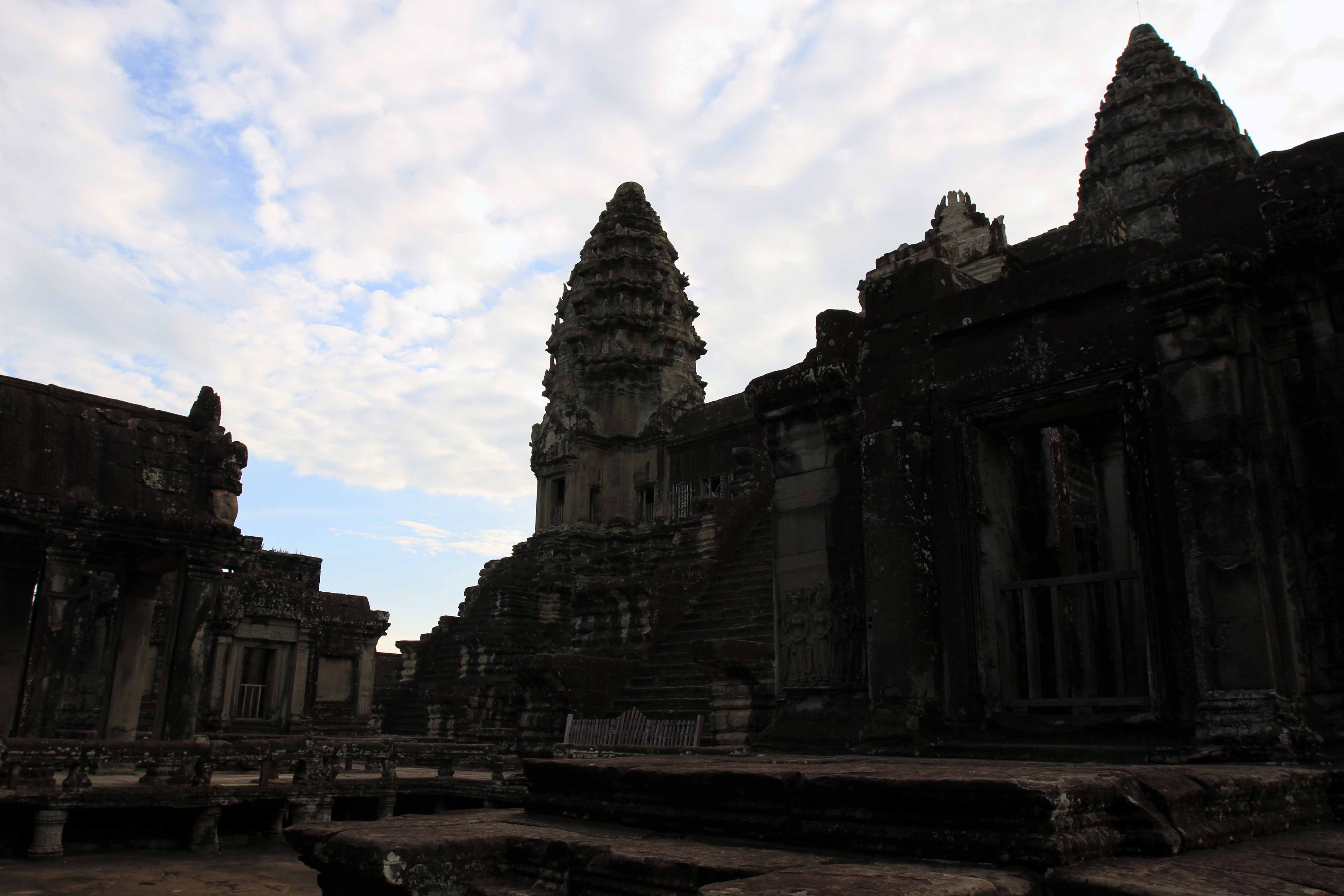
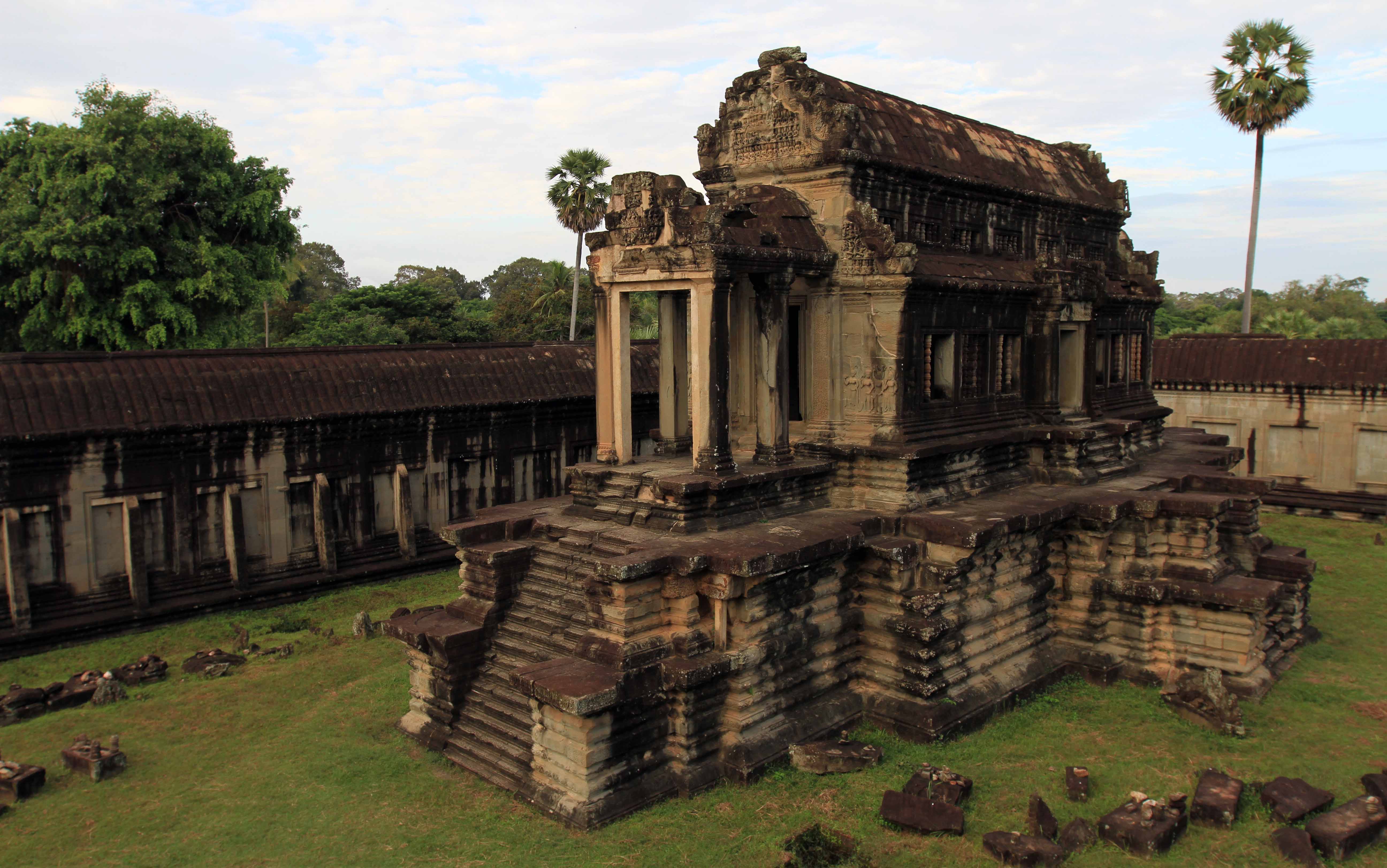
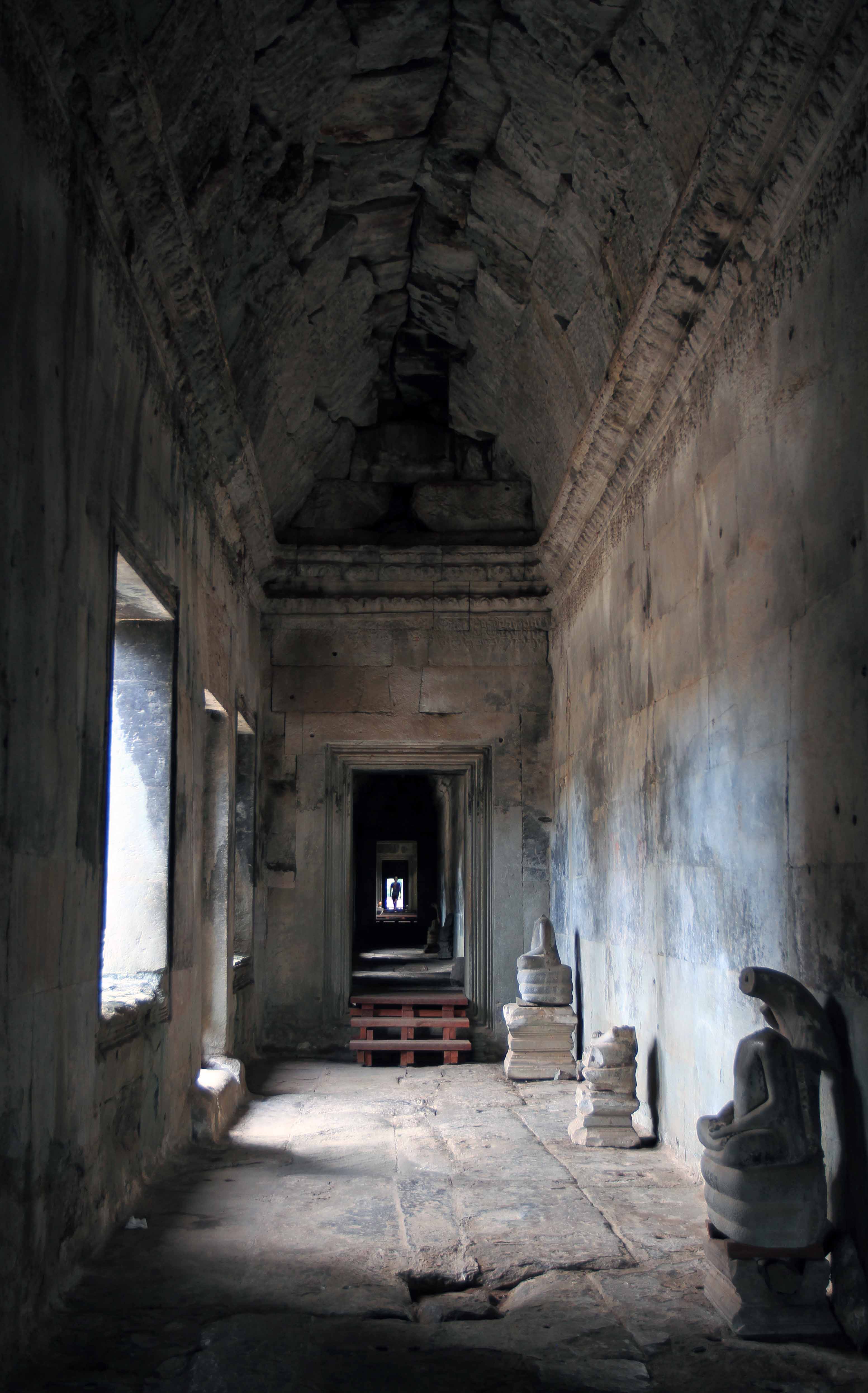
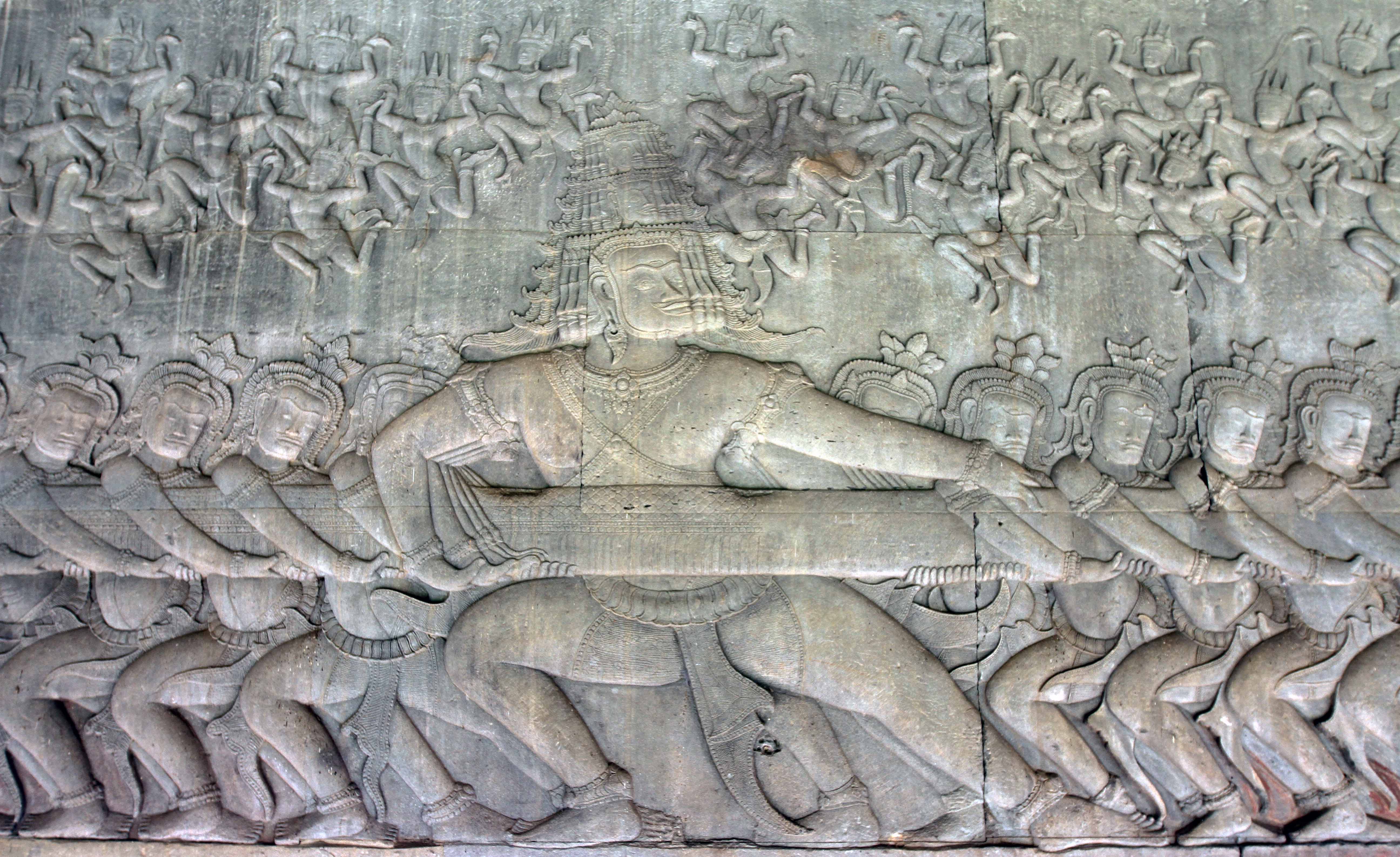
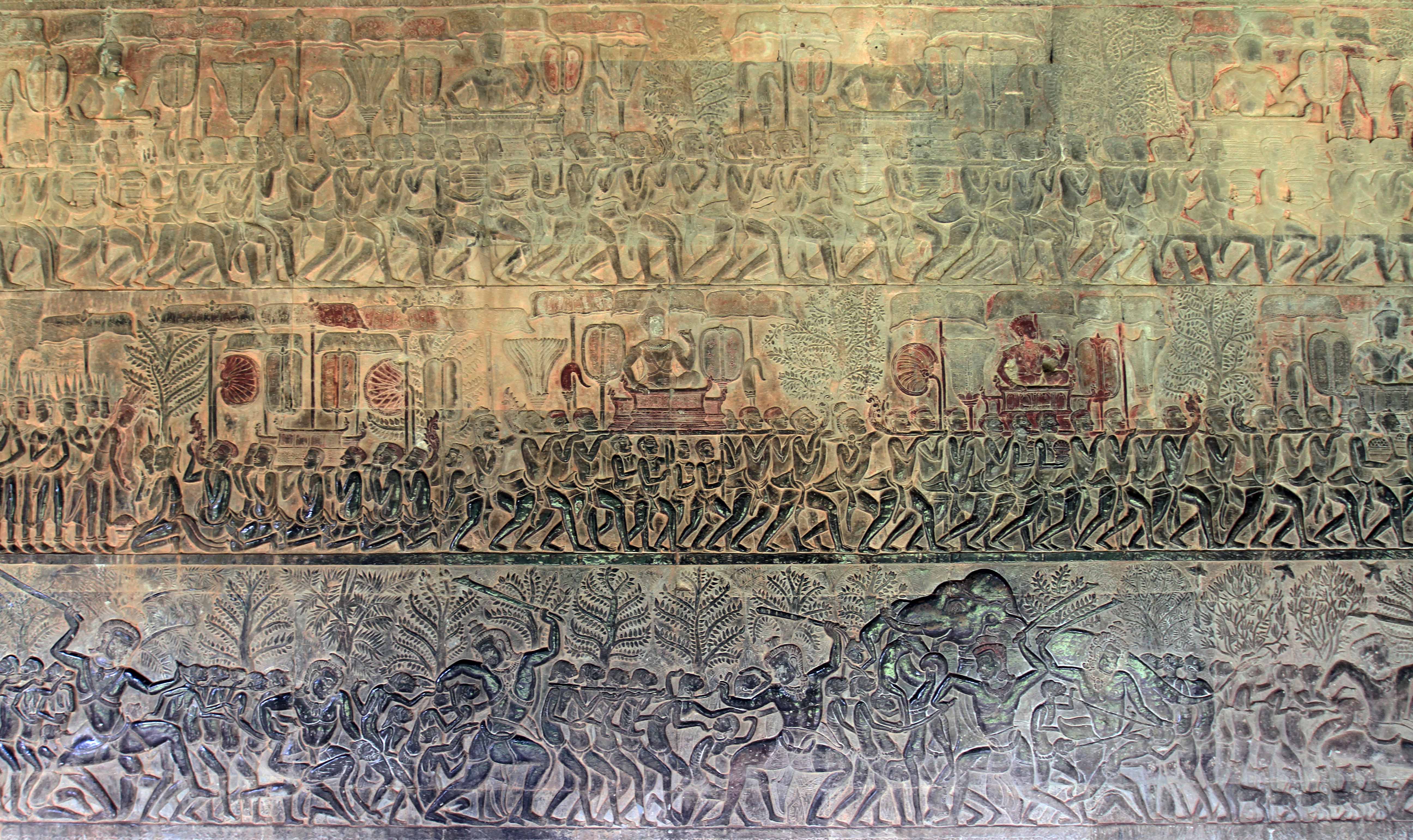
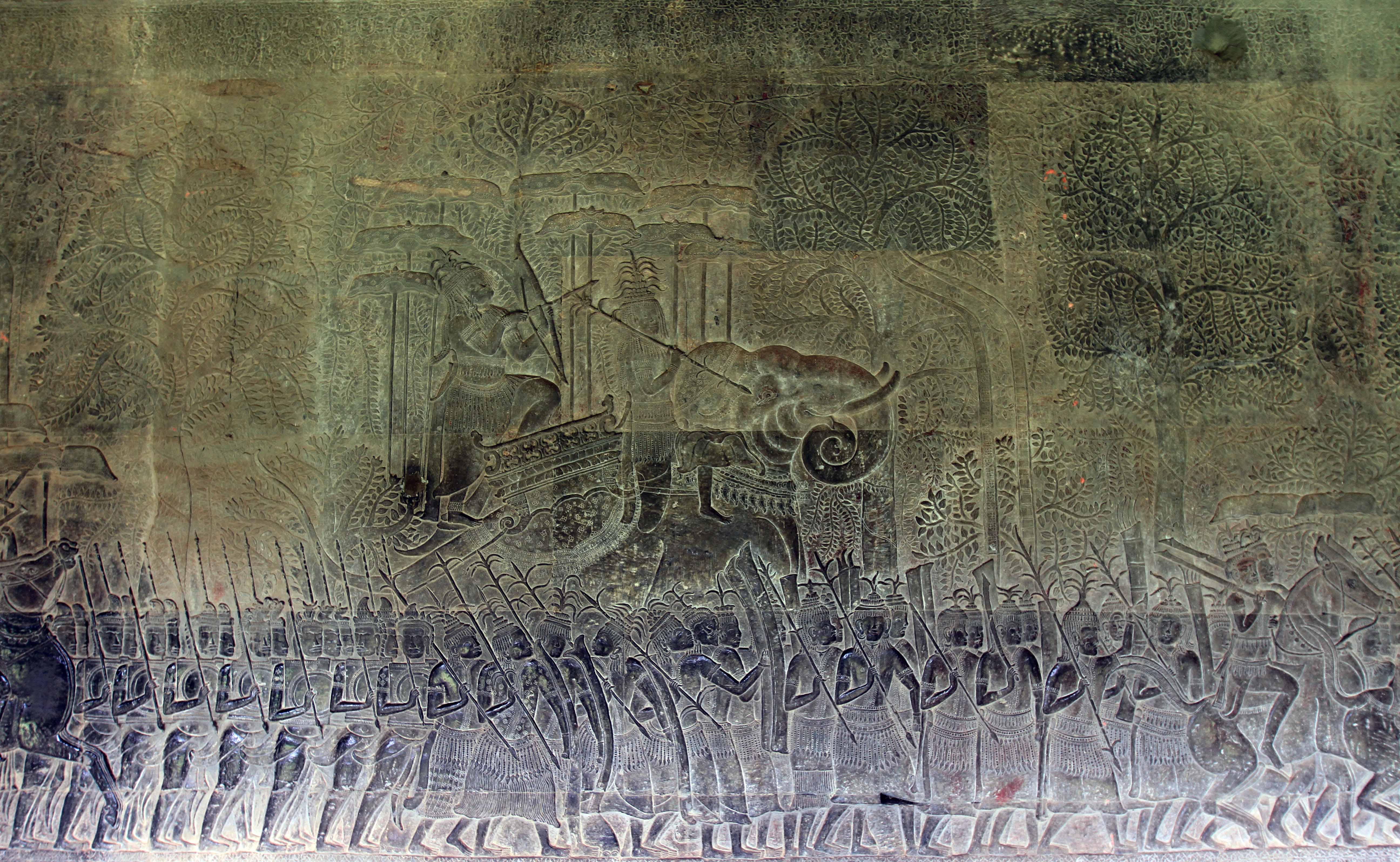
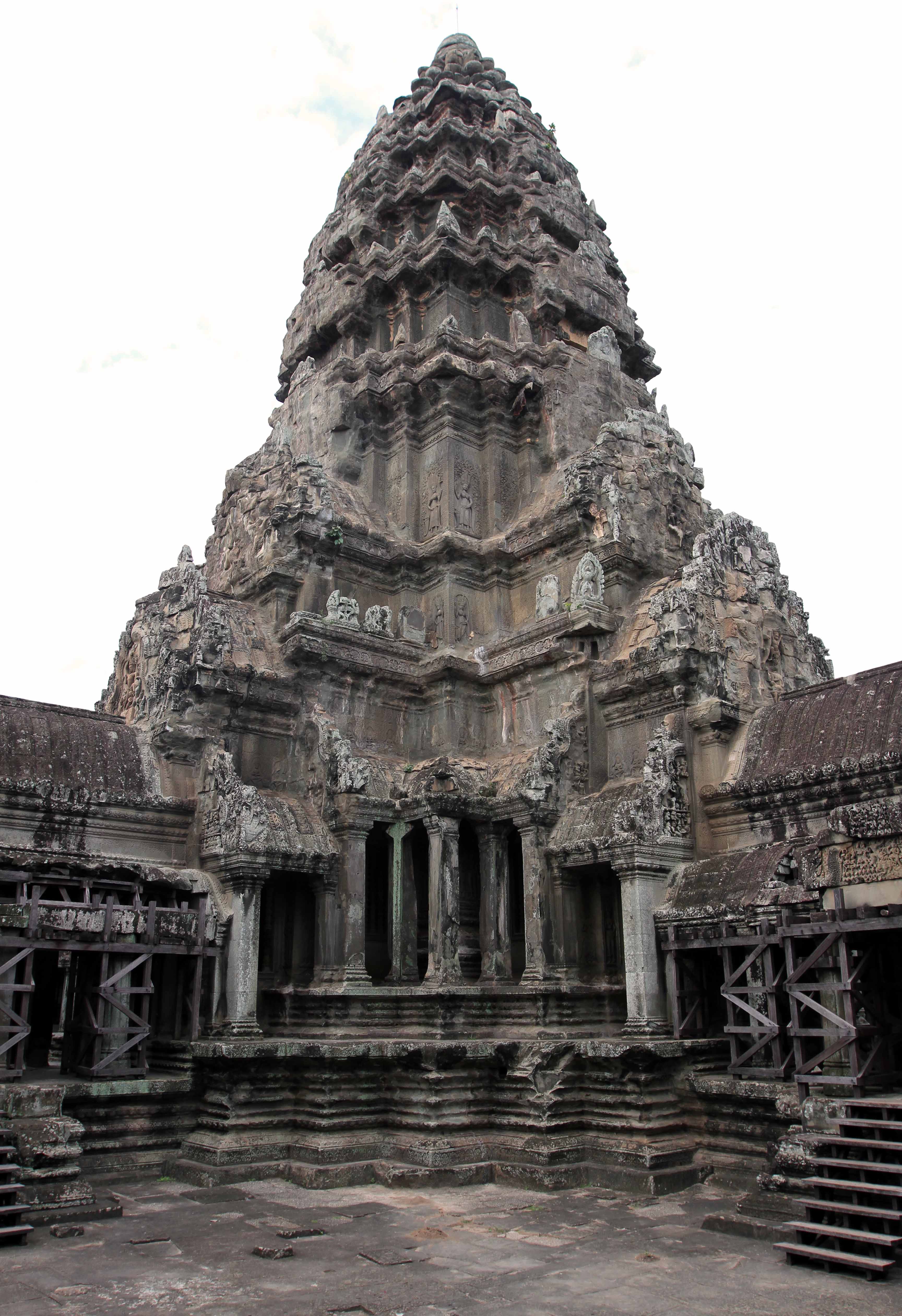
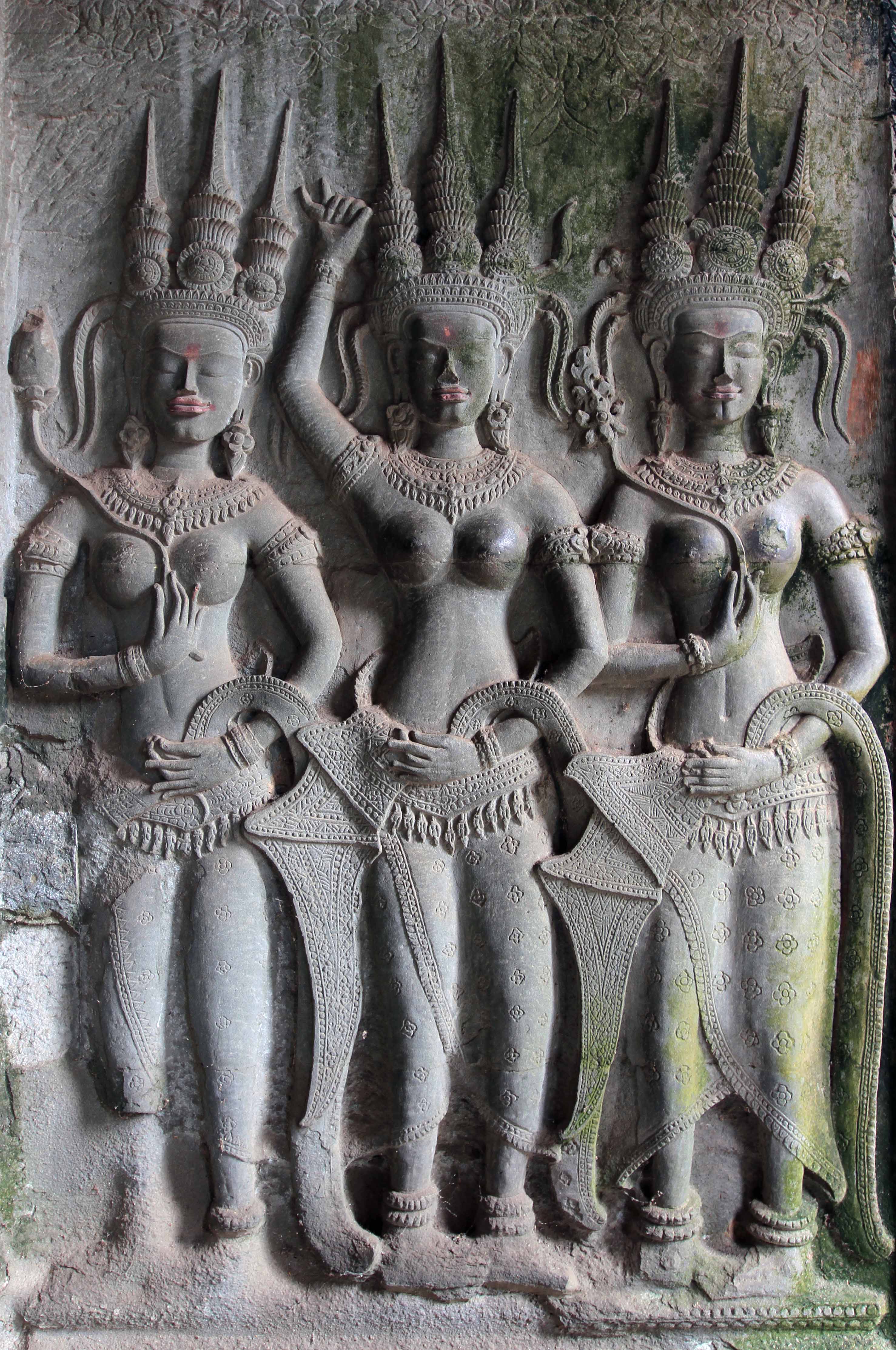
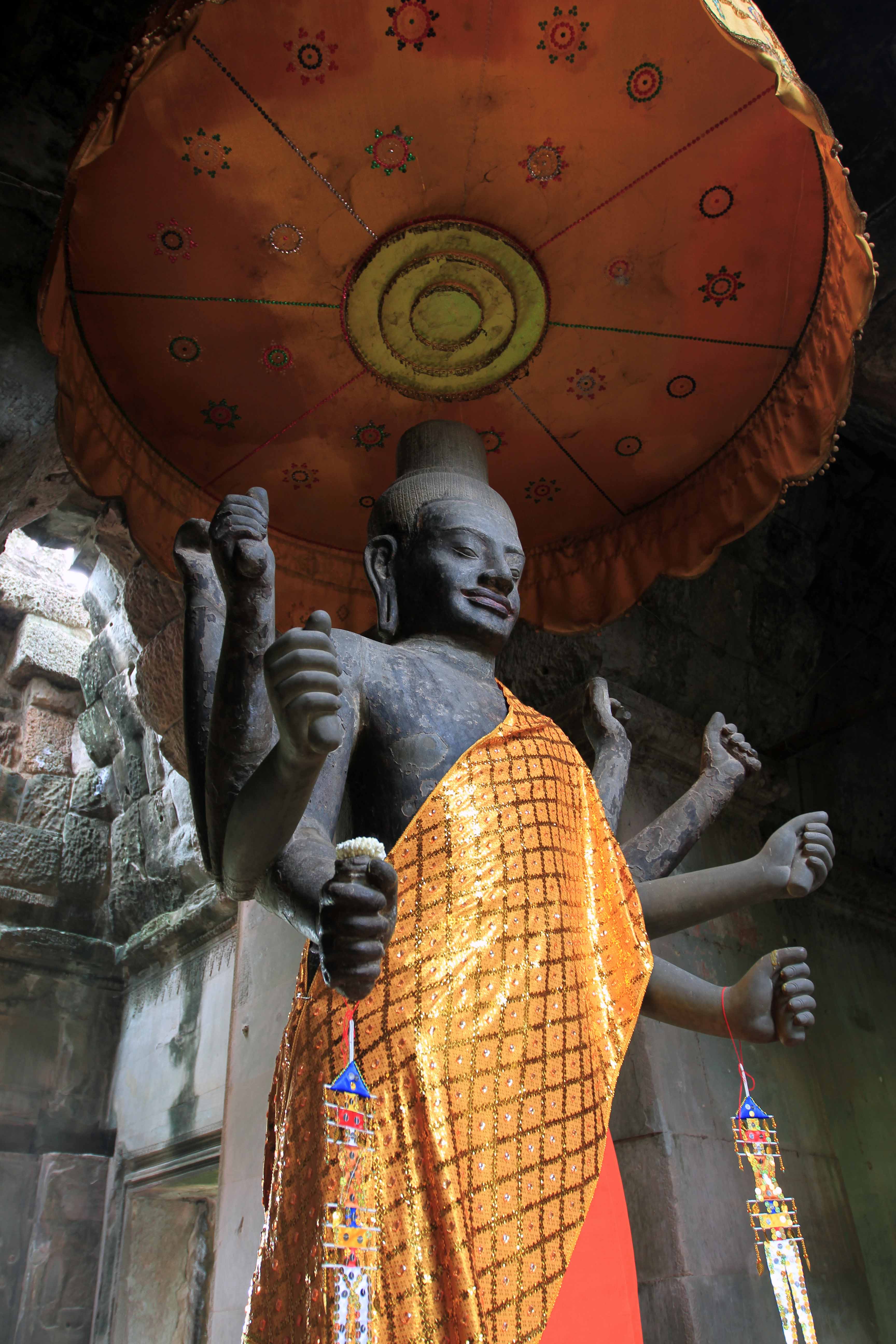
I ended up sleeping in an hour later than I wanted to, waking up at about 05:30. I quickly got ready and grabbed my gear before leaving my room and hitting the road on the bicycle I had rented the night before. I enjoyed riding on the streets early in the morning before most of the traffic was awake – the streets were not so clustered and dangerous. I rode north to Angkor, stopping at the park entrance to pay for my ticket (it cost twenty USD for a one-day pass and the ticket actually had my photo printed on it); I then continued my ride north to Angkor Wat (5.5 kilometers north of Siem Reap). I reached the southern part of the giant moat which surrounds Angkor Wat and then I cycled to the west end where the entrance is located (most temples in Angkor are oriented to the east, but it is believed that Angkor Wat was made to face west since that cardinal direction is associated with Vishnu, the Hindu god this temple was dedicated to). Angkor Wat (which means “Temple City”) was built in the twelfth century by the Khmer King Suryavarman II and there are three galleries (each raised above the previous gallery) surrounding the center temple complex, which was designed to look like Mount Meru (the center of the universe and home of the gods) with the five towers of the temple representing the five peaks of Mount Meru. In the thirteenth century, the temple gradually changed religions, moving from Hinduism to Theravada Buddhism. Upon reaching the temple (at 06:30), I parked and locked my bicycle, then I walked across the sandstone causeway over the moat leading to Angkor Wat’s entrance, passing by many tourists exiting the temple after having viewed the sunrise (I had planned on being there with them, but went to bed much too late and with too much alcohol in my blood); I then walked through the entrance heading straight to the center of the temple, where the “temple mountain” is located; although I discovered that access up the steps to the center would not open until 08:00 by some criminal that was there telling tourists he would allow them access to the top for only five USD per person and of course no park security were around to stop him . . . bah, who am I kidding, the park security probably takes a slice of the profits made by him. So, since I had until 08:00 to see the “temple mountain” (I wasn’t going to support crime) I ended up walking around the three galleries, looking at all the bas-reliefs on the walls and remains of sculptures left in the temple. Then, after 08:00, I walked back to the “temple mountain” and up the steps to the center and highest point of Angkor Wat. After walking around the top and looking in to each shrine built in to the center tower, I walked back down the steps, finished touring the galleries, and then exited Angkor Wat, but not before taking some photos of the temple from a pond located on its grounds which offered a nice view of the temple and its reflection. I then grabbed the bicycle and continued riding north.
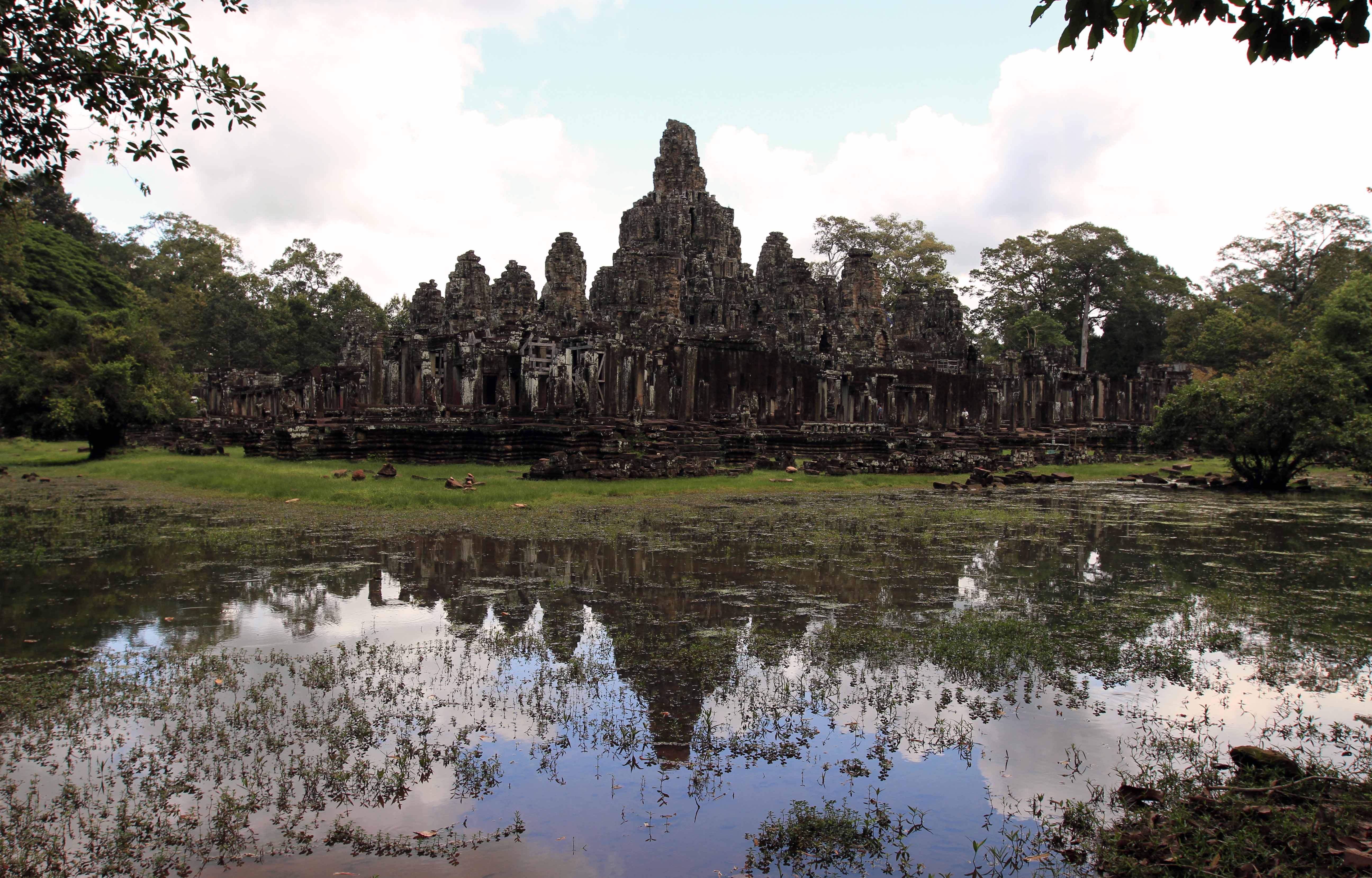
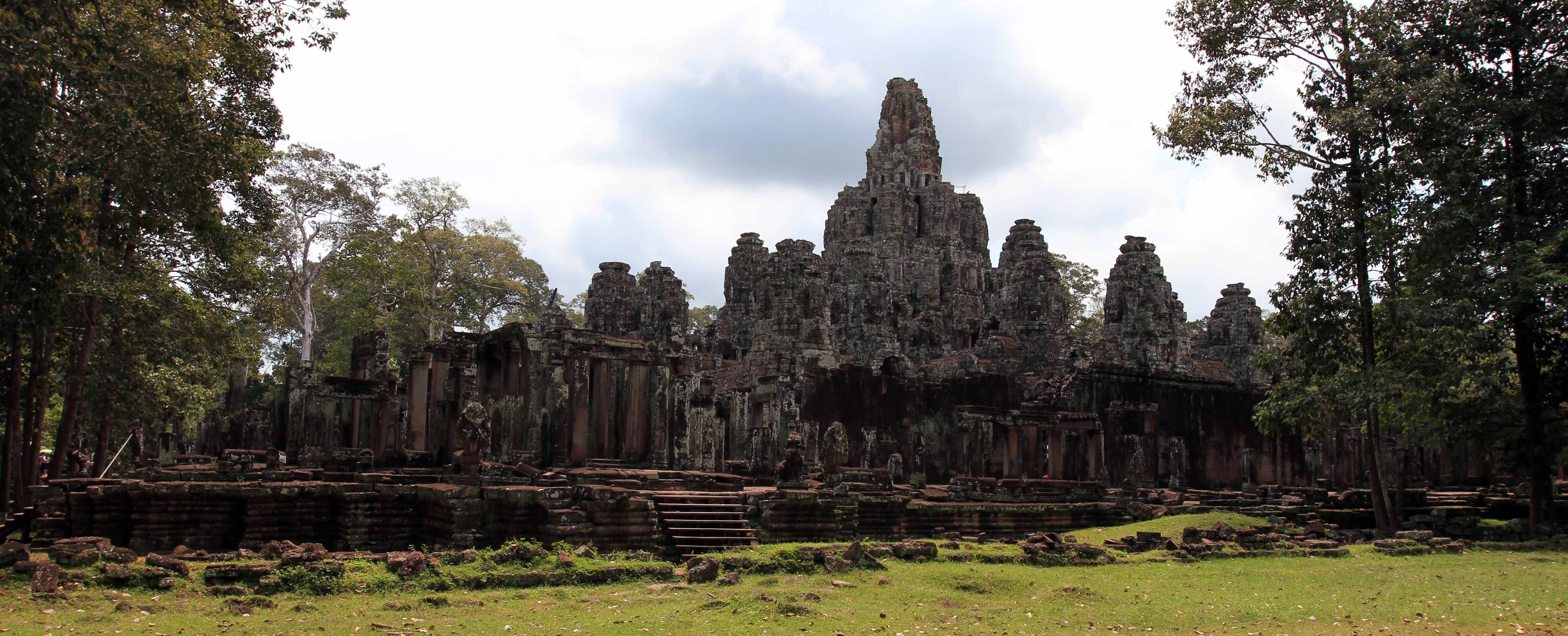
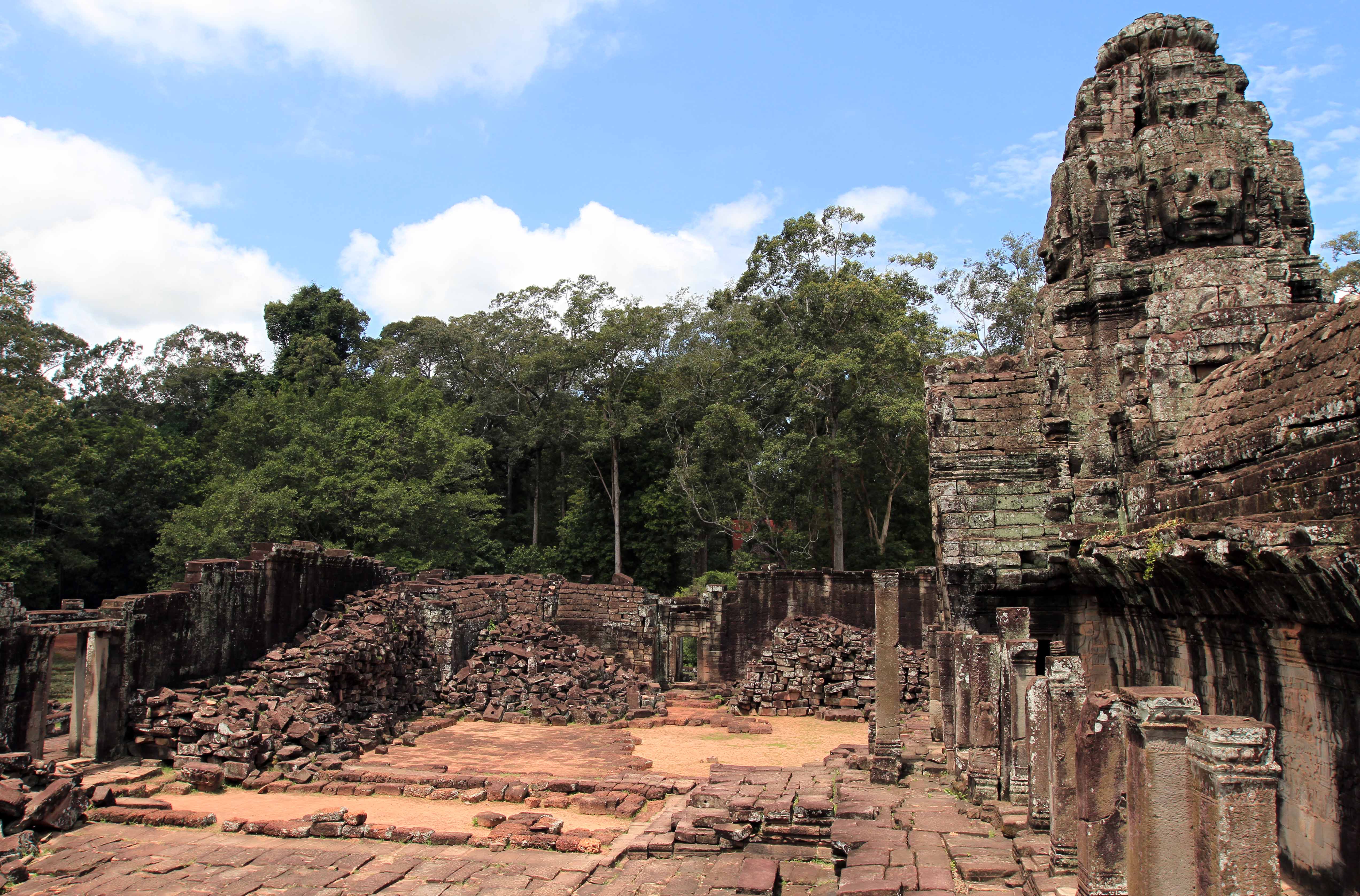
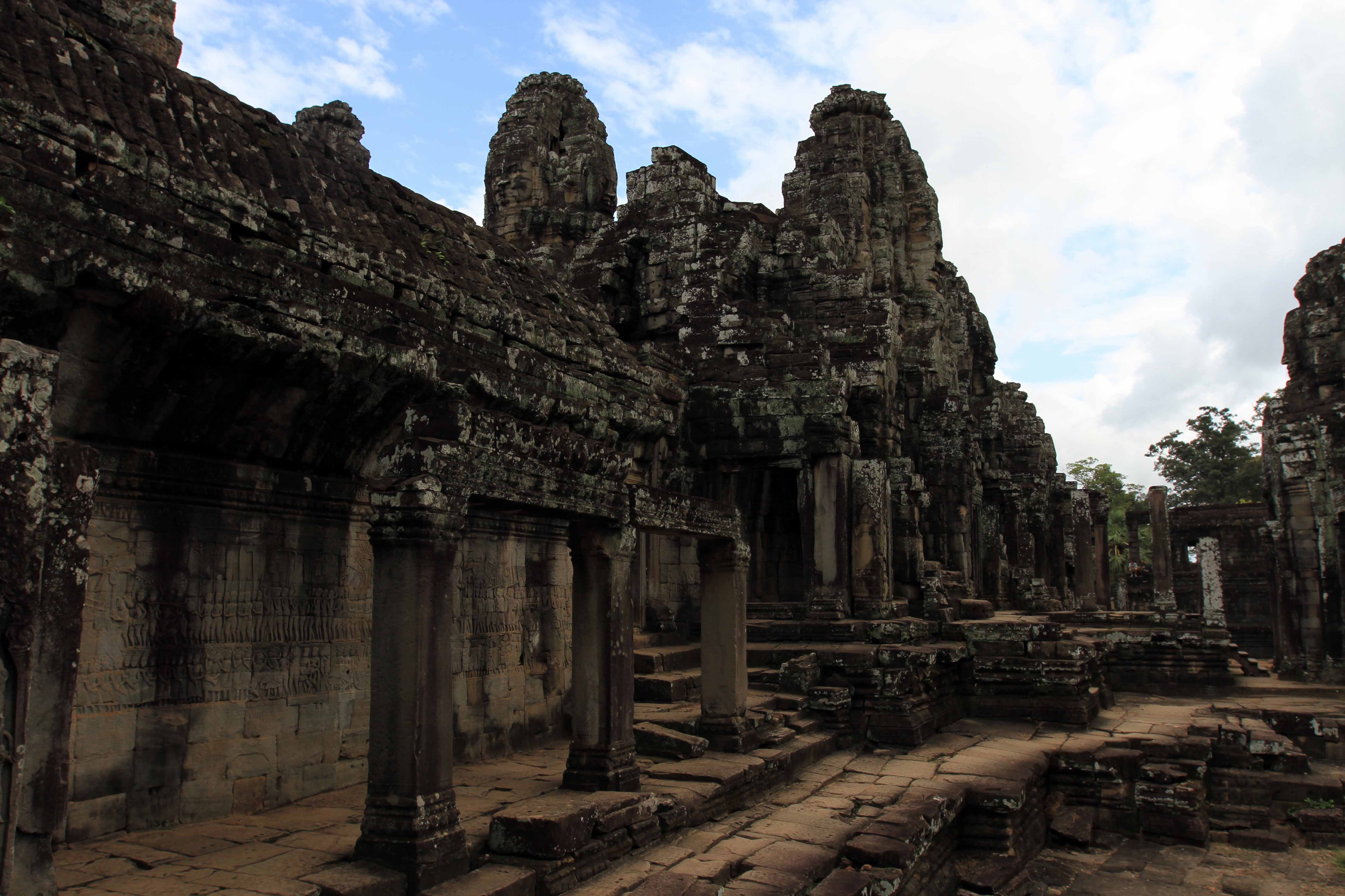
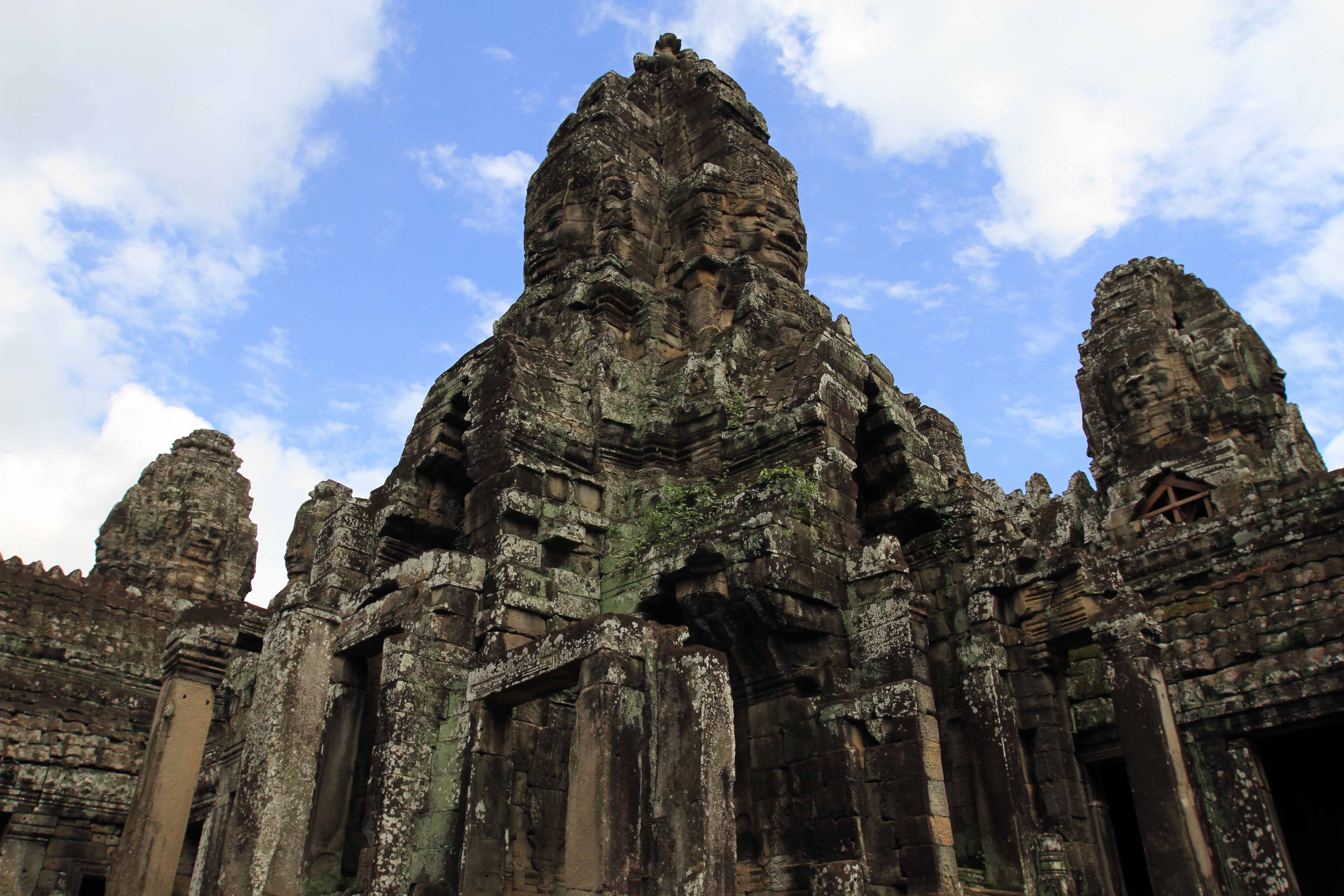
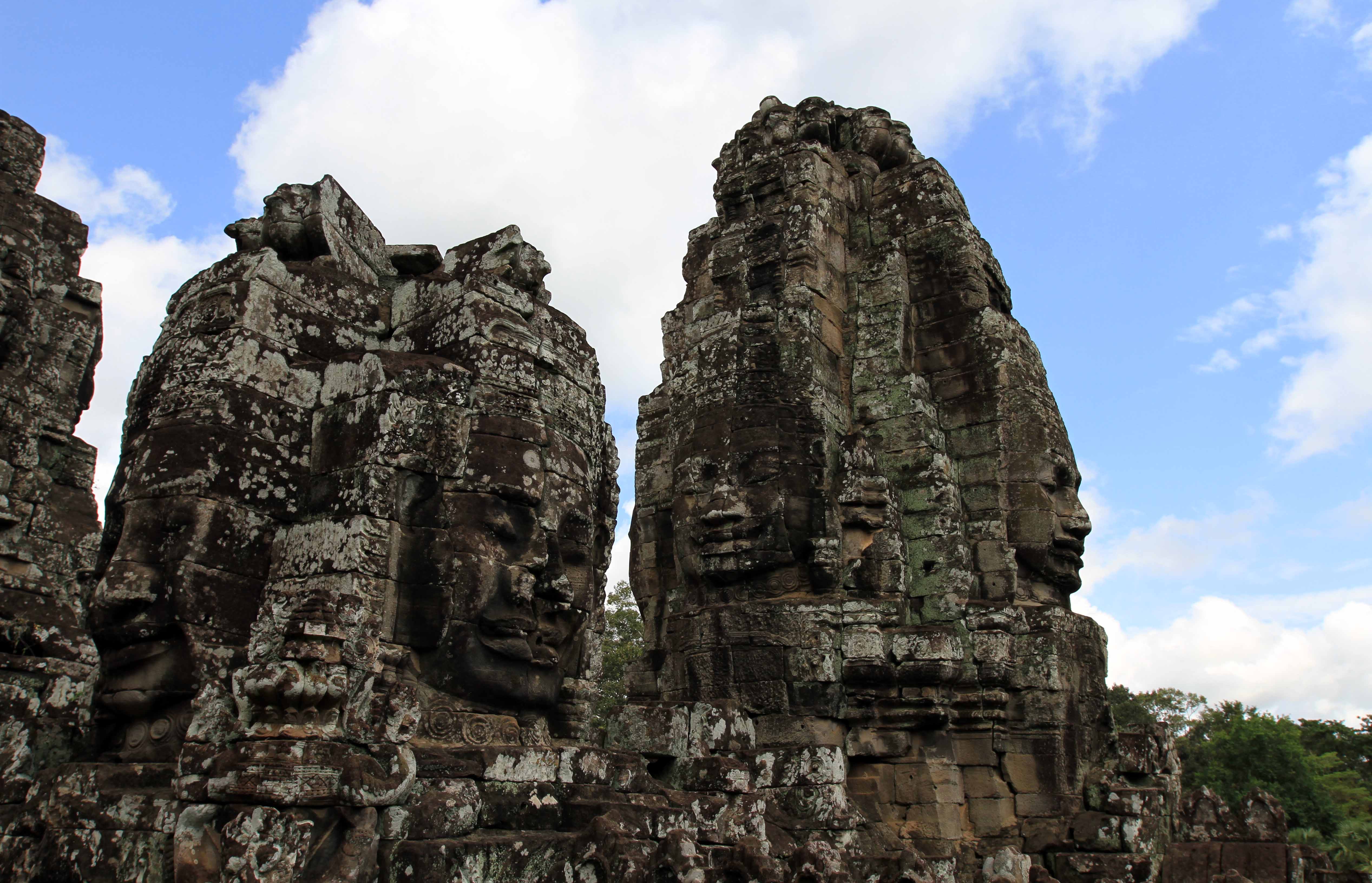

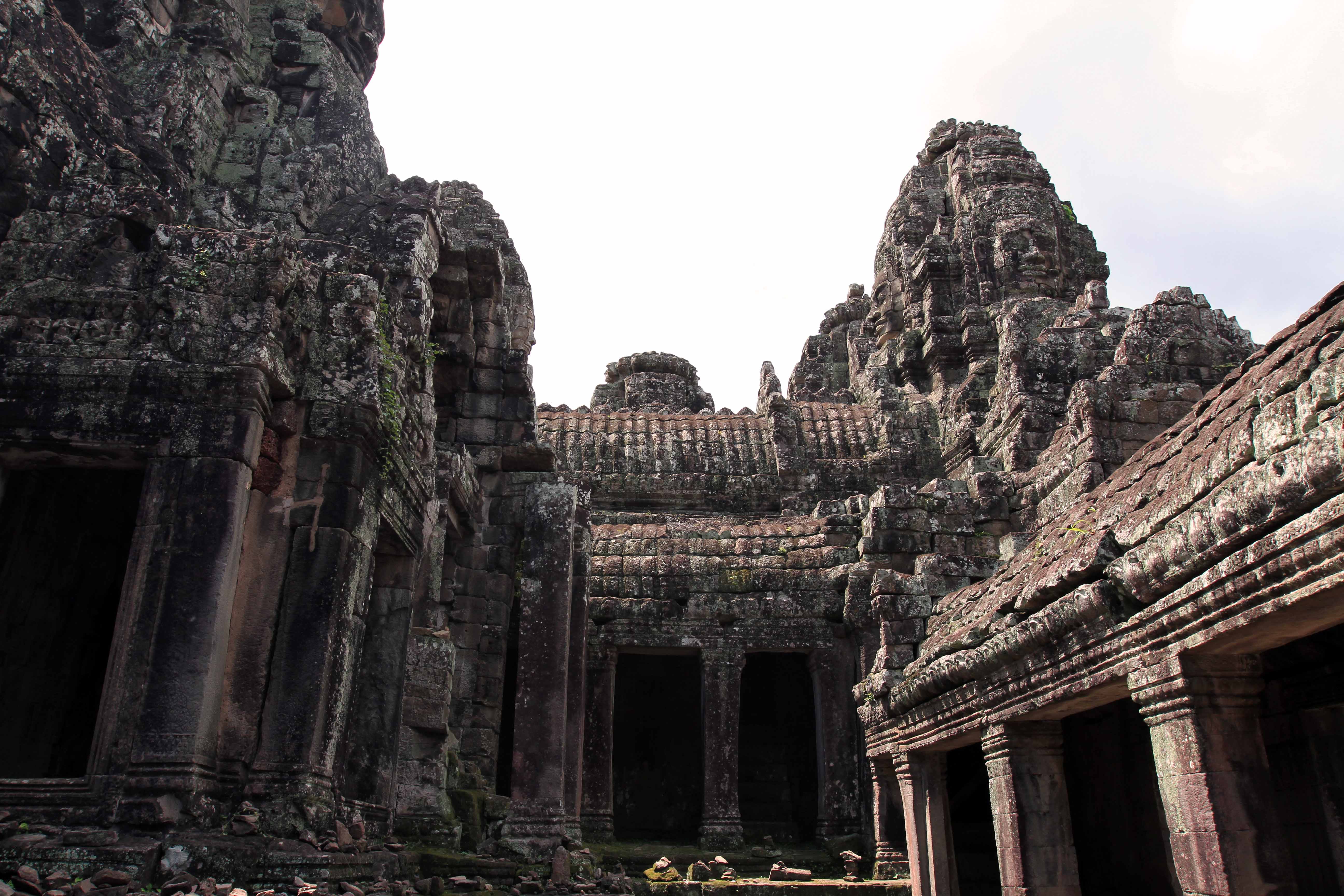
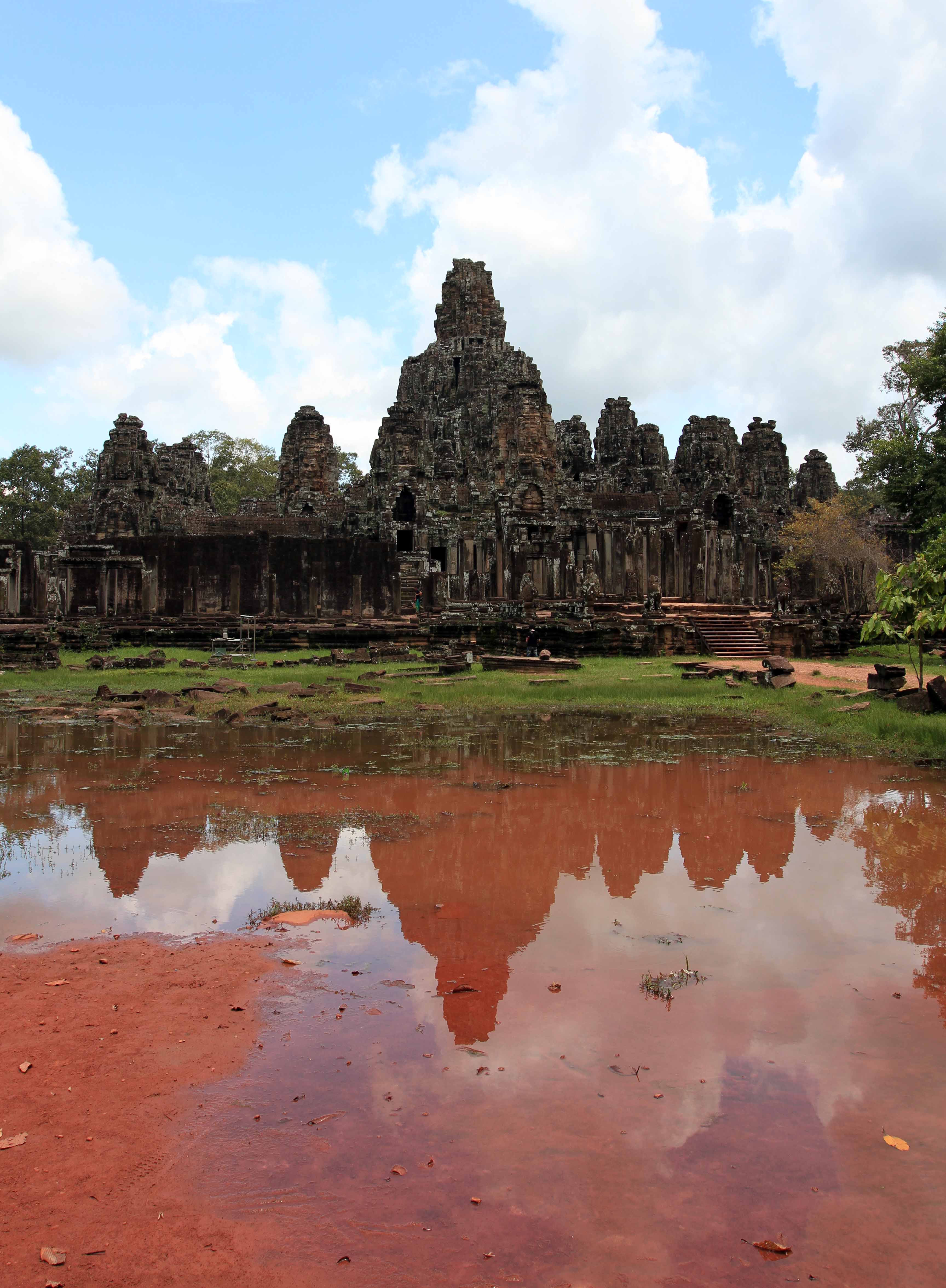
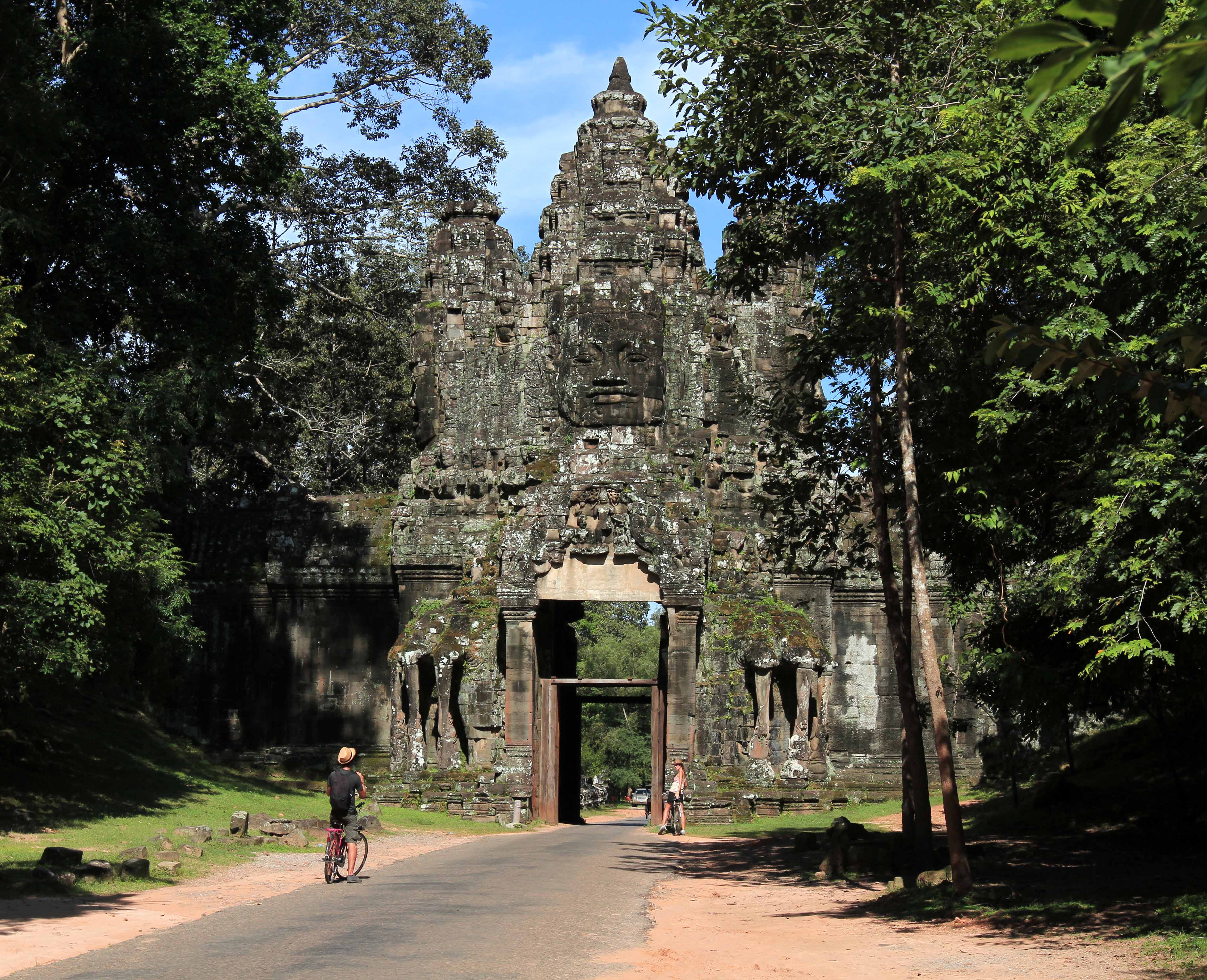
Soon I reached Angkor Thom, located 1.7 kilometers north of Angkor Wat; it too has a moat surrounding it (which I crossed at its southern gate), but the site that the moat surrounds is massive (nine square kilometers) compared to Angkor Wat’s site (0.82 square kilometers). Angkor Thom was built in the twelfth century by King Jayavarman VII and served as the last capital of the Khmer Empire; inside there are a number of monuments, but my first stop was Bayon temple, Jayavarman’s state temple located in the center of Angkor Thom. Bayon is most well known for having many towers with four stone faces on each side of the tower; these stone faces bear a strikingly resemblance to representations of King Jayavarman VII, which has led many scholars to conclude that it is his visage on these towers. I entered the temple on the east side where there was much renovation work being done with a giant crane assisting in the work; on the left there was a two-story stone building with very narrow and steep steps, so I climbed up that first to get some pictures, before coming back down and entering the temple’s inner gallery; I walked all around the complex exploring many different passageways and levels; I walked up to the upper terrace and eventually made my way to central tower. This temple was a lot of fun to explore and it made me feel like a kid again, excited to see where each passageway would lead me; I ended up in one part of the upper terrace that few other tourists seemed to find, so I stayed there for a while capturing as many pictures devoid of other people as I could. After covering just about every part of the temple, I exited and then walked around the outer perimeter of Bayon before heading back to my bicycle and continuing up to the next monument in Angkor Thom.

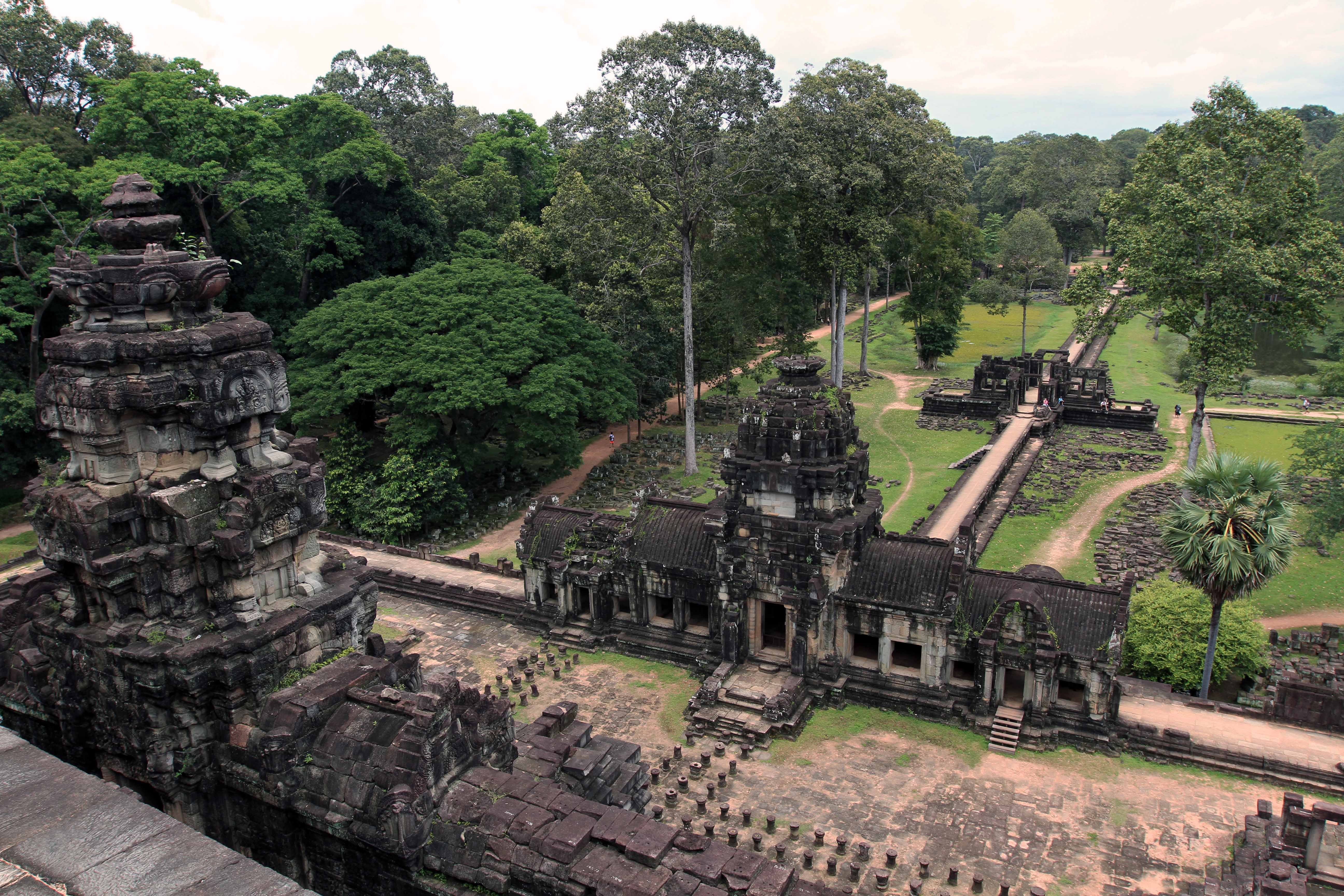
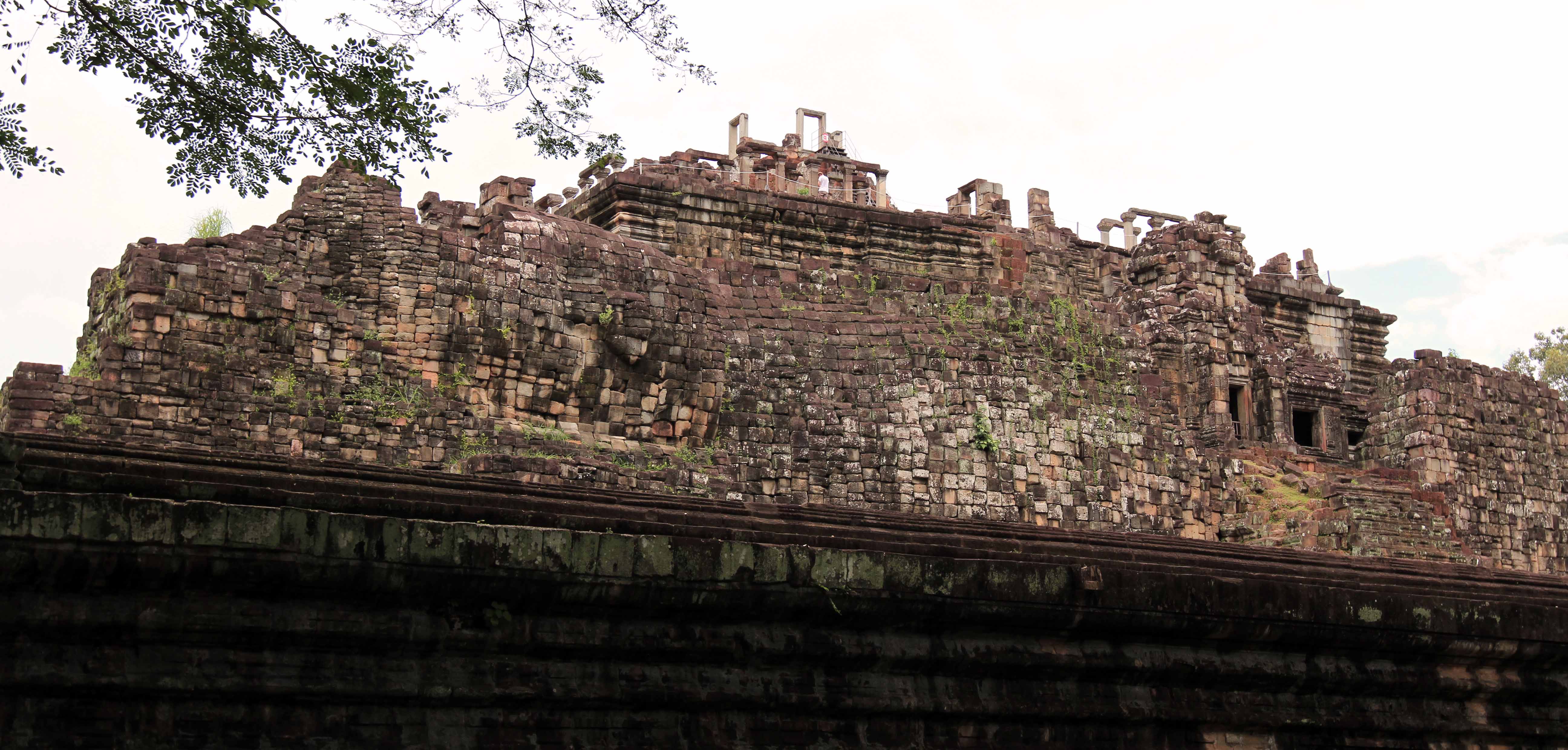
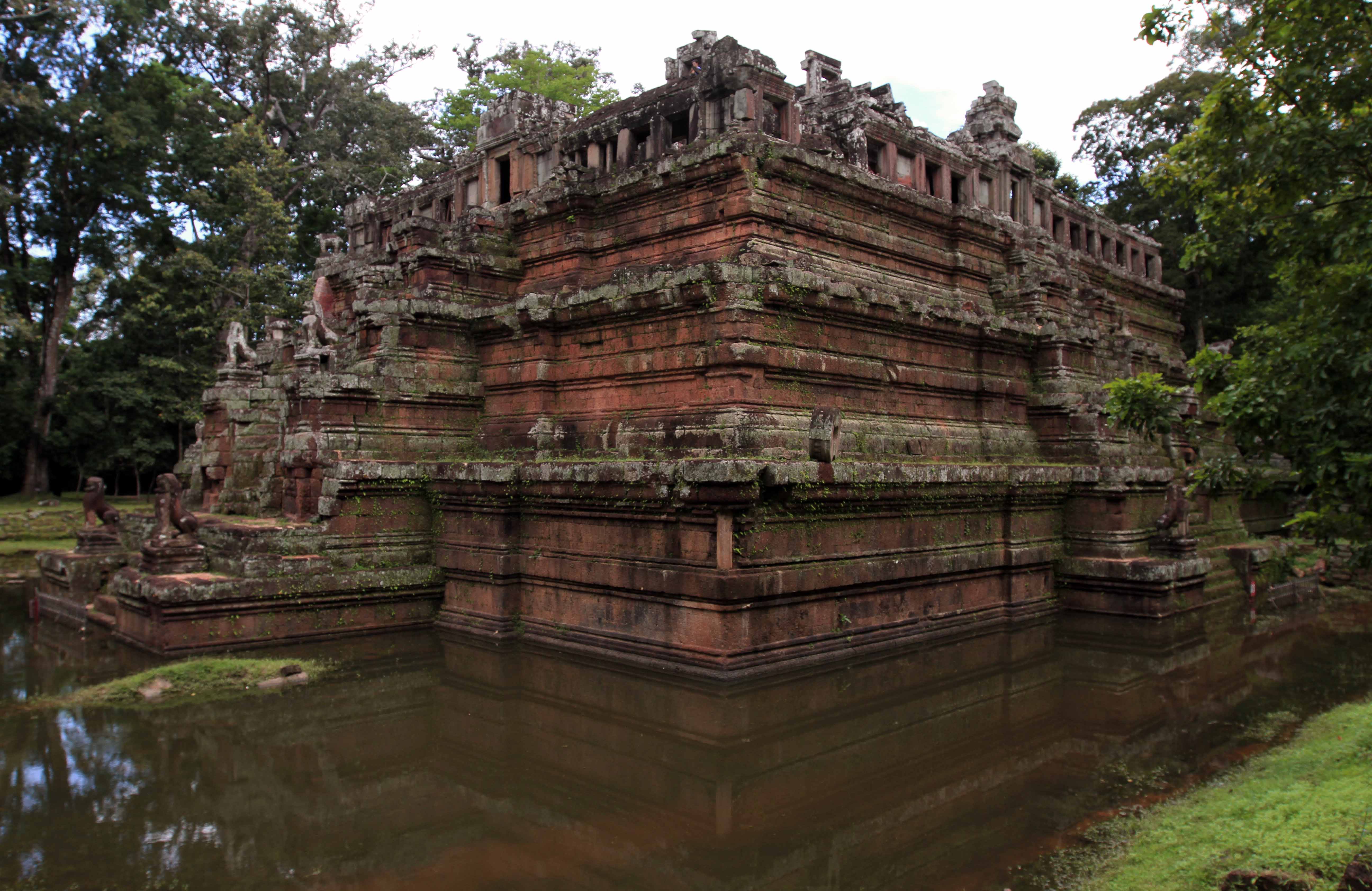
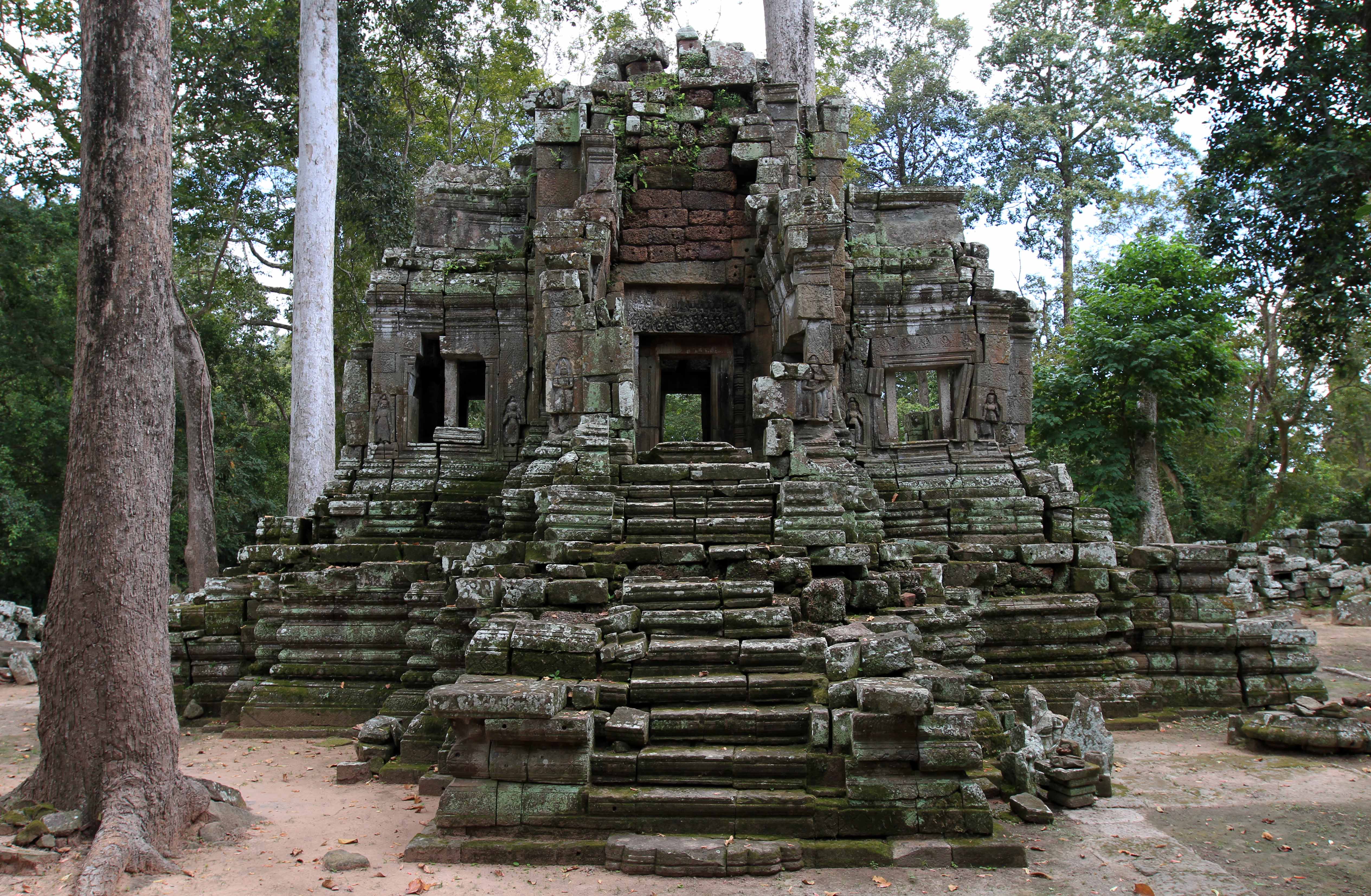
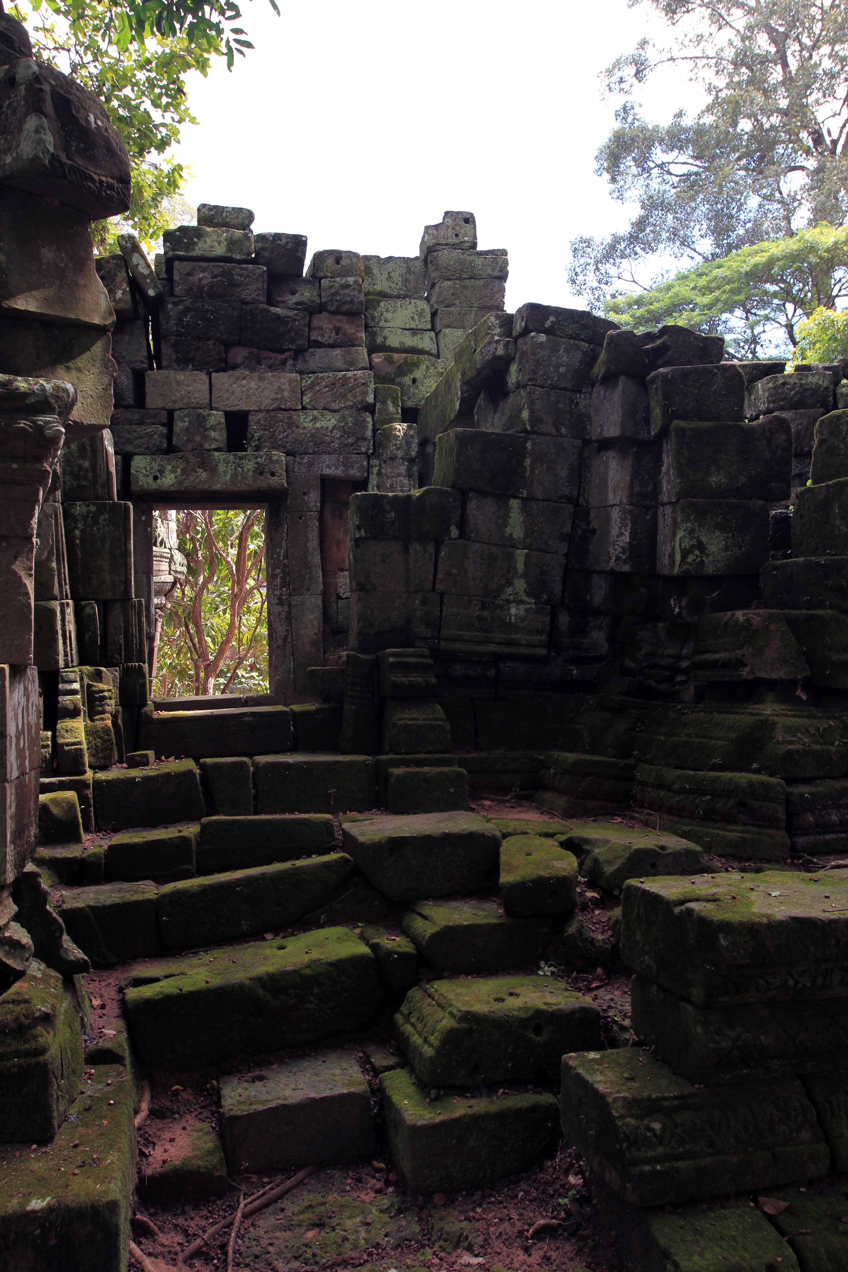
My next stop was Baphuon temple, which was built in the eleventh century as the state temple of King Udayadityavarman II and dedicated to the Hindu god Shiva. There was a raised causeway leading to the temple, which I walked across and then passed through the temple’s ornate entrance; I walked clockwise around the temple and then went up the steps leading up to the top; from the top I was given a great view of the causeway and entrance to the temple. I then walked down the steps and out the back entrance; from the rear of the temple I could see the large reclining stone Buddha that was later built in to the temple’s backside wall. I then followed the visitor path to Phimeanakas, a Hindu temple originally built in the tenth century, but rebuilt in the twelfth century by King Suryavarman II in to a three-tier pyramid and located inside the site of the Royal Palace of Angkor Thom. From there, I walked to the Terrace of the Elephants (a terrace decorated with relief carvings of the fronts of elephants) and followed the terrace north; upon reaching the end of the terrace, I walked to where many food vendors were located and I sought out some much needed Gatorade (I was very exhausted at this point) . . . but no one was selling sports drinks filled with delicious electrolytes, so I was forced to settle on drinking a large bottle of water instead. I then explored the ruins of the Preah Pithu Group, North Kleang, and the northernmost tower in the Prasats Suor Prat. Then I walked to Tep Pranam, Preah Palilay (where there was a stoic monk just sitting near the top of the ruins), and the Terrace of the Leper King (which is so named due to the statue of the Hindu god Yama located on top having been found with discolored stone and moss growing on it, thus sort of resembling someone with leprosy – Note: the original statue is now located in the National Museum in Phnom Penh, so a replacement statue stands on this terrace now). I then walked south across the Terrace of the Elephants and back to my bicycle. I traveled east and exited Angkor Thom through its Victory Gate. I was then set on cycling all the way to my next destination, located twenty kilometers away.

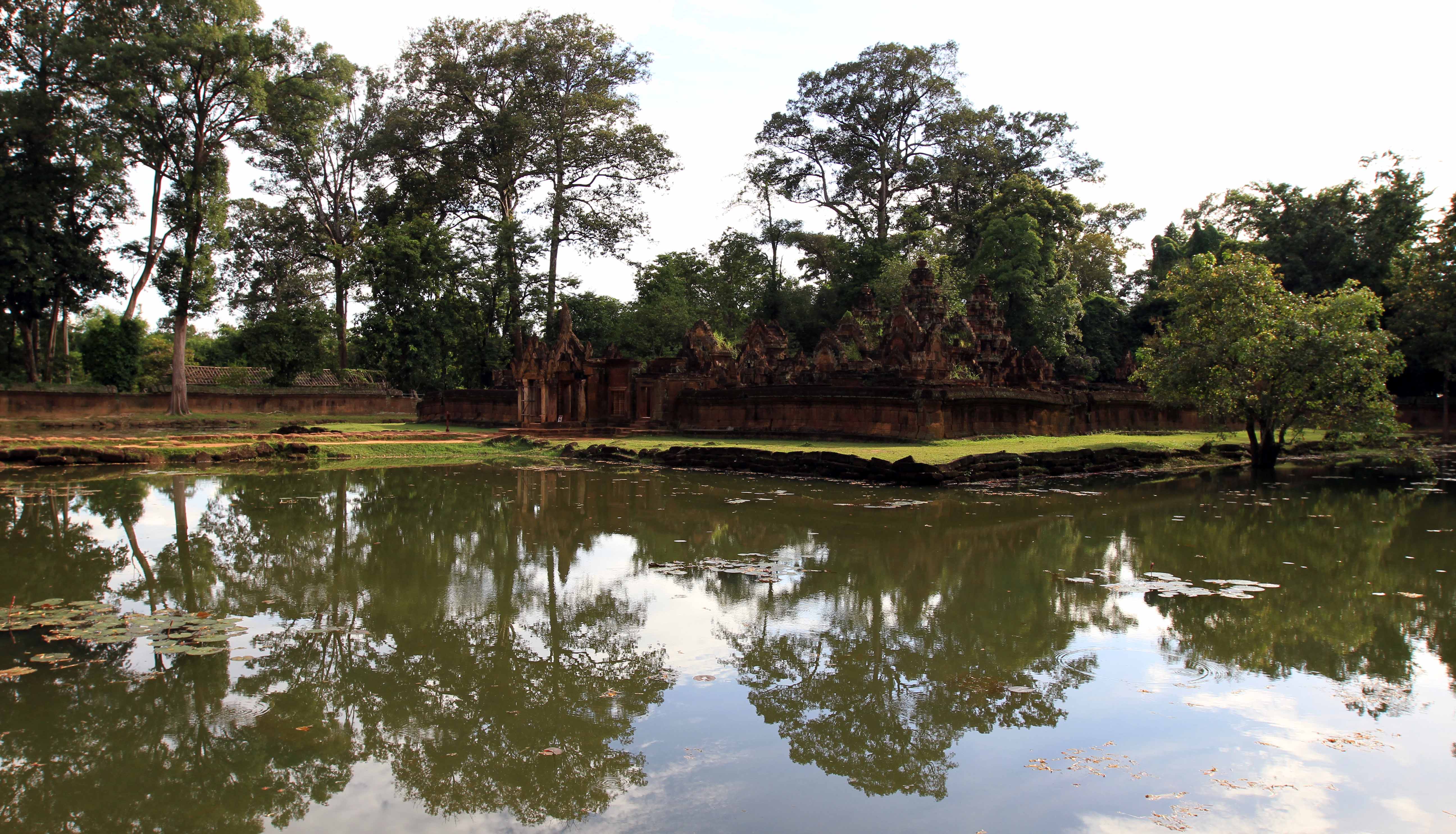
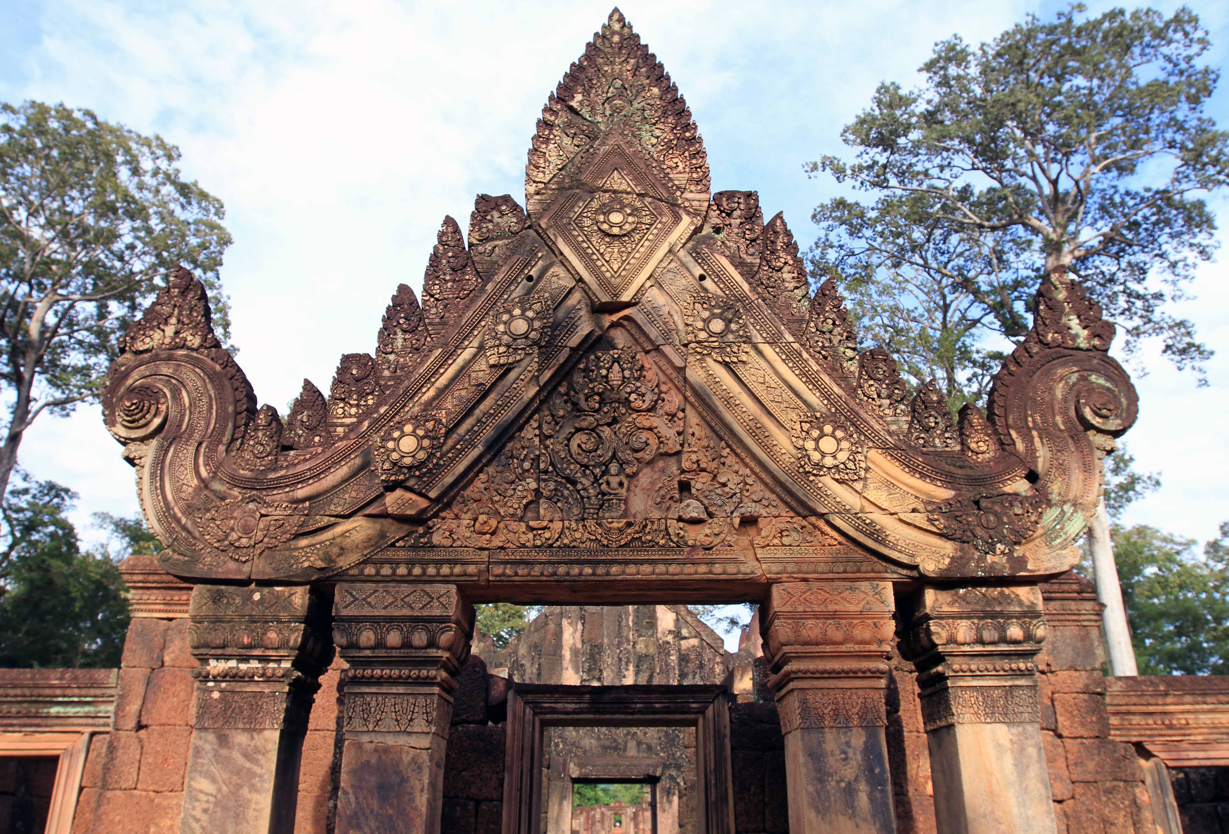

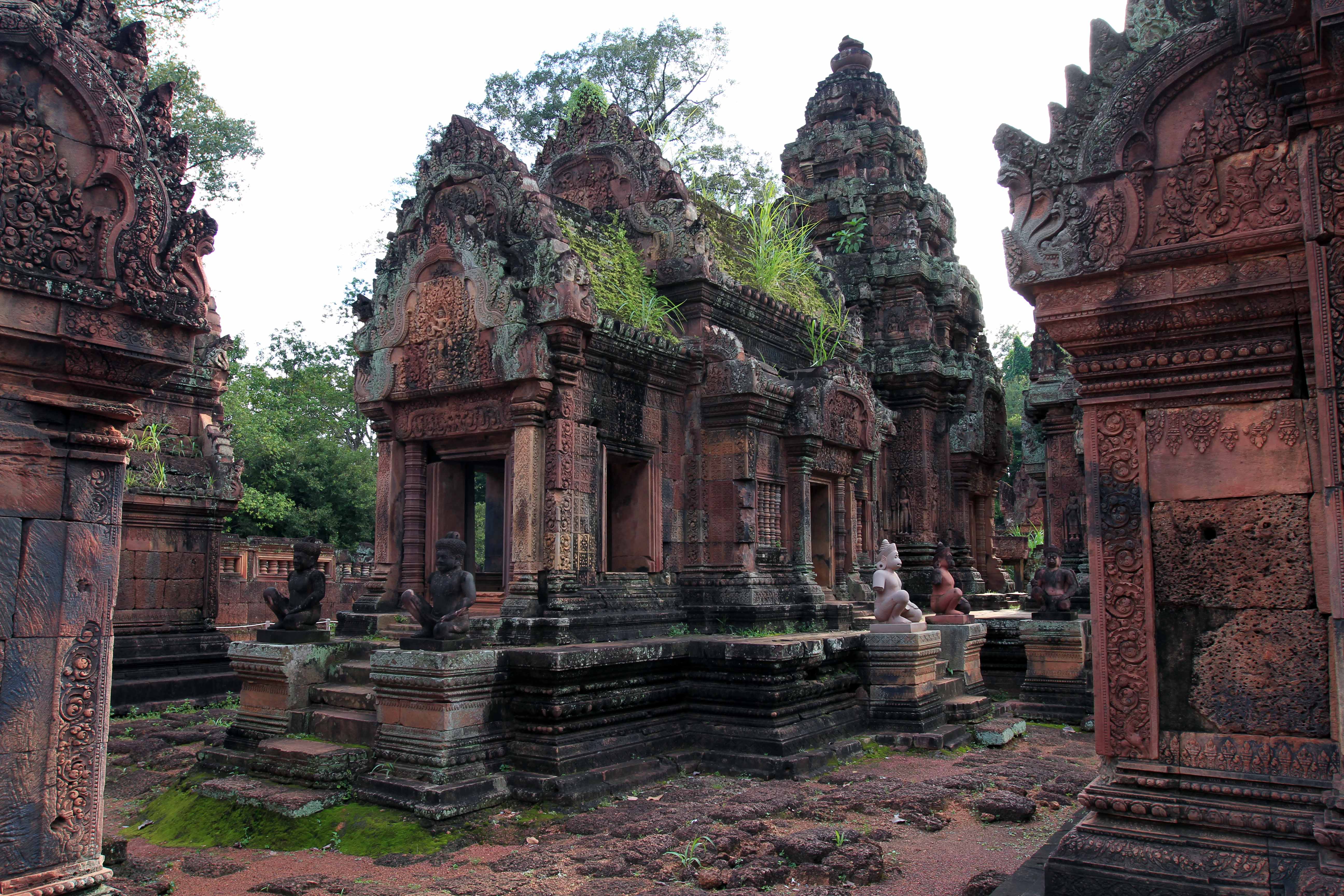
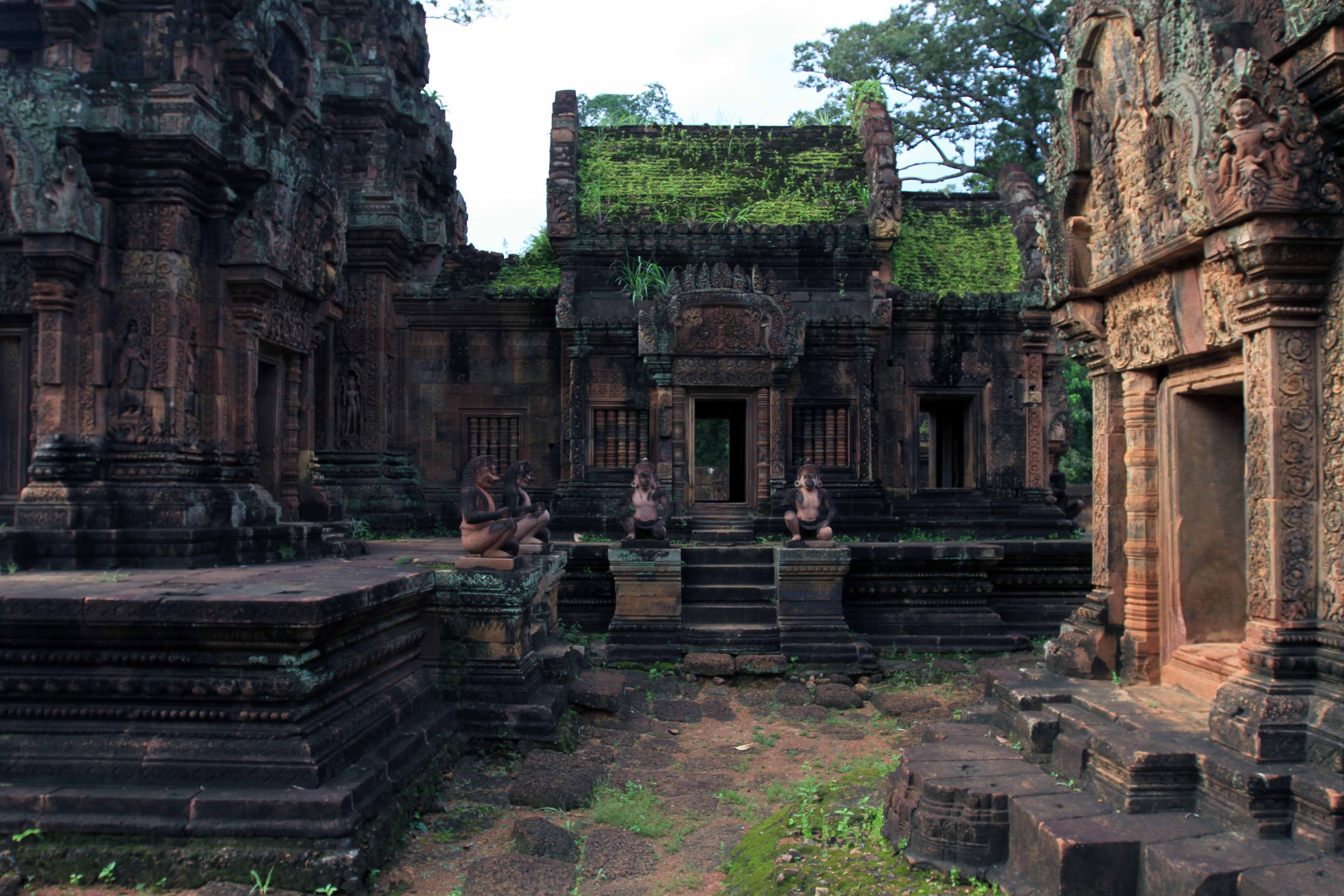

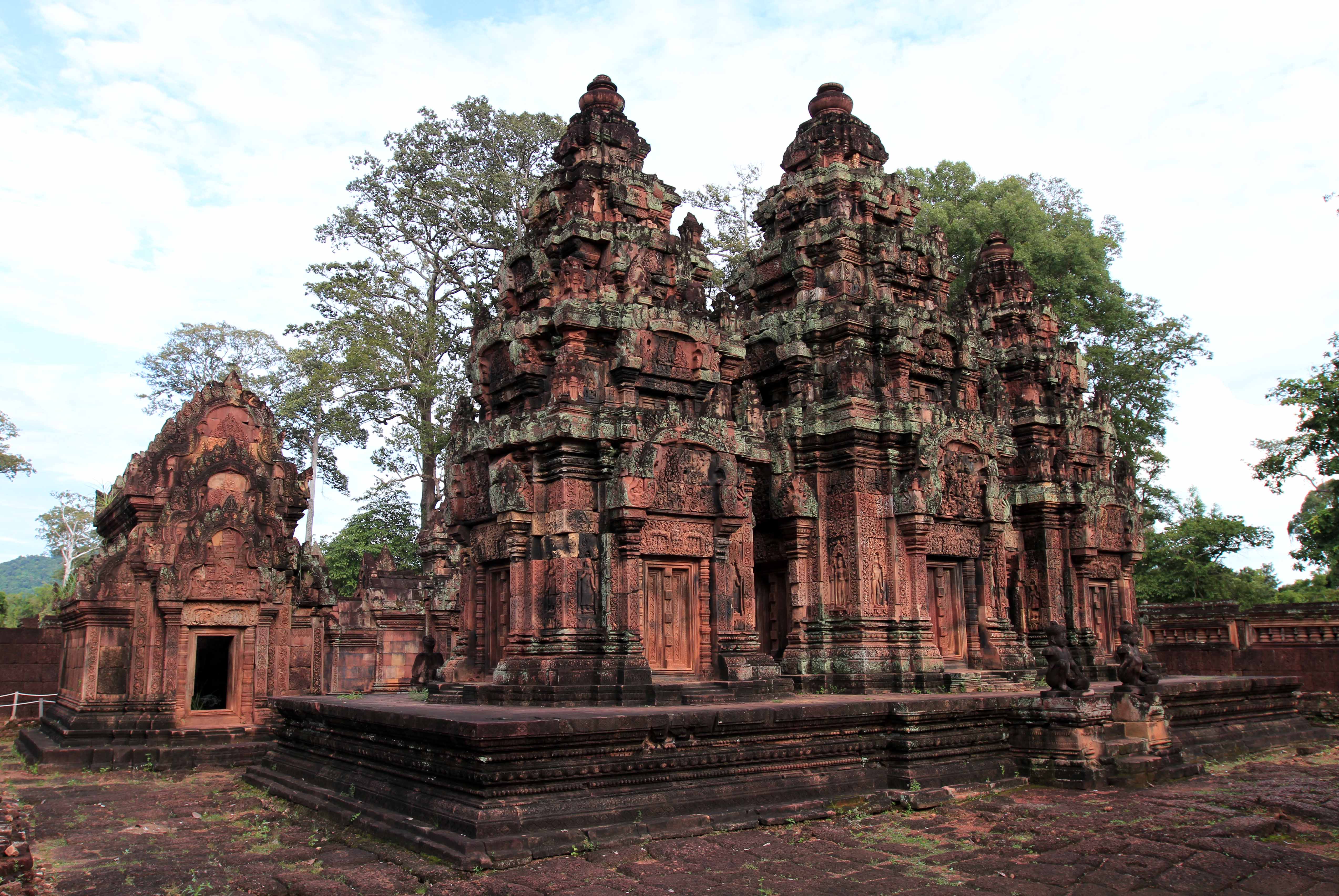
I set out on the road heading toward Banteay Srei, determined to get there on bicycle, which looking back on it was rather foolhardy since it was hot, I was exhausted, and it was already past 15:00 and the temple closed at 17:00. Lucky for me, on my way over there, a persistent man on a motorbike offered to give me a lift to the temple and back for only five USD. I agreed that it would be best for me to accept his offer, so I locked my bike up at a police station along the road and hopped aboard the motorbike. We drove north to the temple and passed by a number of locals cooking using mud ovens located alongside the road. We finally reached the temple park and I entered inside as the motorbike driver waited for me outside. Banteay Srei is a tenth century temple built mostly out of red sandstone and dedicated to the Hindu god Shiva; it has also been described as a “precious gem” by French archaeologists and tourists. I first walked out to a wildlife viewing platform and looked out at the marsh and jungle with some homes built along the water; then I walked to the temple itself (it is part of the Angkor Park even though it is very distant, so I didn’t have to pay a separate entrance fee). The temple is surprisingly smaller than most of the other ones I had seen today and it didn’t take long to walk through its outer entrance up to the moat surrounding the center temple complex, and then in and around the center temple. Also, many sandstone lintels and sculptures have withstood the test of time and are still available for visitors to view. Overall it was very magnificent (as were all of the temples I viewed in Angkor – comparable to the ruins left by the Ancient Greeks, Romans, Egyptians, Aztecs, and Incas) and I loved the reddish color of the sandstone used. After walking around the central temple, I walked along part of the wall near the moat before heading back to the entrance. I found my motorbike driver and soon we were driving south, back to the police station. Once at the police station I unlocked my bike, paid the driver and gave him a tip, and then I rode back to Angkor Thom with the intention of following the roads south back to Siem Riep.

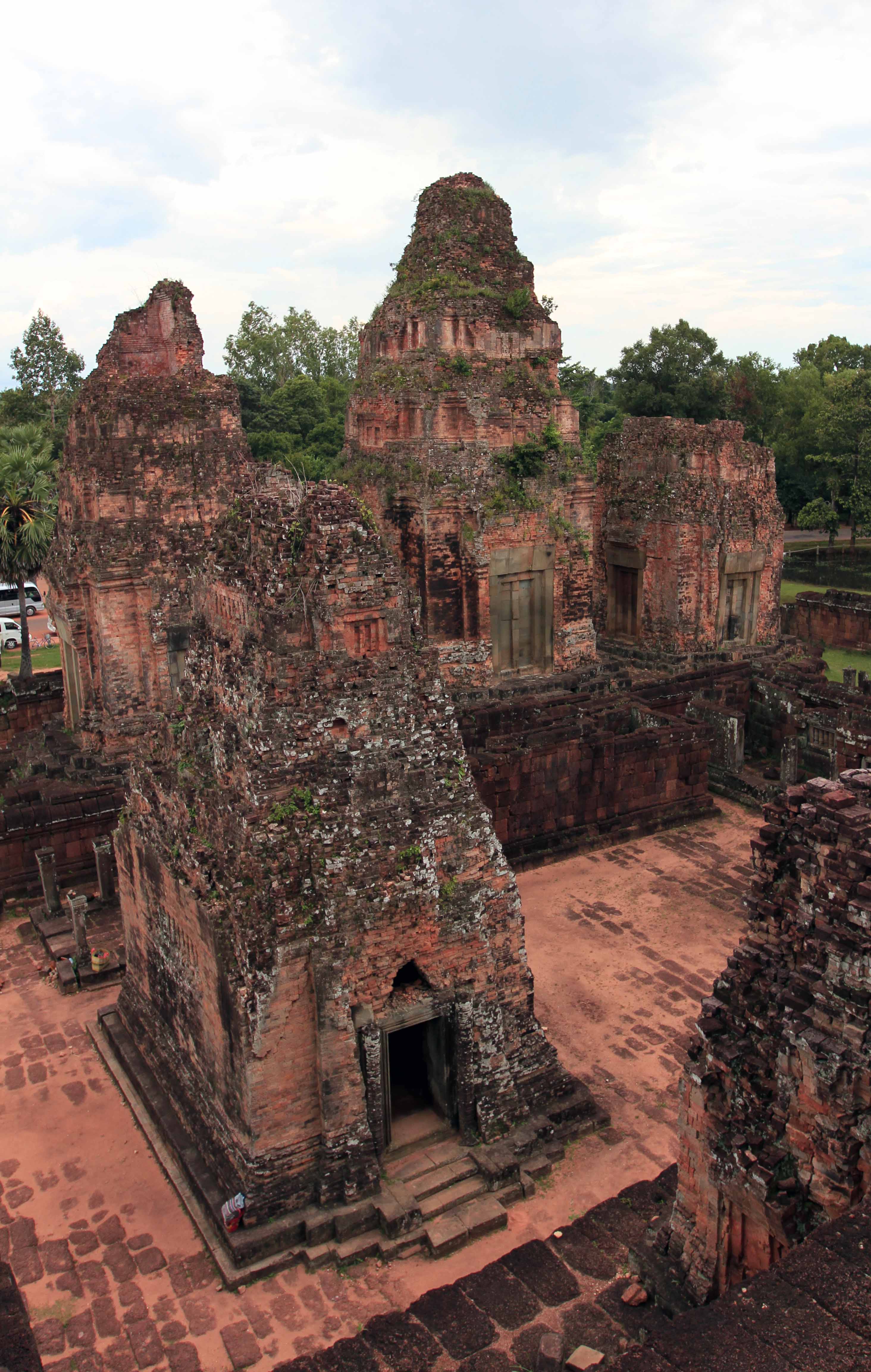
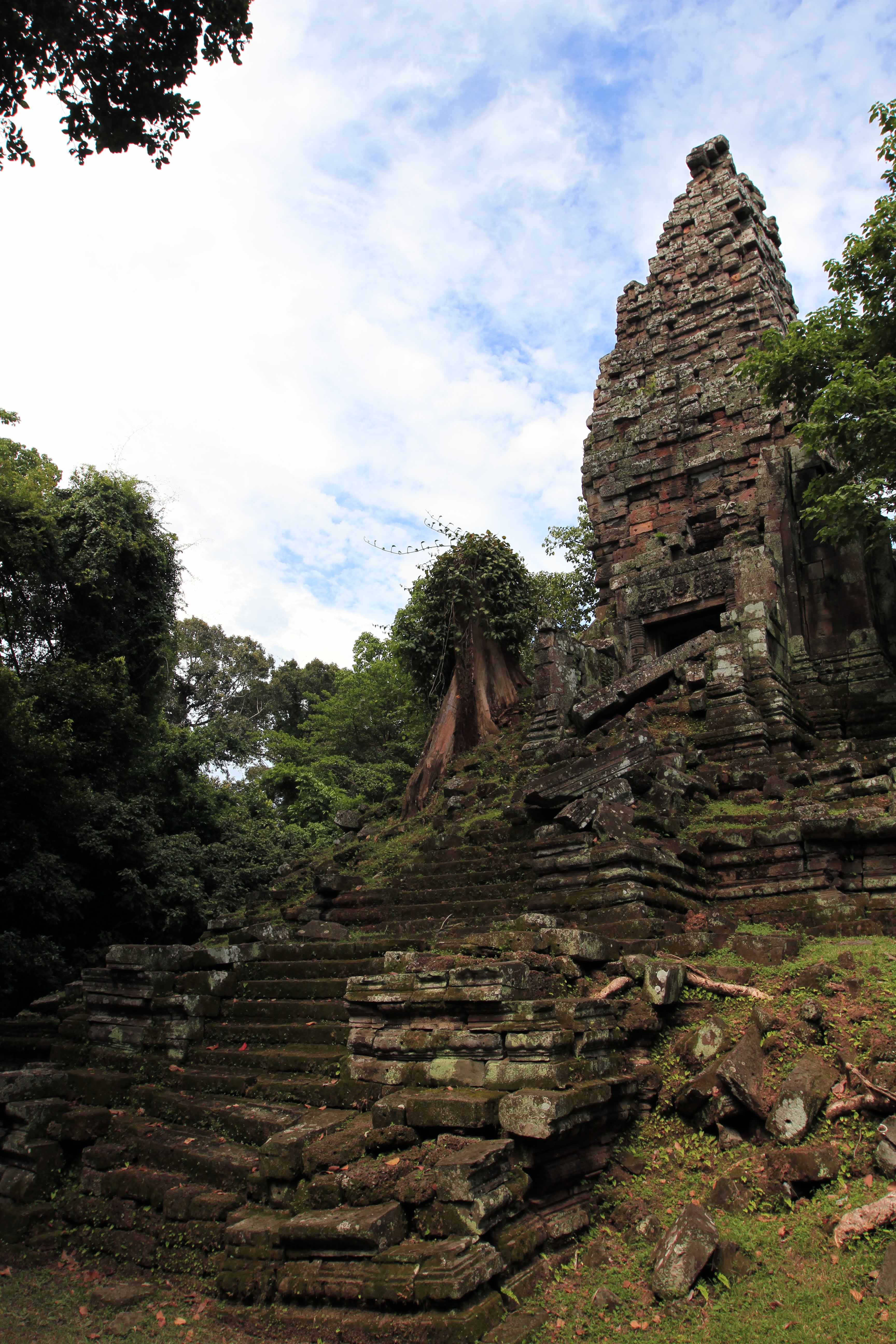
During the ride back I passed by Pre Rup temple (which is situated along a turn in the road) and since there was still enough light outside, I decided to stop and wander around the ruins. Pre Rup was built as the state temple for King Rajendravarman in the tenth century and was dedicated to the Hindu god Shiva; the name means “turn the body”, leading many to believe that funerals were most likely conducted at this temple, with the ashes of the deceased being rotated in different directions during the ritual. This temple is also built as a “temple mountain”, meaning there was a high terrace in the center with five towers representing the peaks of Mount Meru. I walked around the temple and up the steps to the top; at the top there were many tourists sitting and standing, waiting for the sun to set below the jungle out west. I entered in to each tower and wandered around some more at the lowest level before getting on my bicycle again – hoping to reach Siem Reap before it became too dark. I peddled south and came to the outskirts of town as night took its turn on the clock. I then reached bicycle rental shop, returned my bike with lock and key, and then walked back to my hotel room, where I took a much needed shower – I reeked. After getting cleaned up, I then found a place not too distant from my hotel (i.e. not on Pub Street) and had a delicious dinner of stir fried chicken with garlic and basil, amok with coconut cream and chicken (Note: amok is steamed-cooked curry in banana leaves), and beer. After dinner, I then went back to my hotel room and went to sleep.