Huashan, China

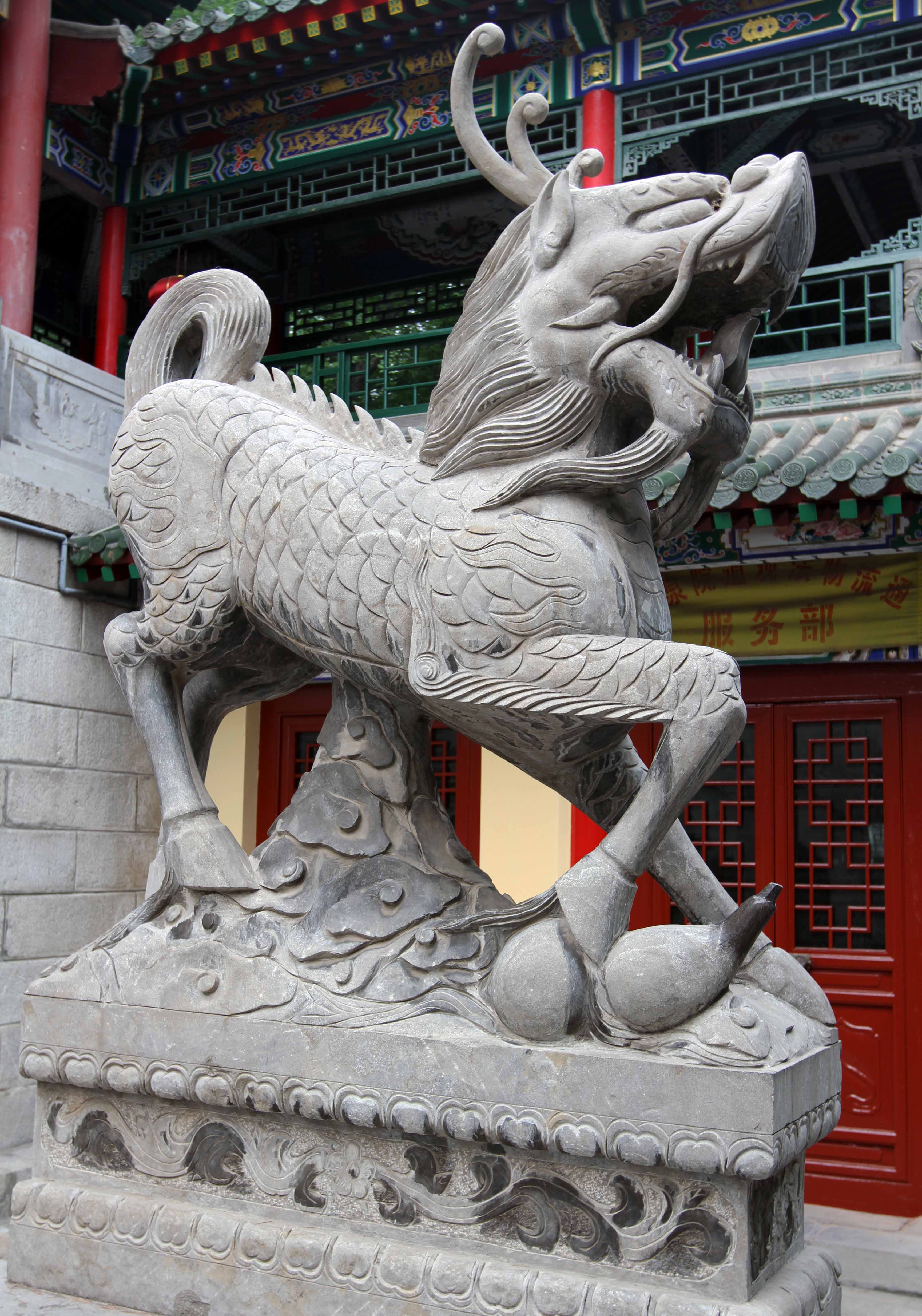

I woke up early today due to a coughing-fit a little before 05:00, got ready, and walked to the train station where the buses depart from Xi’an to go to Huashan. I bought my bus ticket and then we departed at 06:30; the journey took about two hours to reach the village of Huashan. We parked, exited the vehicle, I watched local men doing a whip workout on the sidewalks (they were cracking their whips, side-to-side), I bought water to fill my camelbak (the locals had never seen a camelbak before and found it curious), and started the ascent up Mount Hua to do the “most dangerous trek in the world”. First, I passed through a monastery with many statues of ferocious mythical creatures, then I continued up the path to the entrance gate where I bought my ticket. From that point, I hiked uphill for six kilometers to reach the first split in the trail – I should note that this trail is almost entirely steps (tall steps, narrow steps, steep steps). Also, along this trek, many Chinese wanted photos with me and the other Westerners on the trail, so I made it into a lot of people’s digital photo albums today. From the split in the trail, I met a Taiwanese man and two Scotsmen traveling together to do the “Plank Road in the Sky”; since this is what I came here to do too, I joined up with them.

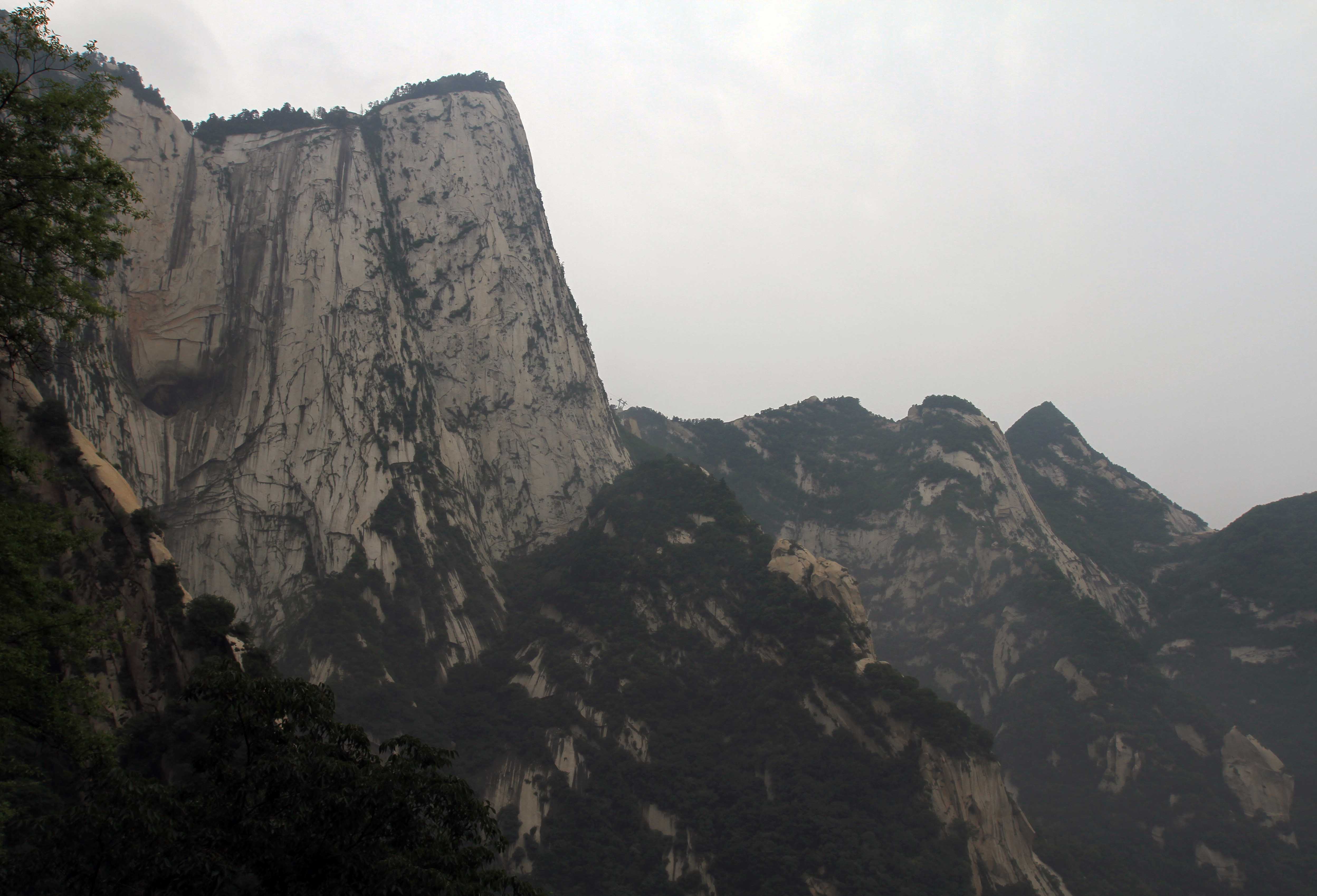
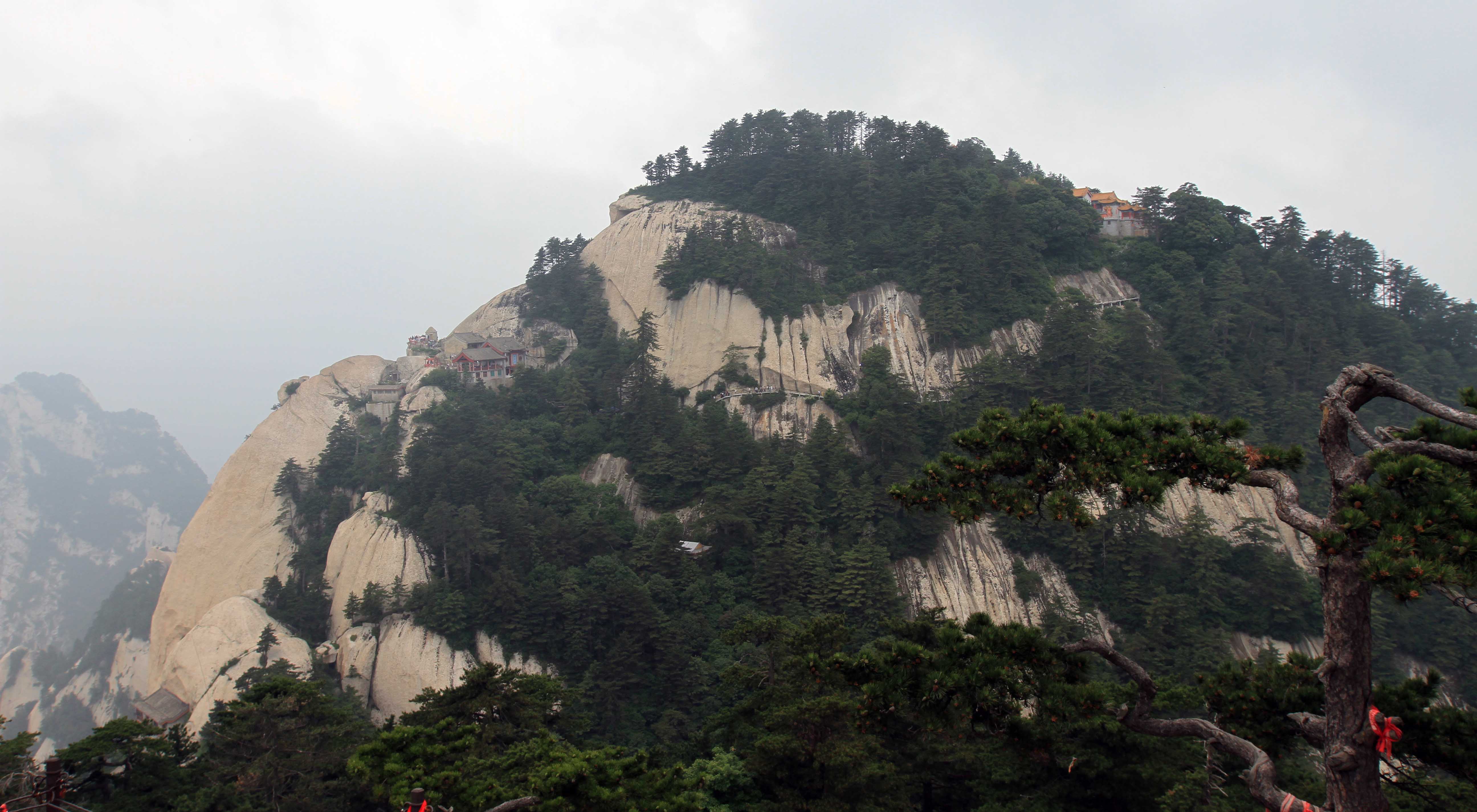
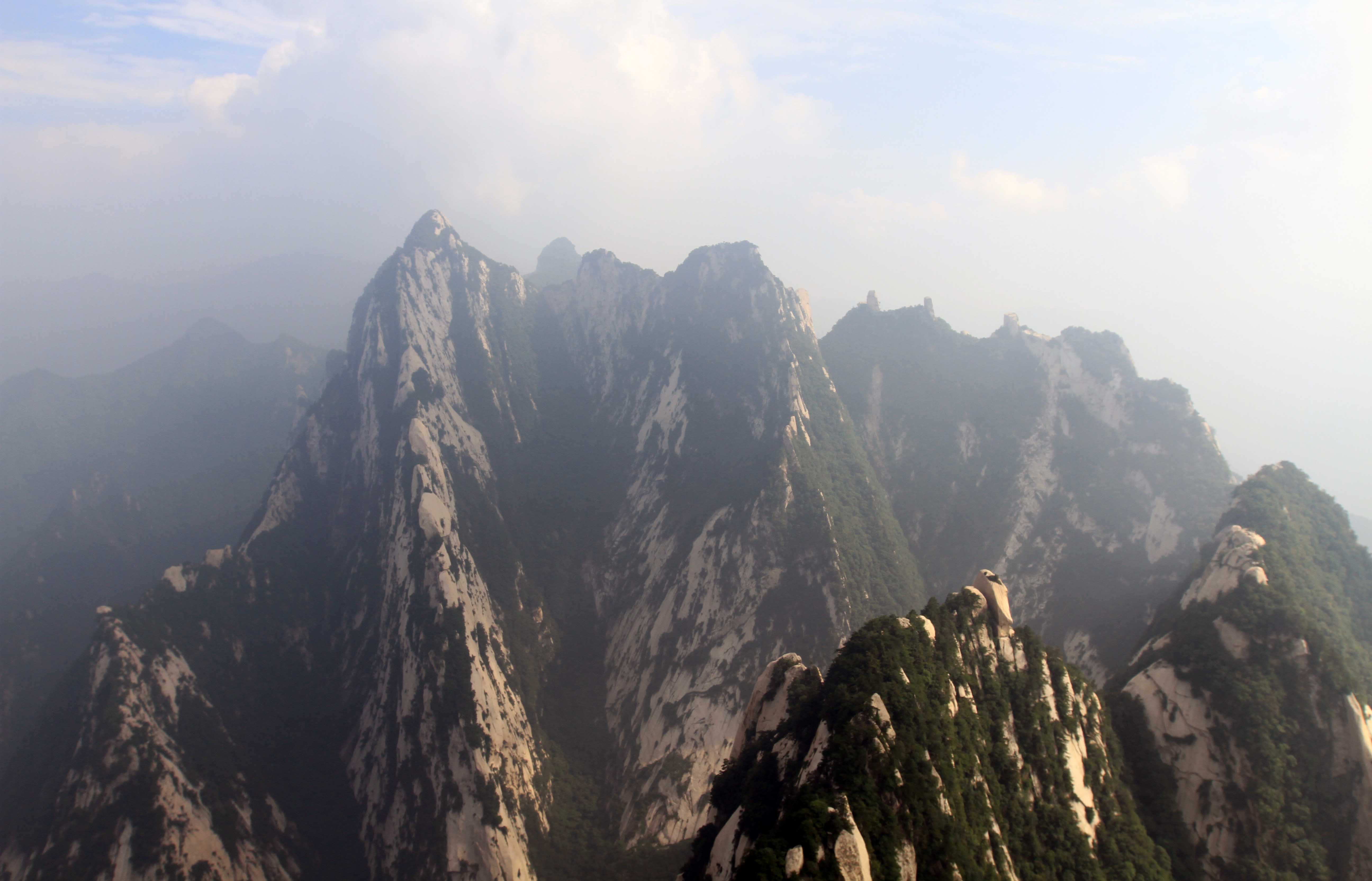
Together we walked to the East Peak summit, met and talked with a South Korean woman, and took many pictures of the South Peak (which was clearly in view) and the surrounding mountains. Overall, it was very hazy, but not enough where we couldn’t enjoy many of the spectacular views. Also, this “most dangerous trek in the world” went right through a restaurant/hotel (never hiked a trail like this before) and had many many vendors along the pathway selling the usual dispensary souvenirs, food, and drink (I cringe to think what Yosemite or Glacier National Park would look like if they were located in China – but of course this wasn’t a national park, it was a historic pilgrimage trail to the top of one of China’s five important peaks).

From the East Peak, we descended to the “Hawk Flipping Over” trail and “Chess Pavilion”, which the Taiwanese man and I did. We used harnesses and were clipped into a safety line to descend a 90-degree trail (we had to feel with our feet the holes cut into the rock for us to use as steps while hanging on to a rusted chain); we then reached the walkway carved into the stone below, where we were able to hike up to the chess pavilion built on top one of the rocks. We then headed back up the trail and linked up with the two Scotsmen (who were watching my valuables (passport, wallet, iPhone, camera – all those things I need for this world-wide trek I’m doing).
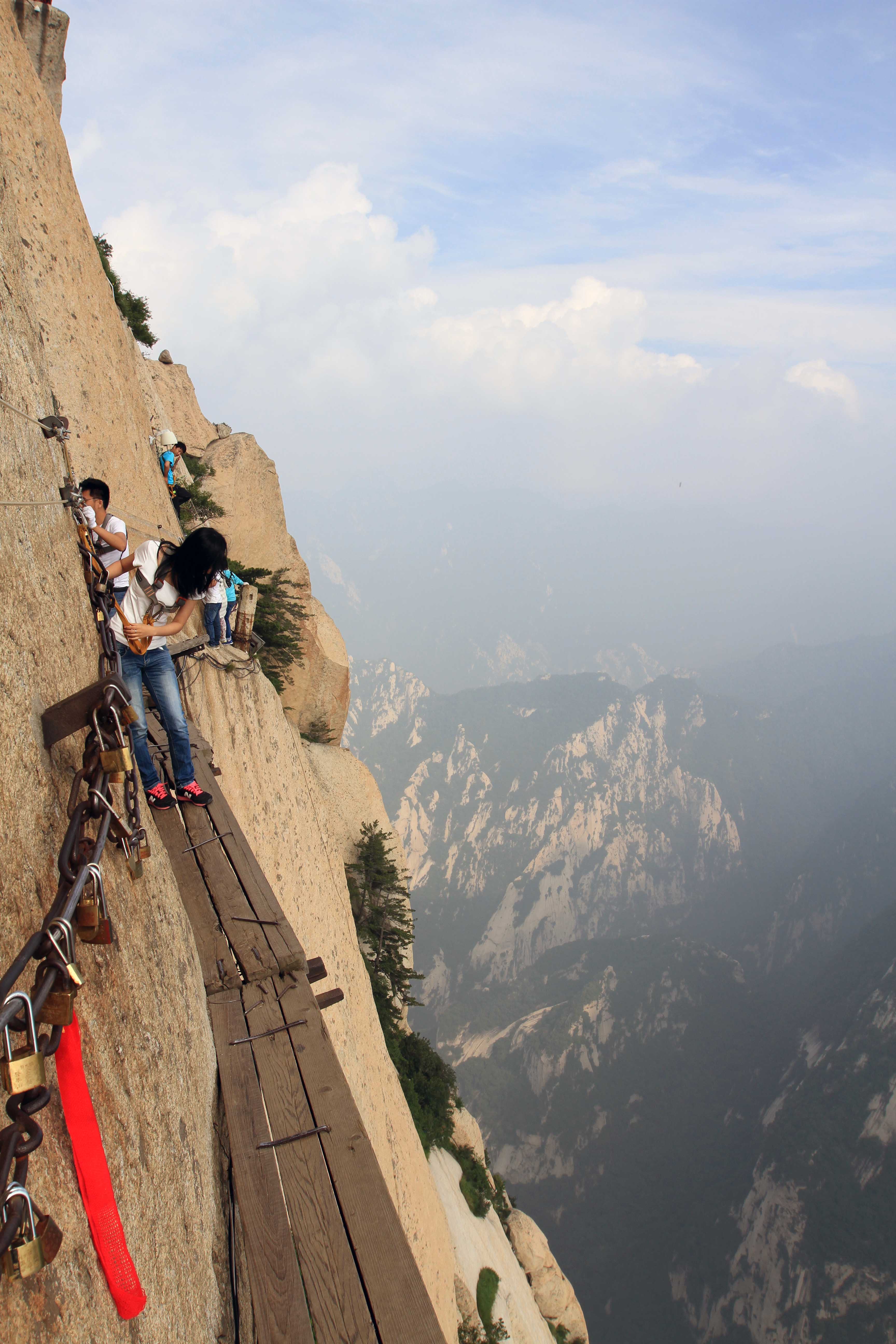

We journeyed to the South Peak next, which is where you find the famous “Plank Road in the Sky”. We waited awhile in line, paid our fee, got our harnesses, and slowly began our move toward the planks. This trail has people coming and going on very narrow paths and not much room to maneuver. First, we descended down a steel ladder built between the rock, then we reached a part of the path that is horizontal and is made from the rock having been cut away, where you can place your feet while holding on to the metal chain. It was here, as I was hugging the rock and allowing people to go around me to ascend back up the trail, that a woman pressed against my camera lens cover, causing the lens cover to plummet down to the earth below. I will now need to buy a new one, but as one of the Scotsmen commented, that if I were to lose the cover, this would be the place to do it. We then finally reached the plank walk, which led us to solid ground (or rock), where a shrine is located. We then went back the way we came, luckily not having to pass through too many other hikers heading toward the shrine, before finishing the famous trail.


We then walked to the West Peak, where we used a recently installed cable car to take us back down. This ride offered us great views and a welcome rest. We reached the bottom, took the shuttle bus back in to town, said our goodbyes, and I left back to Xi’an on a bus. I reached the train station in about two hours, walked back to the hostel, took a much needed shower after being drenched in sweat from the hike, had banana bread and walnuts bought at a local convenience store for dinner along with beer, and then went to sleep.