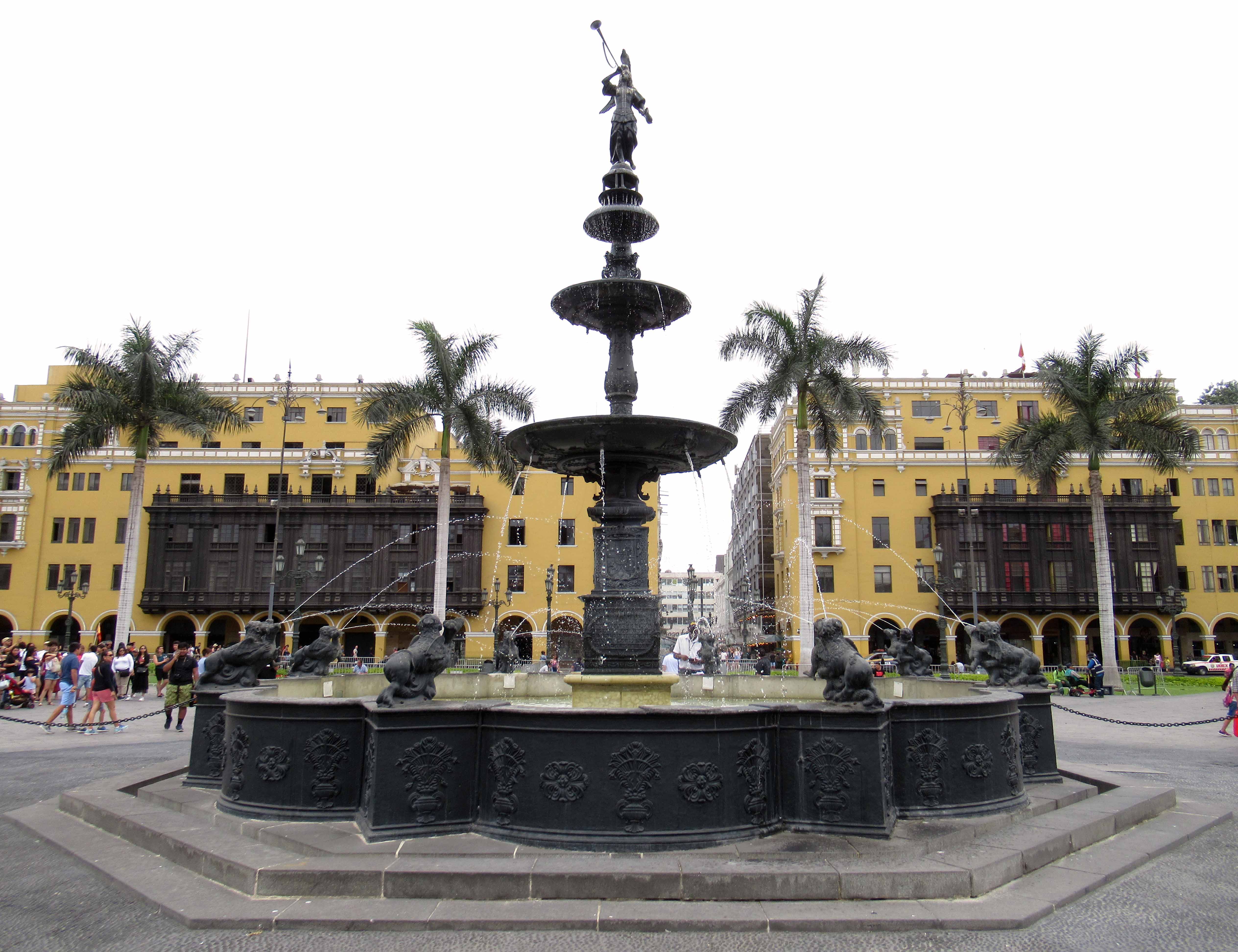
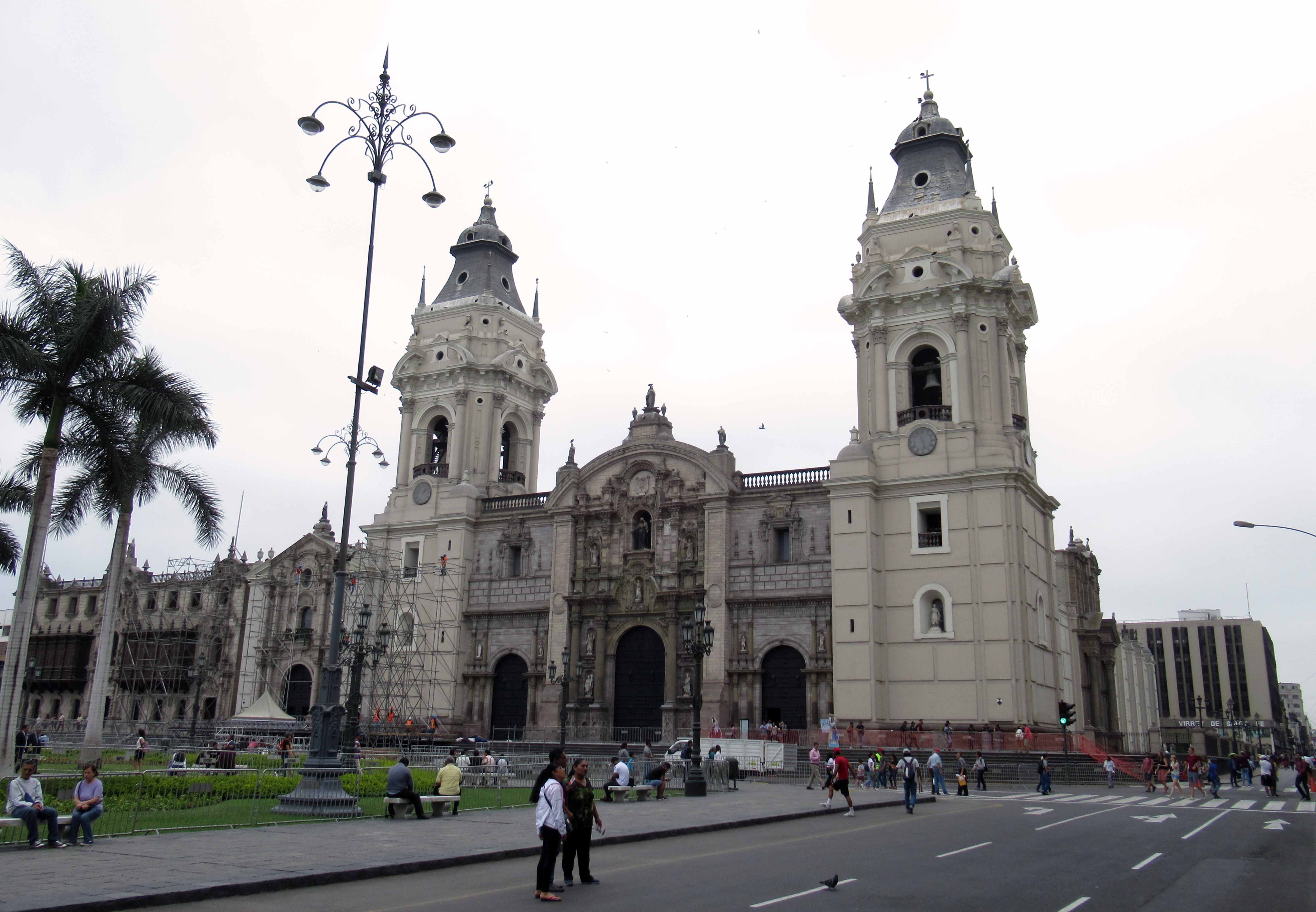
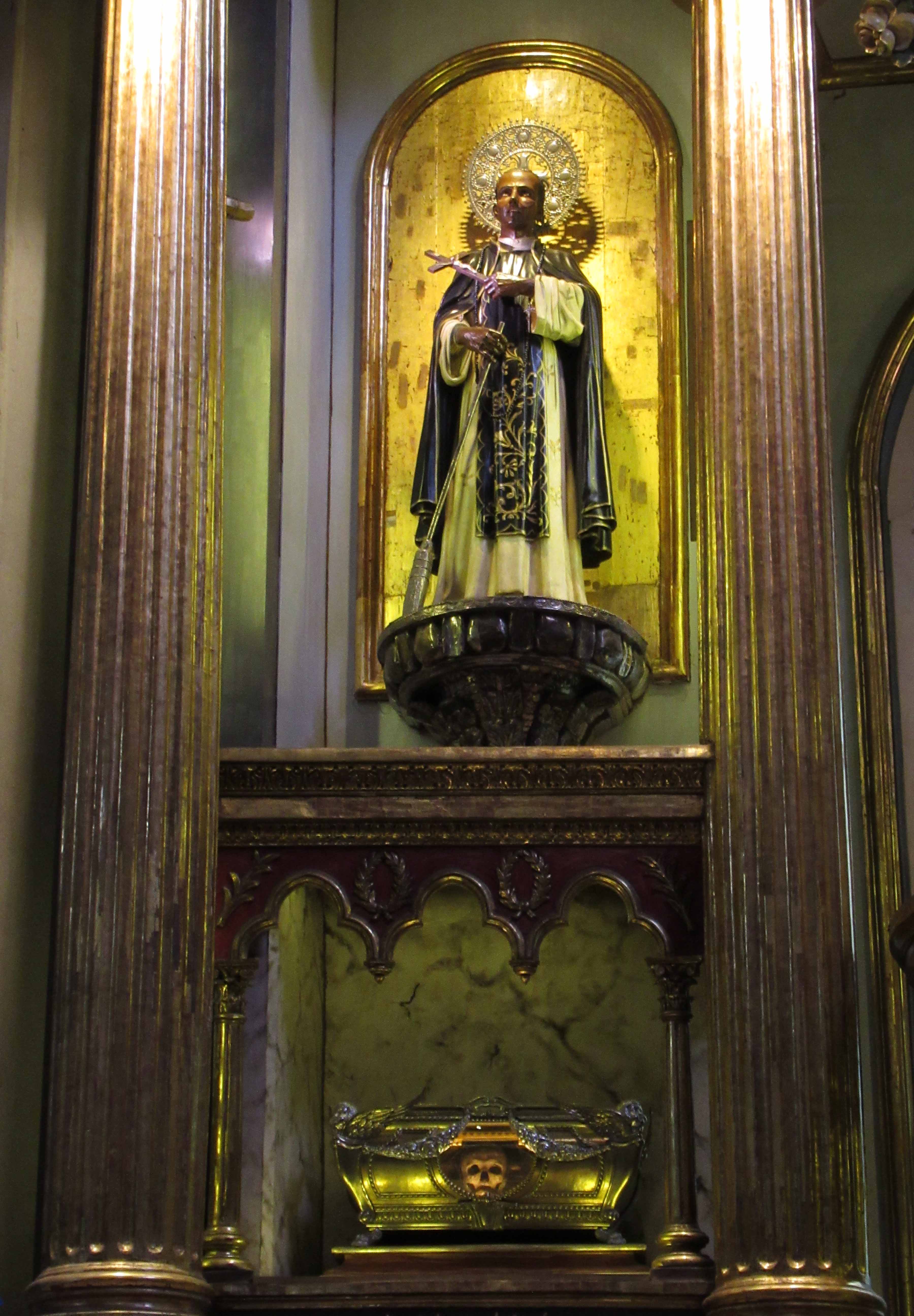
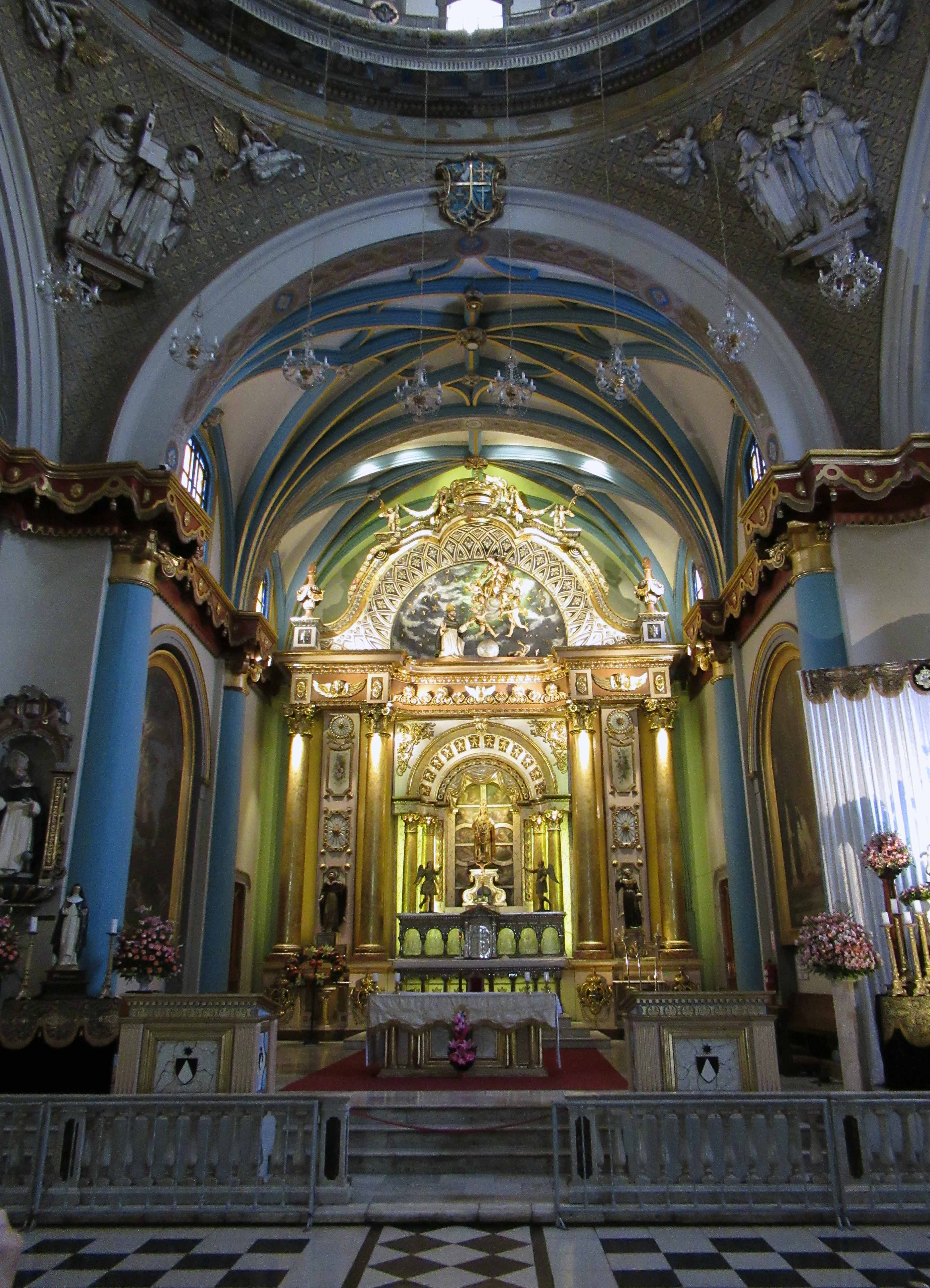
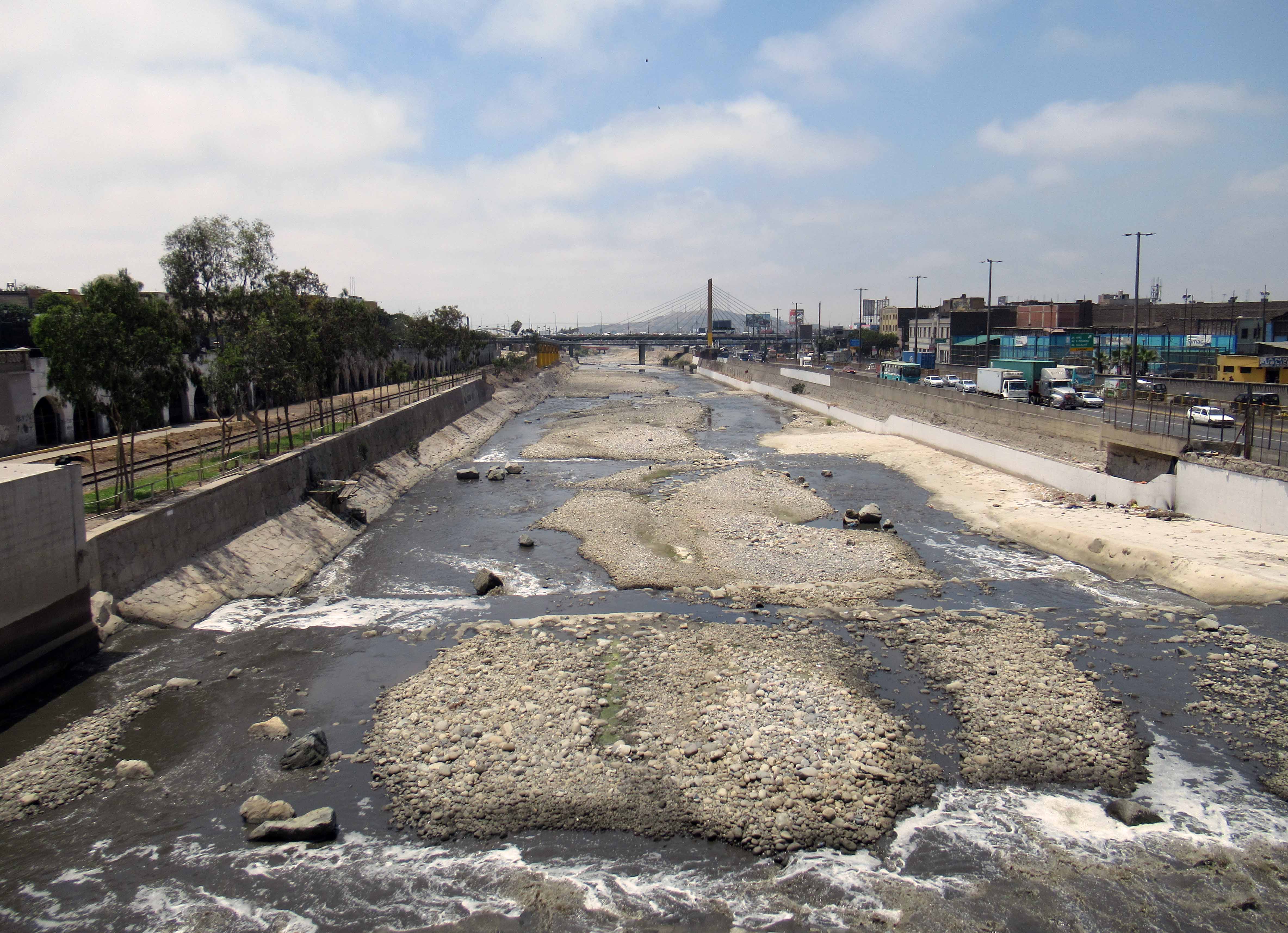
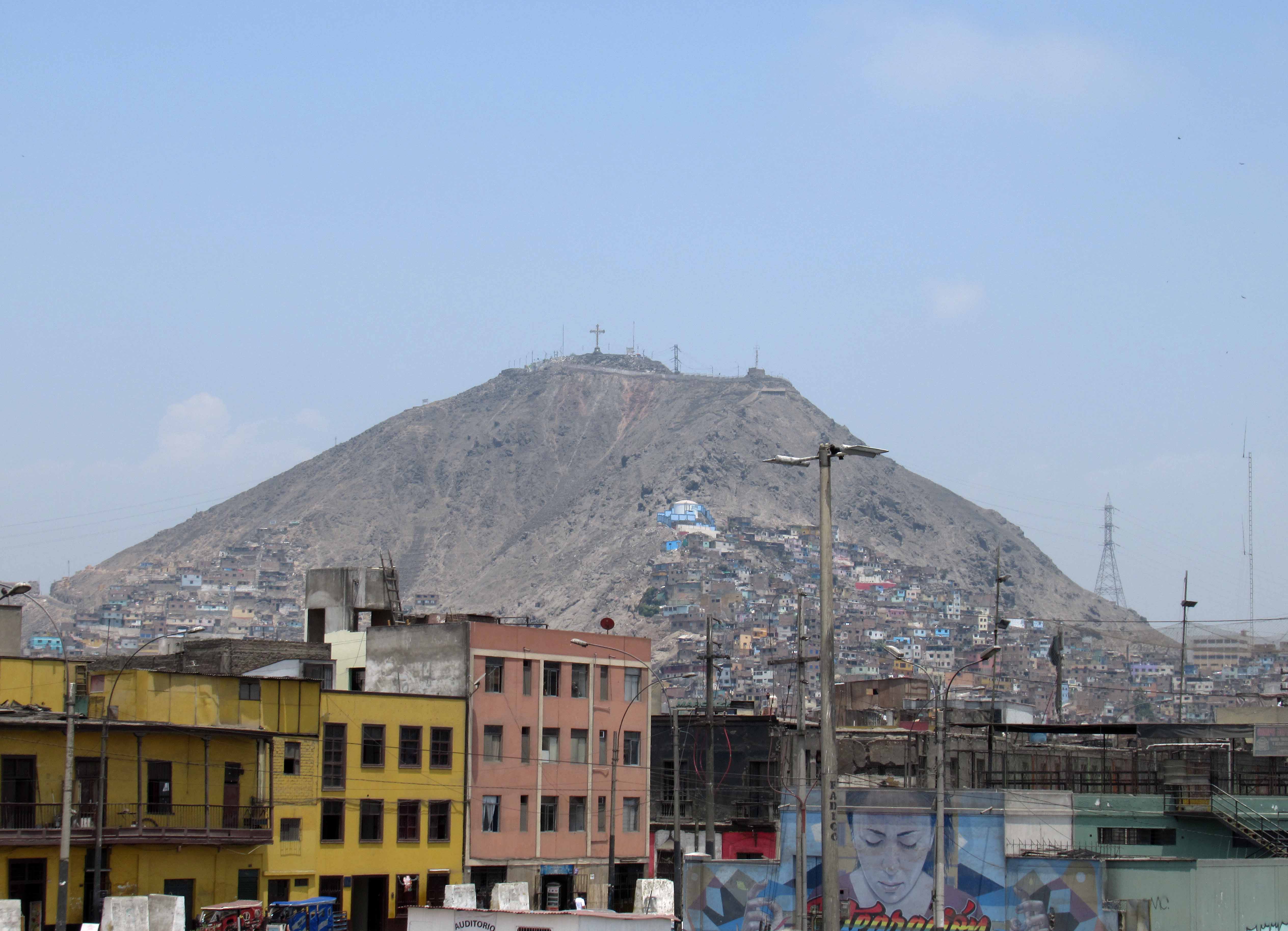
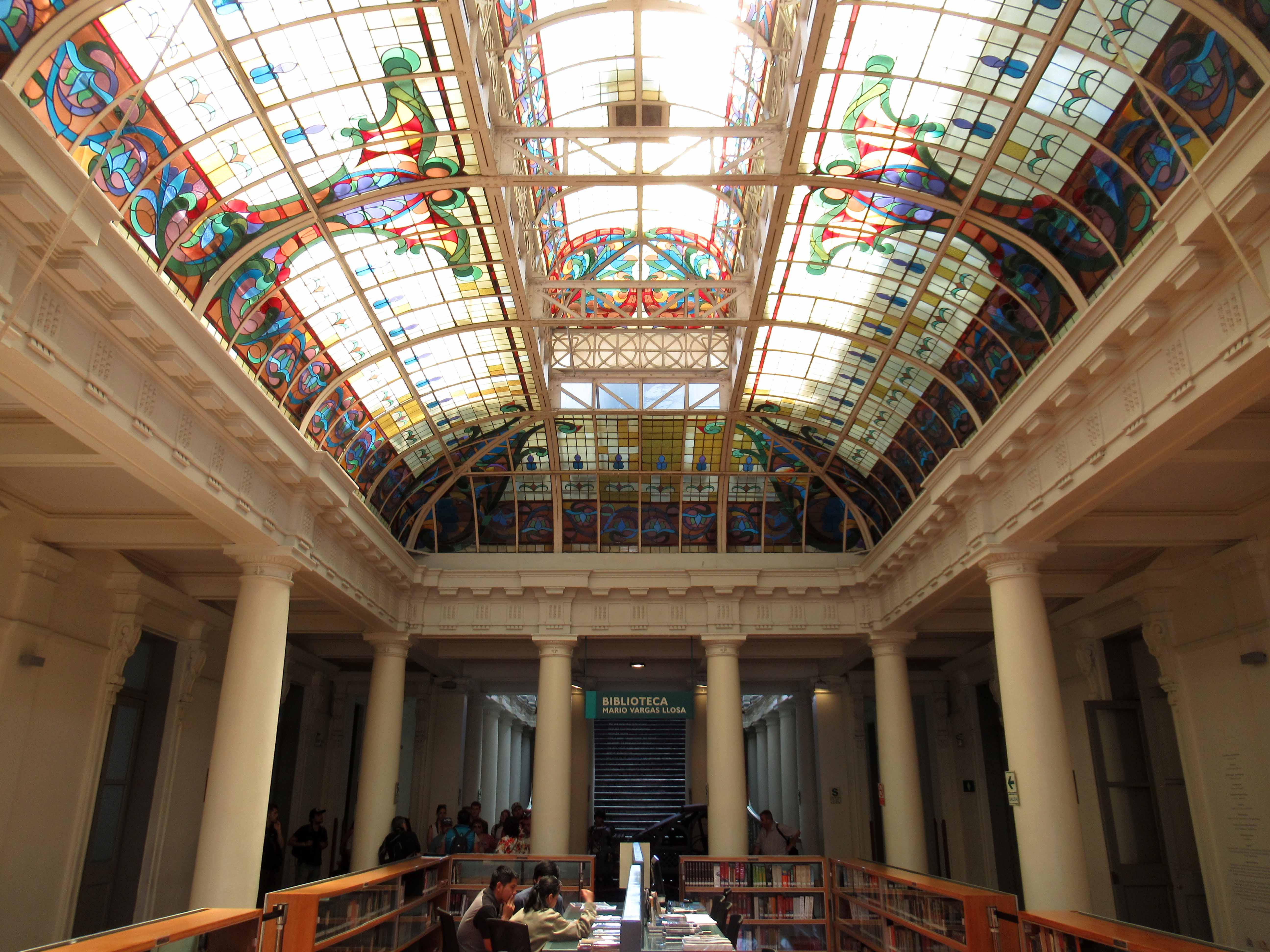
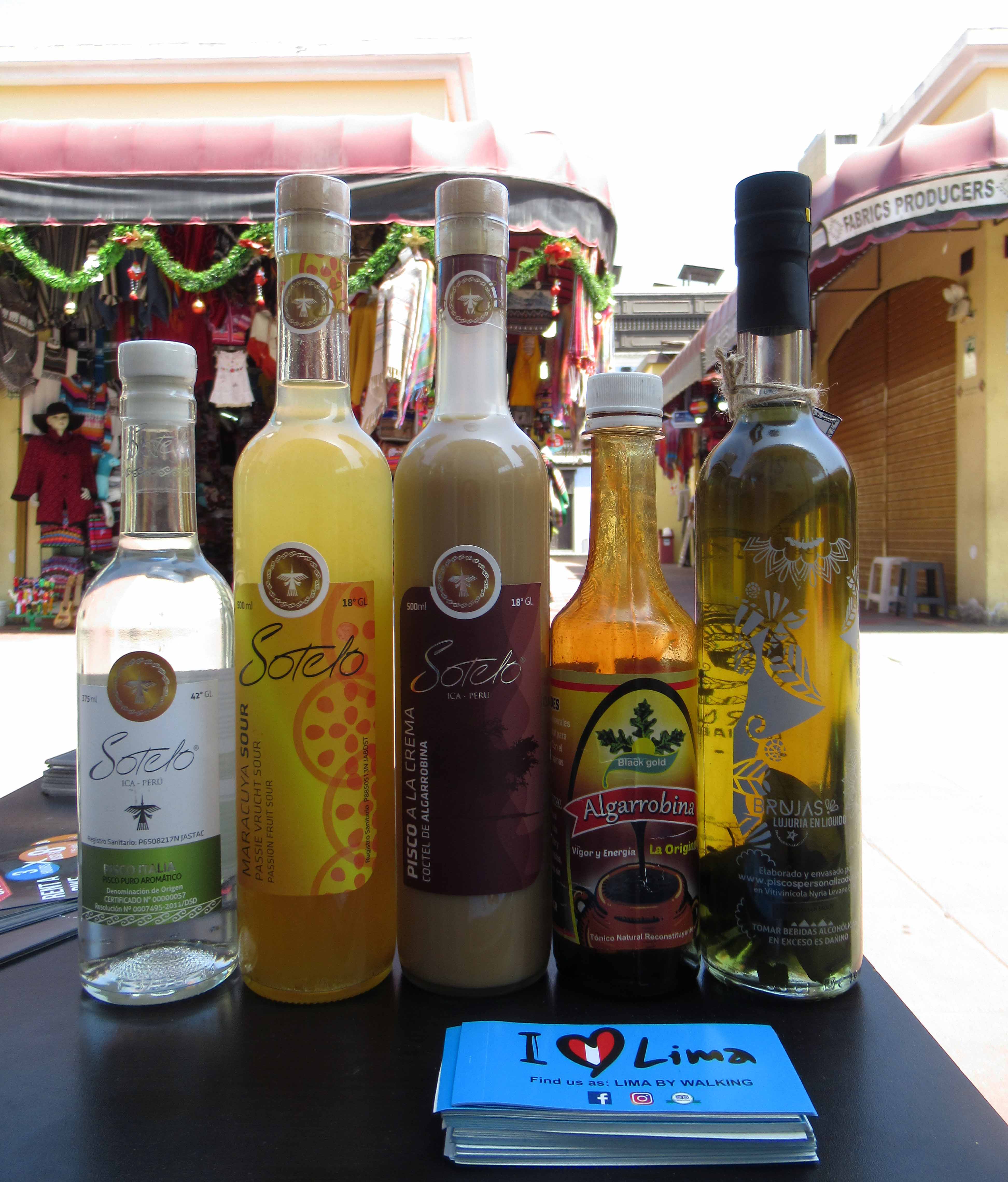
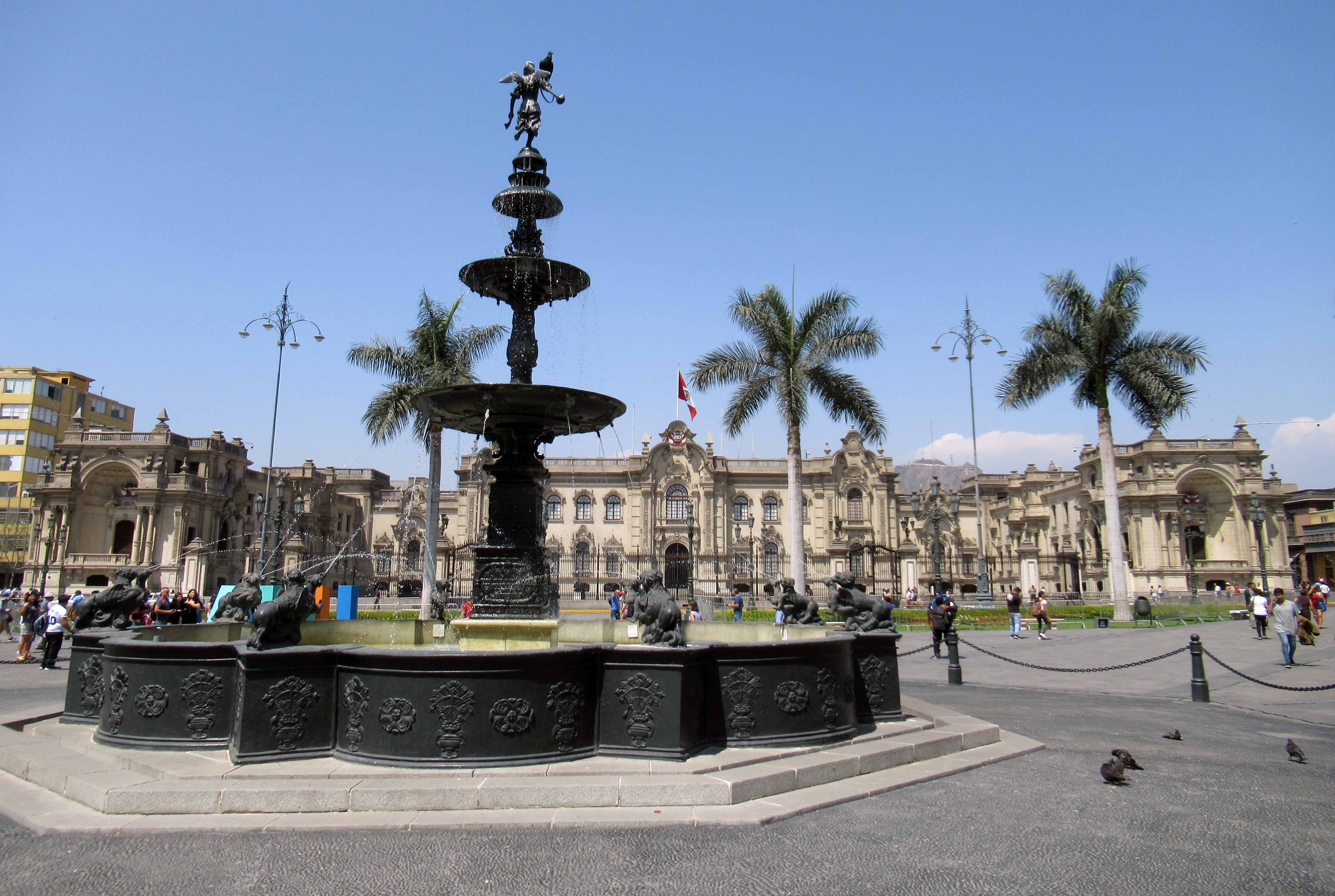
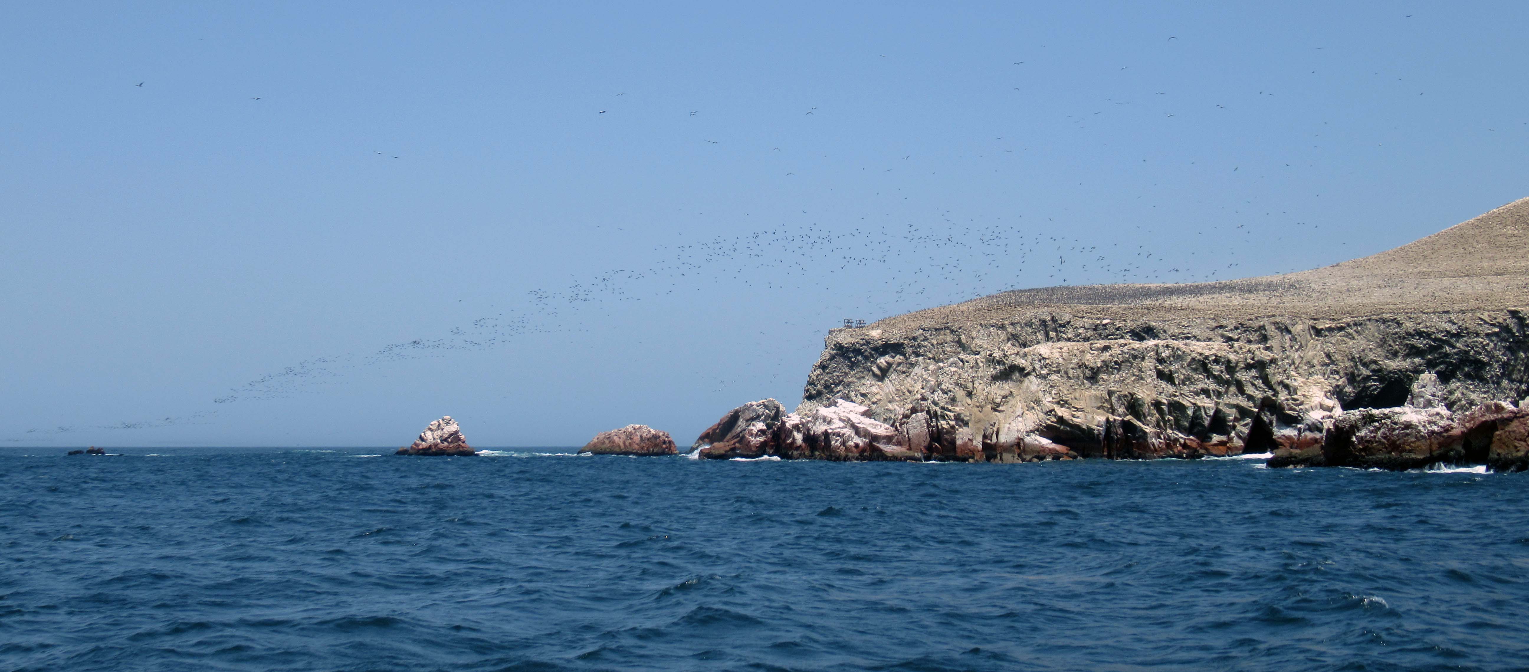
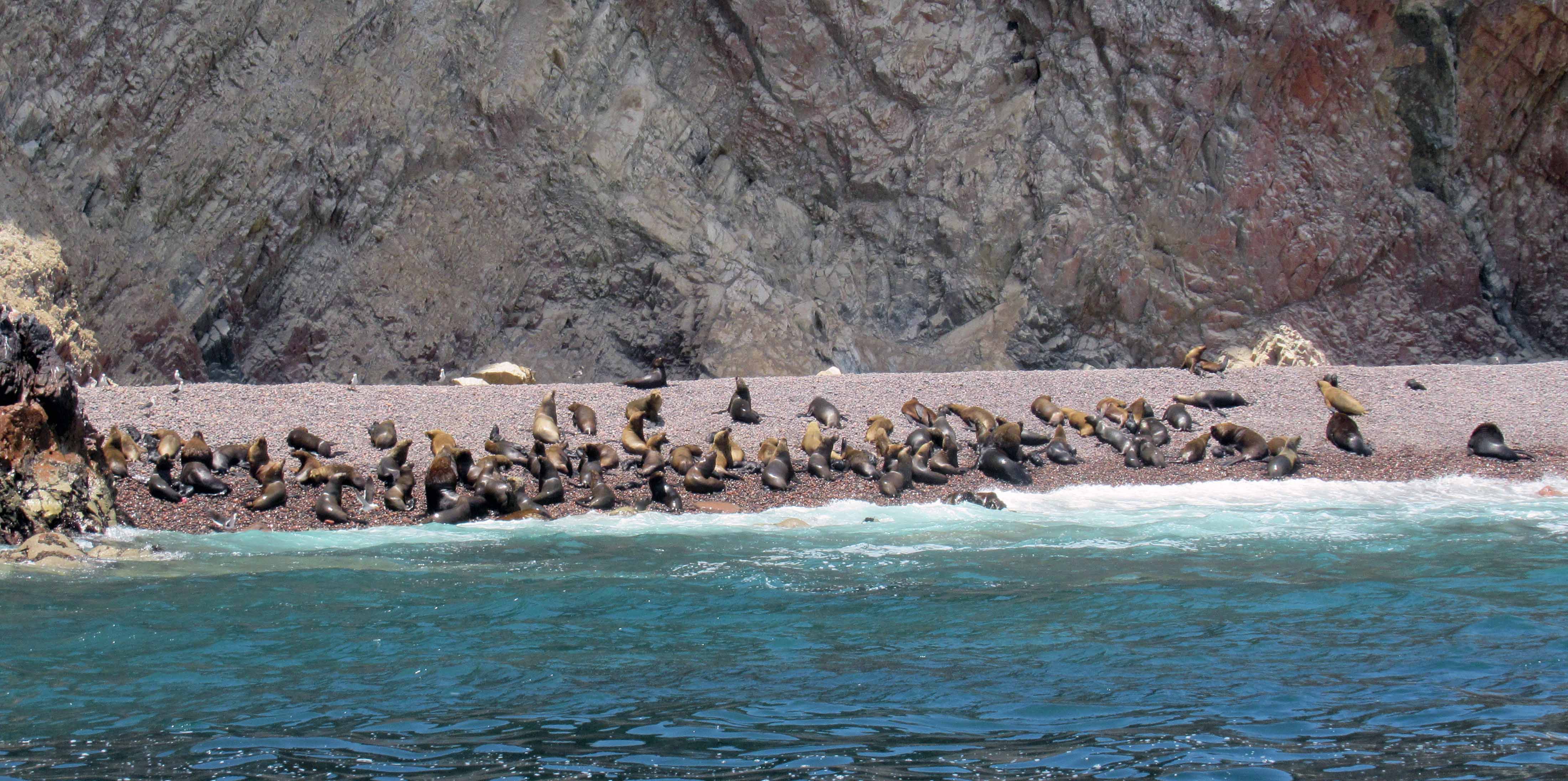
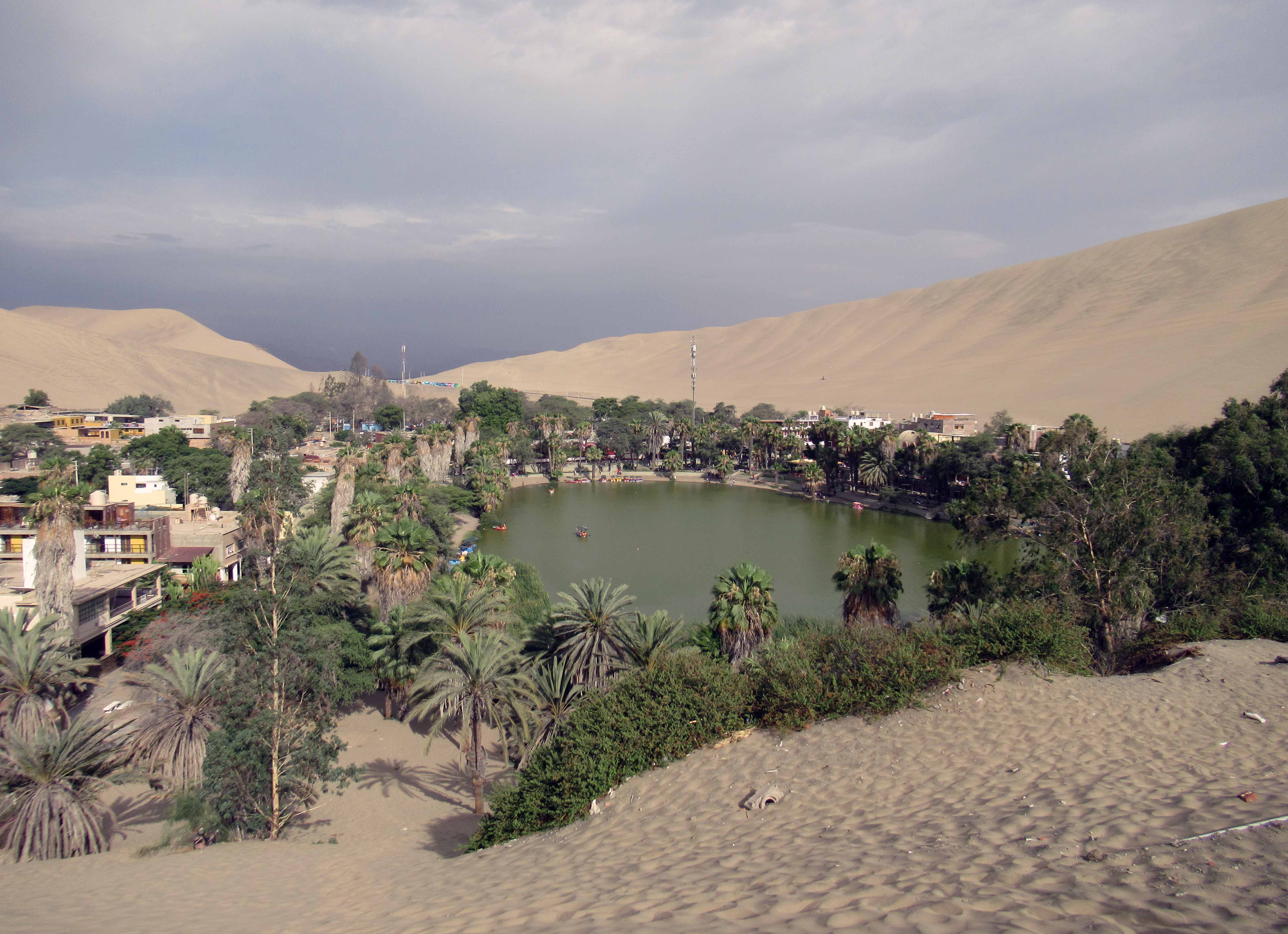
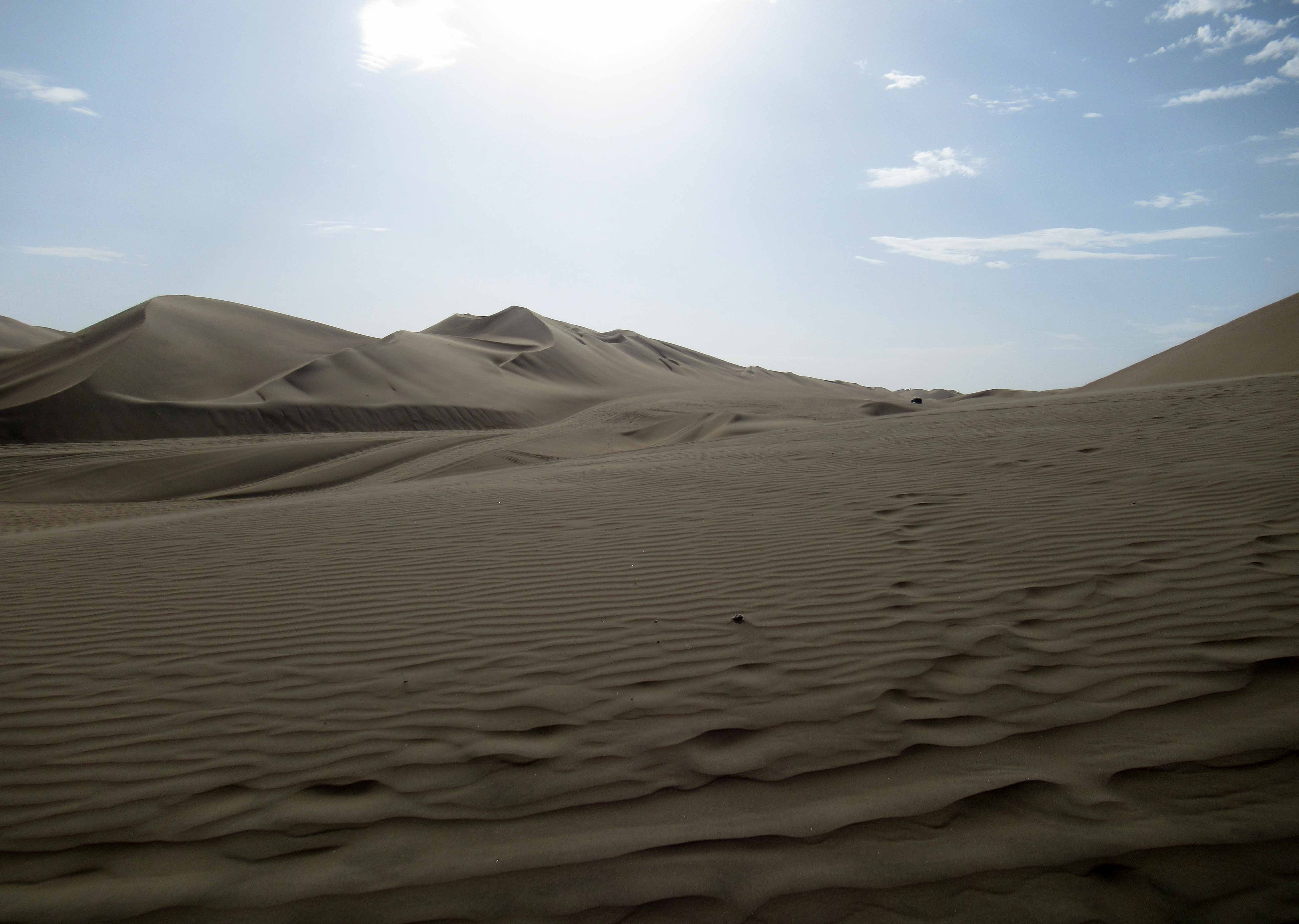
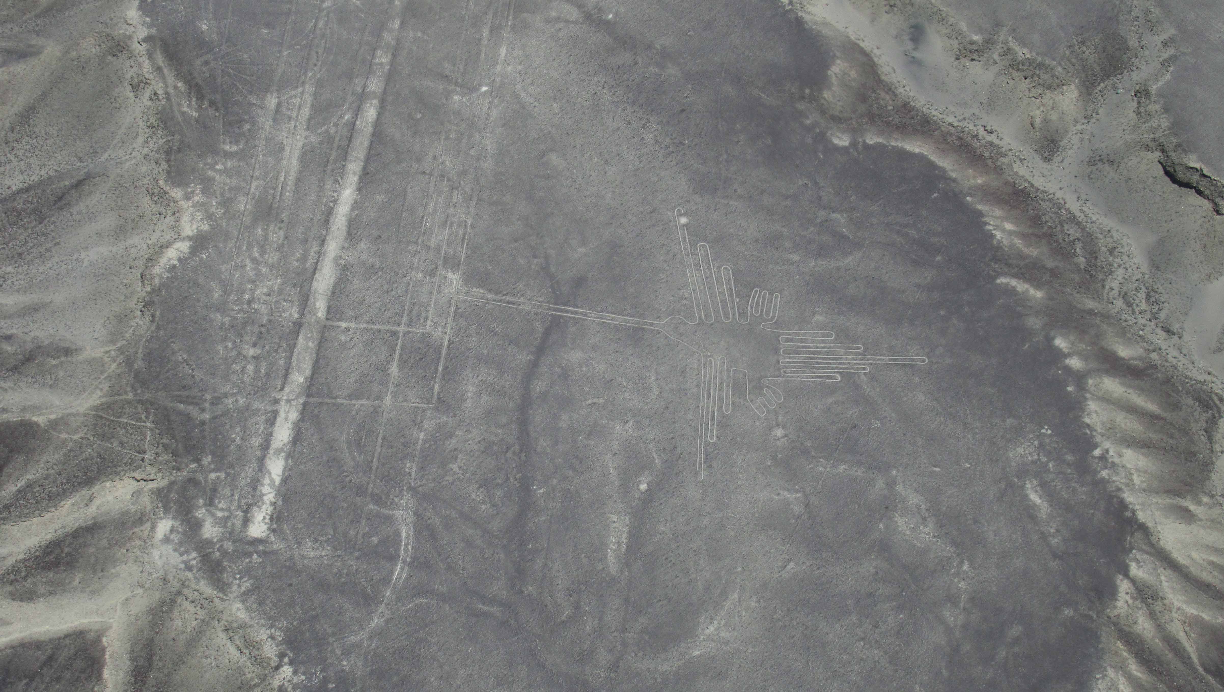
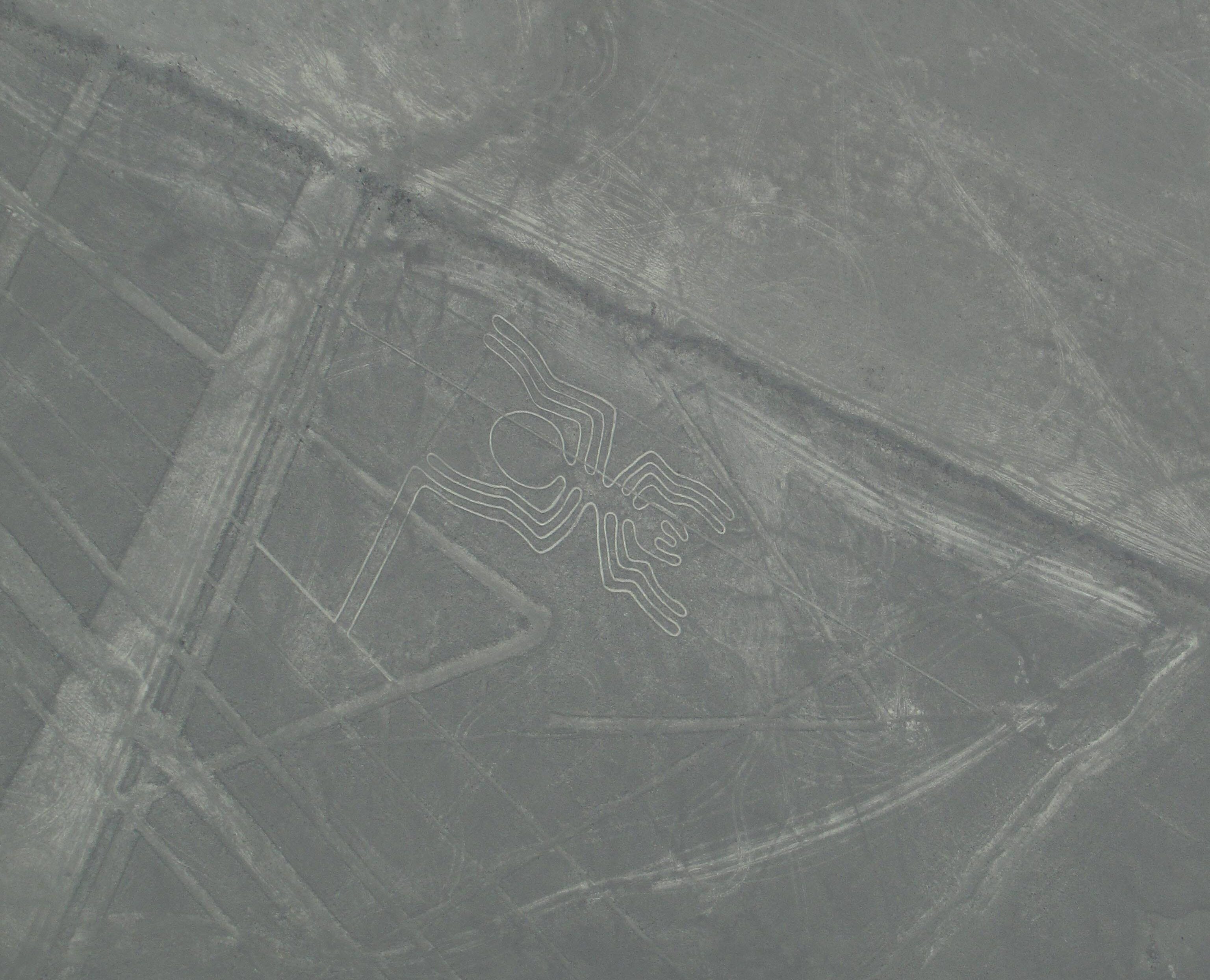
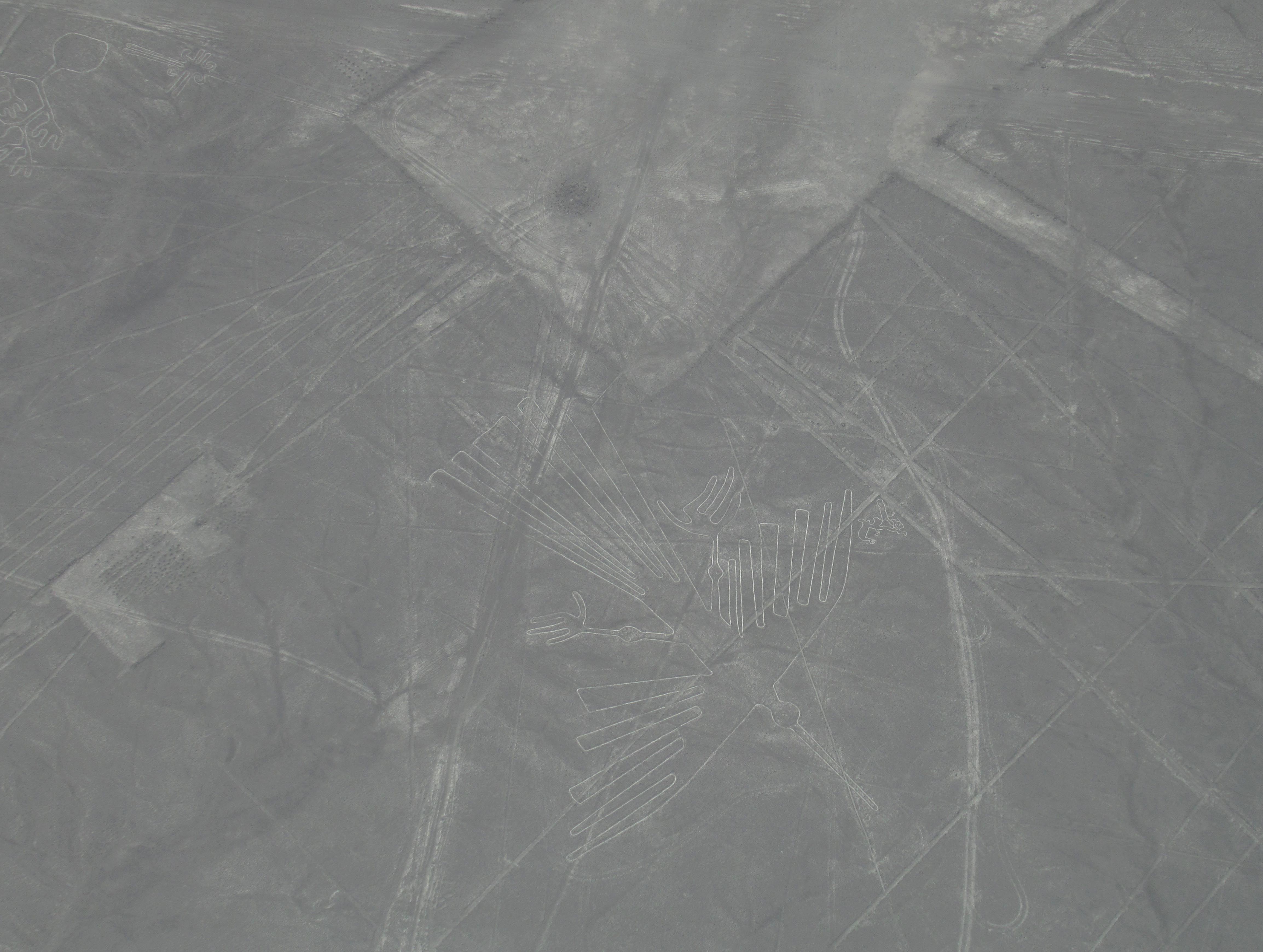
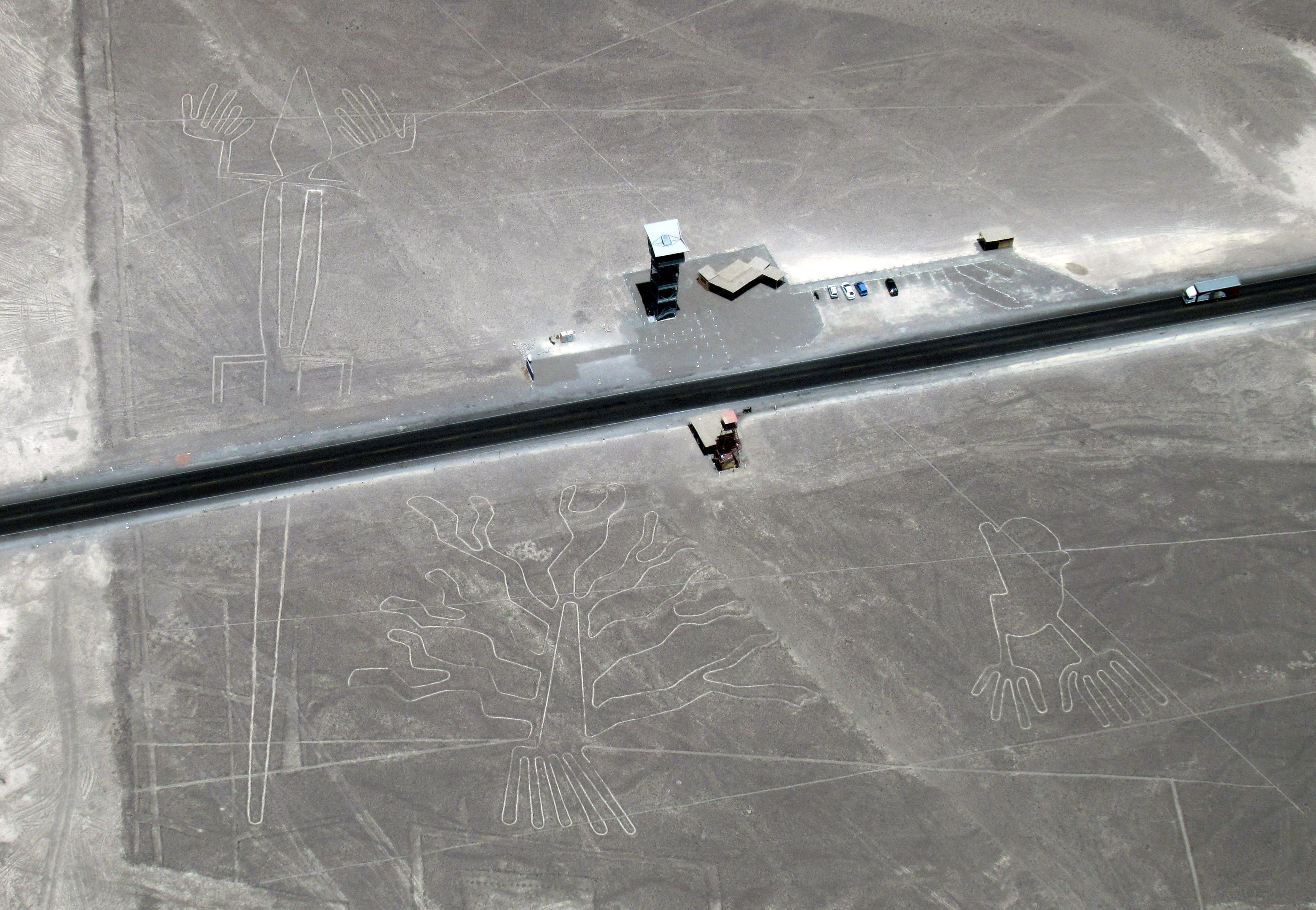
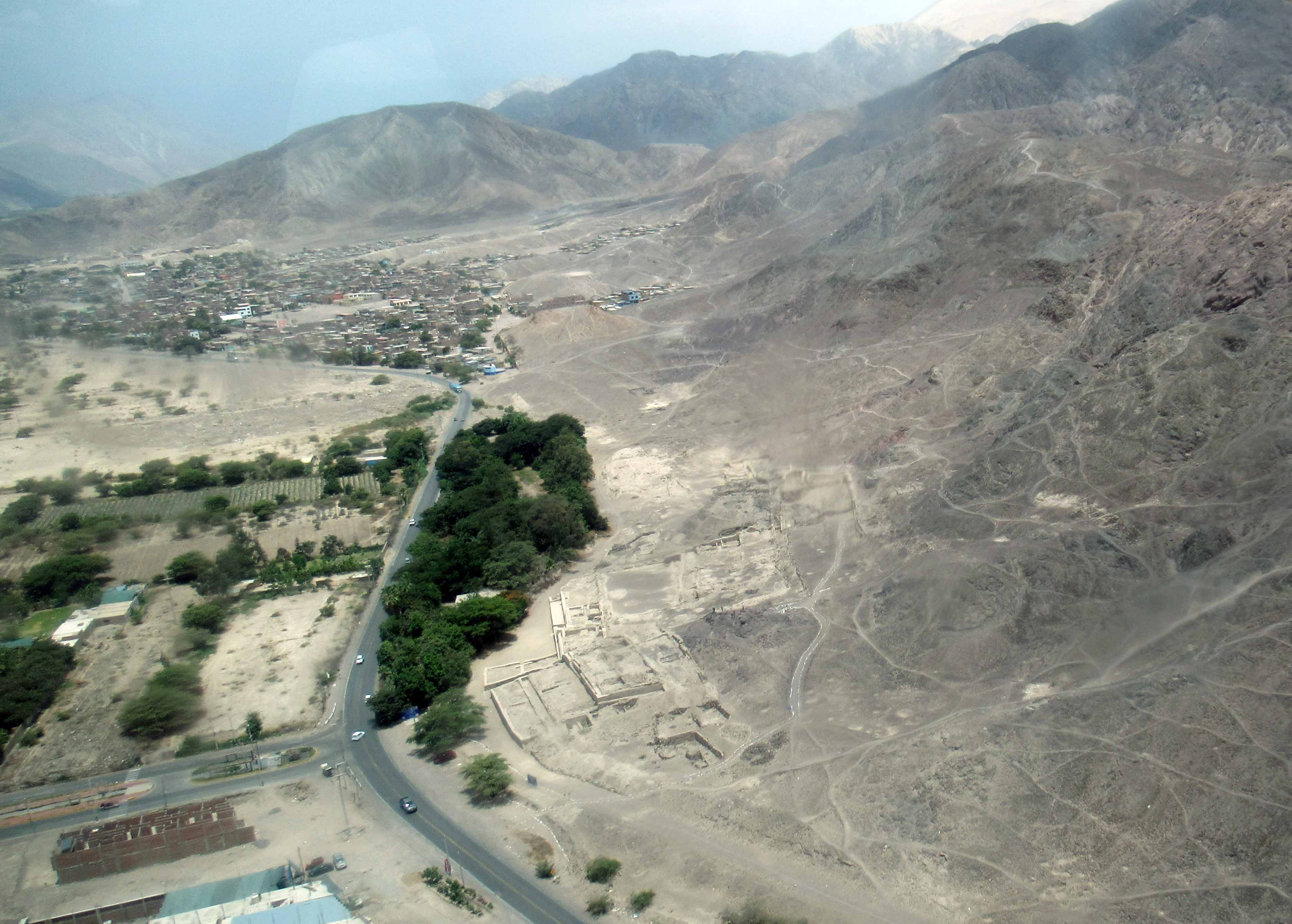
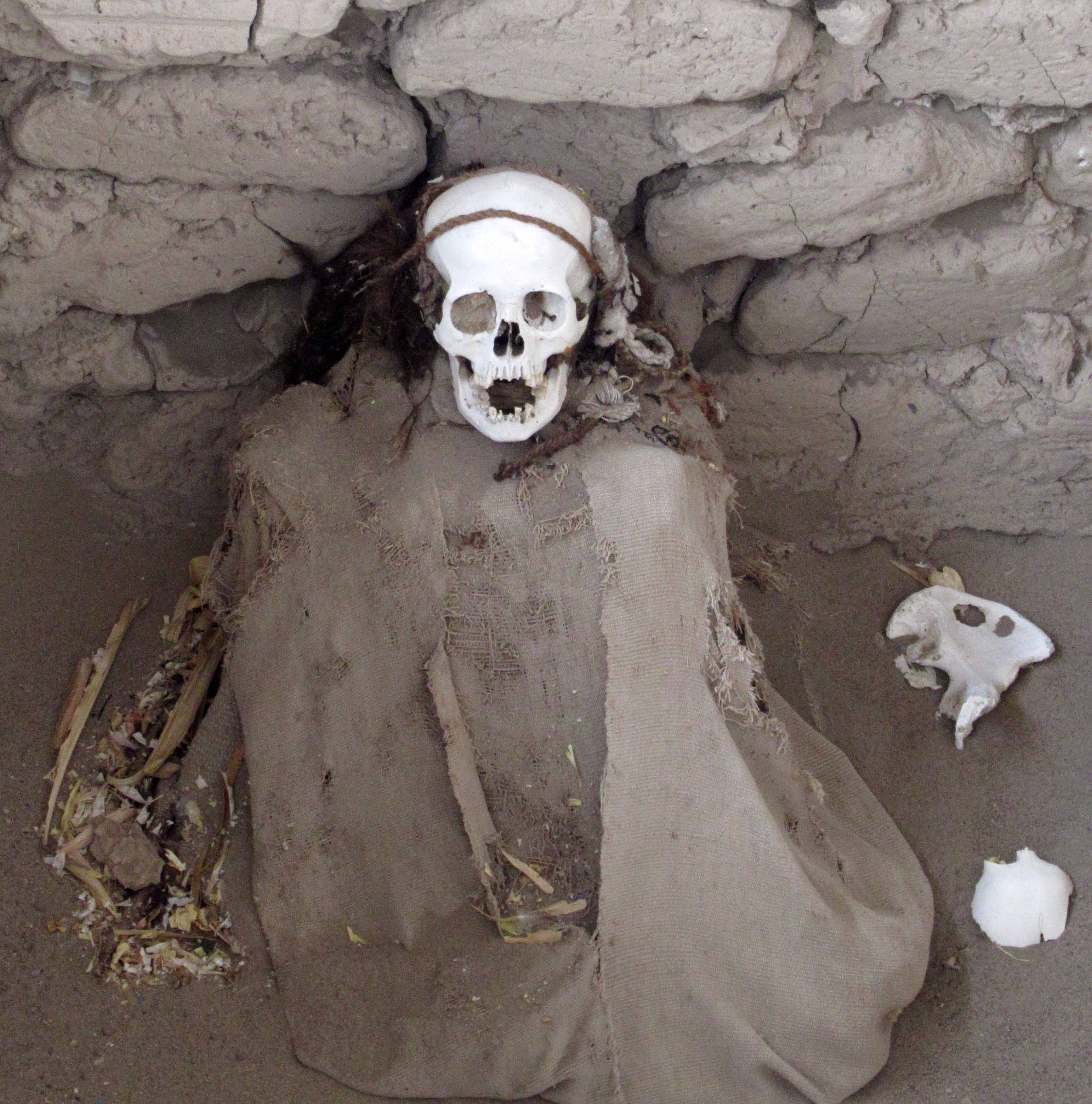
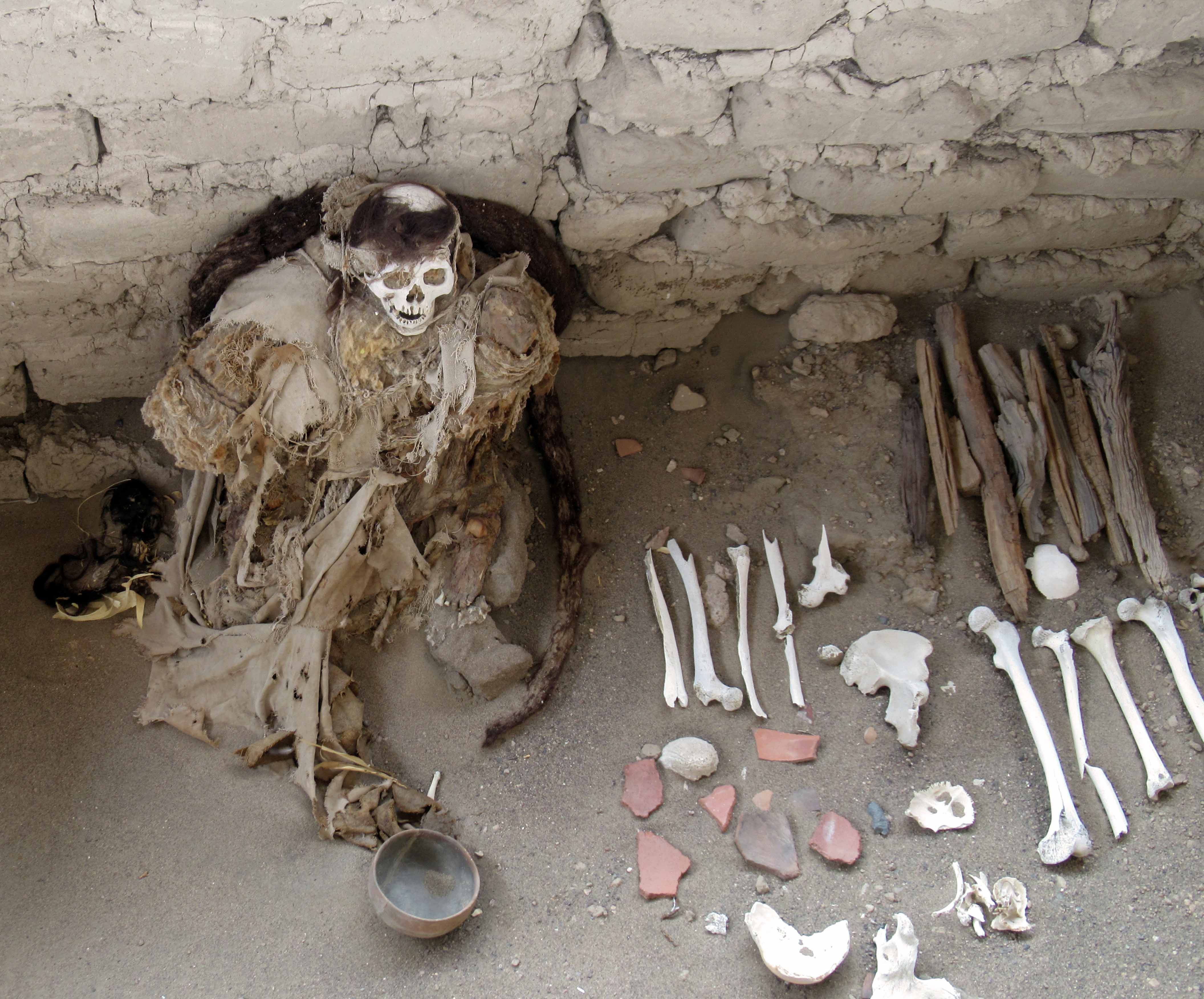
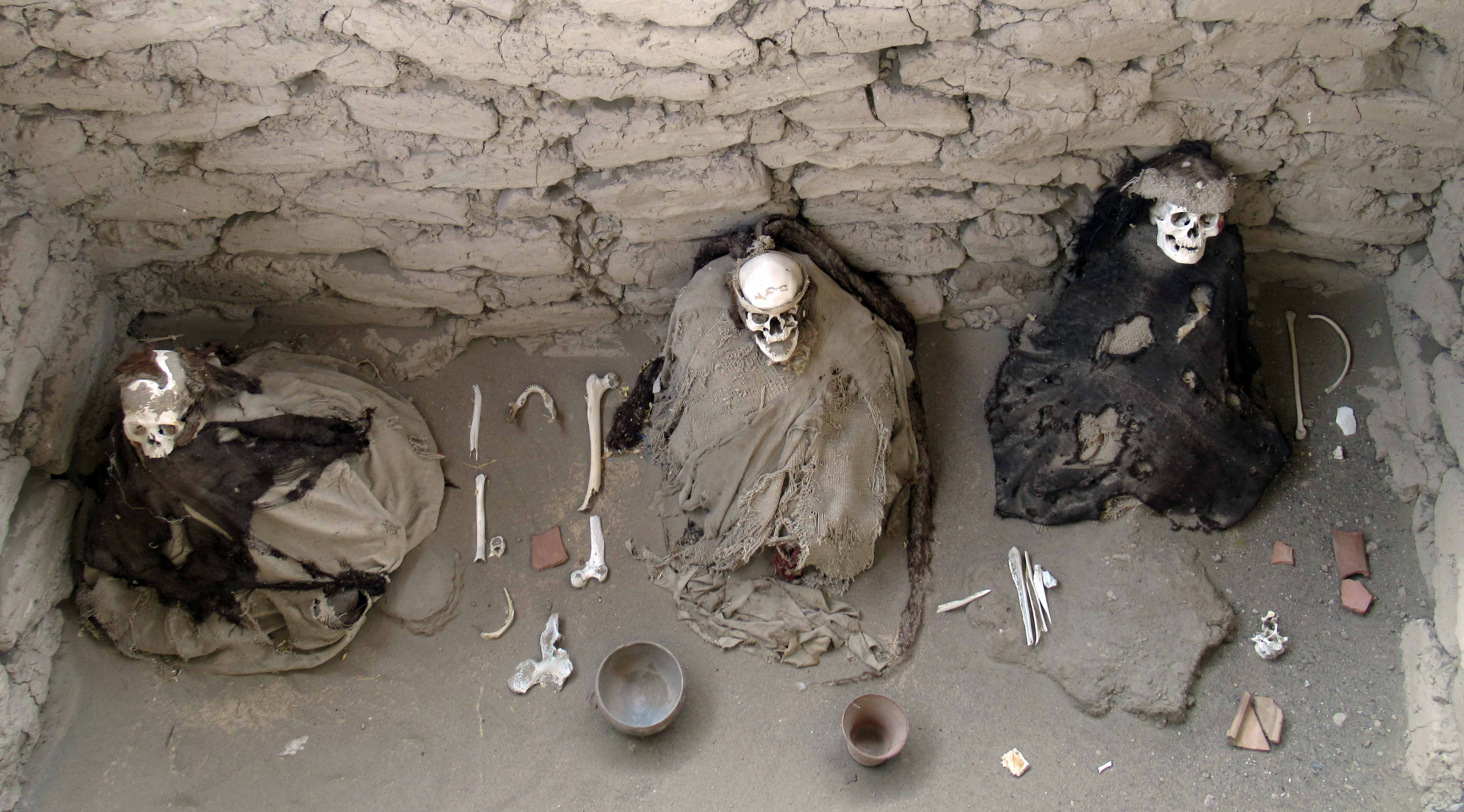
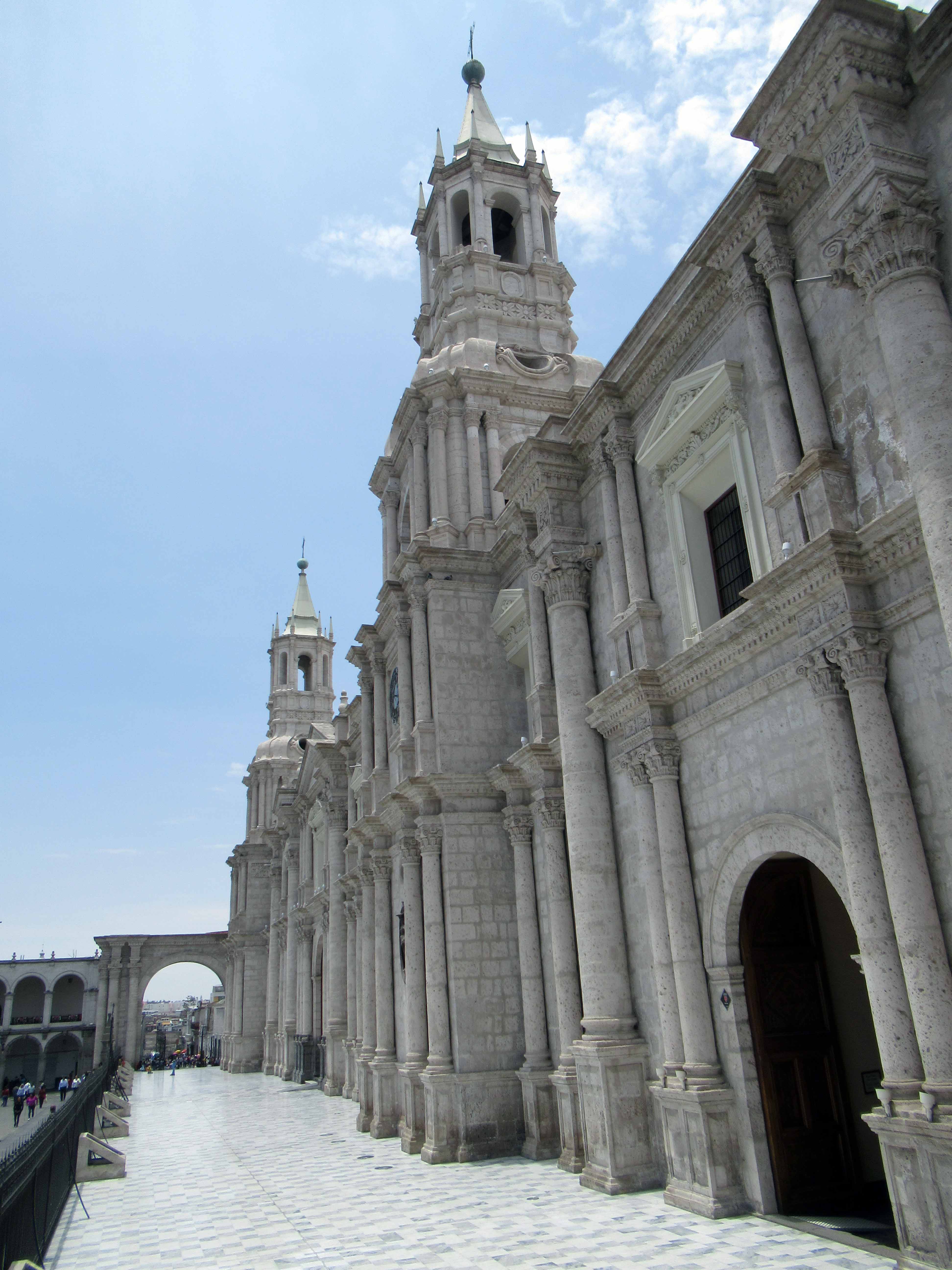
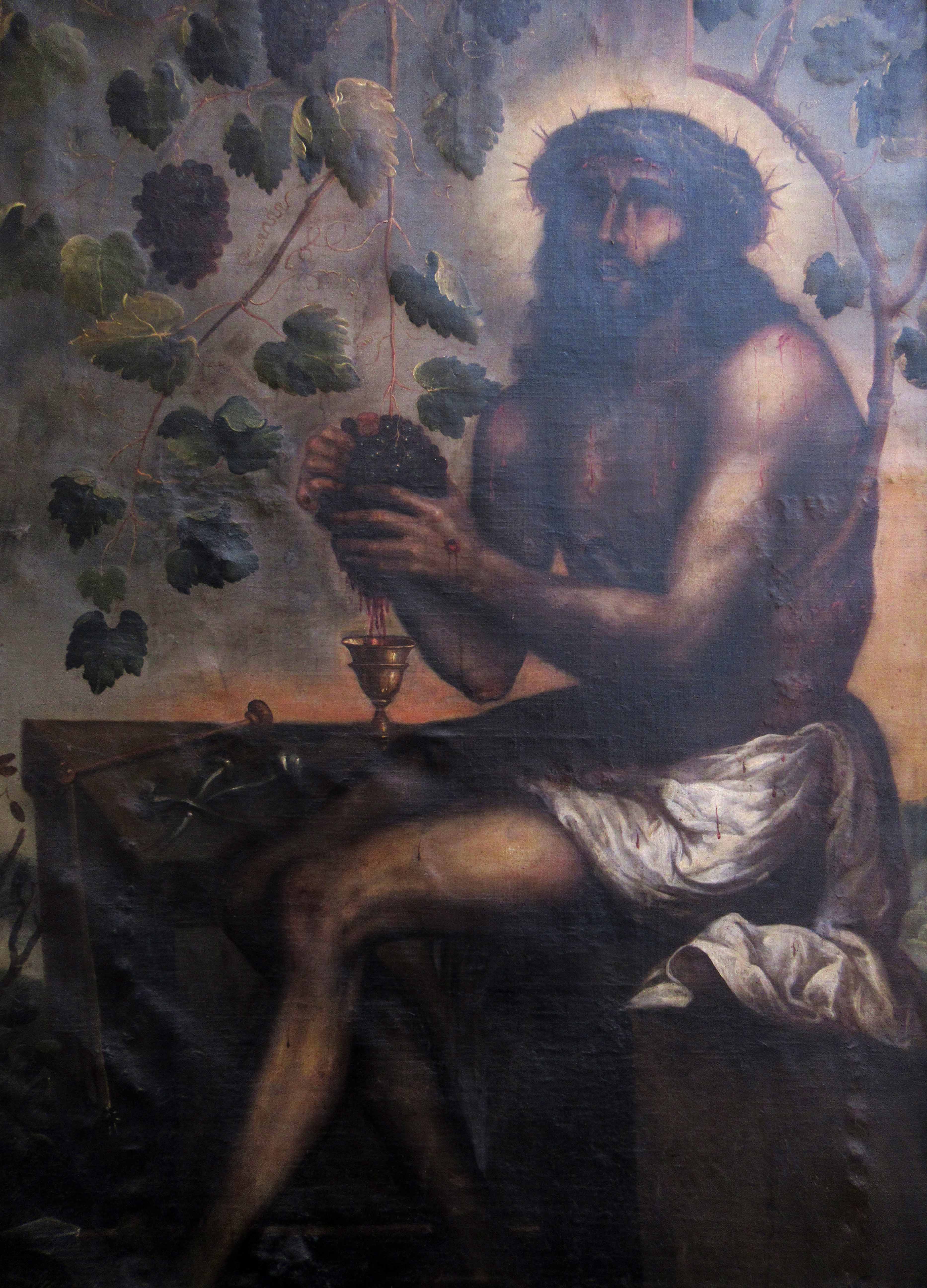
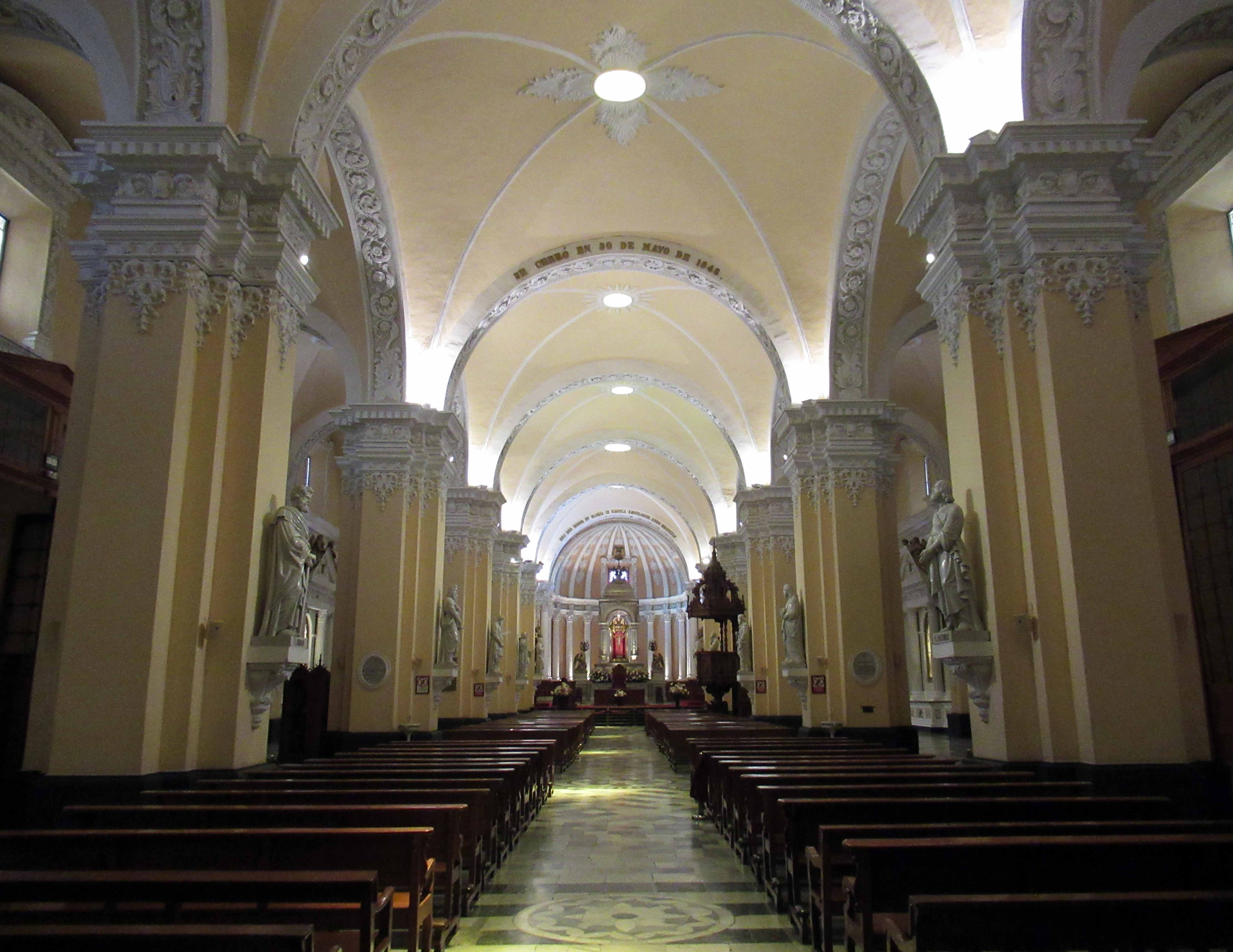
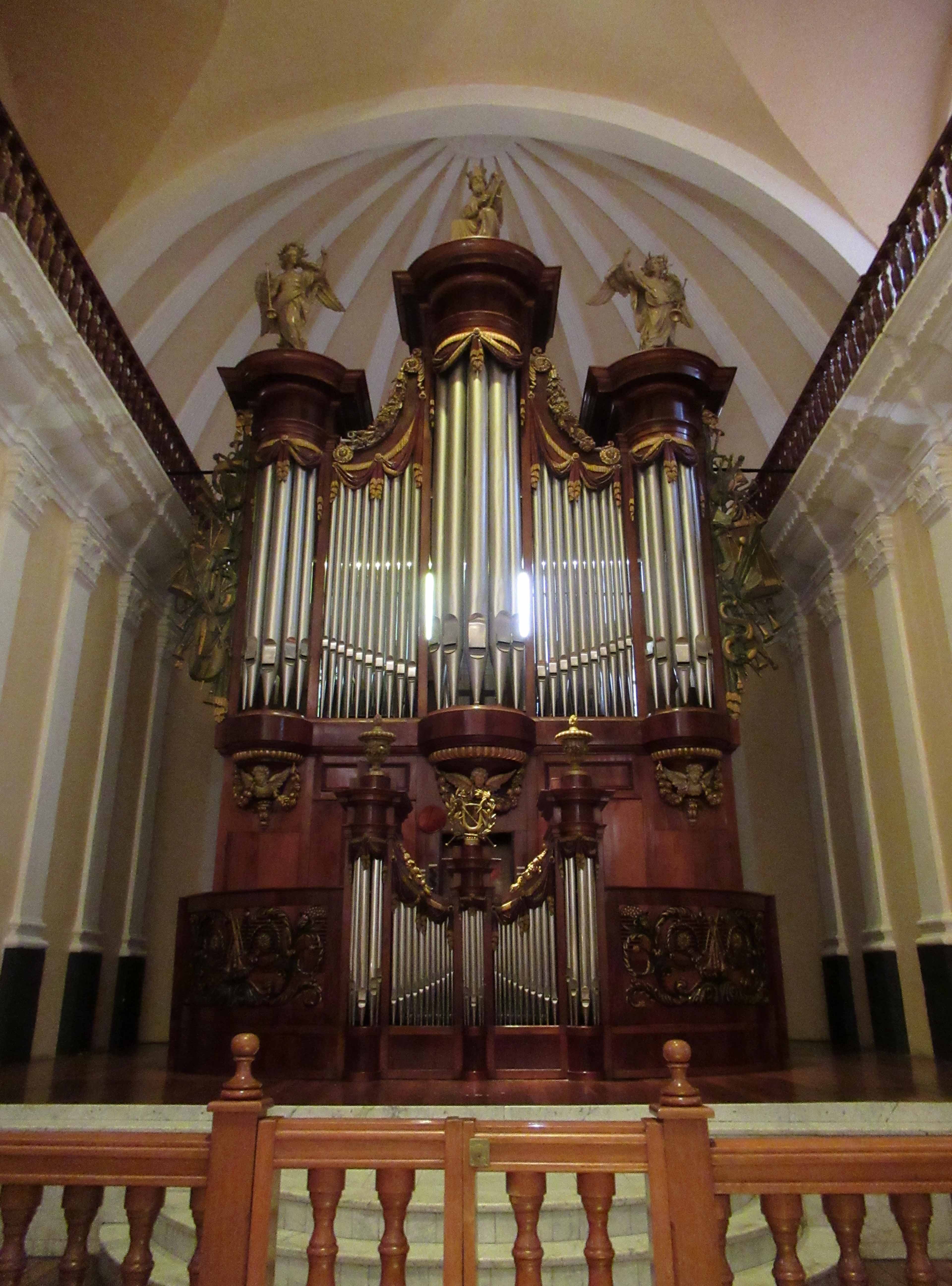
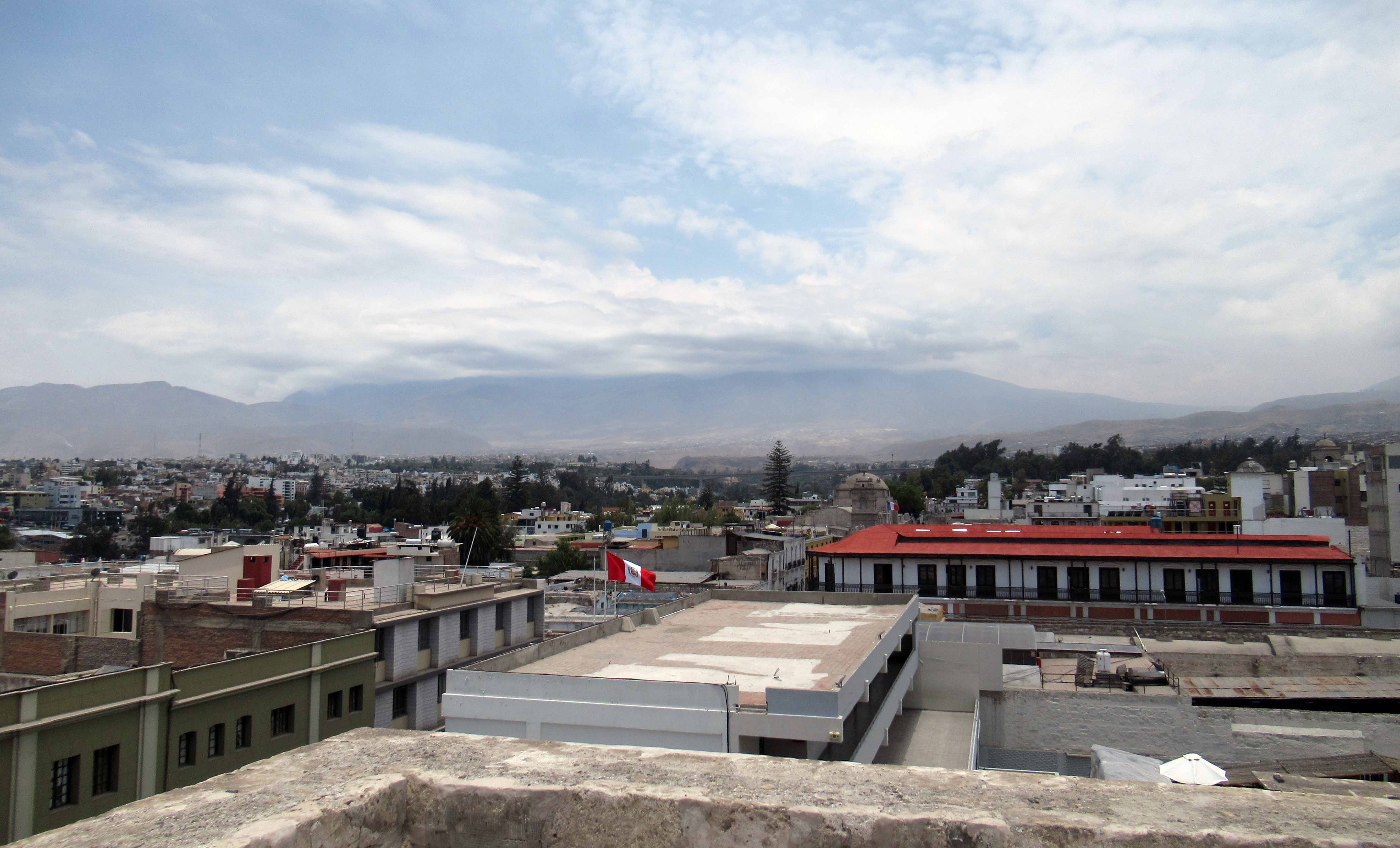
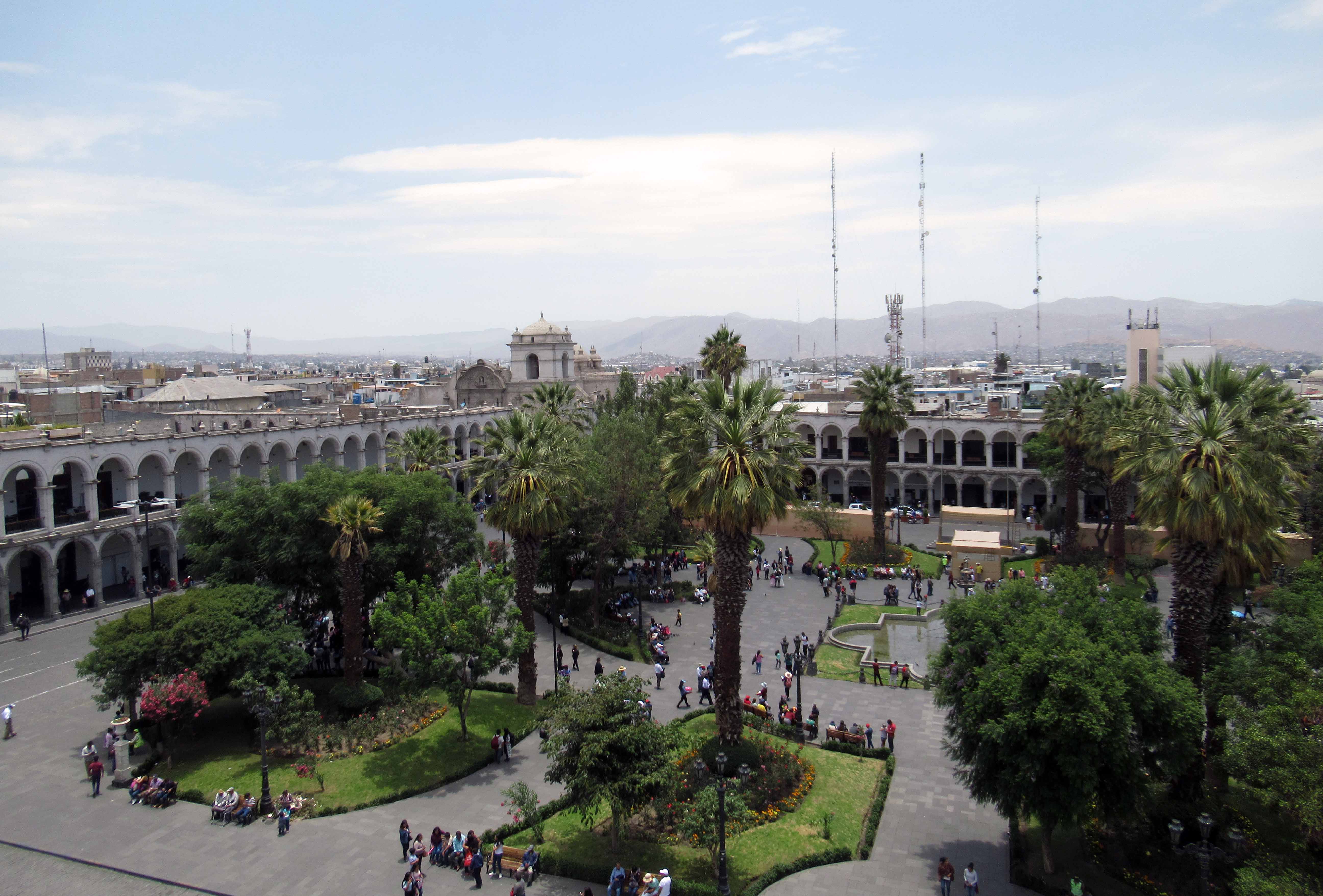
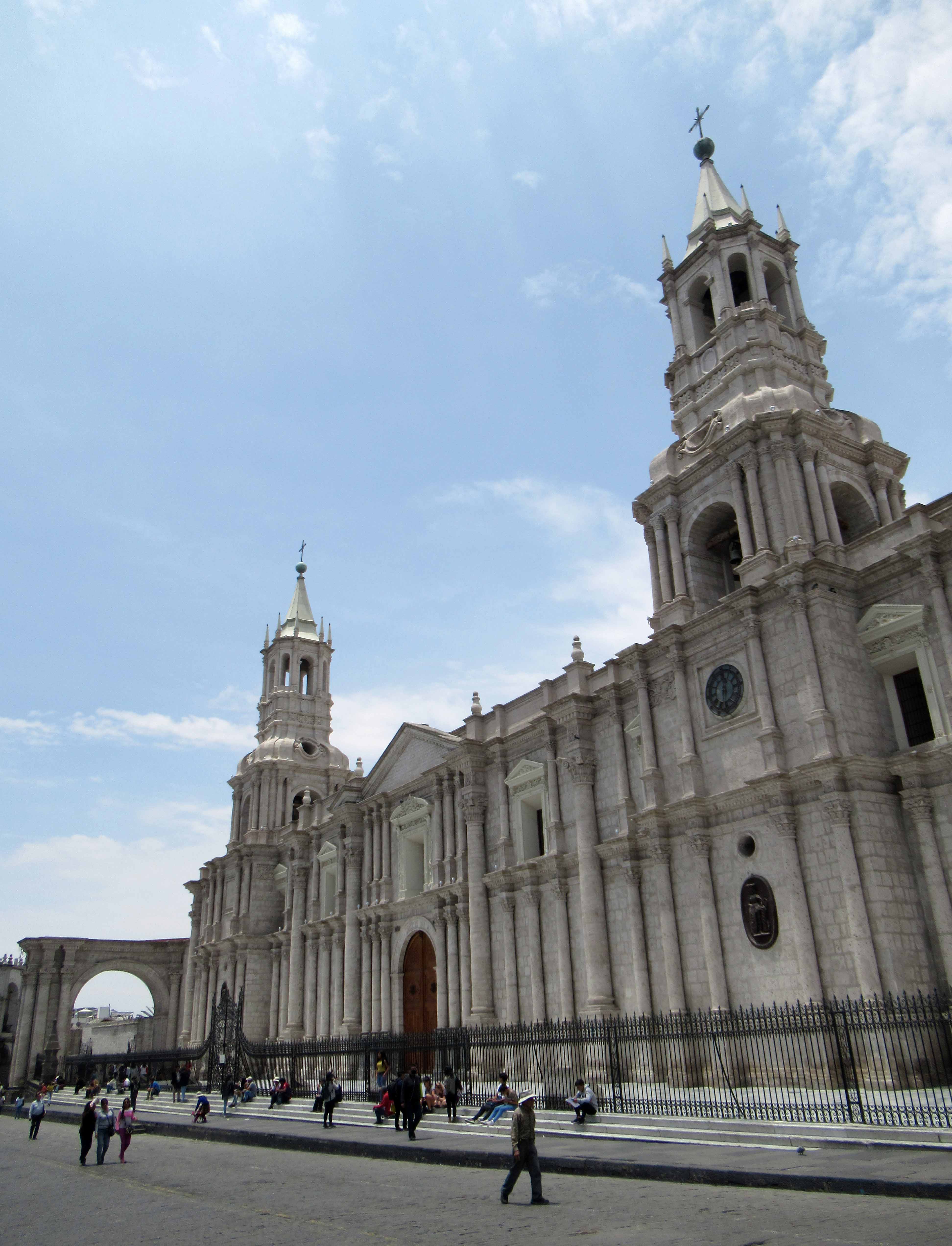
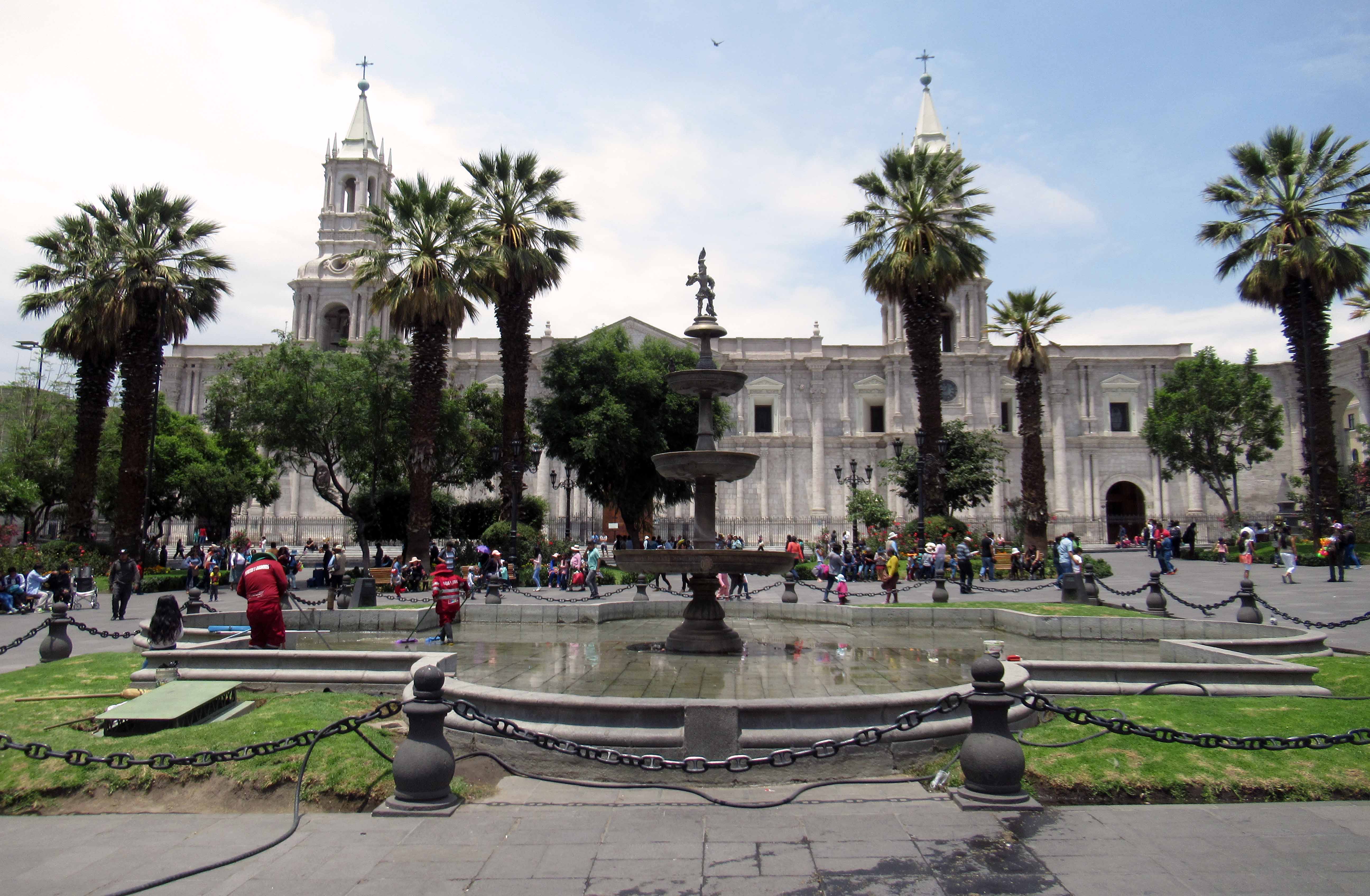
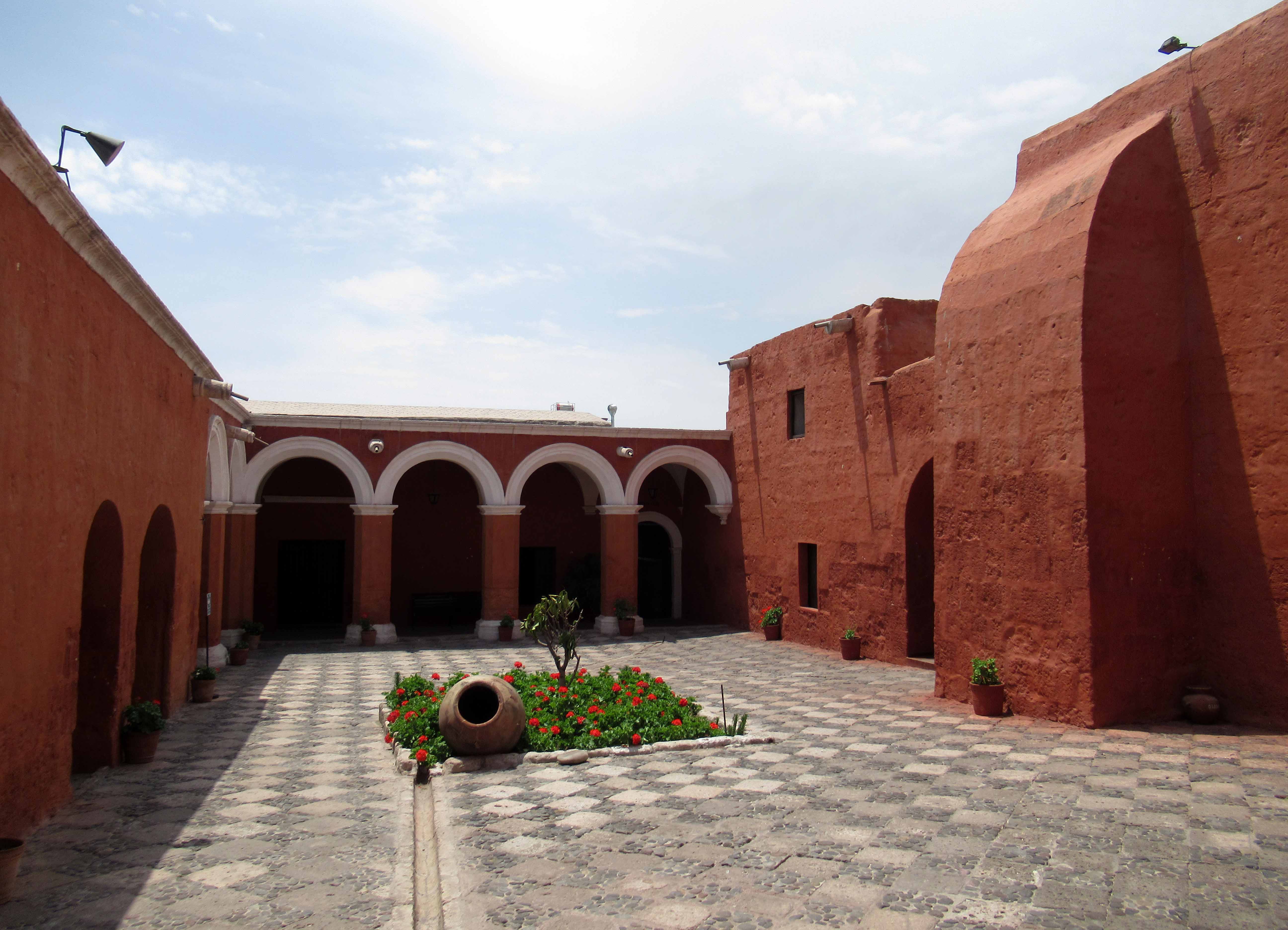
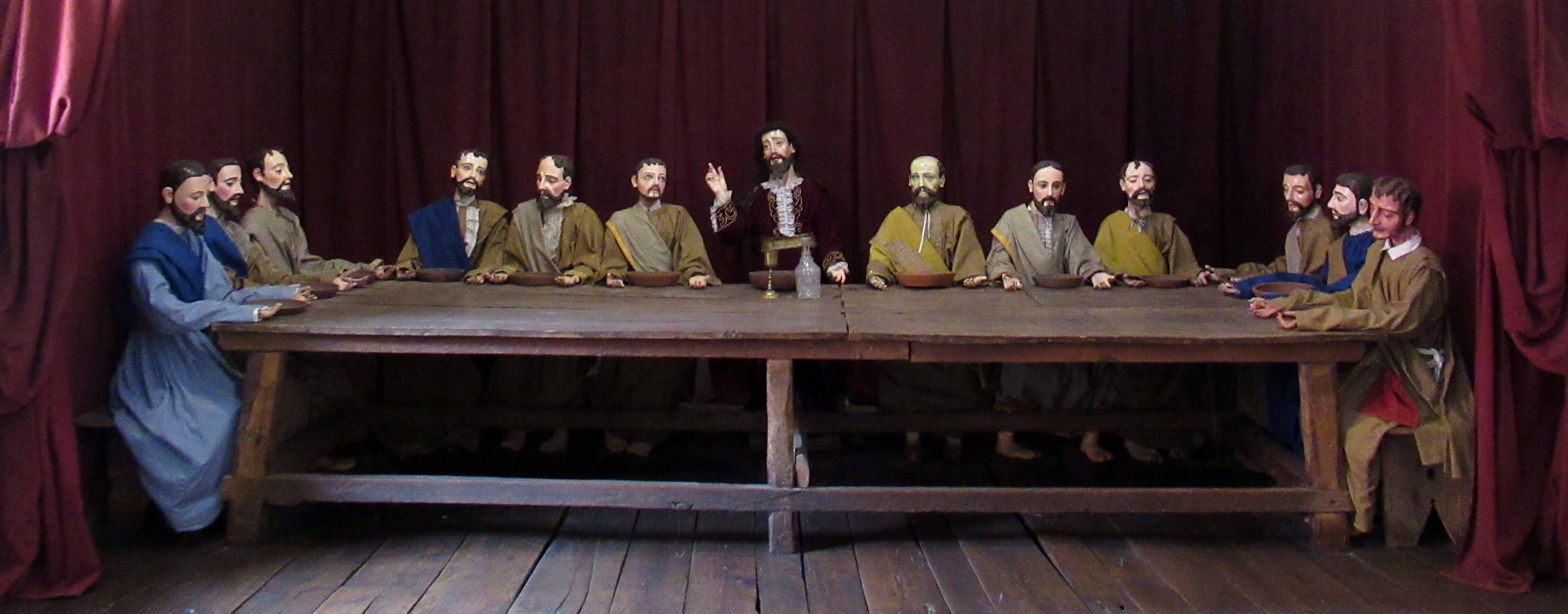
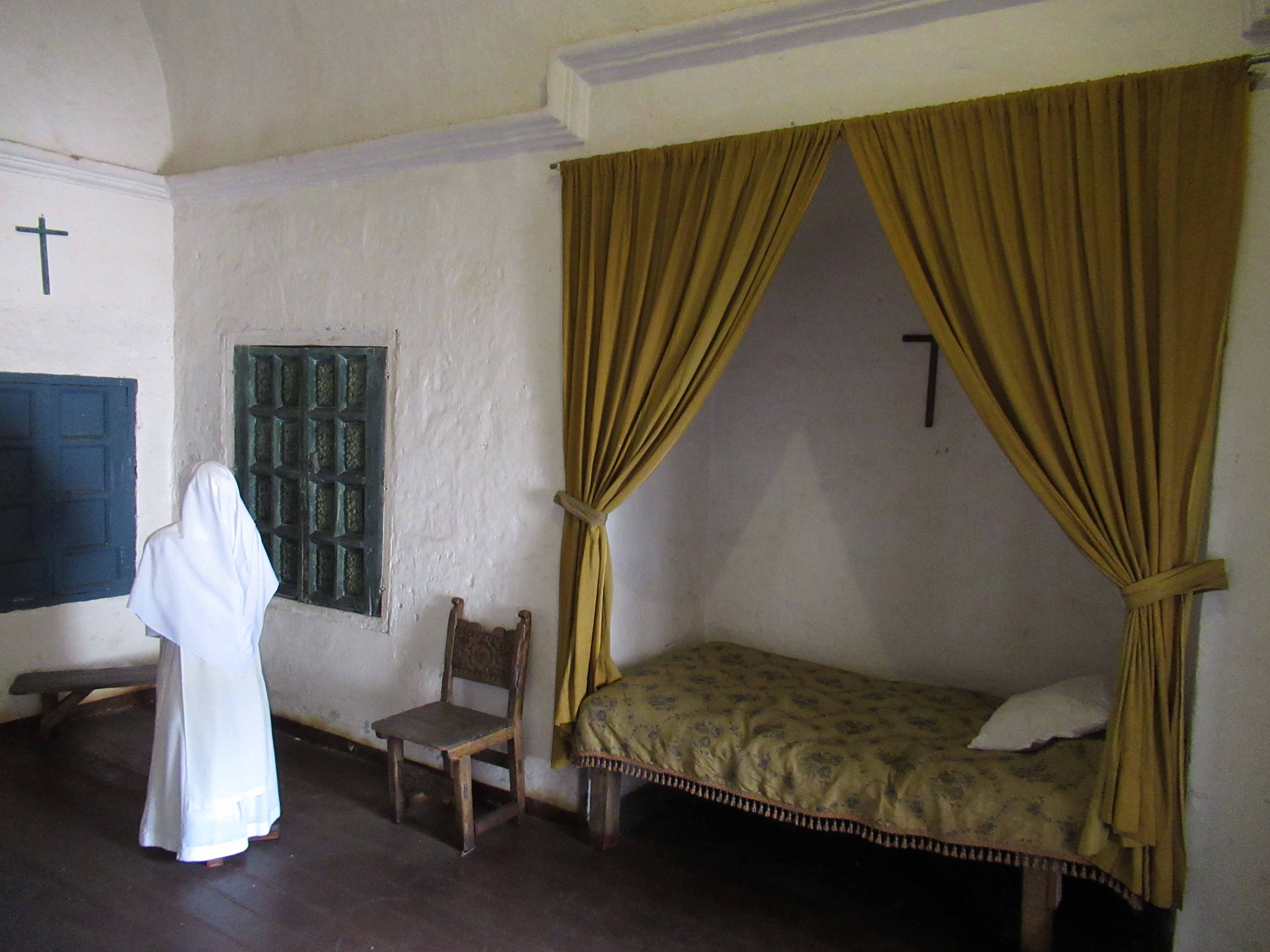
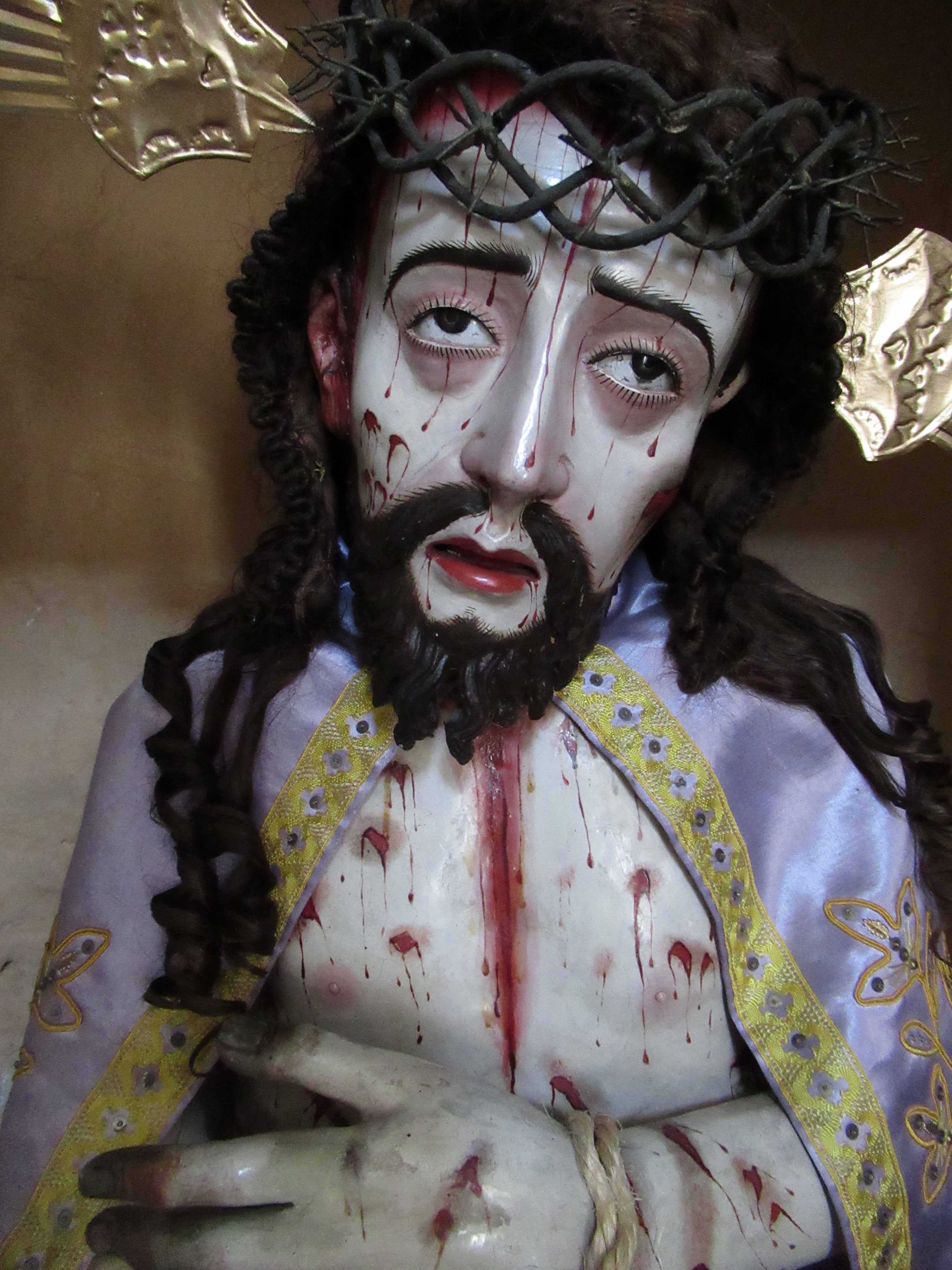
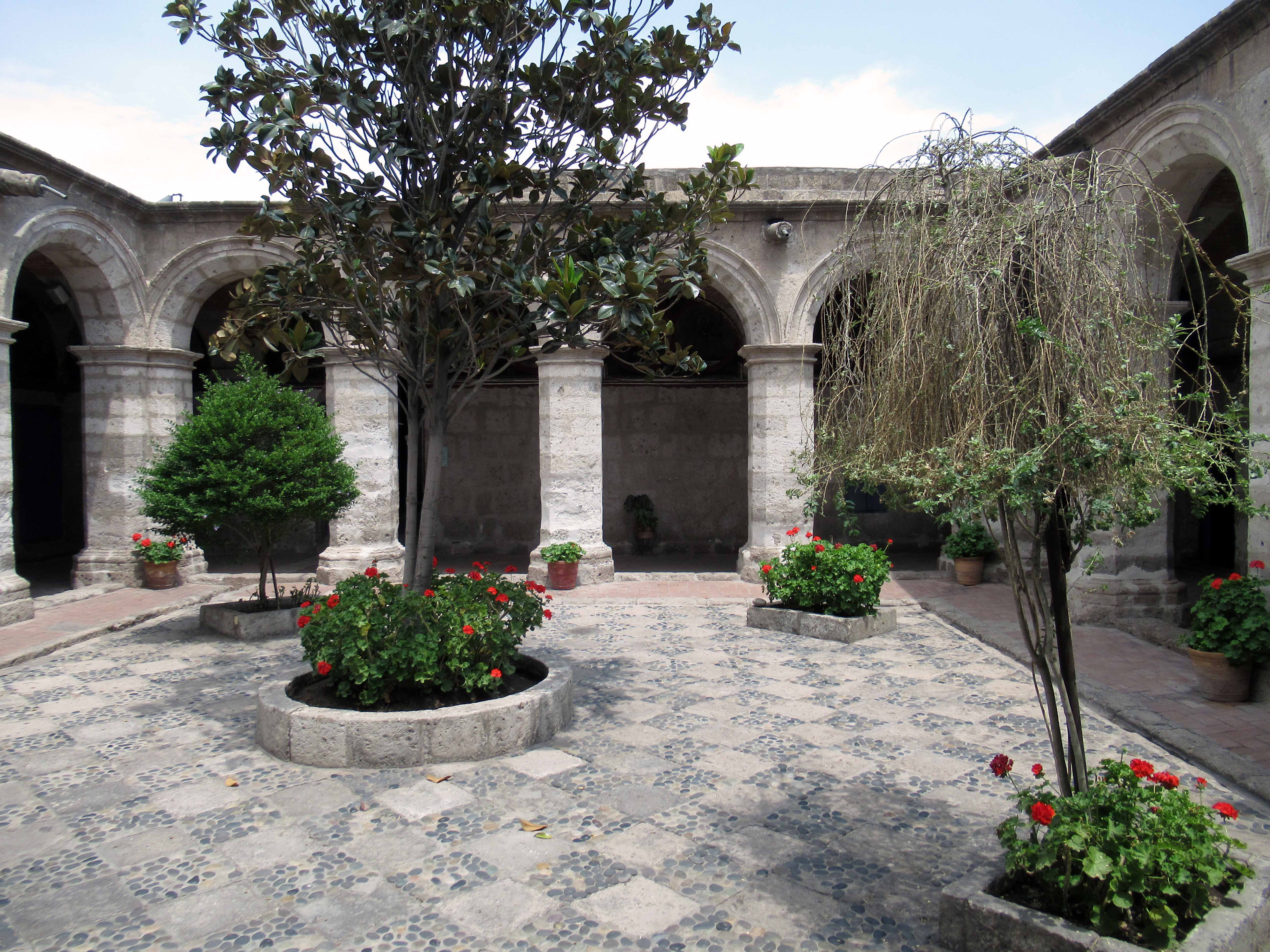
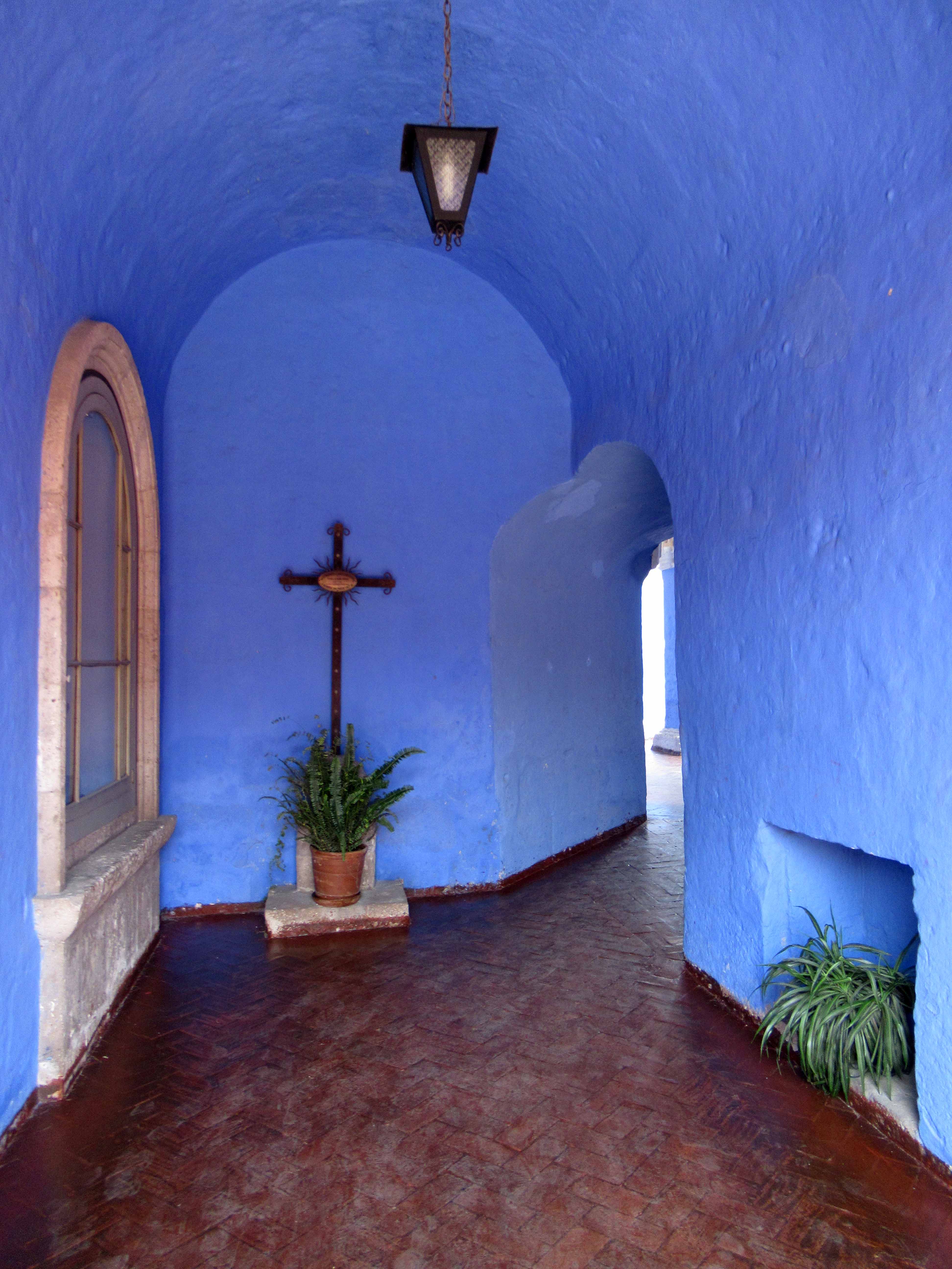
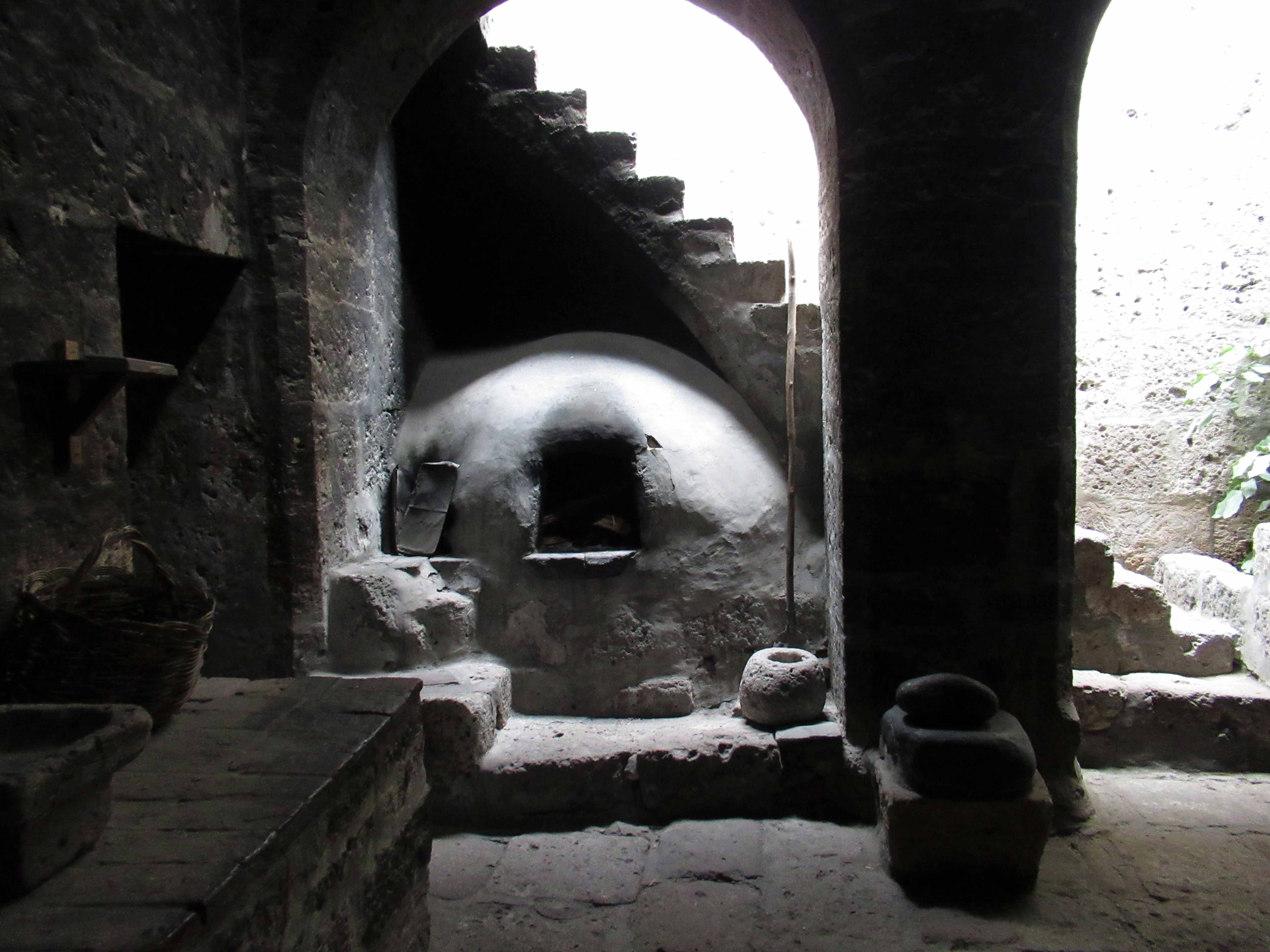
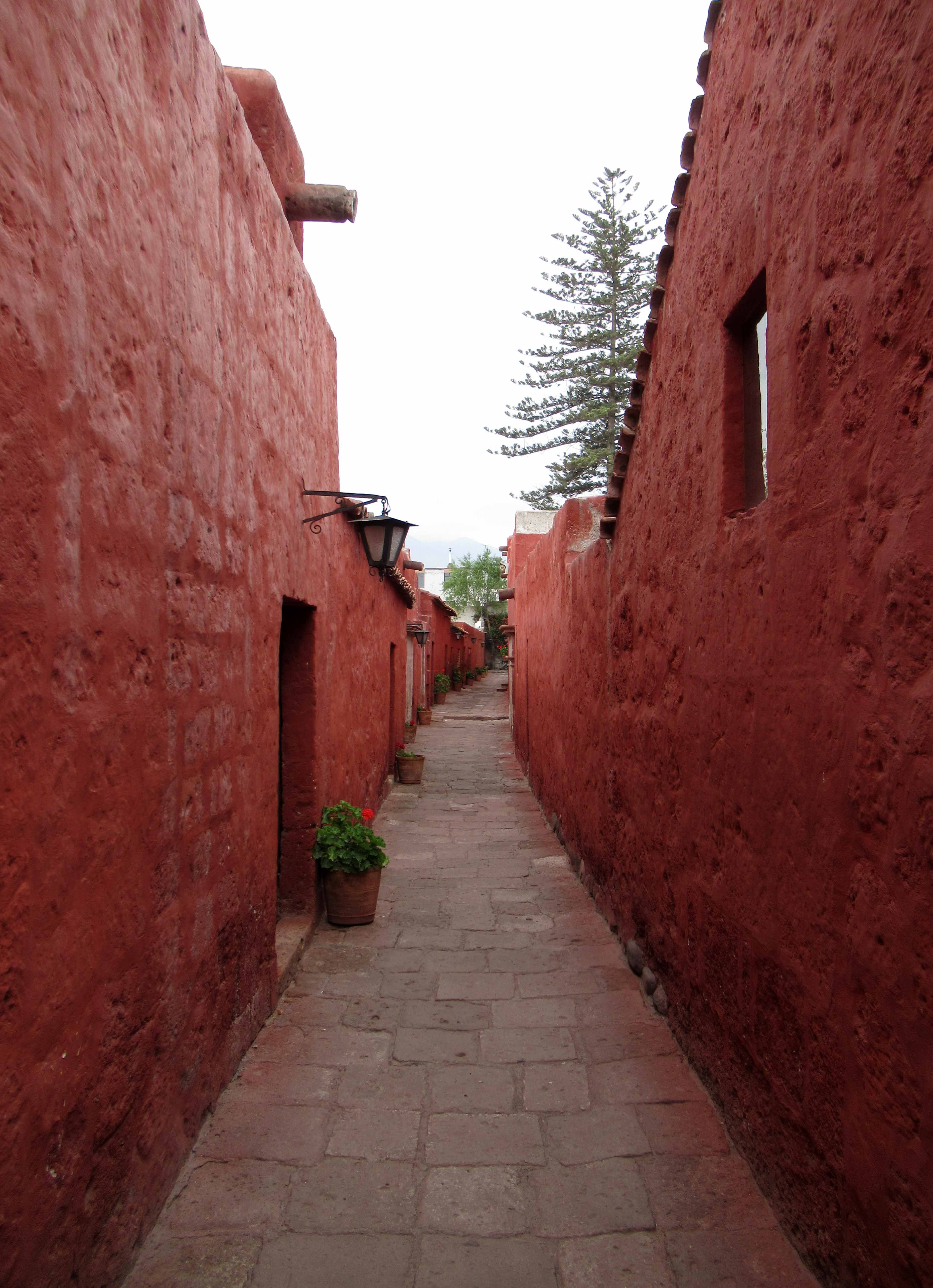
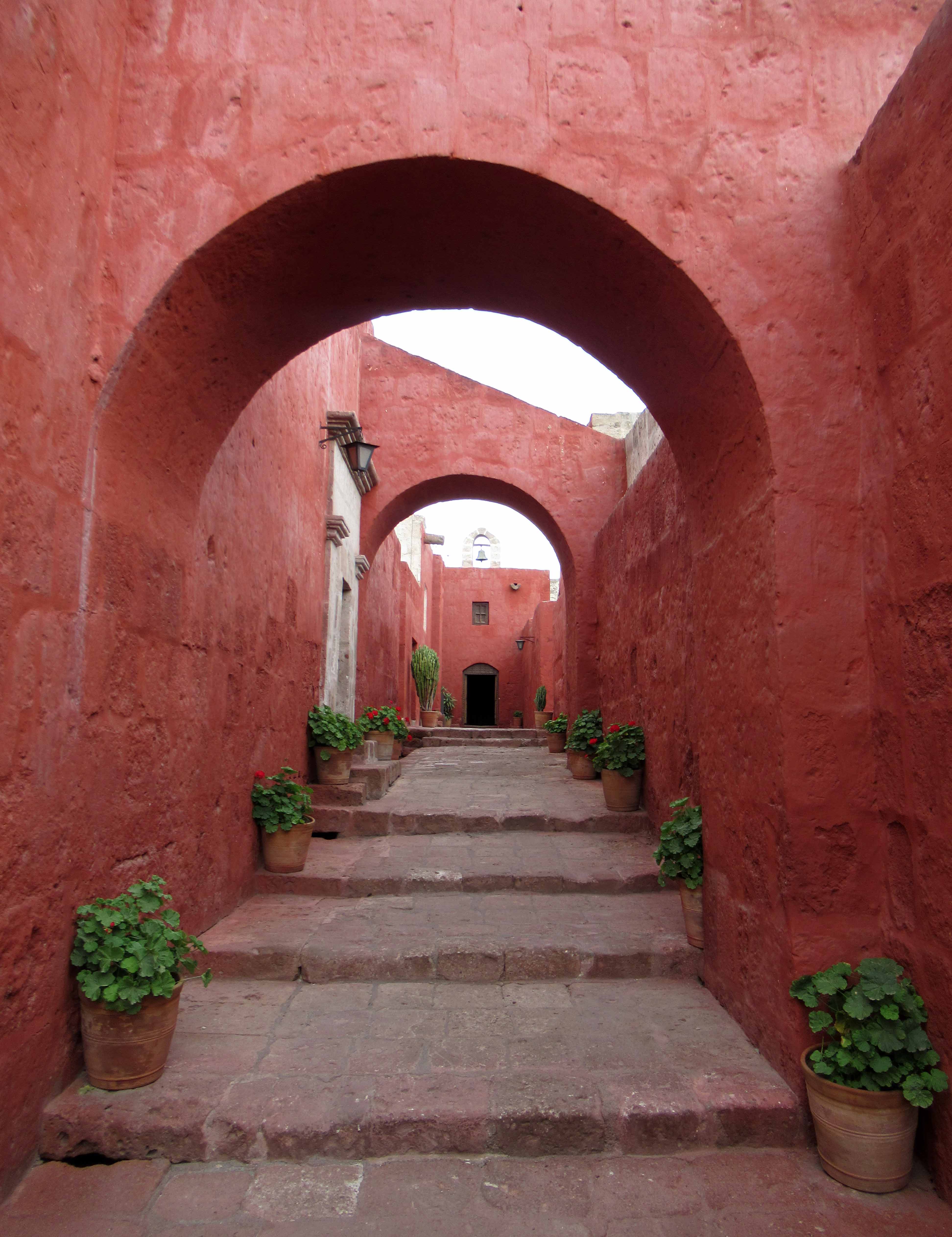
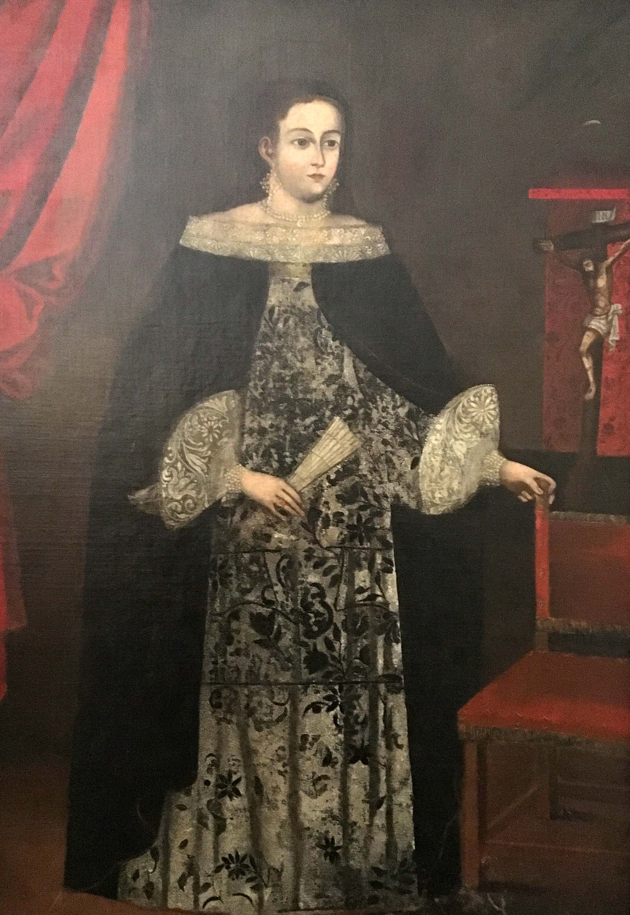
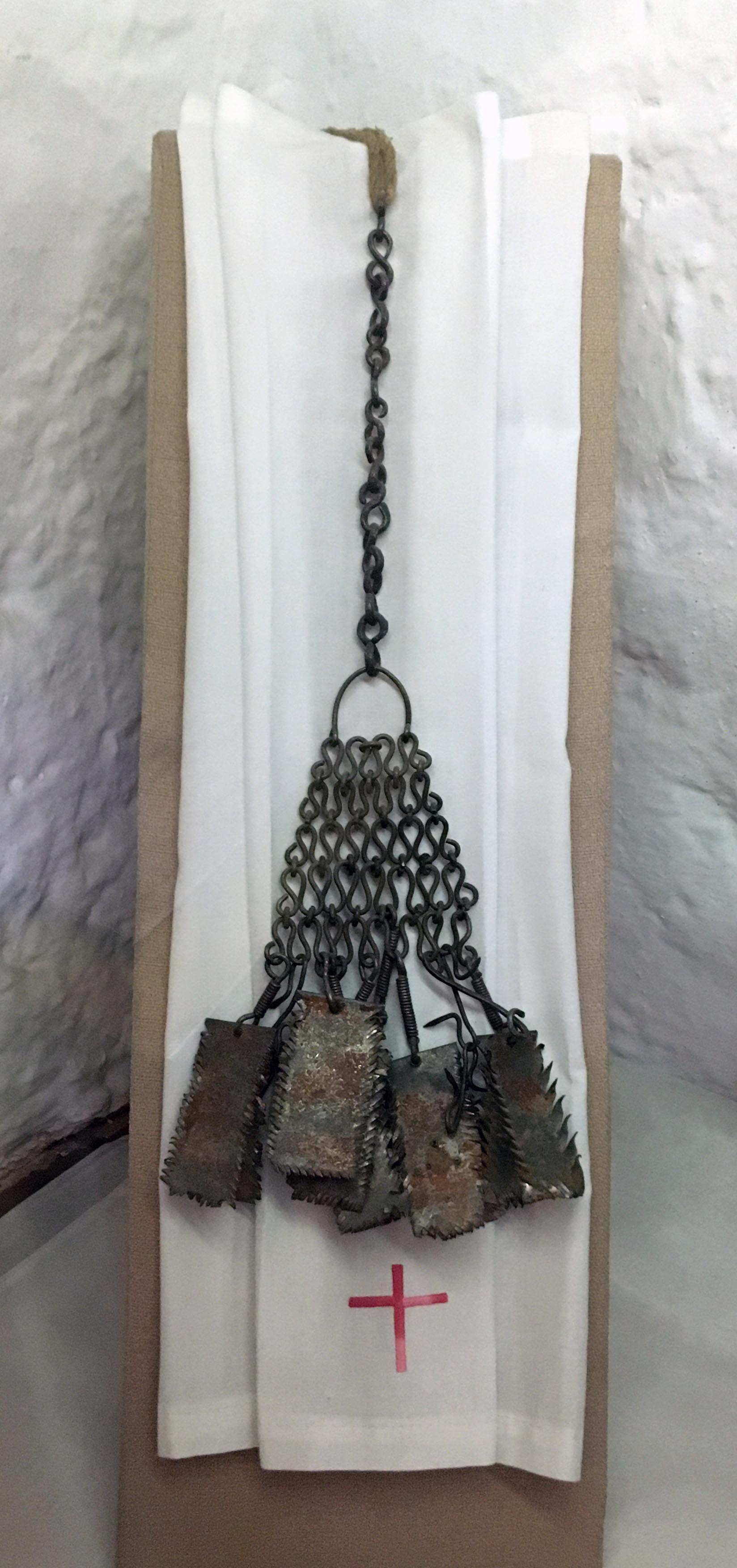
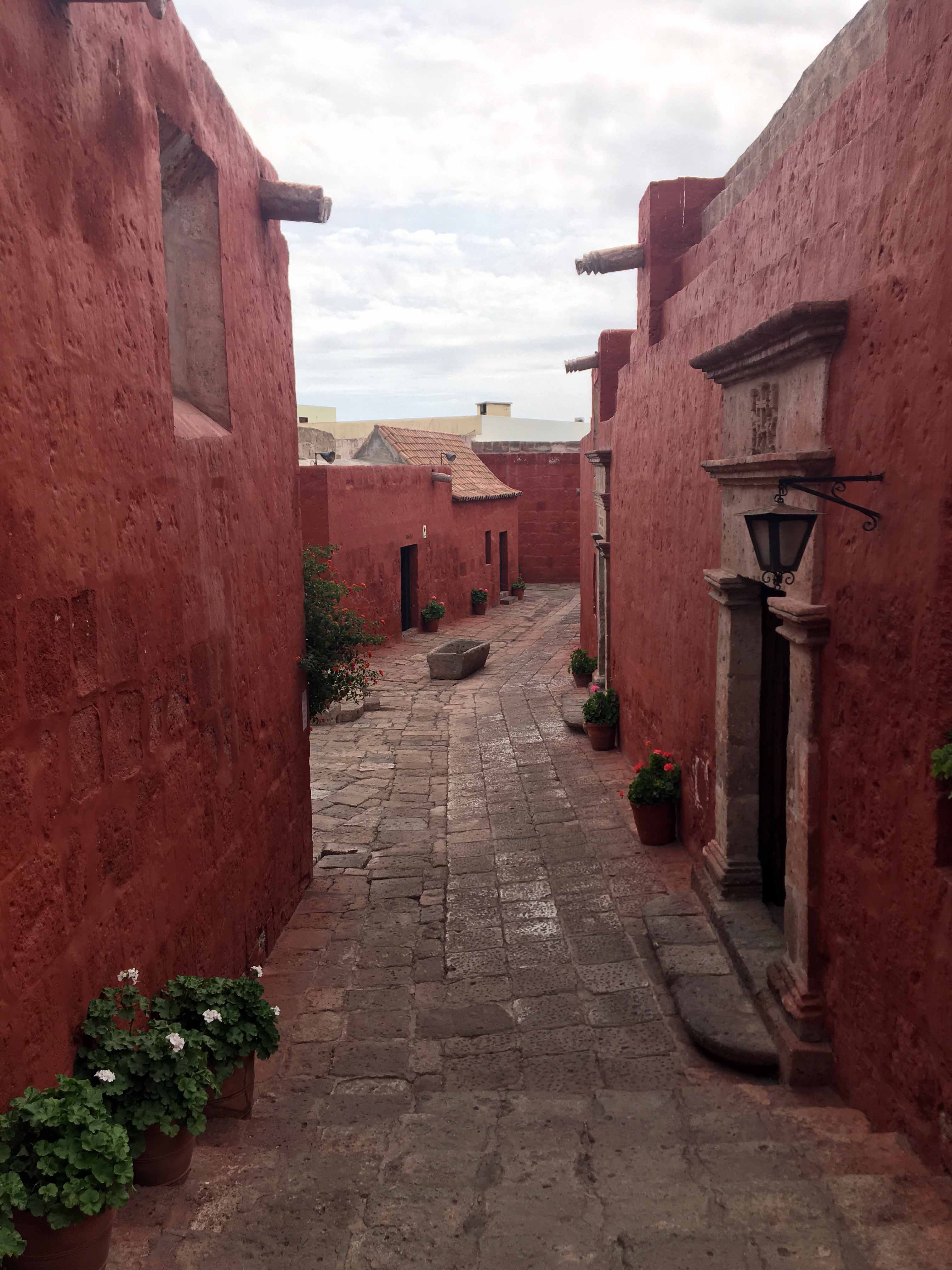
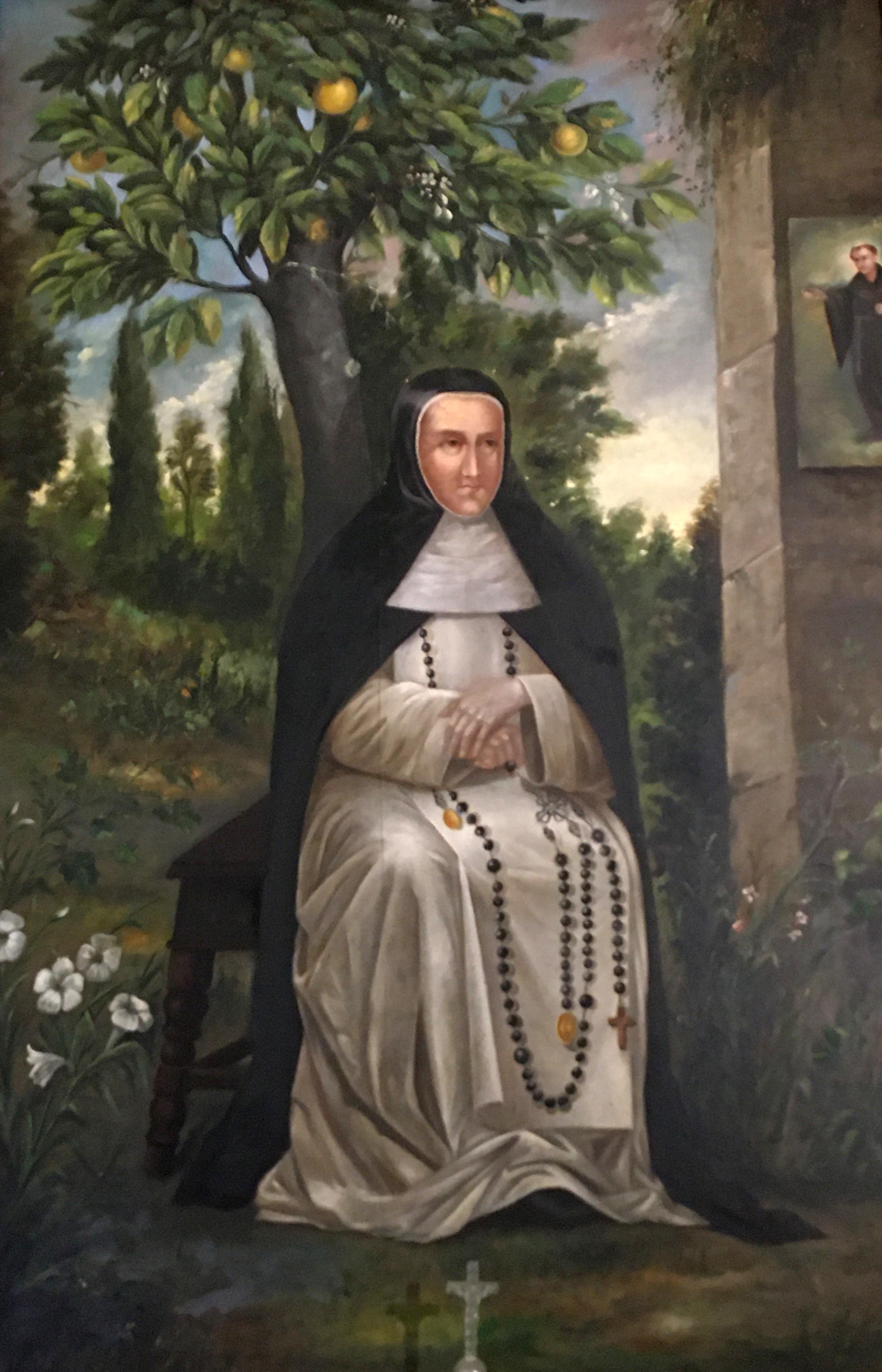
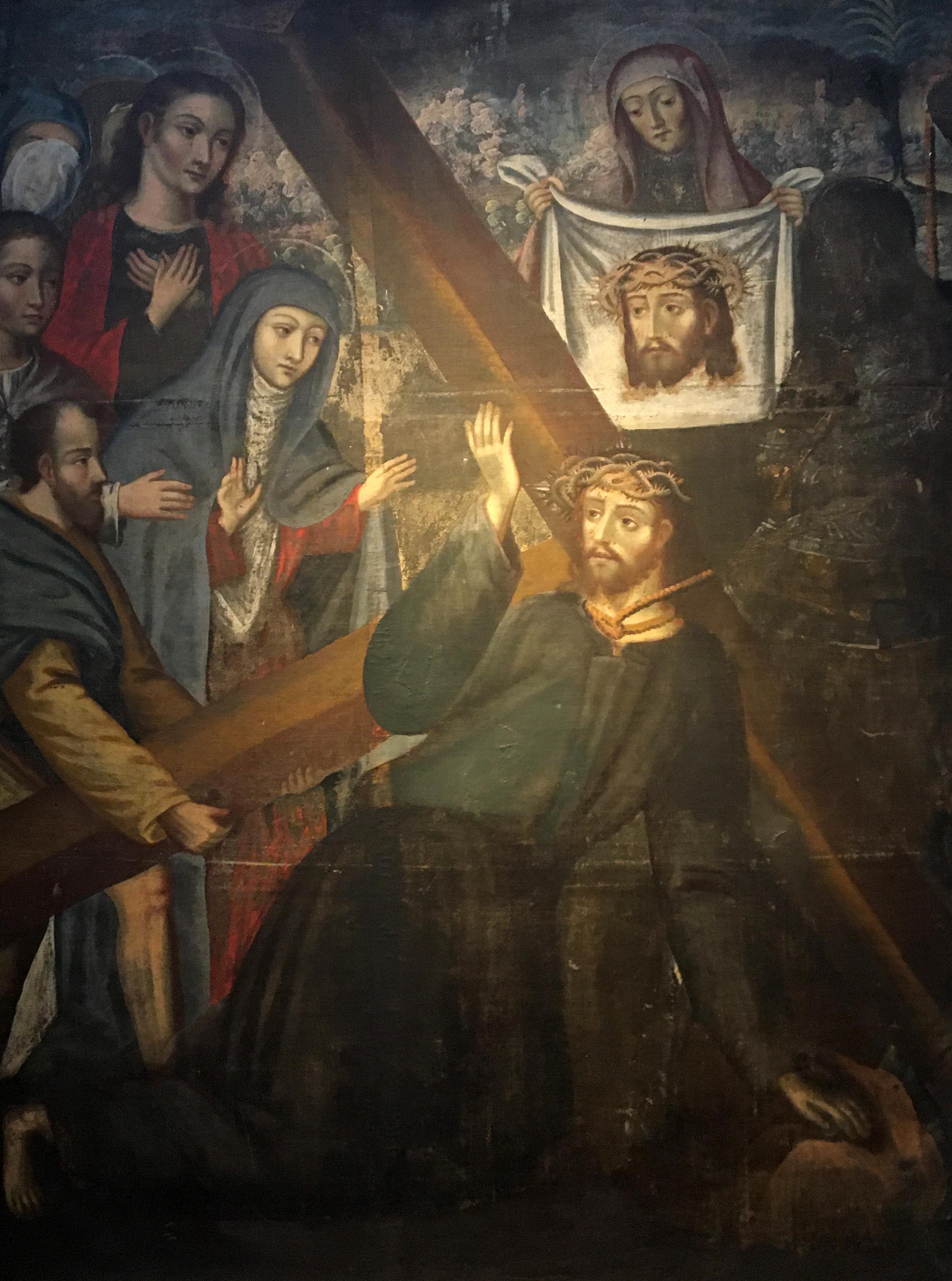
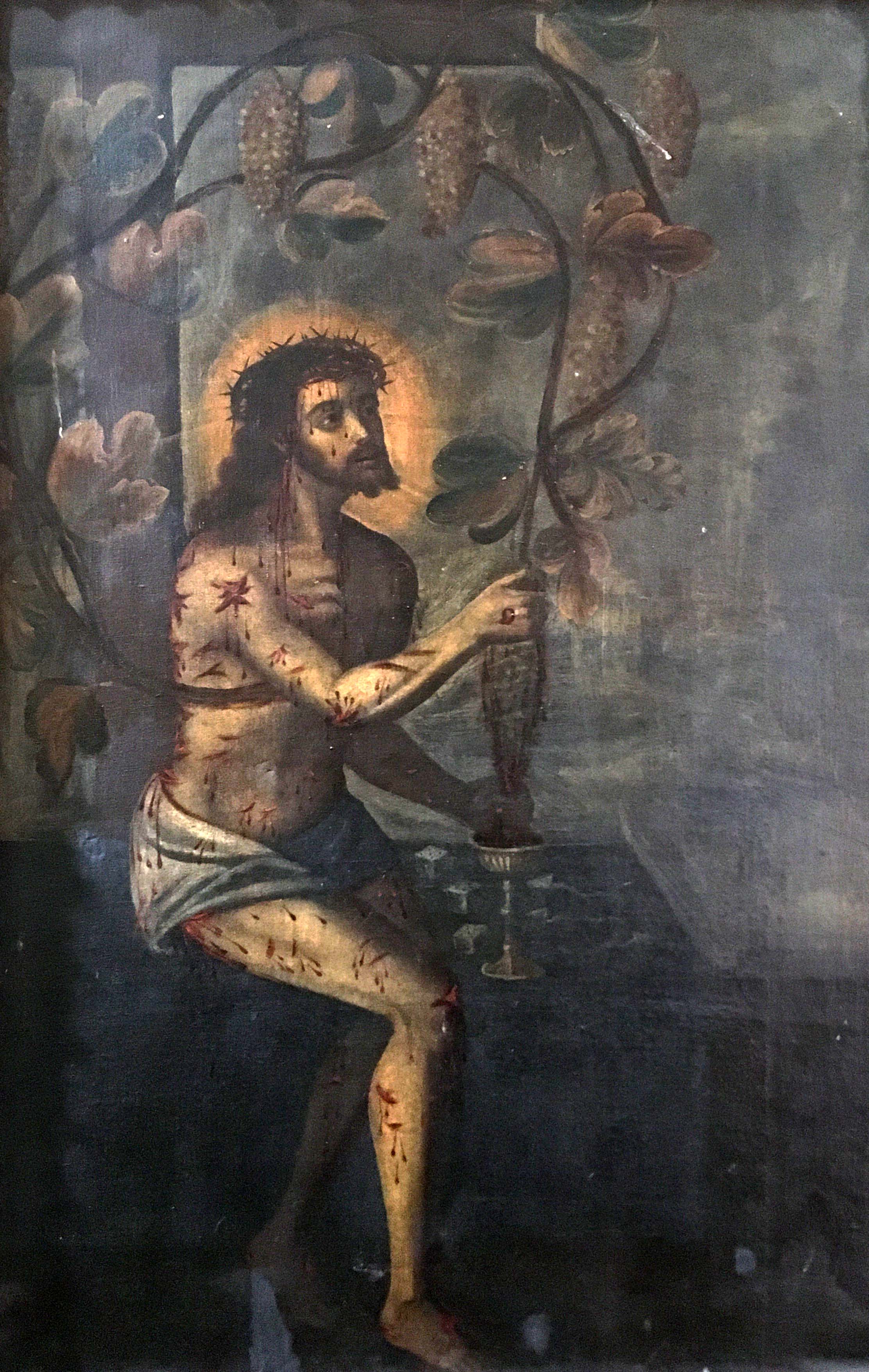
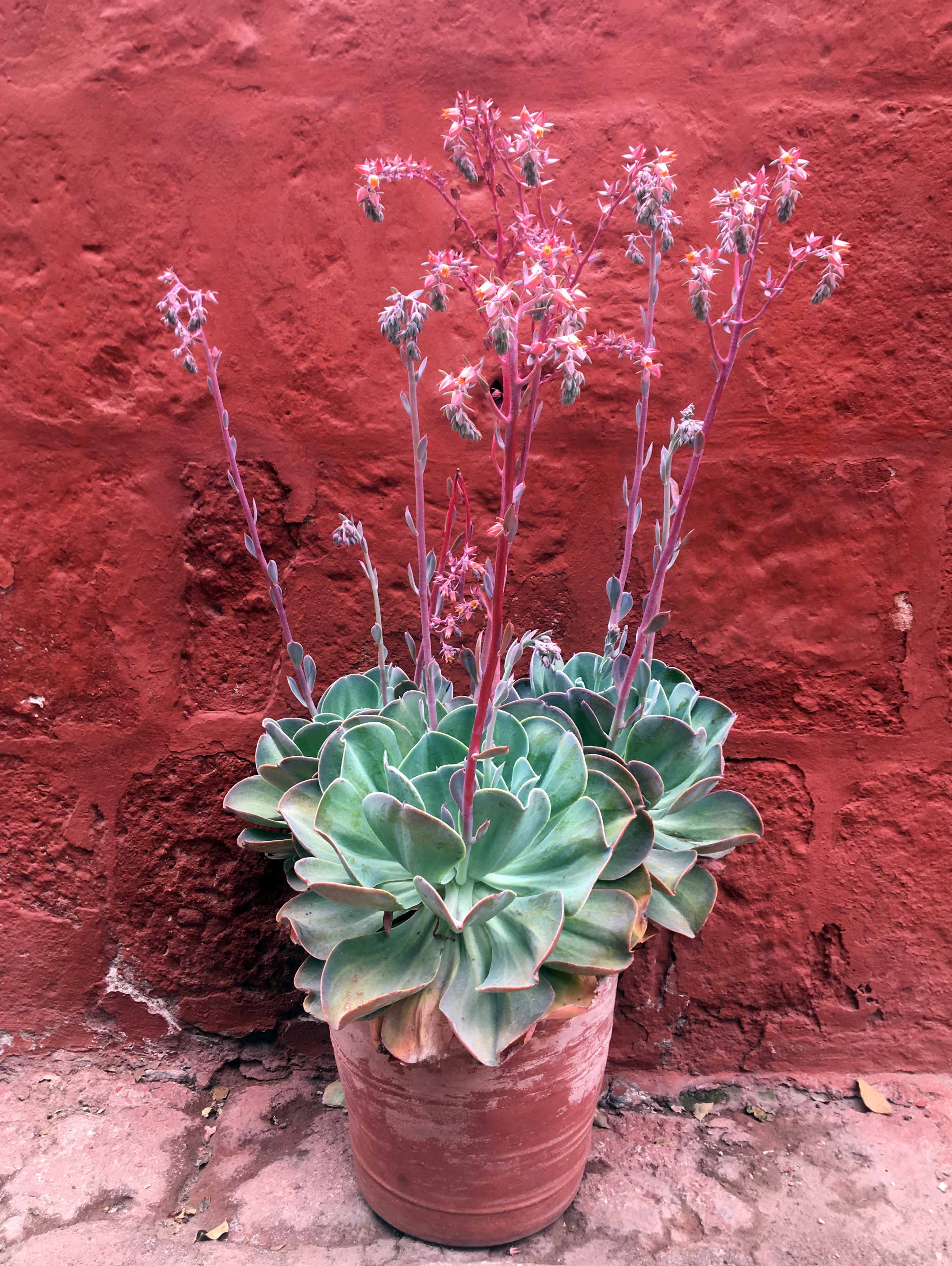
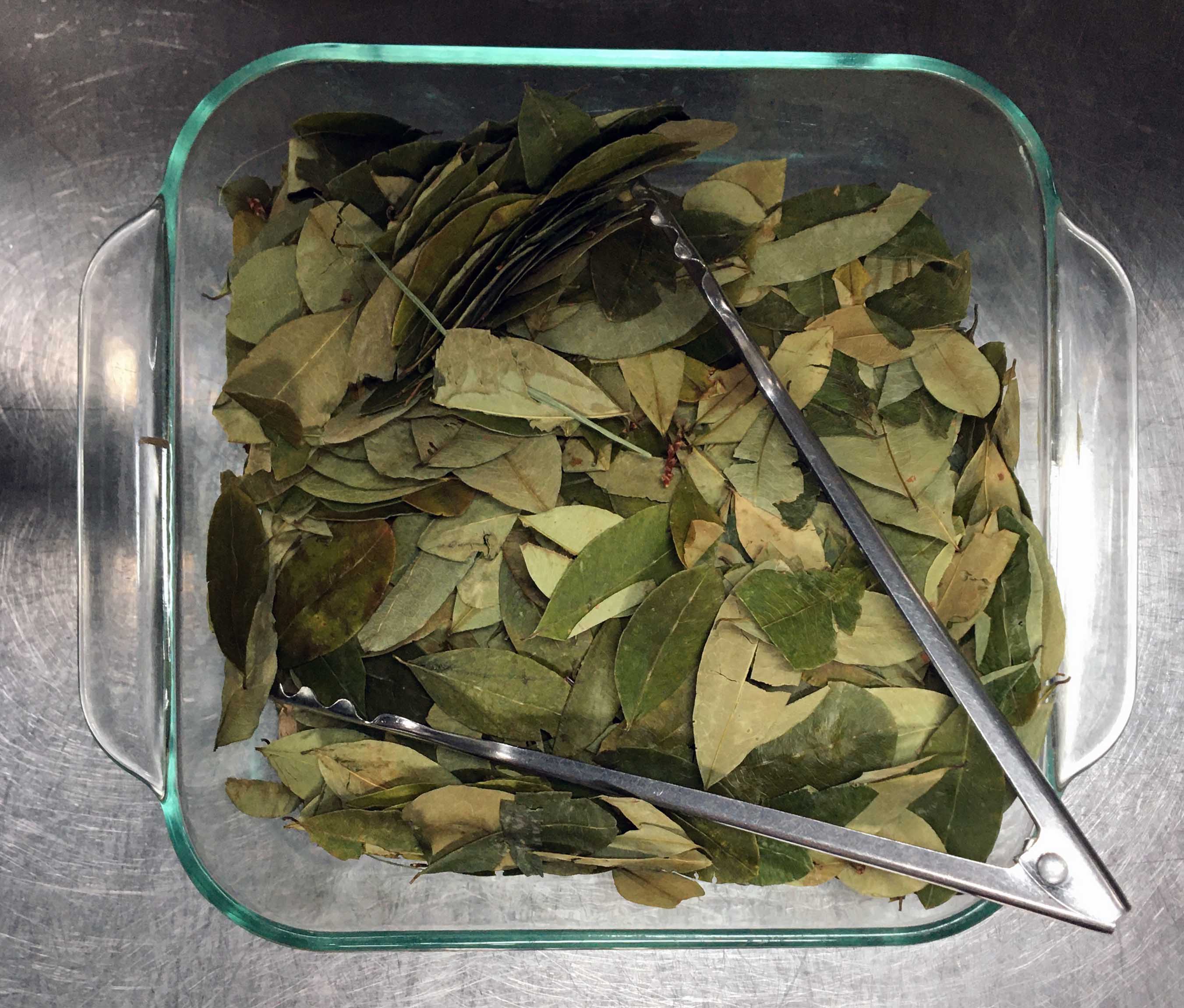
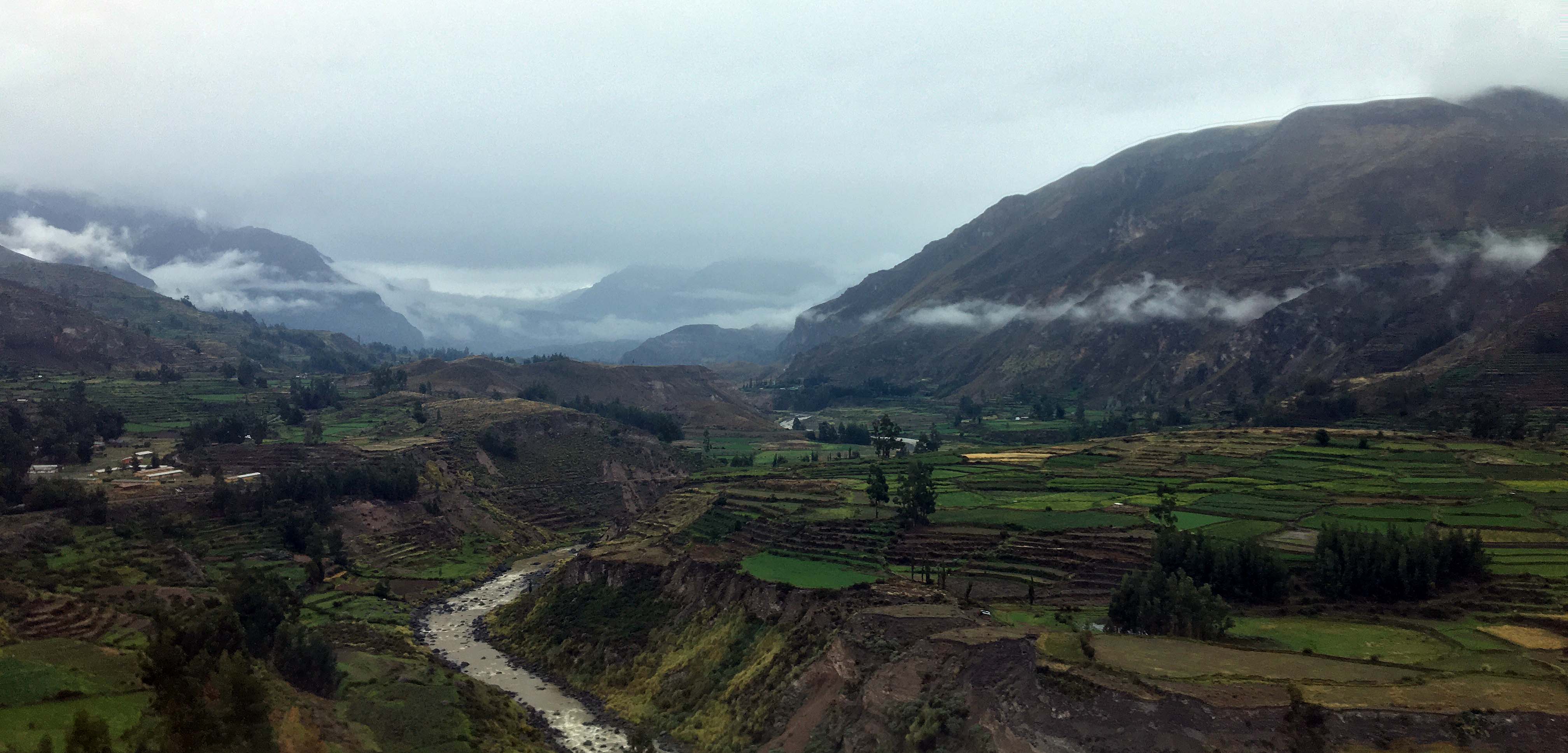
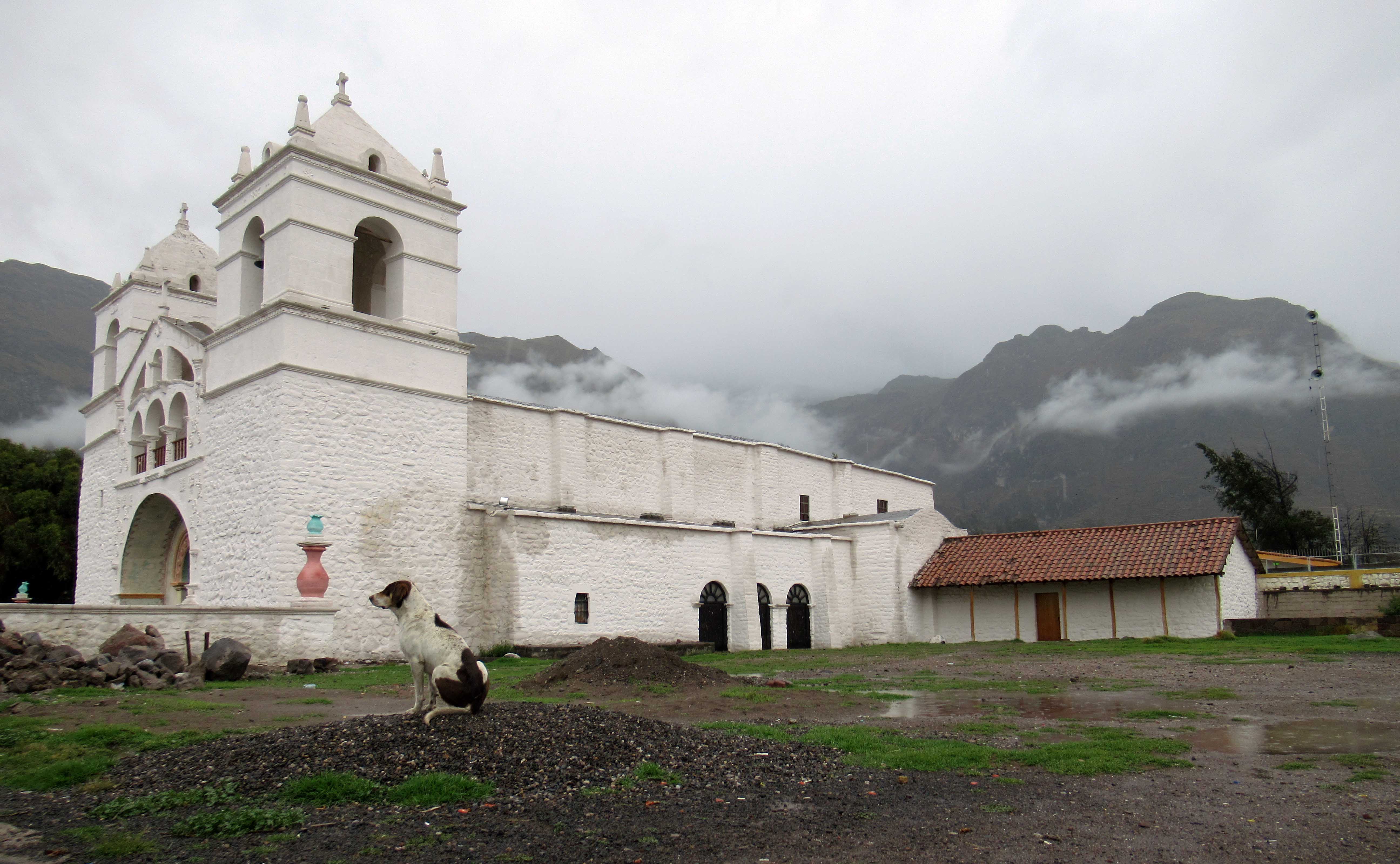
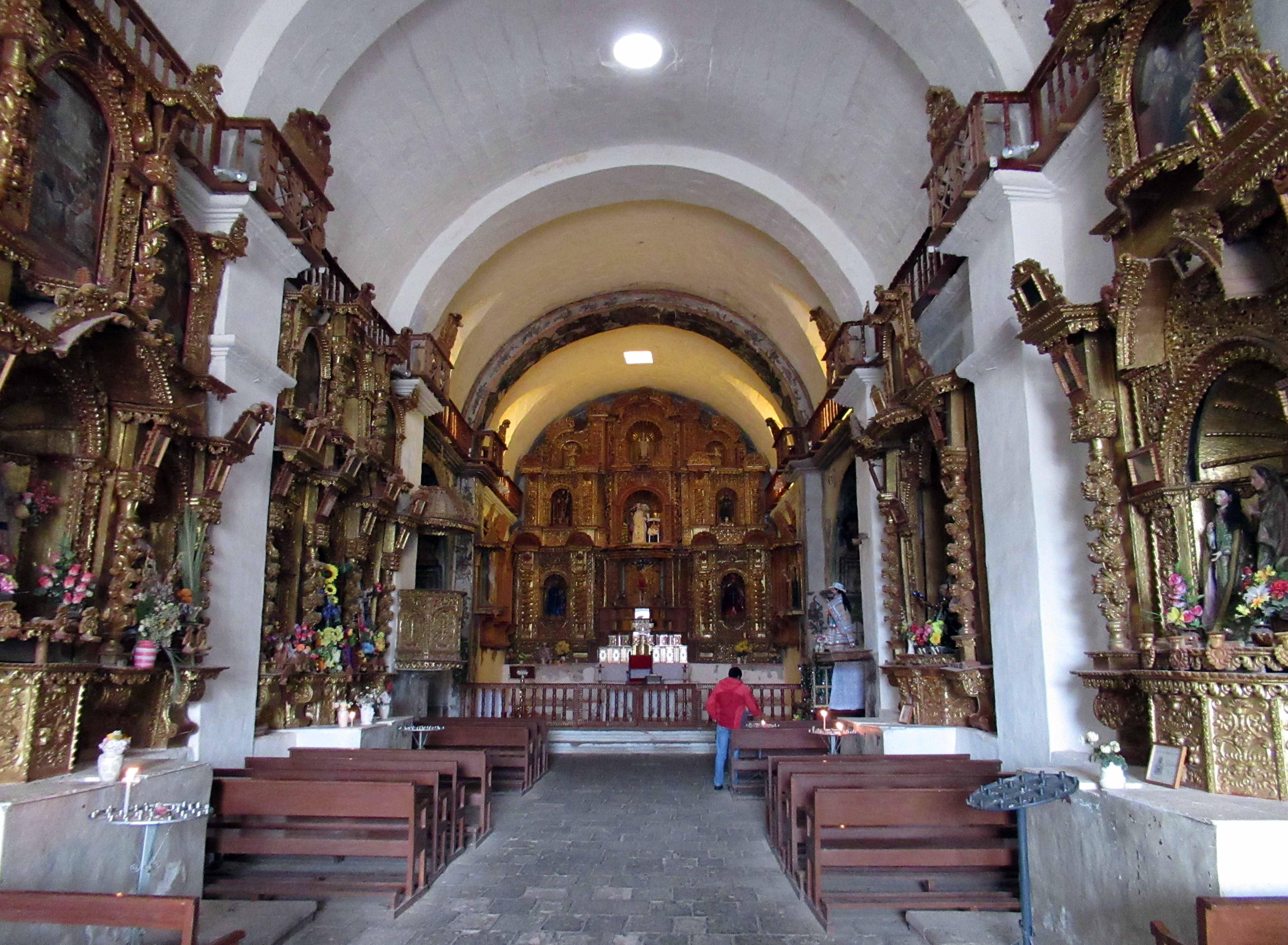
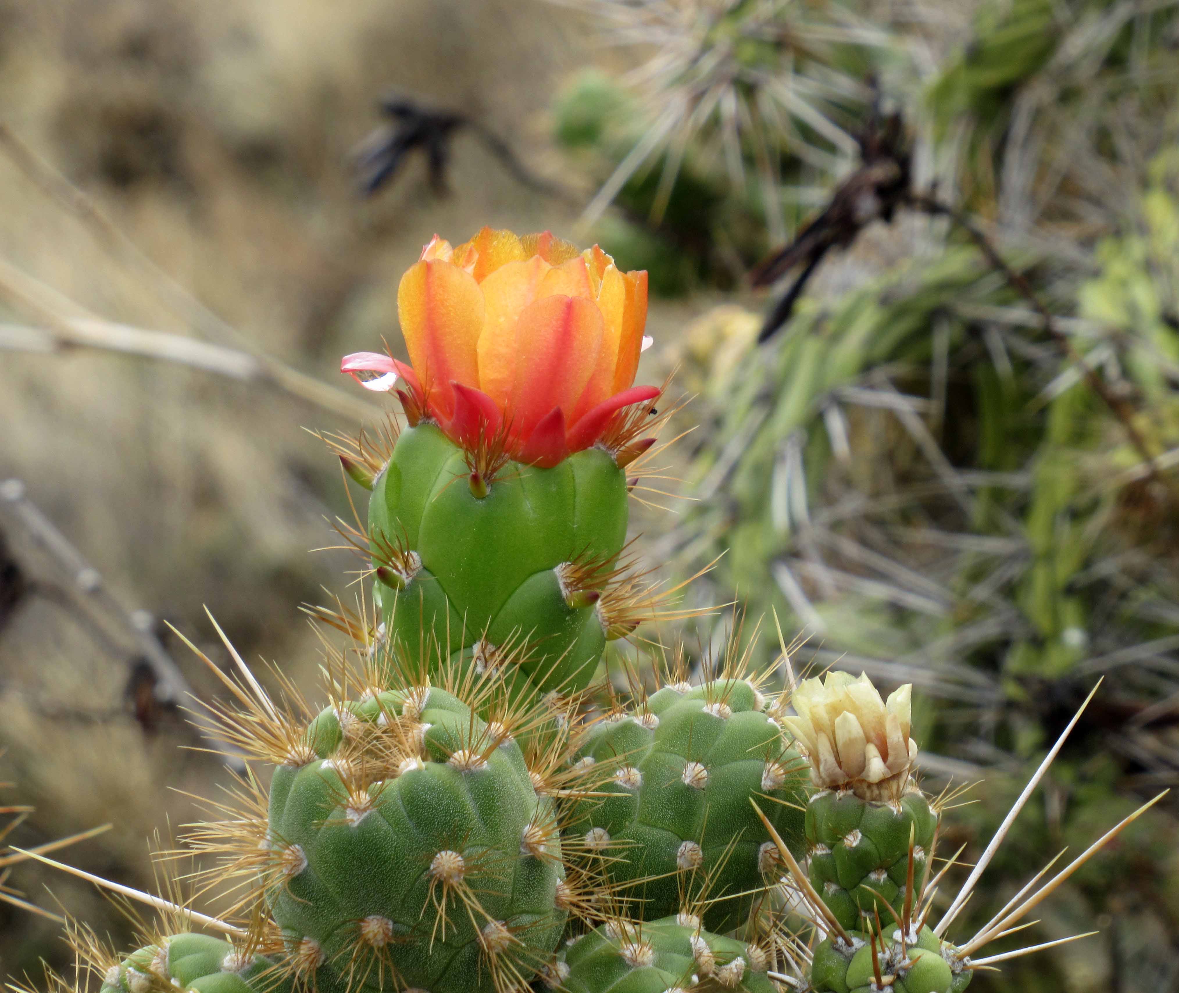
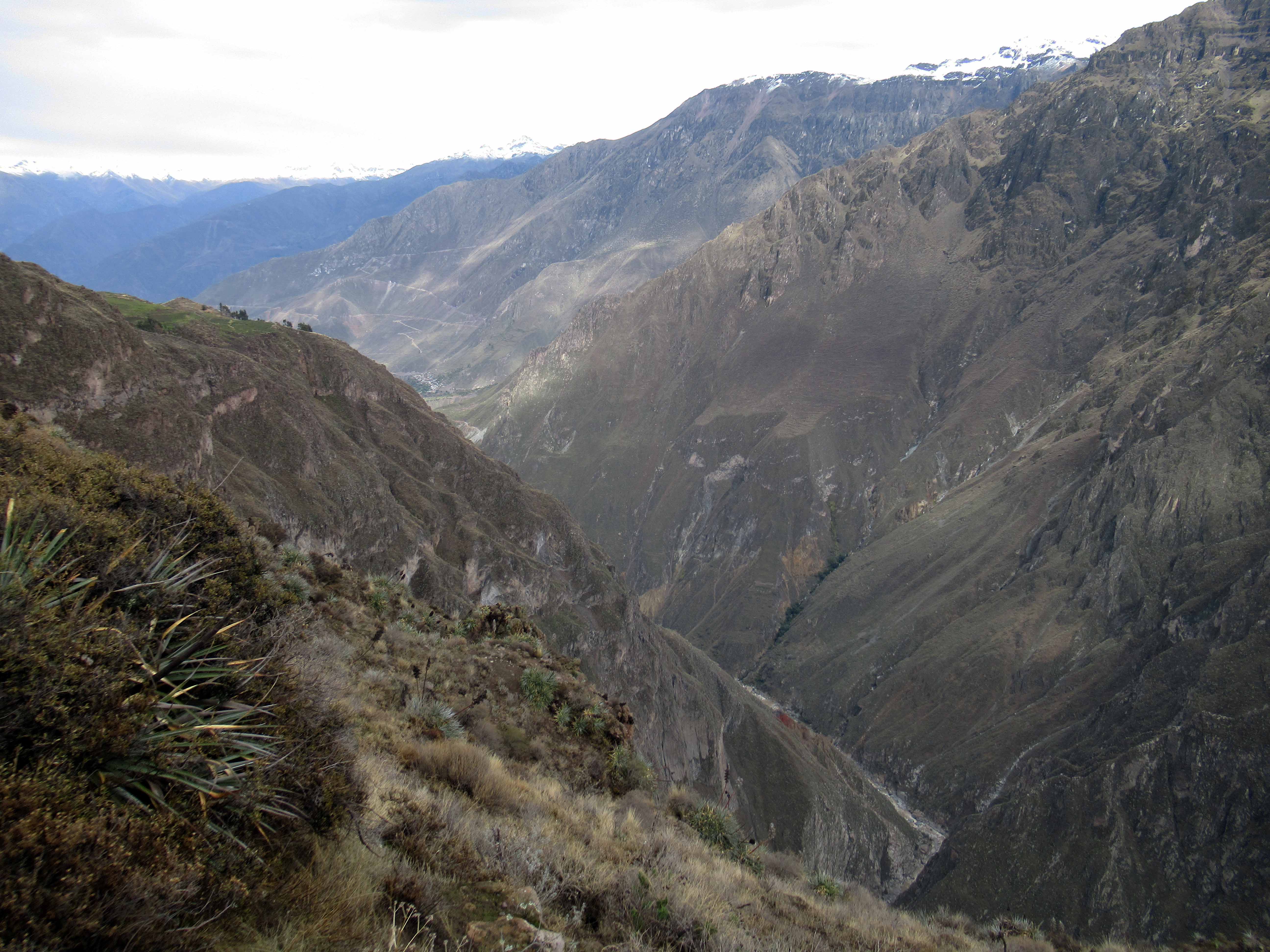
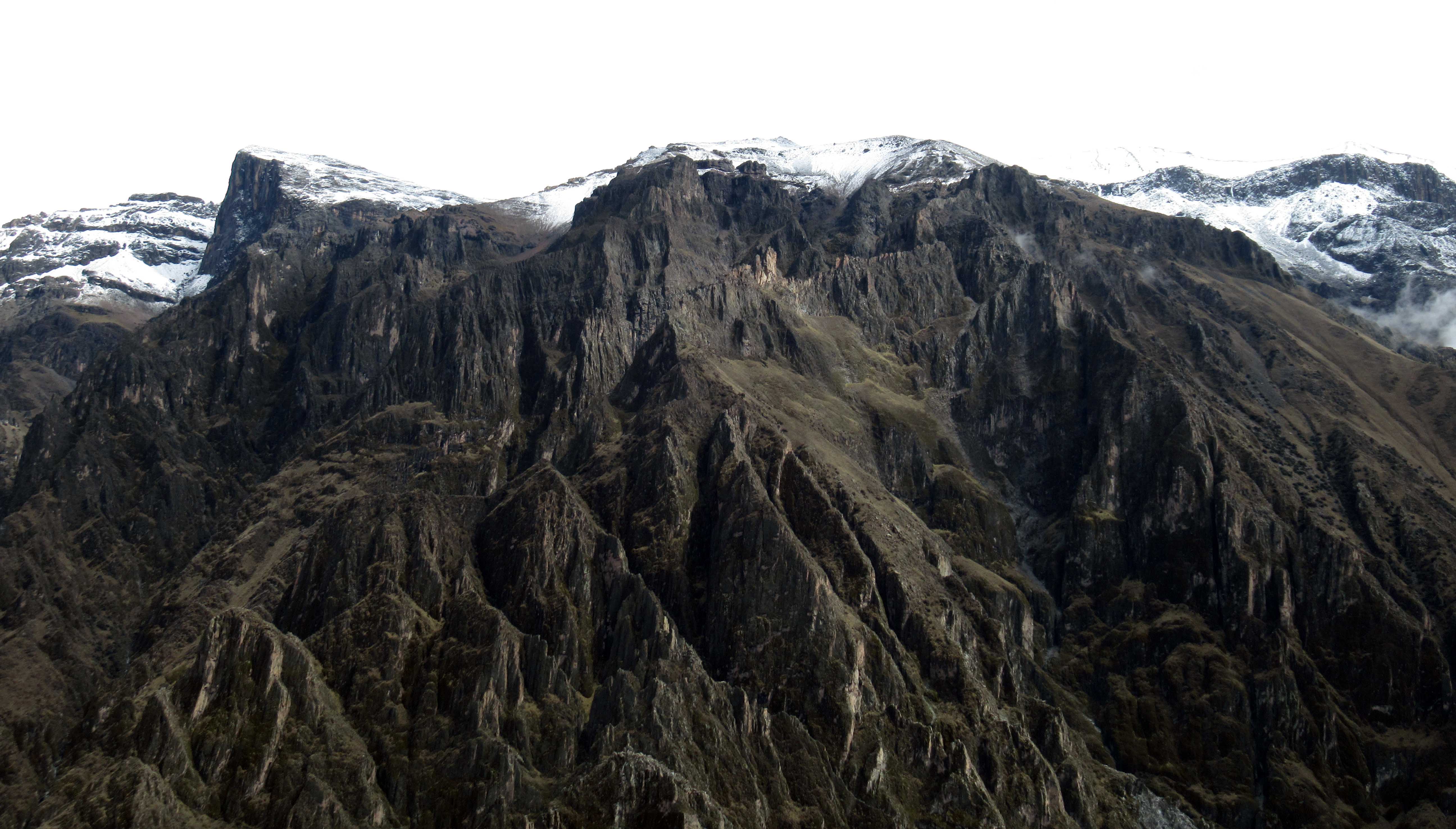
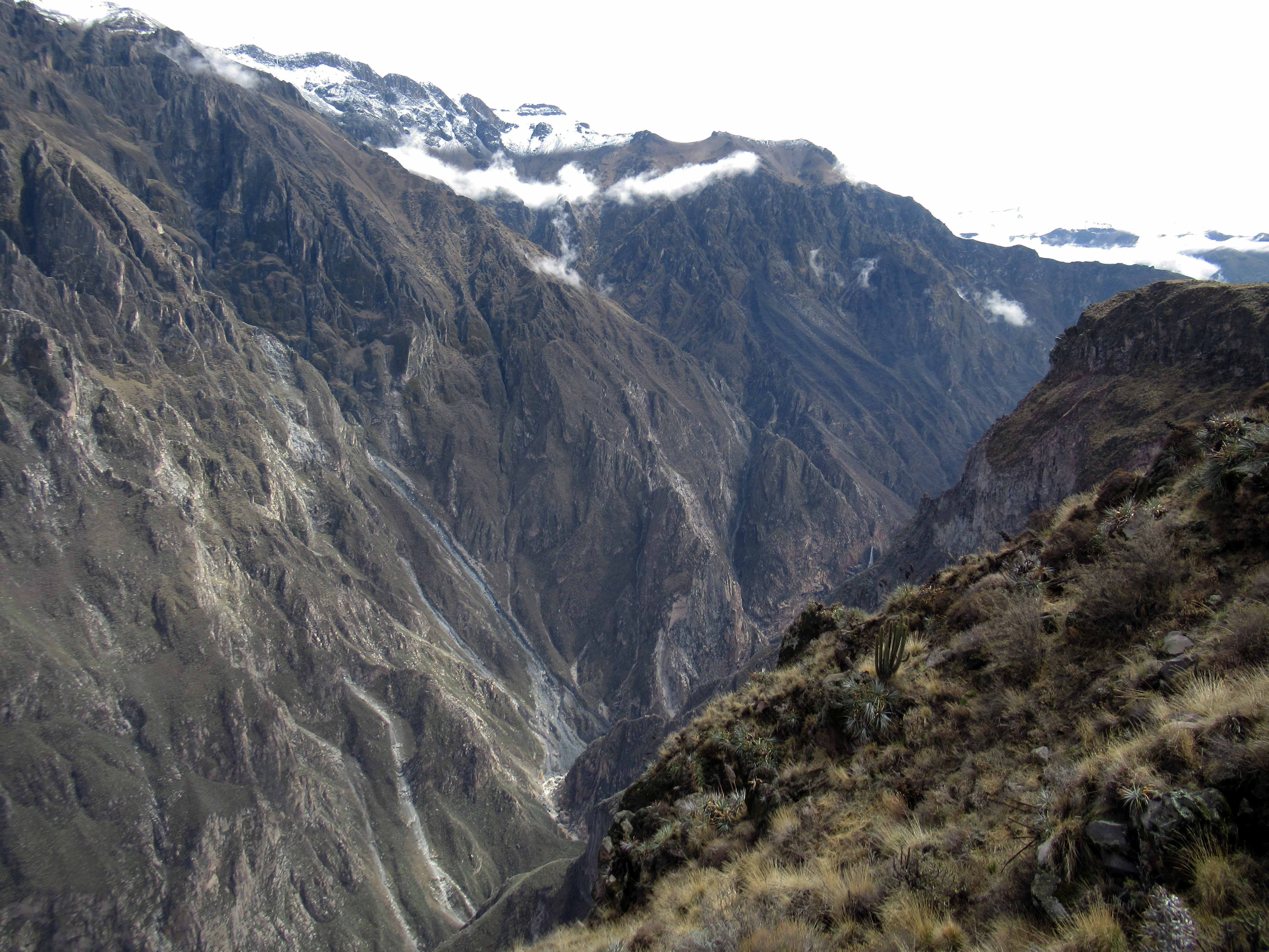
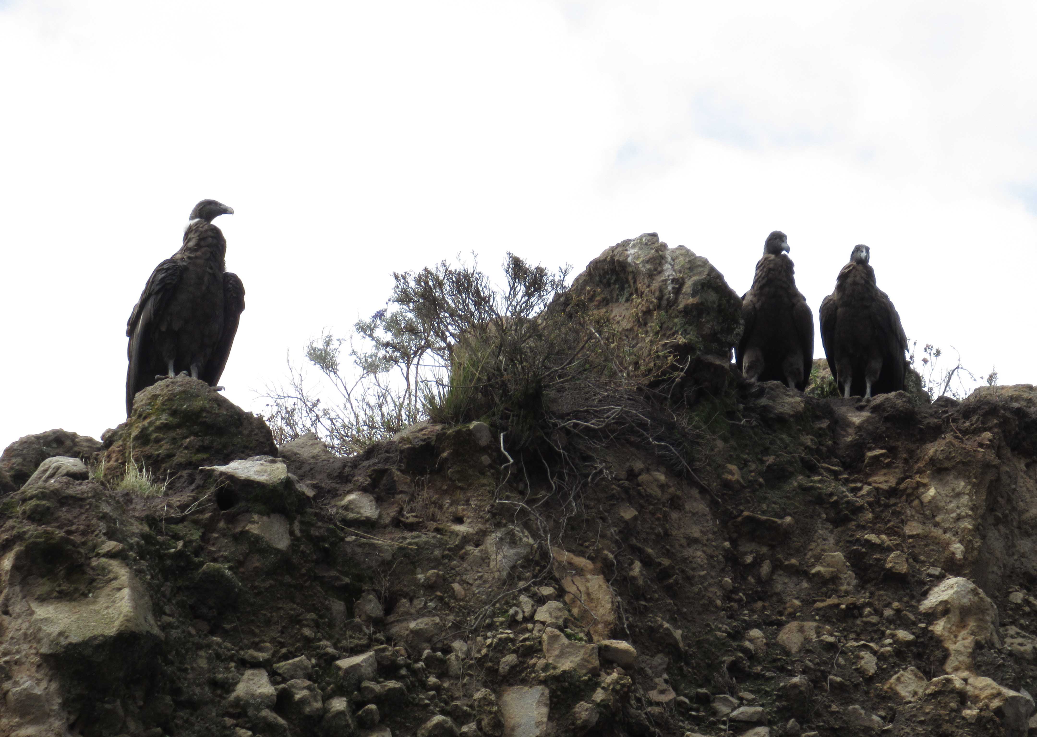
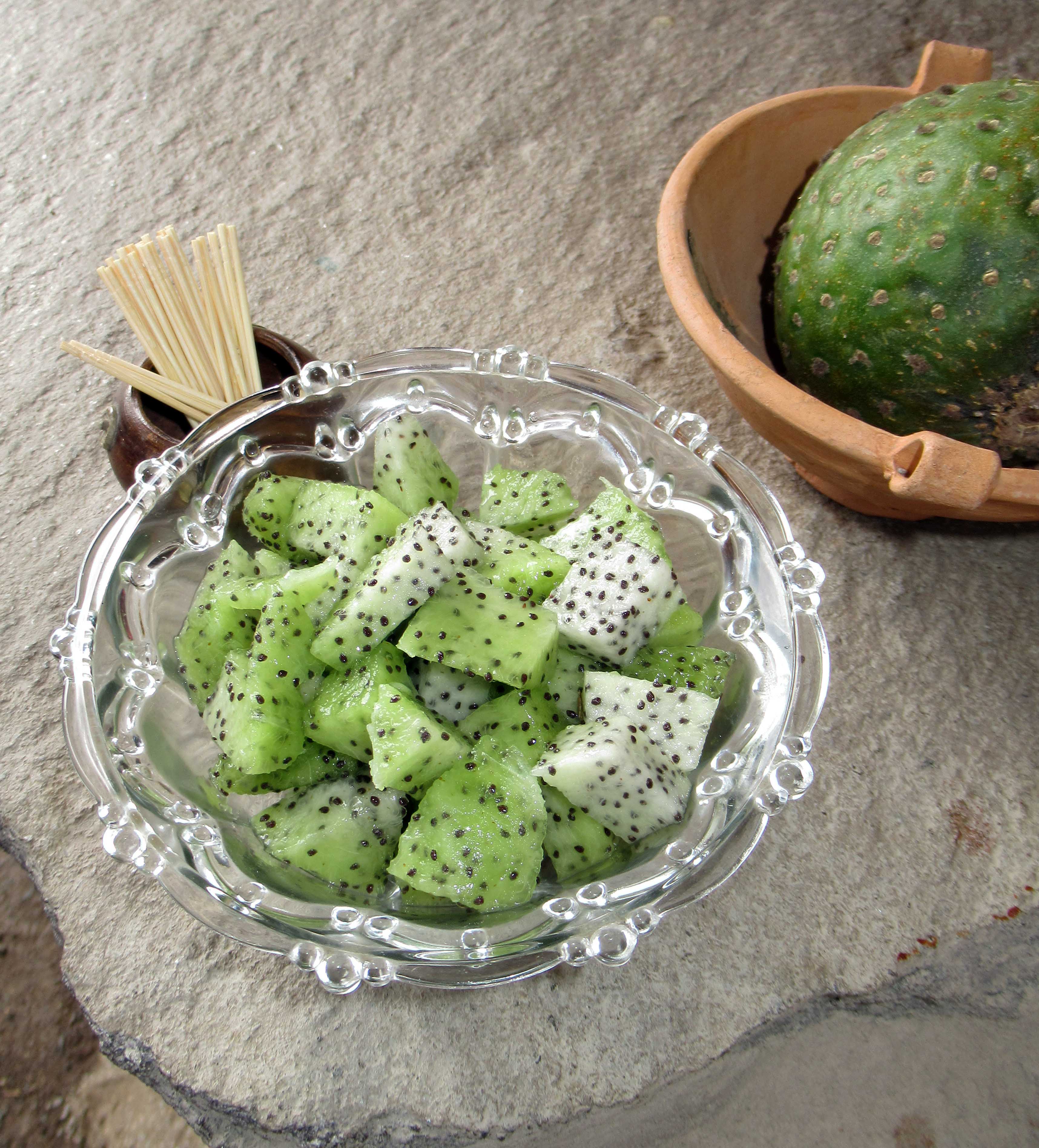
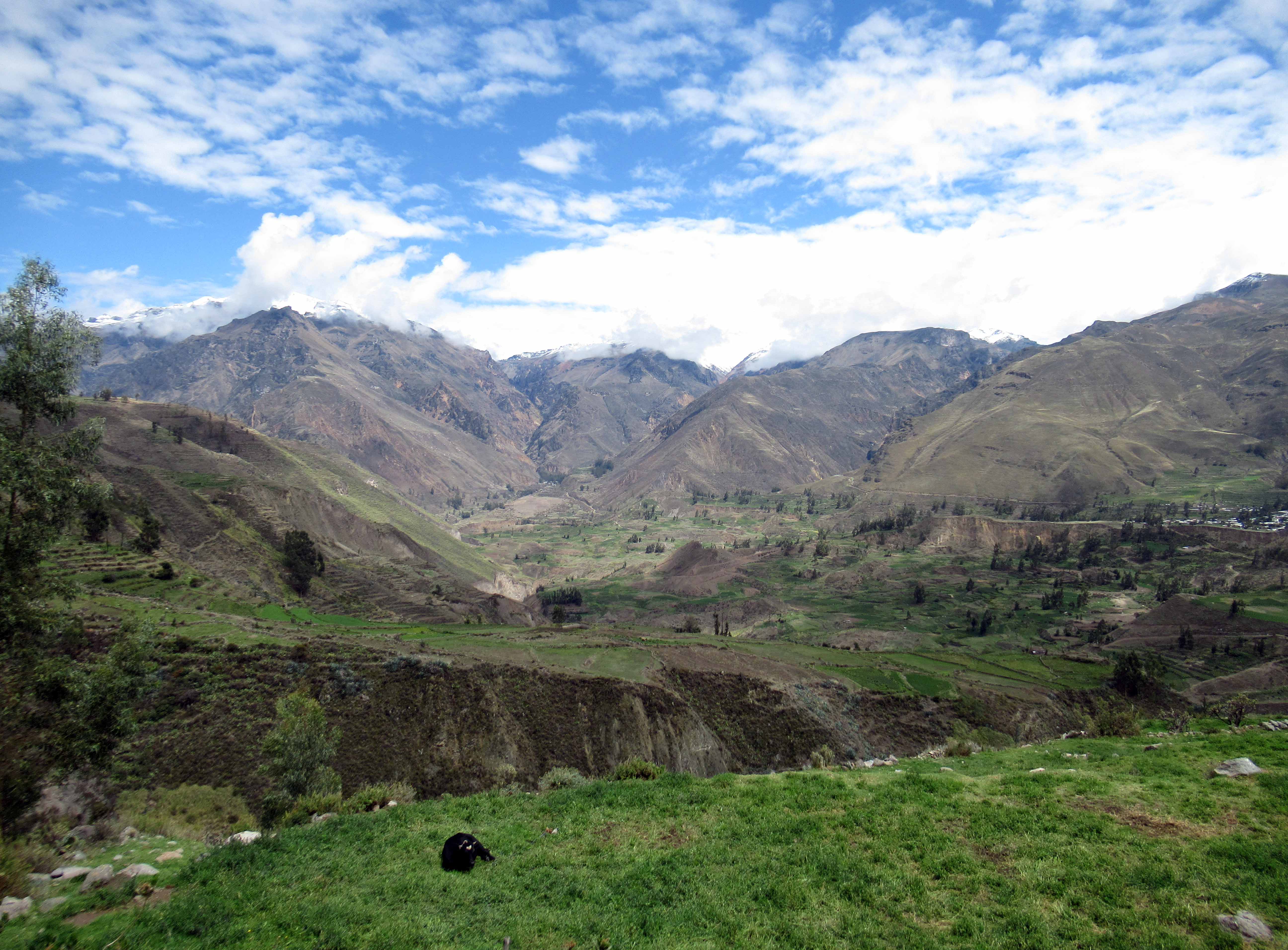
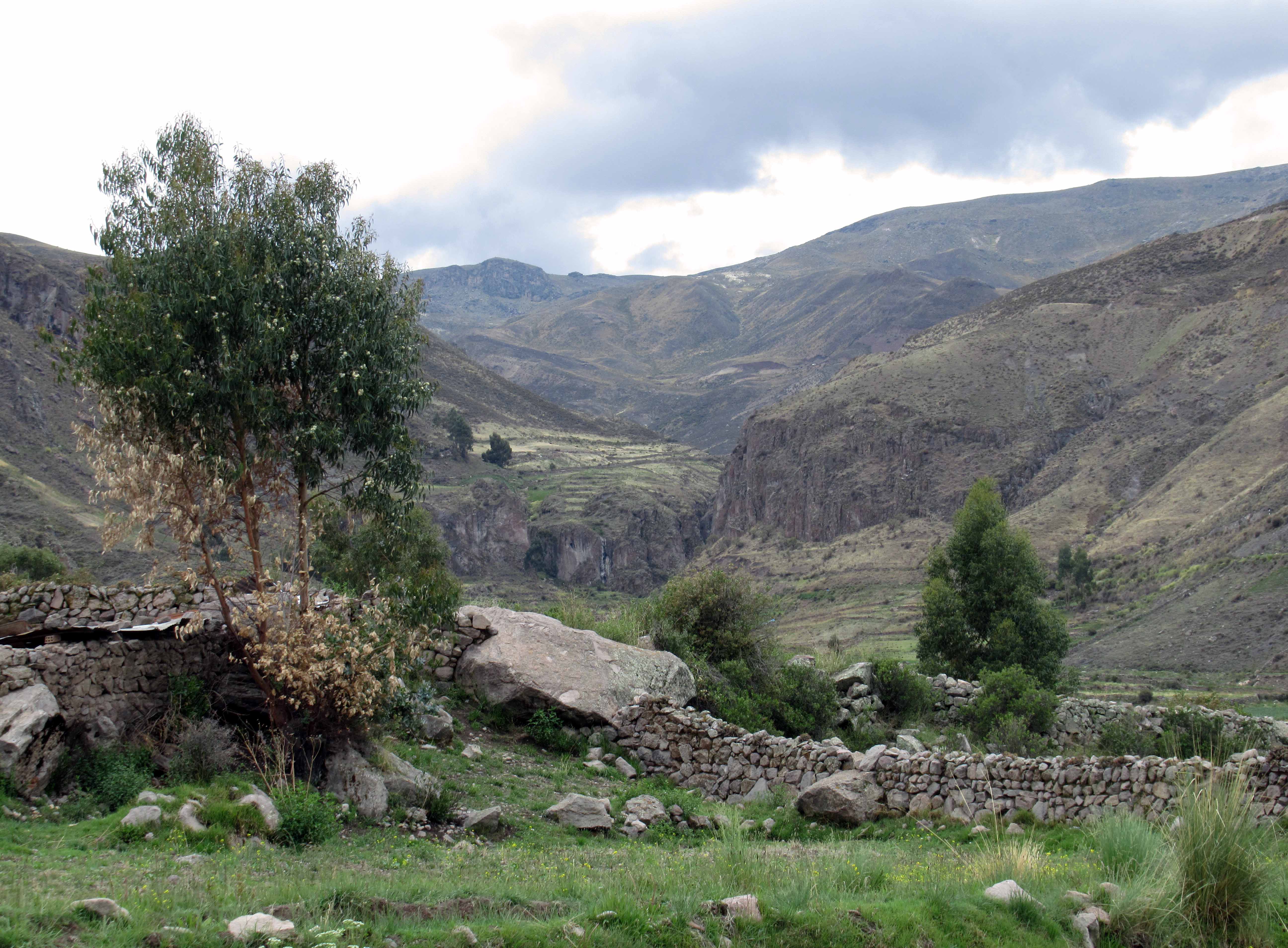
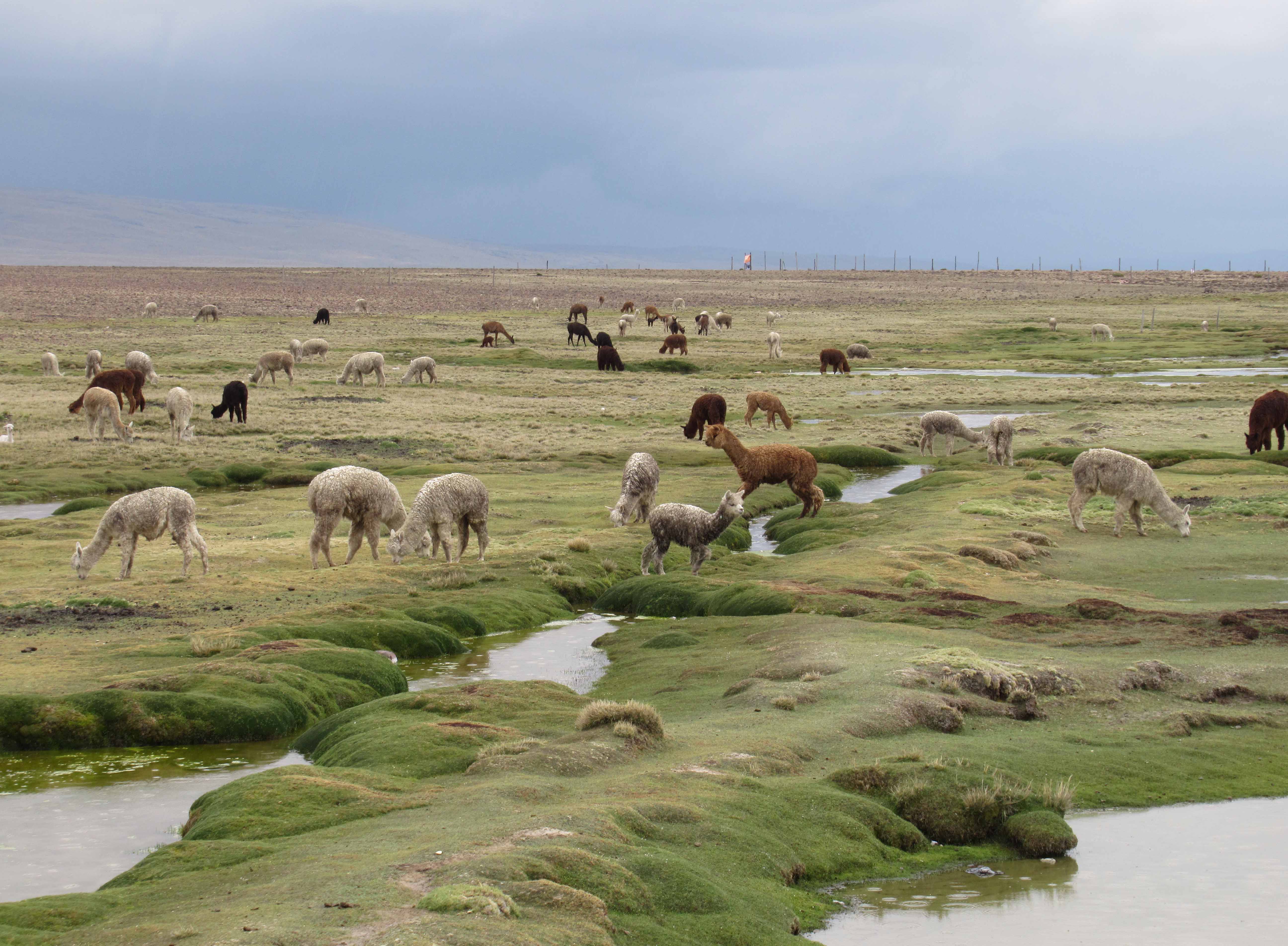
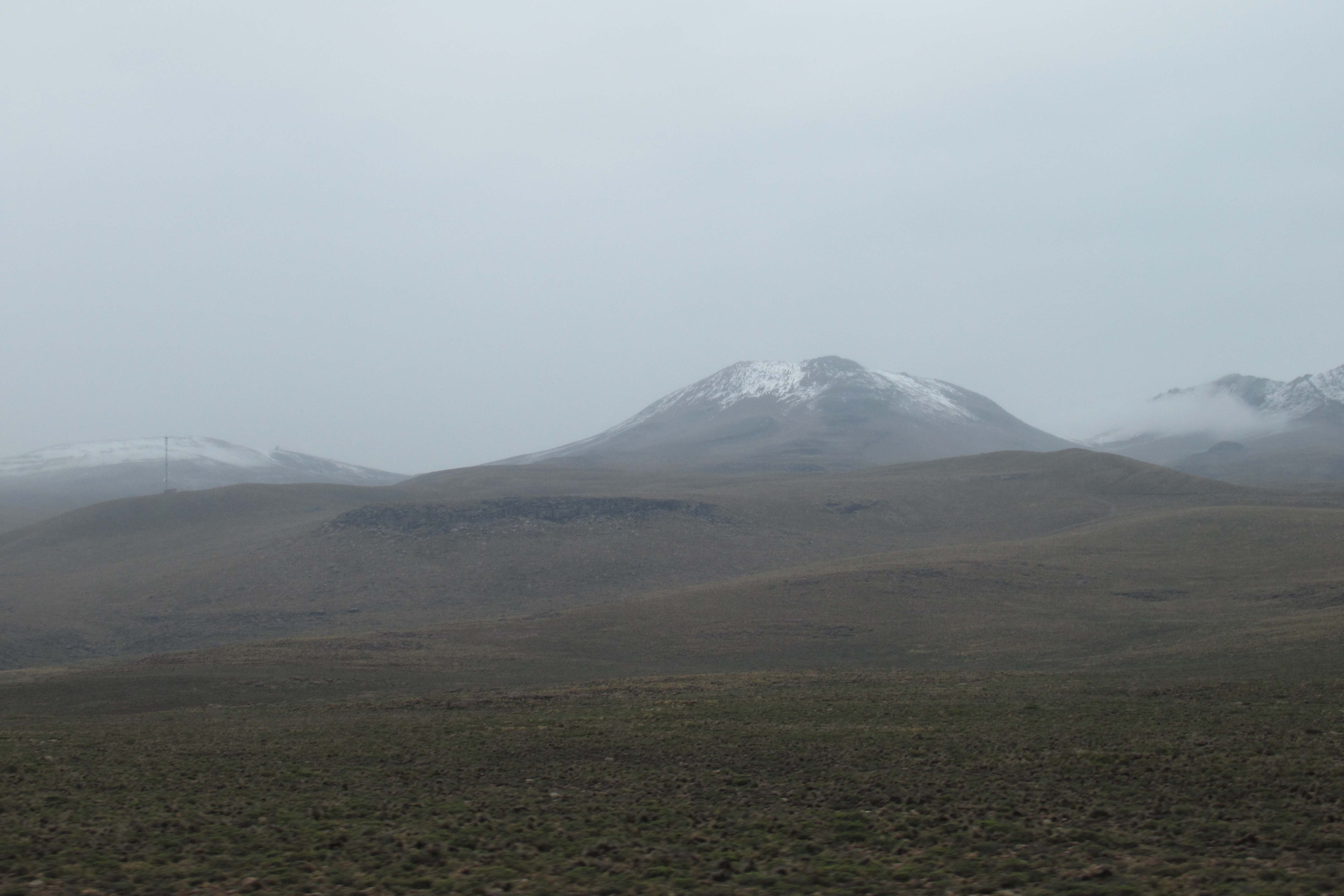
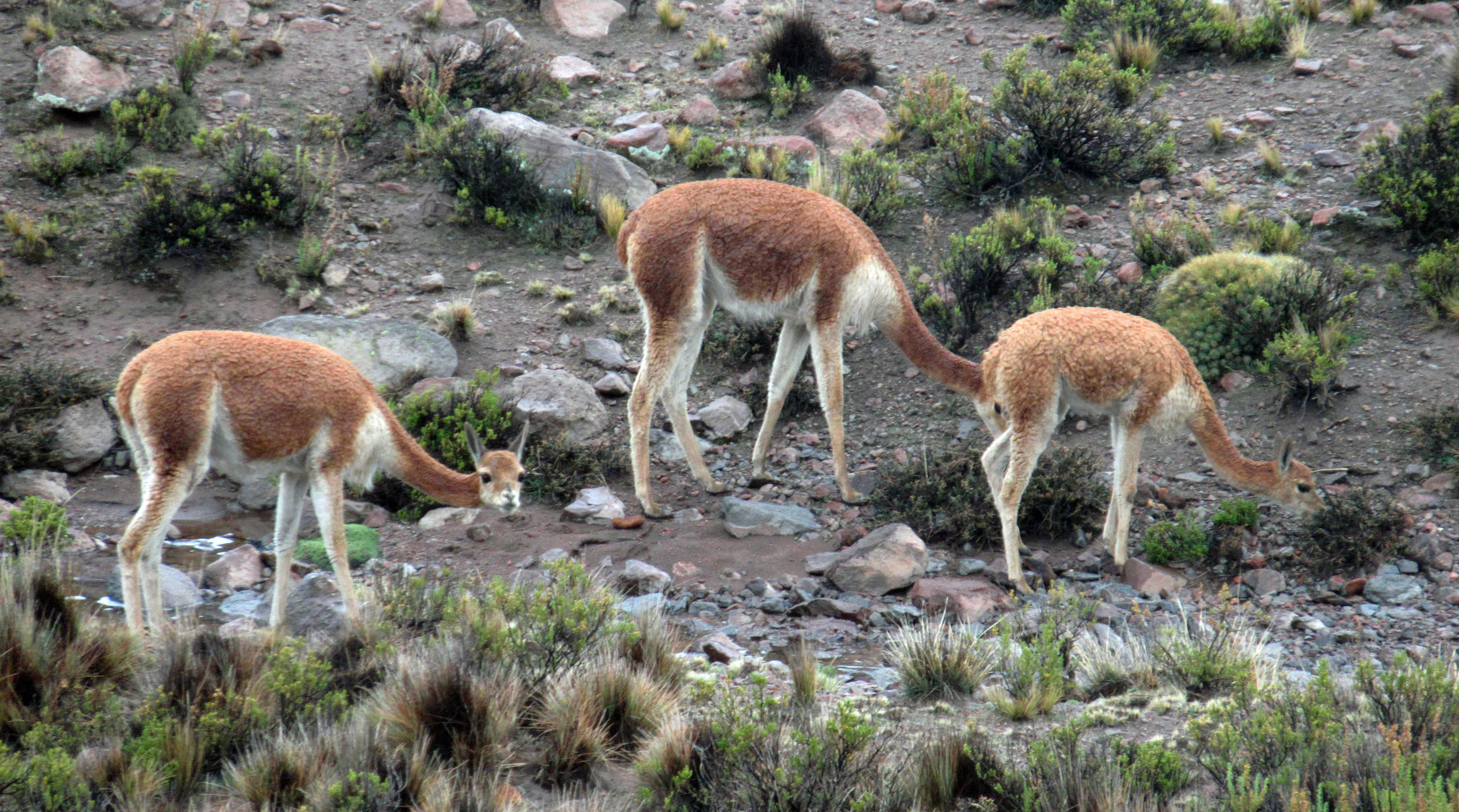
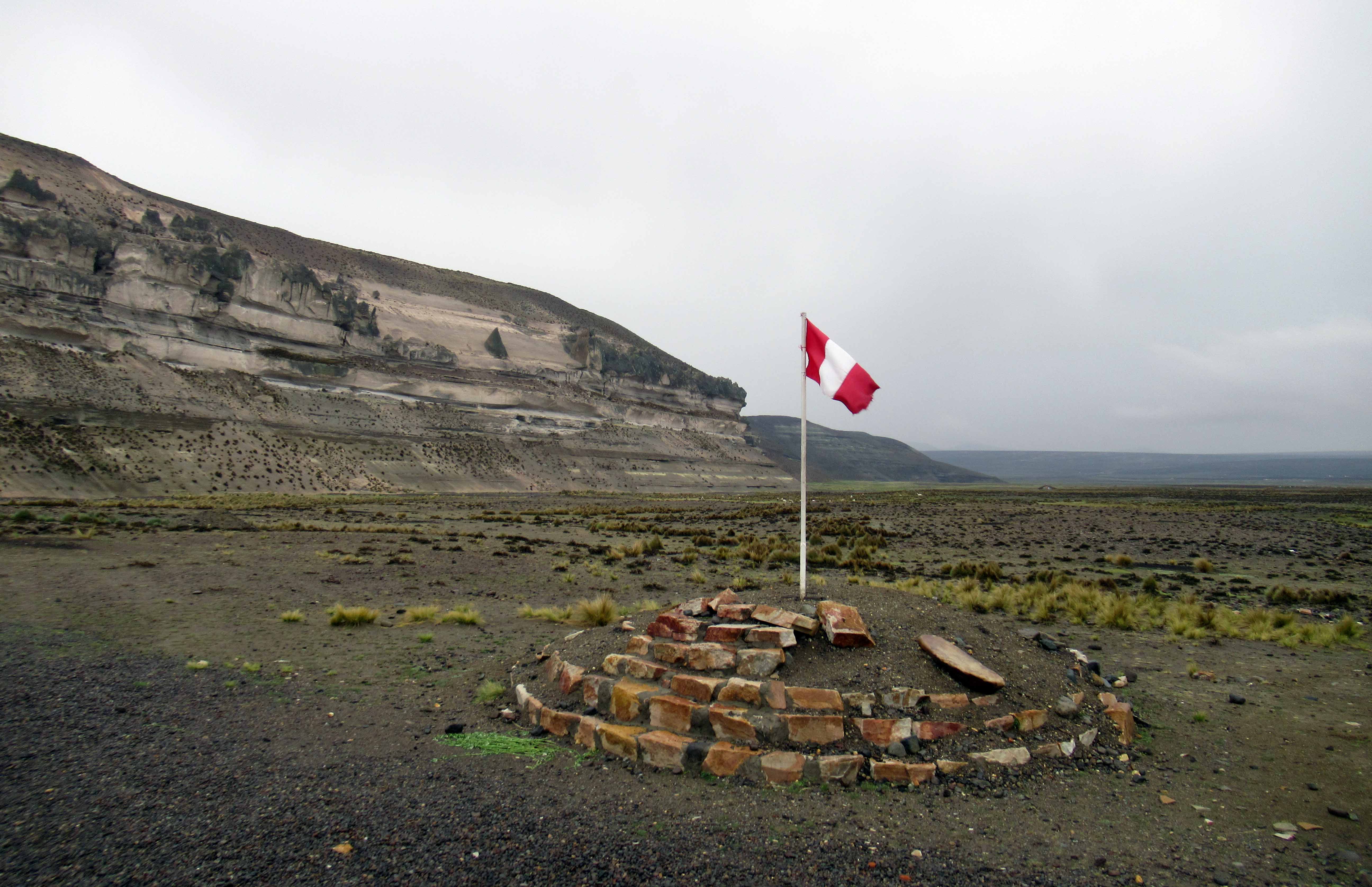
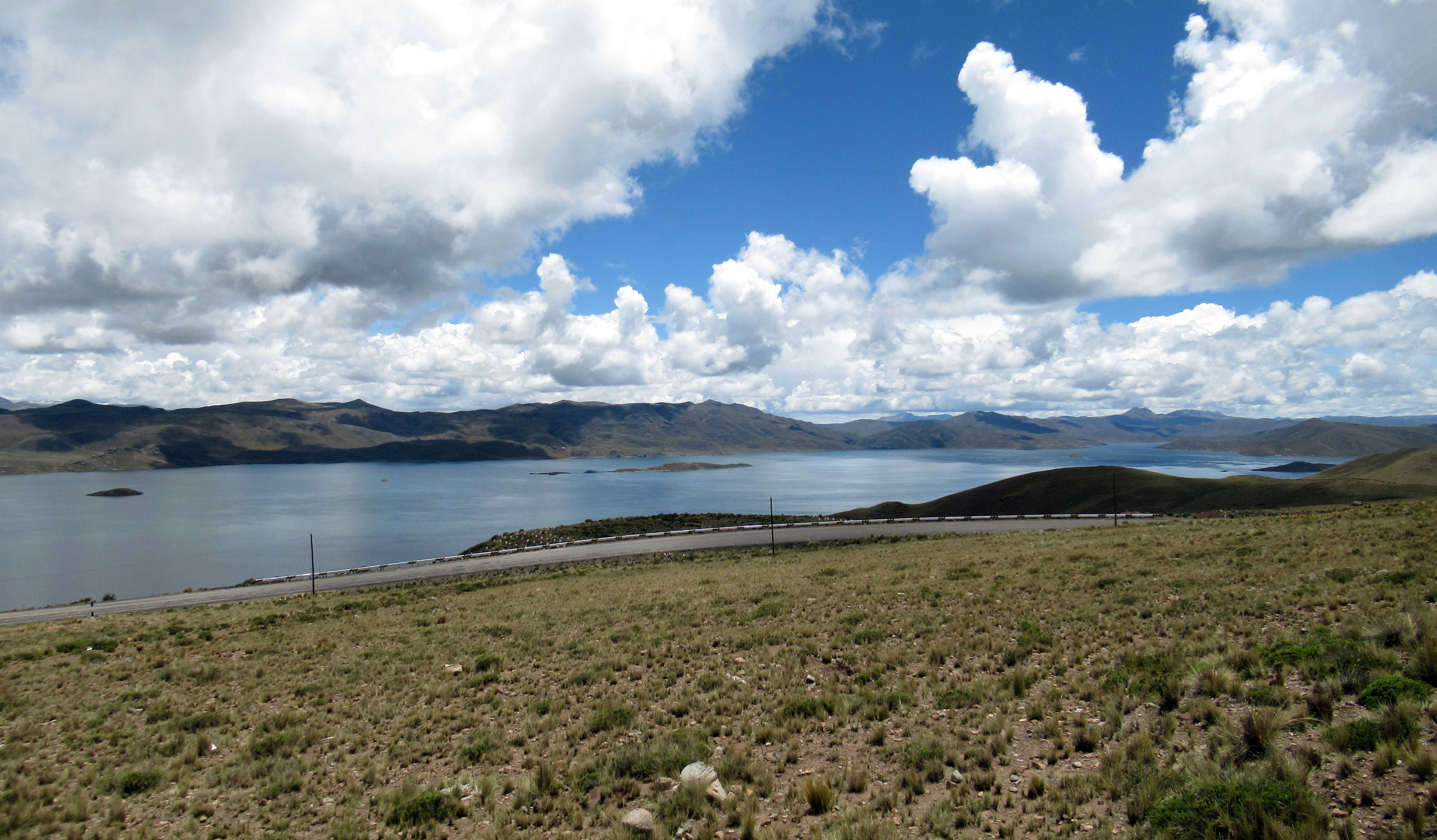
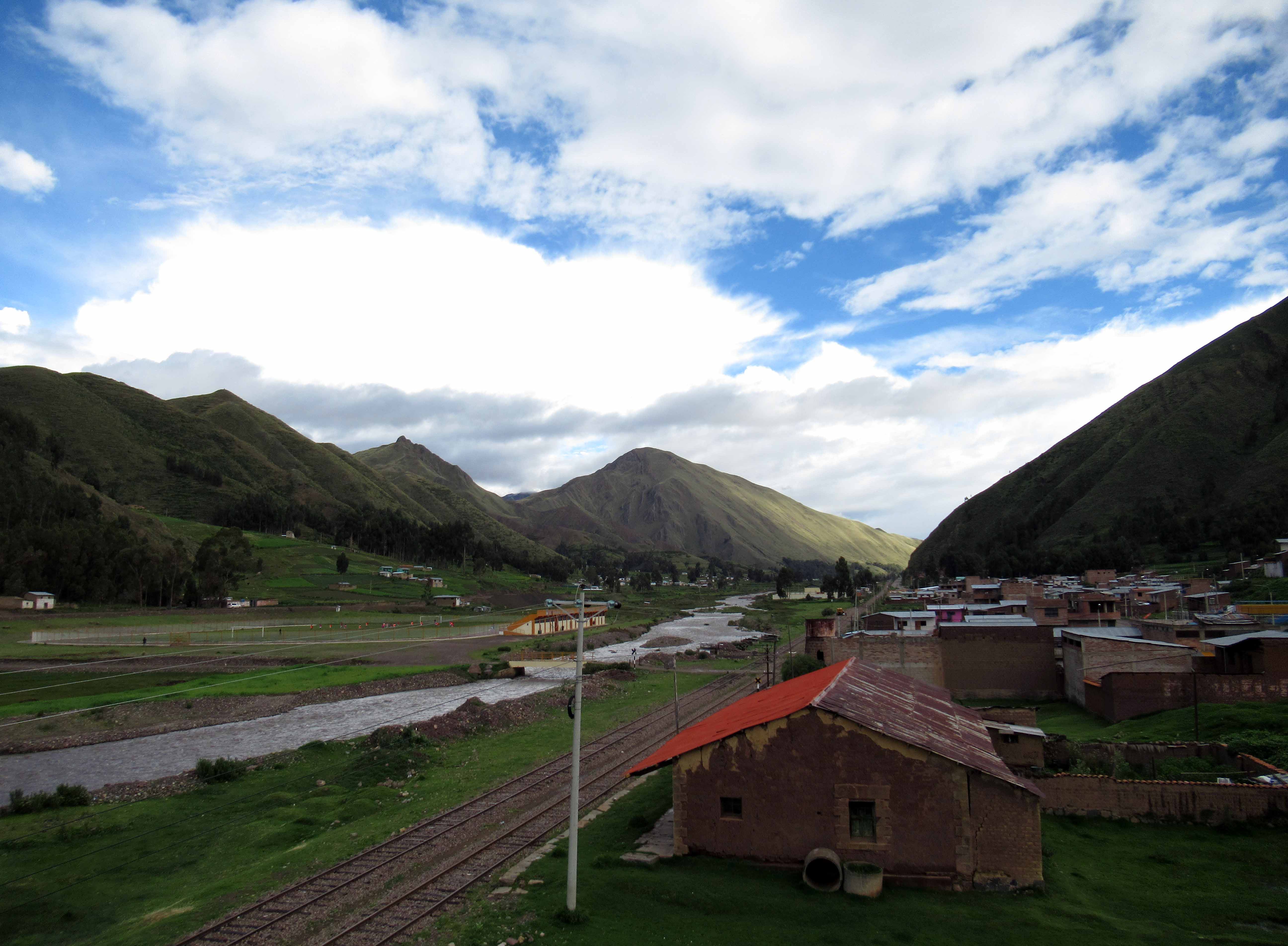
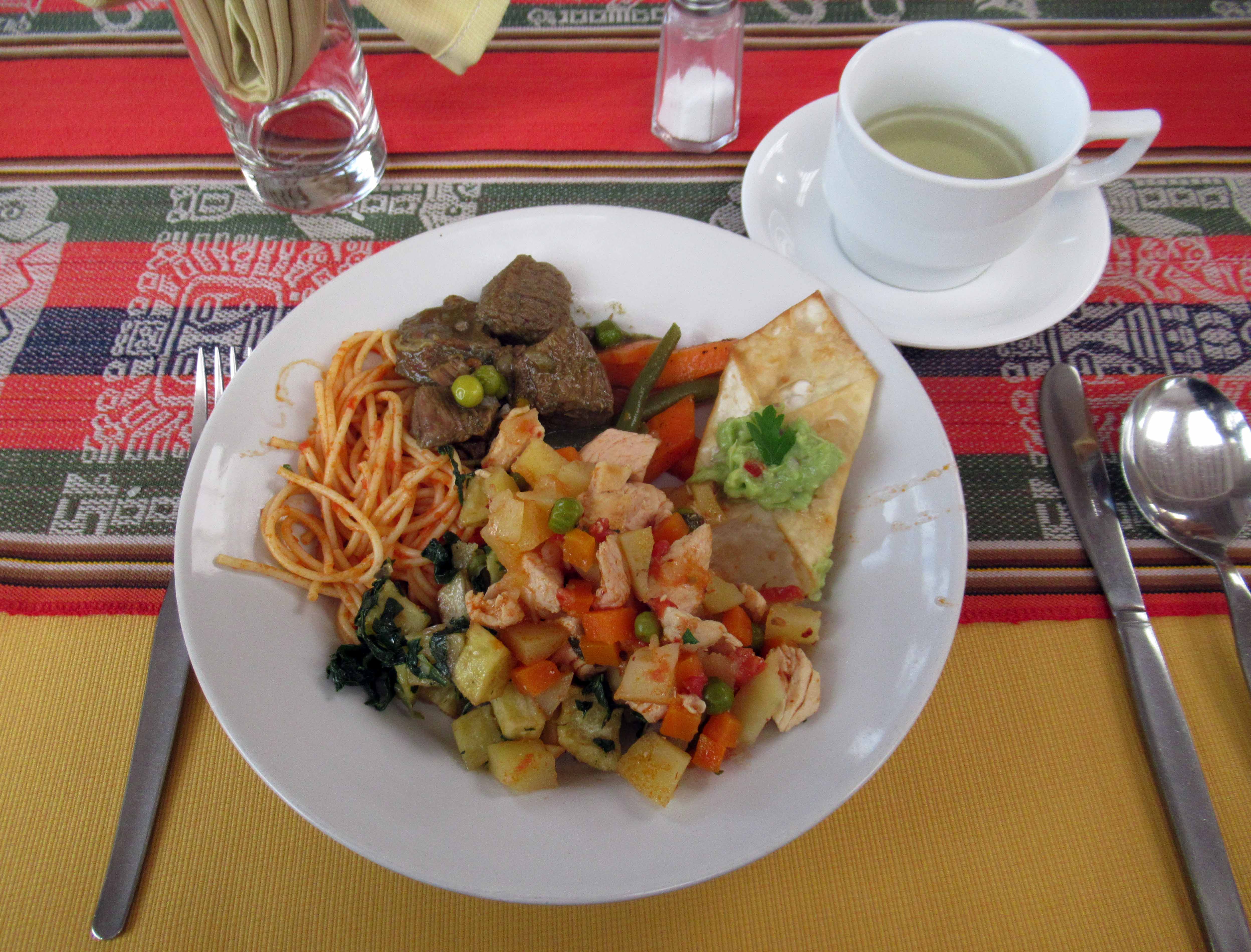
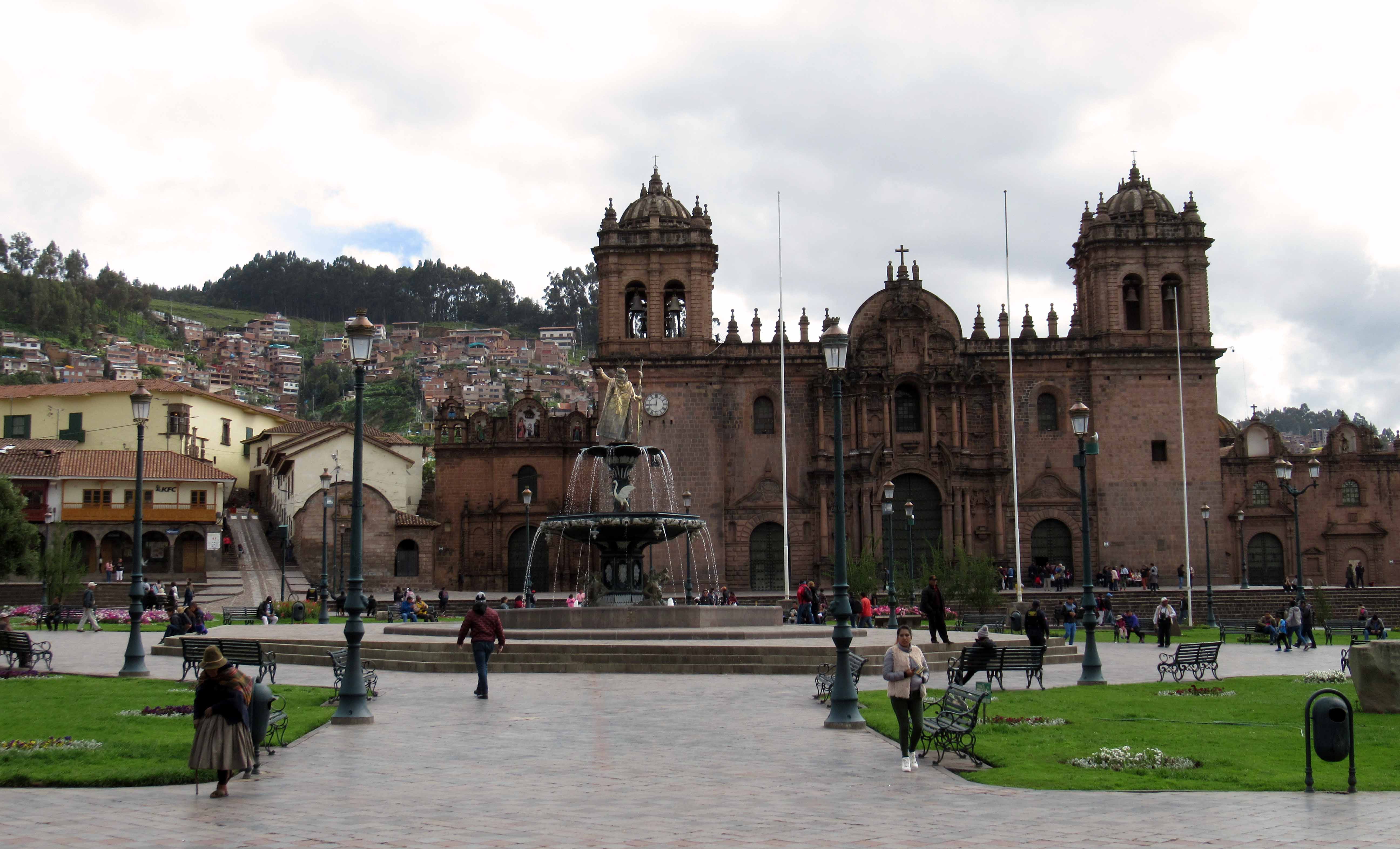
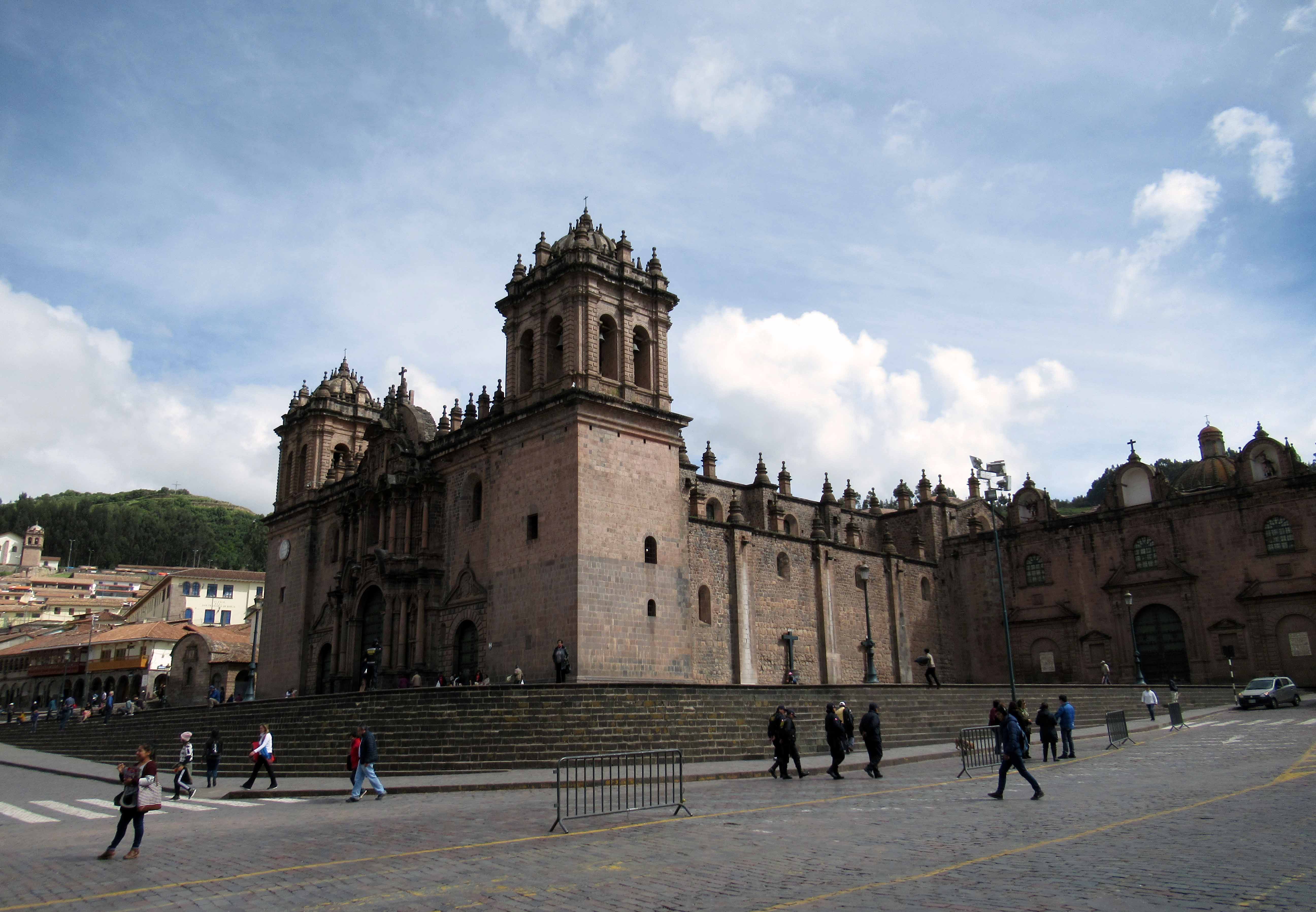
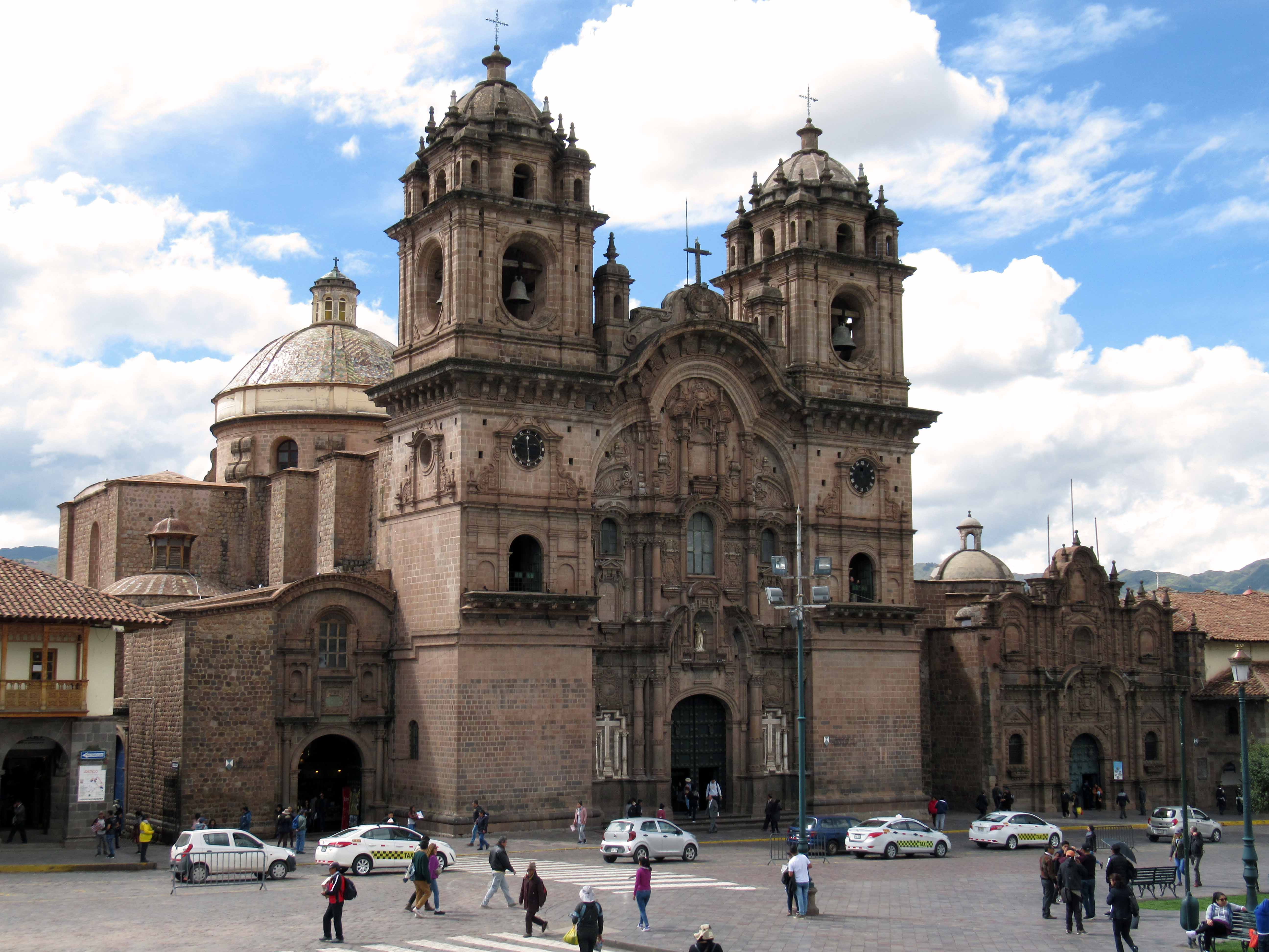
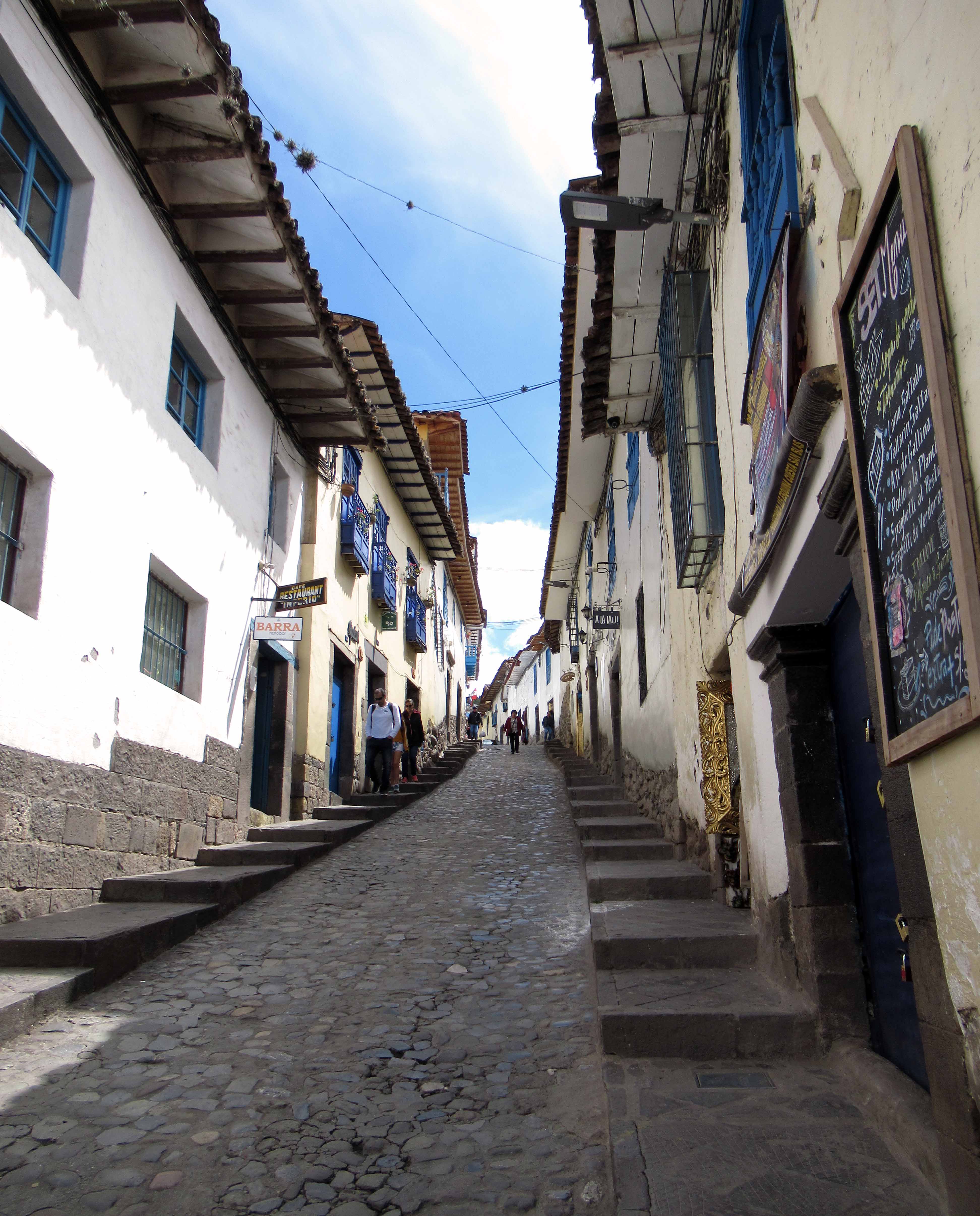
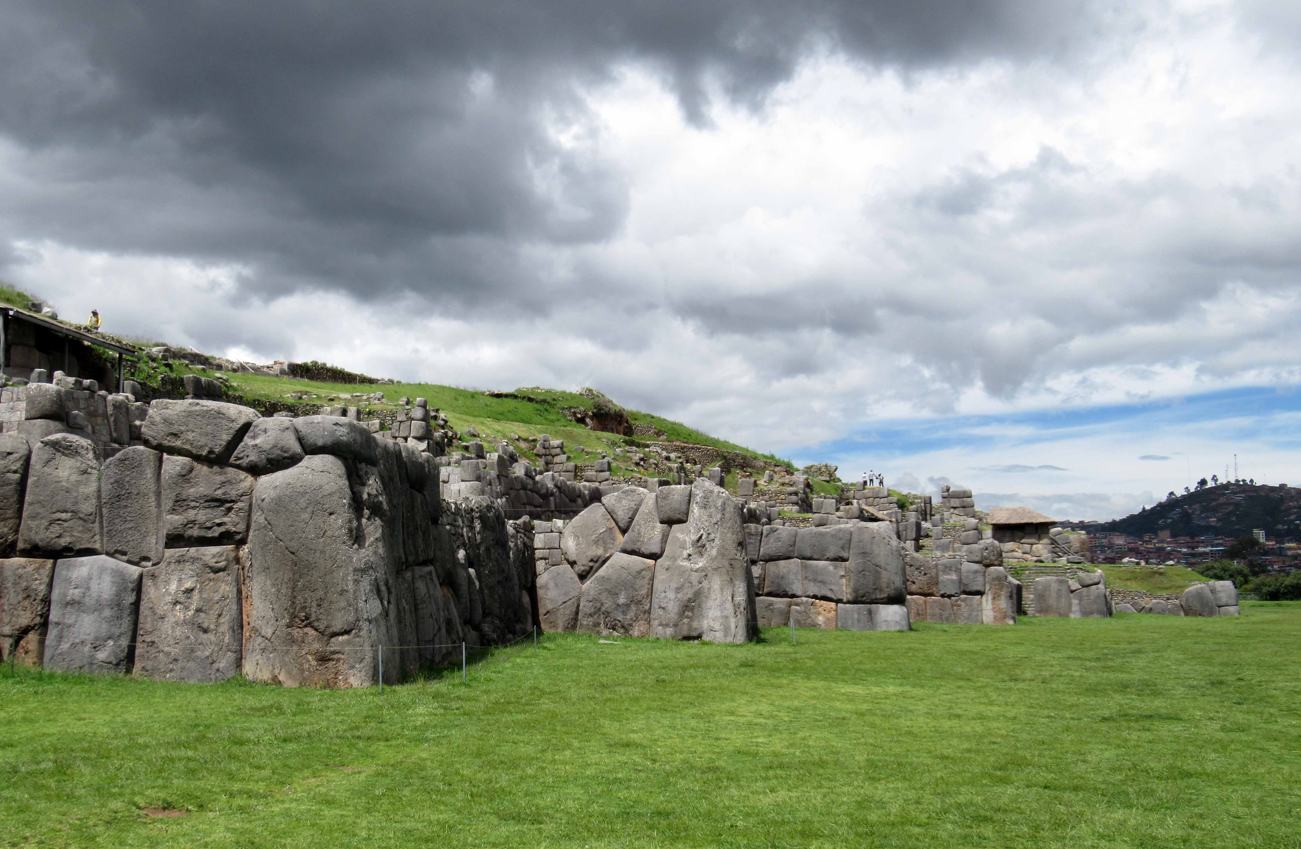
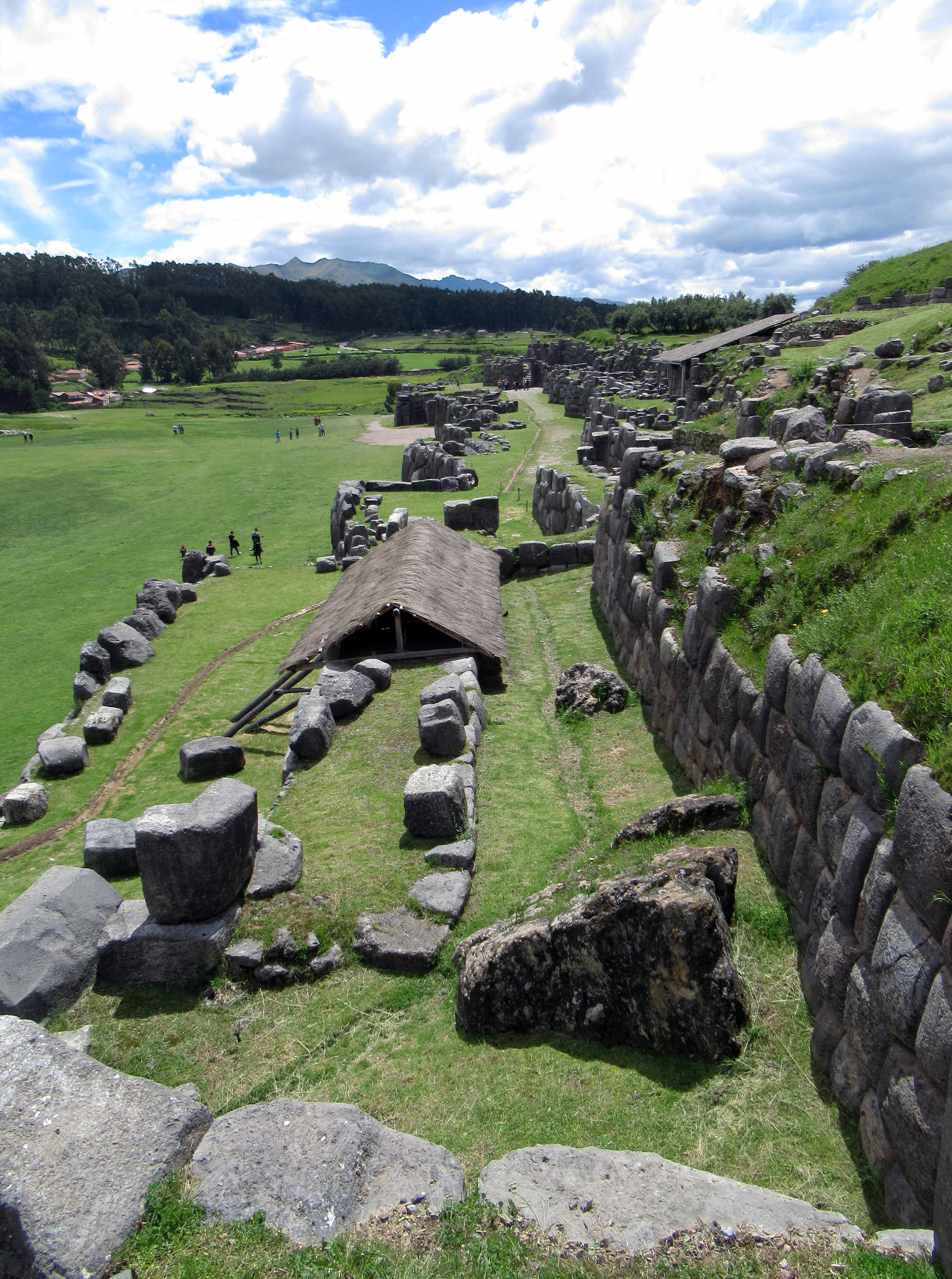
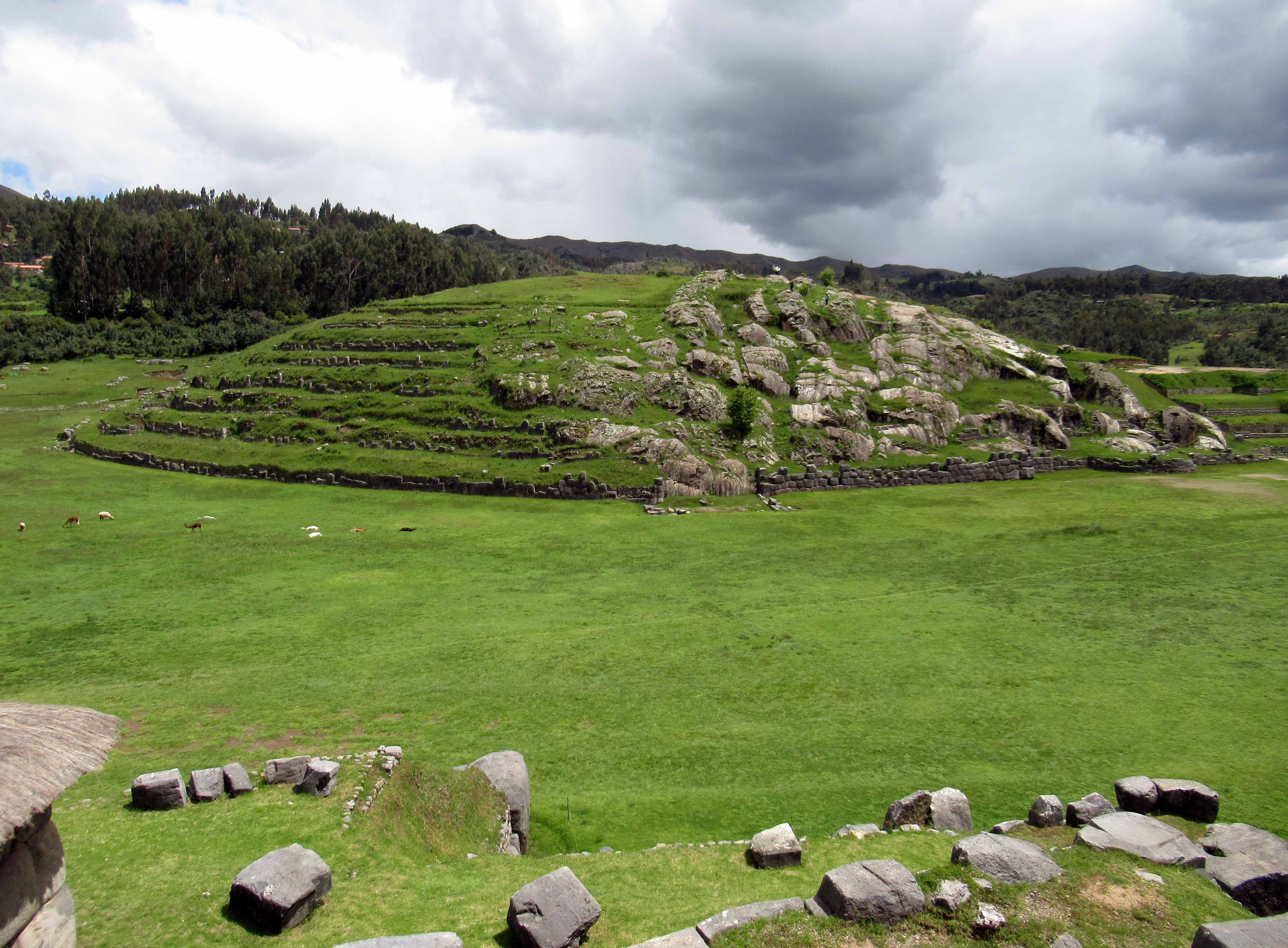
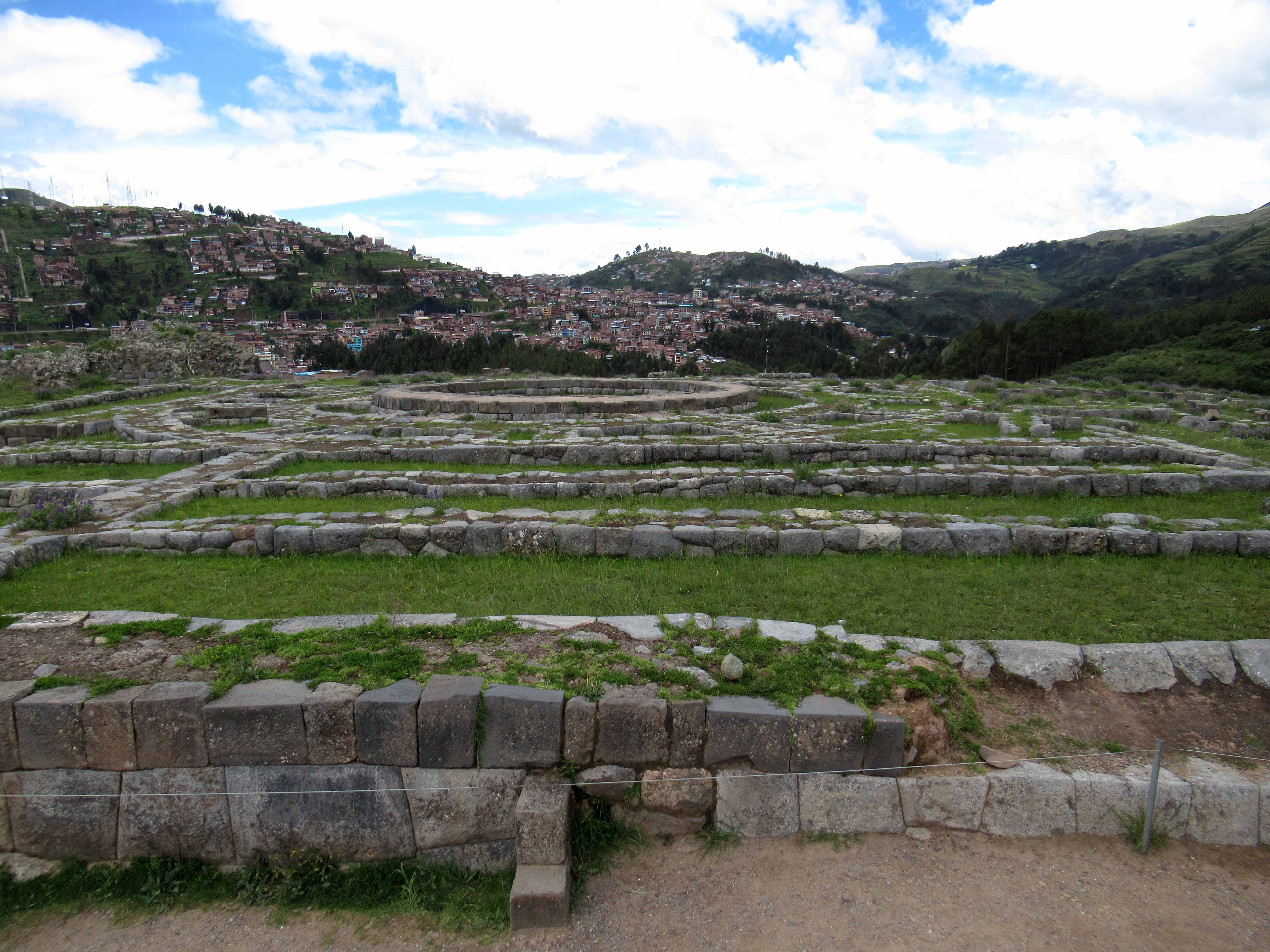
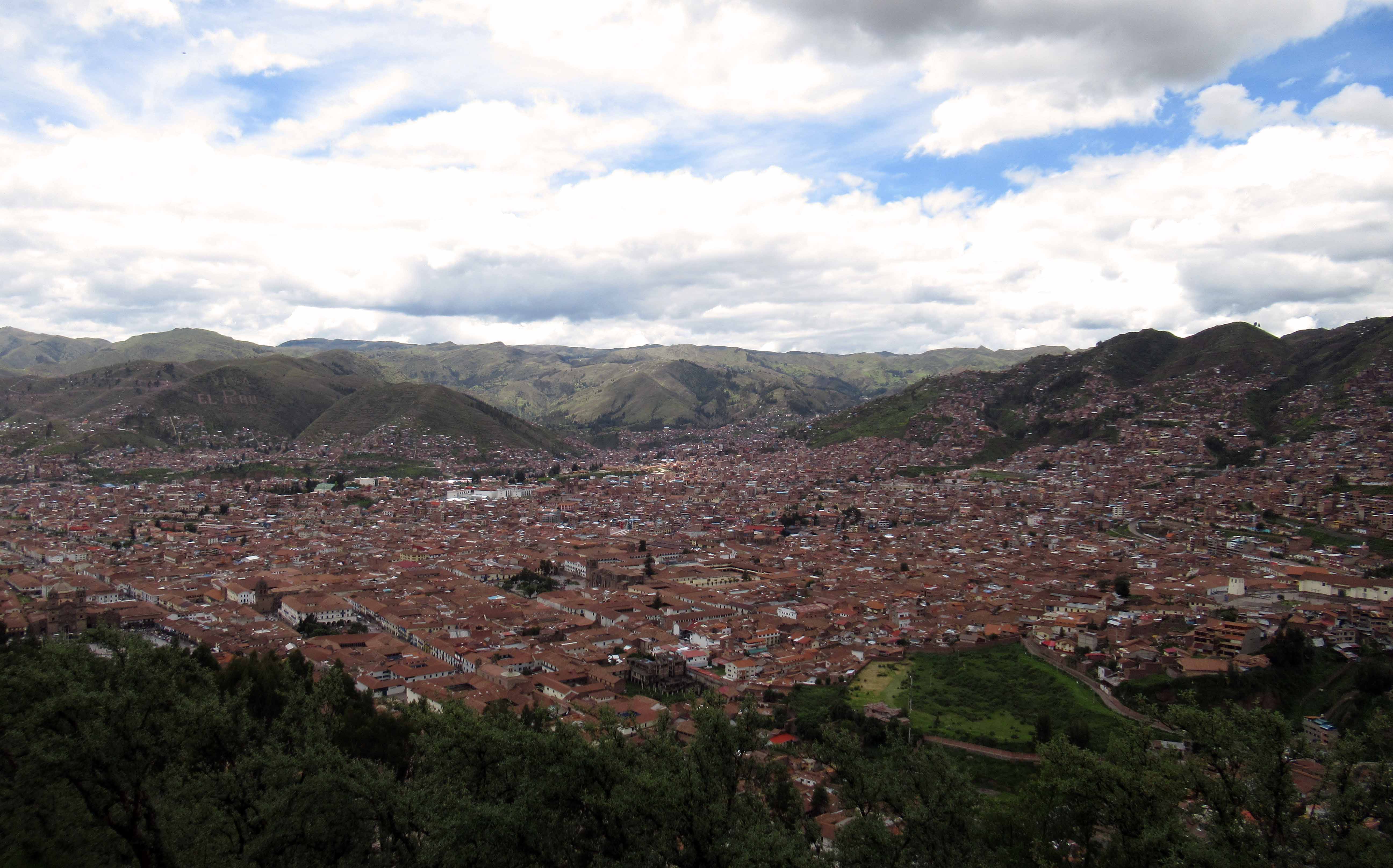
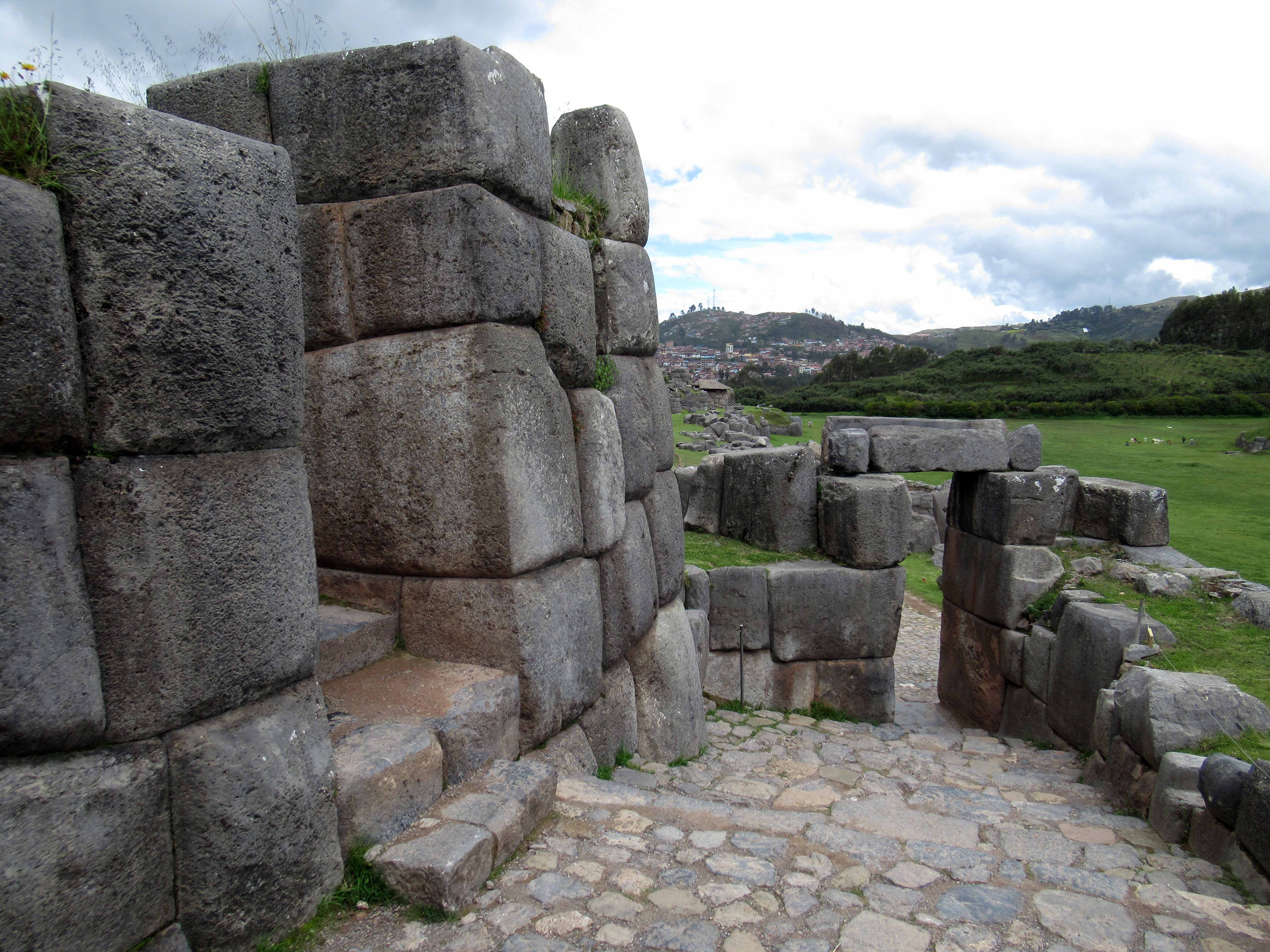
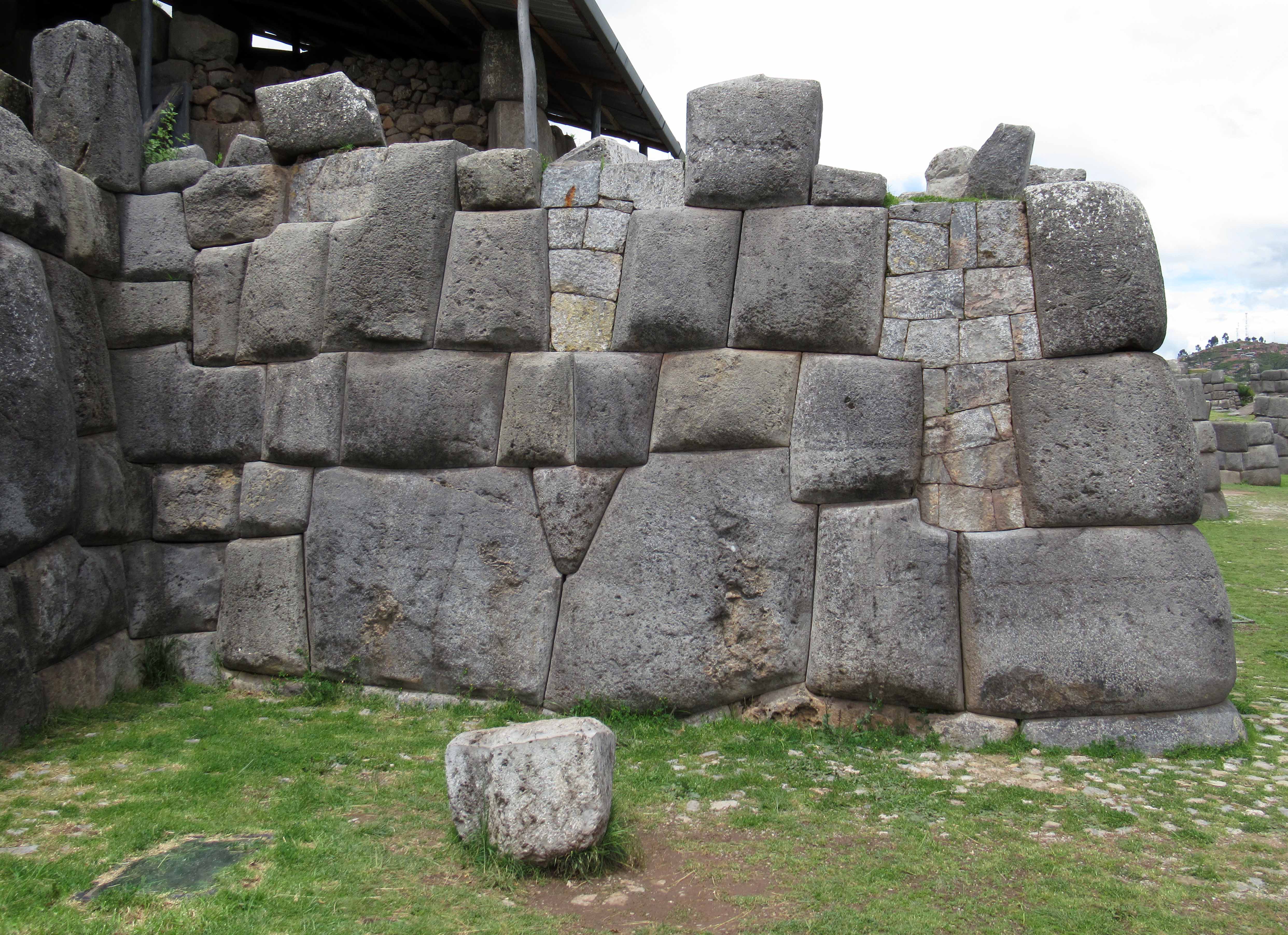
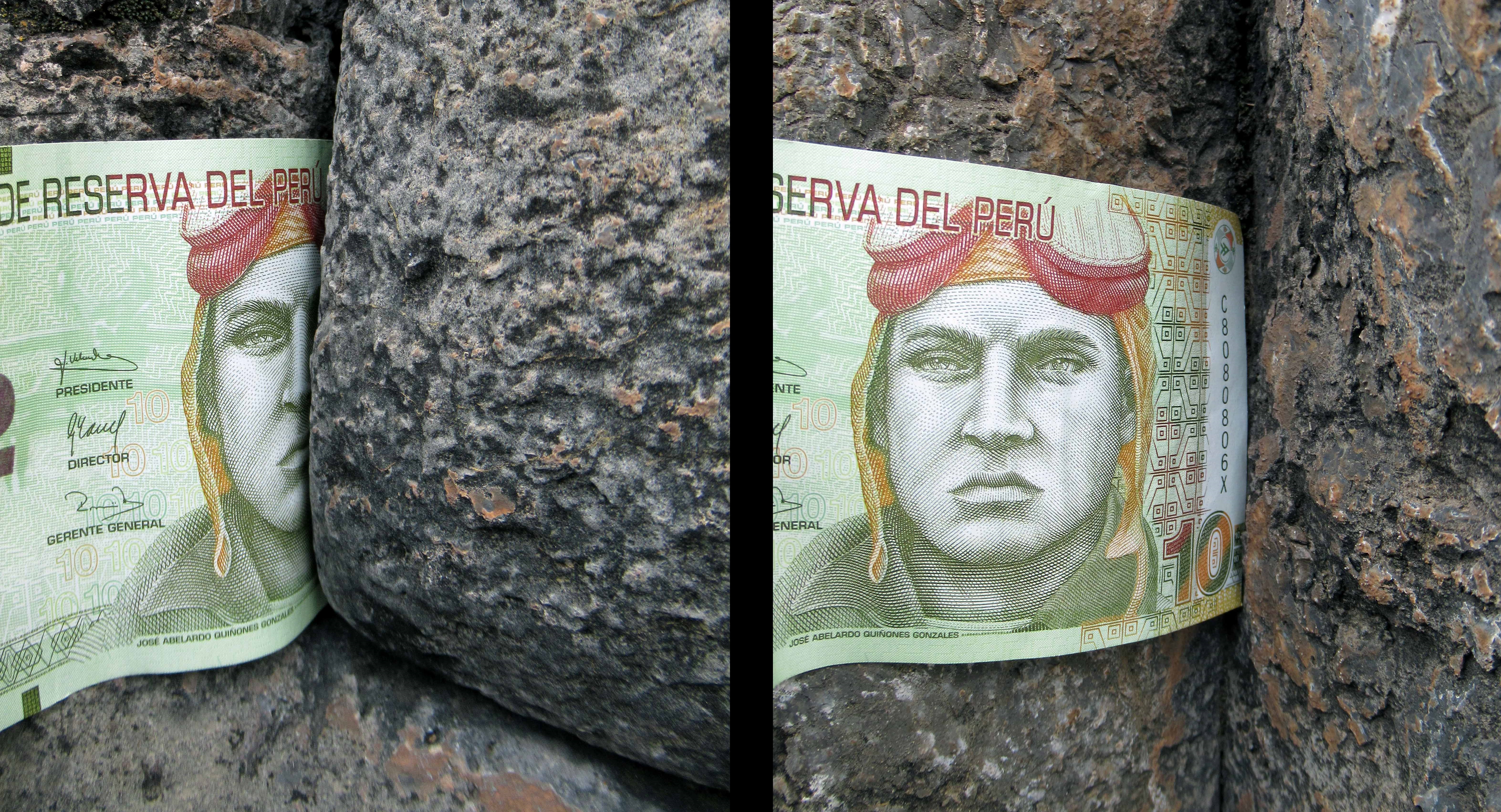
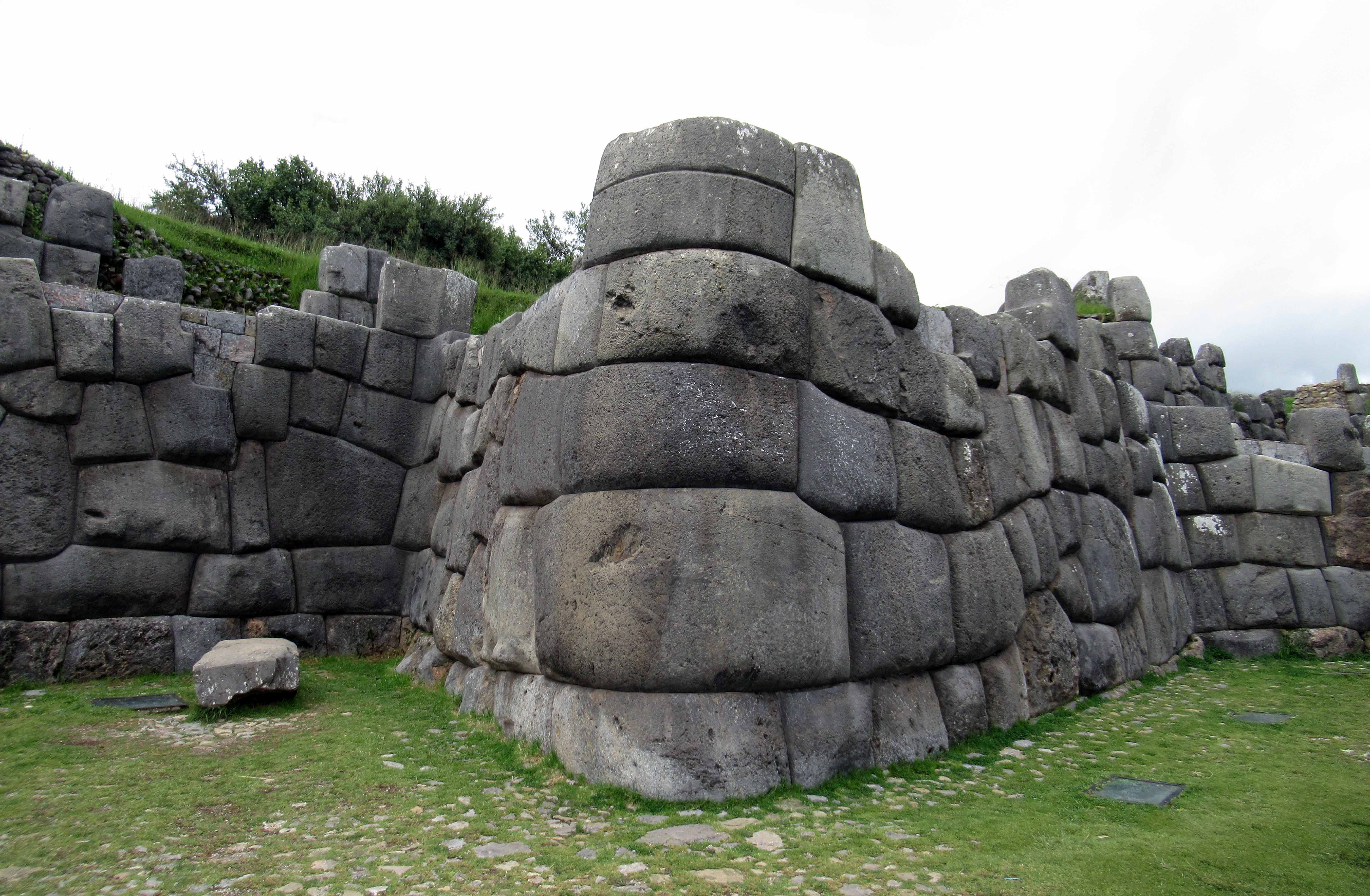
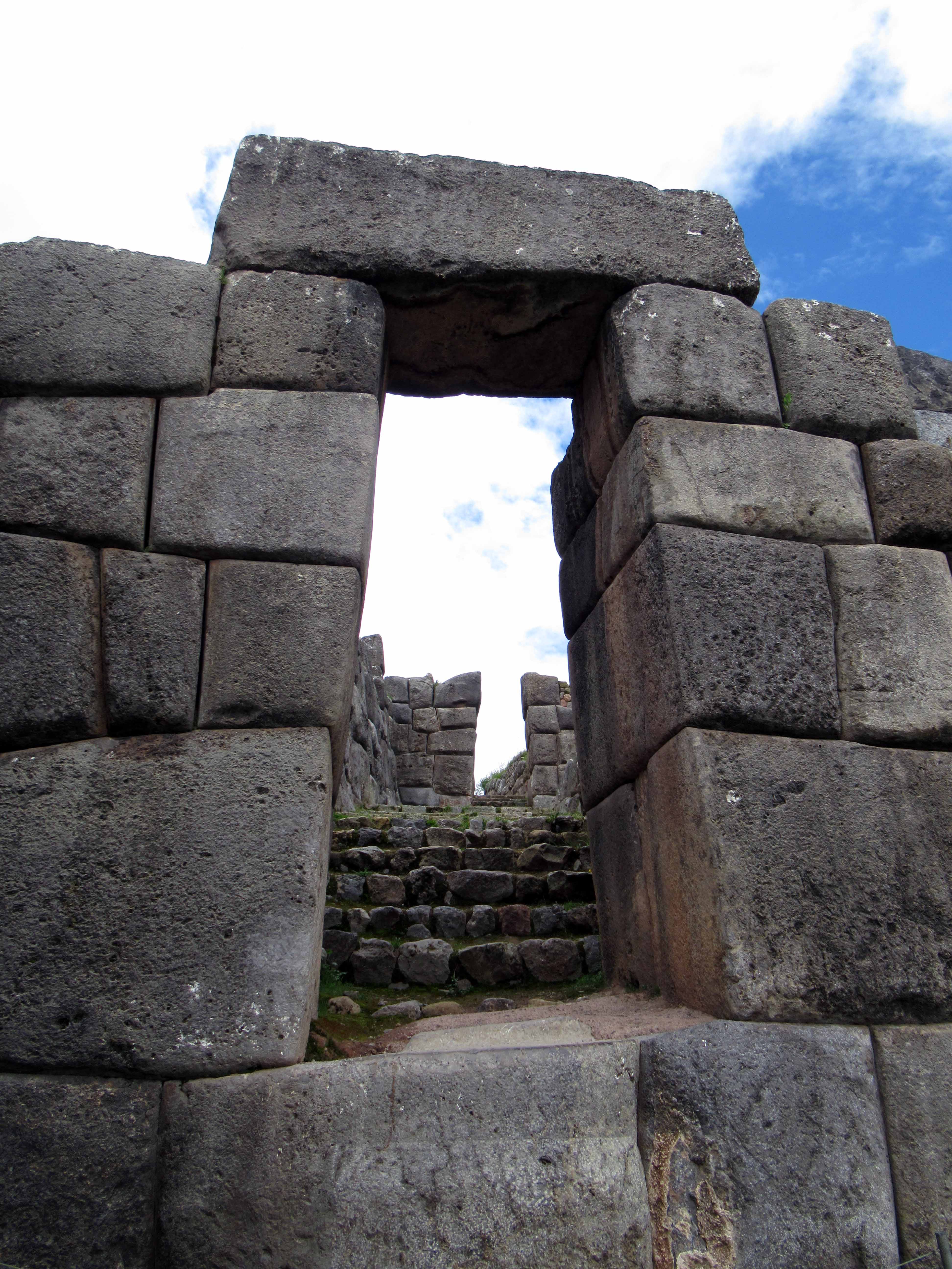
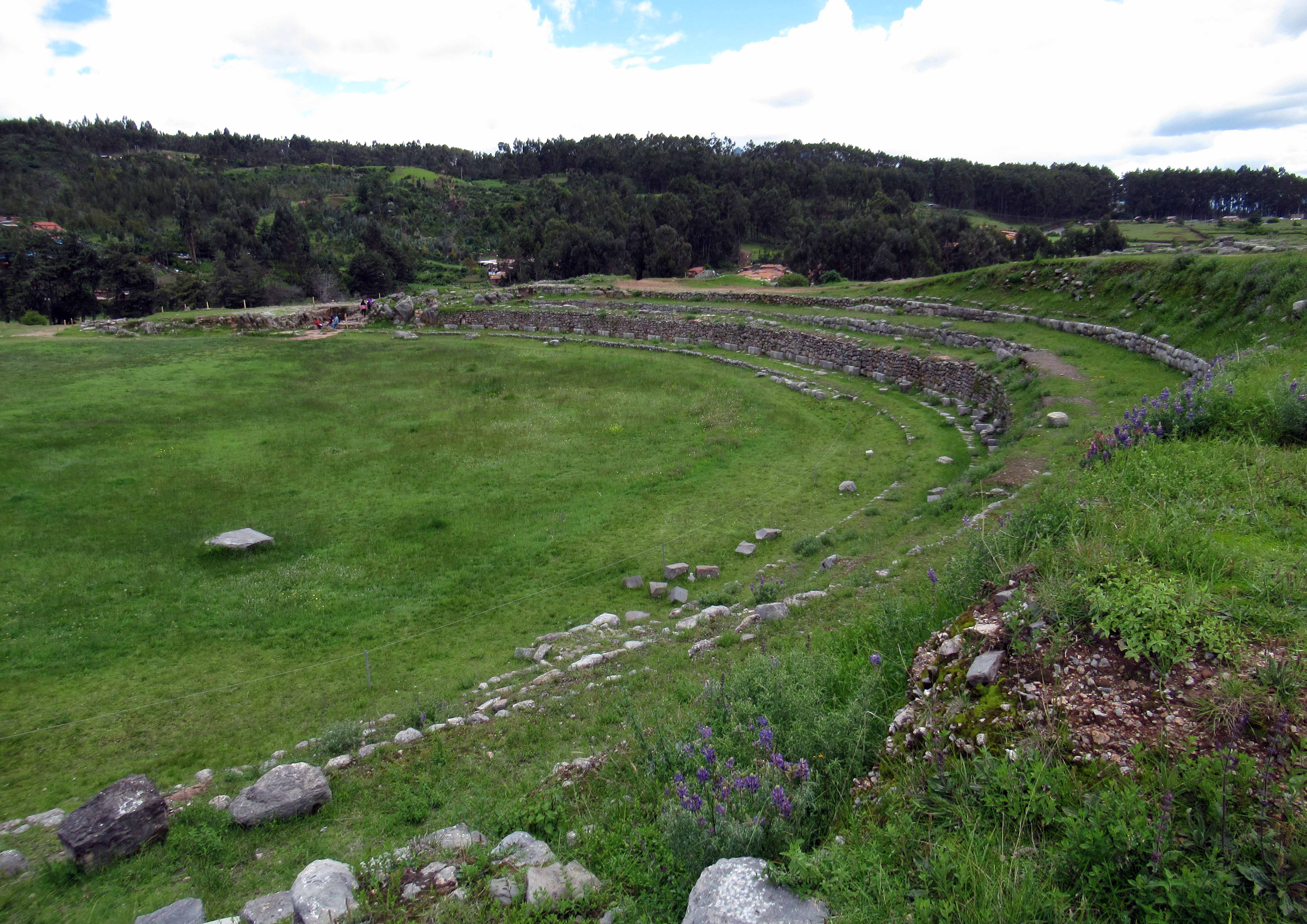
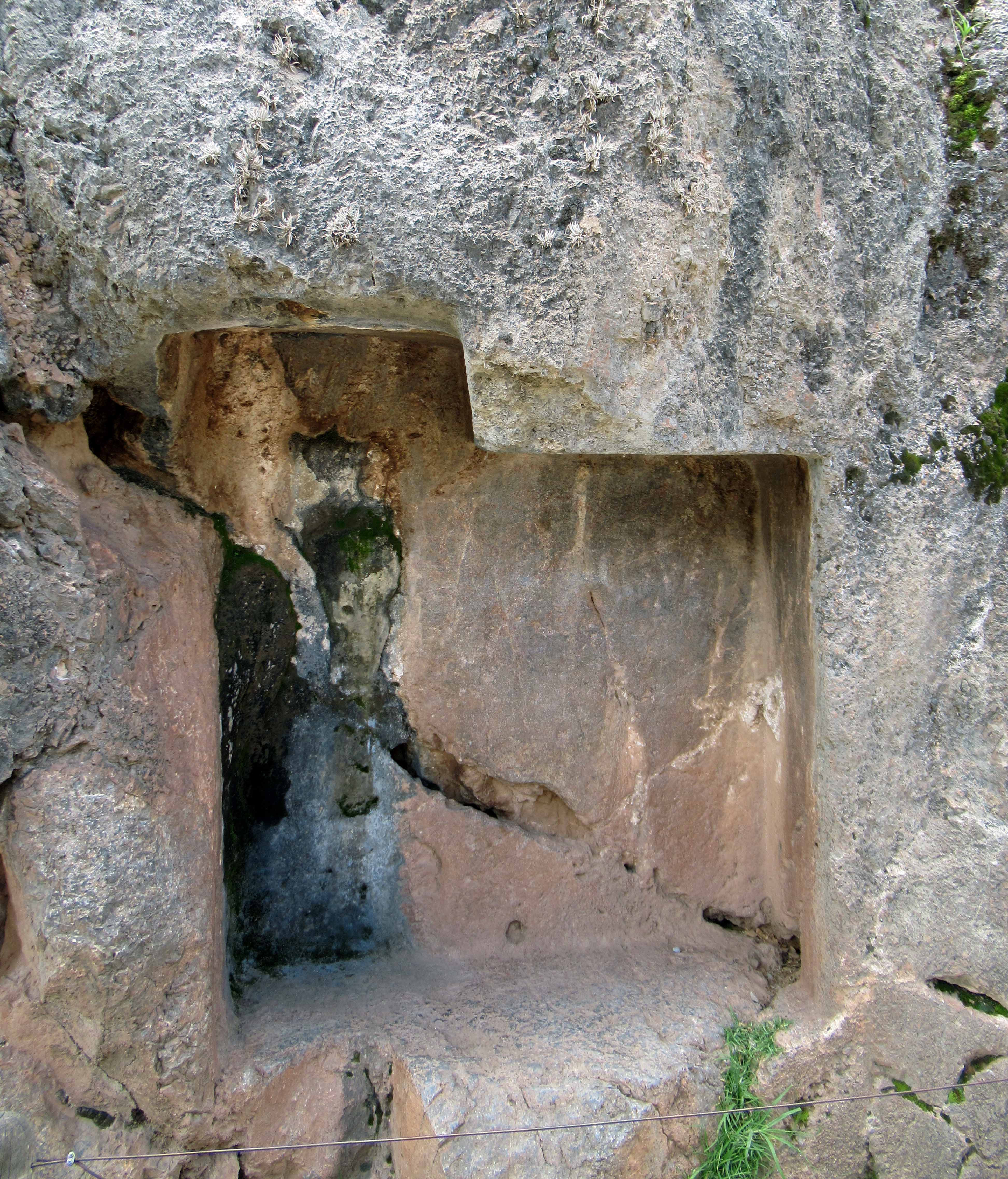
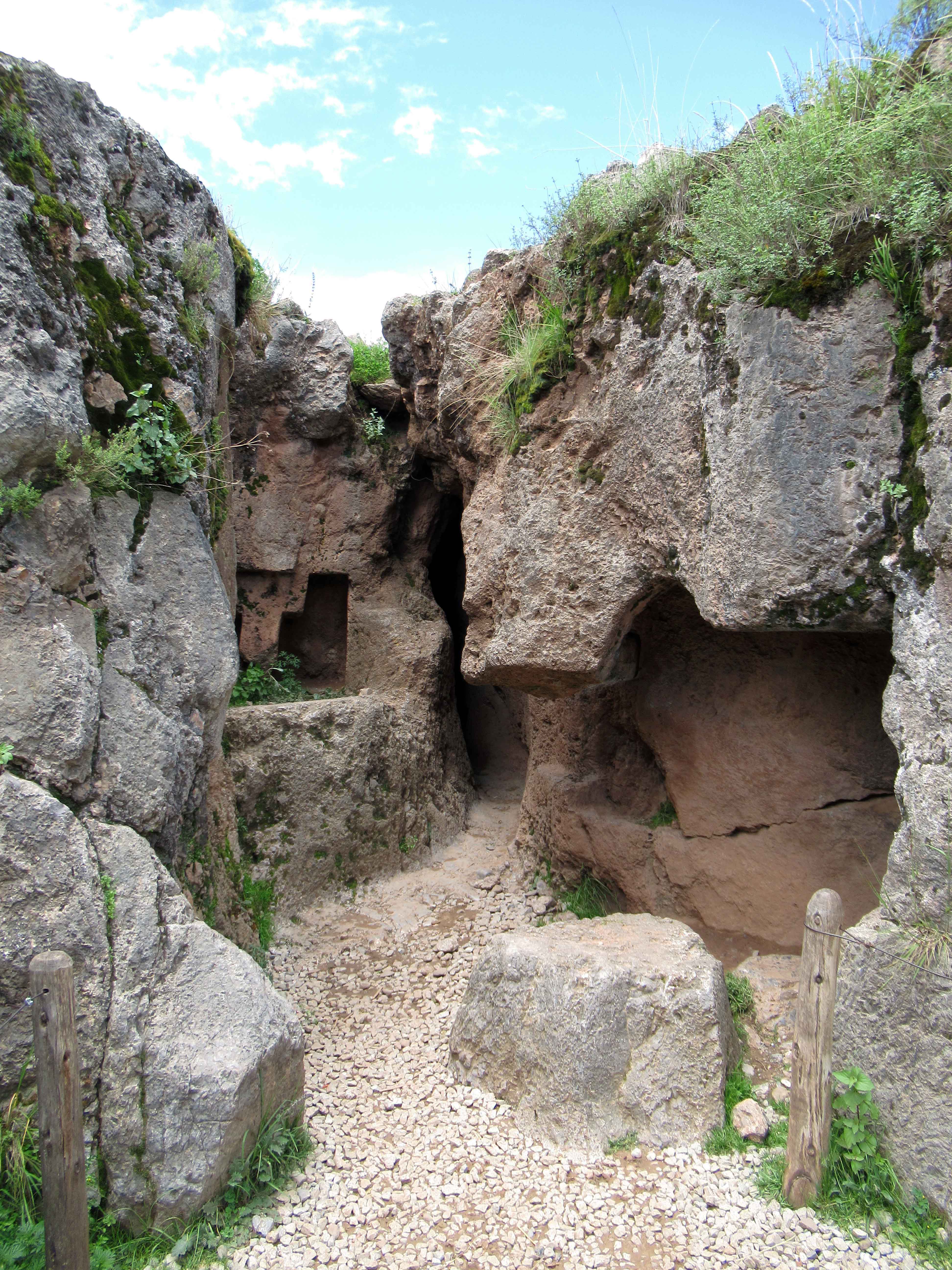
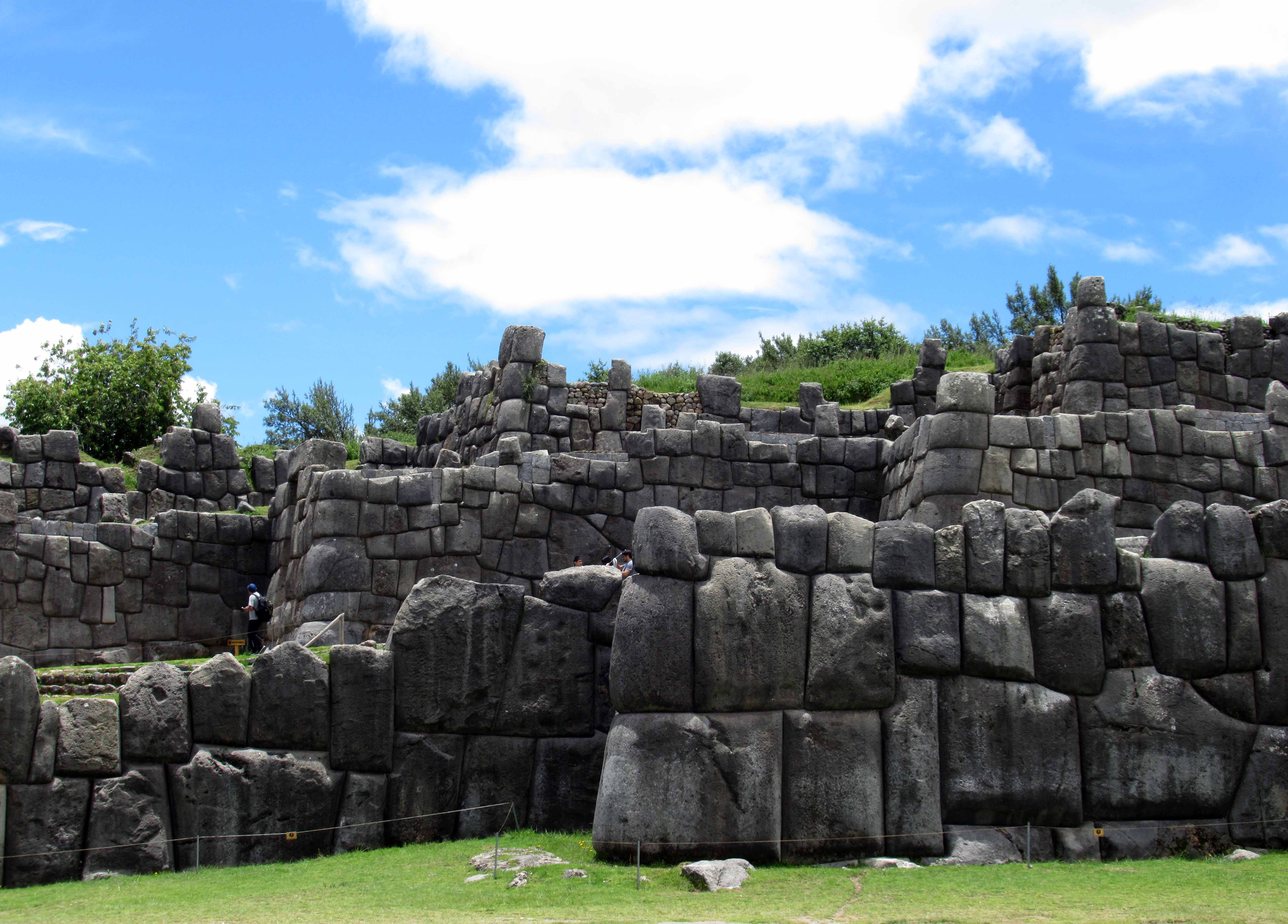
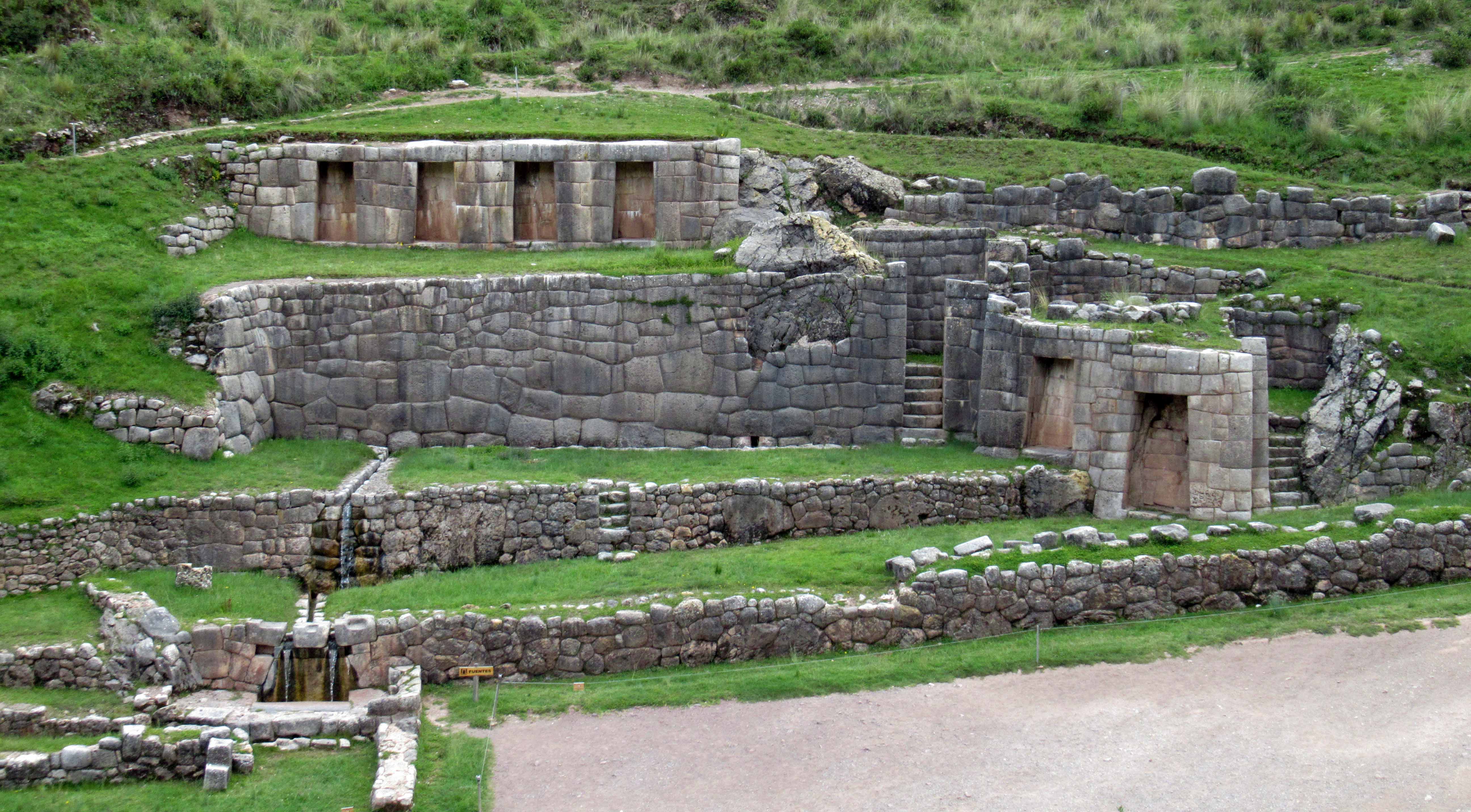
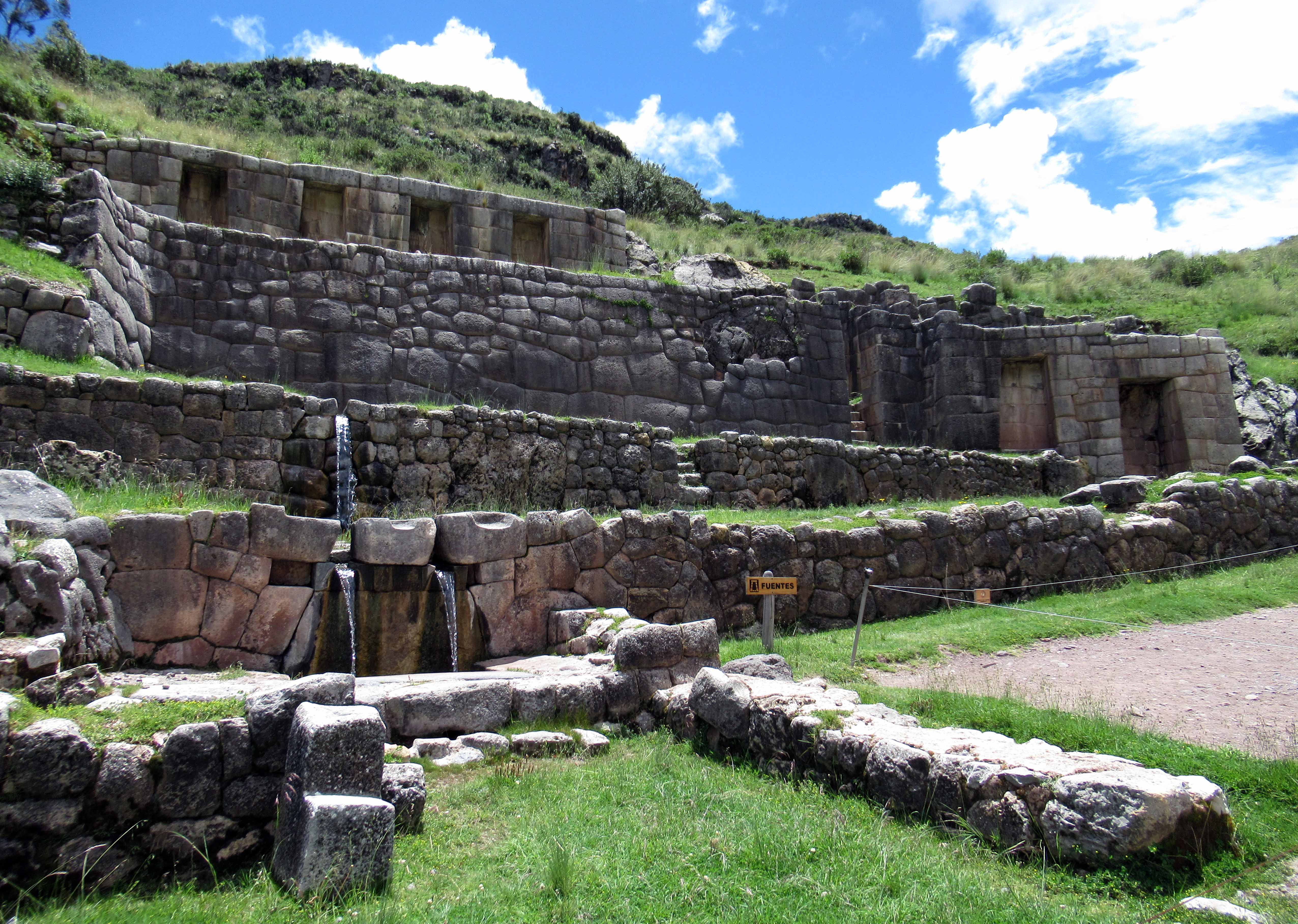
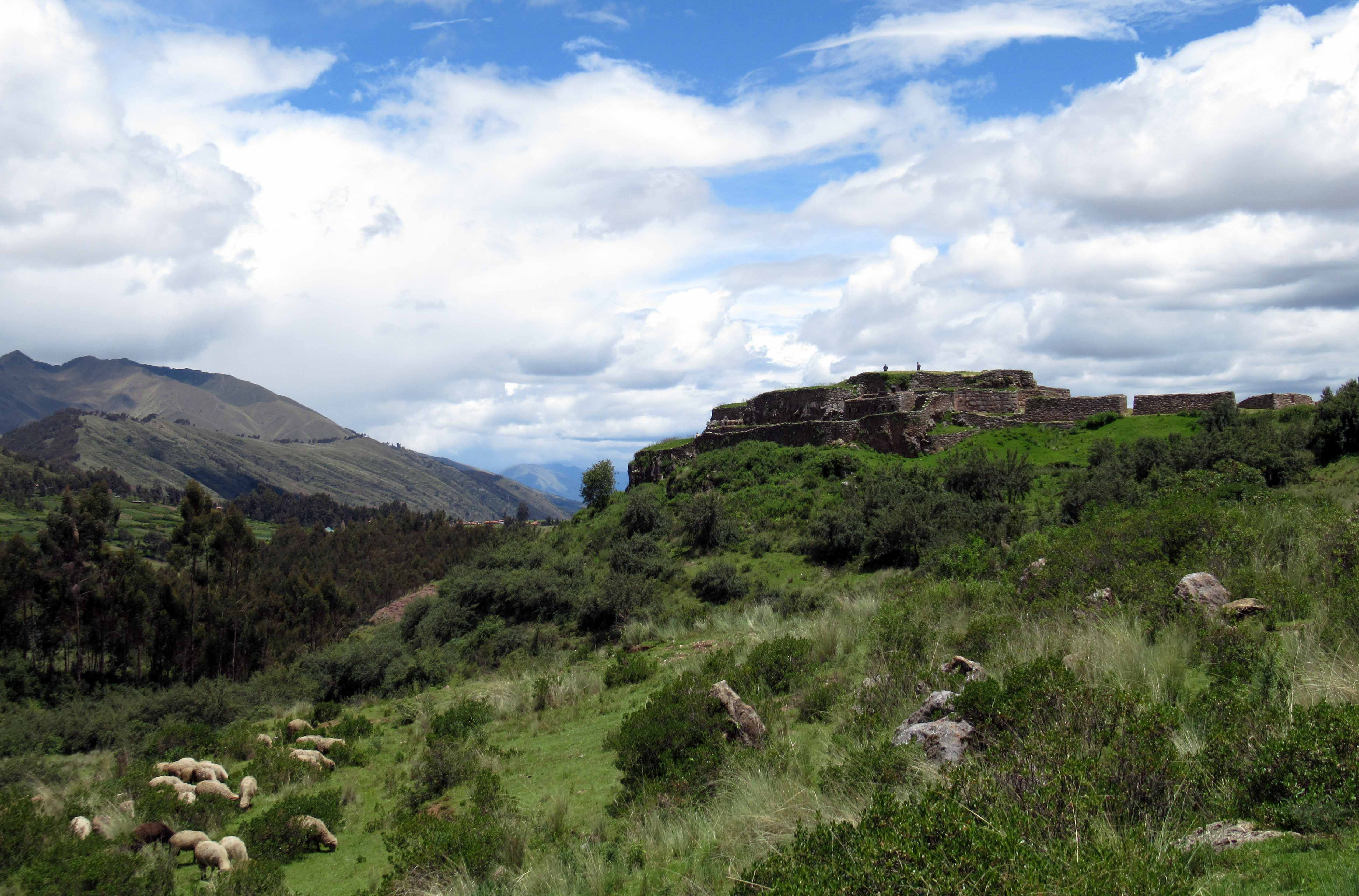
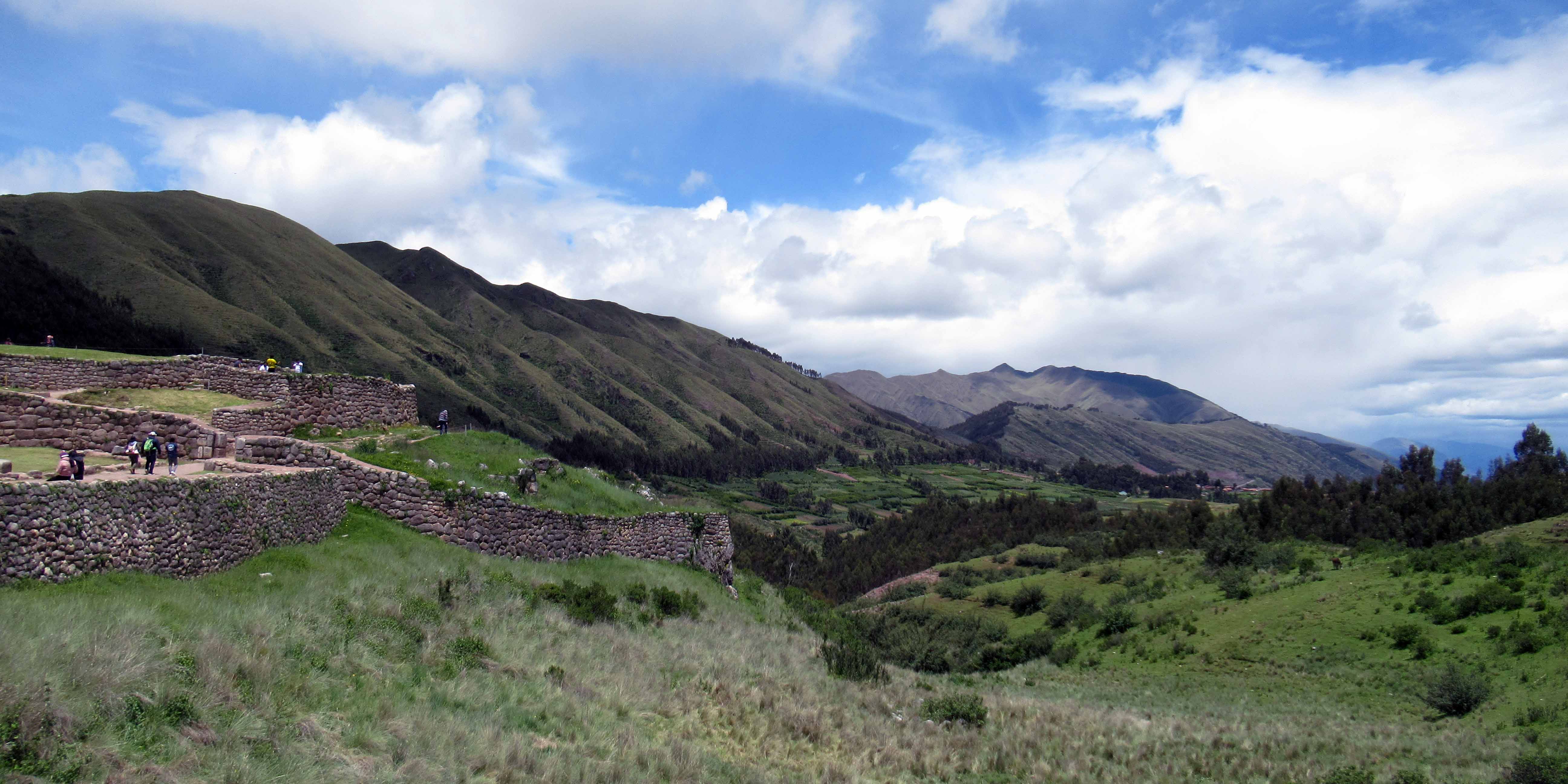
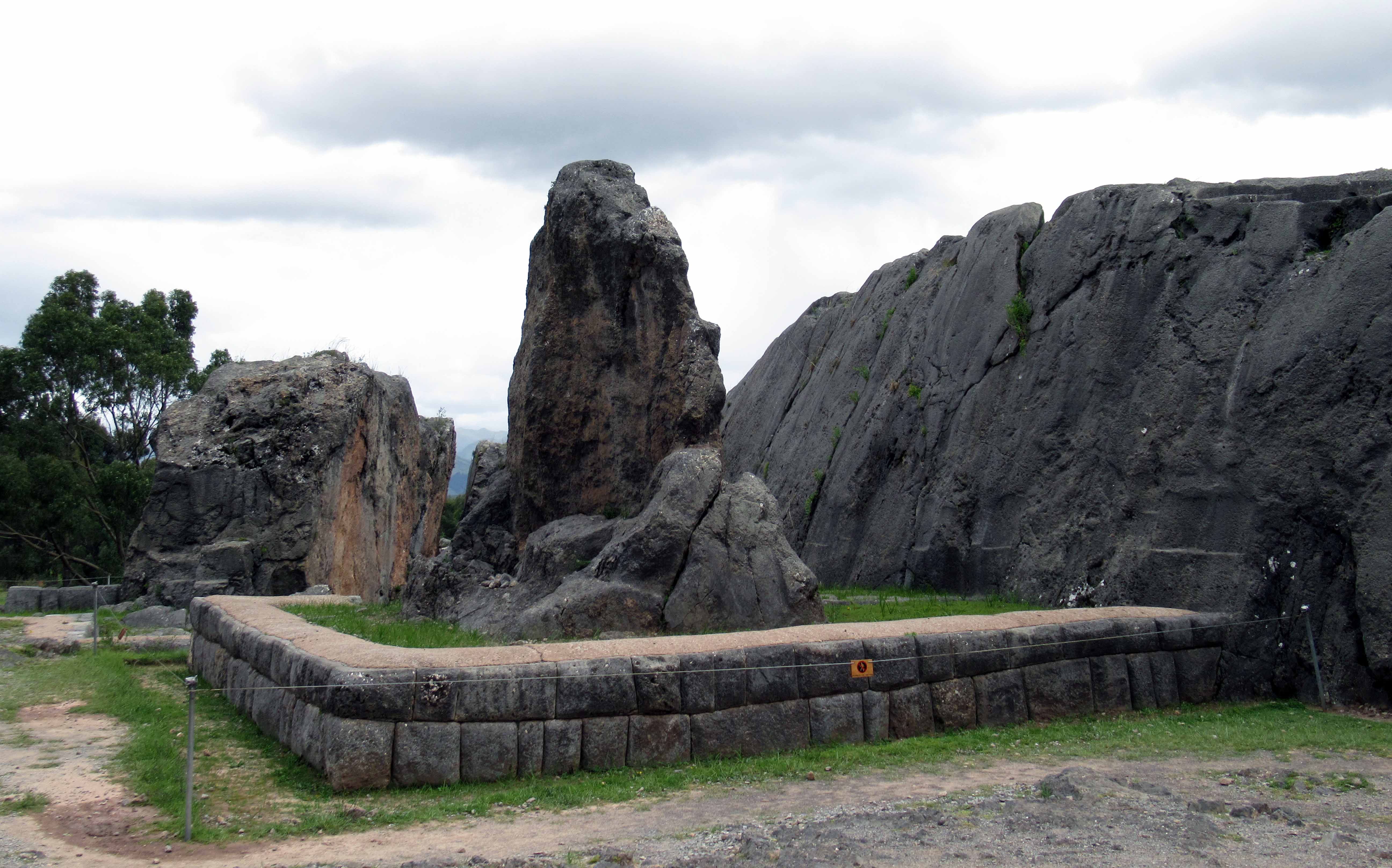
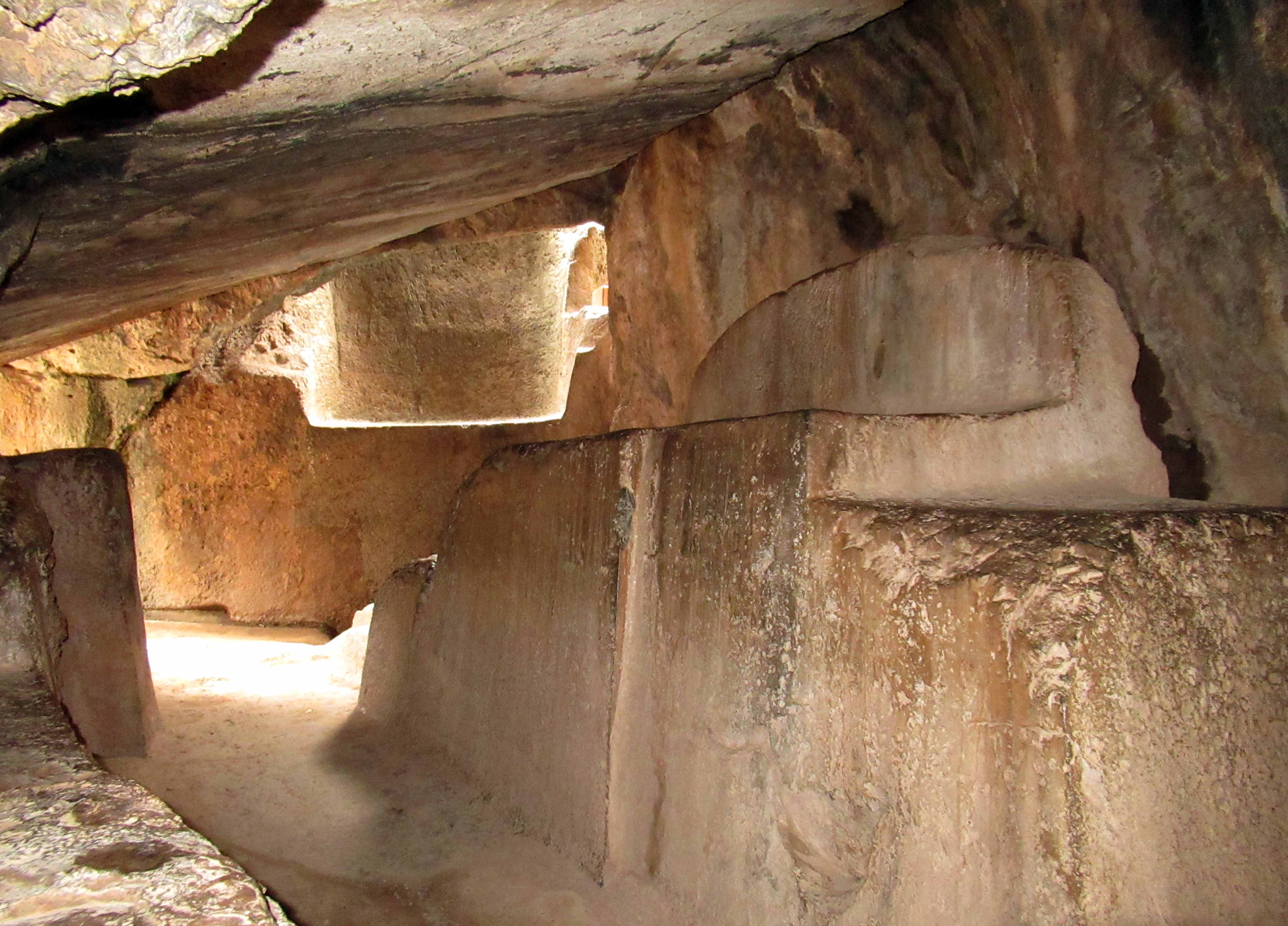
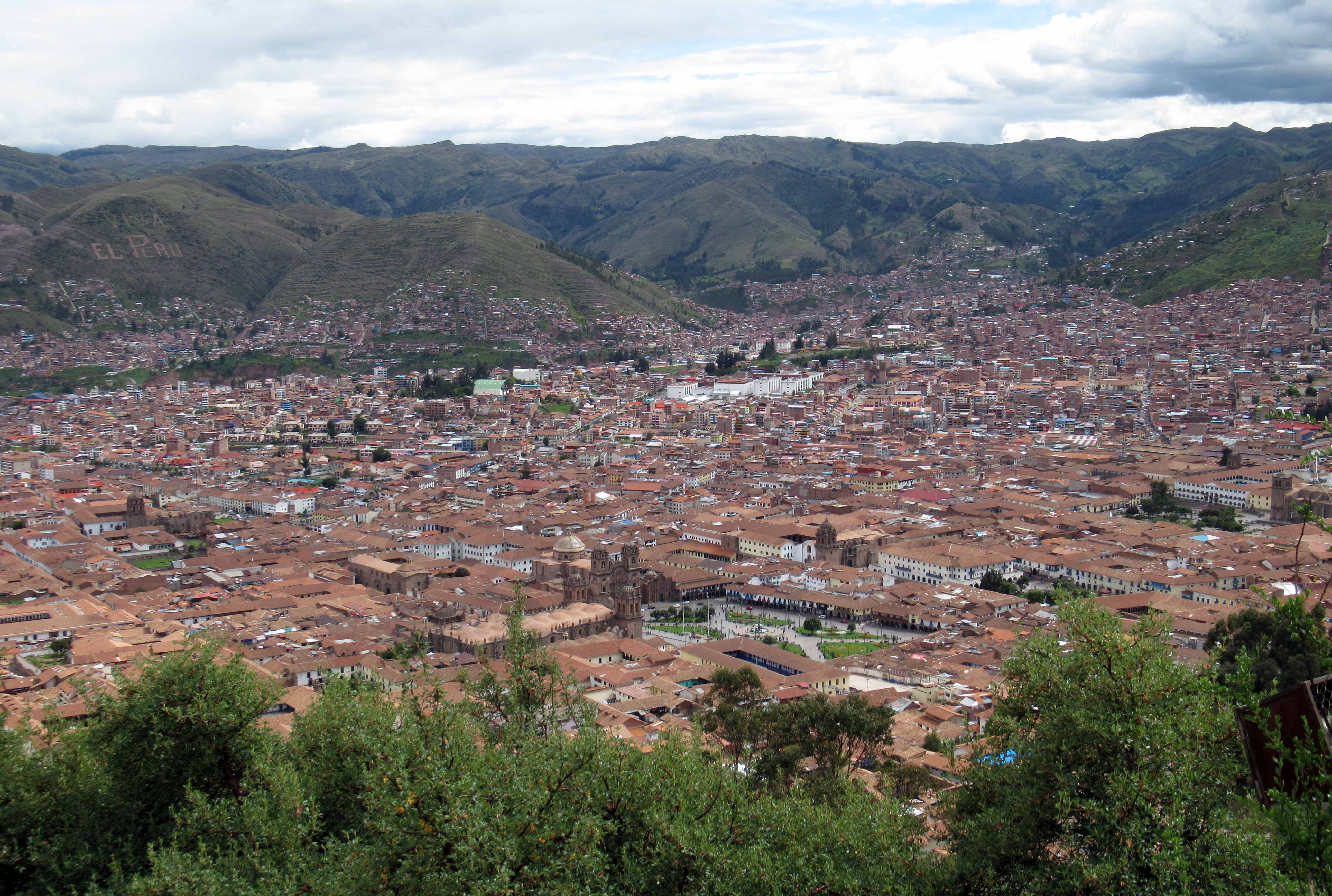
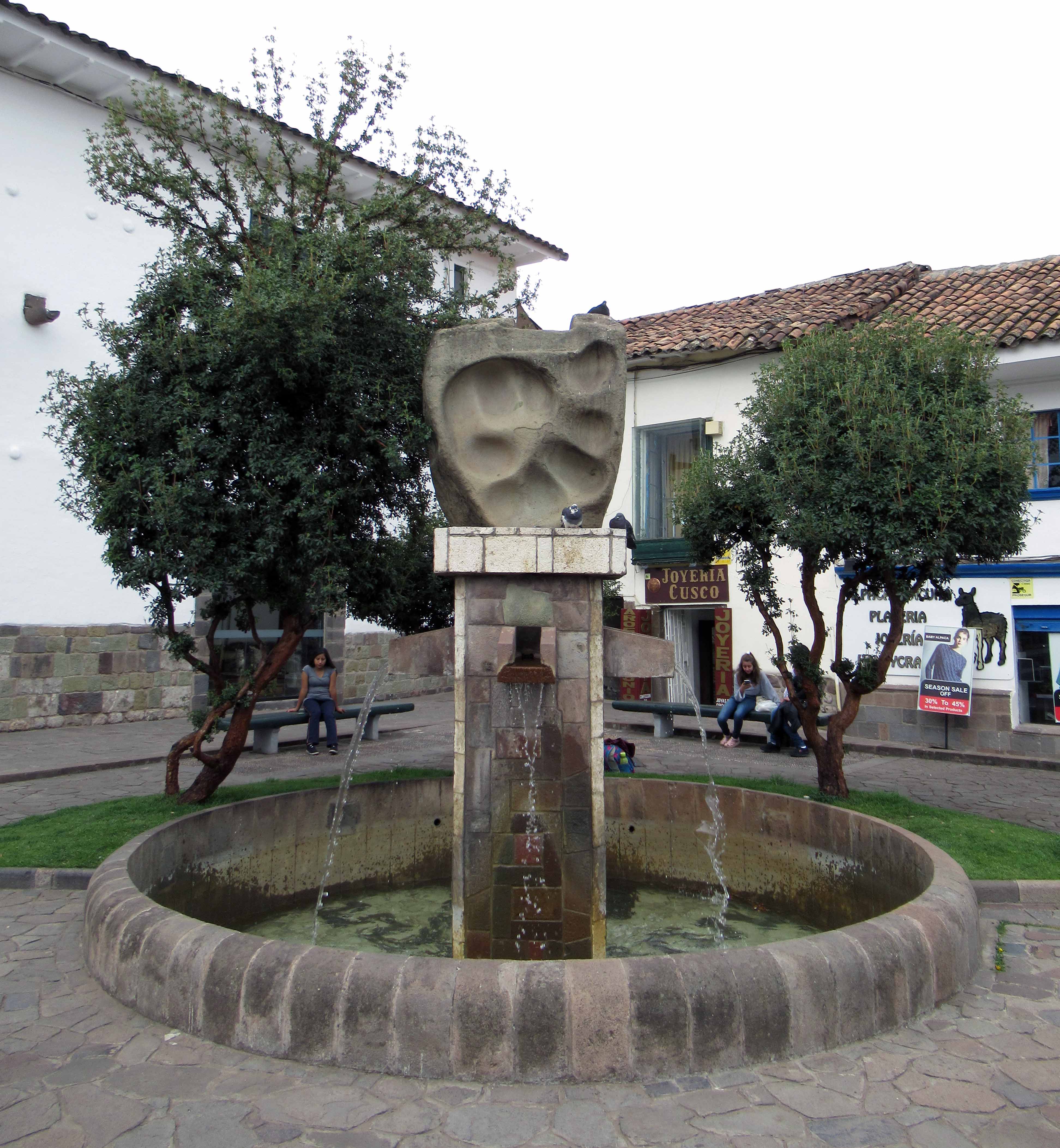
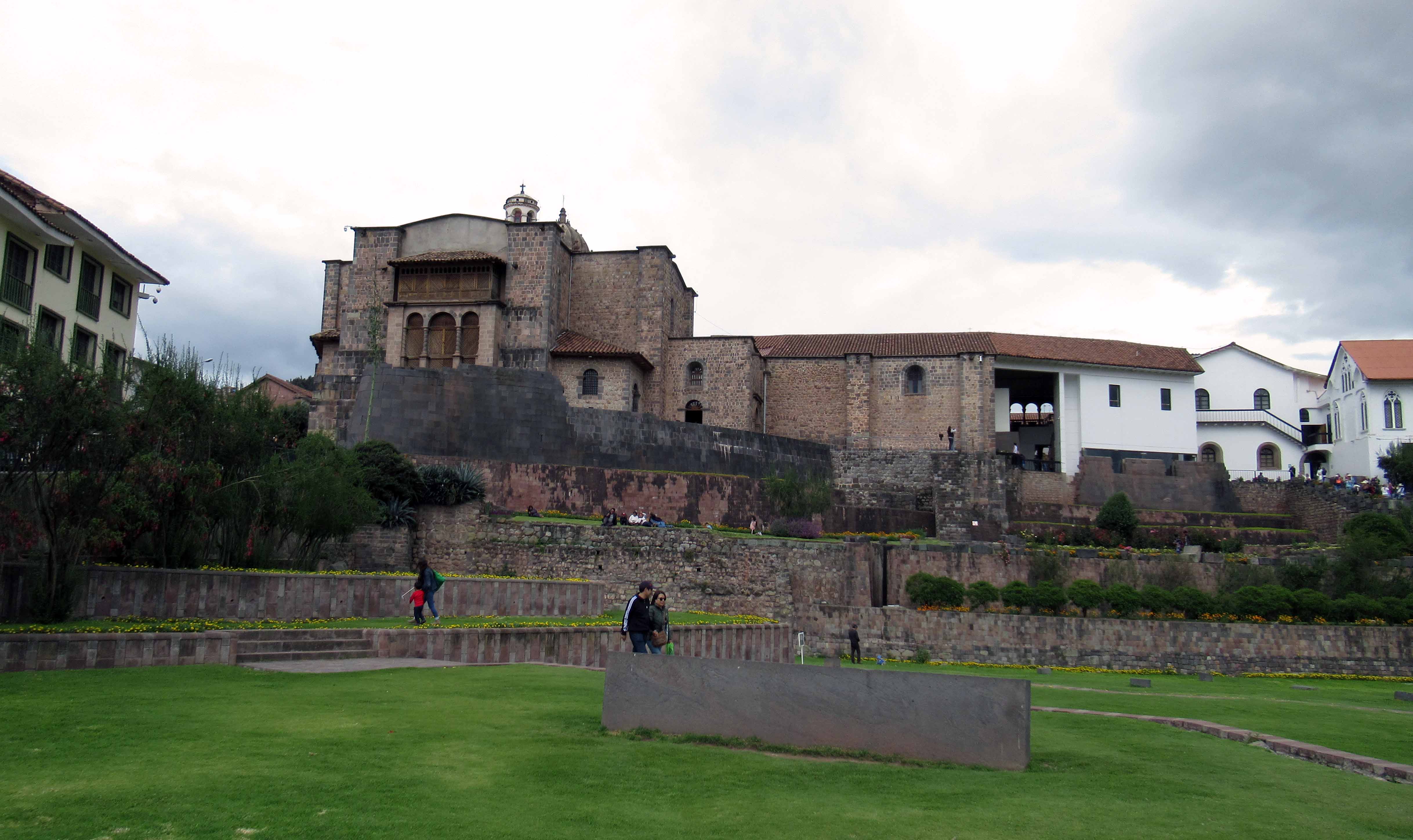
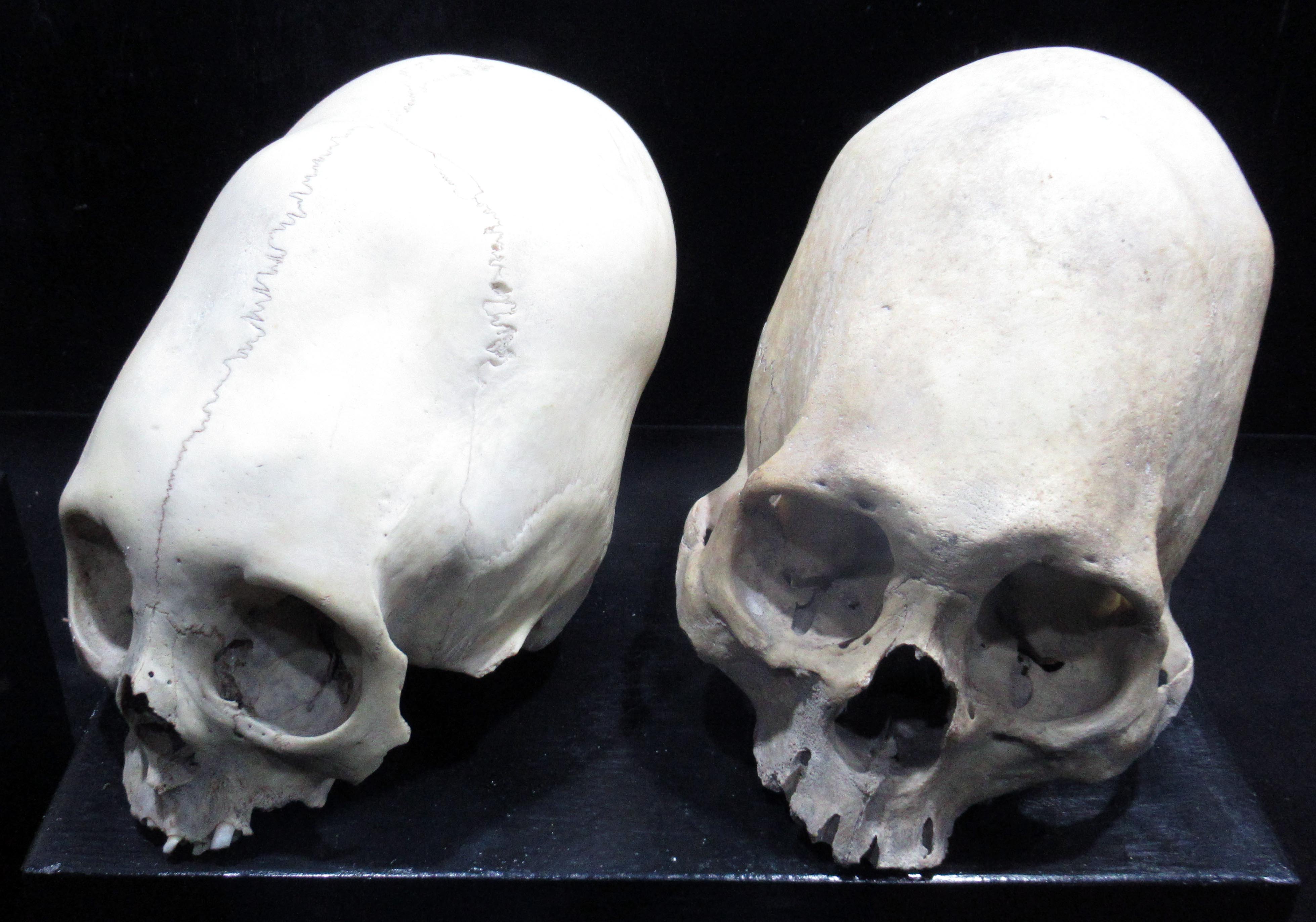
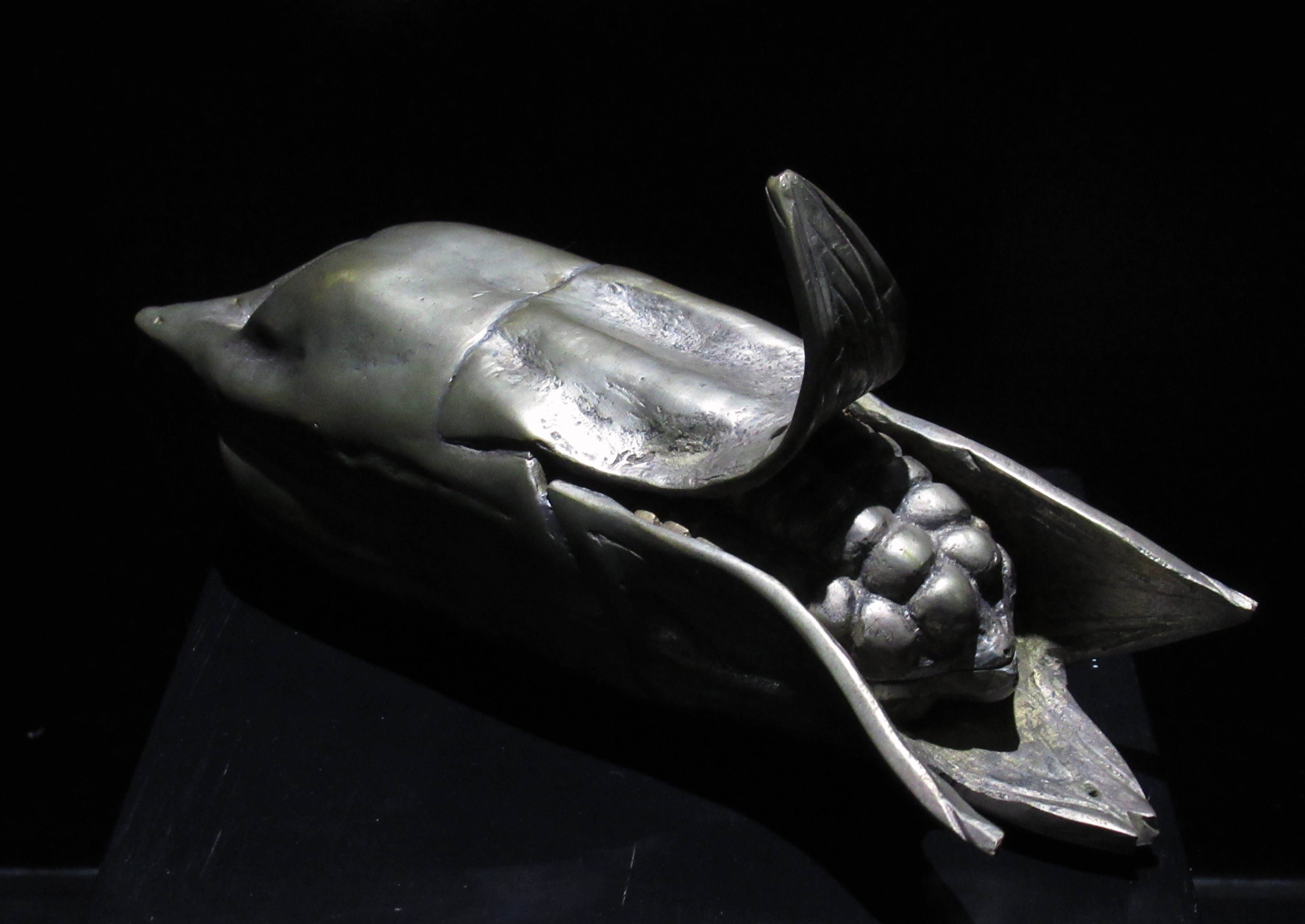
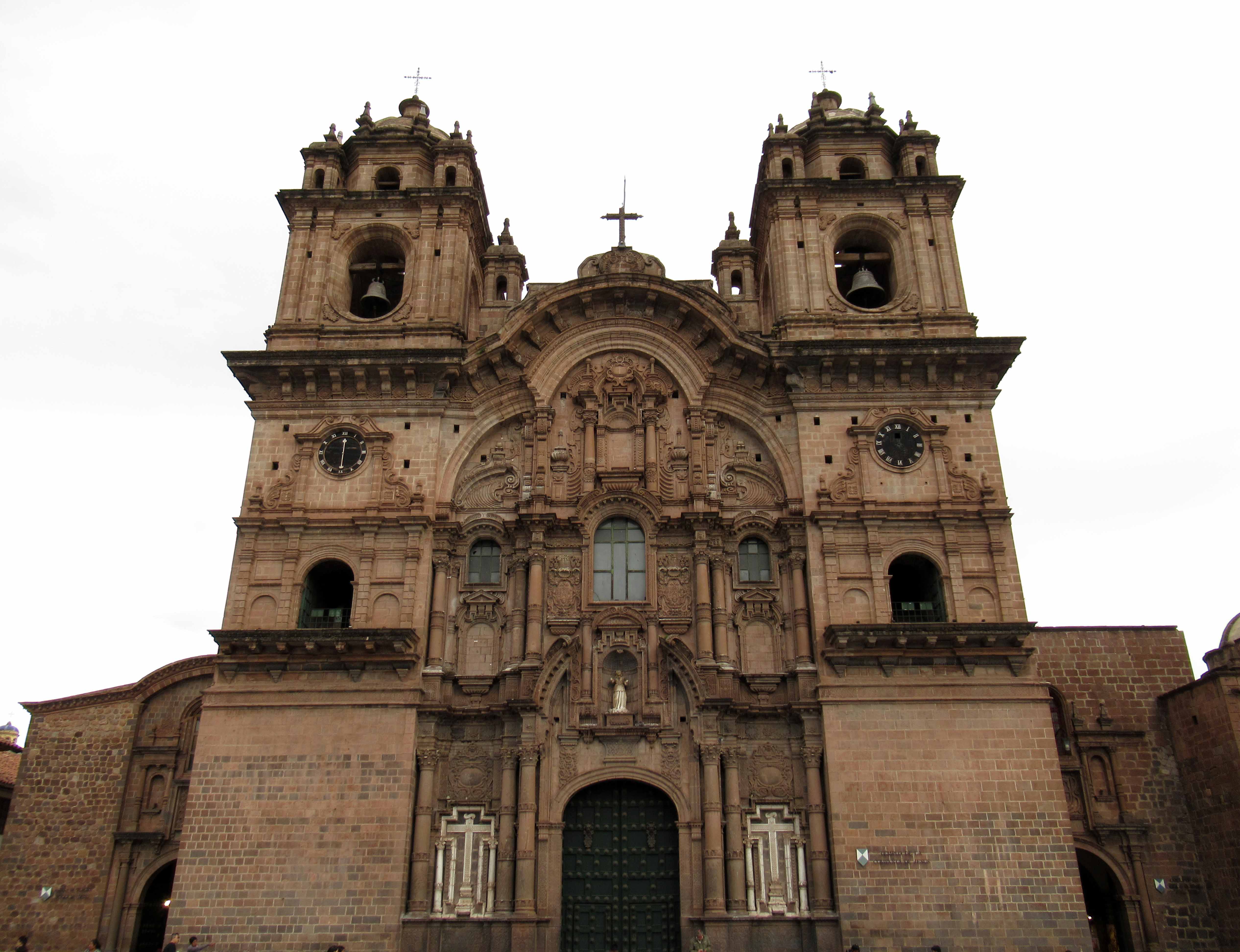
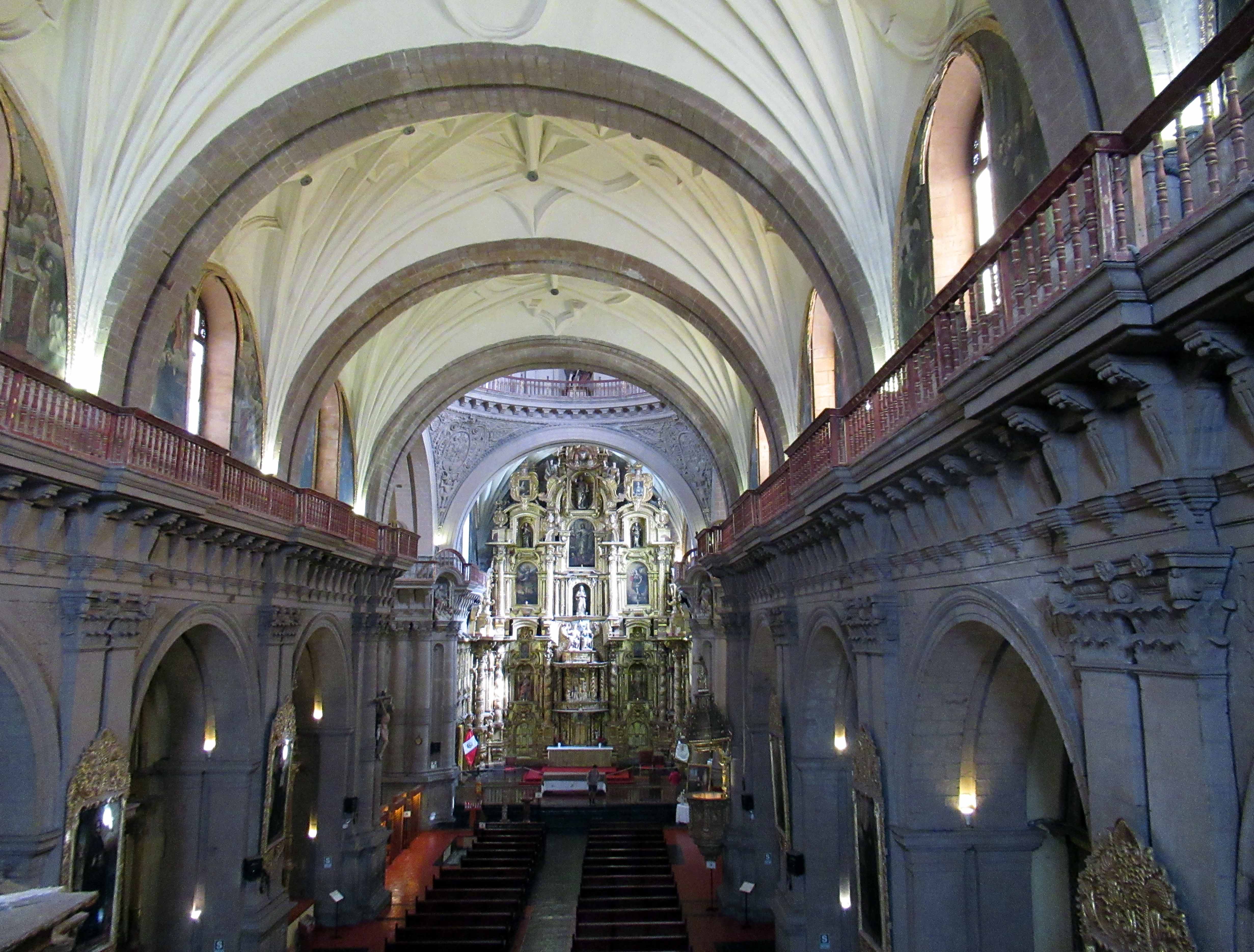
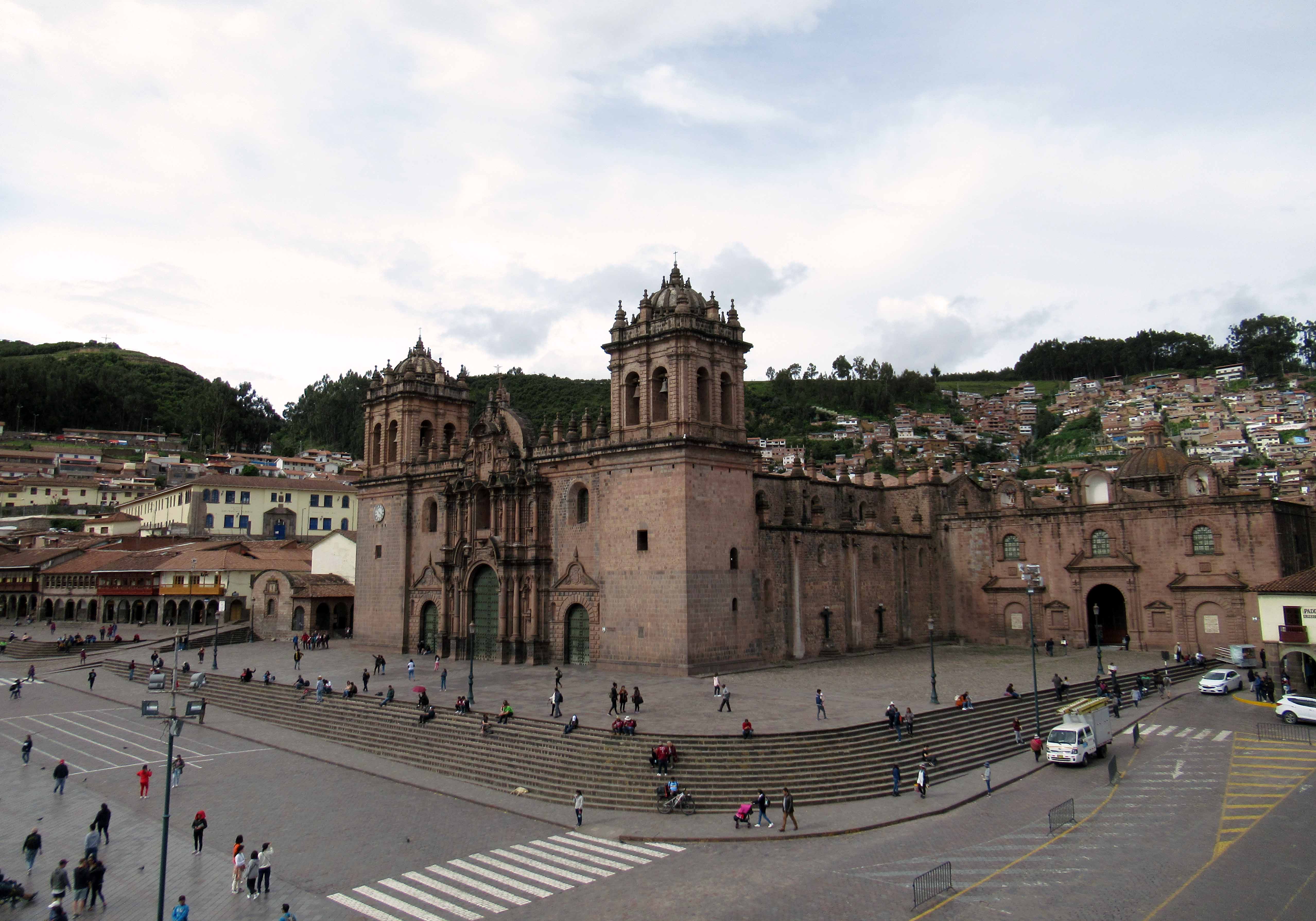
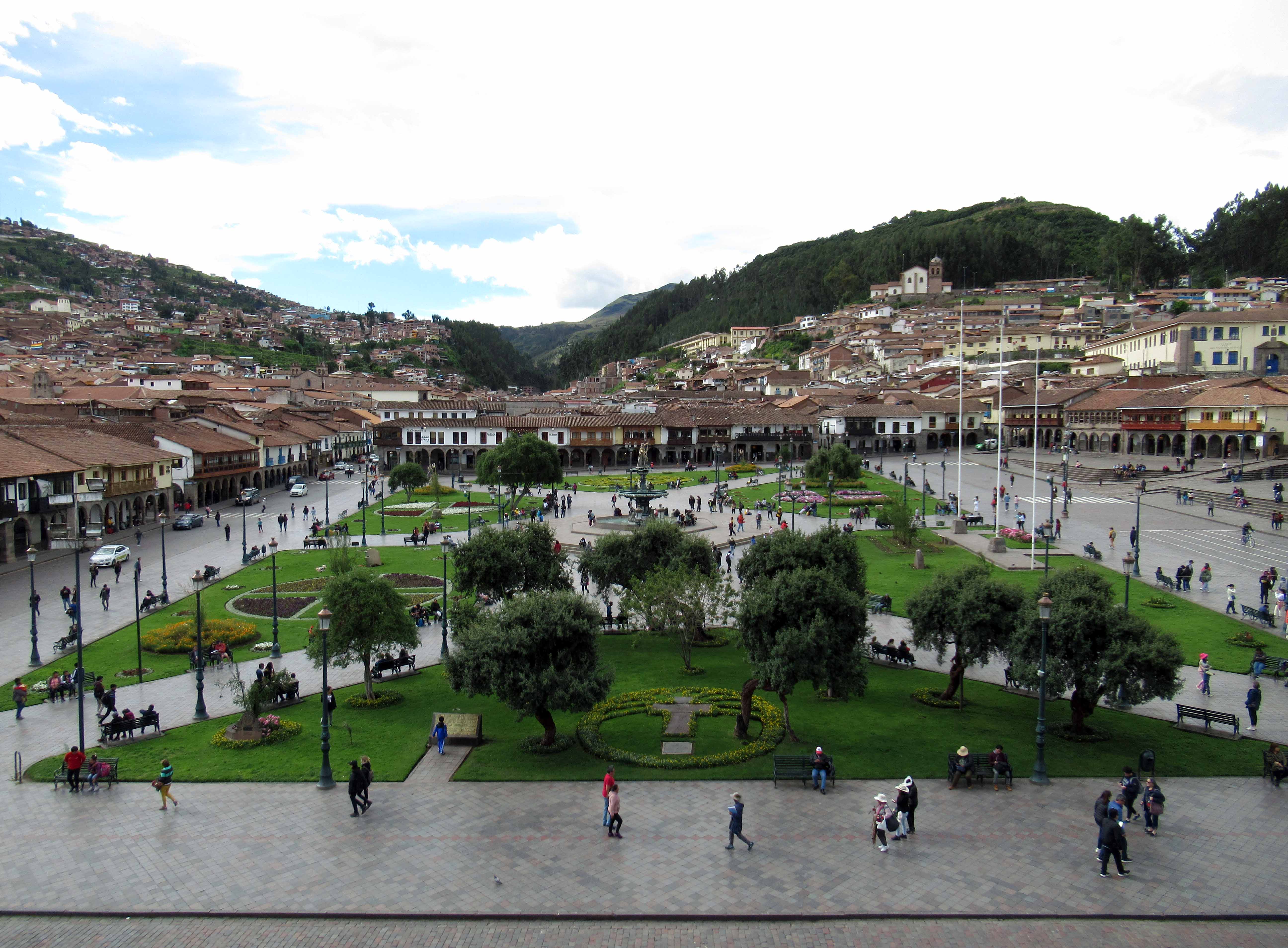
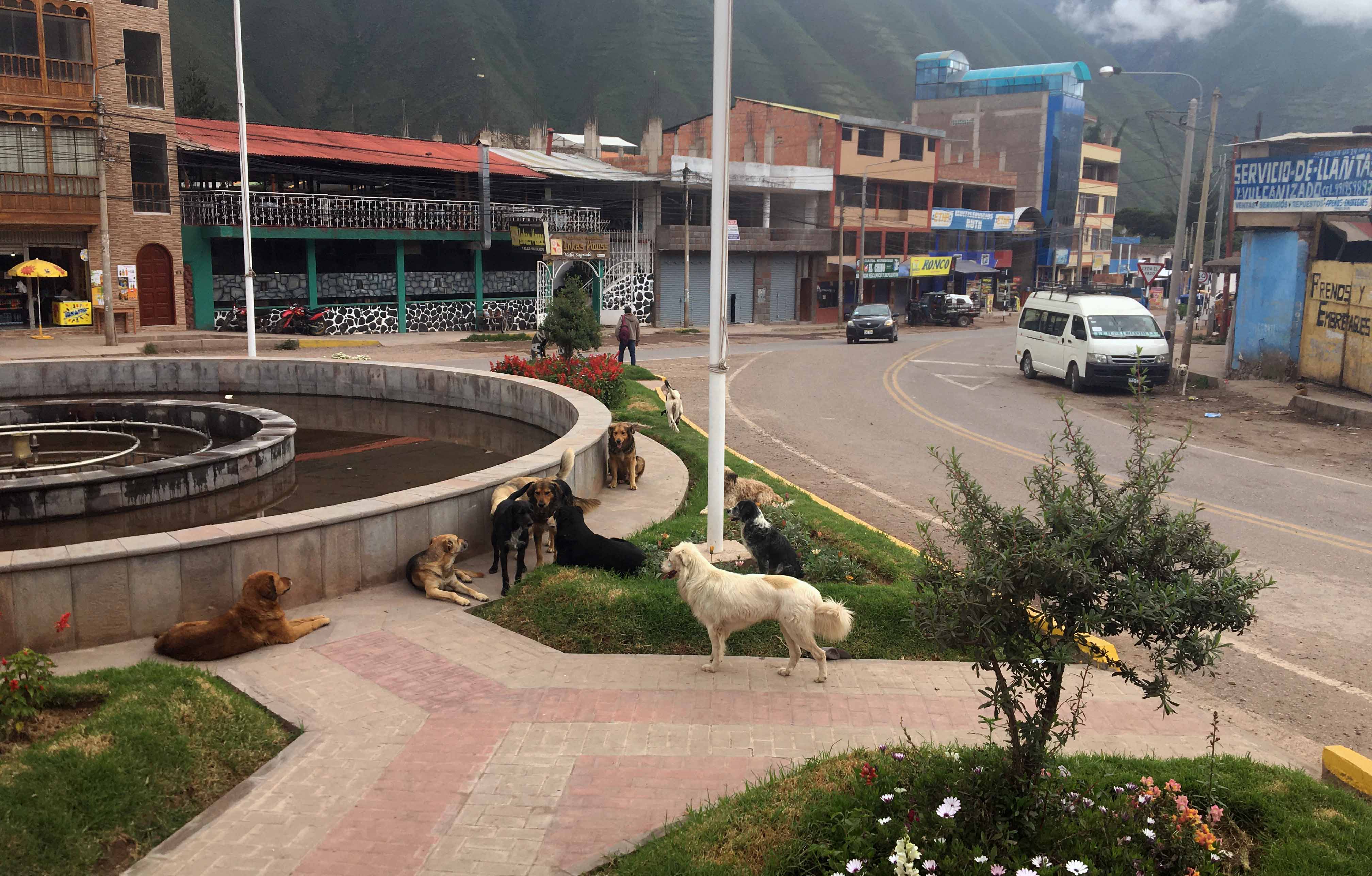
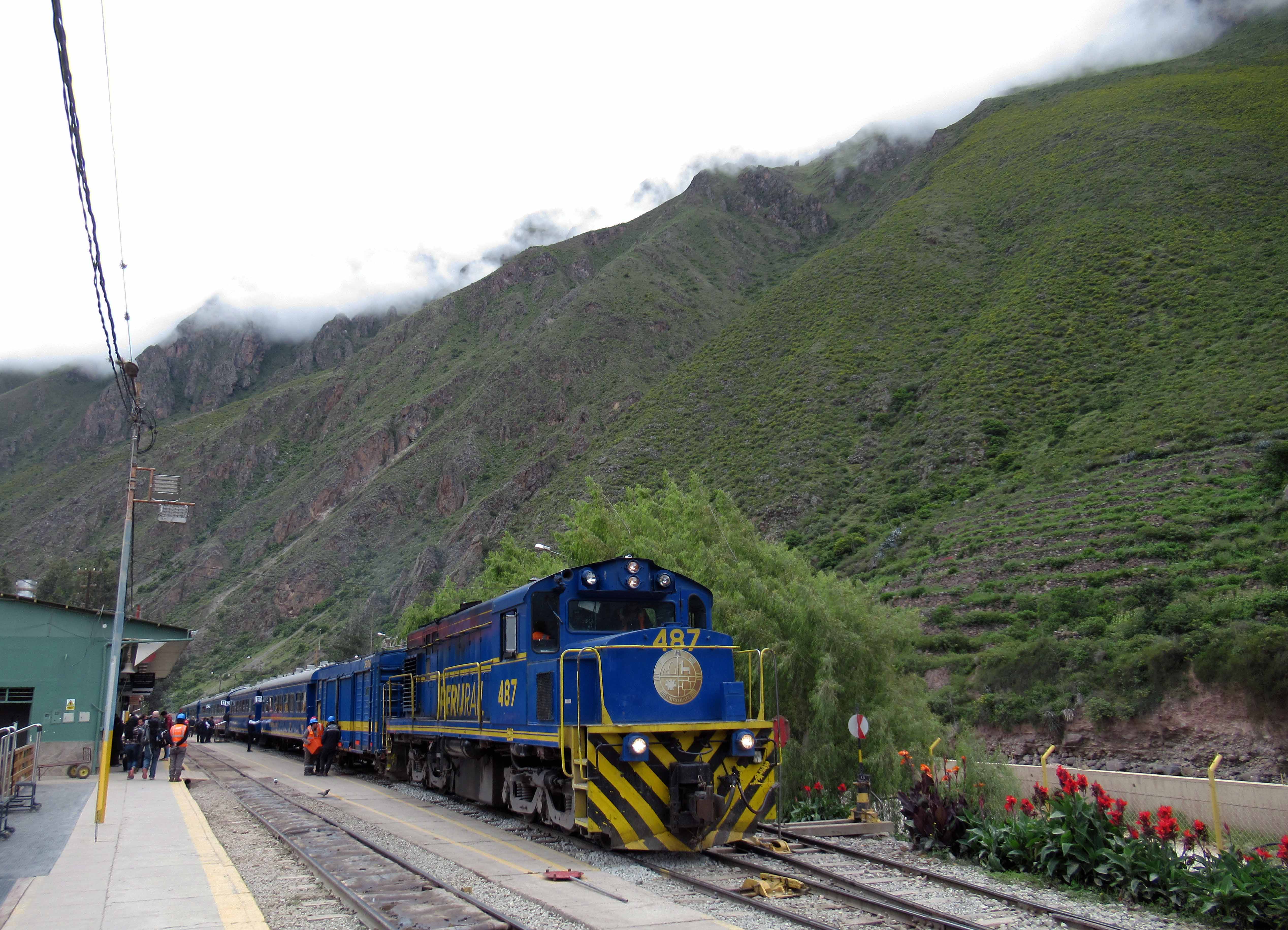
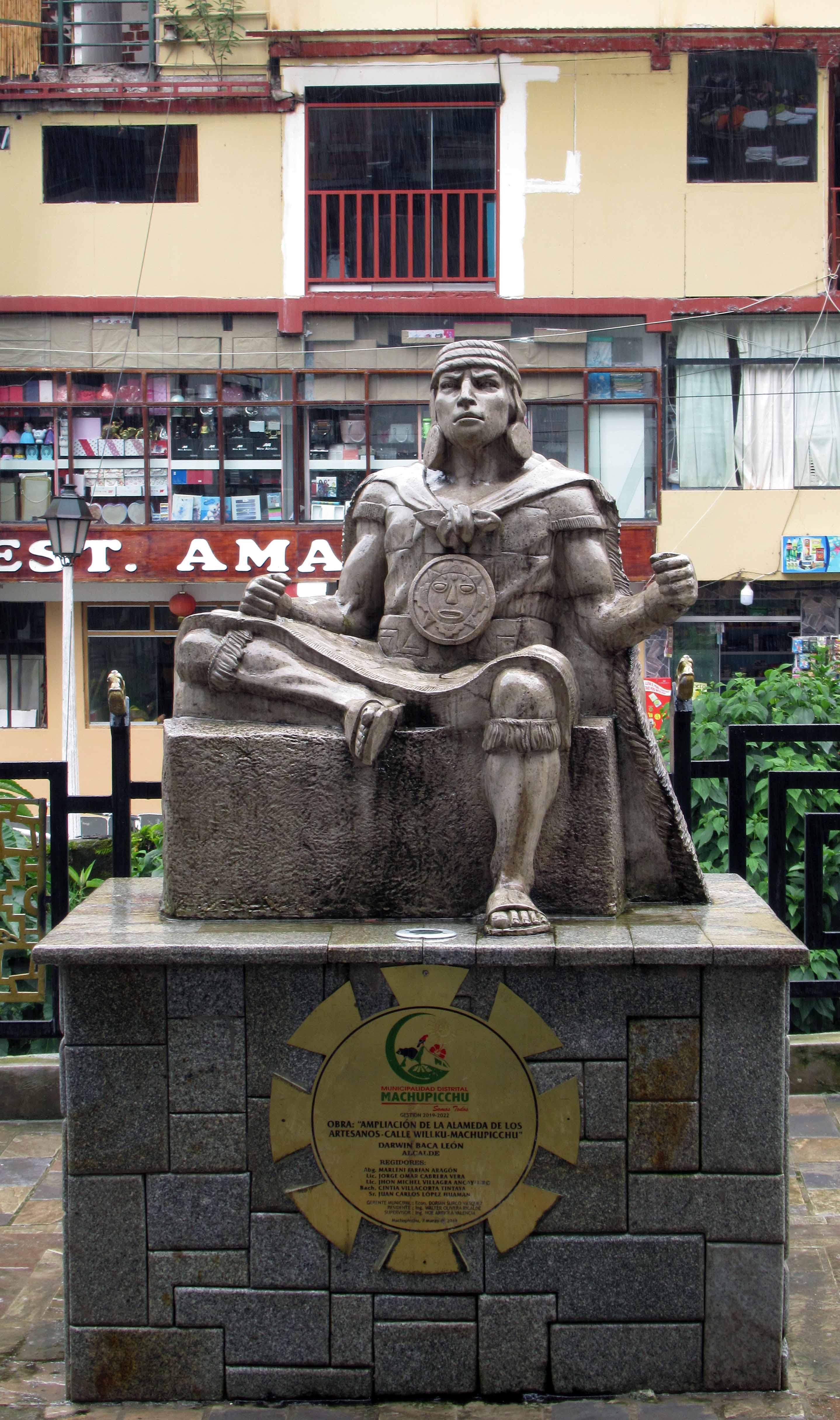
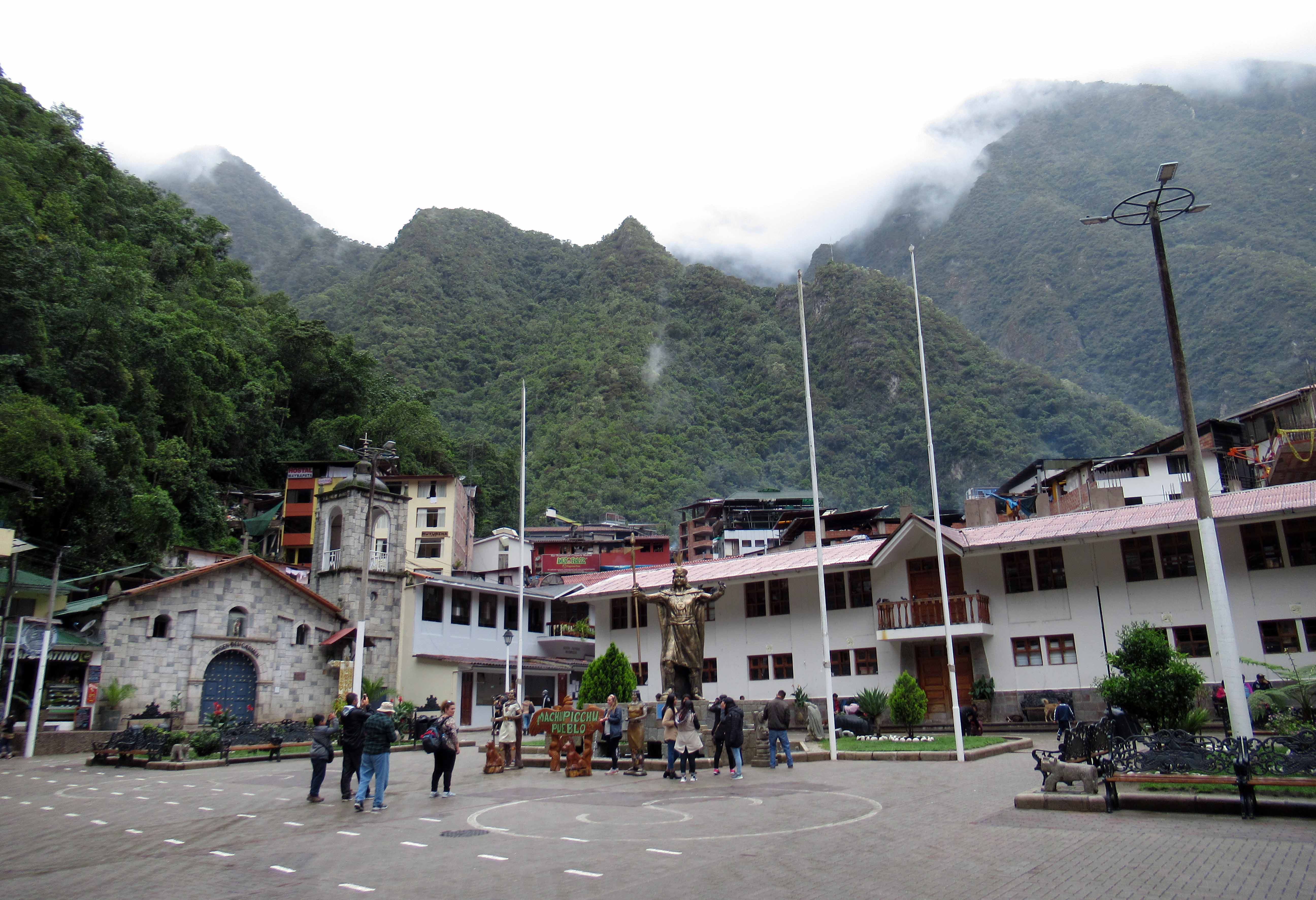
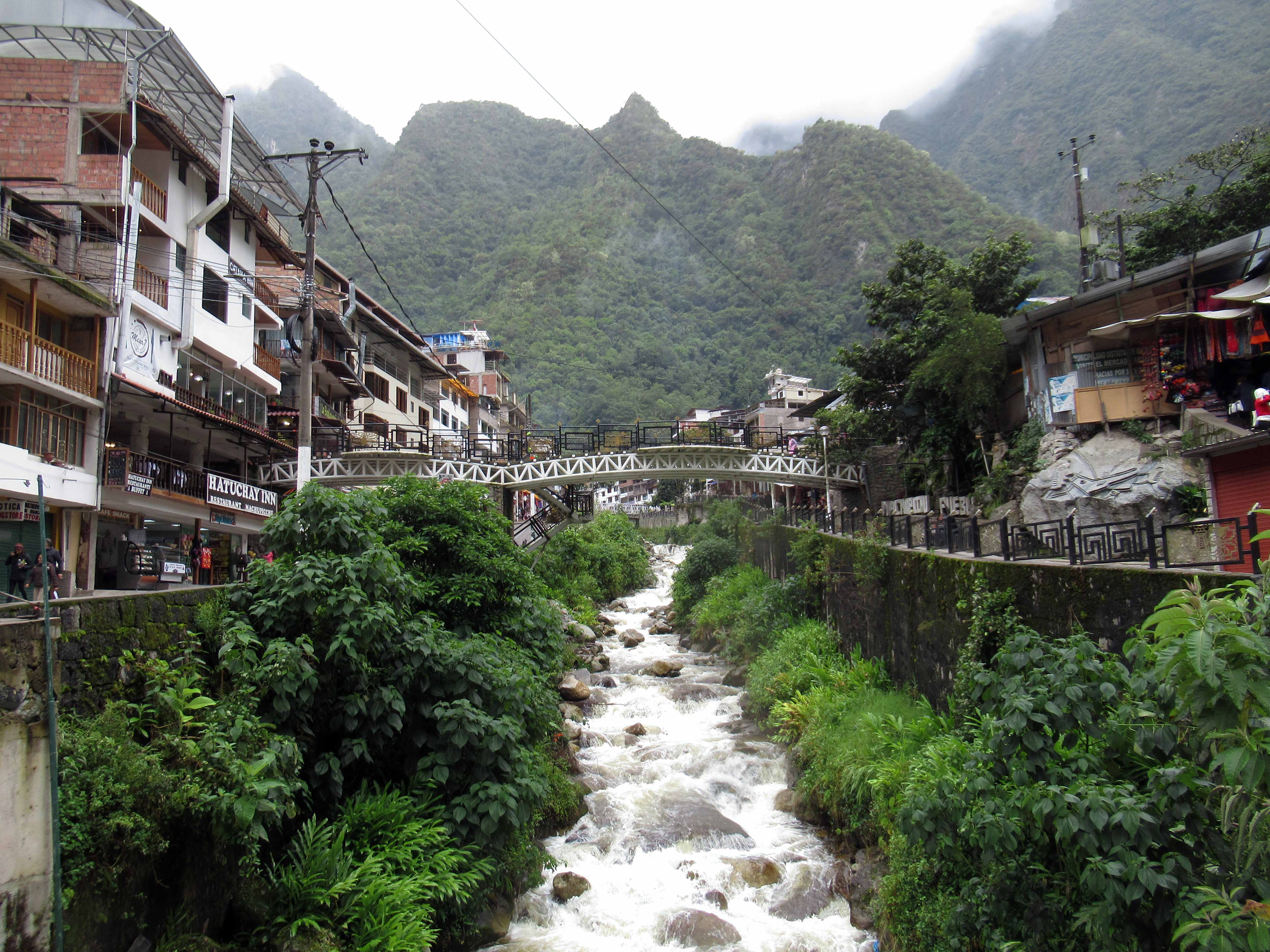
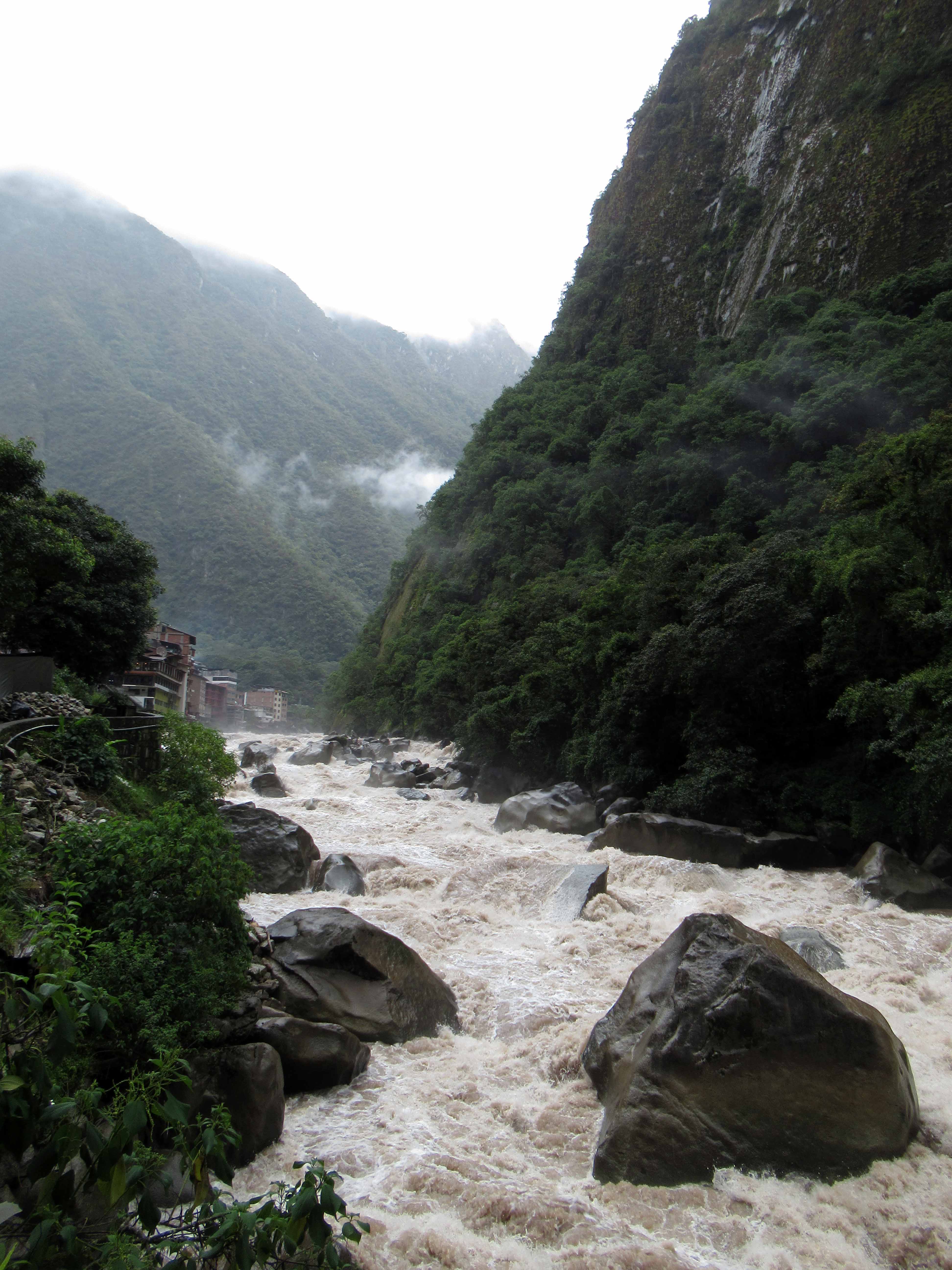
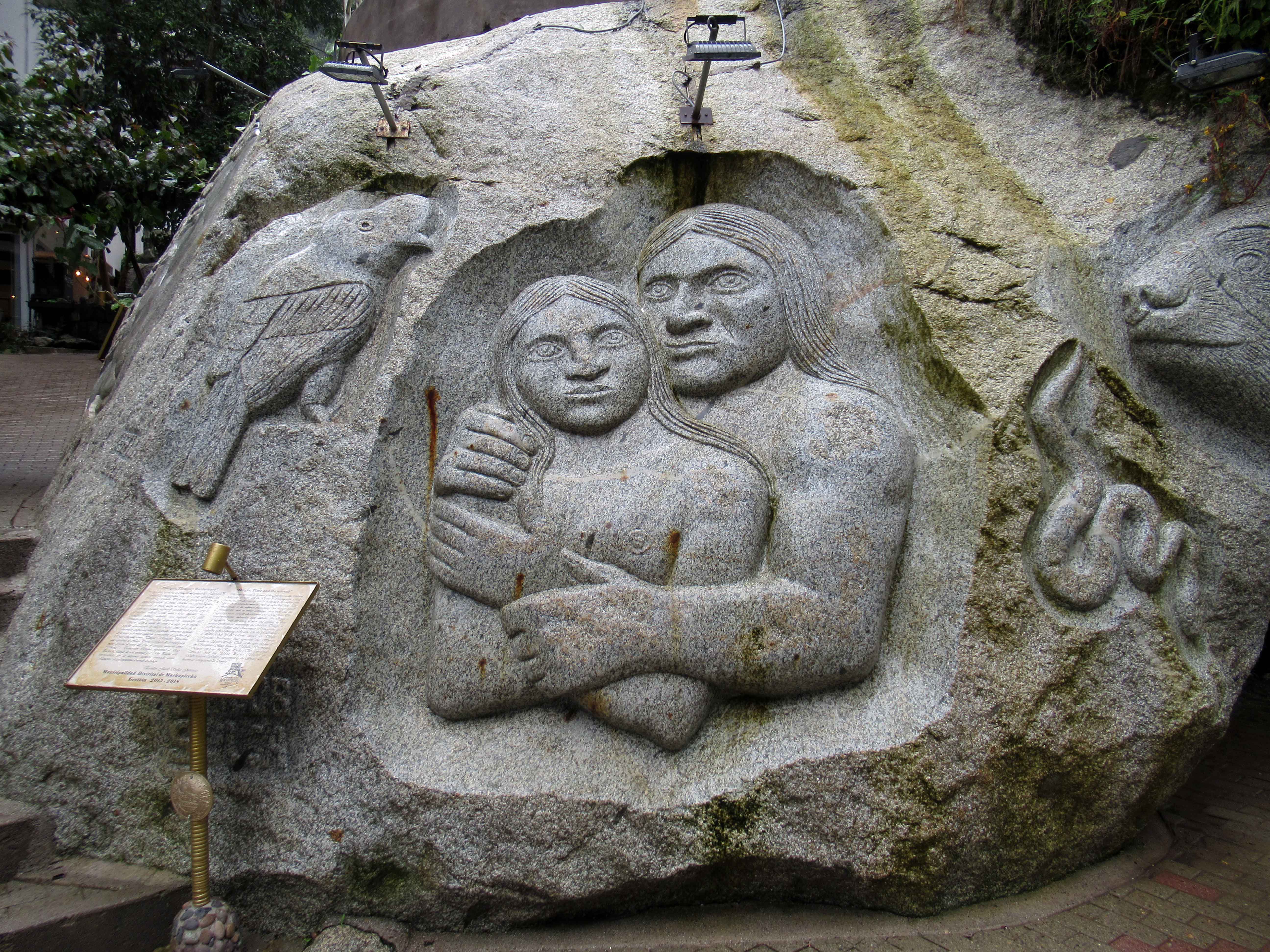
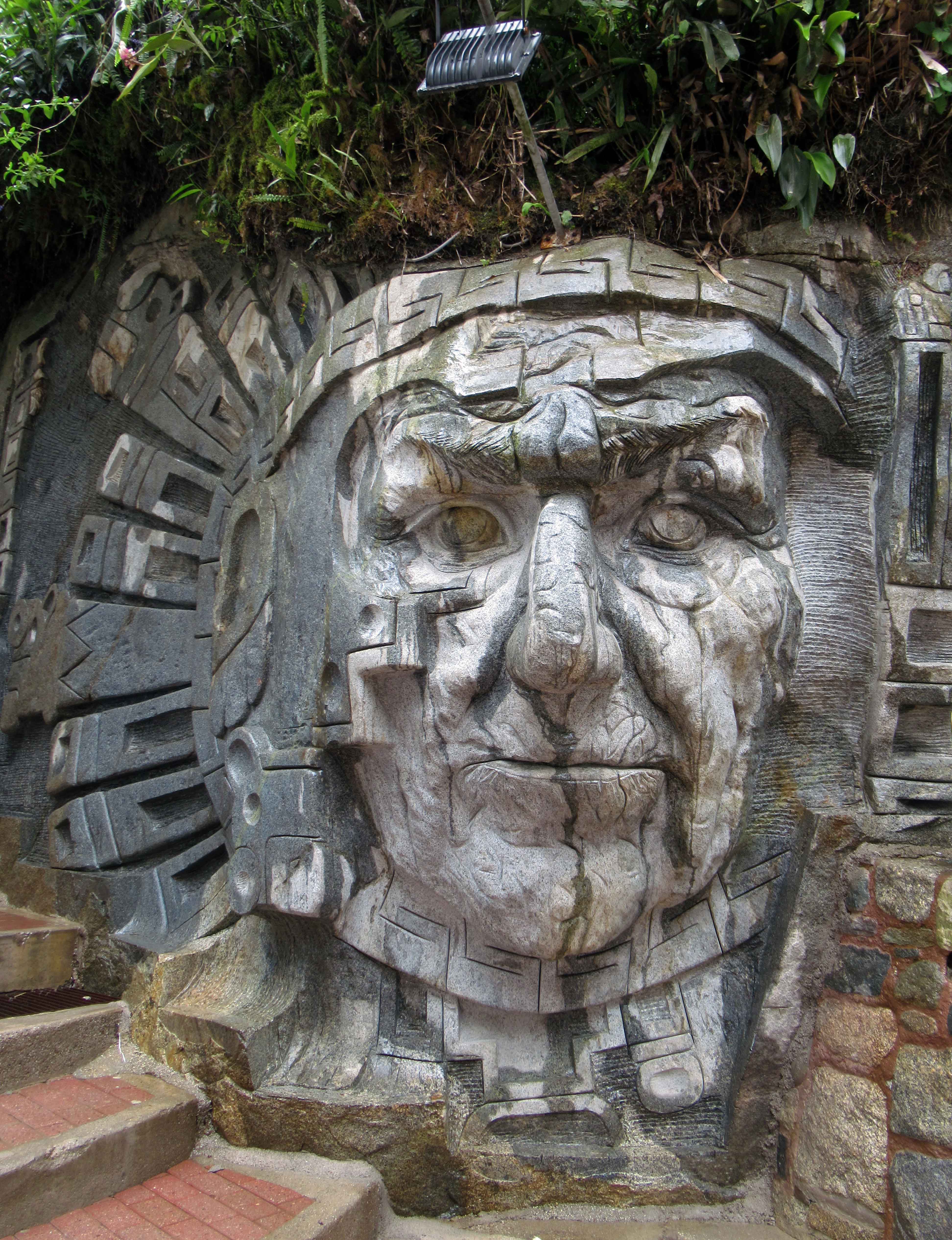
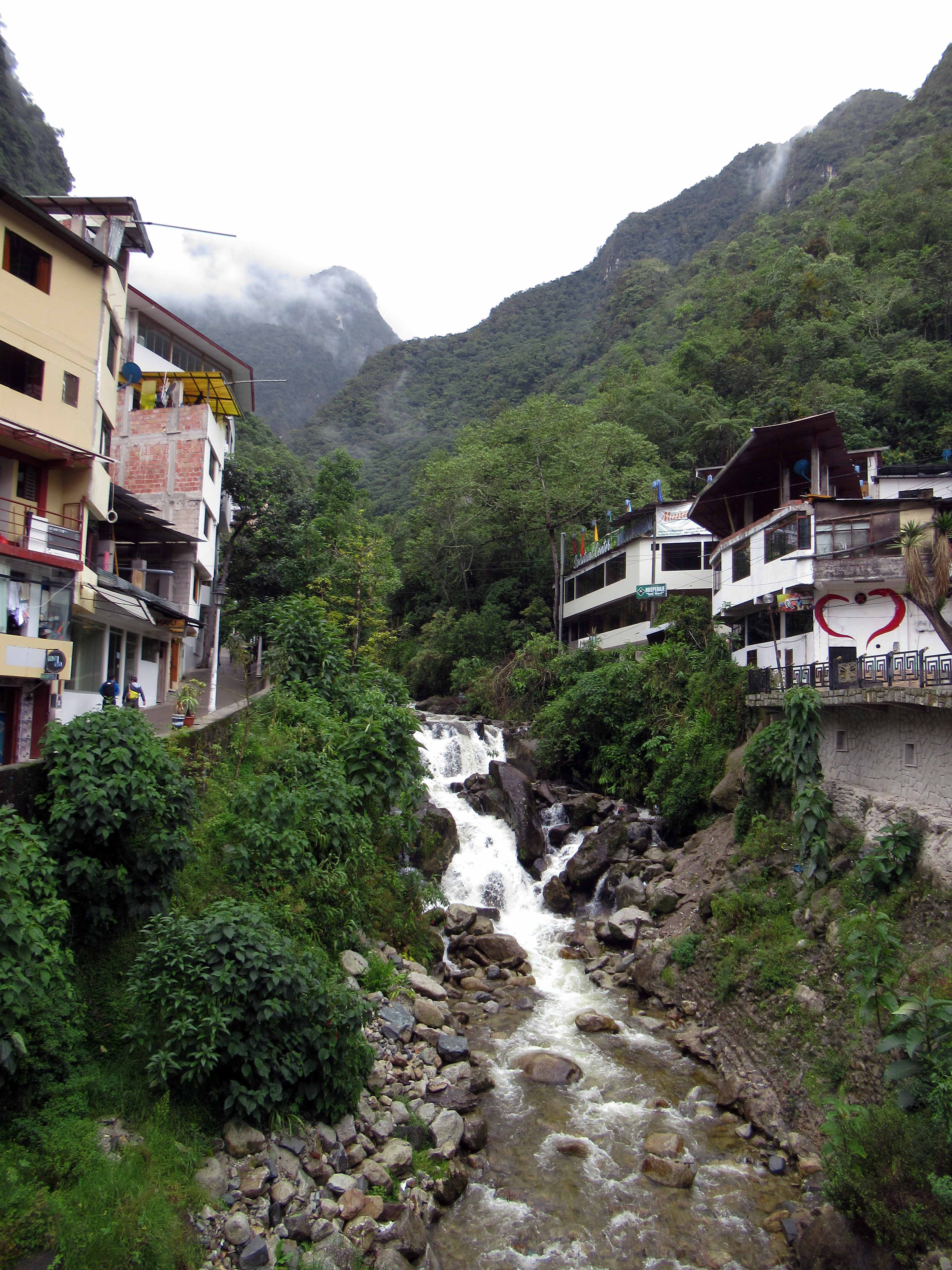
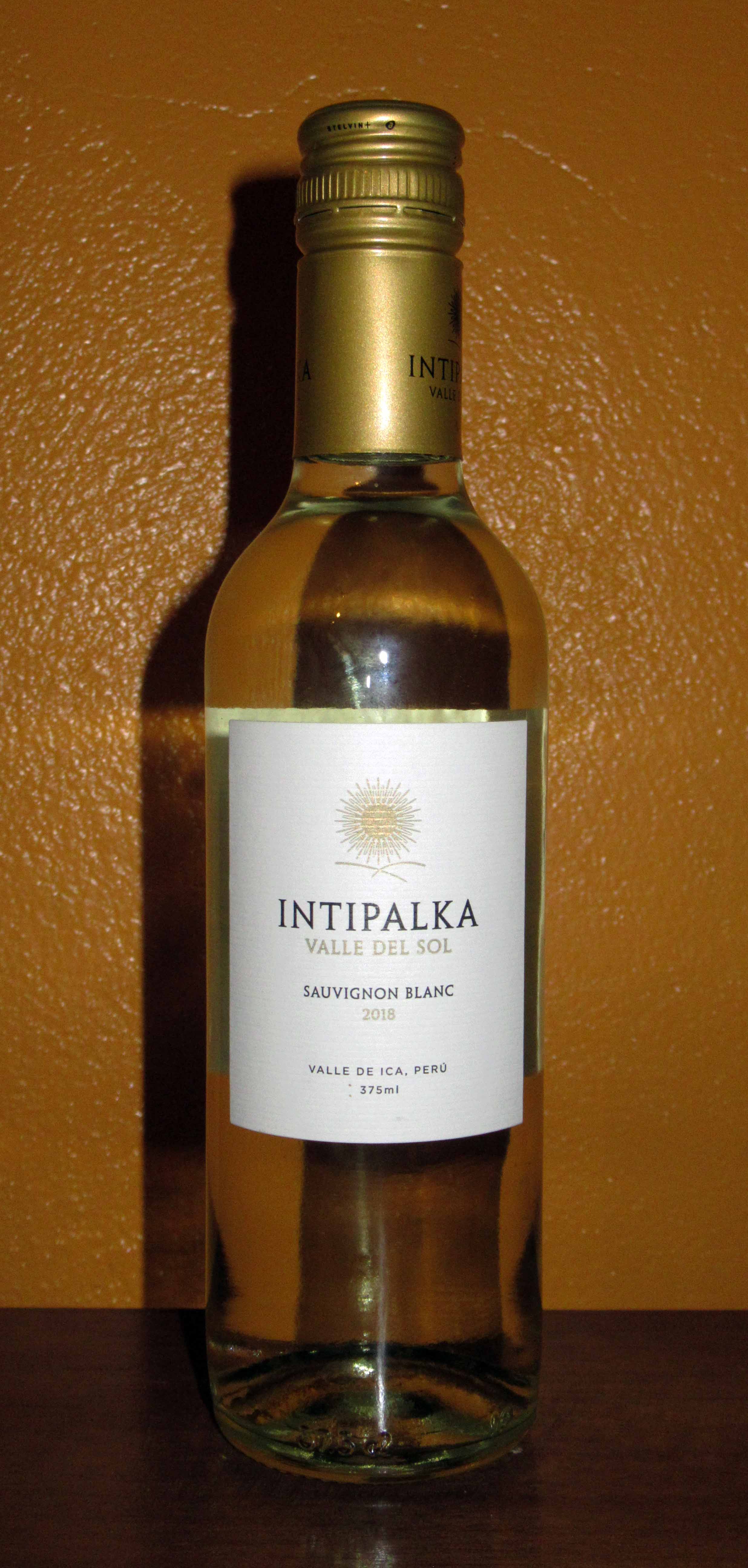
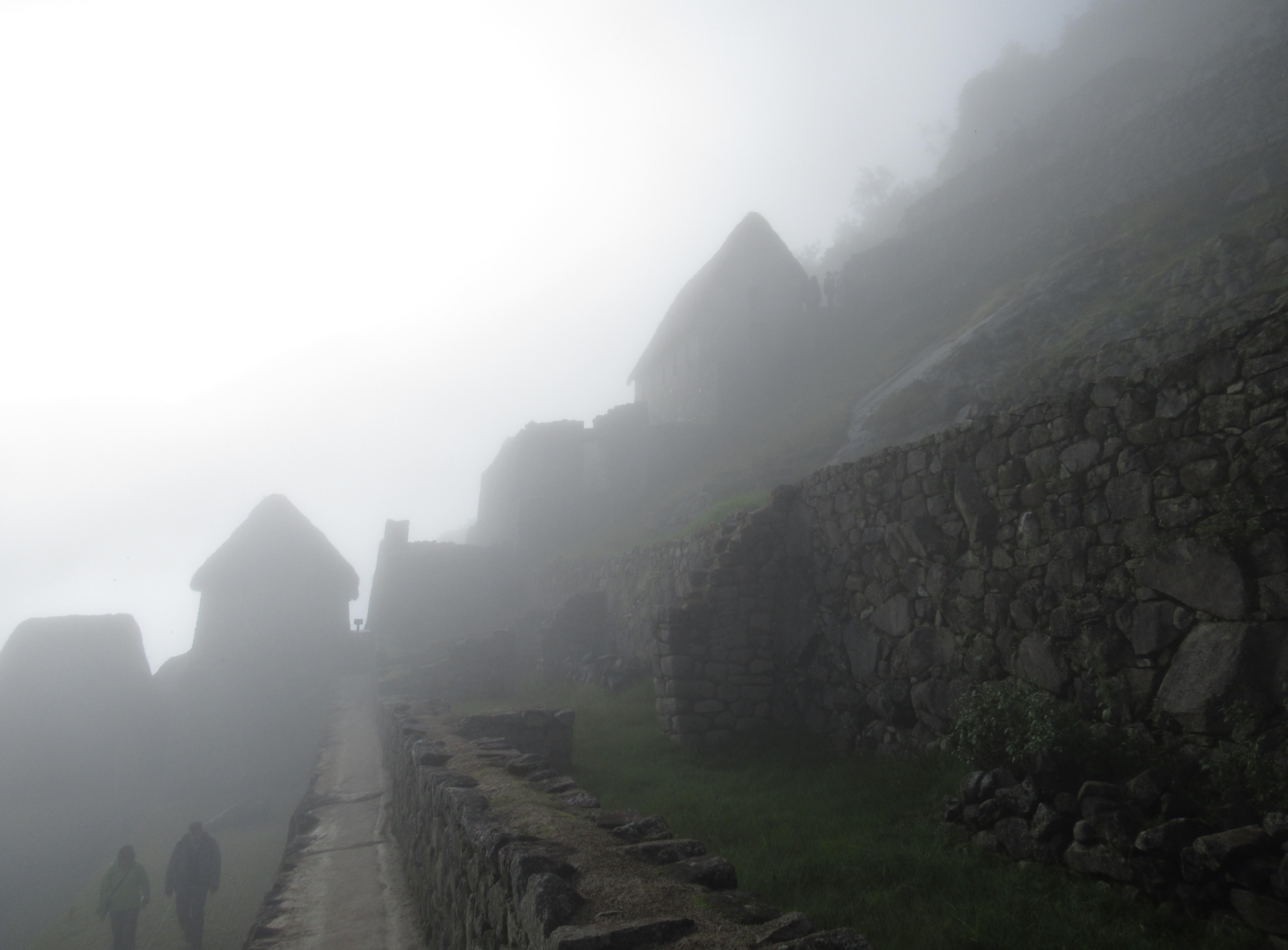
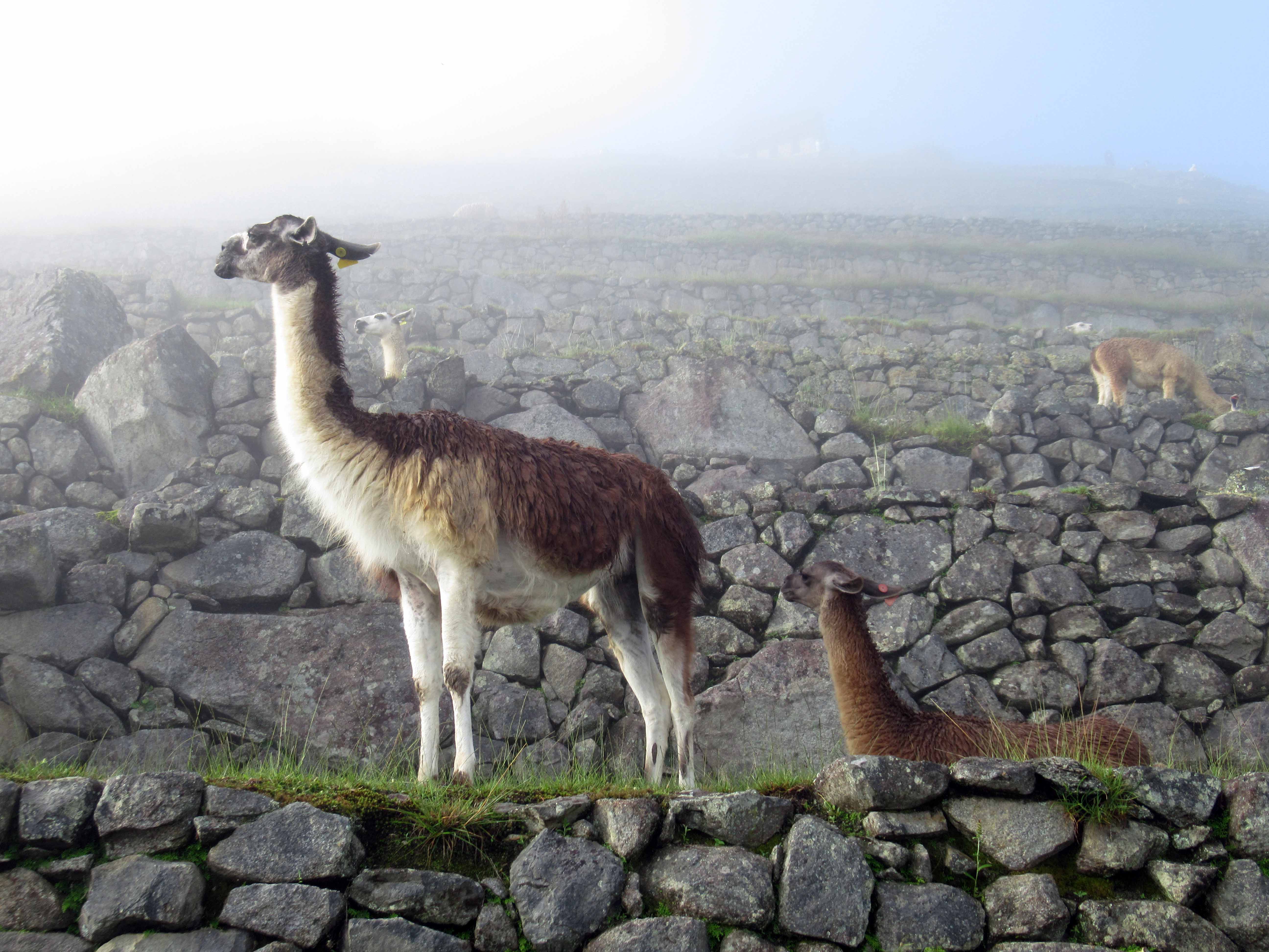
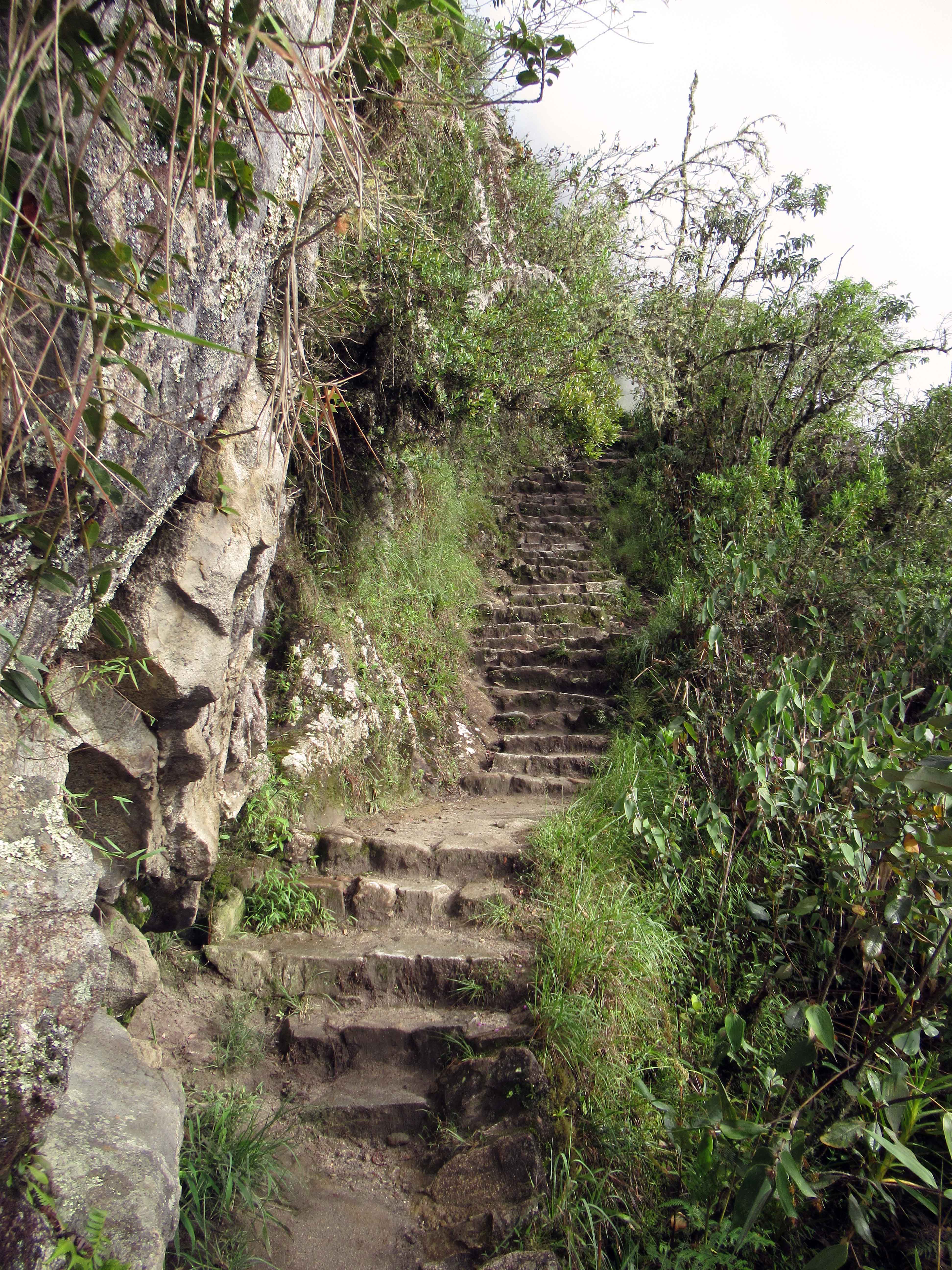
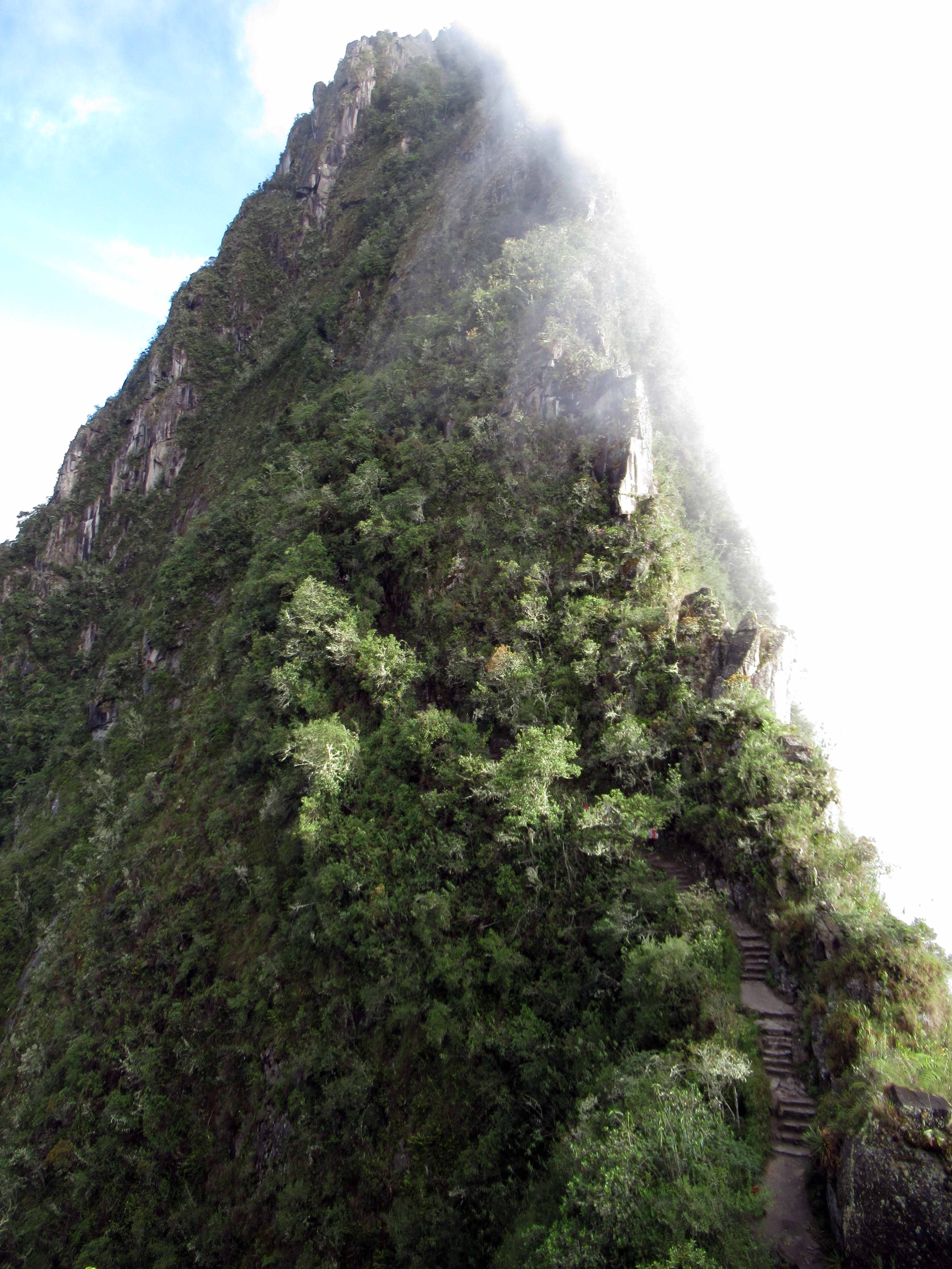
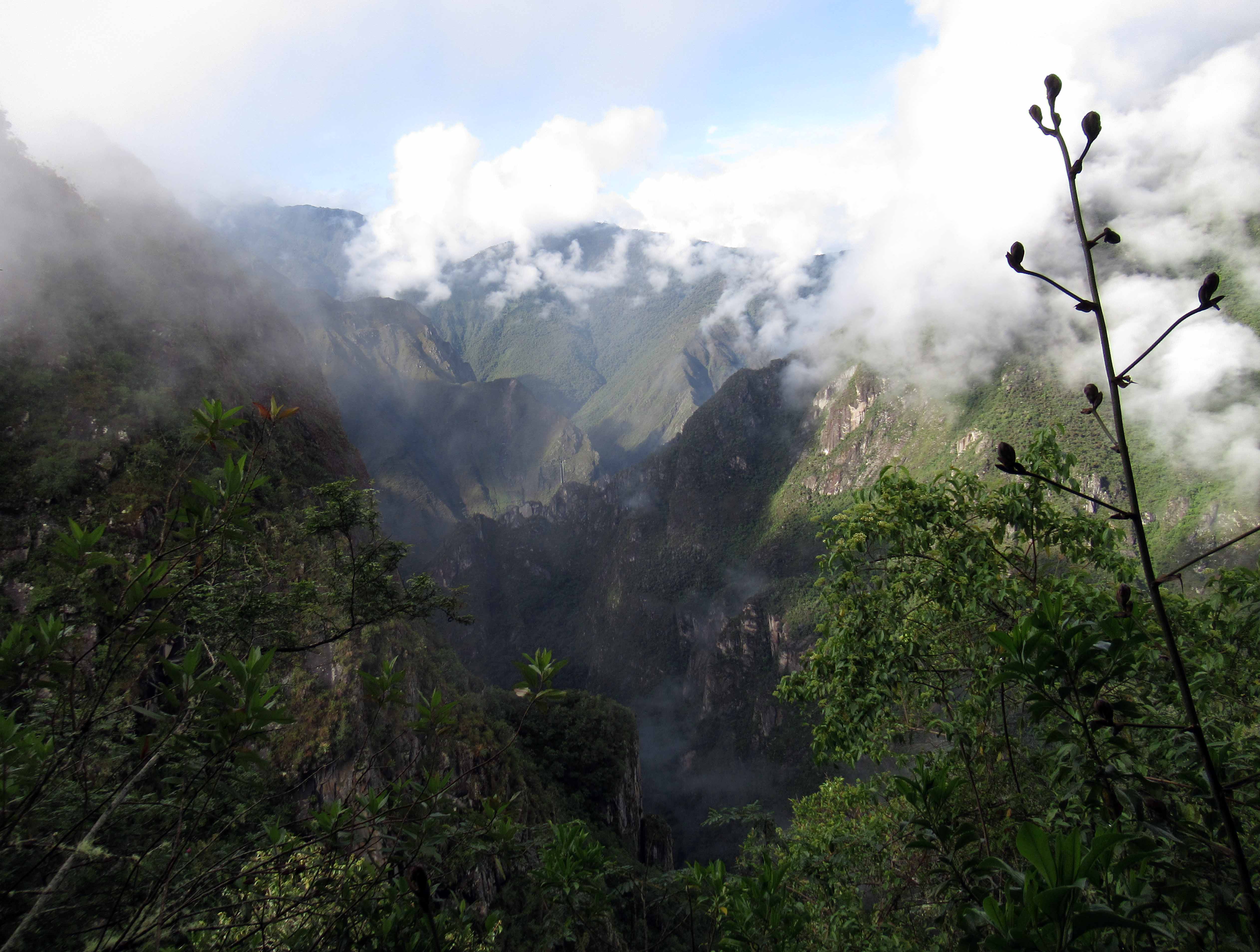
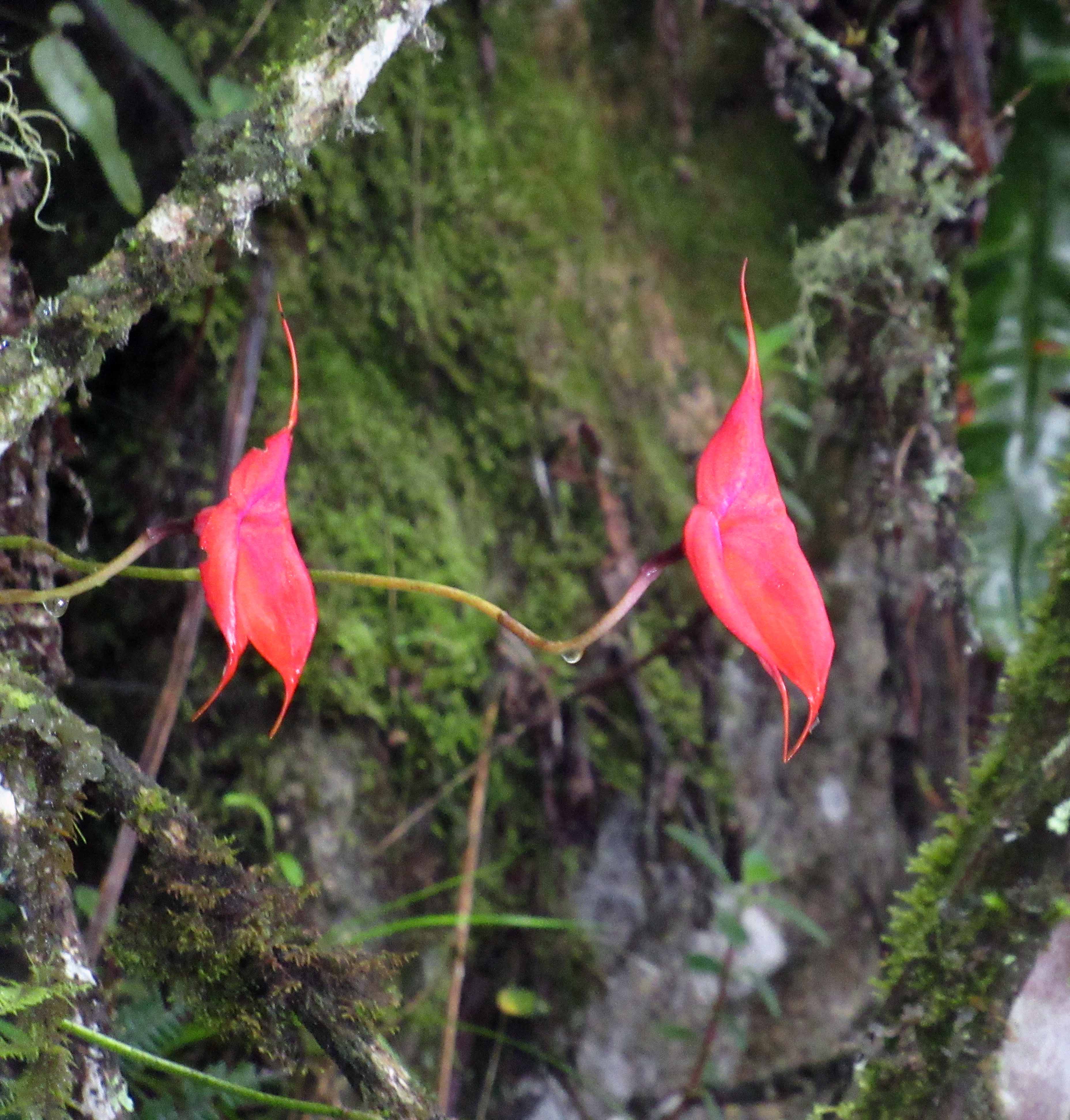
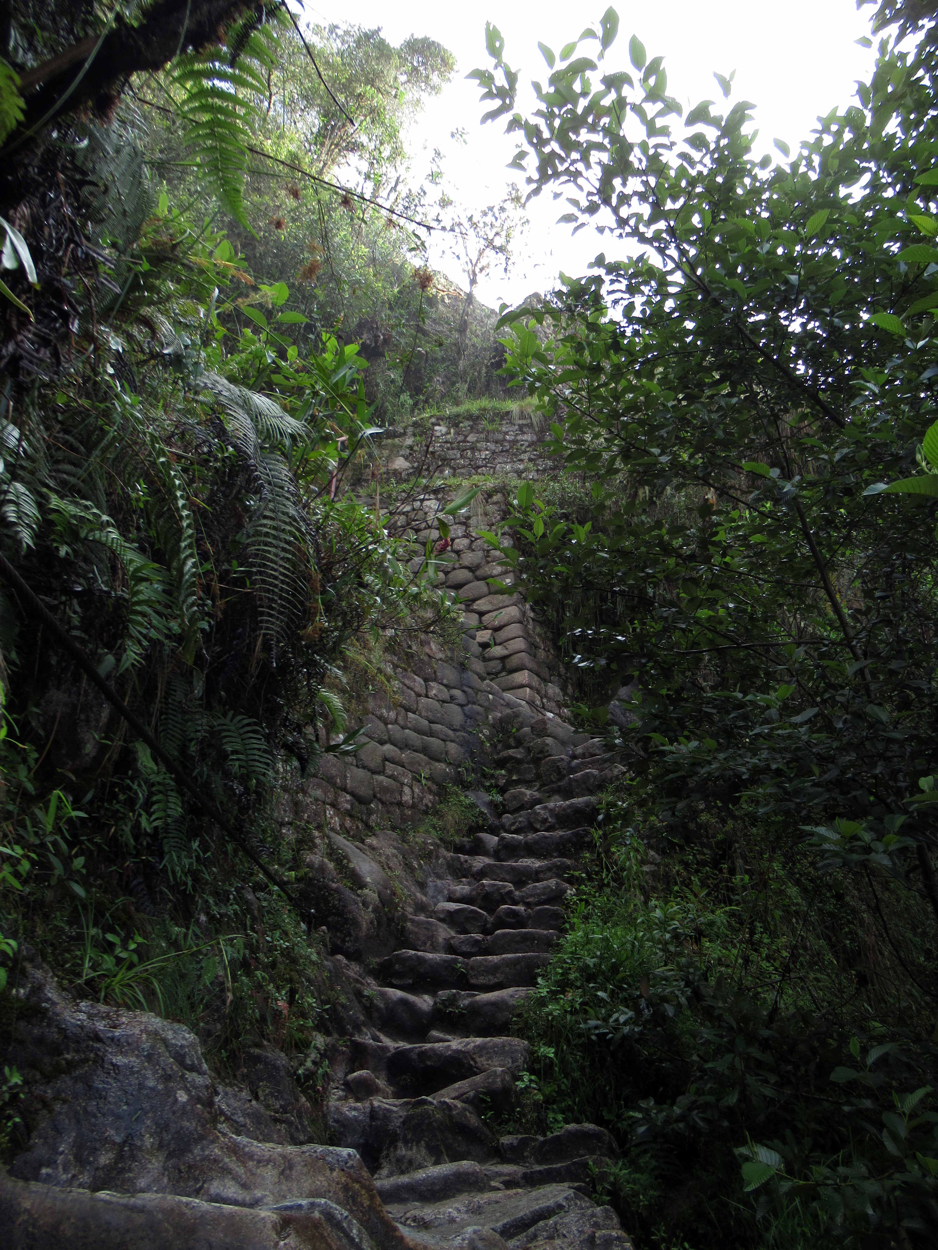
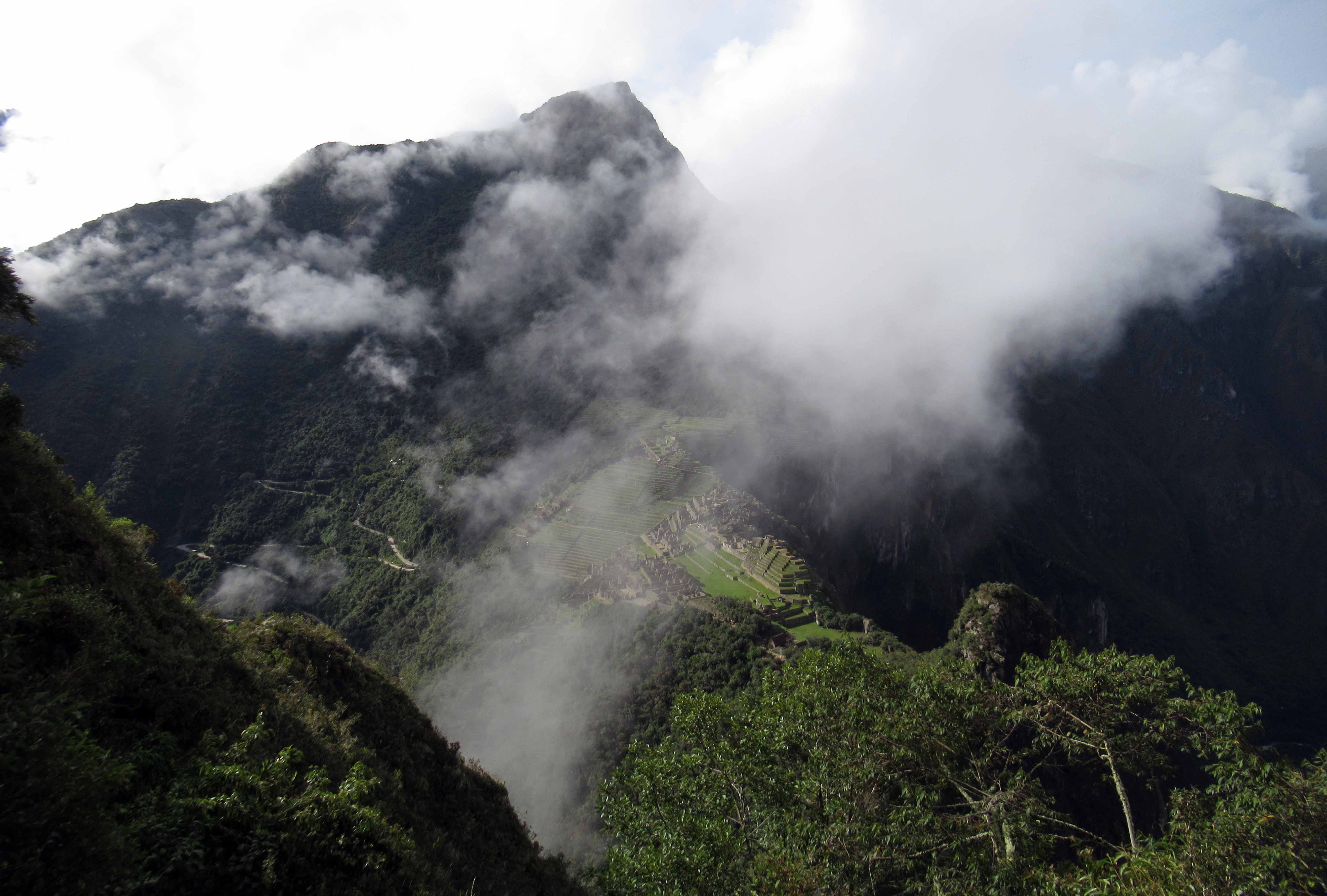
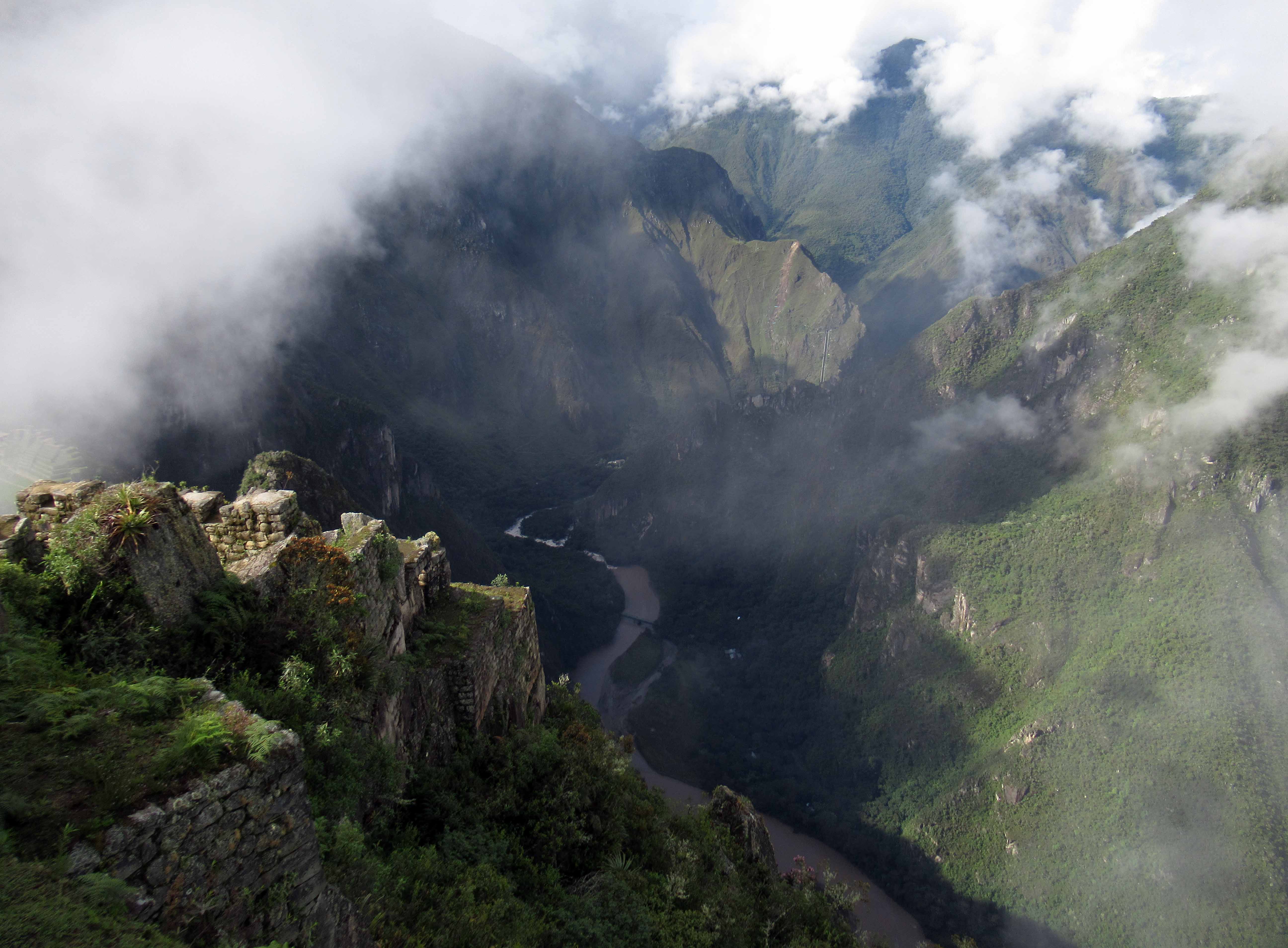
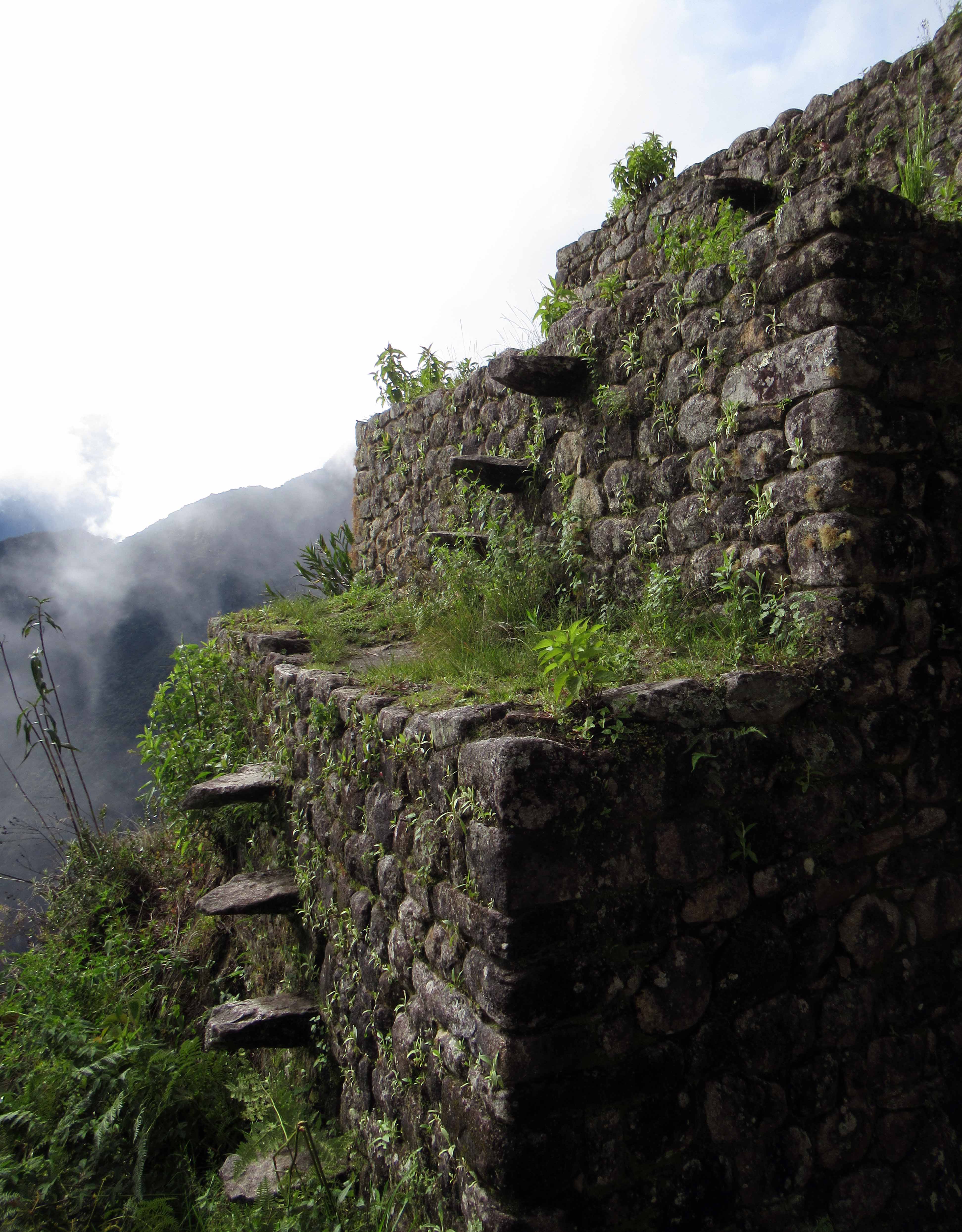
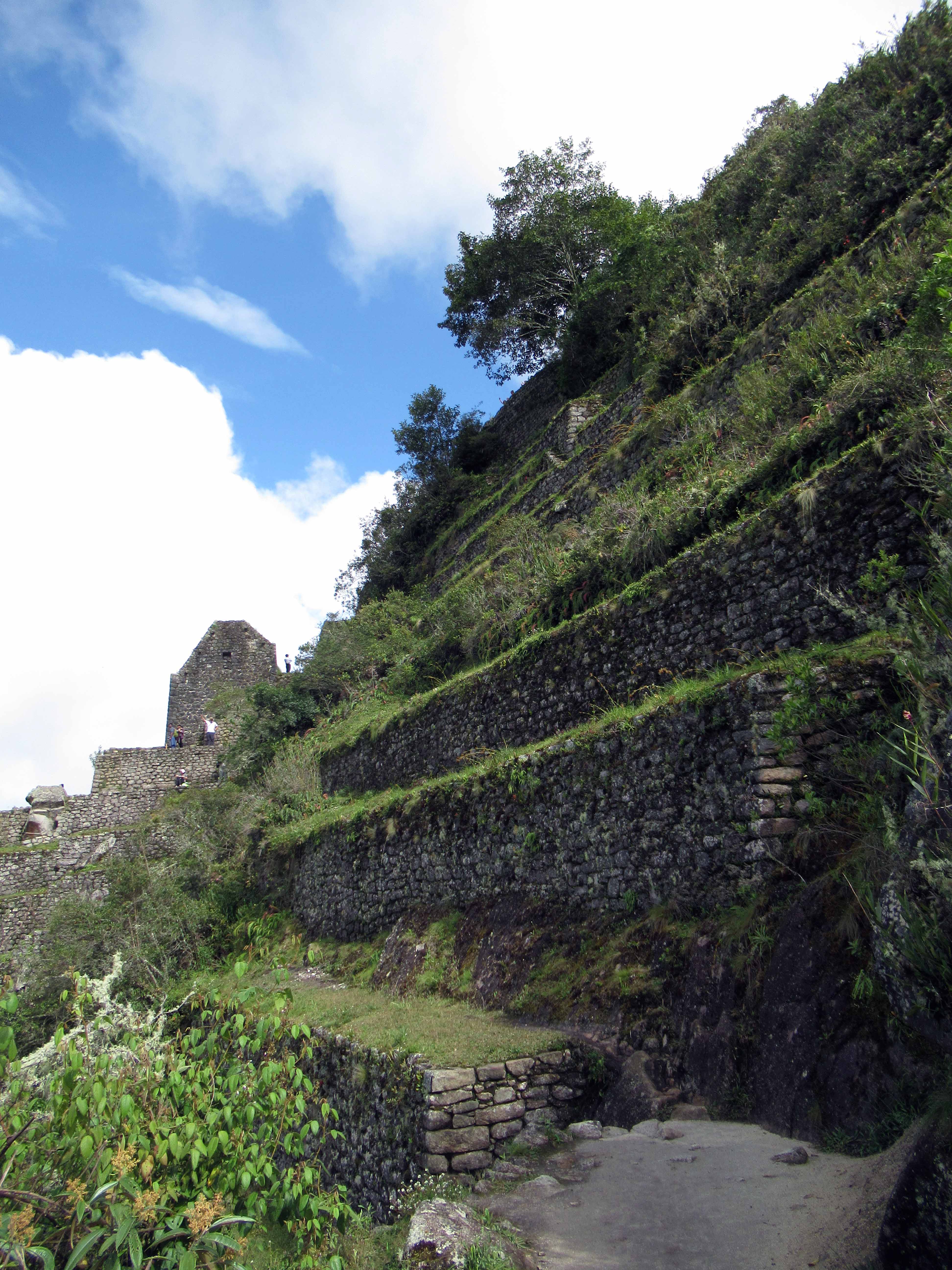
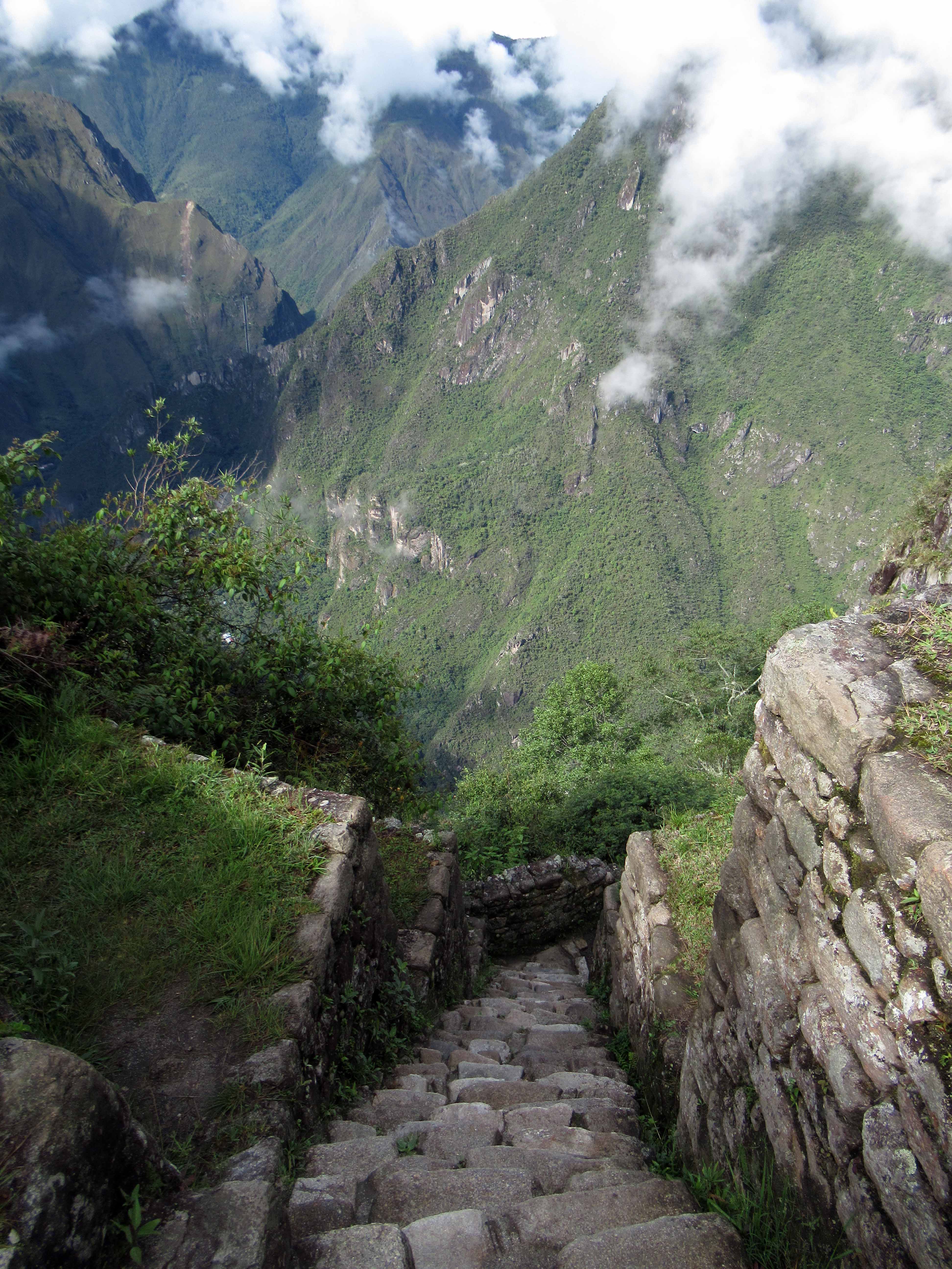
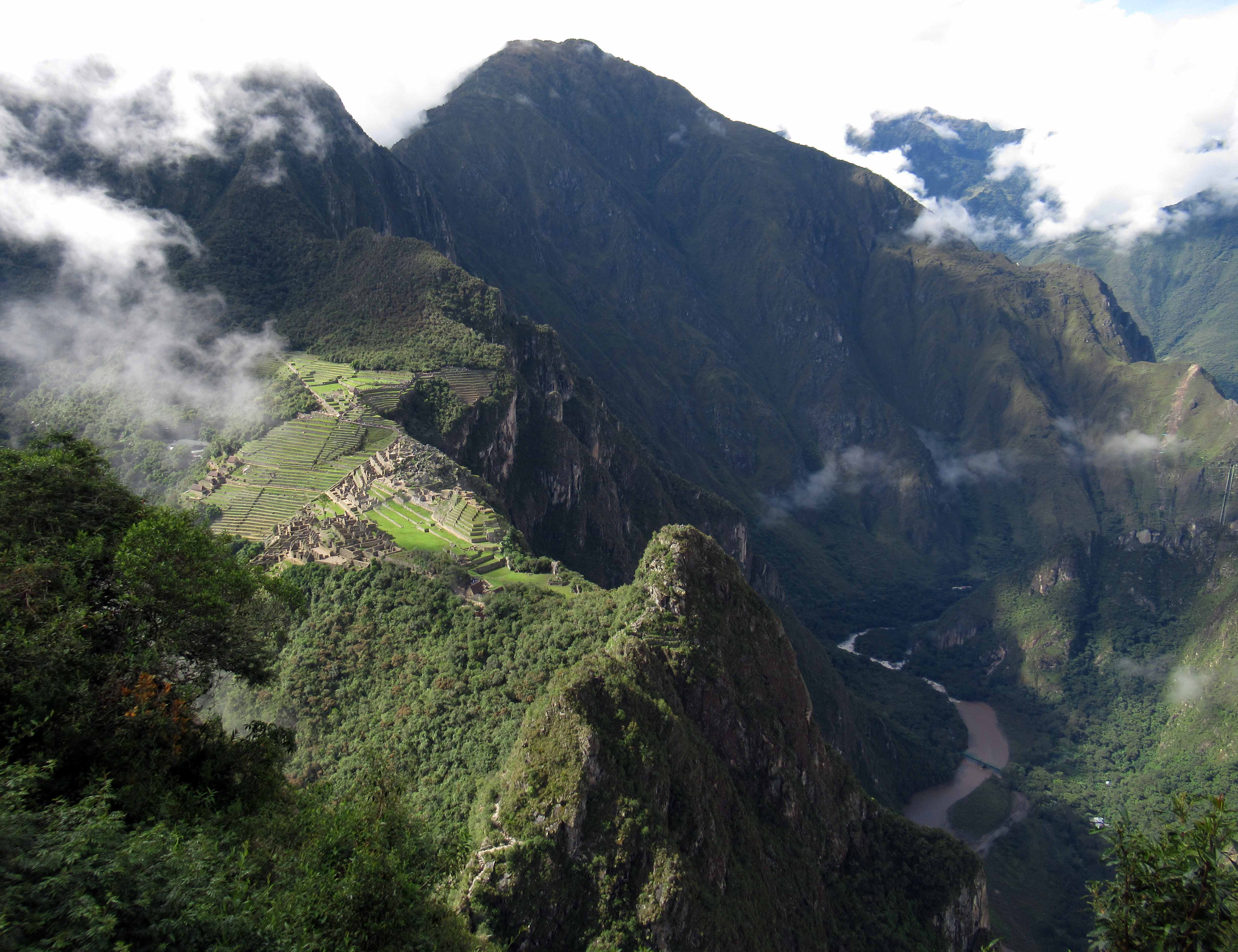
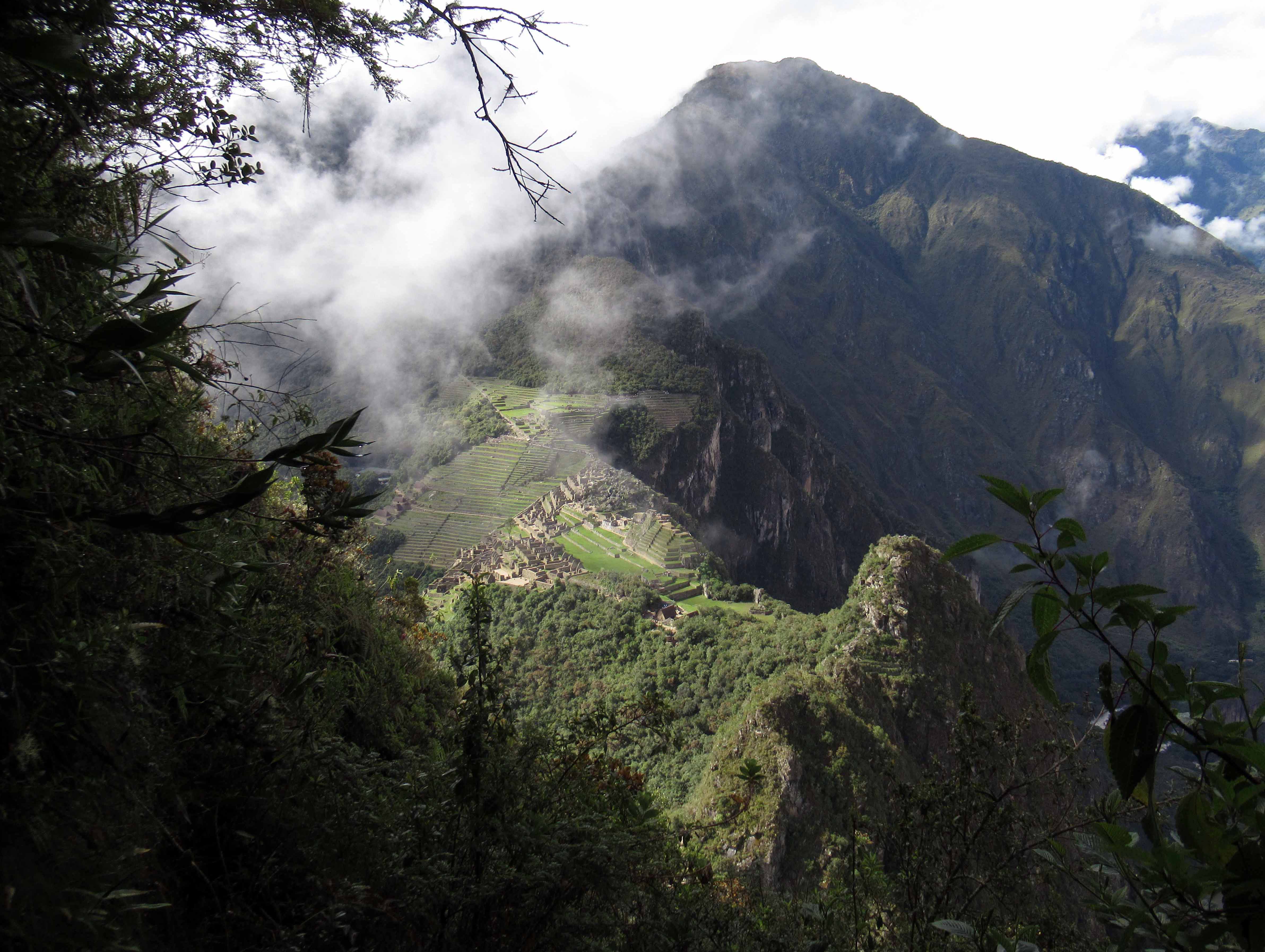
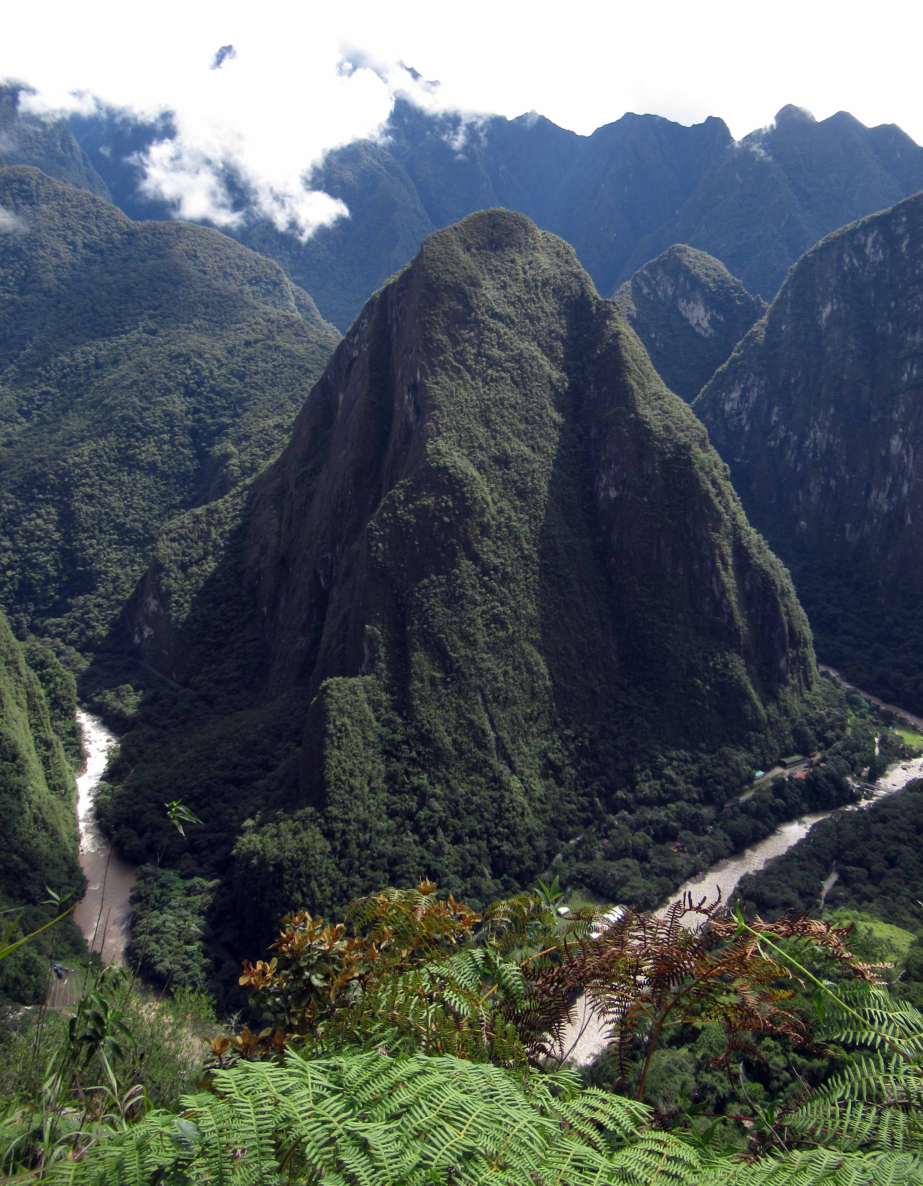
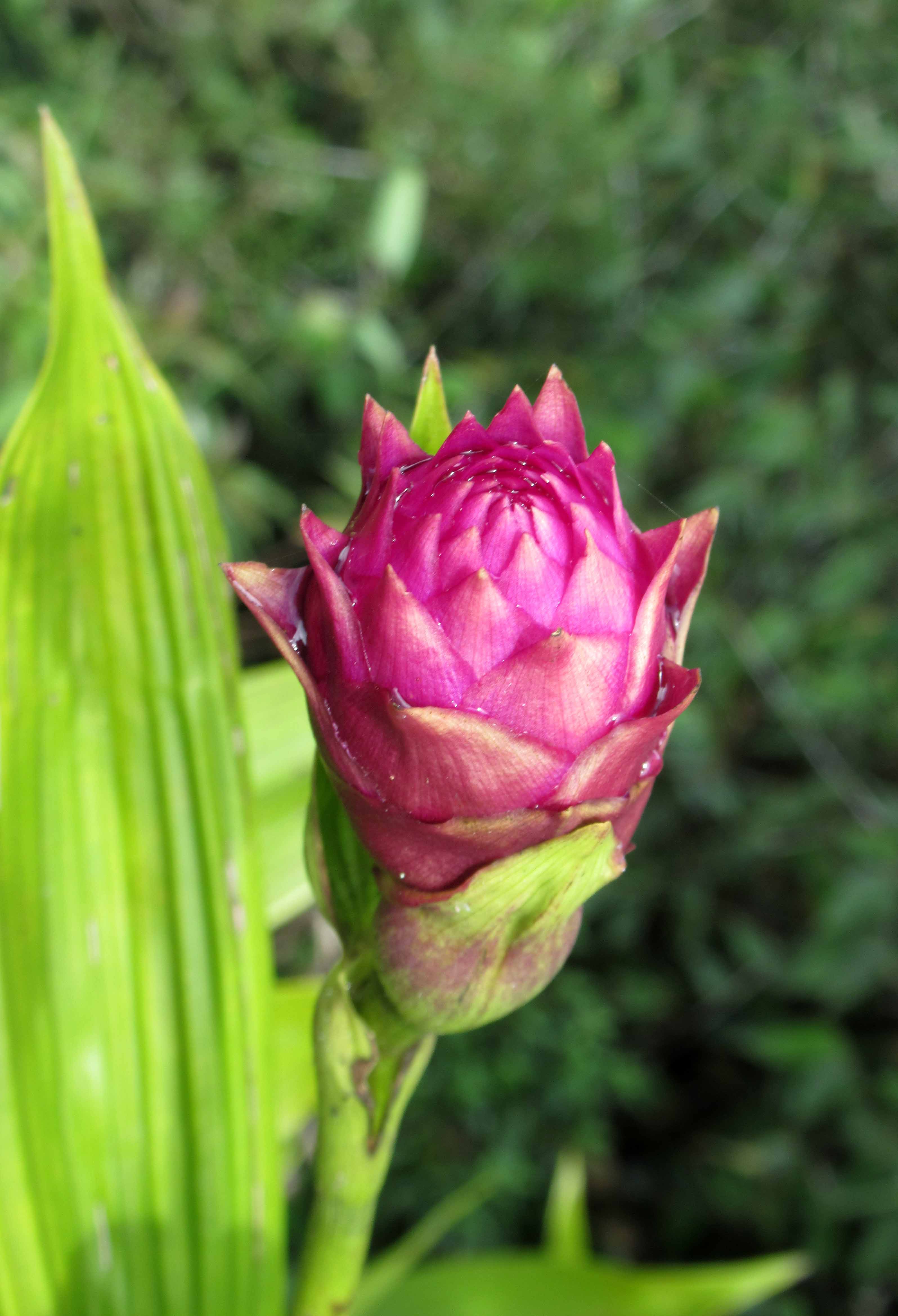
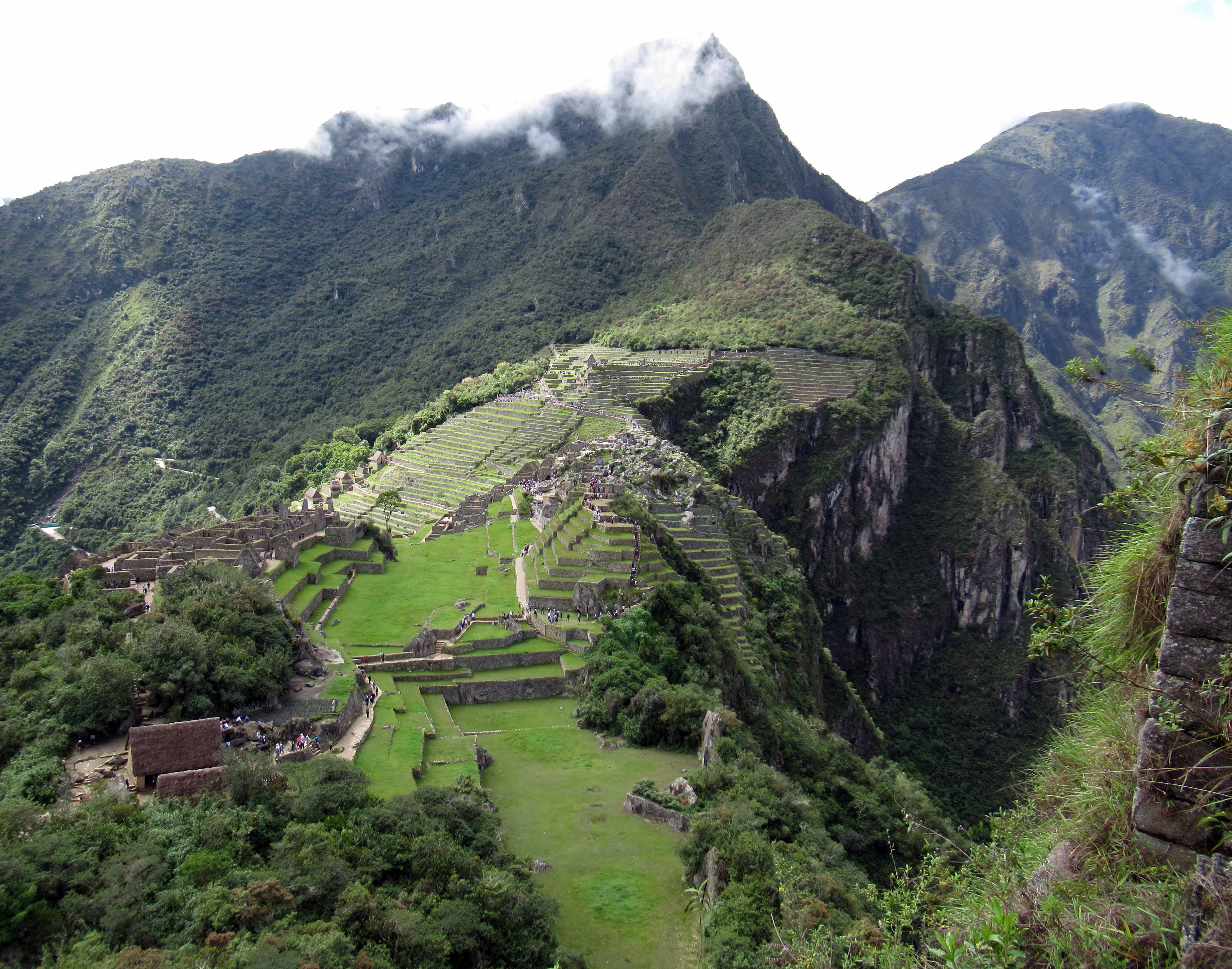
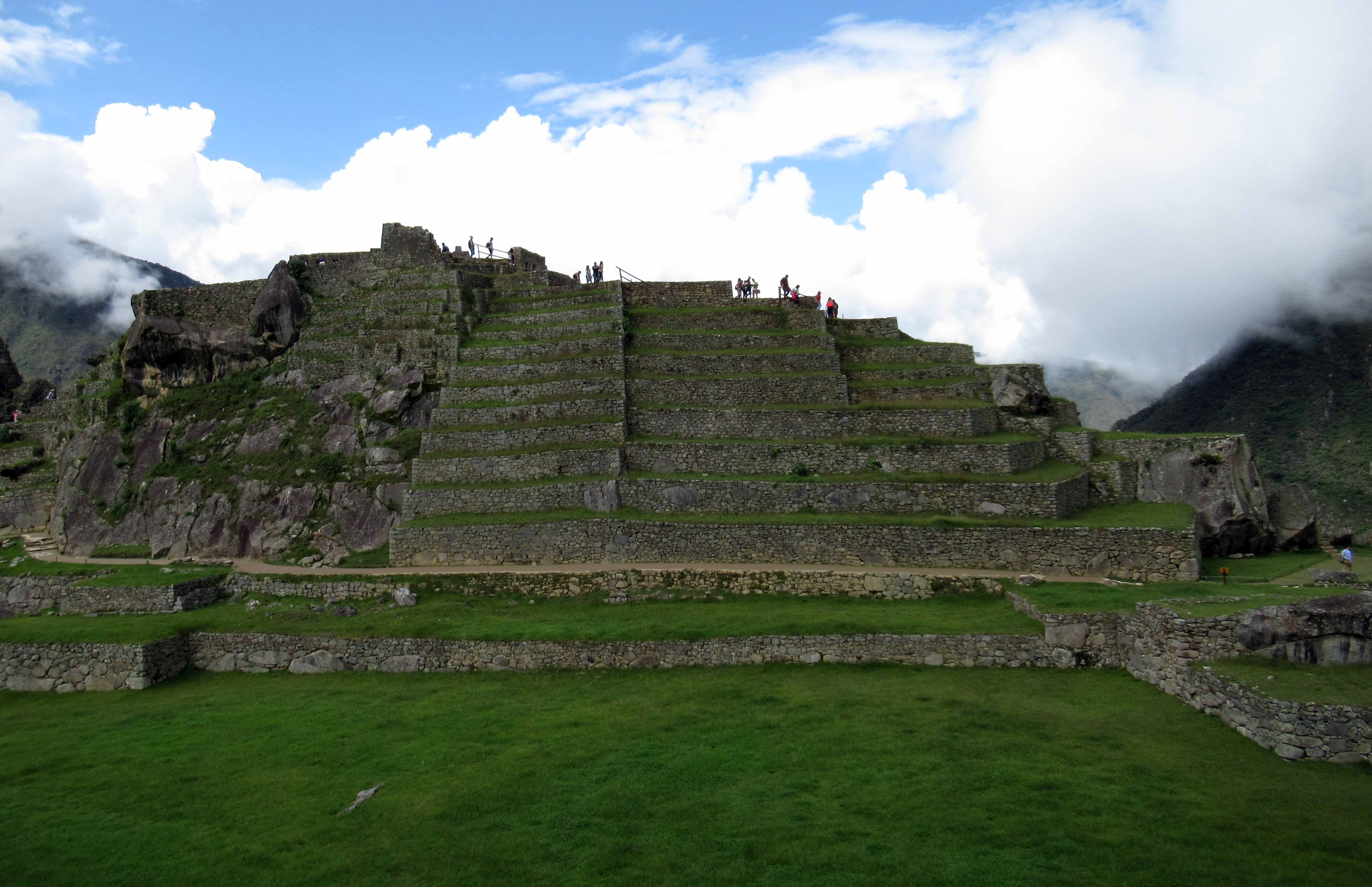
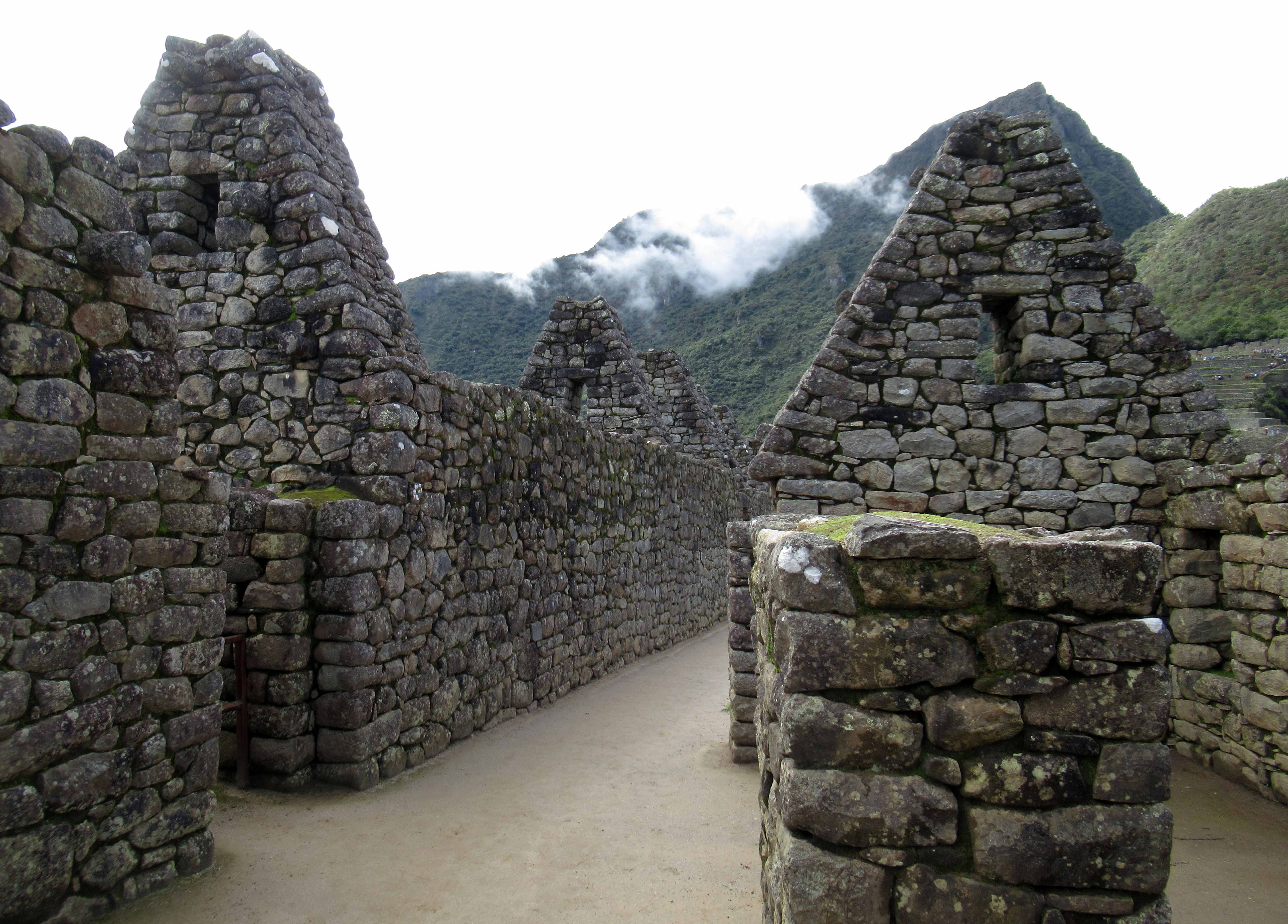
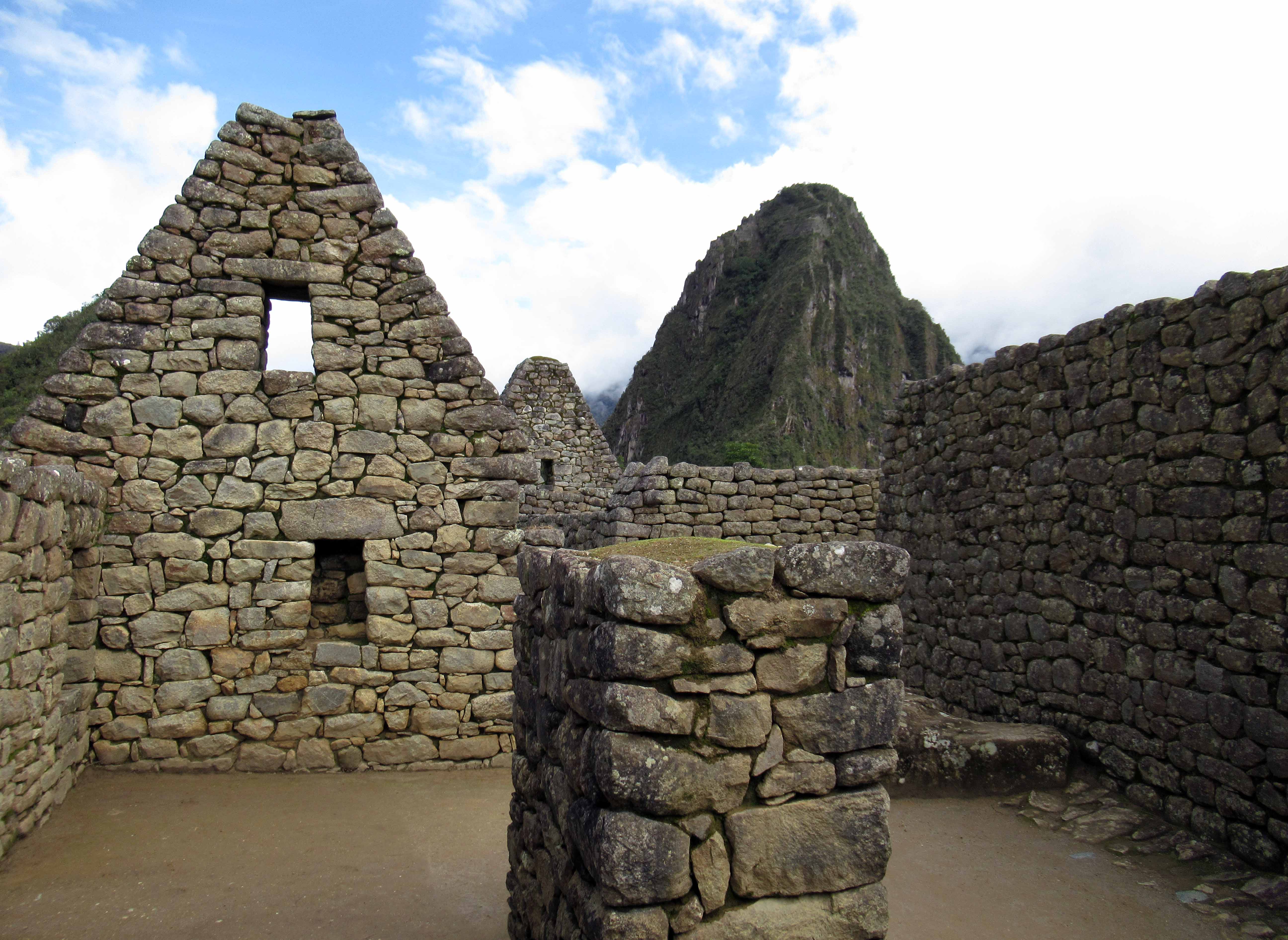
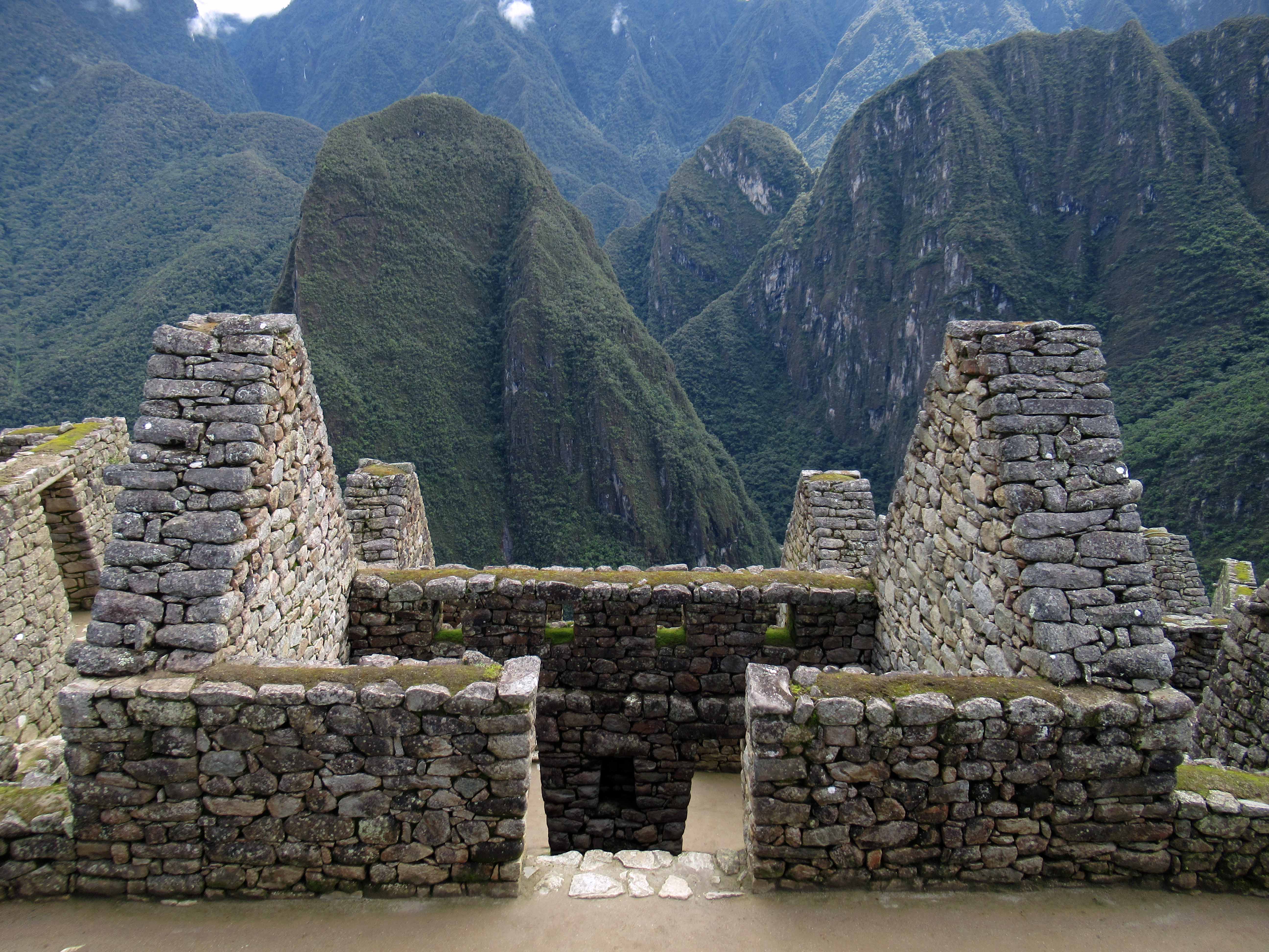
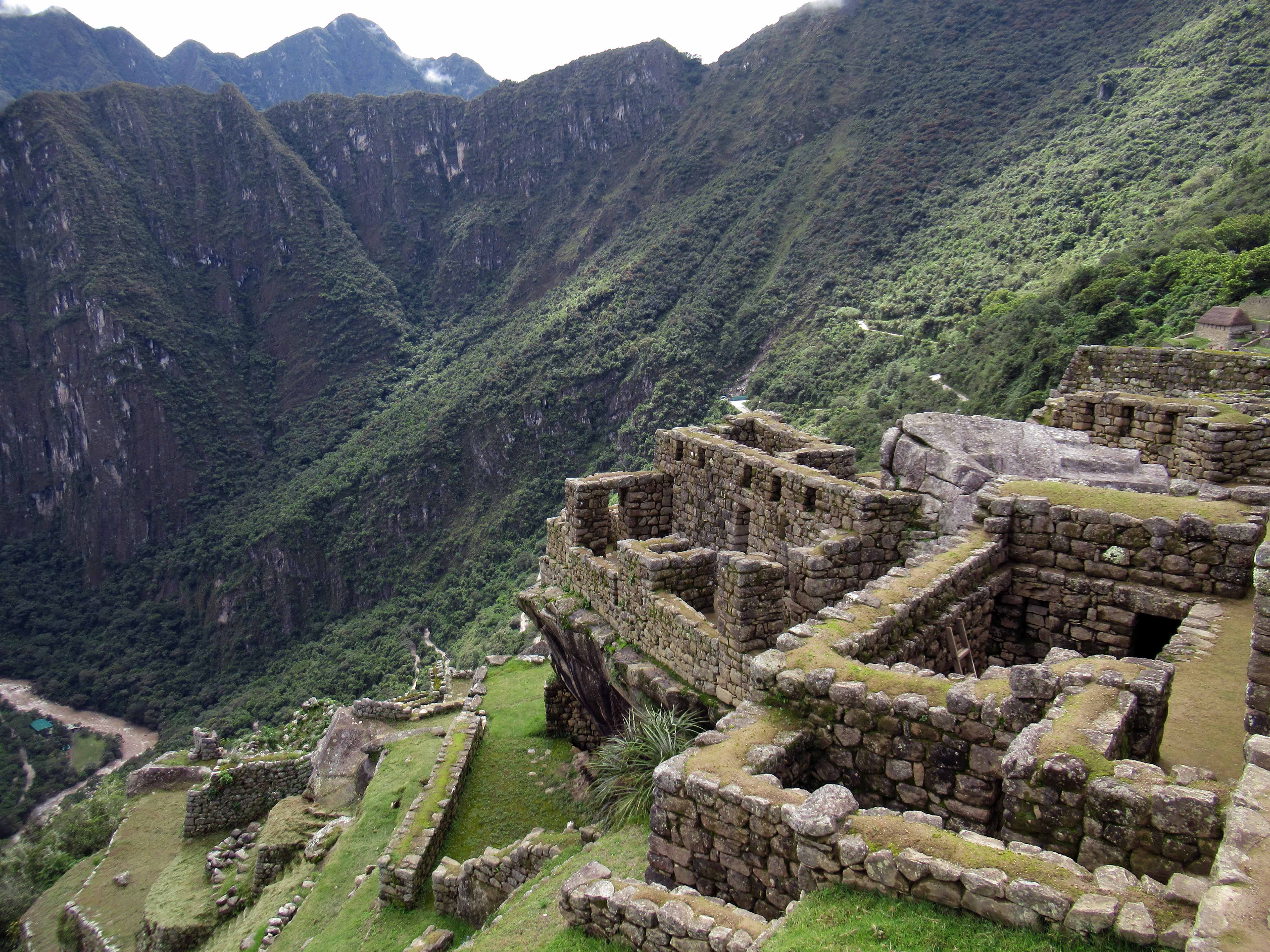
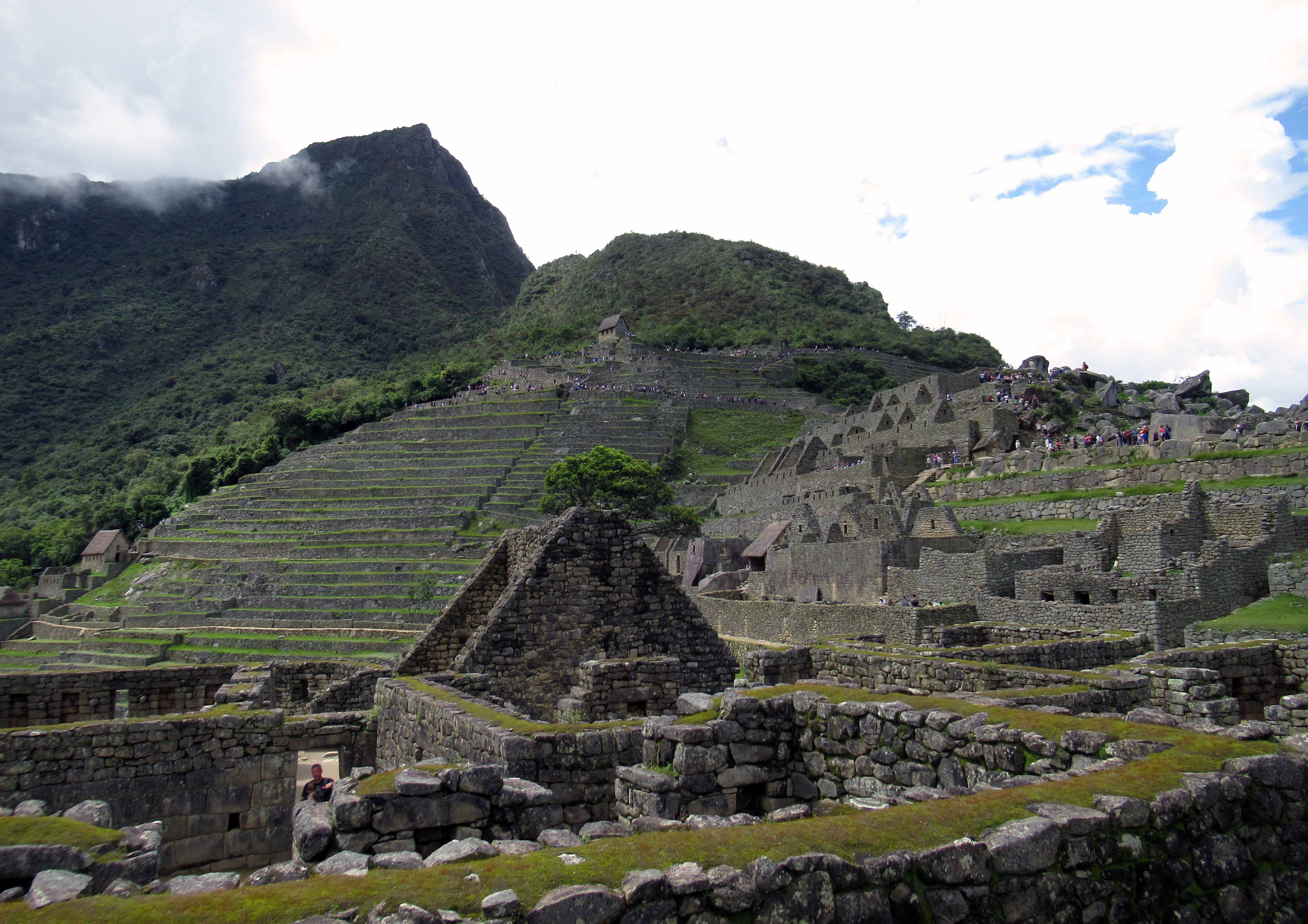
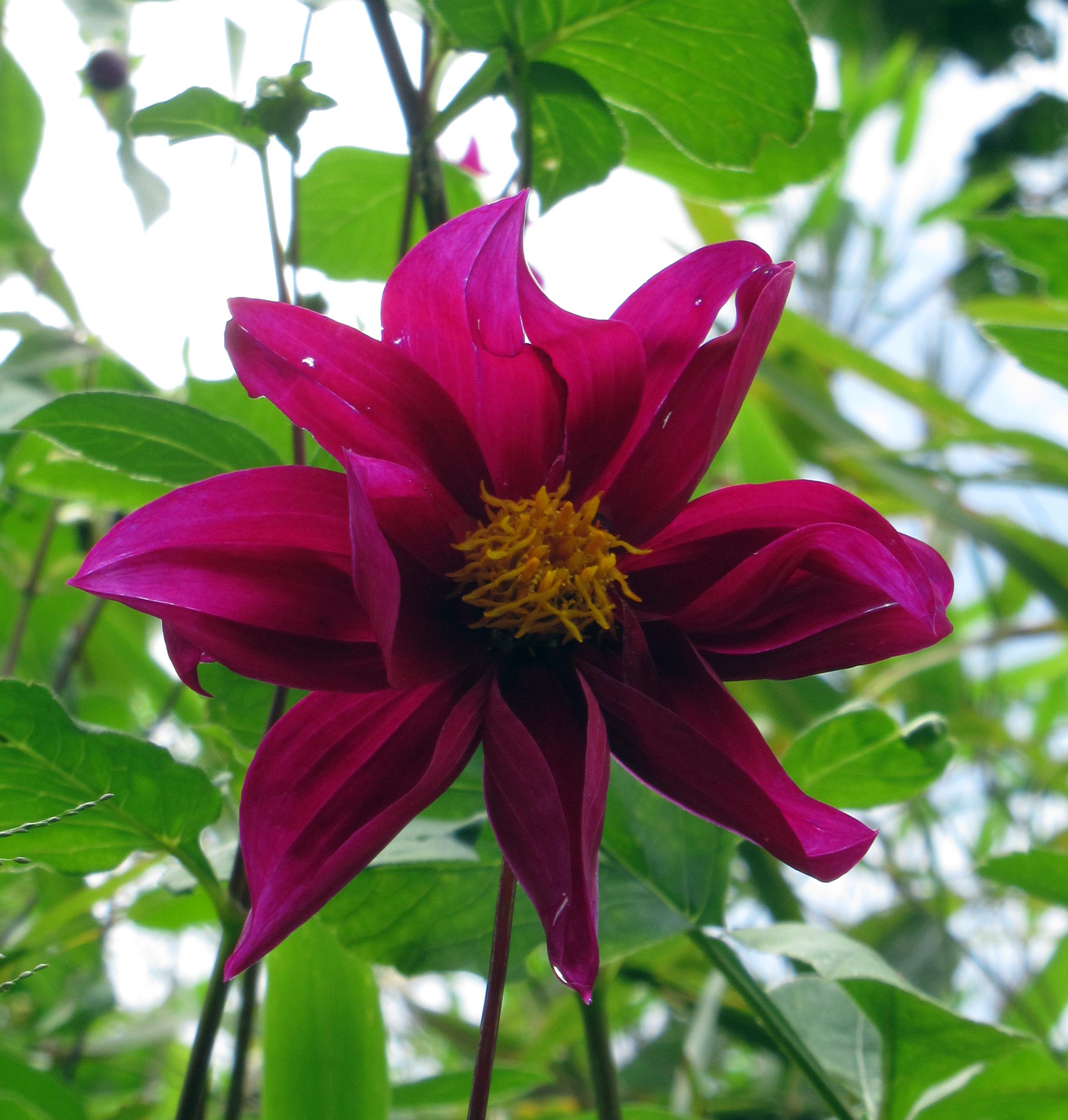
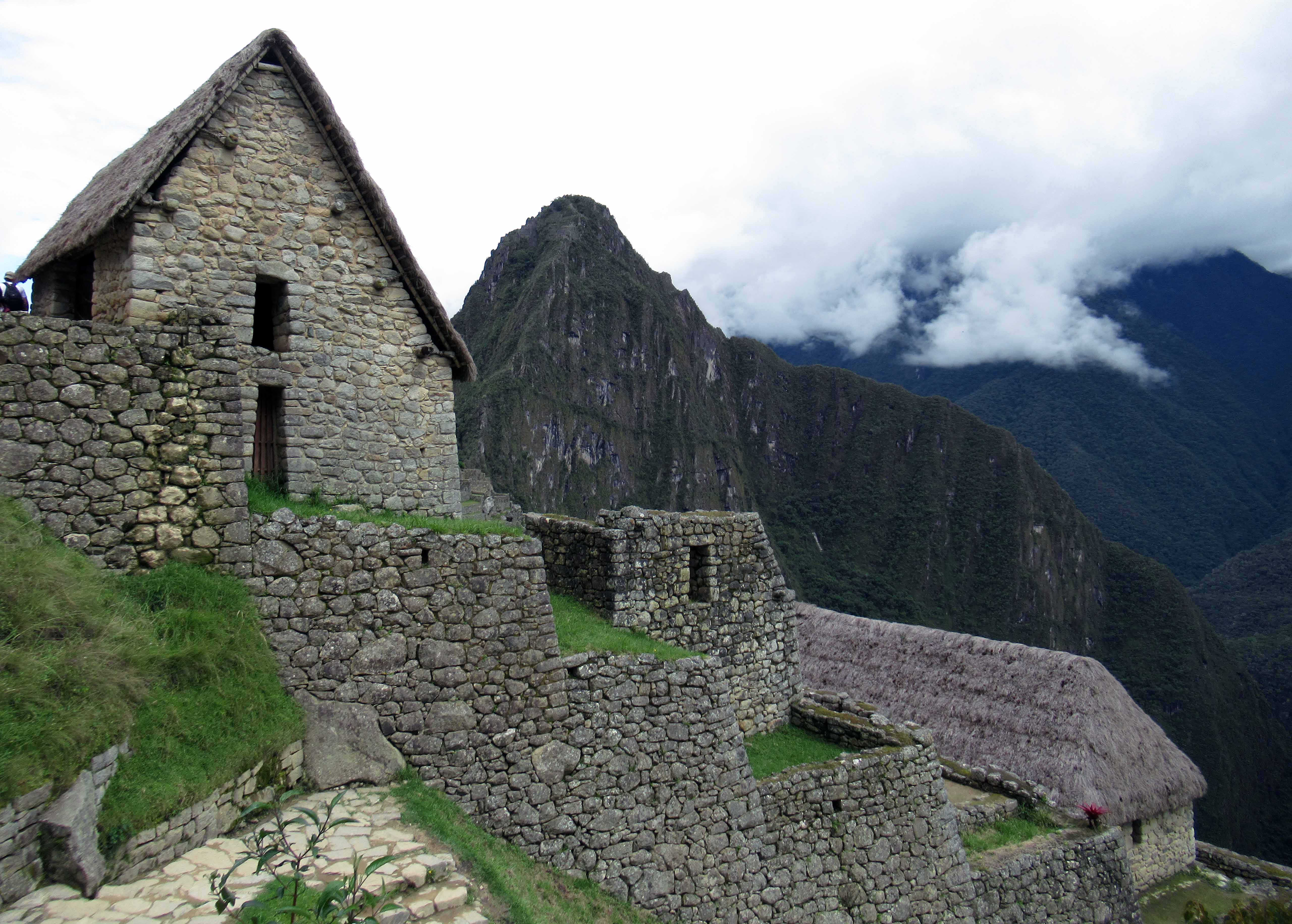
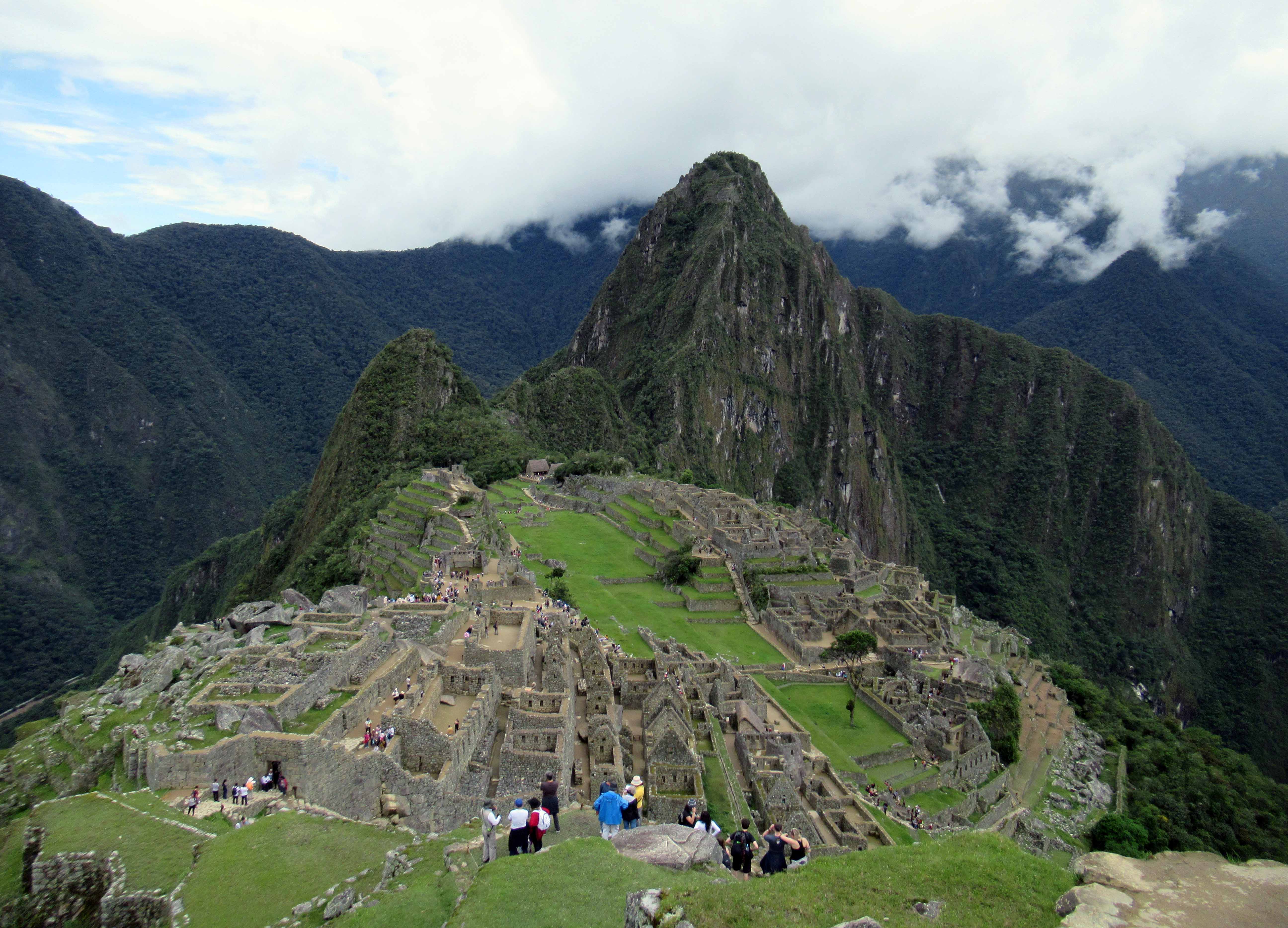
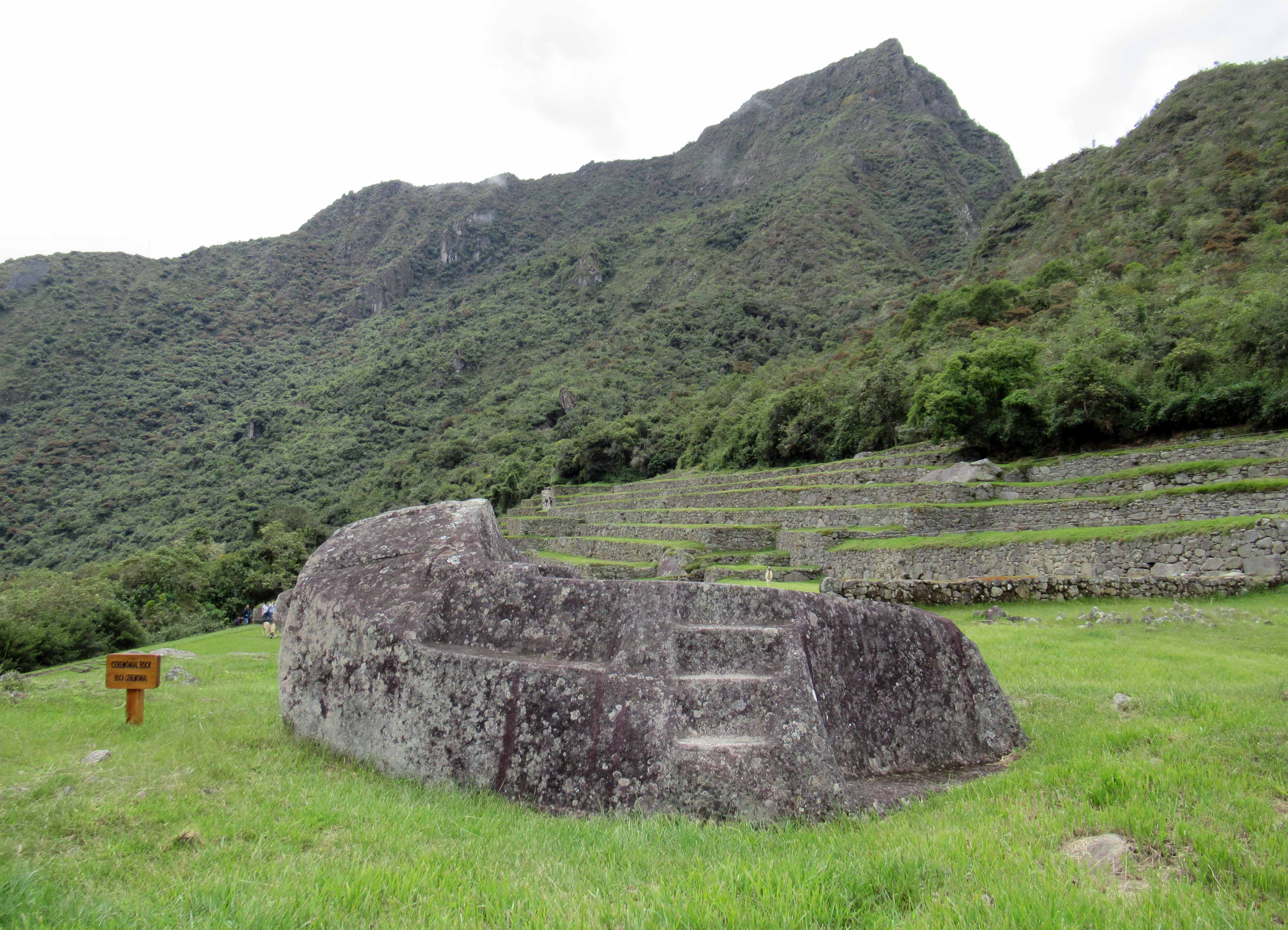
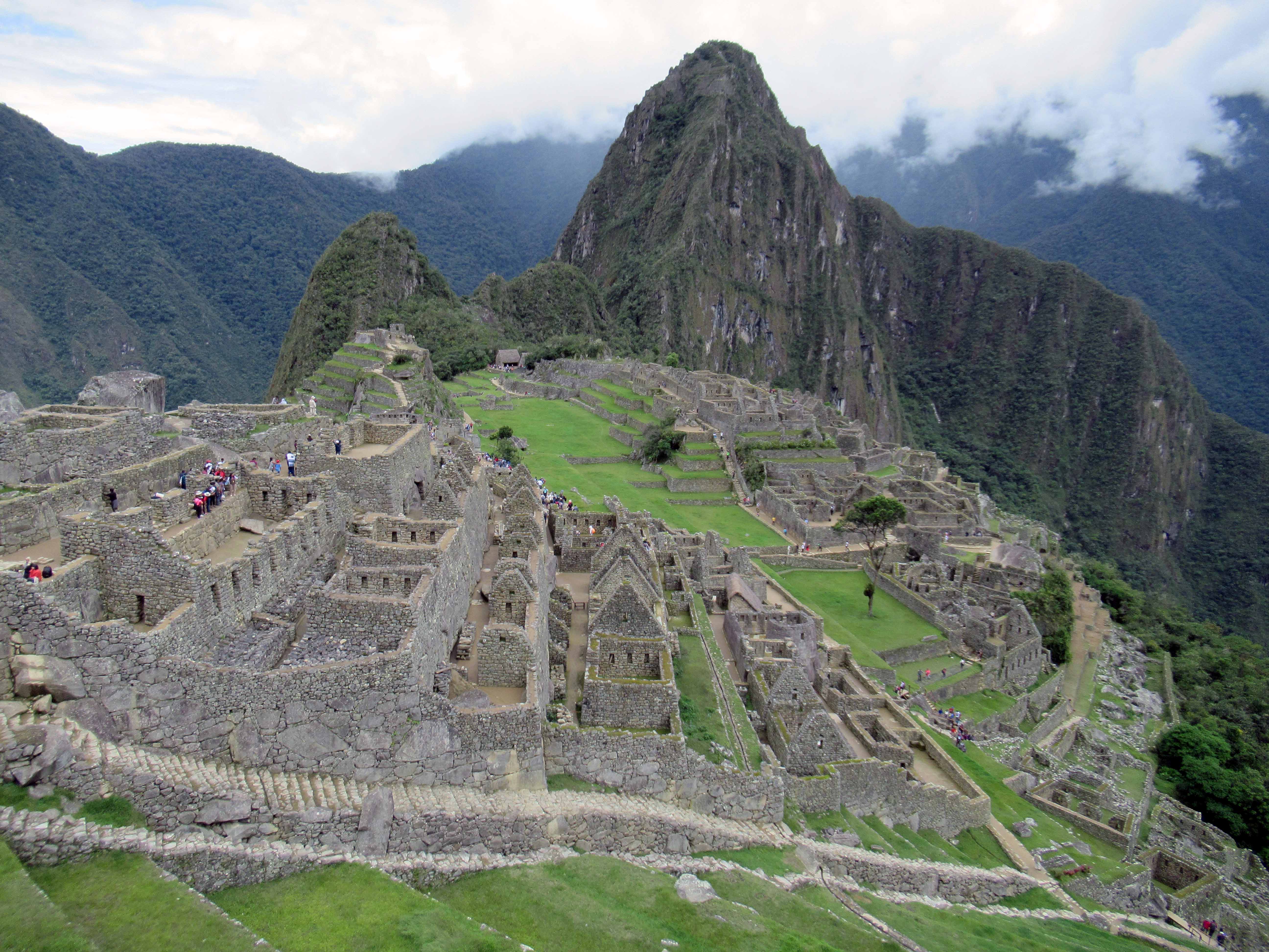
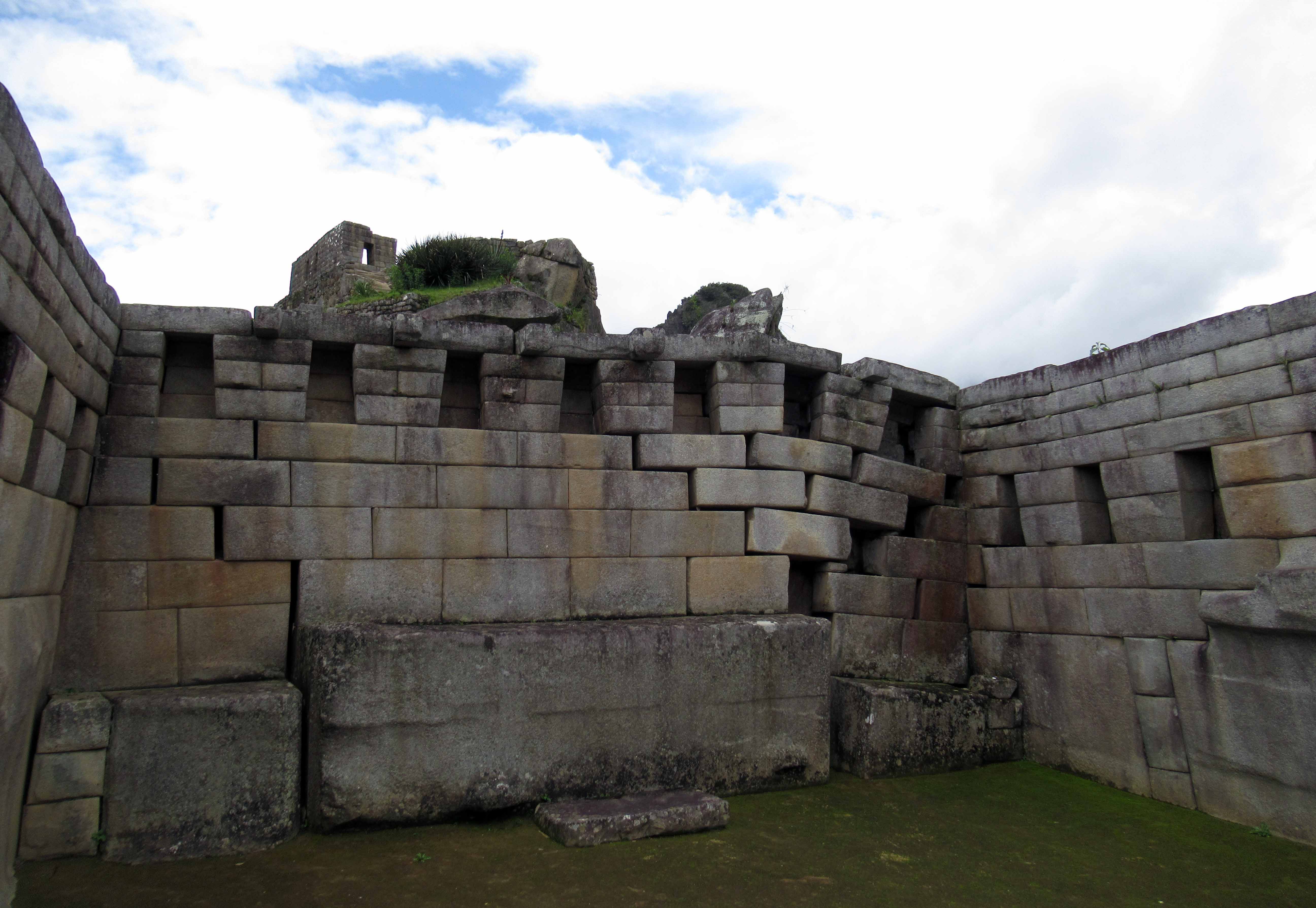
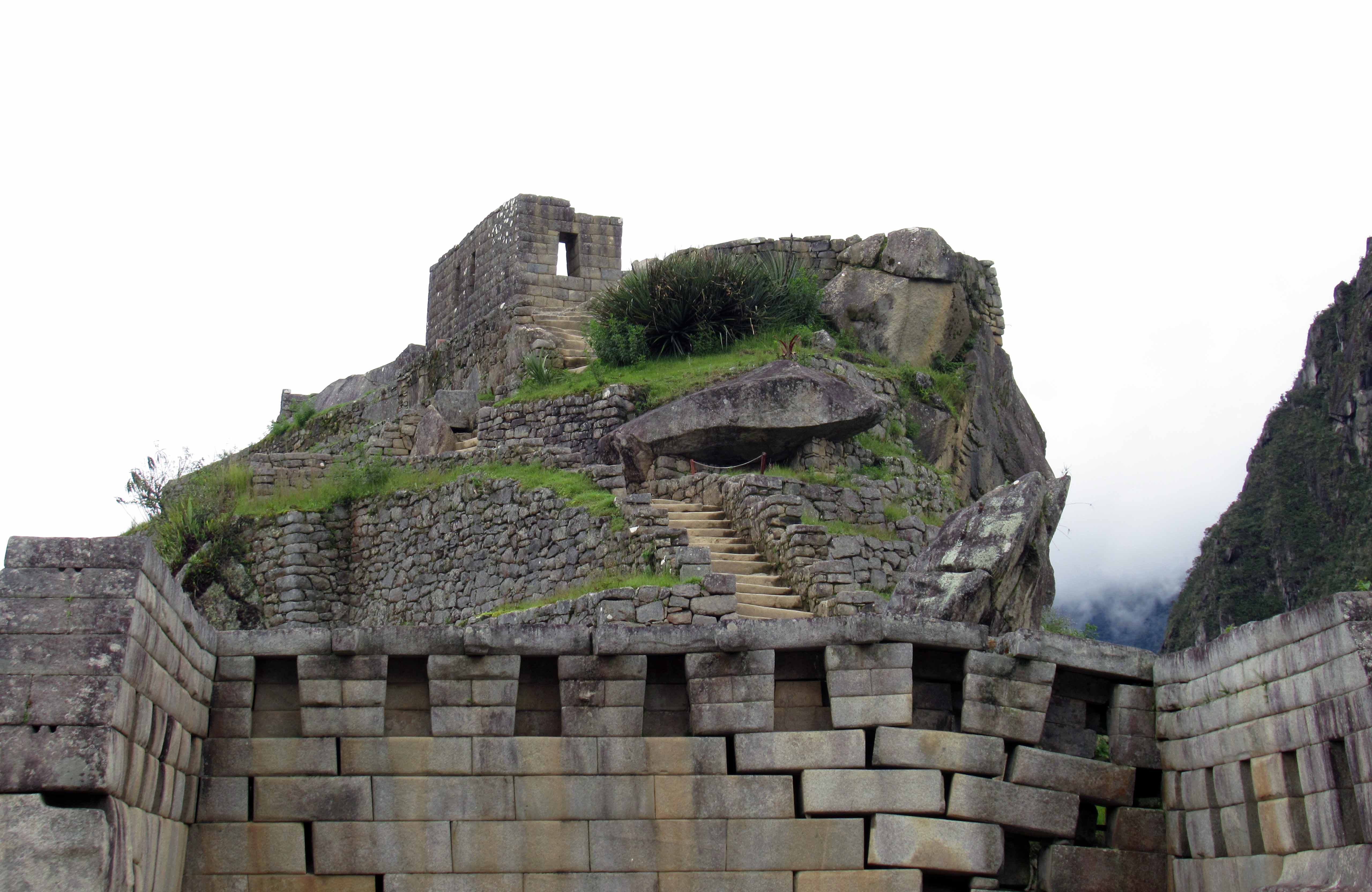
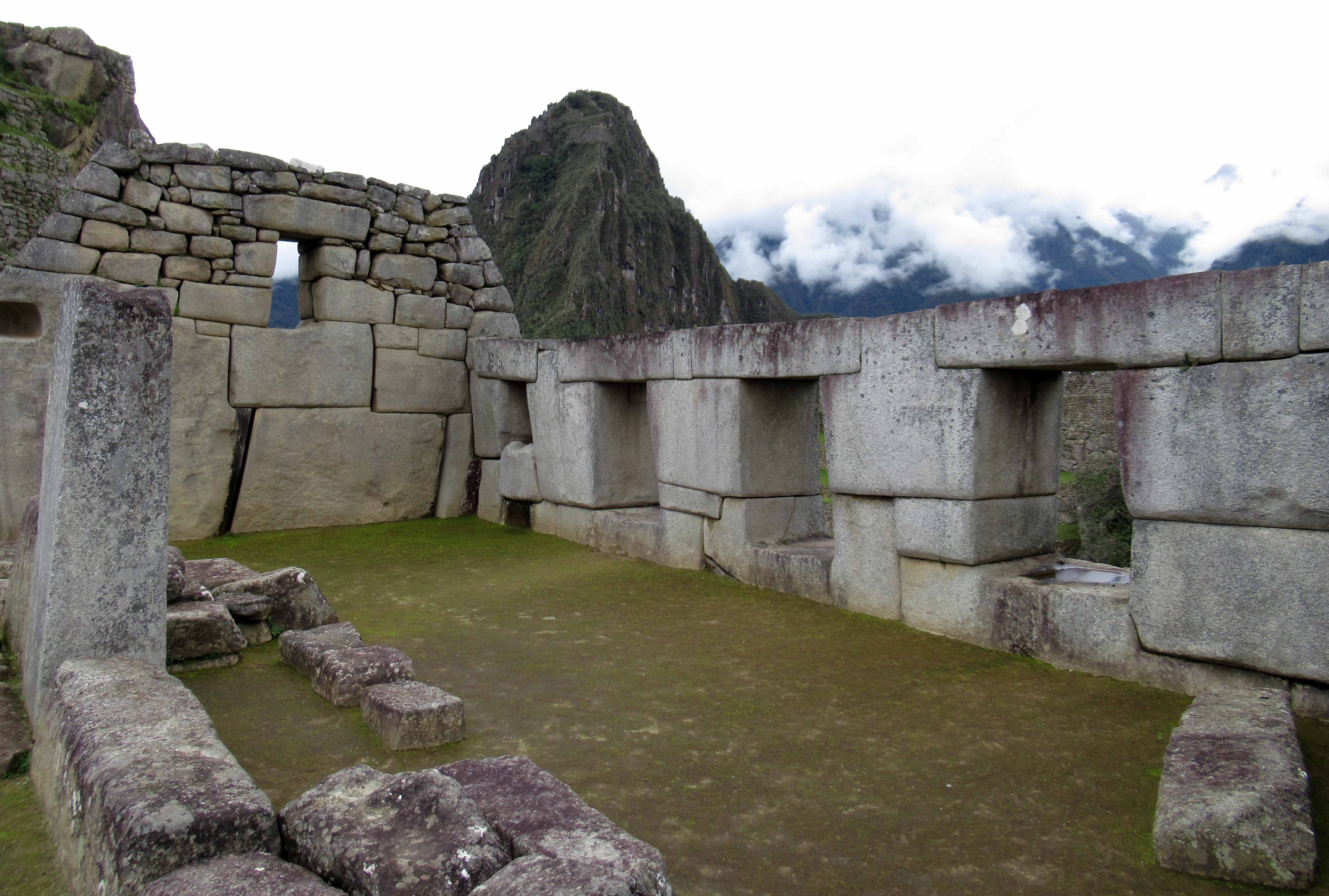
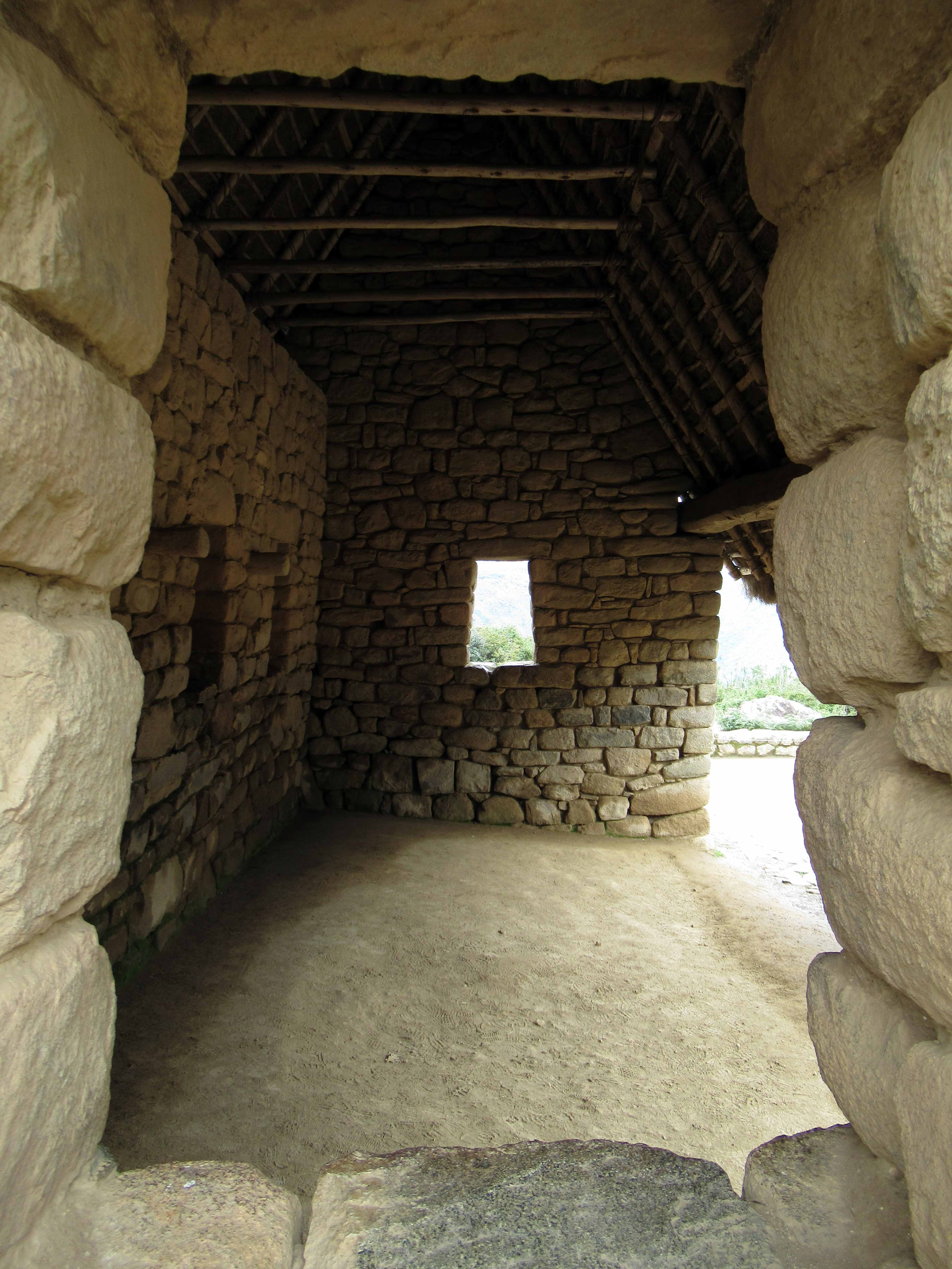
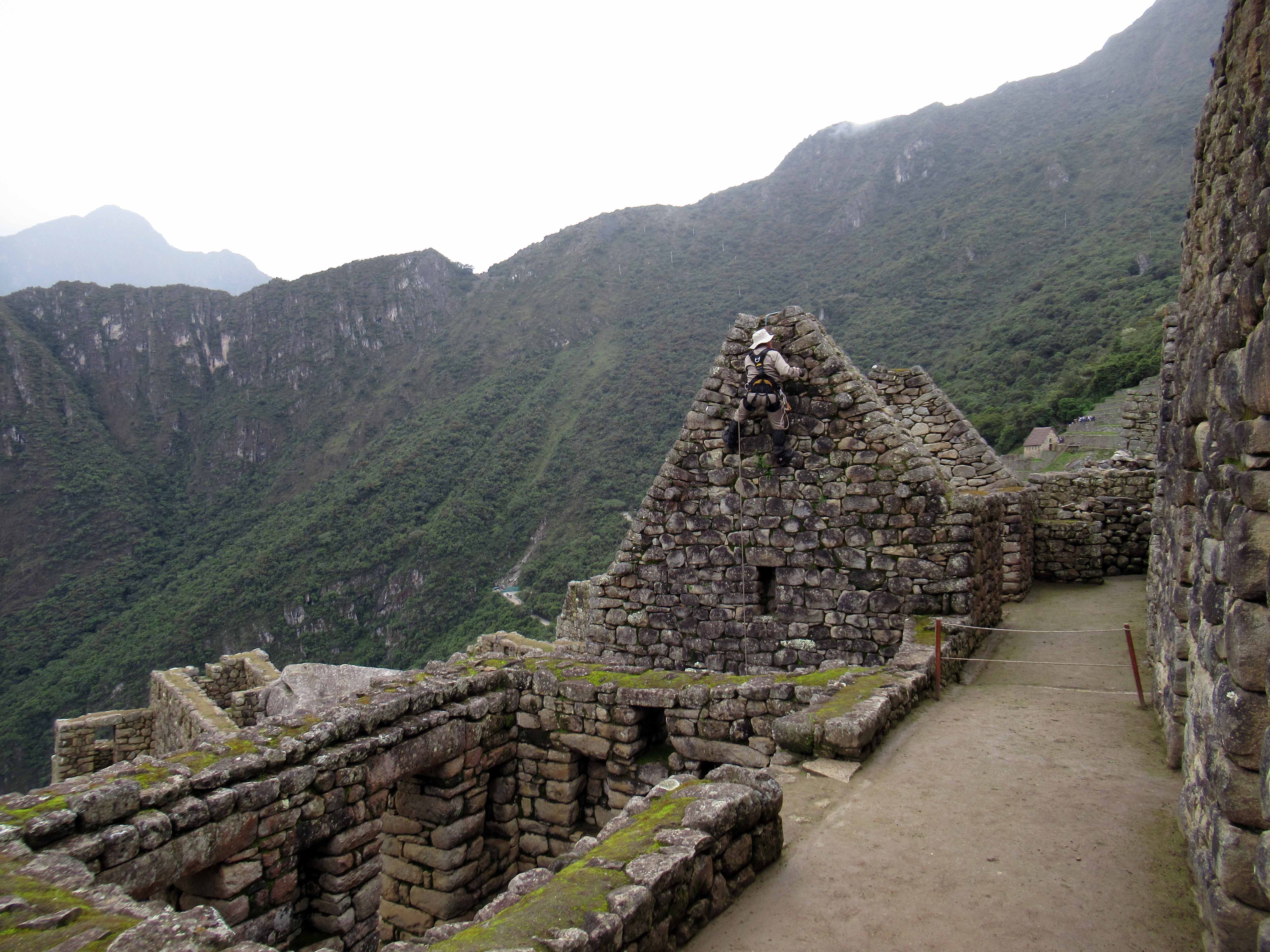
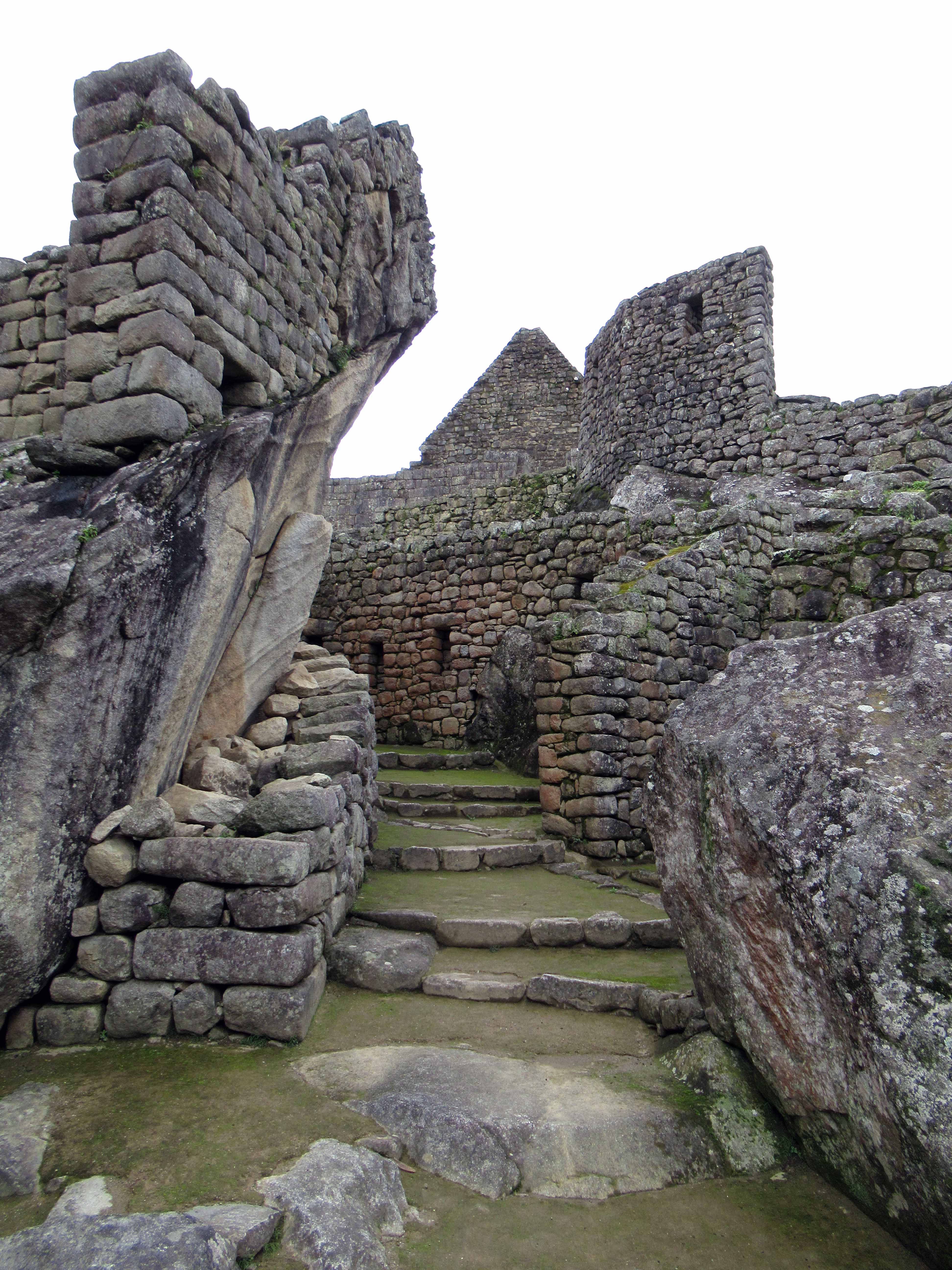
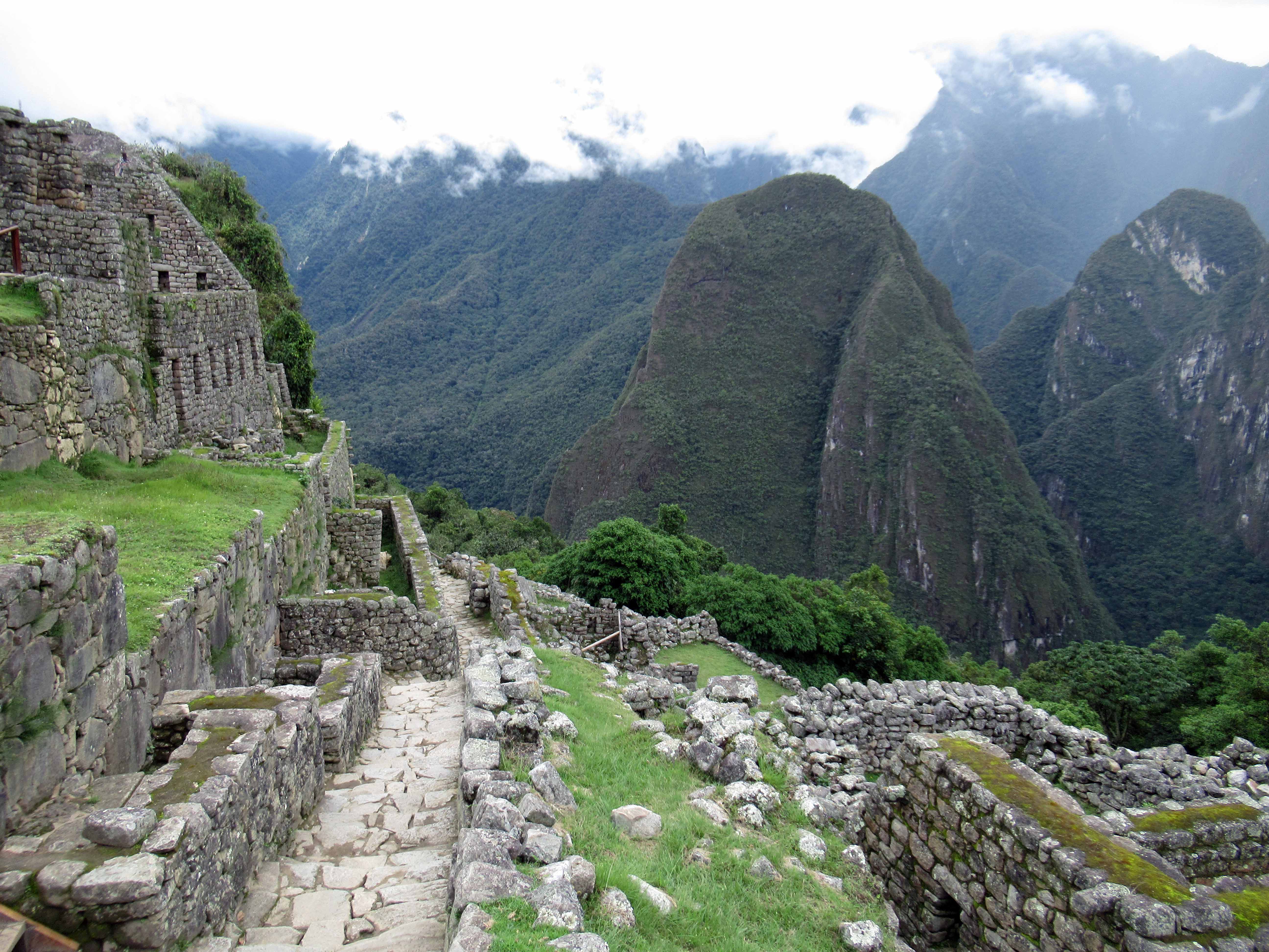
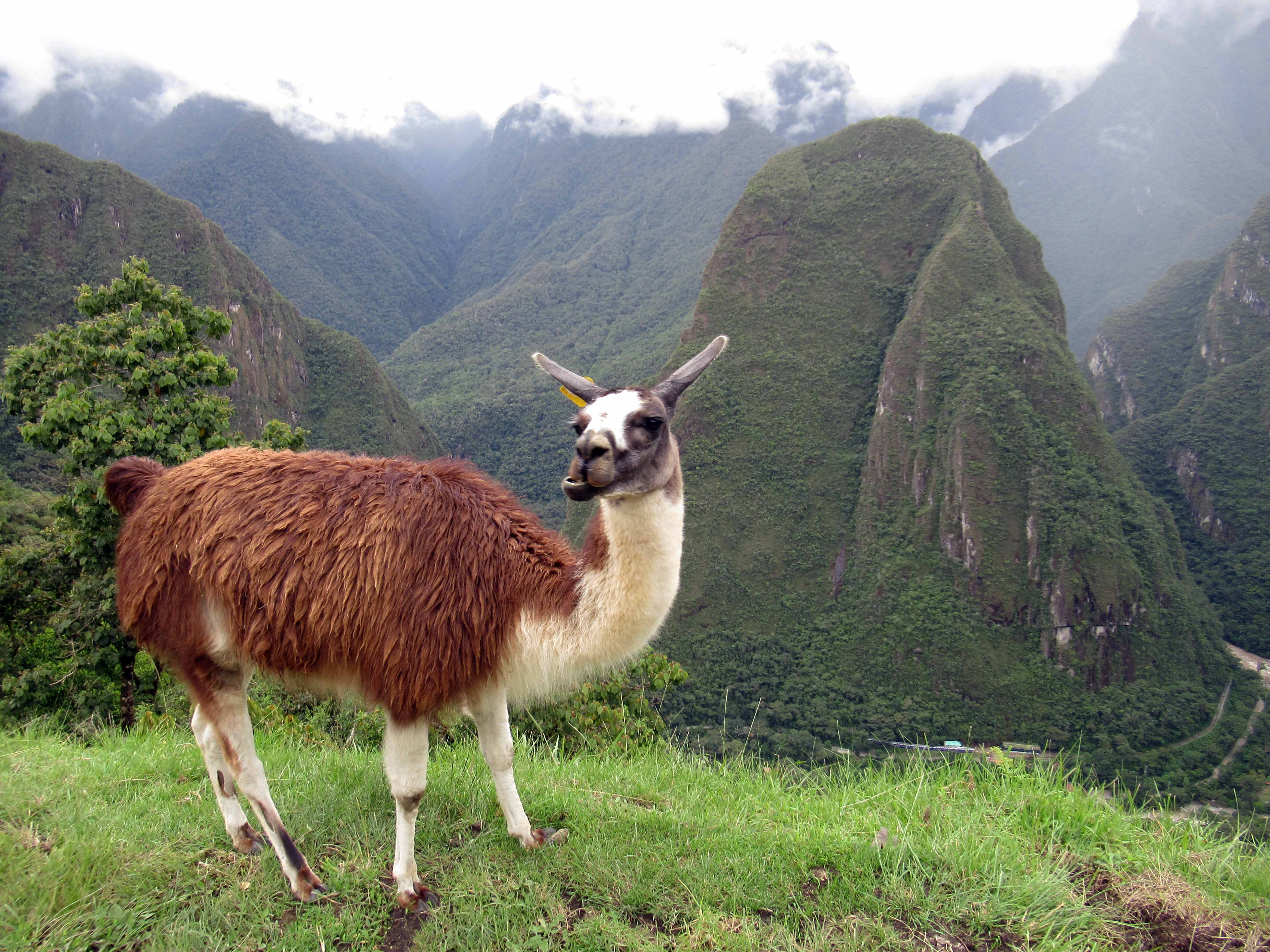
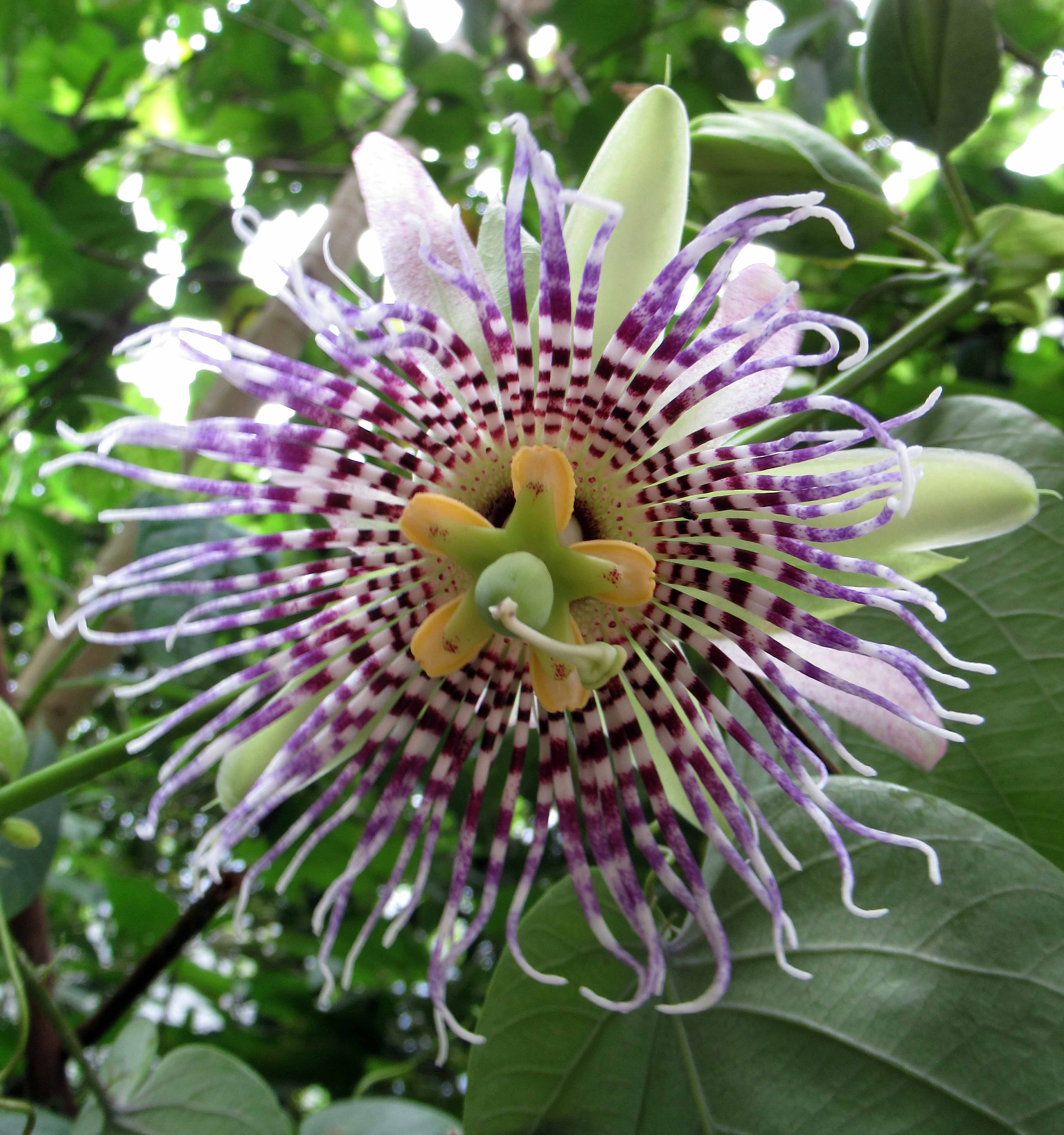
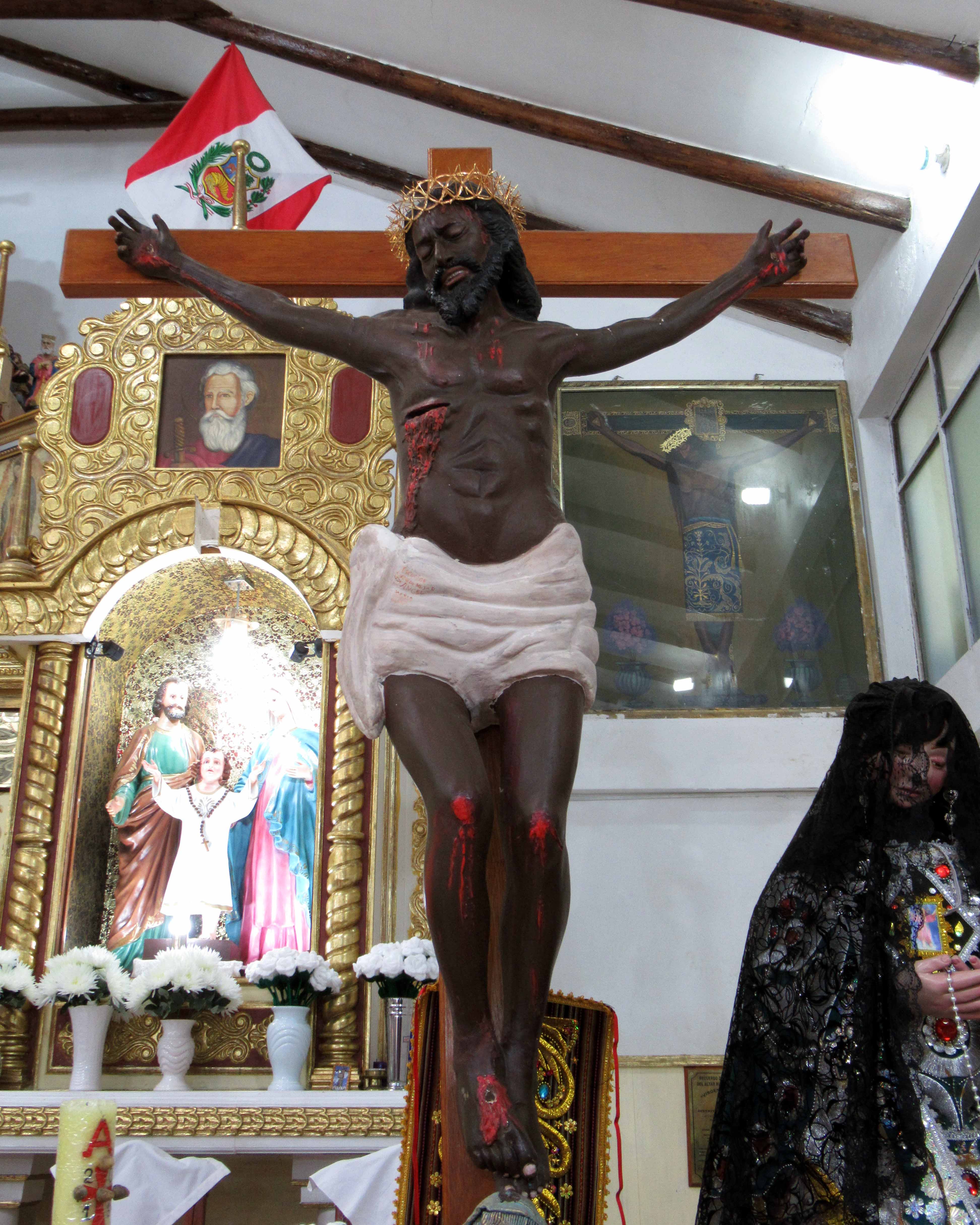
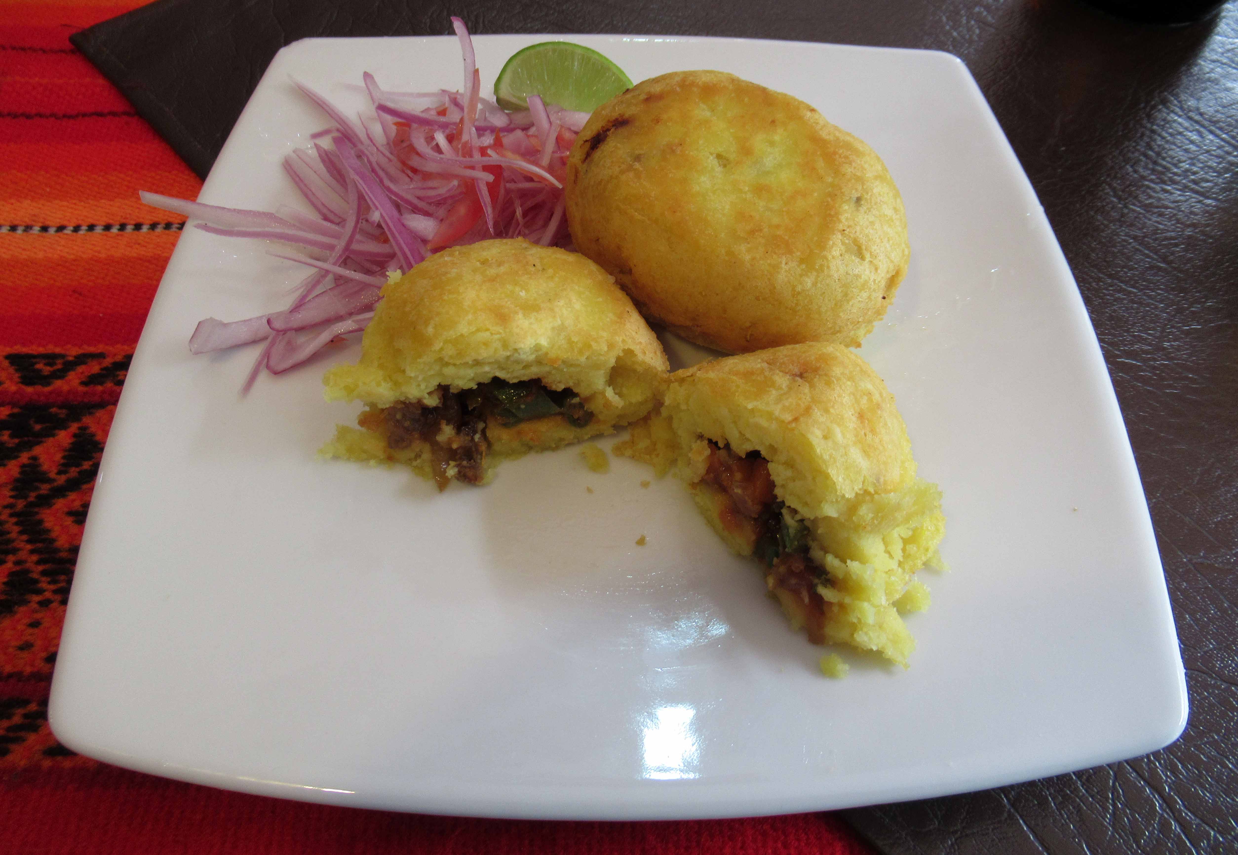
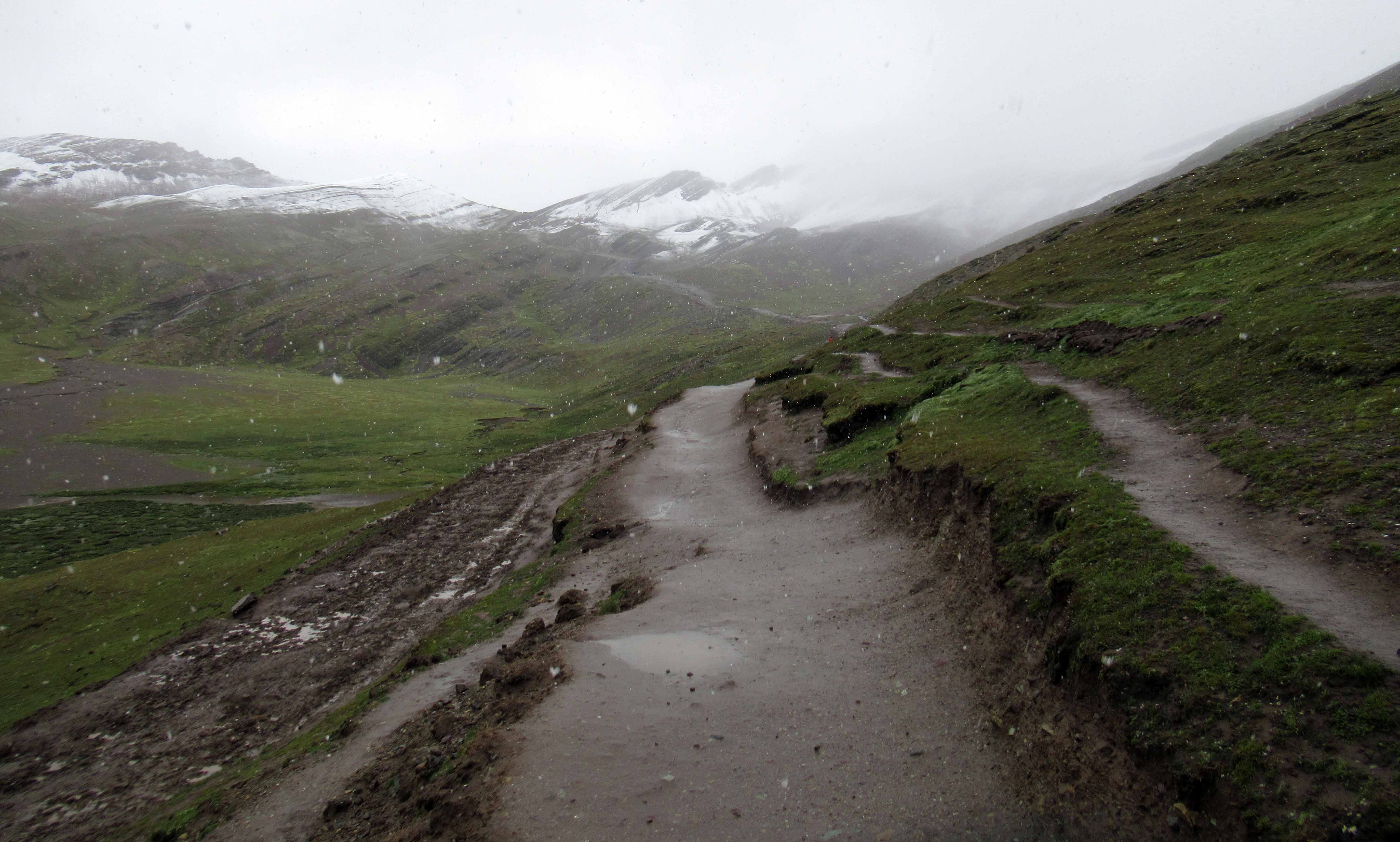
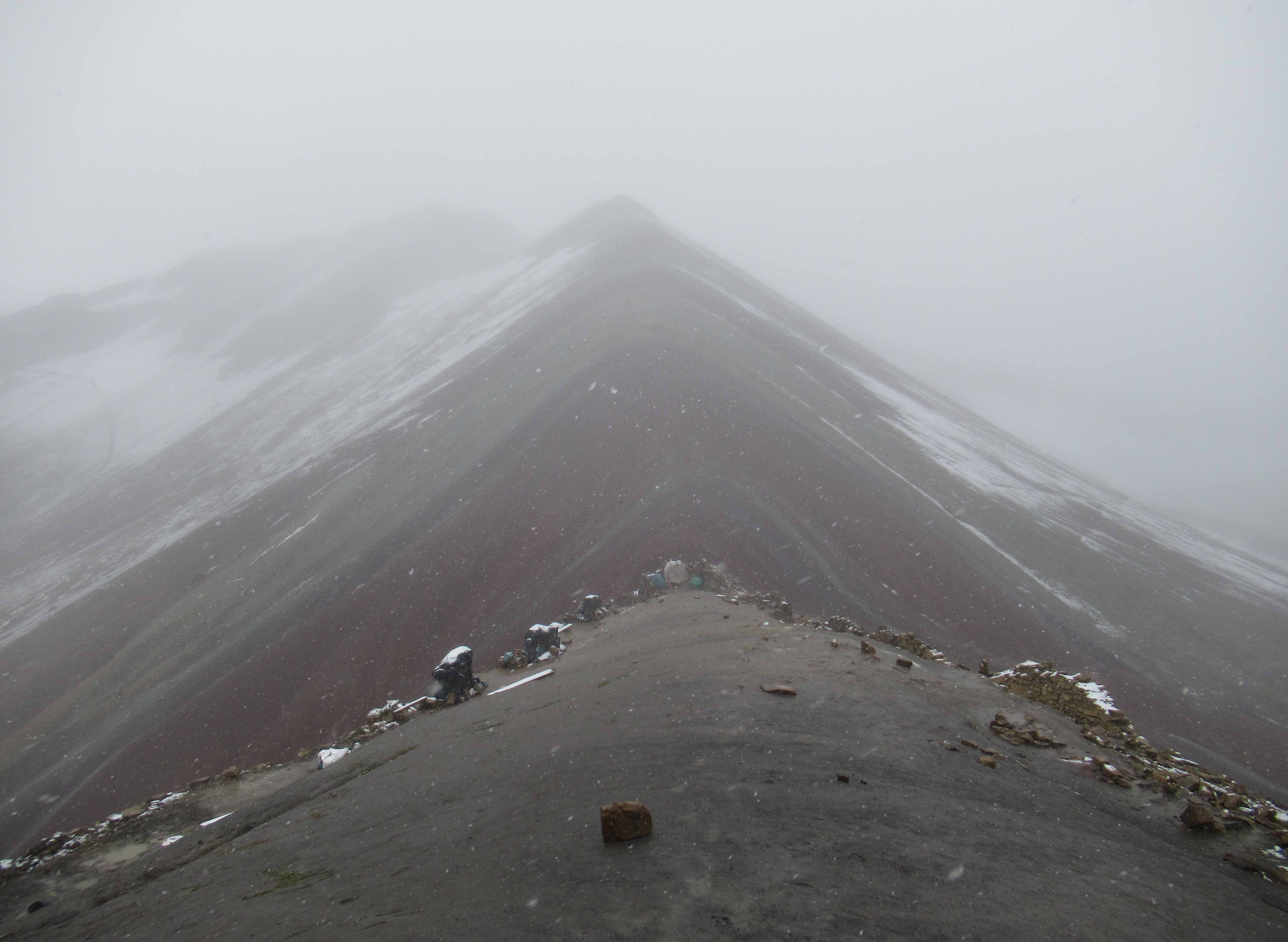
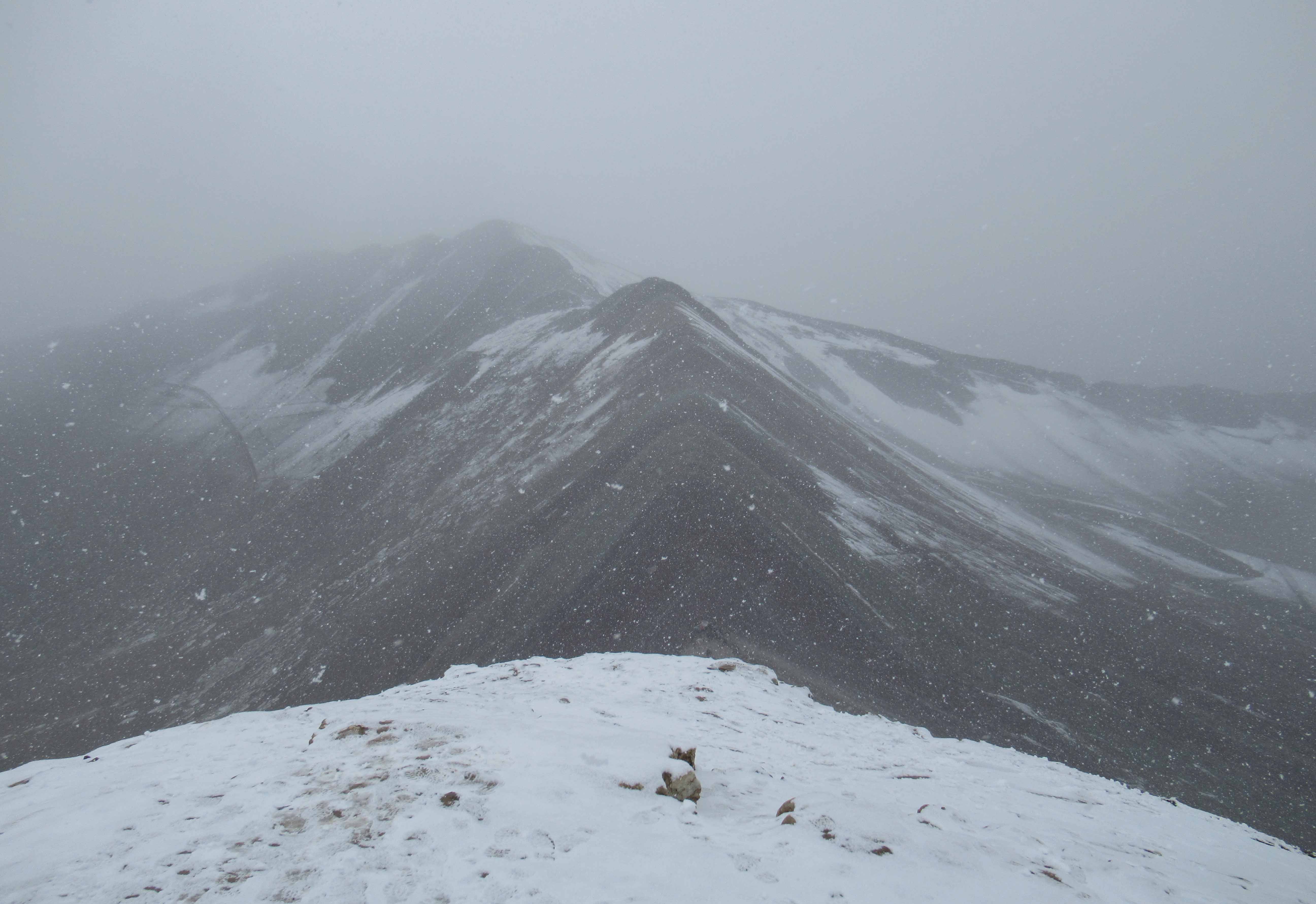
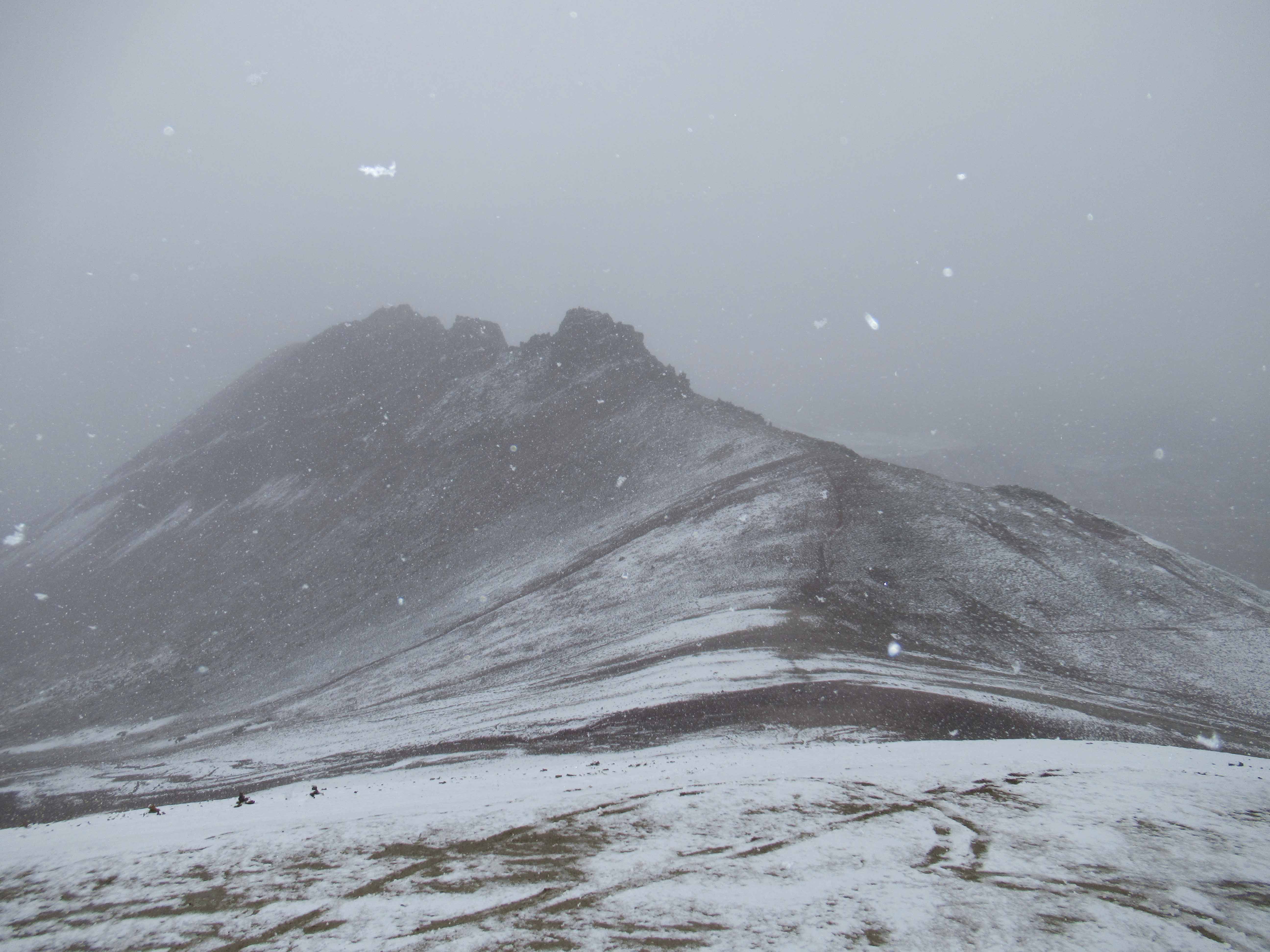
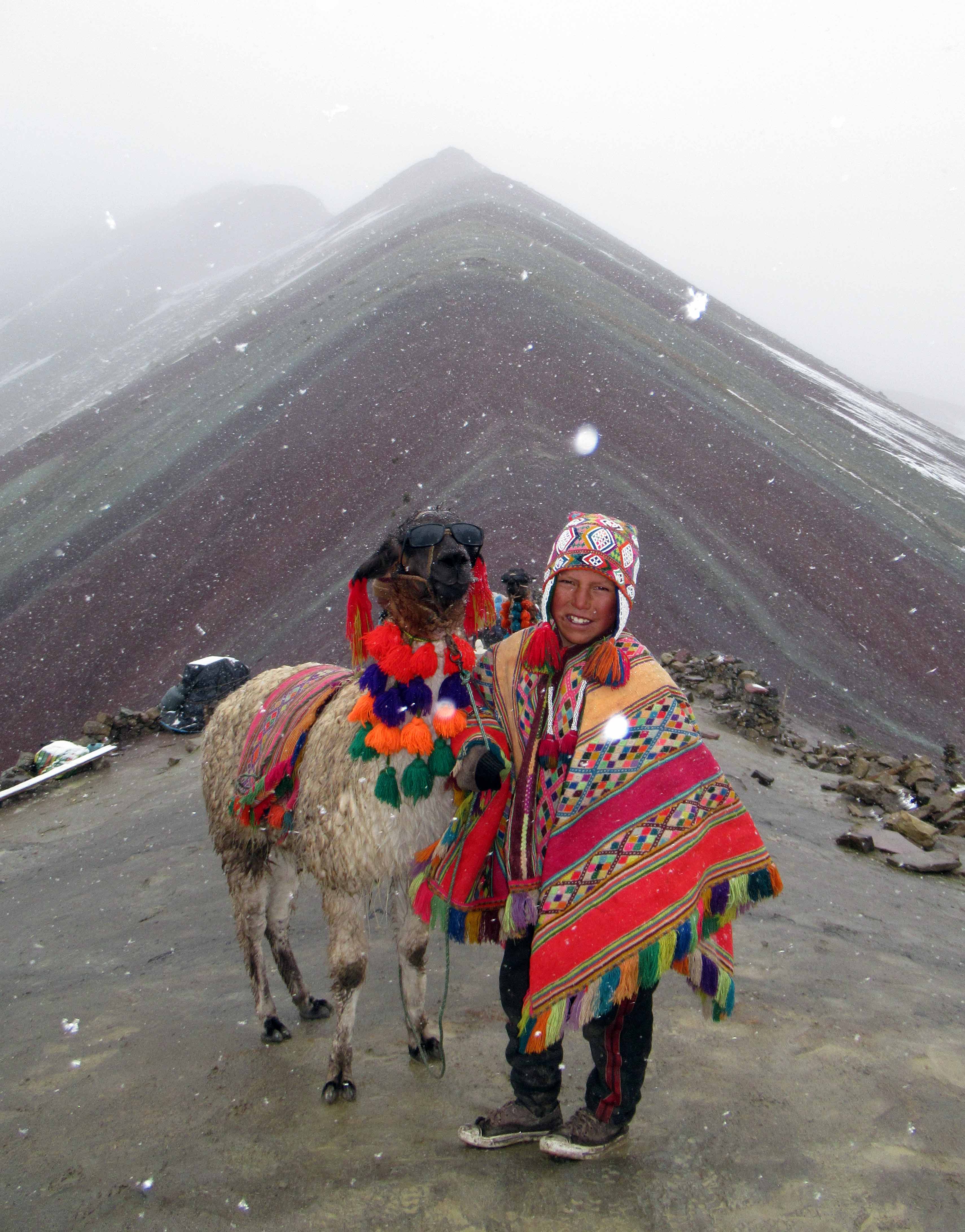
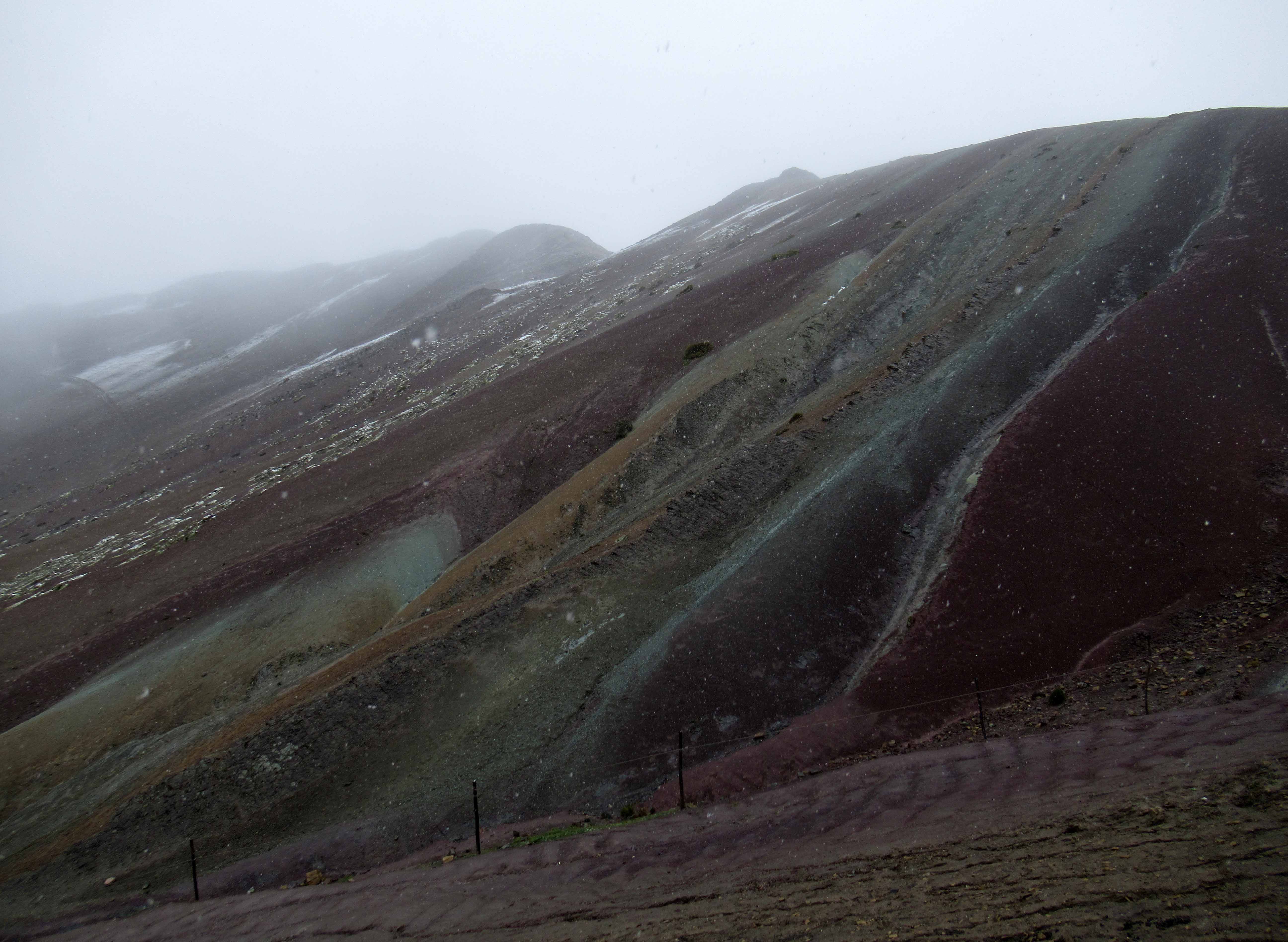
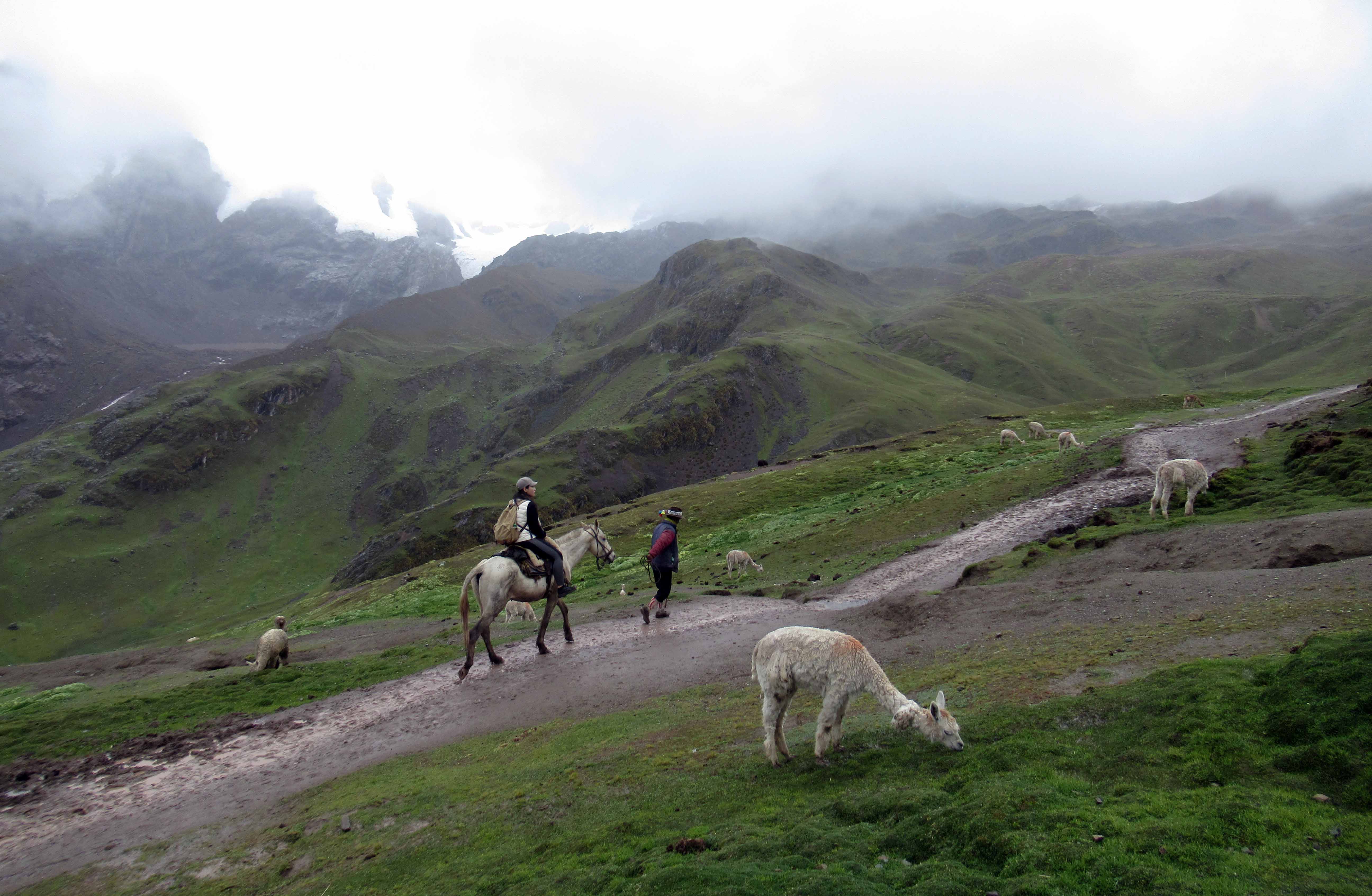
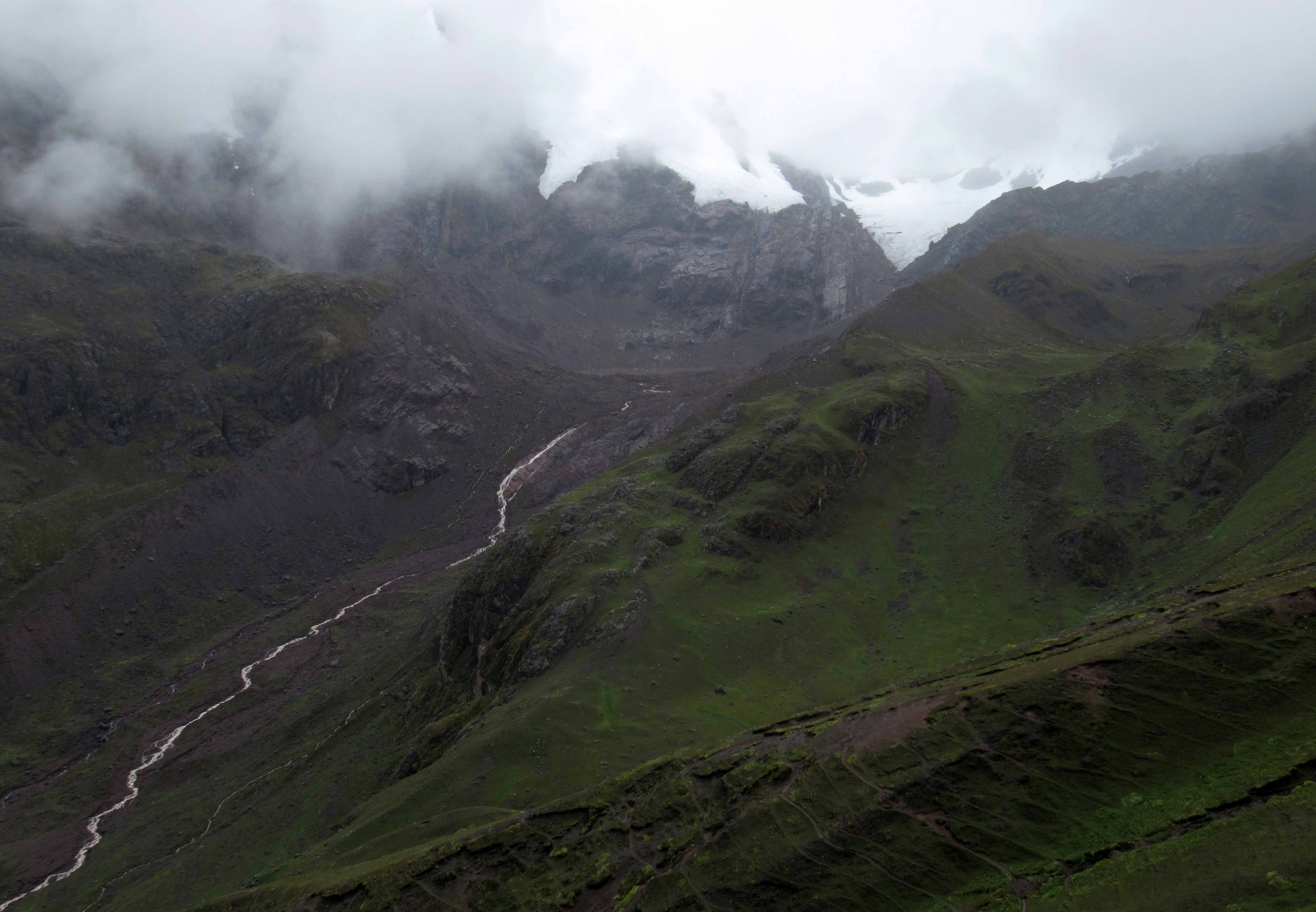
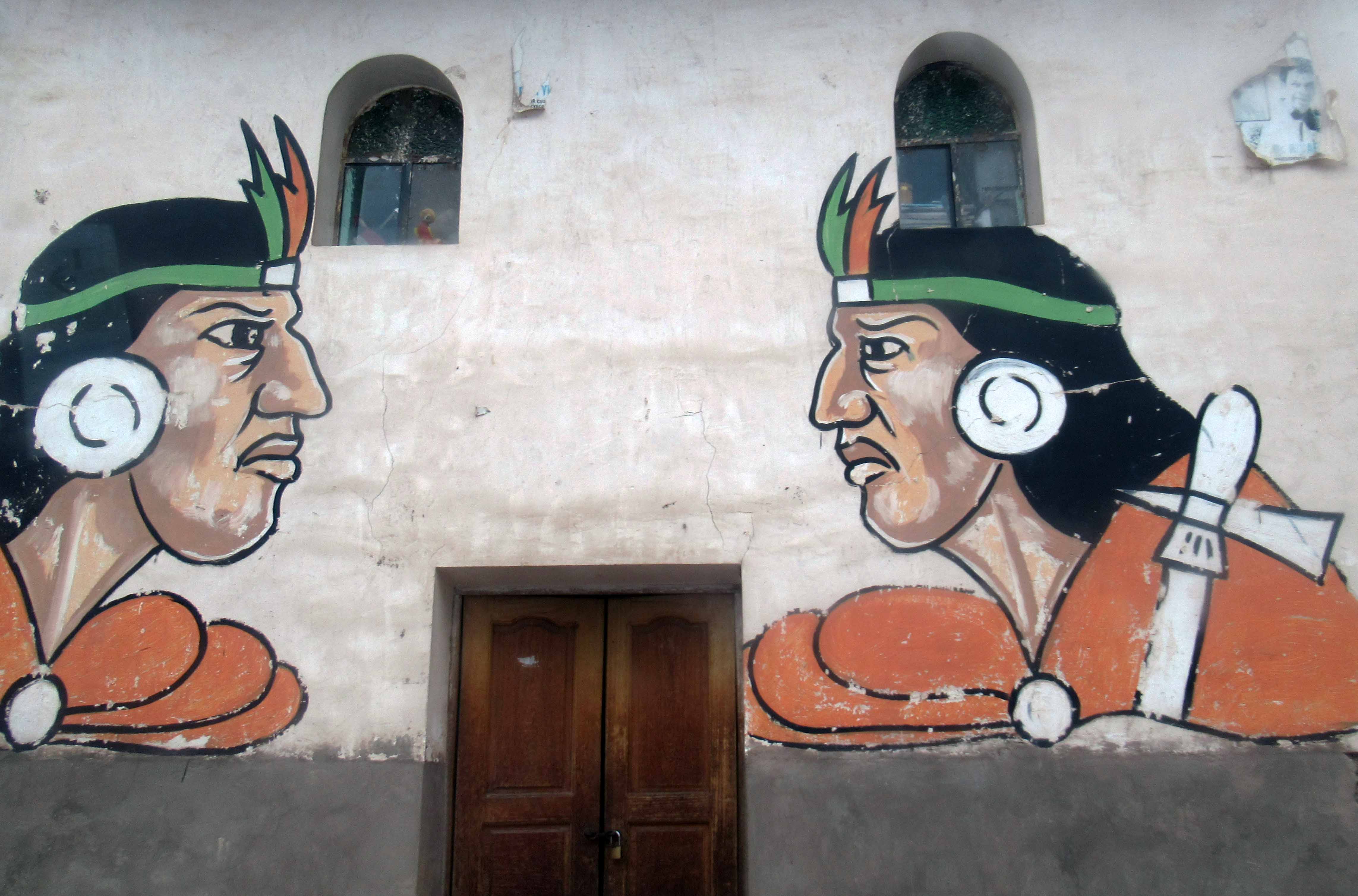
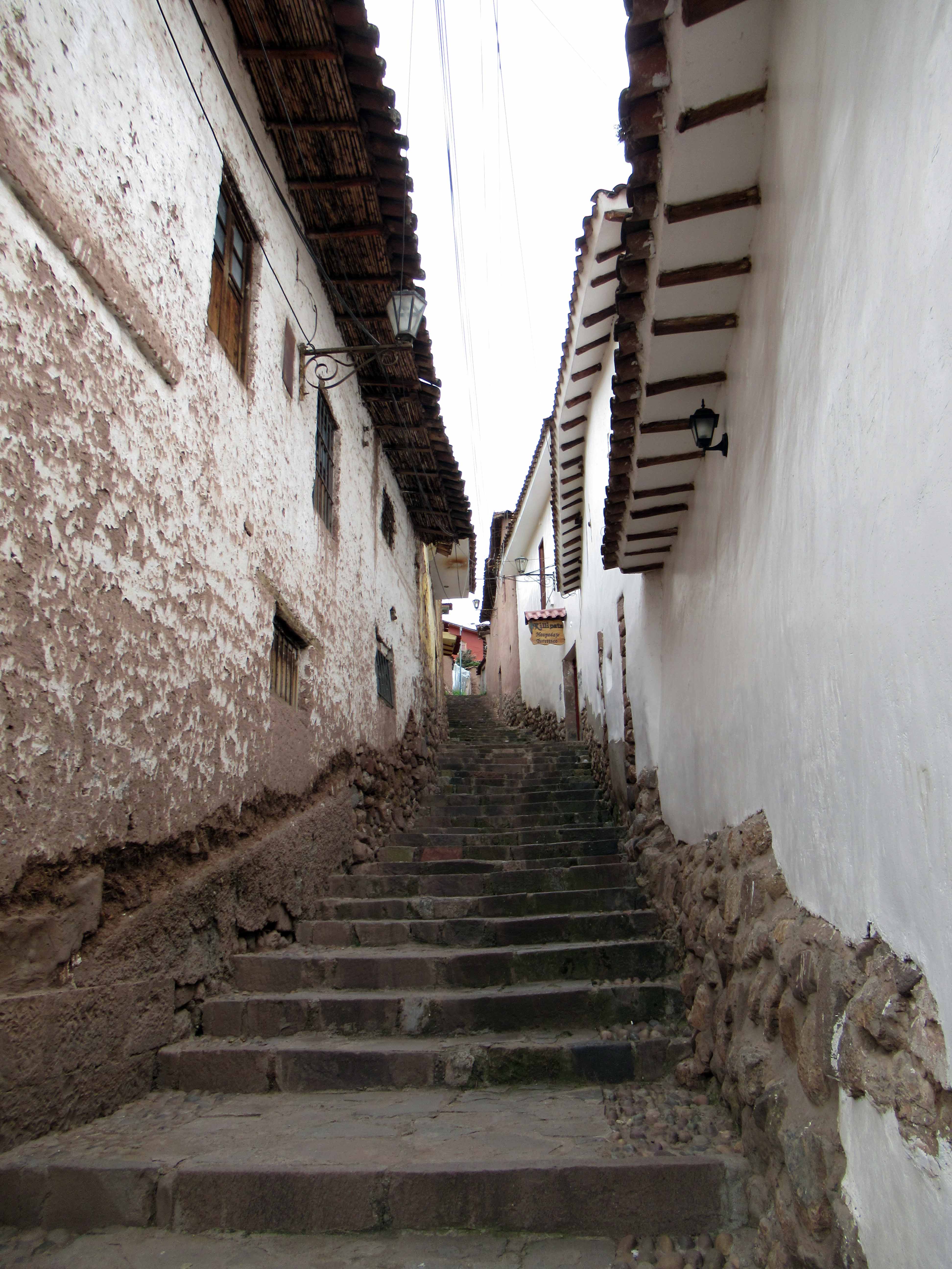
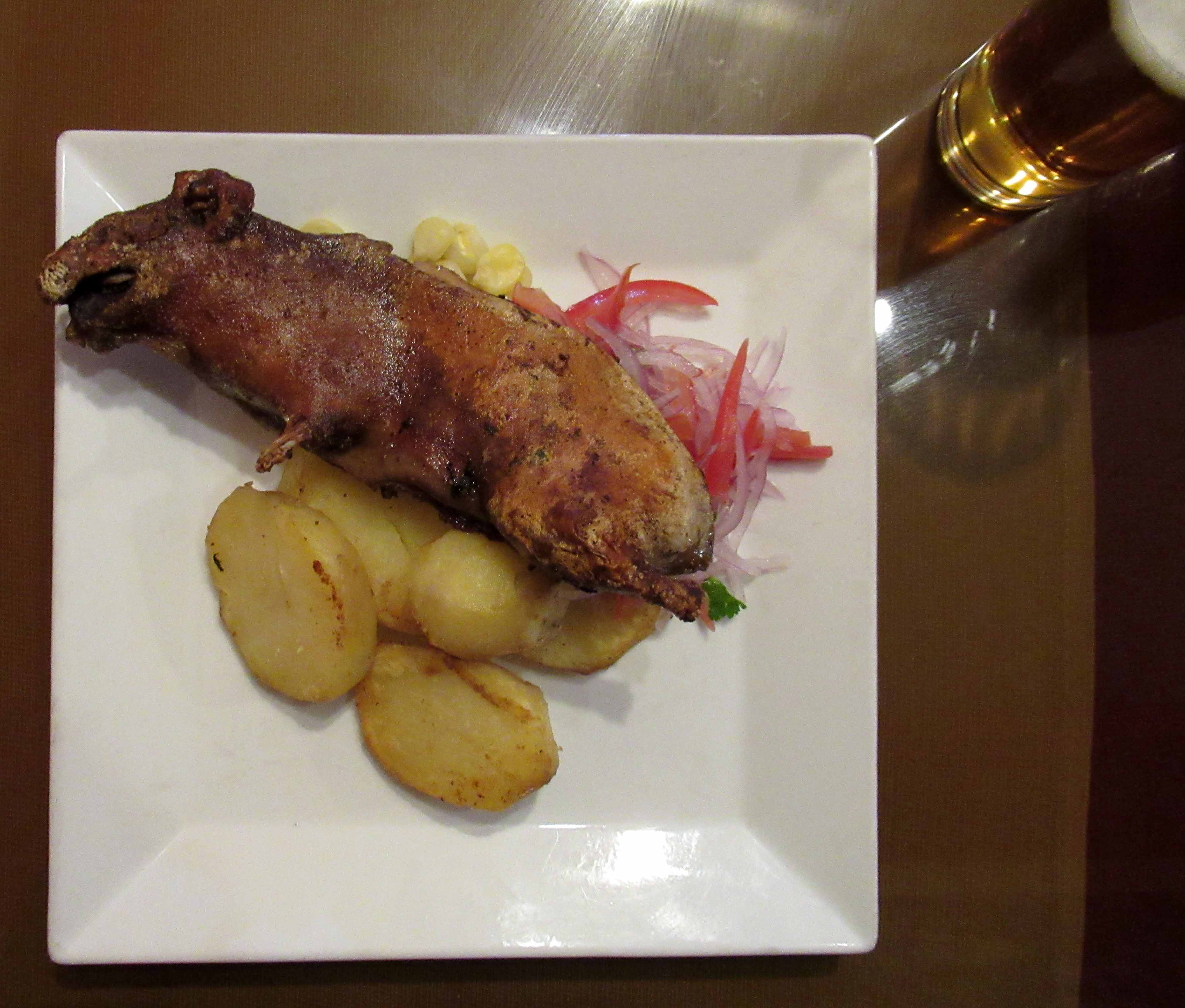
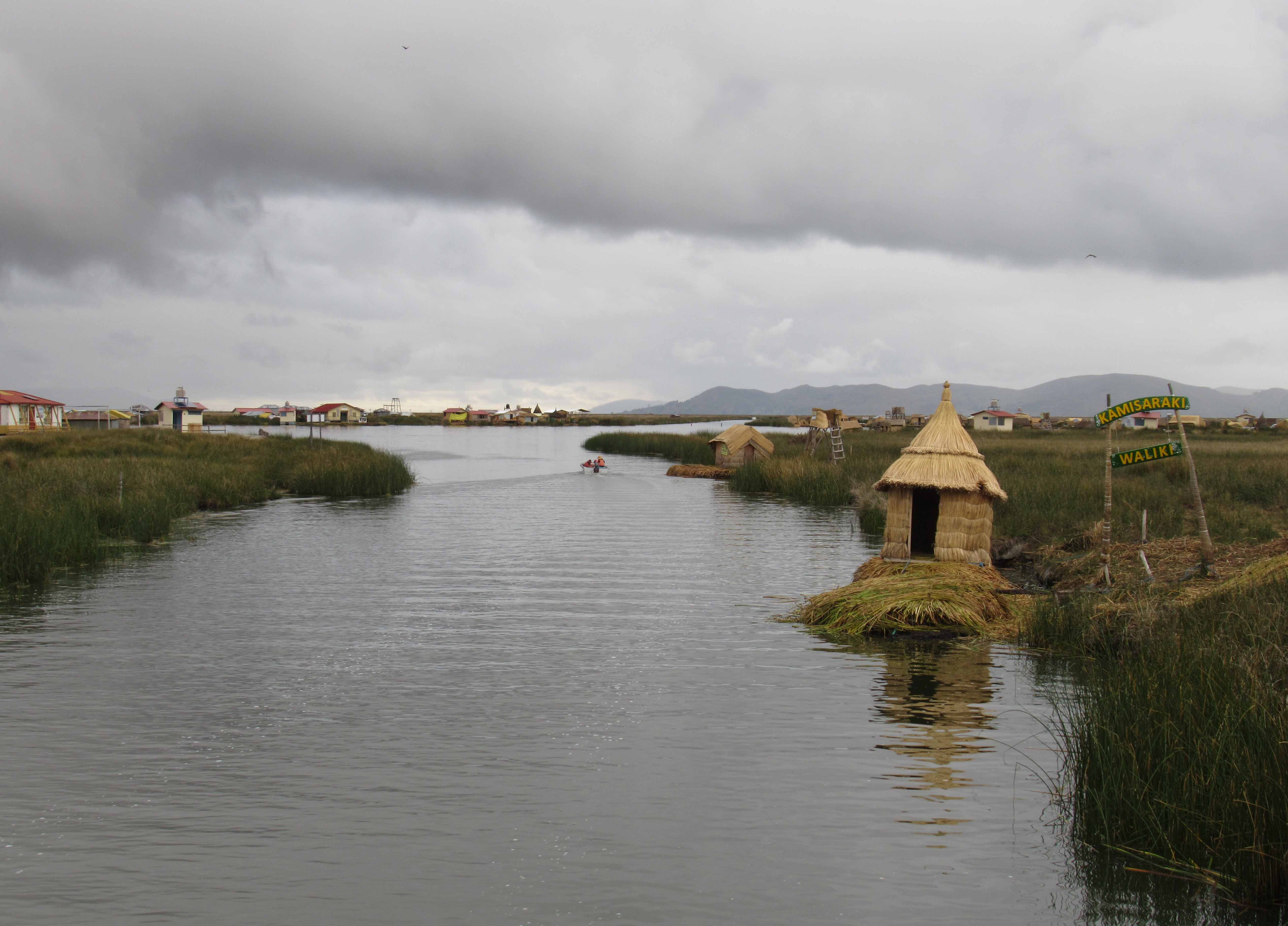
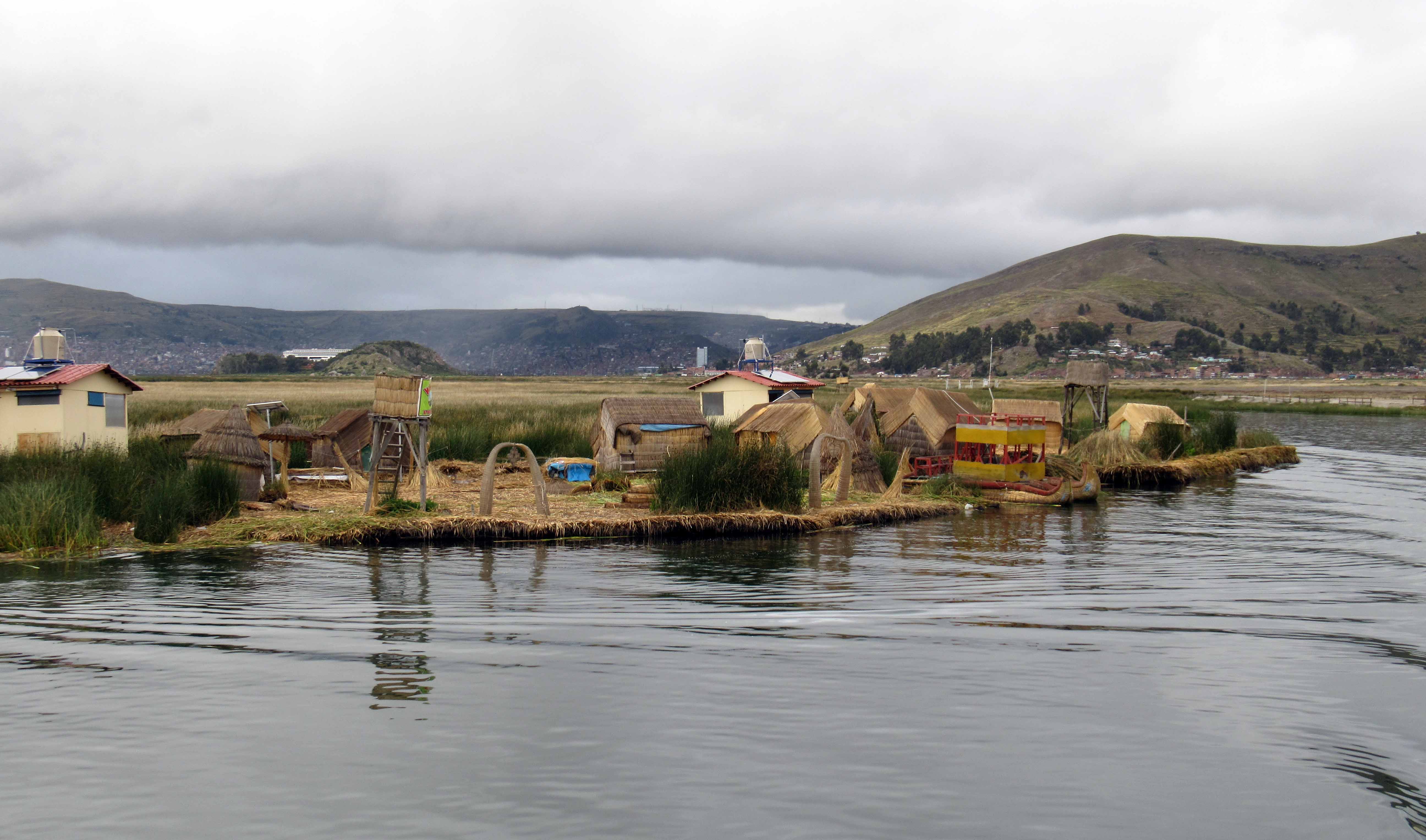
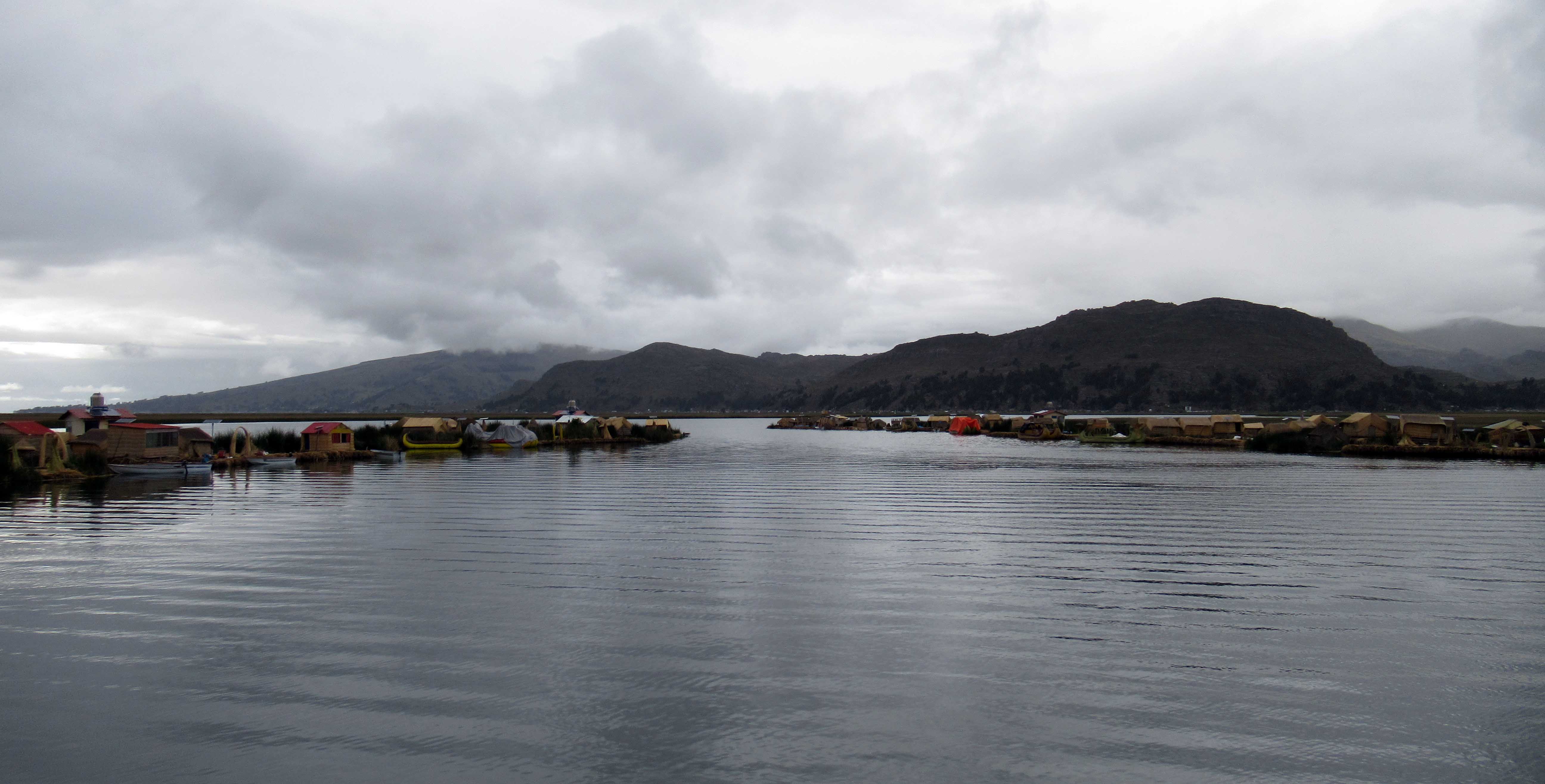
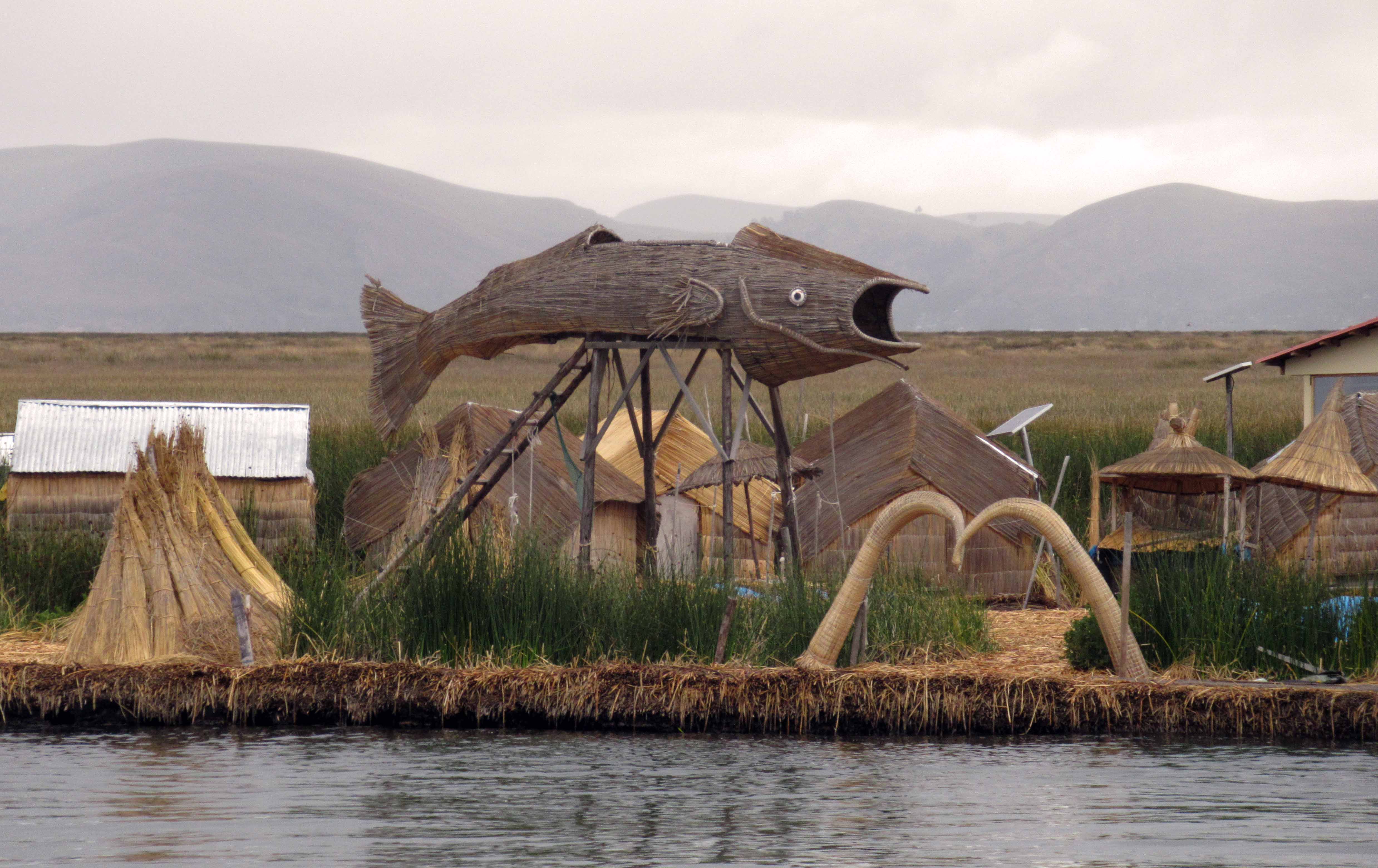
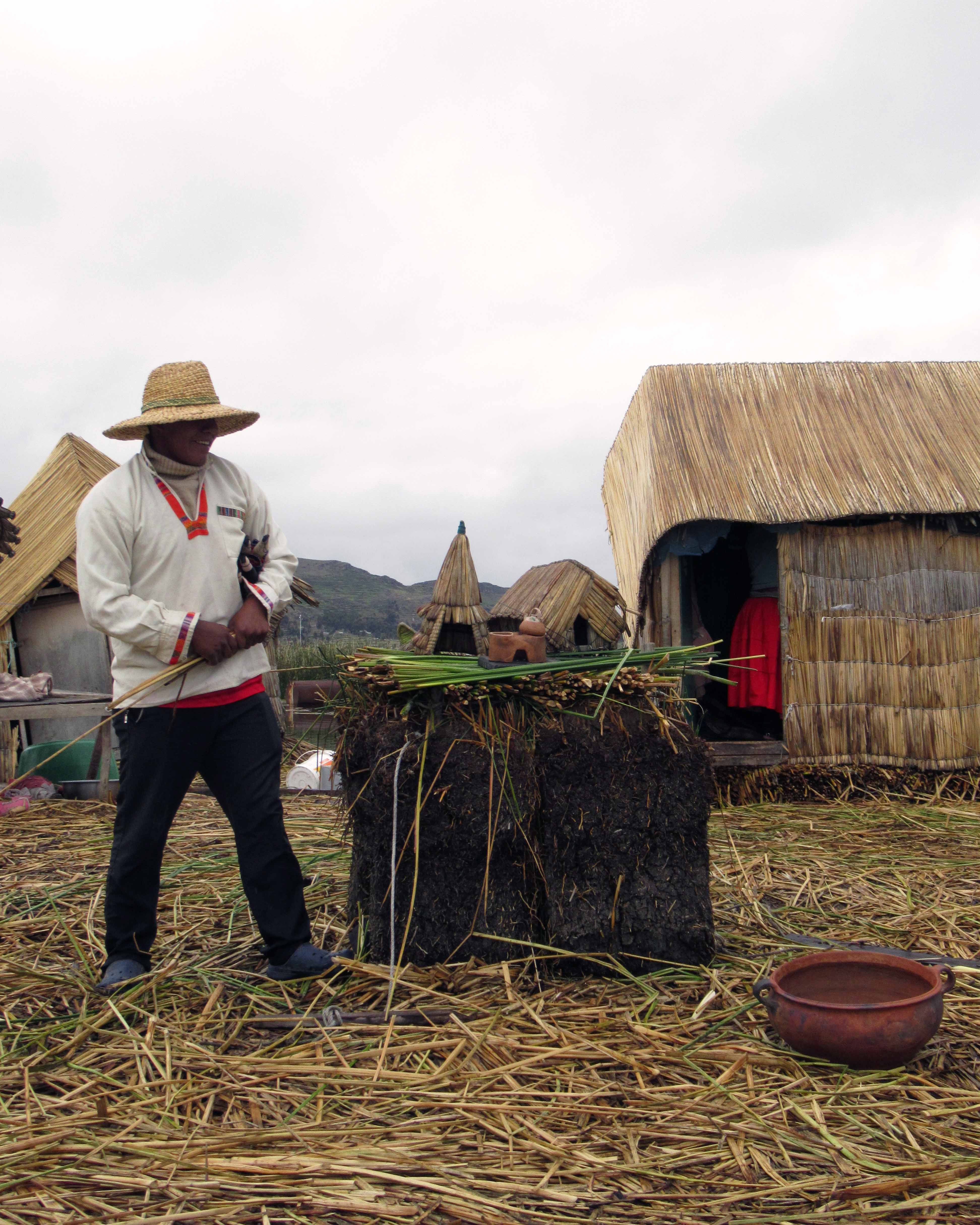
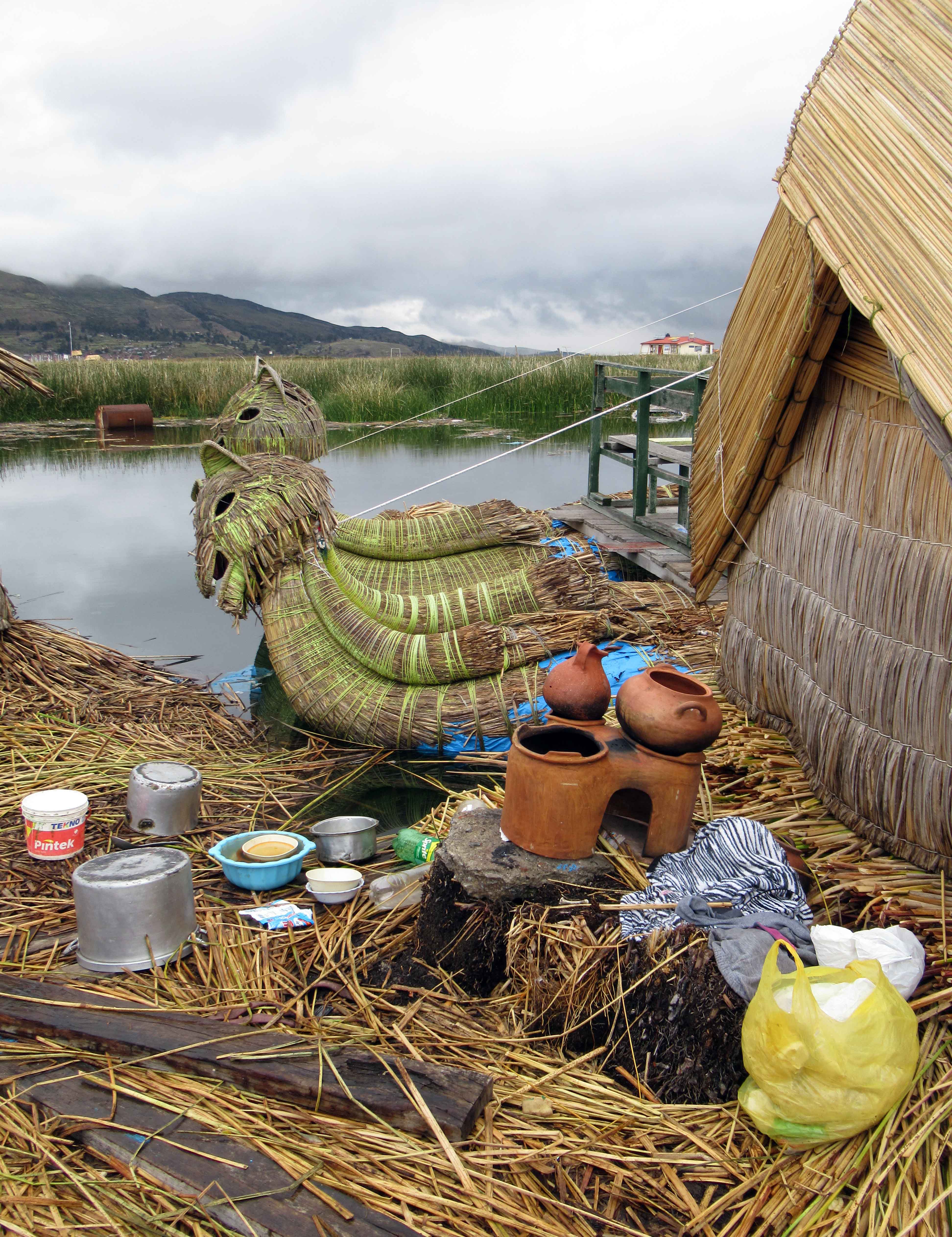
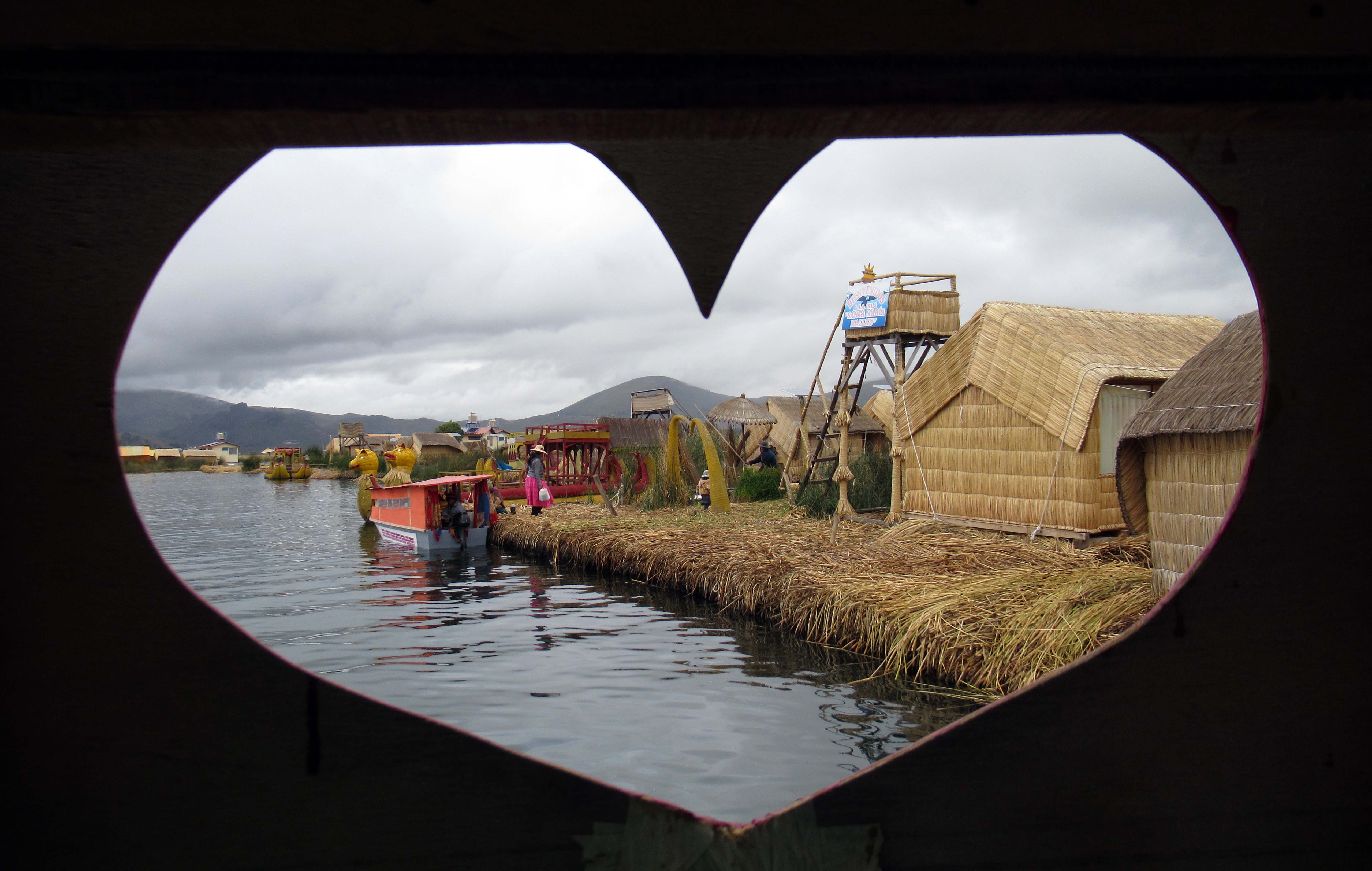
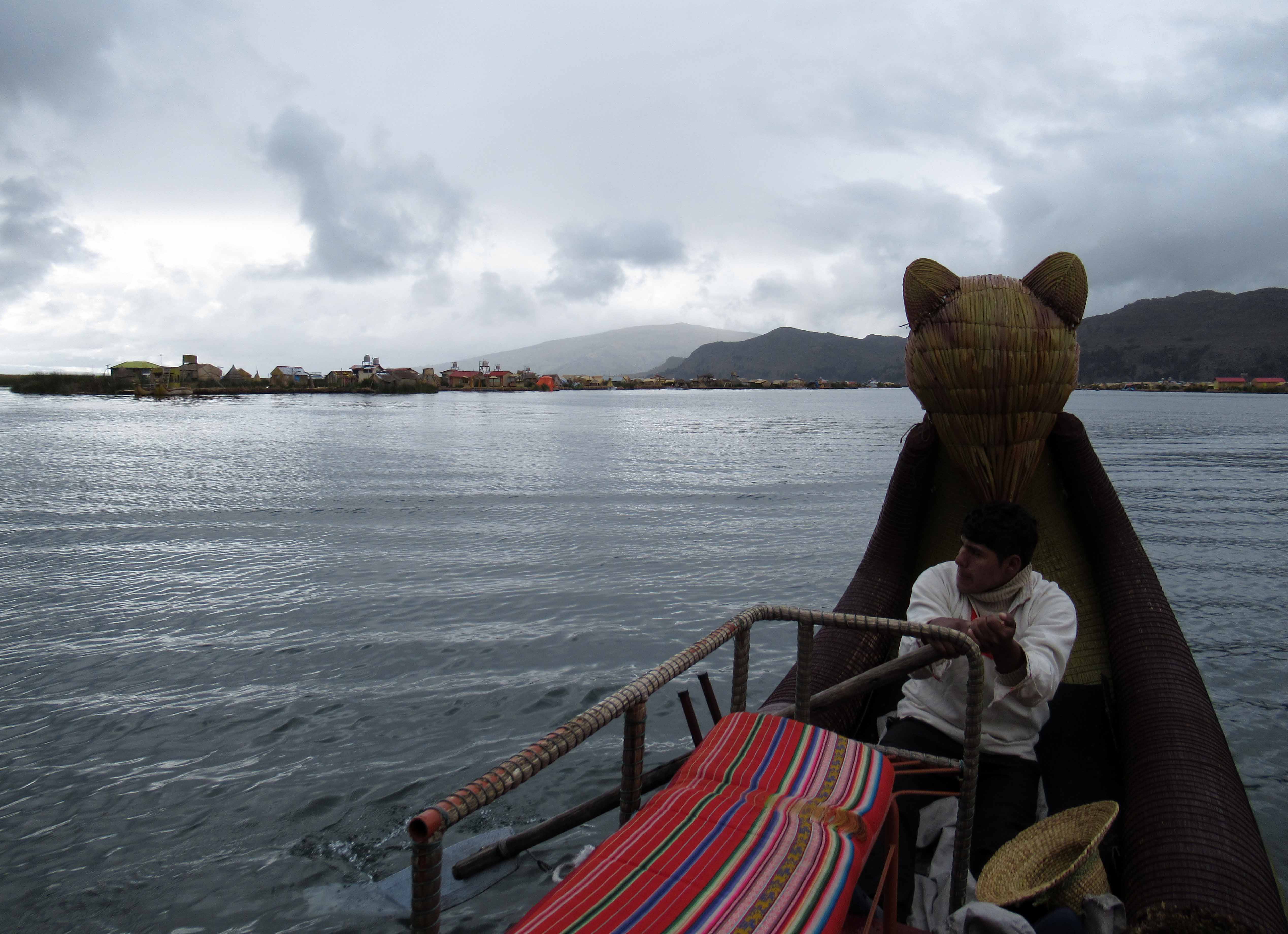
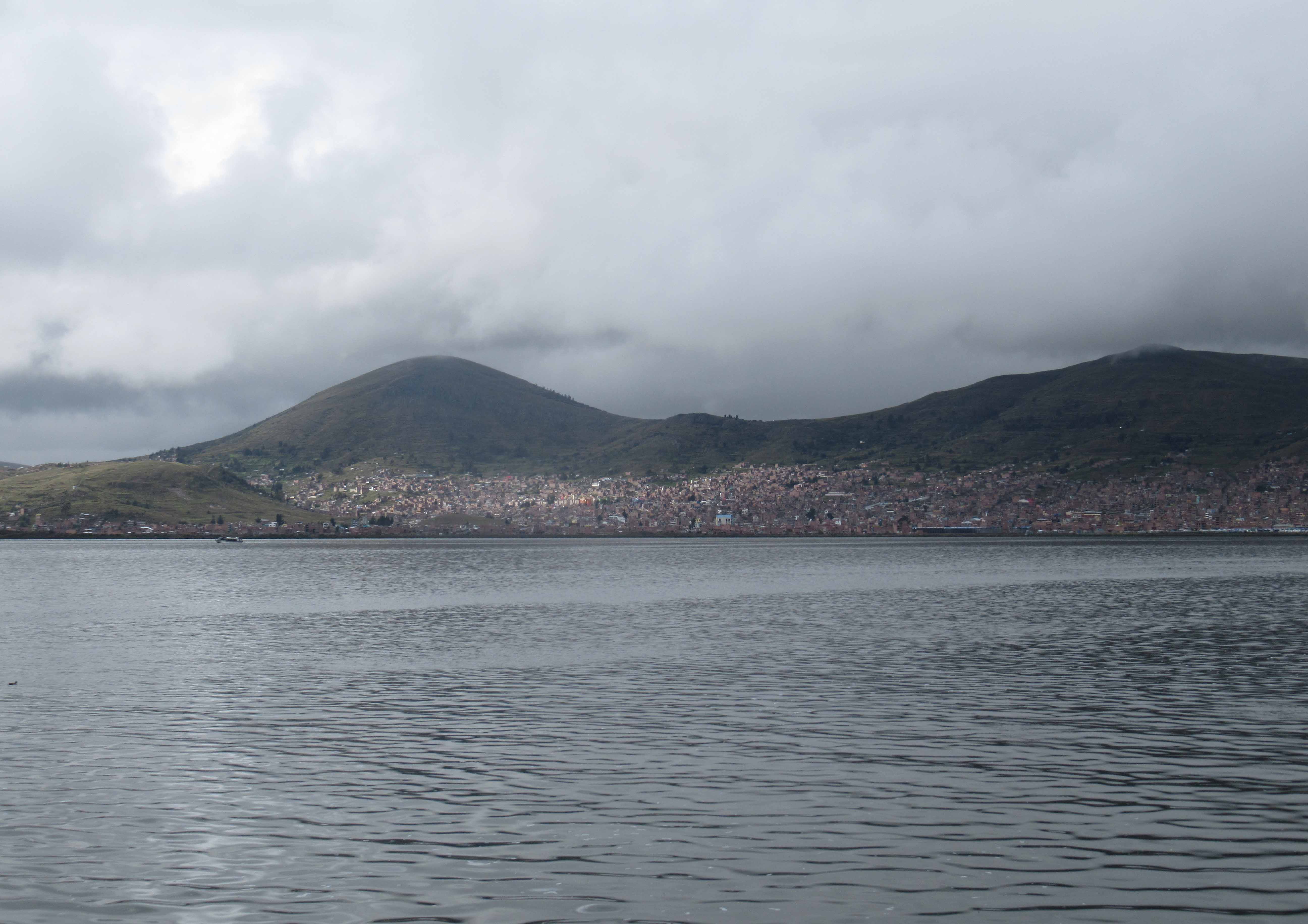
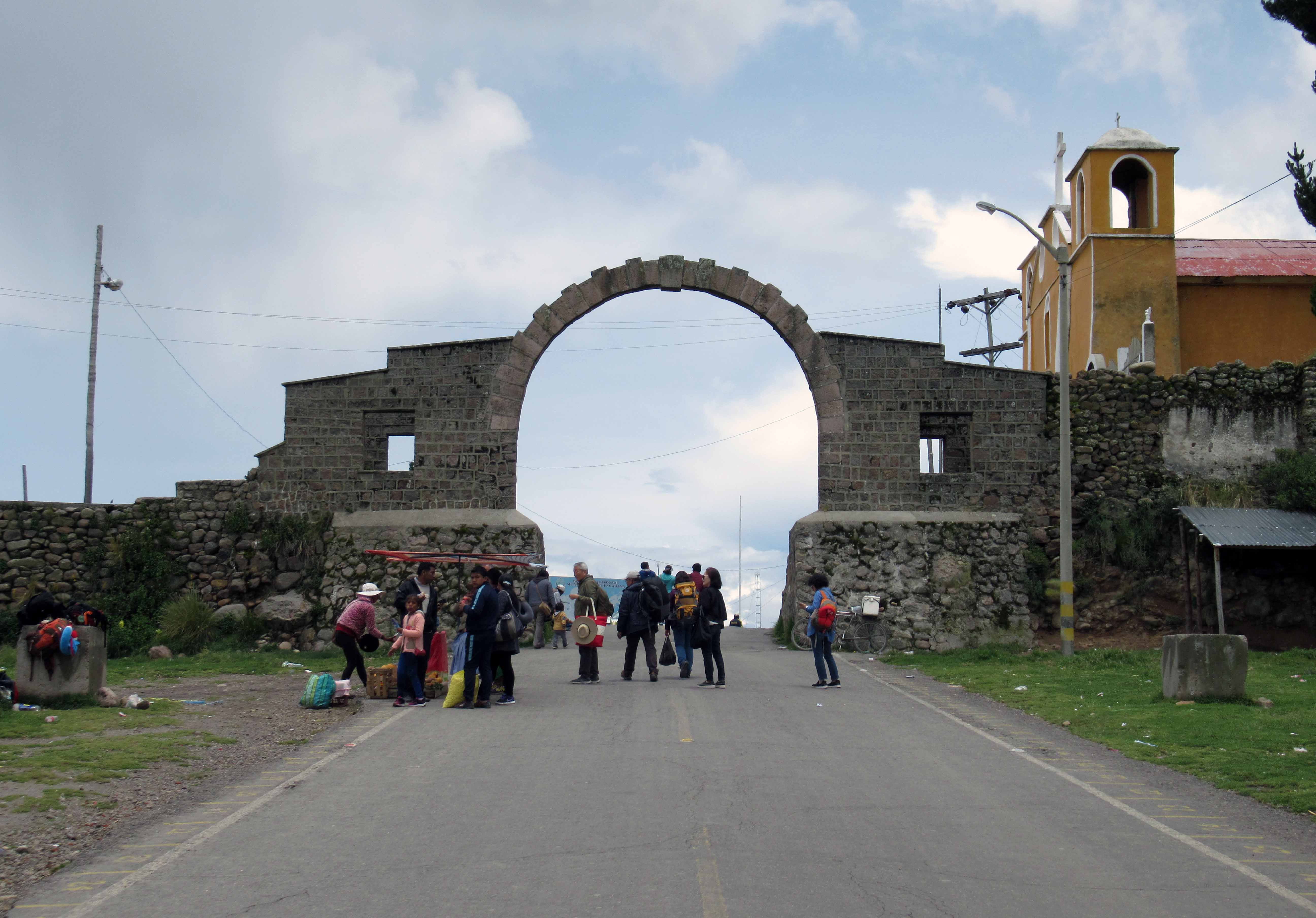
Changing of the Guard Ceremony in front of the Government Palace of Peru; also known as the “House of Pizarro”, the Government Palace is the seat of the executive branch of the Peruvian Government, and the official residence of the President of Peru.Fountain in the center of Plaza de Armas de Lima.Basilica Metropolitan Cathedral of Lima and Primate of Peru (also known as “Lima Metropolitan Cathedral”), which was completed in 1797 AD.Relics of Saint Martin de Porres (1579-1639 AD) in the Basilica and Convent of Santo Domingo.Altarpiece and apse of the Basilica and Convent of Santo Domingo.Rimac River in Lima with Rayos de Sol Bridge in the distance.Cerro San Cristóbal, a mountain that lies to the northeast of the historic city center of Lima.Pasaje Piura in Lima.Inside the Biblioteca Mario Vargas Llosa.Basilica and Convent of San Francisco of Lima.Five different Pisco drinks during the tasting after the walking tour in Lima.Another view of the fountain in Plaza de Armas de Lima with the Government Palace in the background.Façade for the Basilica and Convent of Nuestra Señora de la Merced, which was founded in 1535 AD and completed in 1765 AD.Plaza San Martín.Supreme Court of Peru.Church of the Sacred Hearts of Jesus and Mary.Lomo Saltado – a Peruvian stir fry of beef, onions, and tomatoes, served with French fries and rice, as well as three sauces.Bottle of Peruvian Cabernet Sauvignon.Straight Pisco and a Pisco Sour.Meal of sliced sausage and fries with a fried egg on top, as well as a Pisco Sour on the side.Beach at Paracas.Peruvian coast near Paracas, seen on the boat ride to Ballestas Islands.El Candelabro – a 170 by 85 meter prehistoric geoglyph made in the sand on the Paracas Peninsula; the date it was created is unknown, but pottery dated to 200 AD were found nearby.Natural arch found in the Ballestas Islands (also known as the “poor man’s Galapagos”).Two Humboldt penguins on the Ballestas Islands.Watching another tour boat through a natural arch in the Ballestas Islands.Remnants of a once prosperous guano collection company on the Ballestas Islands.Sea Lions on the Ballestas Islands.Birds hanging out on the islands.Bird flight path from the islands.Sea lions hanging out on a beach in the Ballestas Islands.Spicy ceviche with roasted kernels of corn and slices of sweet potato.Oasis at Huacachina.Sand dunes at Huacachina.More sand dunes around Huacachina.Sand dunes towering over the oasis.Sand being whipped off the crest of the dune by the wind.Neighborhood in Ica (the large city next to Huacachina), seen from the large dune north of the oasis.Viewing Huacachina from the tall sand dune north of the oasis.Looking toward the setting sun from Huacachina.Farm land and mountains seen during the drive to Nazca.‘Árbol’ (“Tree”) – one of the geoglyphs that make up the Nazca Lines – seen from the roadway near the Mirador De Las Líneas De Nazca observation tower.Six-passenger airplane ready for the flight tour to observe the Nazca Lines at the Aeropuerto María Reiche Neuman in Nazca.‘Ballena’ (“Whale”) of the Nazca Lines; these geoglyphs were created between 500 BC and 500 AD.Trapezoids – like the other Nazca Lines, these geoglyphs are typically 10 to 15 centimeters deep and were made by removing the top layer of reddish-brown iron oxide-coated pebbles to reveal a yellow-grey subsoil.‘Mono’ (“Monkey”) geoglyph; no one knows why the Nazca Lines were created, but one hypothesis is that they were art created specifically for the deities in the sky.‘Colibrí’ (“Hummingbird”).‘Araña’ (“Spider”).‘Cóndor’ (“Condor”).The roadway and the Mirador de las Líneas de Nazca observation tower, with the following Nazca Lines geoglyphs visible: ‘Lagarto’ (“Lizard”), ‘Árbol’ (“Tree”), and ‘Manos’ (“Hands”).Cantalloc Aqueducts, which were built by the pre-Inca civilization of Nazca around 500 AD.Los Paredones – an Incan site that dates back to the 15th-century AD.Mummy and burial goods in Chauchilla Cemetery.Two more mummies, some other bones, and more burial goods on display in the cemetery.Close-up of a mummy with its sun-bleached bones; Chauchilla Cemetery was used for burials from roughly 200 to 800 AD by the Nazca culture.Another mummy with various unearthed bones and artifacts laid out next to it.Three more mummies in Chauchilla Cemetery; the dry climate of the desert, as well as Nazca funerary rites of covering the bodies in embroidered cotton, painting the skin with a resin, and placing the bodies in mud-brick tombs all contributed to helping preserve the mummies.Sechura Desert landscape, seen from Chauchilla Cemetery.Another unearthed tomb with a mummy and burial objects displayed inside it at the Chauchilla Cemetery.Mummy on display inside the small museum at Chauchilla Cemetery; this one still has dried skin covering most of their legs.Close-up of the feet of an infant mummy that still has much of its skin and toenails intact (seen in the small museum at Chauchilla Cemetery).Inca Kola – a very sweet soda that tastes similar to bubblegum.Portal de San Agustín, on the western side of Plaza de Armas de Arequipa.Basilica Cathedral of Arequipa, which was originally completed in 1656 AD.Painting inside the Basilica Cathedral of Arequipa that depicts Christ squeezing grapes and bleeding into a chalice to produce the Eucharistic sacrifice of His Blood.Interior of the Basilica Cathedral of Arequipa.Organ inside the Cathedral.Sculpture of the devil at the base of the Cathedral’s pulpit, which was made by Charles Buisine-Rigot in 1879 AD.Bishop vestments with the image of a mother pelican feeding her chicks with her own blood in a time of famine to prevent starvation – a common image that symbolizes the Eucharist and Christ’s sacrifice for our redemption.View of Arequipa from the Cathedral’s rooftop.Bell towers seen from the Cathedral’s roof.View of Plaza de Armas Arequipa from the Cathedral’s roof.Façade of the Basilica Cathedral of Arequipa, which was largely made with white sillar (a variety of rhyolite) like most colonial buildings in Arequipa.Fountain in Plaza de Armas de Arequipa.Iglesia de la Compania de Arequipa (“Church of the Jesuits in Arequipa”), which is a Peruvian Baroque church from the 17th-century AD.One of the courtyards in Santa Catalina Monastery, which is a monastery of nuns of the Dominican Second Order.Life-size diorama of the Last Supper inside the monastery.Room inside the monastery.Statue of Christ inside one of the chapels.Another courtyard in the Santa Catalina Monastery; the buildings inside the monastery date from the 16th- to 20th-century AD.Blue passageway to the Orange Tree Cloister inside the monastery.Wood-fired oven inside one of the kitchens in the monastery.Red painted alleyway in the monastery.Another colorful passageway in the monastery.Toilet with a removable chamber pot.Portrait of María de Guzmán, who became a nun after her husband died when she was 30 and childless; she founded this monastery in the late 16th-century AD.Discipline (i.e. a small scourge) used for penance by Sister Ana de los Ángeles Monteagudo.Another red painted path in the monastery.Portrait of Sister Ana de los Ángeles Monteagudo.‘Veronica’ by an anonymous painter of the Cusqueña School (early 18th-century AD).‘Lagar Divino’ (“Divine Winery”) by an anonymous painter of the Cusqueña School (18th-century AD).Potted plant found in the Santa Catalina Monastery.Dinner of aji de gallina (chicken cooked with yellow chili peppers, walnuts, spices, turmeric, and garlic, served with two olives, boiled potatoes, rice, and tomato slices).Coca leaves for making tea.Rio Colca and terraced farmland in the Colca Valley.Church of Santa Ana in the small village of Maca.Interior of the Church of Santa Ana.Statue on one of the altarpieces inside the Church of Santa Ana.Another view of the Colca Valley.More of the terraces in the Colca Valley.Looking down at the Rio Colca.View of the opposite mountainside in Colca Canyon, which is one of the deepest canyons in the world with a depth that varies between 1,000 to 2,000 meters.Cactus flower.Another view of Colca Canyon.Yet another view of Colca Canyon, taken near the Mirador Cruz del Cóndor observation deck.Snow on top of the peaks over Colca Canyon.One final view of the impressive Colca Canyon.Condors near their nesting area in Colca Canyon.Sankayu – a cactus fruit.View of Colca Valley, taken near the roadside vendors selling sankayu and Pisco Sours.Hot Springs alongside the Rio Colca, just west of the town of Yanque.One last view of Colca Valley.Piece of Chachacoma plant, which can help alleviate altitude sickness by making a tea or inhaling its aromas.Alpacas in the Salinas Reserve.Mountains viewed from the roadside near Salinas Reserve.Vicuñas – a type of wild alpacas.Peruvian flag at a roadside stop in Patahuasi.Basilica Cathedral of Arequipa at night.Dinner of alpaca tenderloin smothered in a sauce, with shrimp, chips, lettuce, and tomatoes.Misti Volcano, seen from Arequipa.Pinkish desert near the north of Arequipa, seen from the bus ride to Cuzco.Another view of the desert landscape near Arequipa.Overlook at Lake Lagunillas.River flowing through the village of Marangani.Dinner consisting of noodles with tomato sauce, beef stew, chicken stew, steamed carrots and green beans, a fried vegetable medley, and coca tea.Coca leaf candy.Plaza de Armas de Cuzco with Cuzco Cathedral on the other side.Another view of Cuzco Cathedral, which was built on top of the foundation of Kiswarkancha (the Inca palace of Viracocha) and completed in 1724 AD.Church of the Society of Jesus, a Spanish Baroque church built in 1668 AD.Cuesta de San Blas.Part of the wall at Sacsayhuamán – the citadel next to Cuzco that is believed to have been constructed by the Killke around 1100 AD, before the Incans occupied the area and made Cuzco their capital.View of the wall at Sacsayhuamán (sometimes spelled, “Saqsaywaman”).Looking at the stone walls from a vantage point at Sacsayhuamán.Looking toward the rocky mound at Sacsayhuamán, where the Rodadero (or “Suchona”) is located.Remains of Muyuqmarka, the Temple of the Sun, at Sacsayhuamán.View of Cuzco from Sacsayhuamán.Path and portal at Sacsayhuamán.Smaller stones used to restore gaps in the wall that are missing larger stones.Testing if I could slip paper currency between the joining cracks of the huge stones at Sacsayhuamán; sometimes I could (e.g. the left photo) , but other times I could not (e.g. the right photo) – of course centuries have past since these walls were built and some may have settled and widened cracks that were once impenetrable; either way, it is a marvelous feat of engineering for an ancient civilization.Corner section of the wall built with curved stone blocks.Looking up at the lintel in one of the stone portals at Sacsayhuamán.Looking at the three zig-zag walls at Sacsayhuamán, seen from the Rodadero.Qochas Chincanas – the principal temple for worshiping water at Sacsayhuamán.Cut-out made into part of the rock outcrop at Sacsayhuamán.More cut-outs made in to the rock at Sacsayhuamán, in a place known as “Chincana Chica.”Another view of the three zig-zag walls on the terraces at Sacsayhuamán.Peruvian woman wearing a traditional dress and producing llama yarn at Tambomachay.Ruins at Tambomachay, an Incan structure that may have been a military outpost, inn, spa resort, imperial baths, or a religious site.Another view of the main structure at Tambomachay with its spring-fed fountain still flowing.Closer view of the fountain at Tambomachay.Puka Pukara (“red fortress”), which is a fort built by the Incan Empire on a spot that overlooks Cuzco and the valley around the city.Closer view of the reddish walls of Puka Pukara, which may have been built during the reign of Pachacuti, between 1438 and 1472 AD.Portal at Puka Pukara.Monolith at Q’enqo, which is an Incan huaca (“holy place”) where archaeologists believe sacrifices and mummification took place.Cavernous tunnel at Q’enqo with what appears to be two large altars carved into the rock – these may have been used for sacrifices or funerary rites.View of Cuzco (with the Cathedral and Plaza de Armas de Cuzco in sight) from the top of Pukamuqu.‘Cristo Blanco’ (“White Christ”) on top of Pukamuqu.Advertisement for Cusqueña beer.Walking down Pumacurco street, heading back to the historic city center of Cuzco.Calle San Agustin.Fountain at Plaza Limacpampa Chico.Site of Coricancha (“Golden Temple”), which was the most important temple in the Incan Empire, but now all that remains are some ruins with a church (Santo Domingo Convent).Deformed human skulls (from around 1438 AD); the Incas purposely deformed children’s skulls to make them more beautiful.Bronze and silver figure of maize, produced by the Incas (ca. 1438 AD).Façade of the Church of the Society of Jesus.Interior of the Church of the Society of Jesus.View of Cuzco Cathedral, from the Church of the Society of Jesus.Viewing the Plaza de Armas de Cuzco, from the Church of the Society of Jesus.Courtyard inside the Regional Historical Museum of Cuzco.Sculpture of an Incan at the top of the fountain in Plaza de Armas de Cuzco.Market next to Plaza San Francisco.Stir-fry of pork with garlic and vegetables in soy sauce, fried rice, and a stir-fry of fried chicken, pork, pineapple, peach, and fried wanton in a tamarind sauce, as well as a Cusqueña beer (enjoyed at a Chinese restaurant in Cuzco).Three Peruvian craft beers.Gang of stray dogs hanging out at the roundabout in Urubamba (a town in the Sacred Valley).Station at Ollantaytambo with the train to Machu Picchu Pueblo.Statue in Machu Picchu Pueblo (formerly known as “Aguas Calientes”).Plaza Manco Capac with Iglesias Virgin del Carmen to the left.Rio Aguas Calientes.Train tracks in Machu Picchu Pueblo.Urubamba River.‘Origin, Time, and Movement’ by Jacob Sullca Gutierrez (2015-2018 AD) – found in the sculpture garden at Machu Picchu Pueblo.‘Wiracocha’ sculpted by Jimena Medina Astete, Juan Vargas Huaman, and Jhon D. Cansaya Puertas (2015-2018 AD).Another part of Rio Aguas Calientes, which flows right through Machu Picchu Pueblo.Bottle of 2018 Sauvignon Blanc that was produced in the Valle de Ica, Peru.Clouds obscuring the ruins at Machu Picchu, which archaeologists believe was built around 1450 AD, as an estate for the Inca emperor Pachacuti, and abandoned about a century later.Llamas on the terraces at Machu Picchu.More ruins at Machu Picchu shrouded in a light cloud.Steps on the trail to the top of Huayna Picchu (the mountain peak to the north of Machu Picchu).Looking at the trail and peak of Huayna Picchu.View from the trail up Huayna Picchu.Masdevallia veitchiana flowers.Trail leading up to Incan ruins on Huayna Picchu.Machu Picchu seen from the trail on Huayna Picchu.Incan ruins on Huayna Picchu, with the Urubamba River below.Steps built into the walls of the Incan structure.Terraces and ruins on Huayna Picchu.Looking down at Incan steps in the ruins on Huayna Picchu.View of Machu Picchu and the Urubamba River, from Huayna Picchu.Another view of Machu Picchu.Looking down at a bend in the Urubamba River, from the saddle between Huayna Picchu and Huchuy Picchu.Flower that appears to belong to a species from the ginger family.Looking southwest at the Urubamba River from Huchuy Picchu.Machu Picchu seen from Huchuy Picchu.Small and large stones used in the construction of a building at Machu Picchu.Intiwatana Pyramid – also known as the “astronomical observatory.”Residential section of Machu Picchu.View of Huayna Picchu from the buildings in Machu Picchu.Looking down on some more of the residential buildings.Ruins and terraces on the eastern slope of Machu Picchu.Millipede.Looking up at the terraces in the agricultural zone, Guardhouse, and peak of Machu Picchu Mountain (to the south of the site).Another flower seen at Machu Picchu.Storage buildings with thatched roofs – located to the southeast of the site, near the entrance to Machu Picchu.View from the Guardhouse.Ceremonial Rock (also identified as the “Funerary Stone”), located in the upper cemetery by the Guardhouse.View of Machu Picchu from the terraces near the Guardhouse.View of Machu Picchu from near the Main Gate (out of frame, to the left).Inside the Sacred Plaza.Looking up at the steps ascending the Intiwatana Pyramid – viewed from within the Sacred Plaza.Temple of the Three Windows.Looking into a building at the northern end of the site, near the Sacred Rock.Employee conducting maintenance on one of the residential buildings.Steps in the Temple of the Condor.Looking northeast toward Phutuq K’usi Mountain, from the steps near the water fountains at Machu Picchu.Llama resting at Machu Picchu.Another llama seen at Machu Picchu.Passion flower at Machu Picchu.Façade of Iglesias Virgin del Carmen in Machu Picchu Pueblo.Crucifix inside Iglesias Virgin del Carmen.Papa rellena – a popular Peruvian dish of baked potato dough filled with chopped beef, onions, and other filling.Fountain at Orellana Park in Cuzco.Valley near Rainbow Mountain, seen near the Rainbow Mountain Cusipata Trail Parking.Looking at small glaciers and a stream, from the Rainbow Mountain Cusipata Trail.Snow falling on the trail to Rainbow Mountain.Rainbow Mountain – the official name is “Winikunka” or “Vinicunca.”Another view of the often-photographed Rainbow Mountain – although, not very colorful on this day.Mountain peaks near Rainbow Mountain.Boy and his llama posing for a photograph at Rainbow Mountain.More of the colorful rocks on the eastern slope of Rainbow Mountain.Heading back down to the valley to the west of Rainbow Mountain.Looking back at the trail with the mountain saddle (where one views Rainbow Mountain) in the distance.Llama off of the Rainbow Mountain Cusipata Trail.Tourist riding a horse on the trail through a herd of grazing llamas.Another view of the glaciers and stream near Rainbow Mountain.Looking back at the trail to Rainbow Mountain.Passing by a valley stream – viewed from a road near Rainbow Mountain.Incan warriors painted on the side of a building in a community near Rainbow Mountain.Walking up Cuesta de Santa Ana in Cuzco.Pedestrian path in Cuzco.Dinner of fried guinea pig, fried potato slices, corn, onions, tomatoes, and beer.Plaza de Armas de Cuzco in the evening.Entering the floating islands community in Puno Bay in Lake Titicaca.Passing by some floating islands in Puno Bay.Another view of some floating islands, which are inhabited by the Uru people.Giant fish, huts, and islands all made out of reeds.“President” (or “chief”) of this particular floating island explaining how they make the islands out of reed blocks and their way of life.Cooking area on one of the floating islands.Reed hut on a floating island.Looking out from the cabin of a reed boat.The floating island “president” rowing his reed boat through the Uru community.Puno, seen from a motor boat on Lake Titicaca.Gateway arch to Bolivia, at the border crossing in Khasani – seen from the Peruvian side.