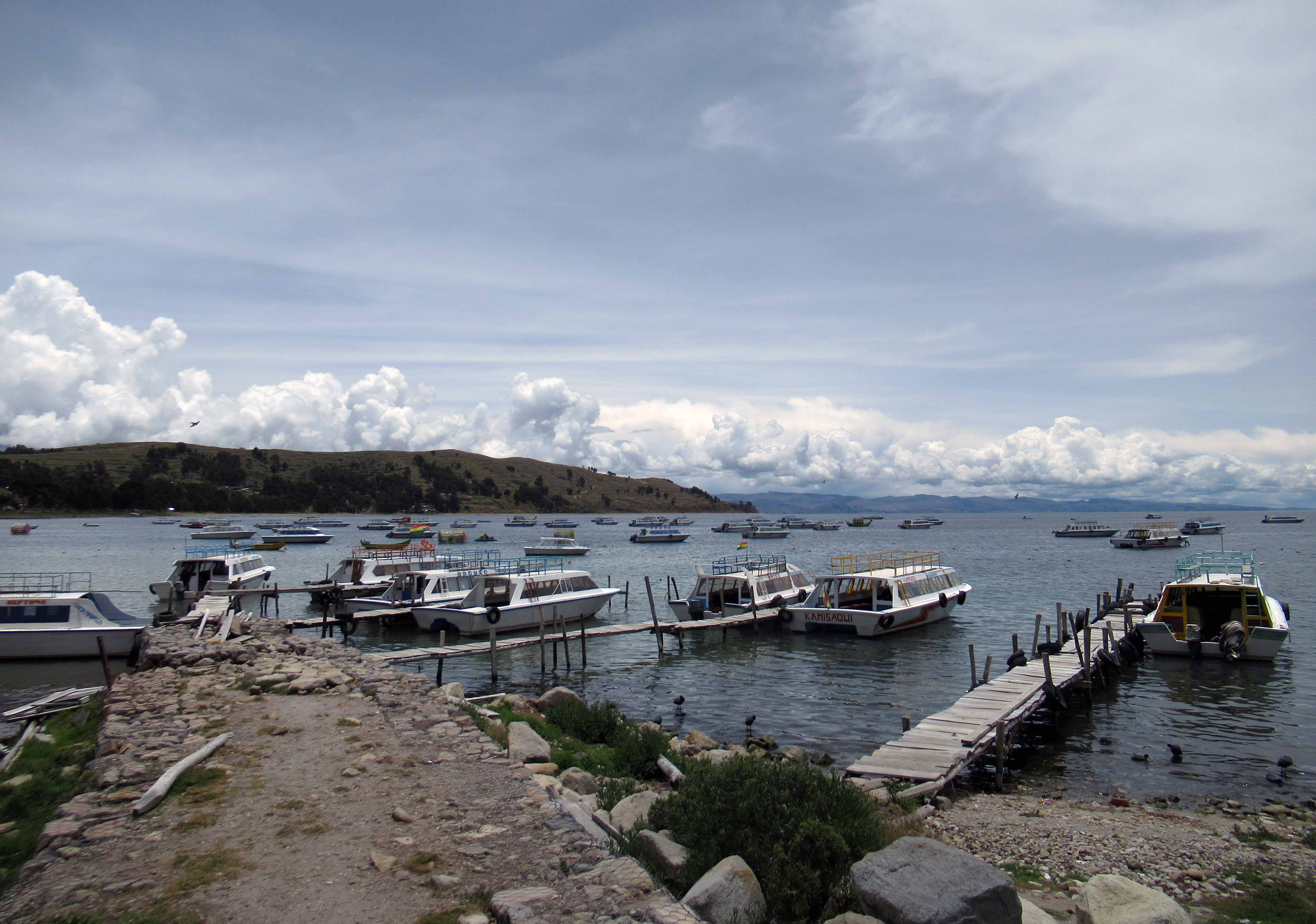
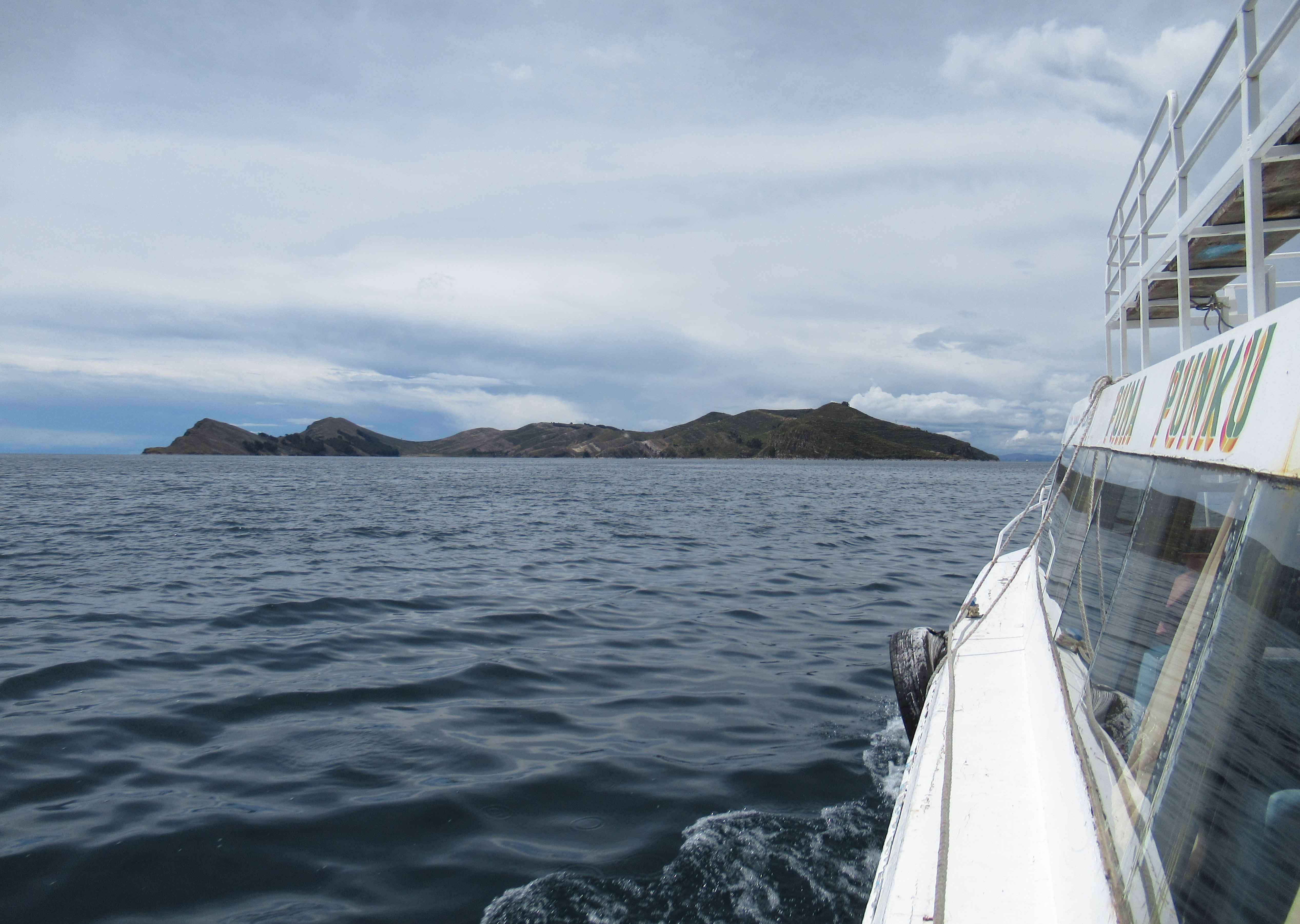
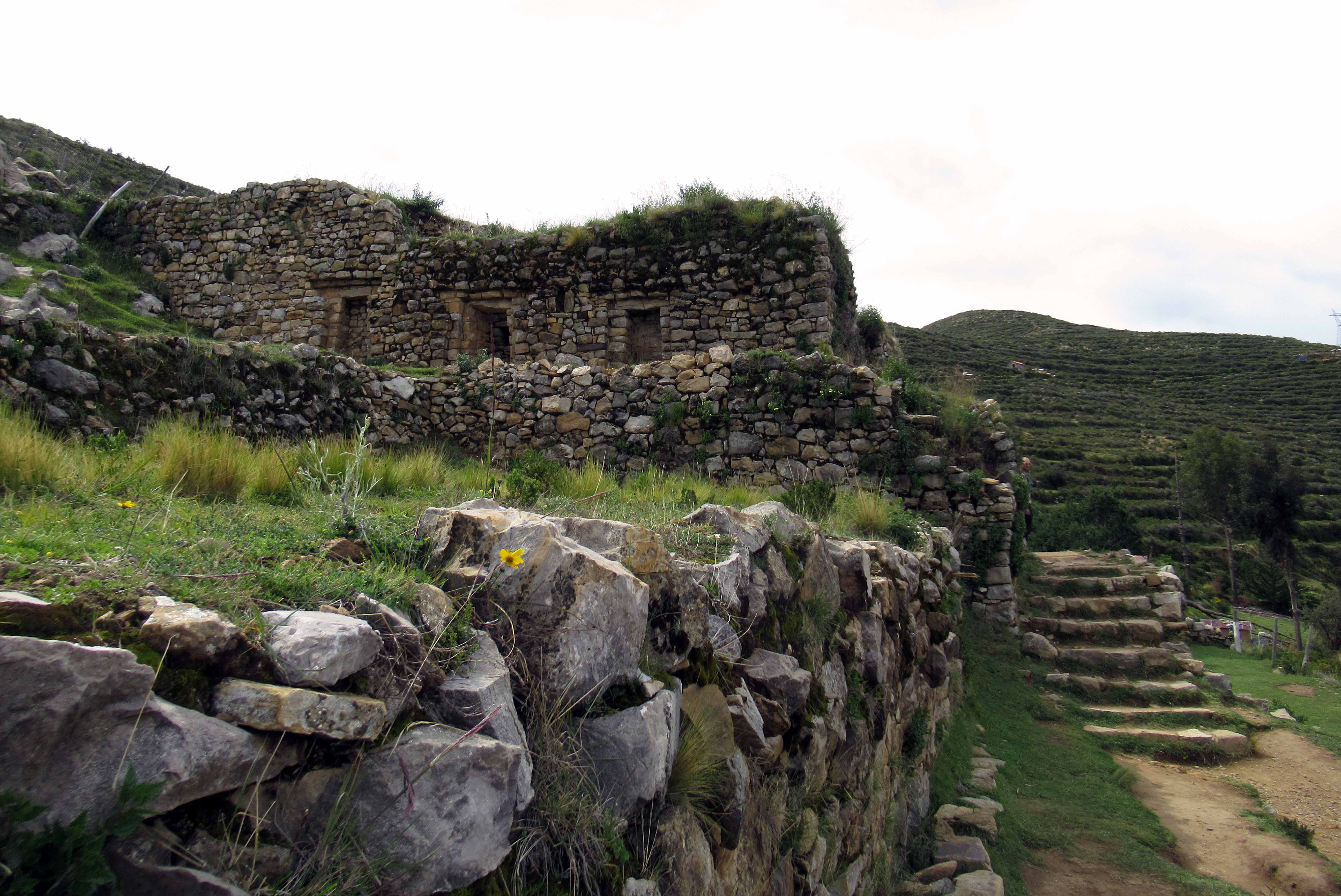
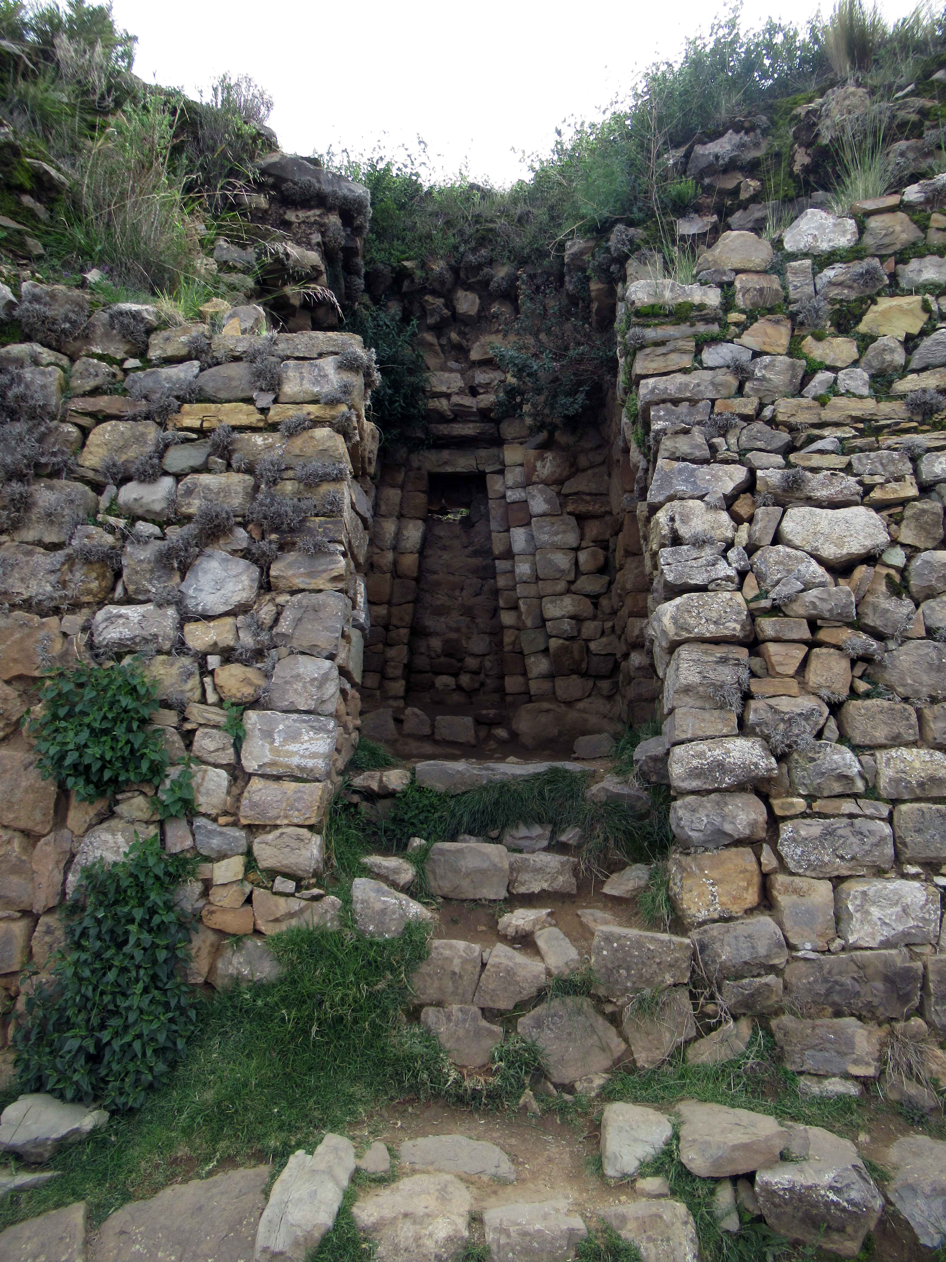
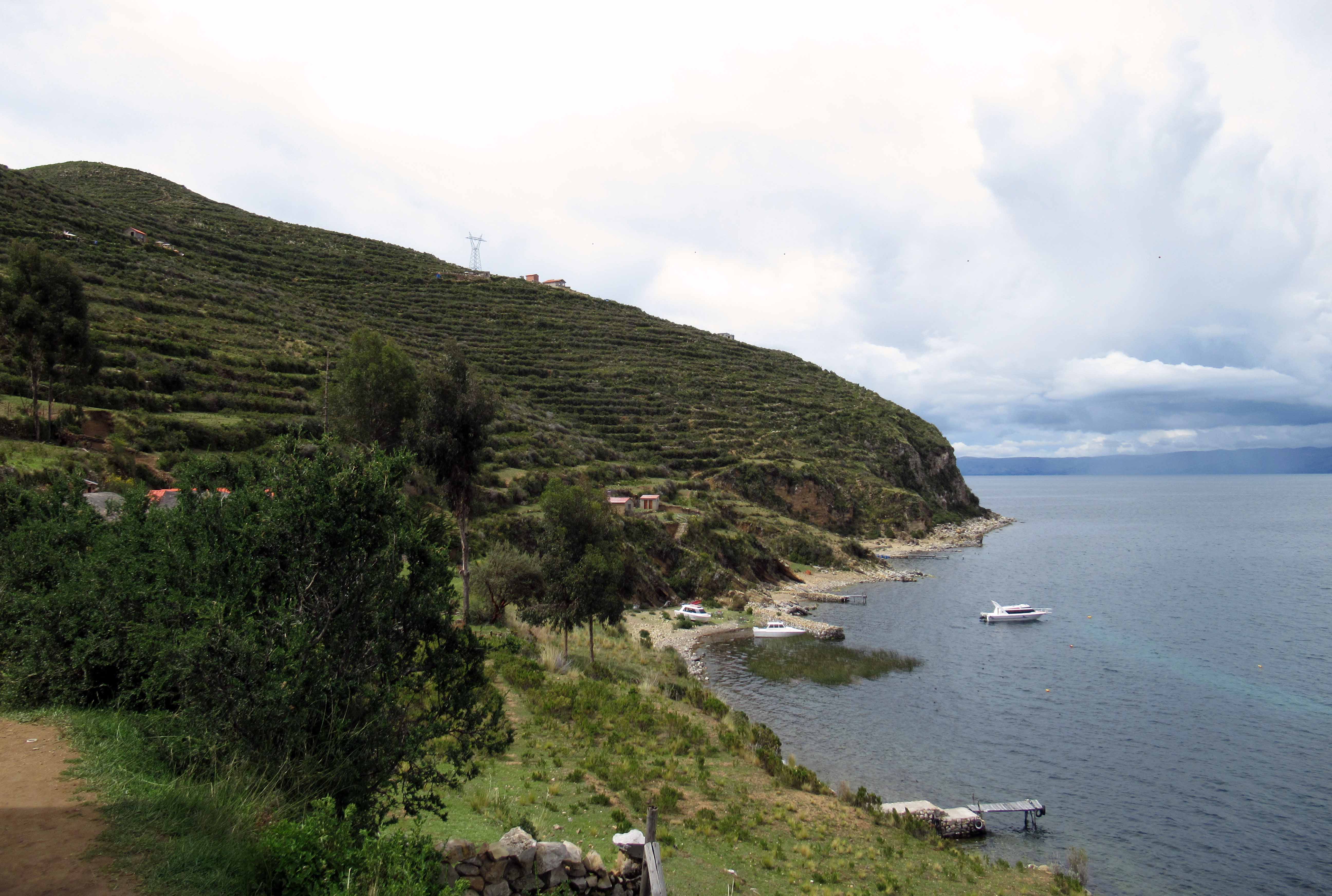
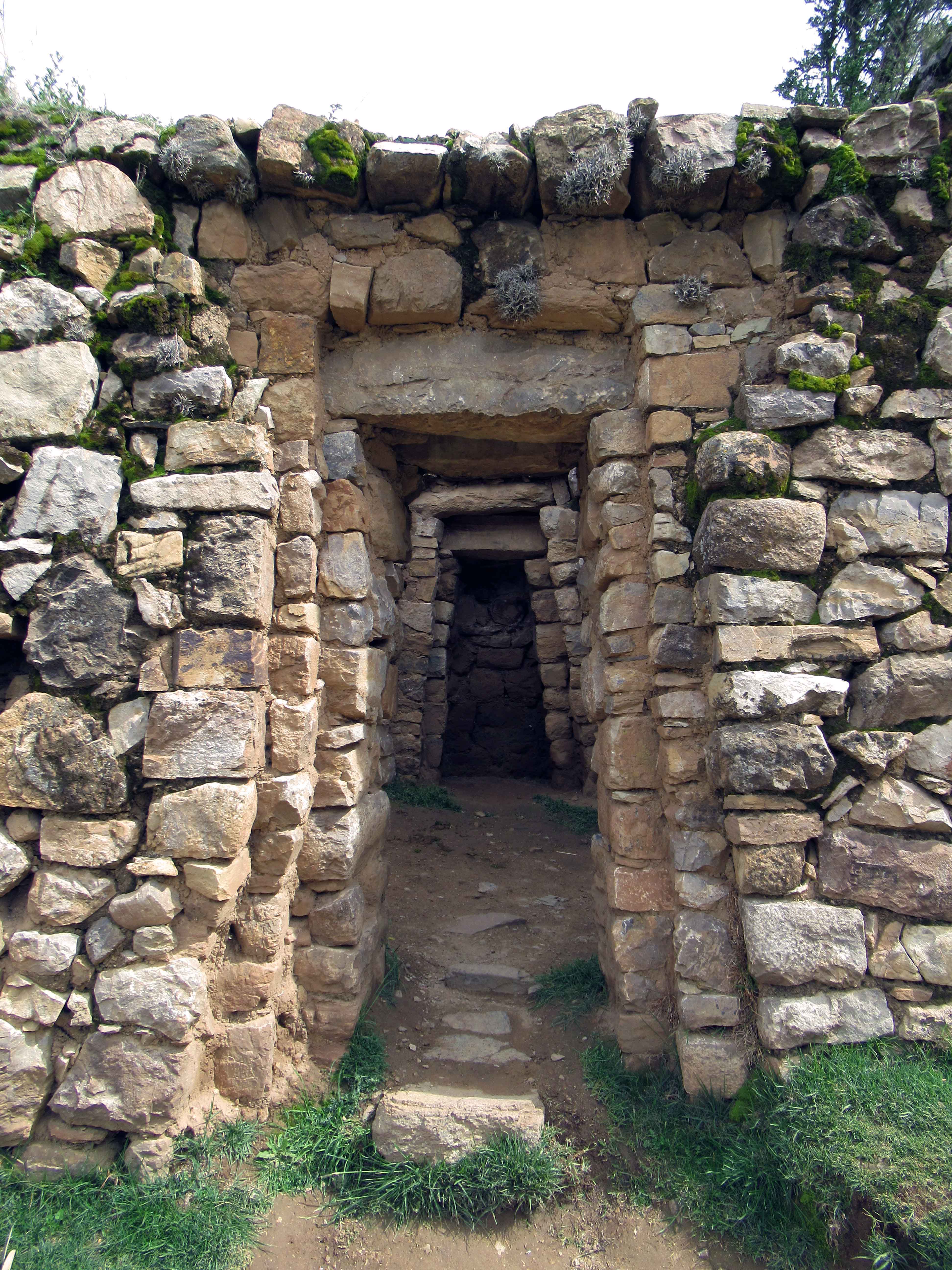
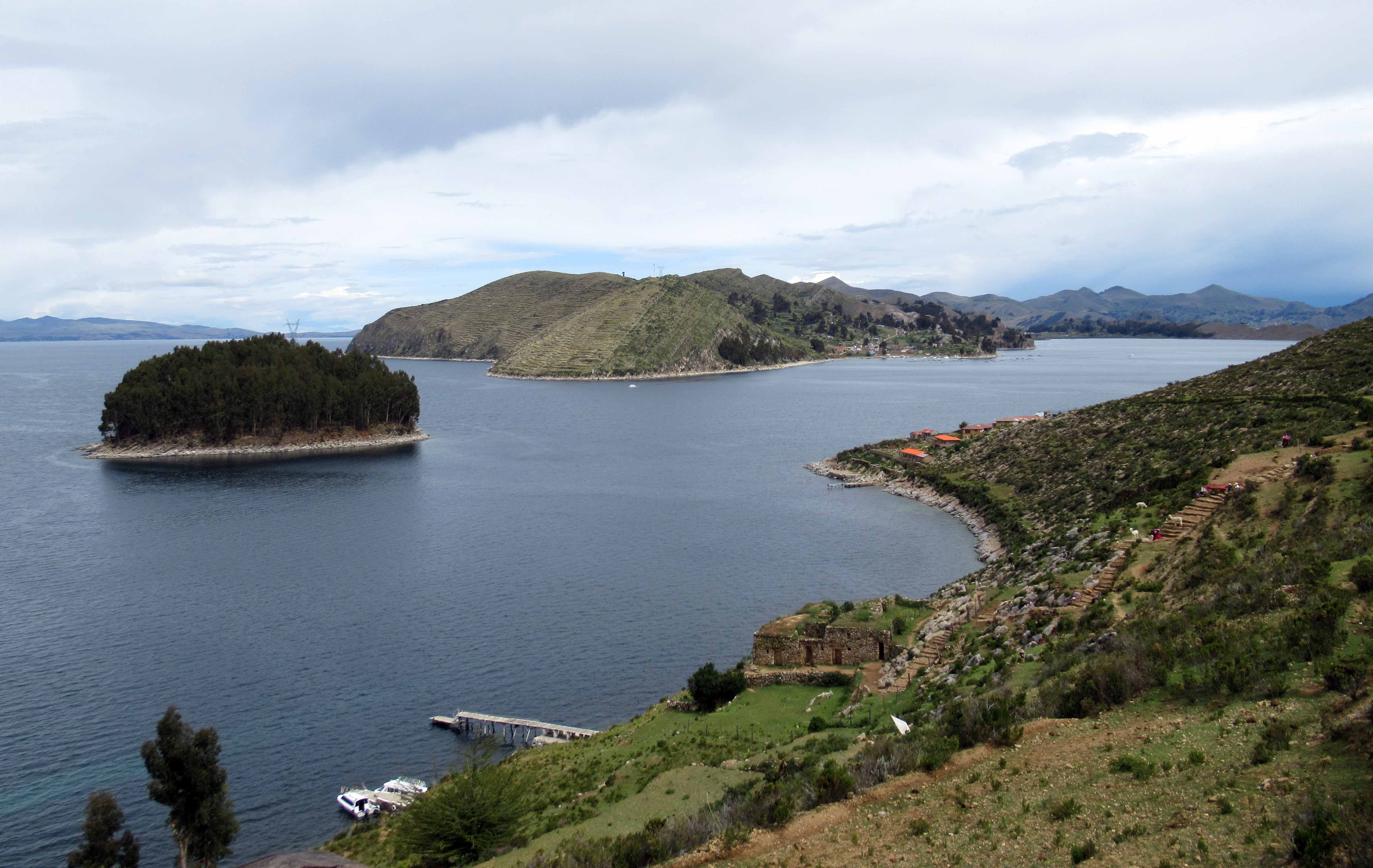
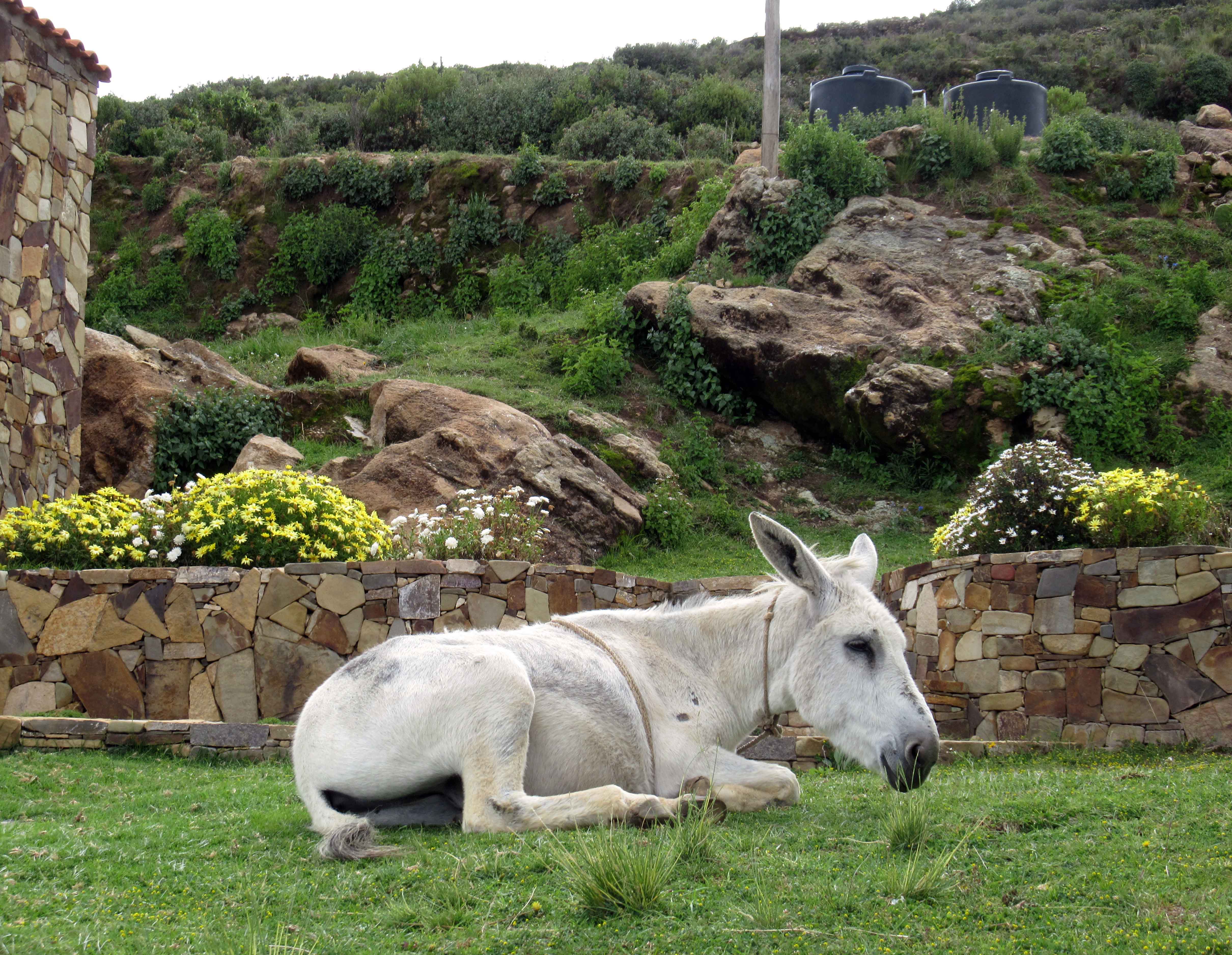
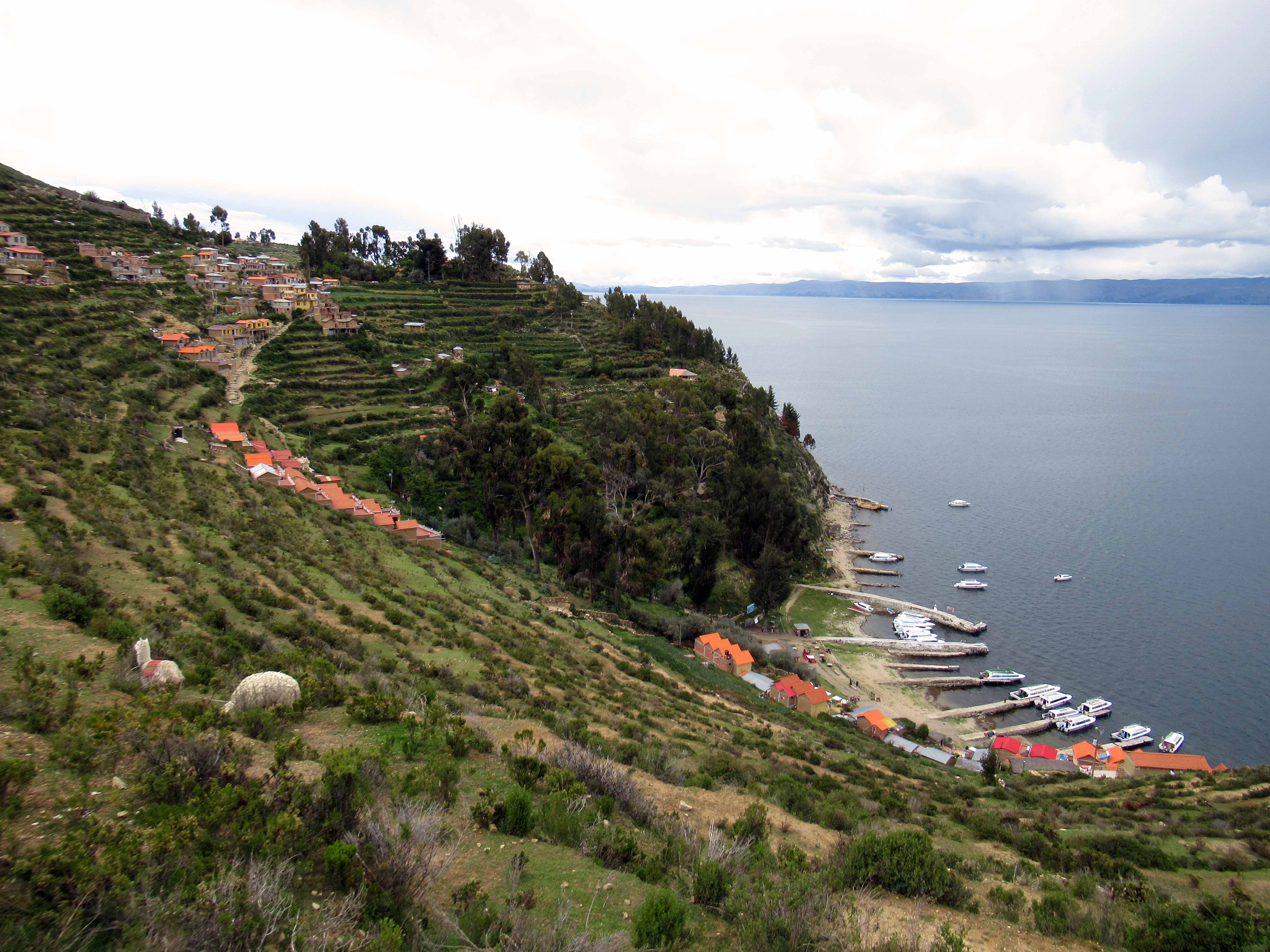
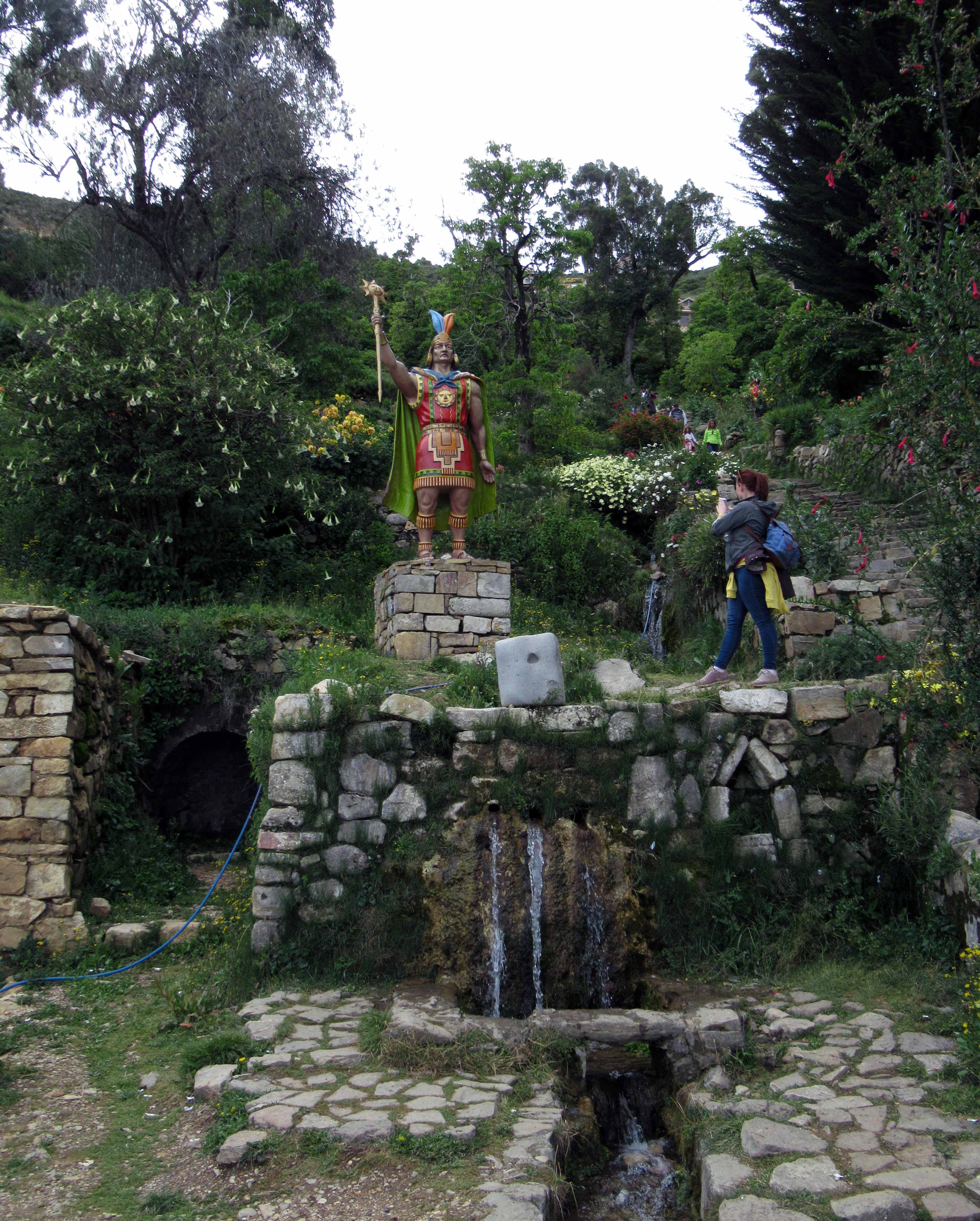
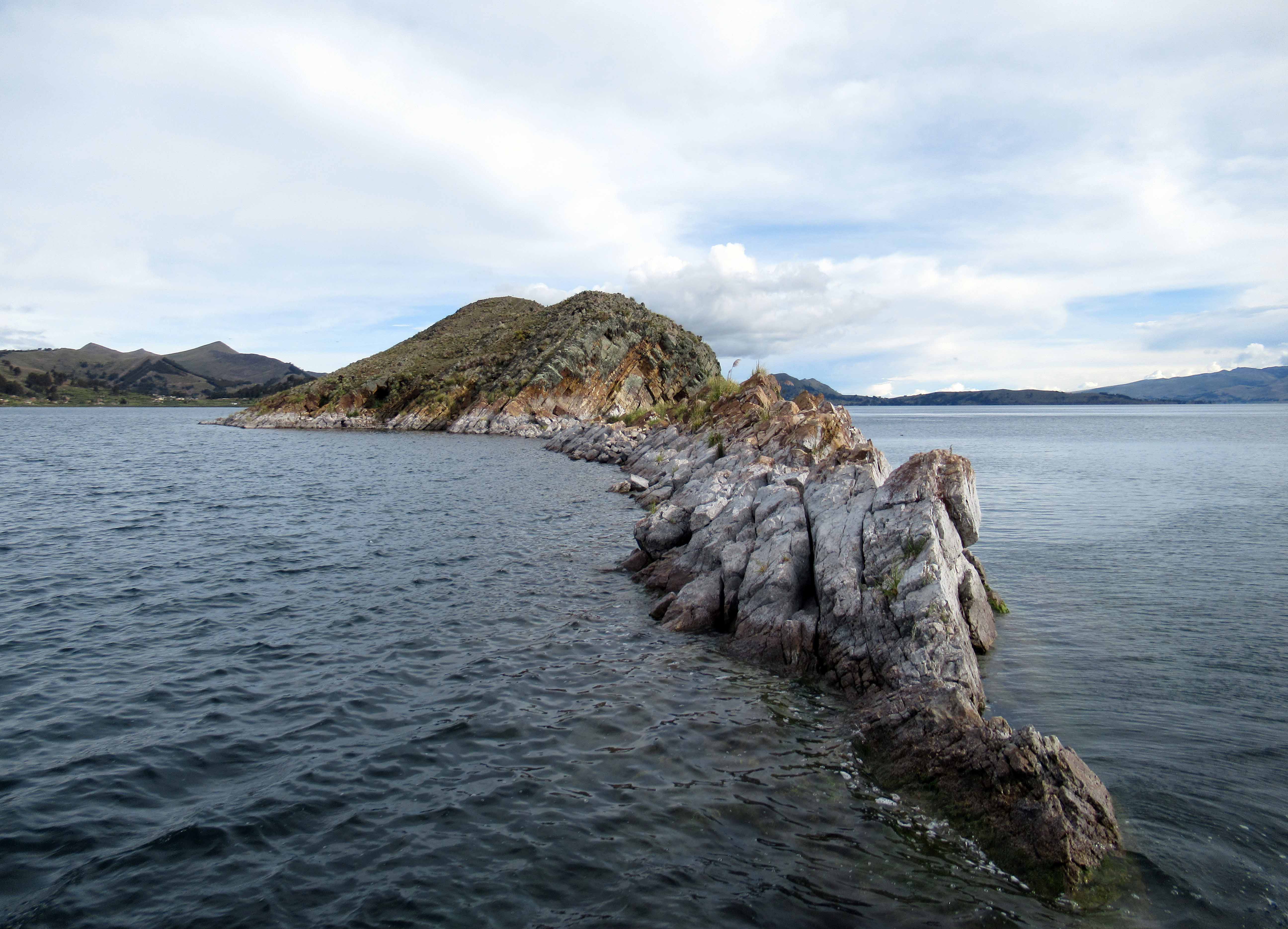
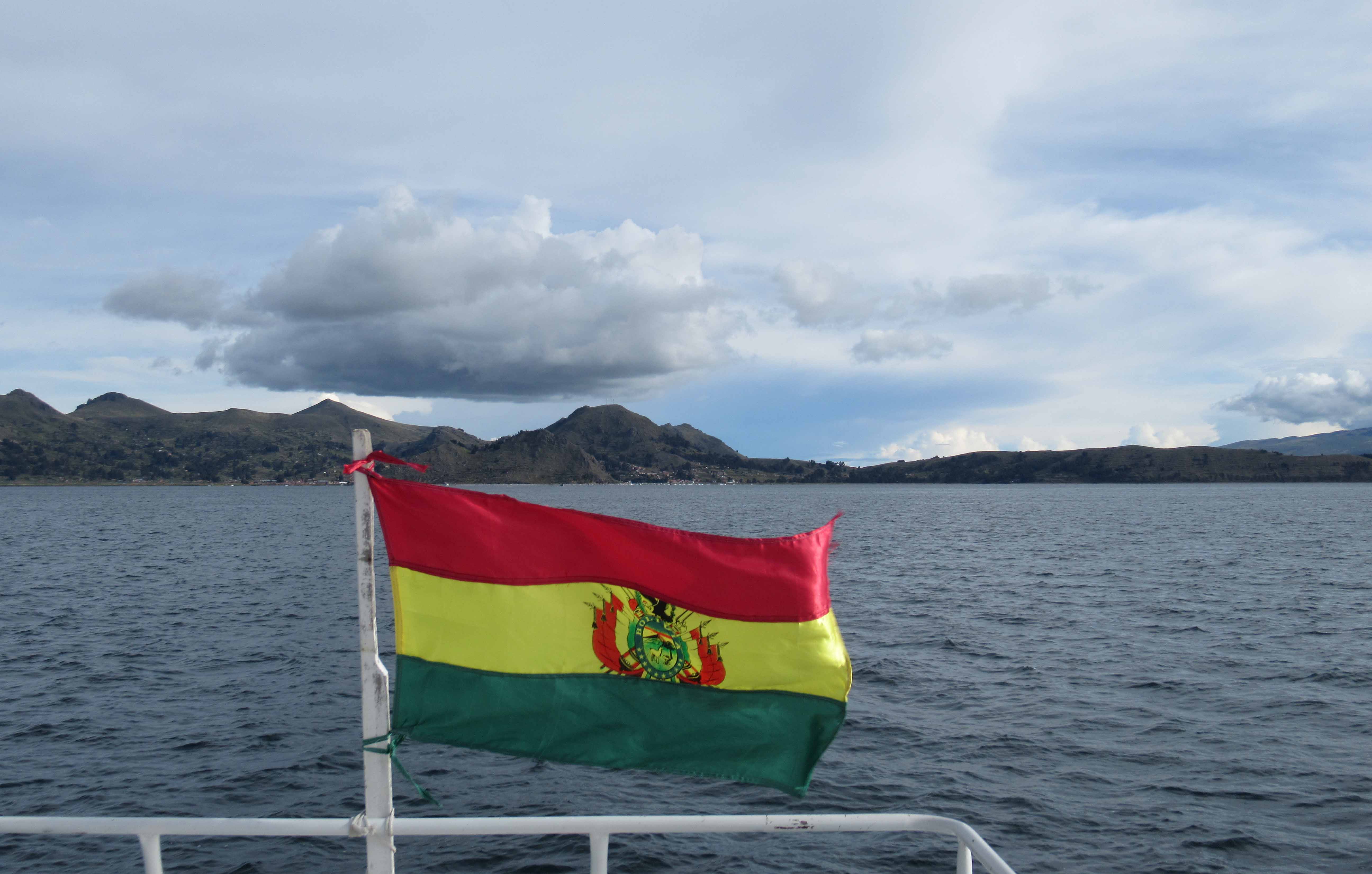
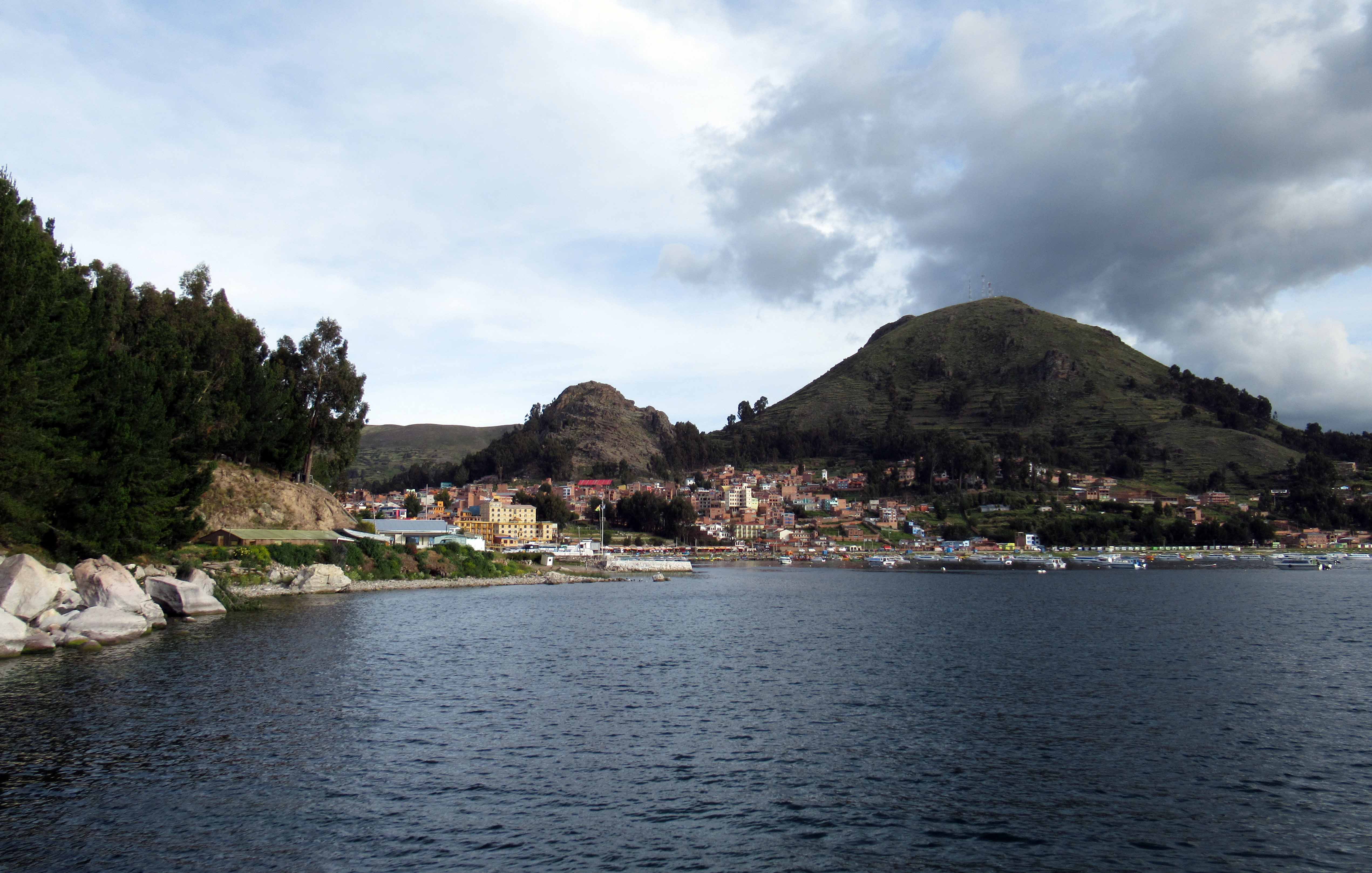
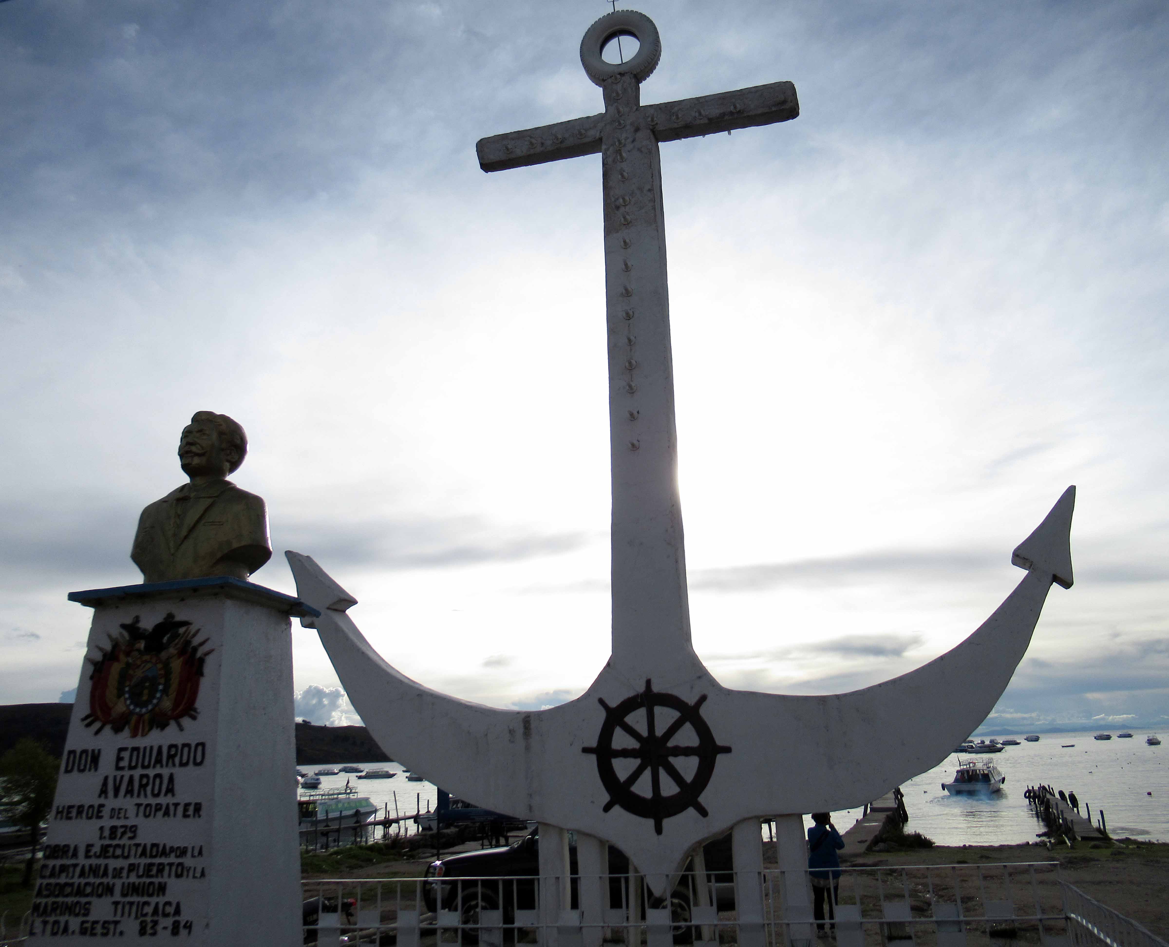
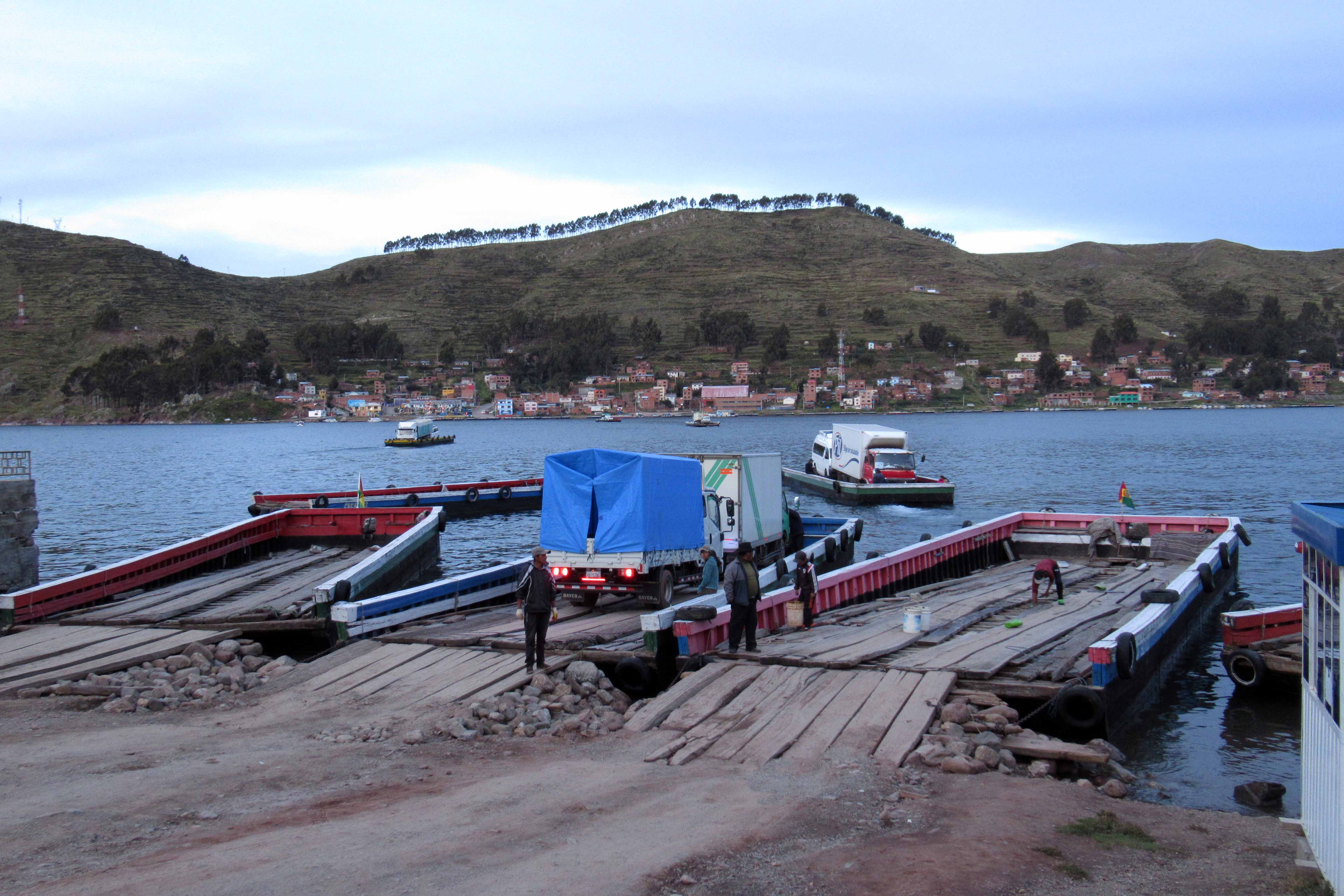
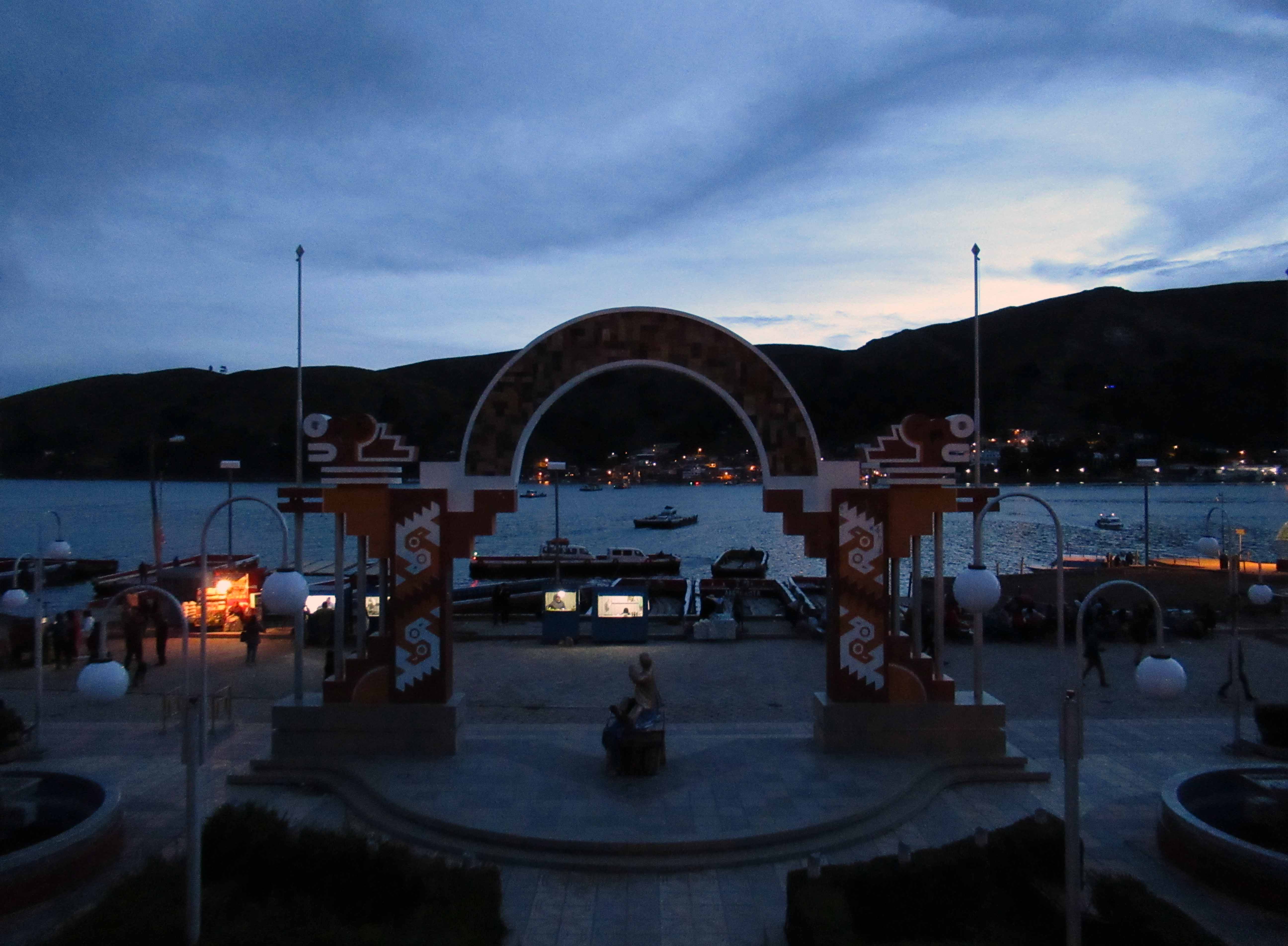
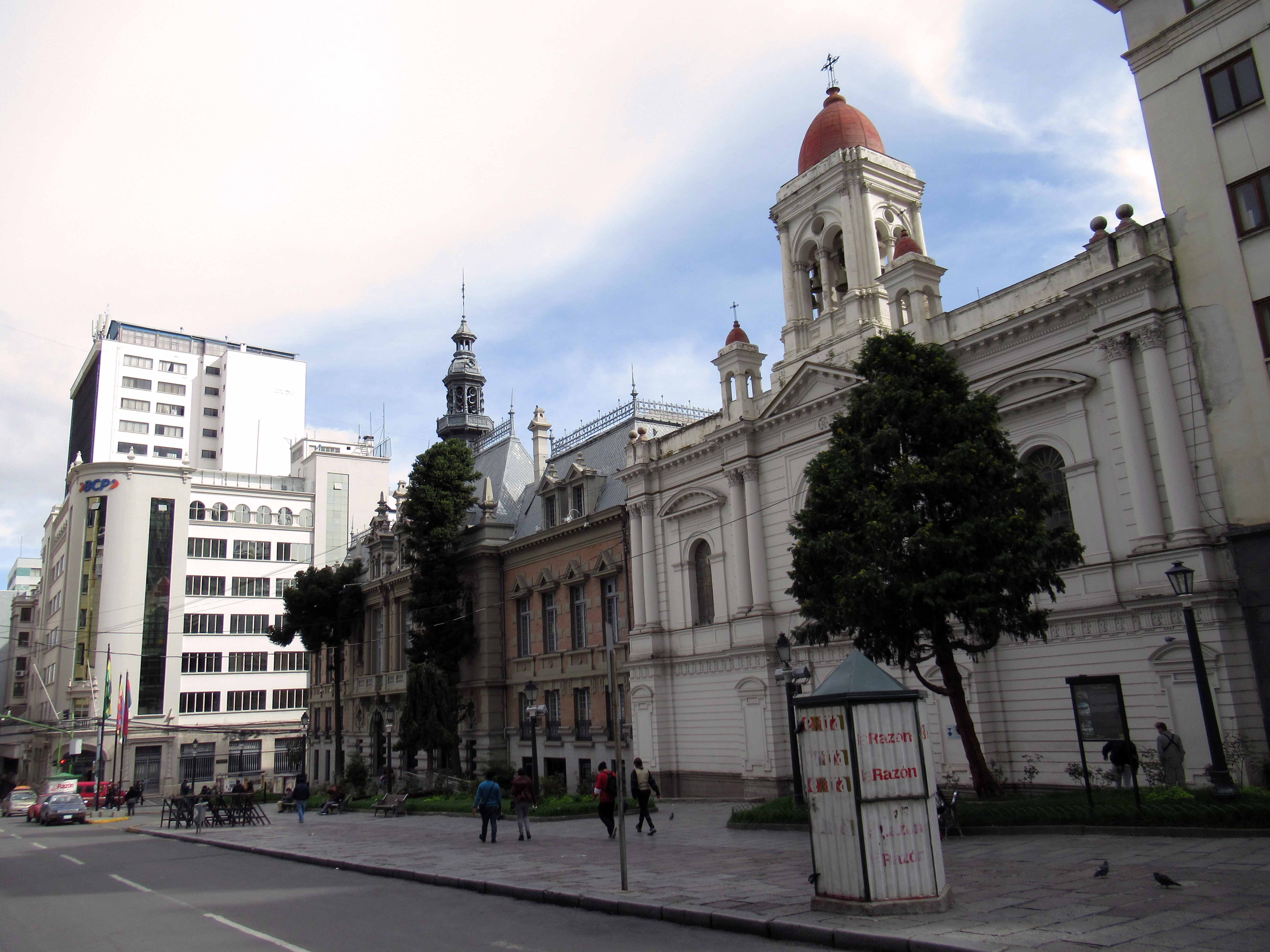
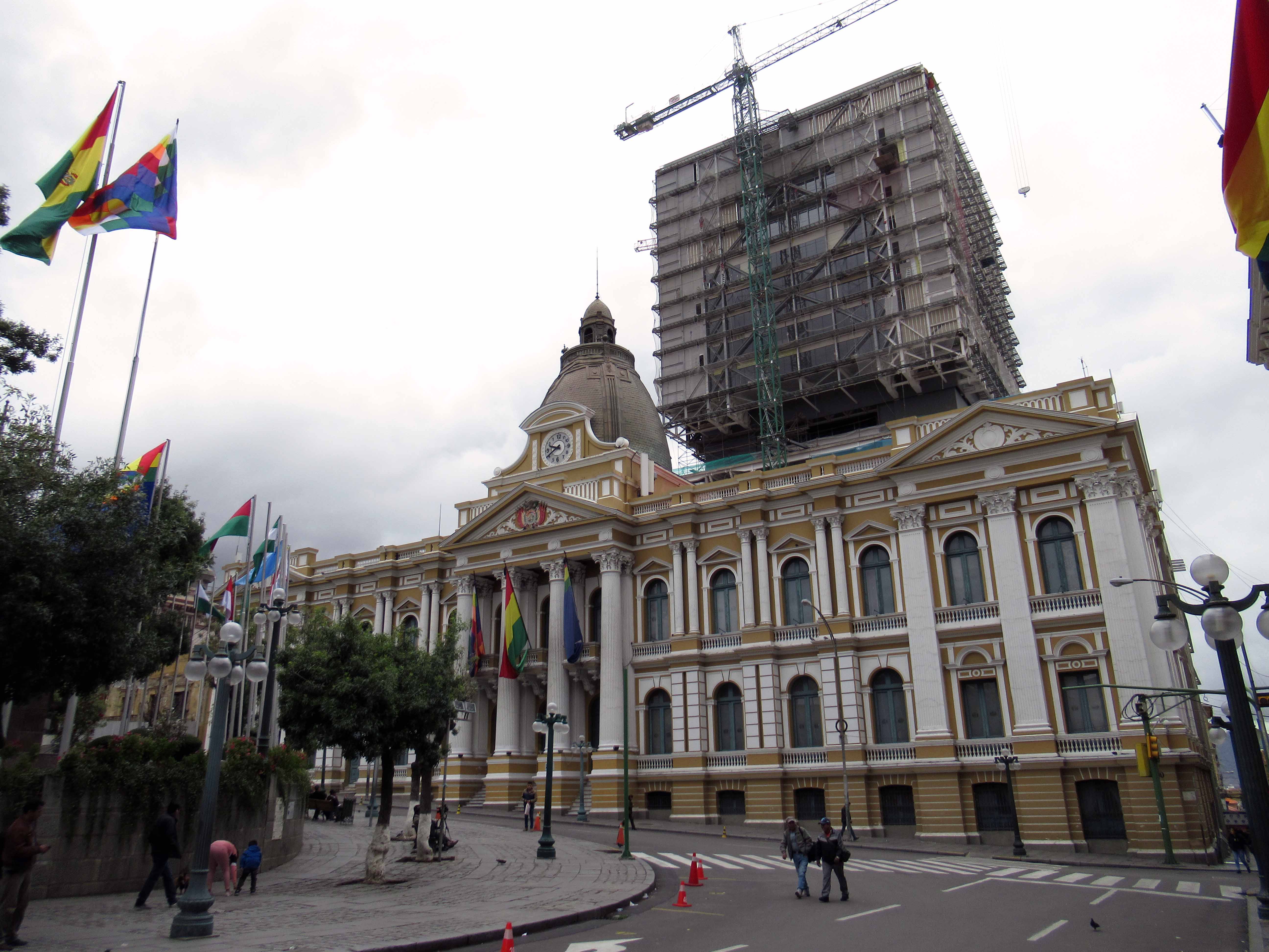
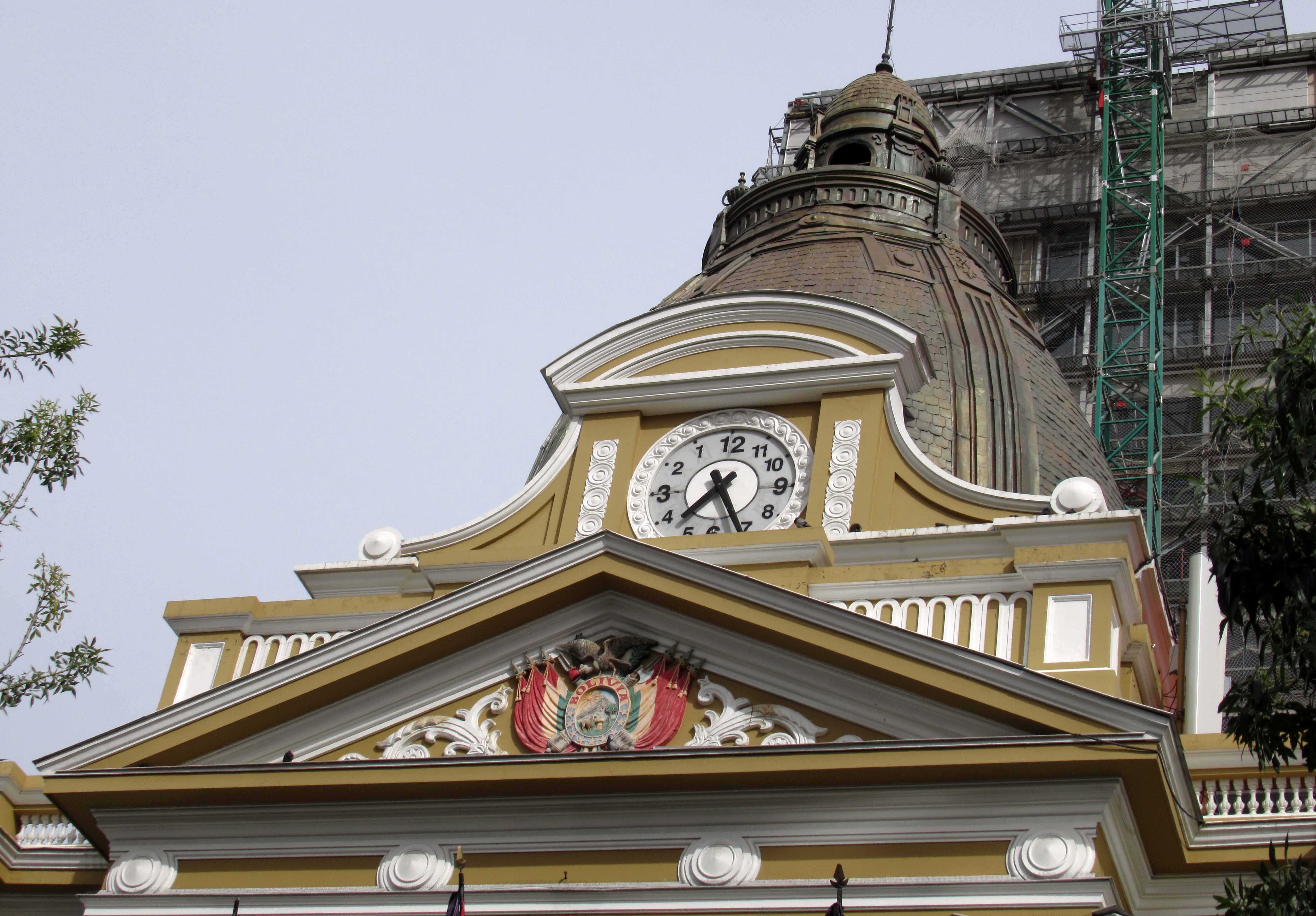
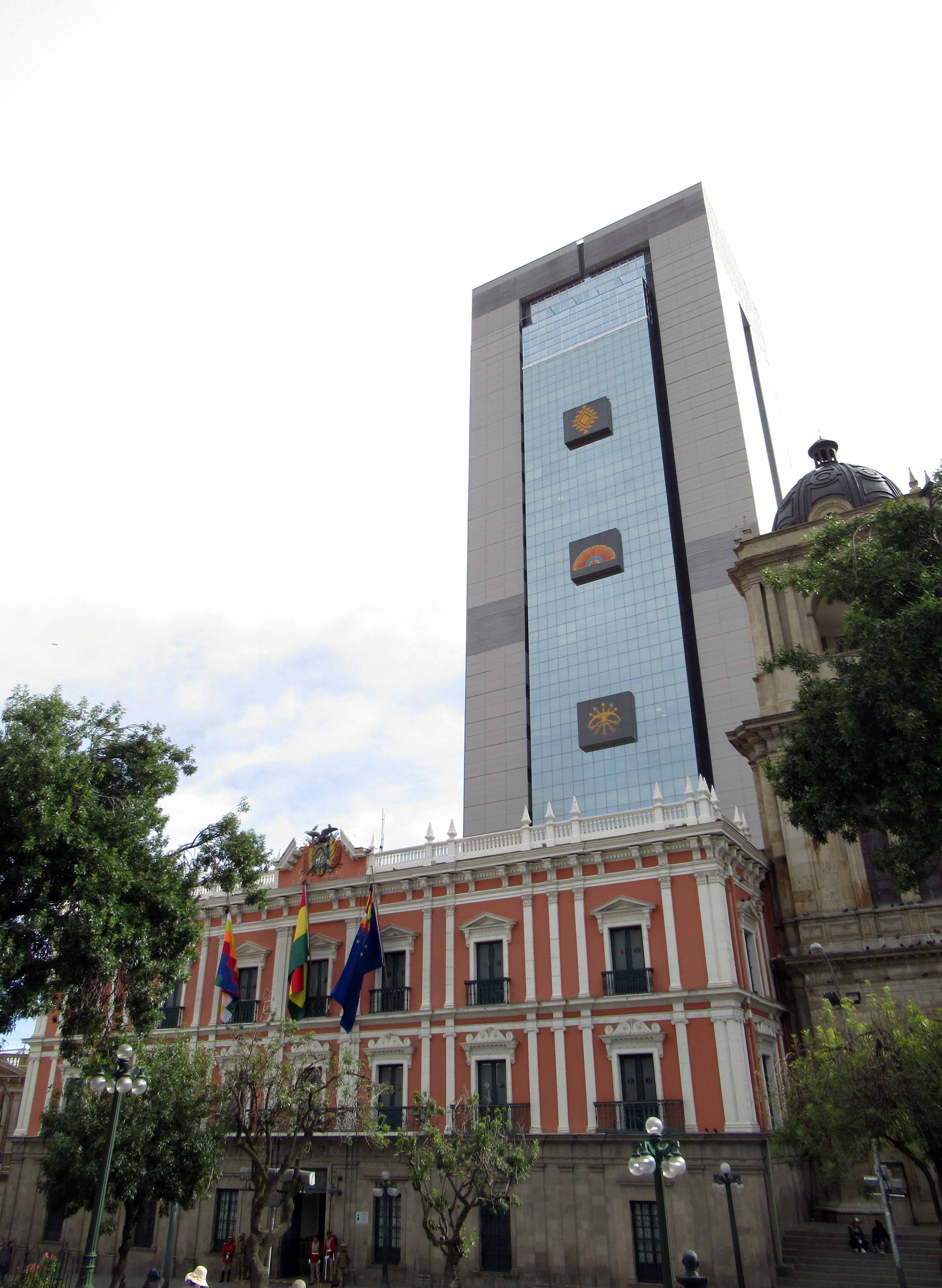
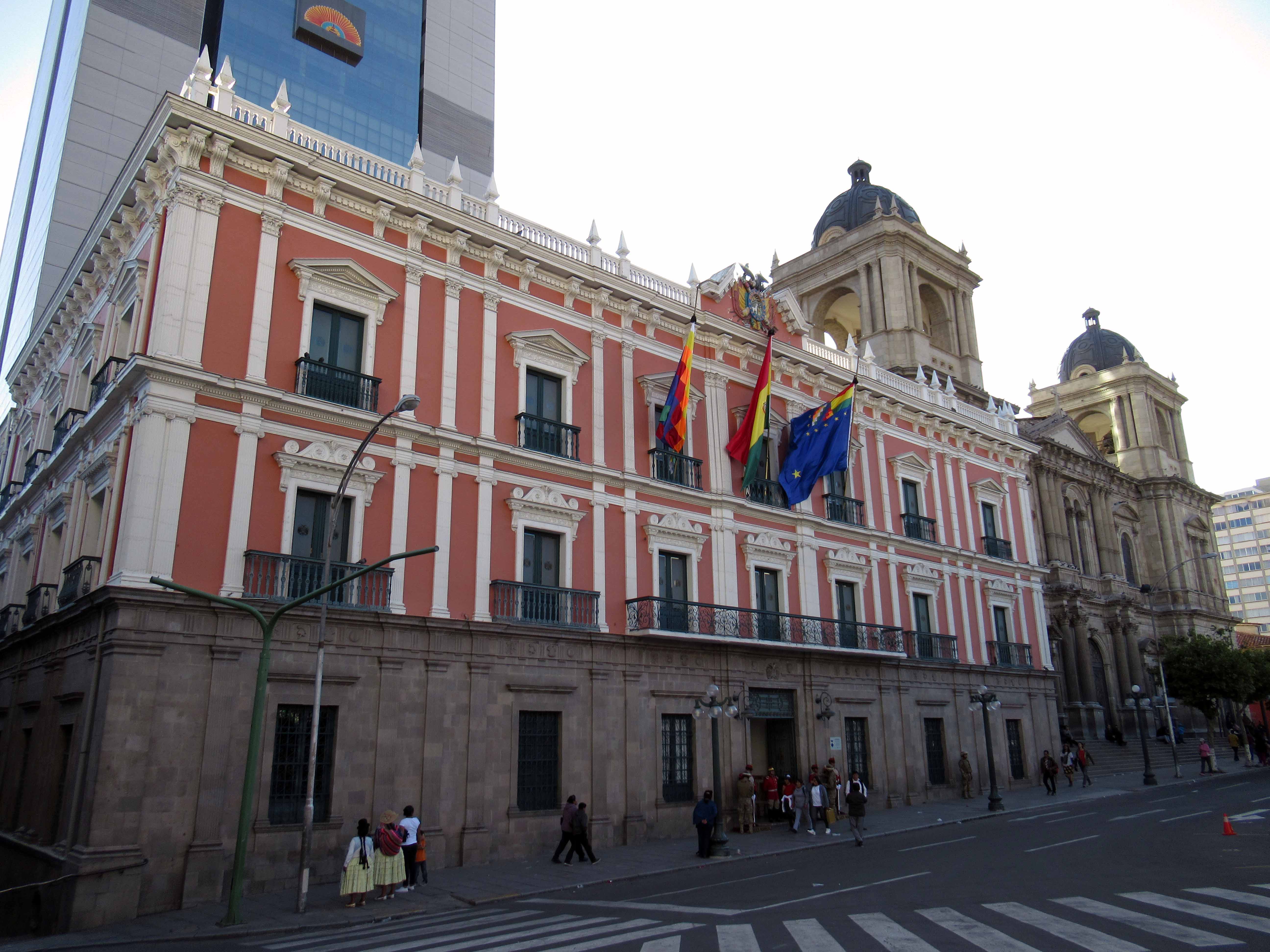
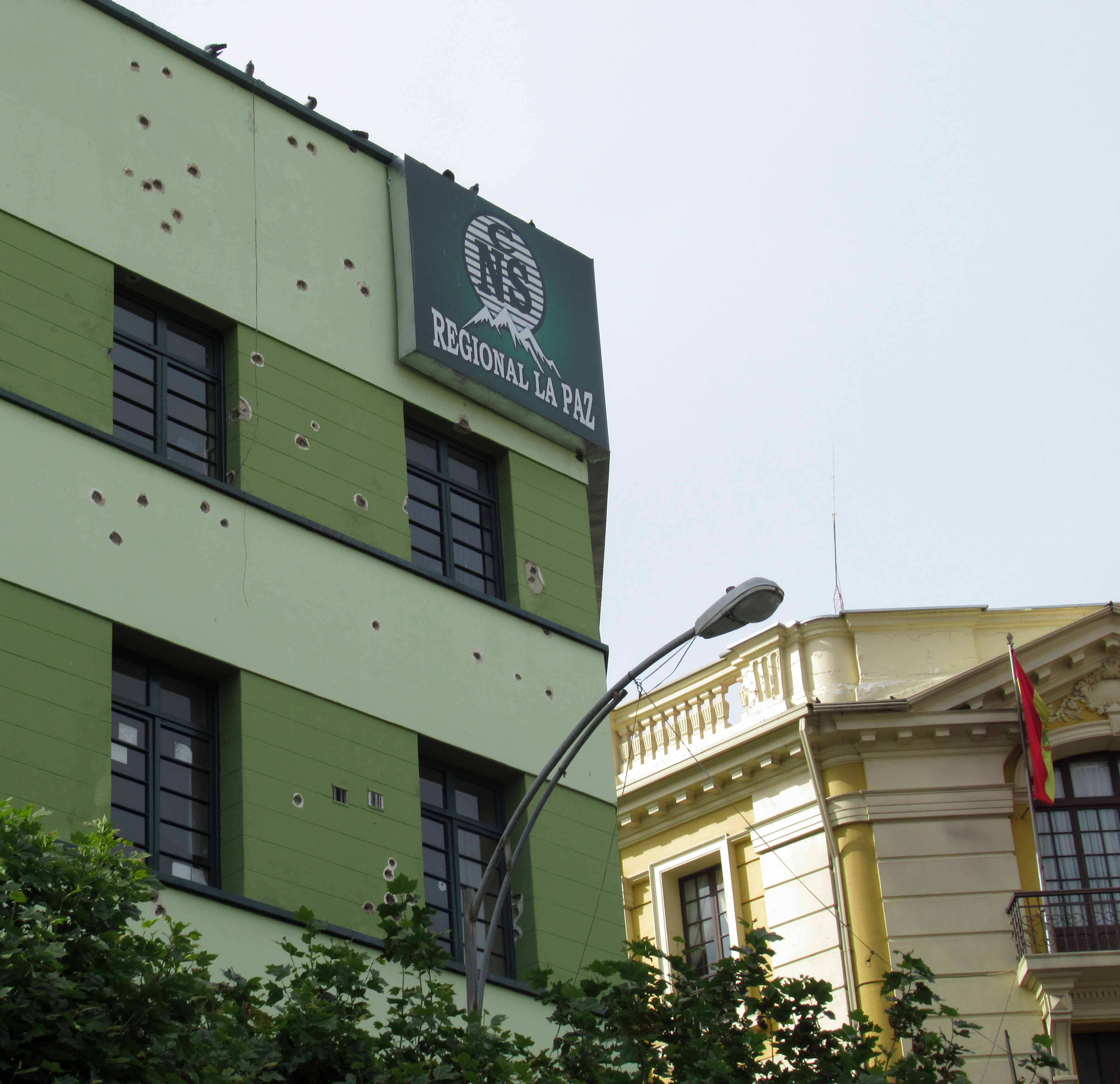
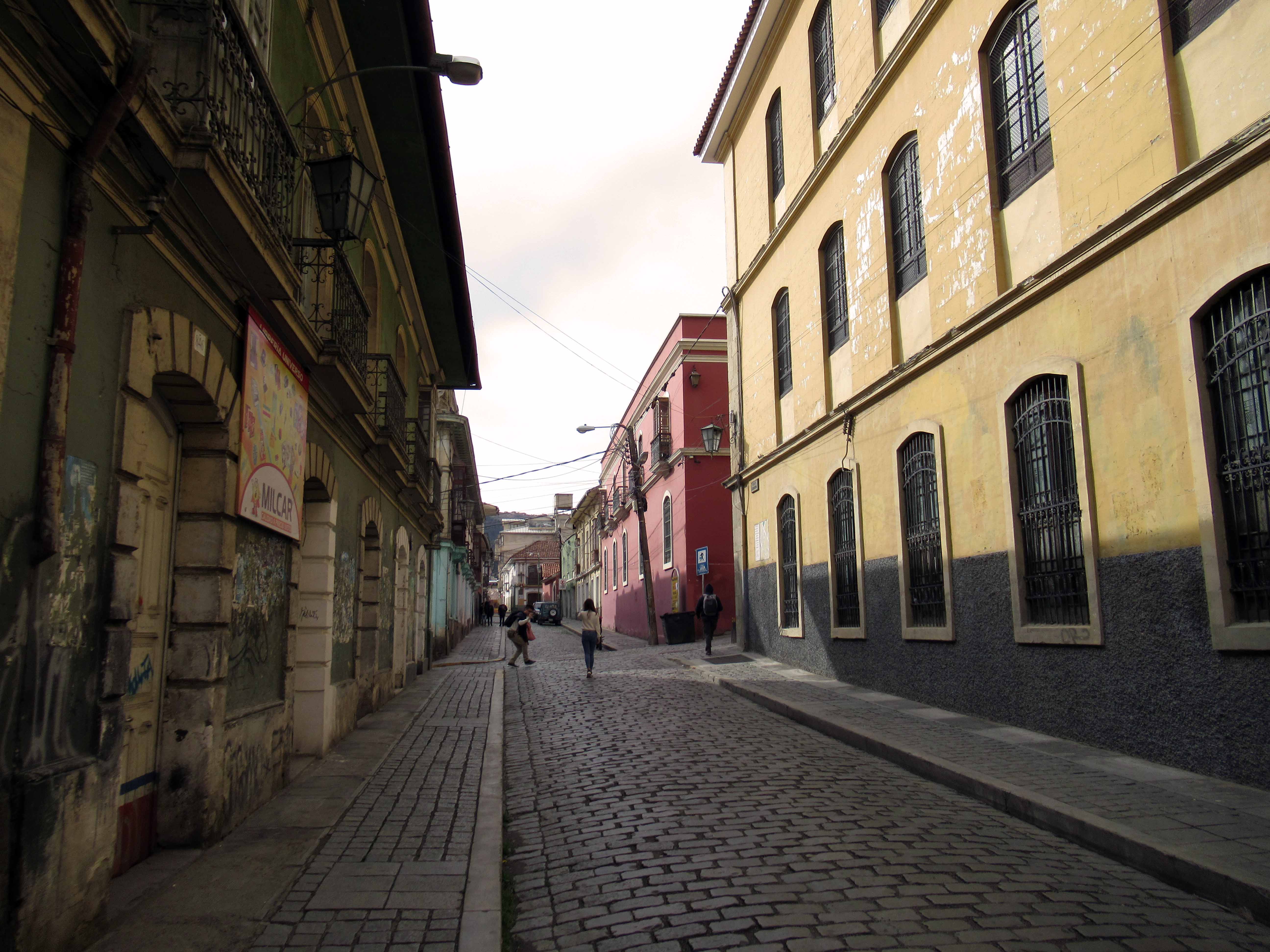
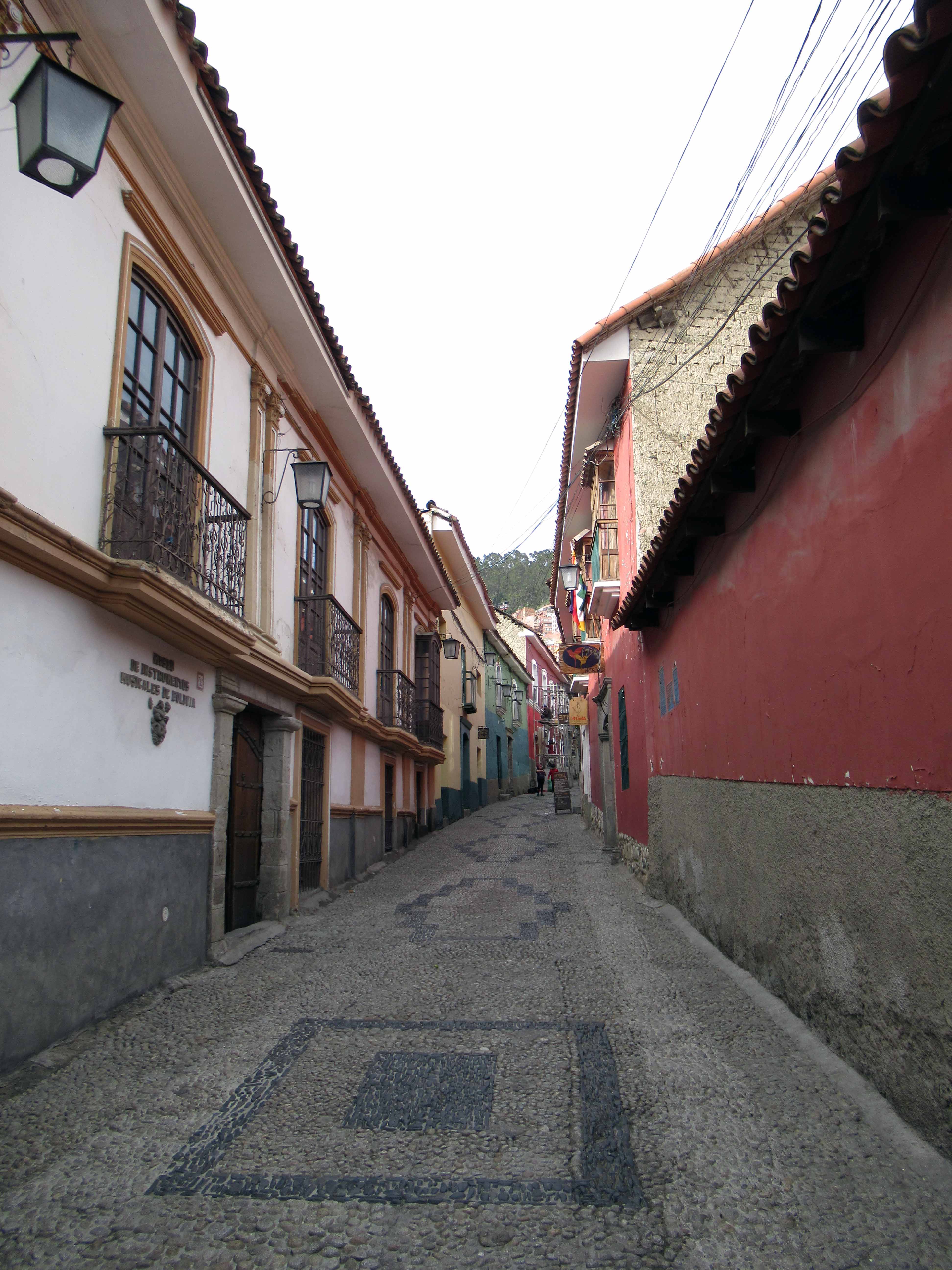
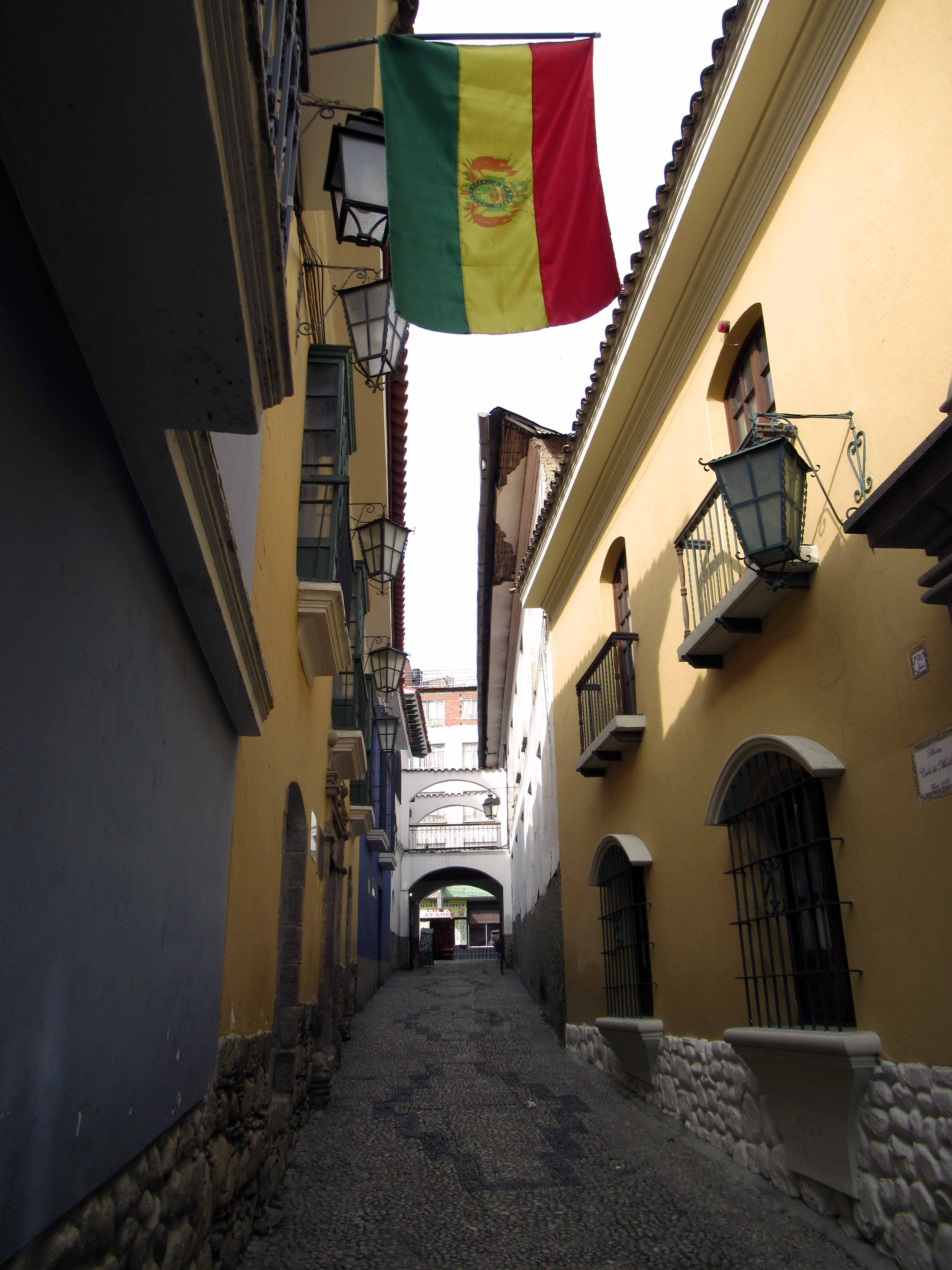
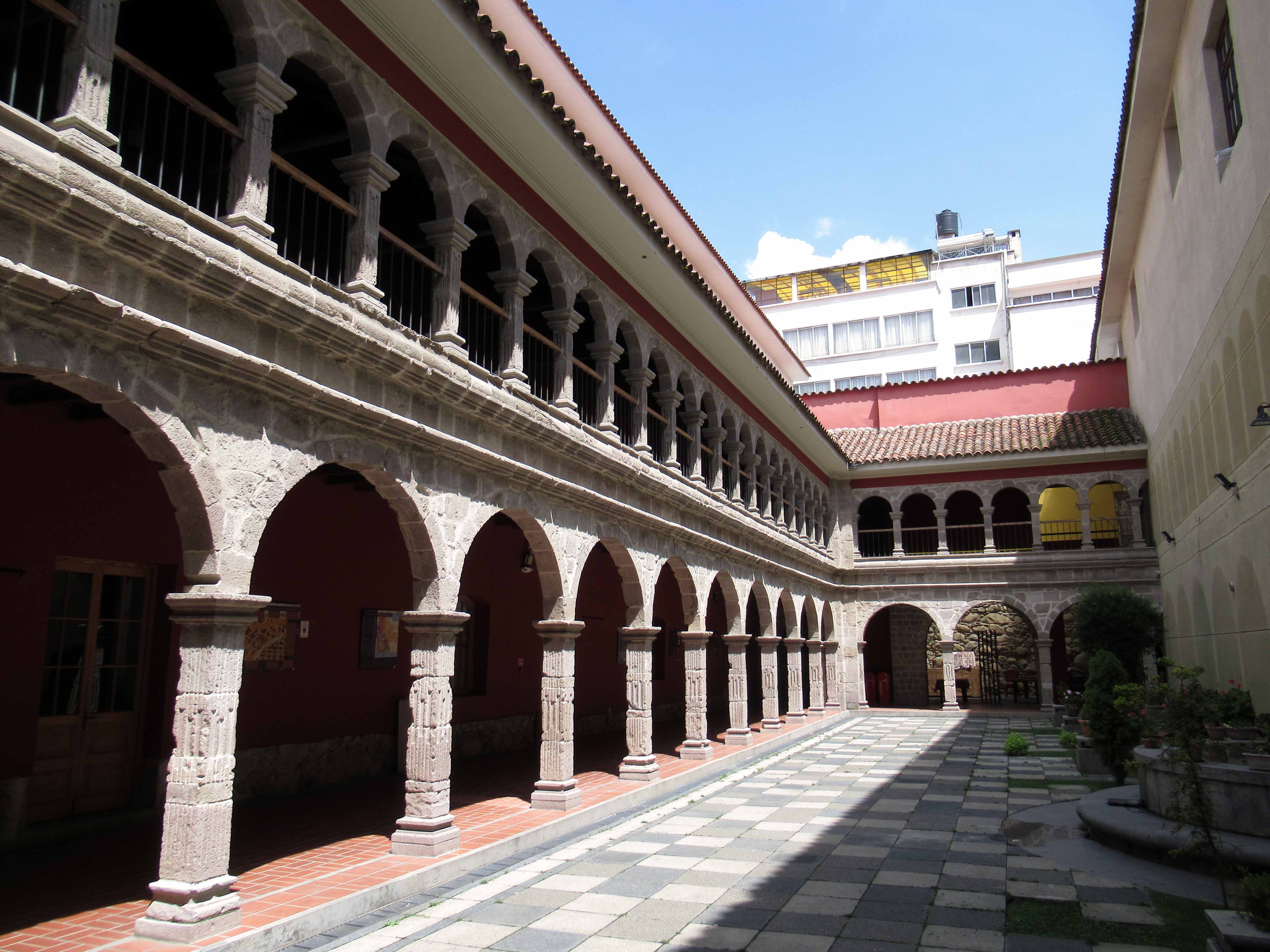
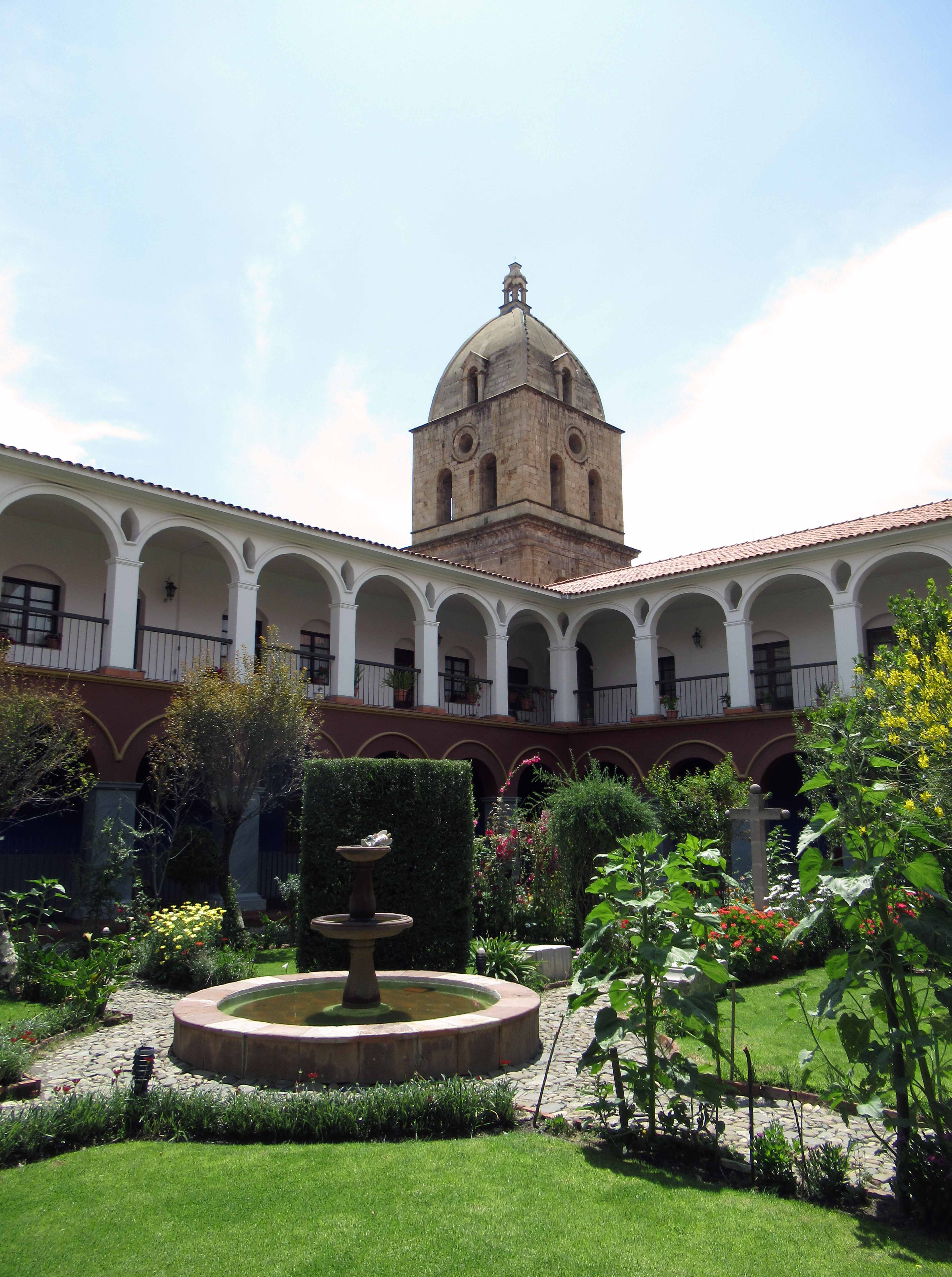
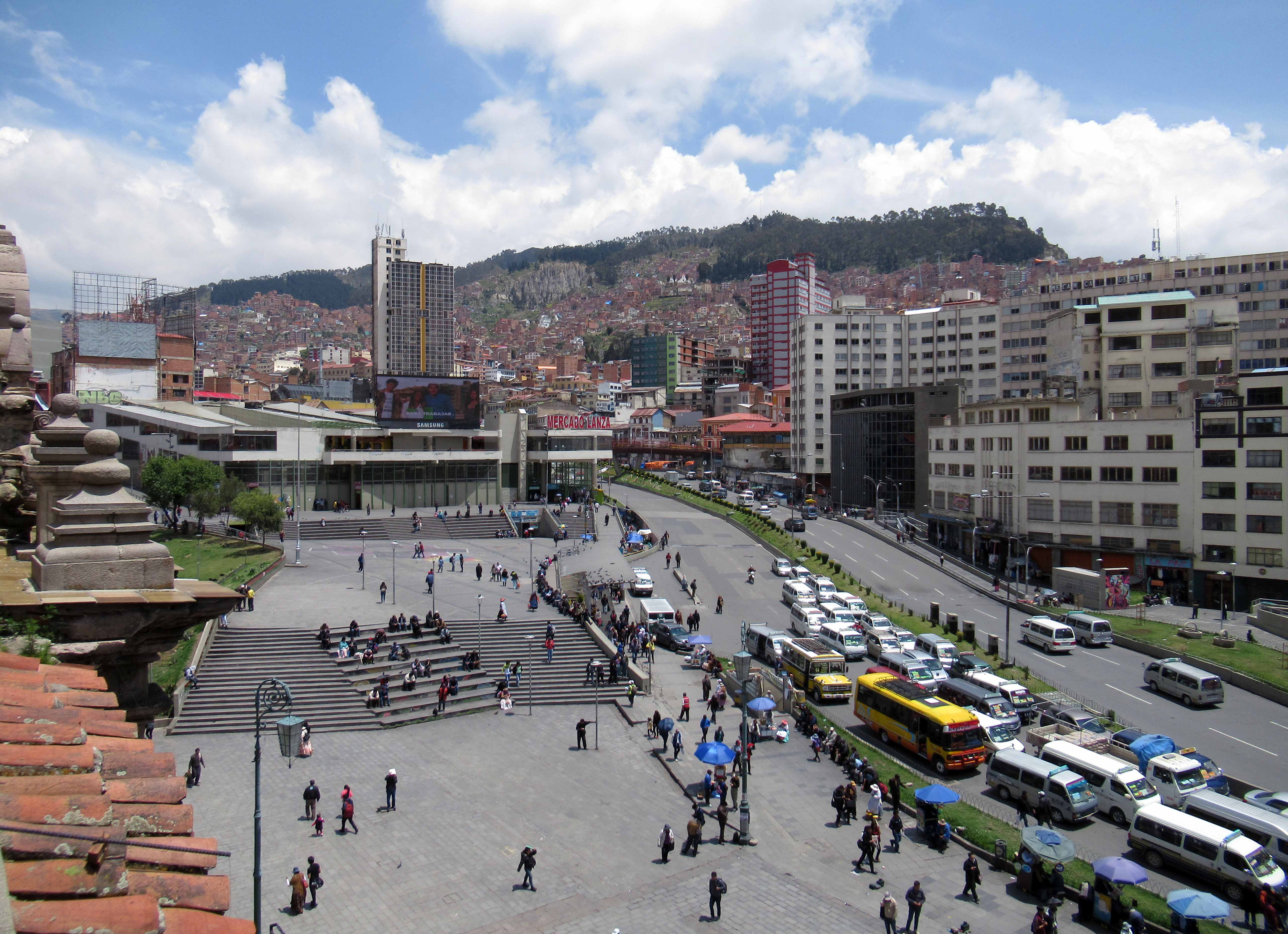
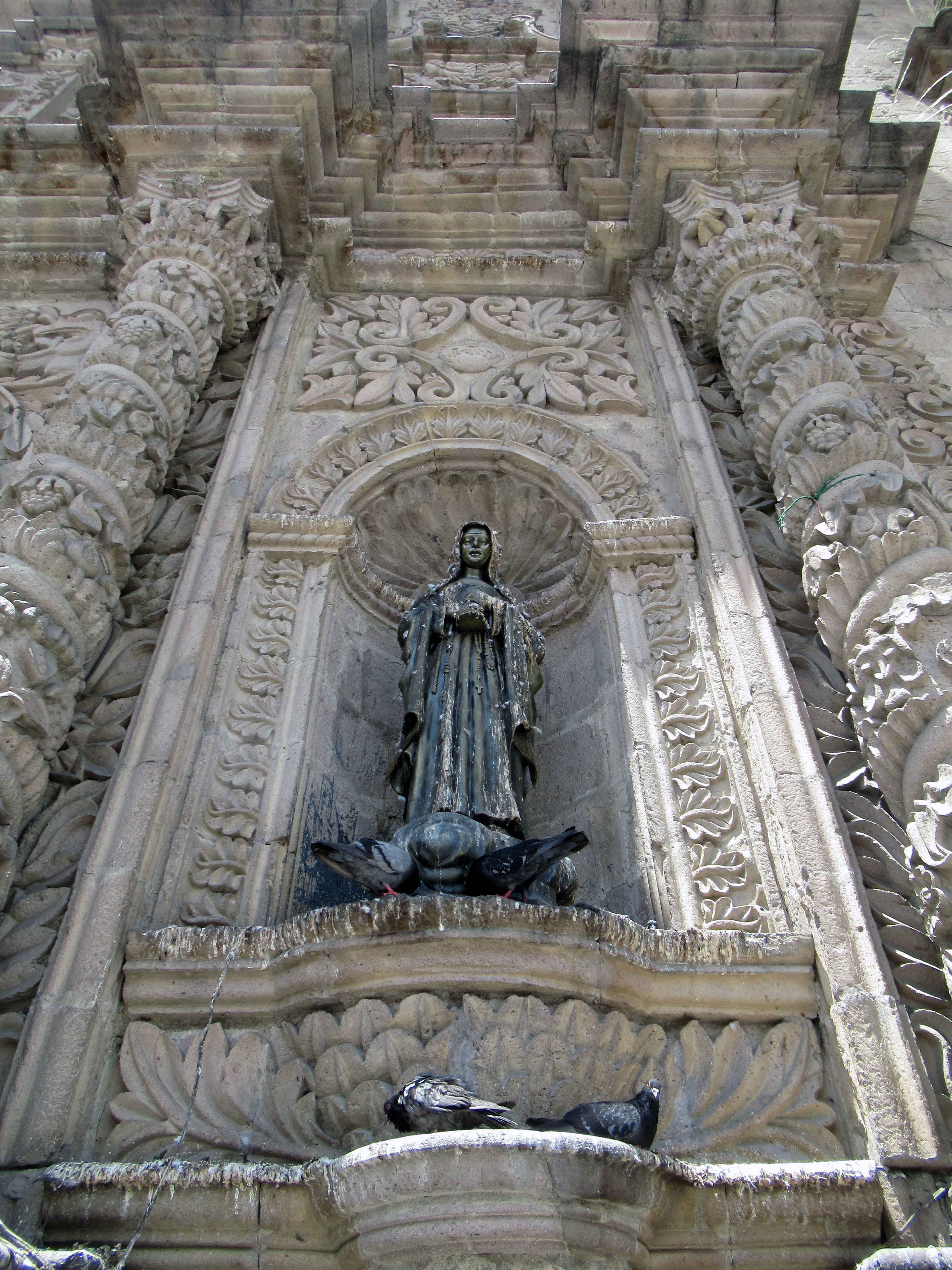
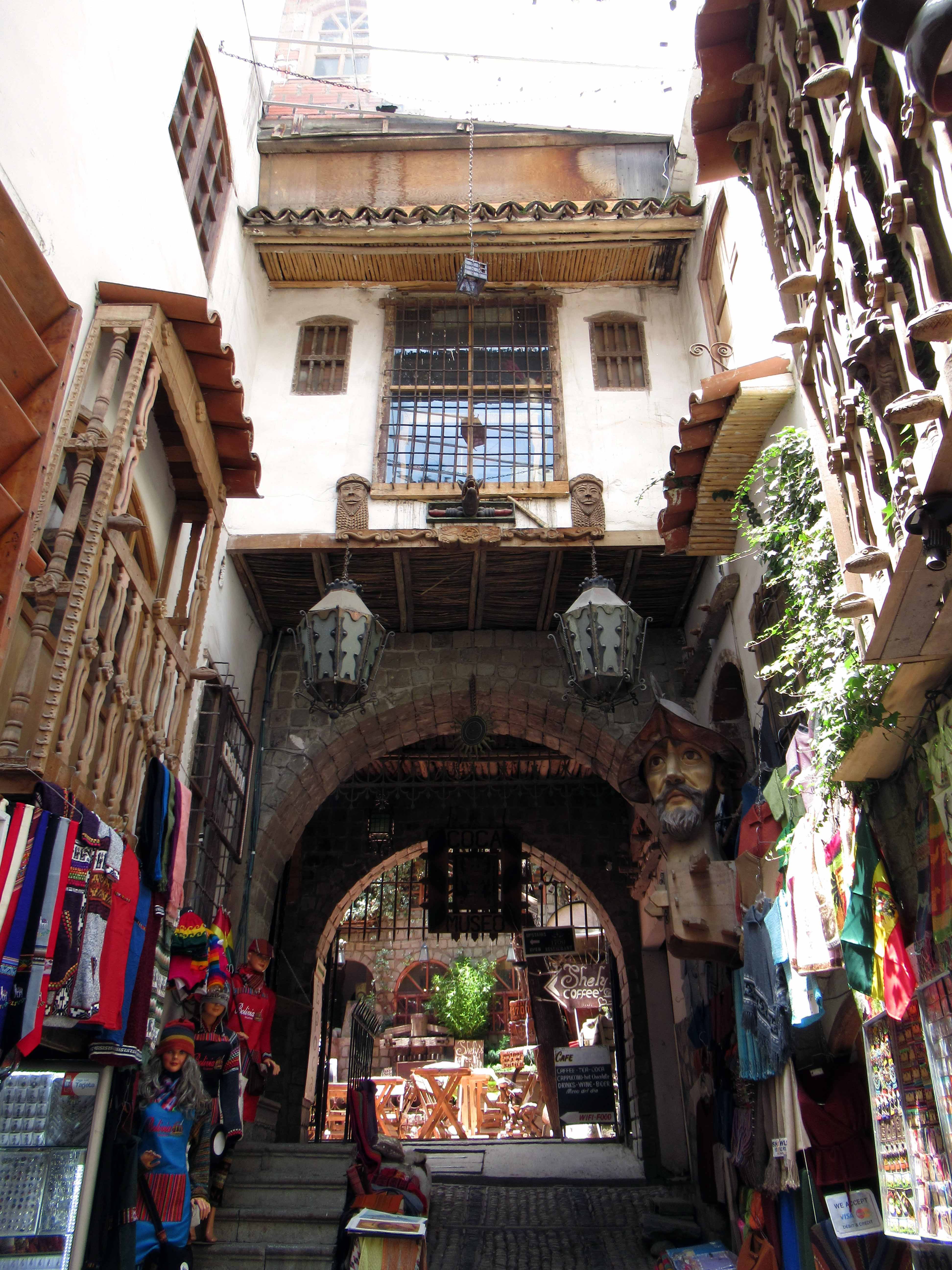
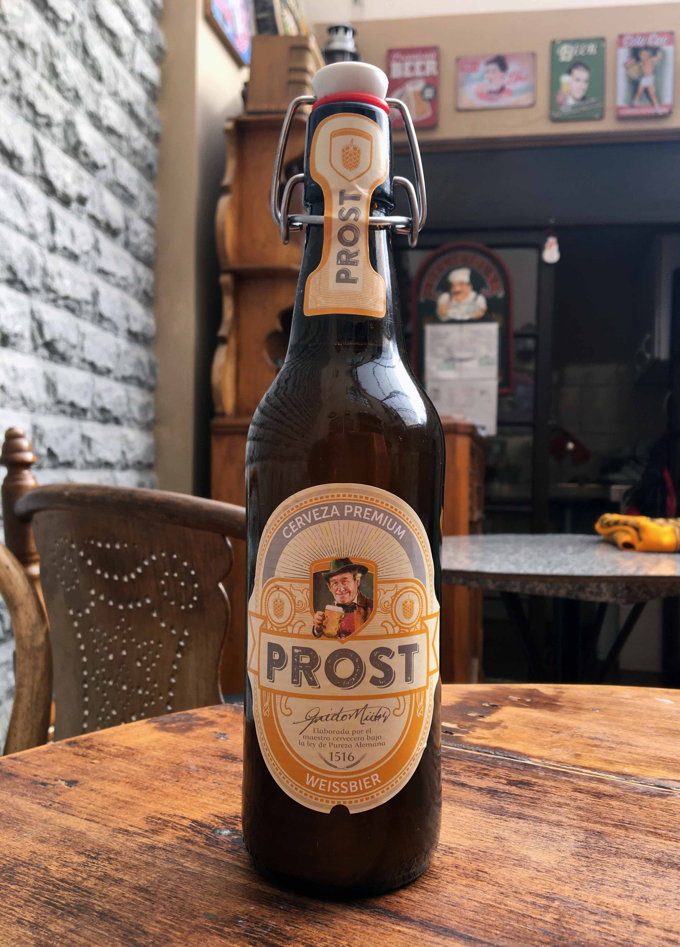
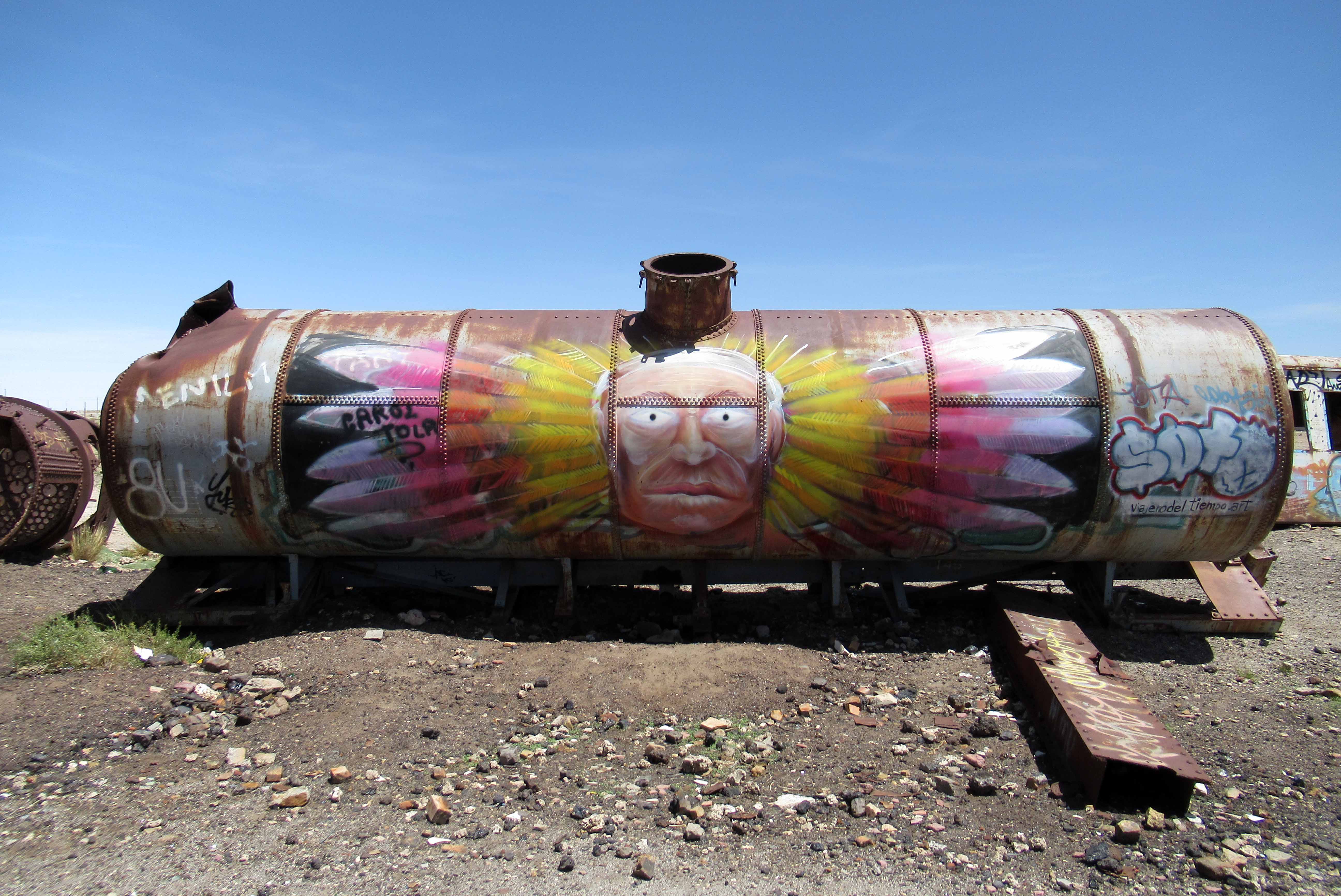
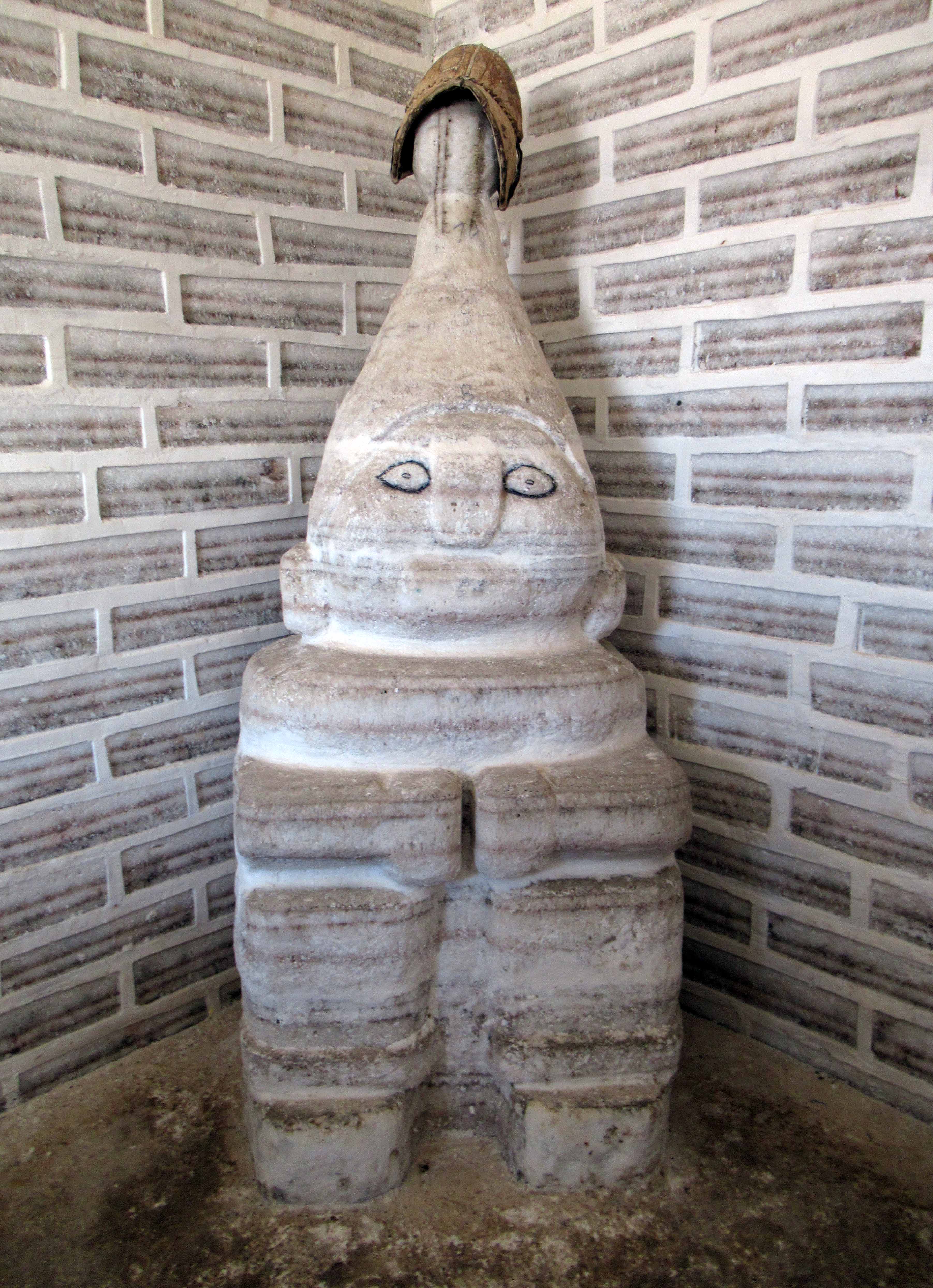
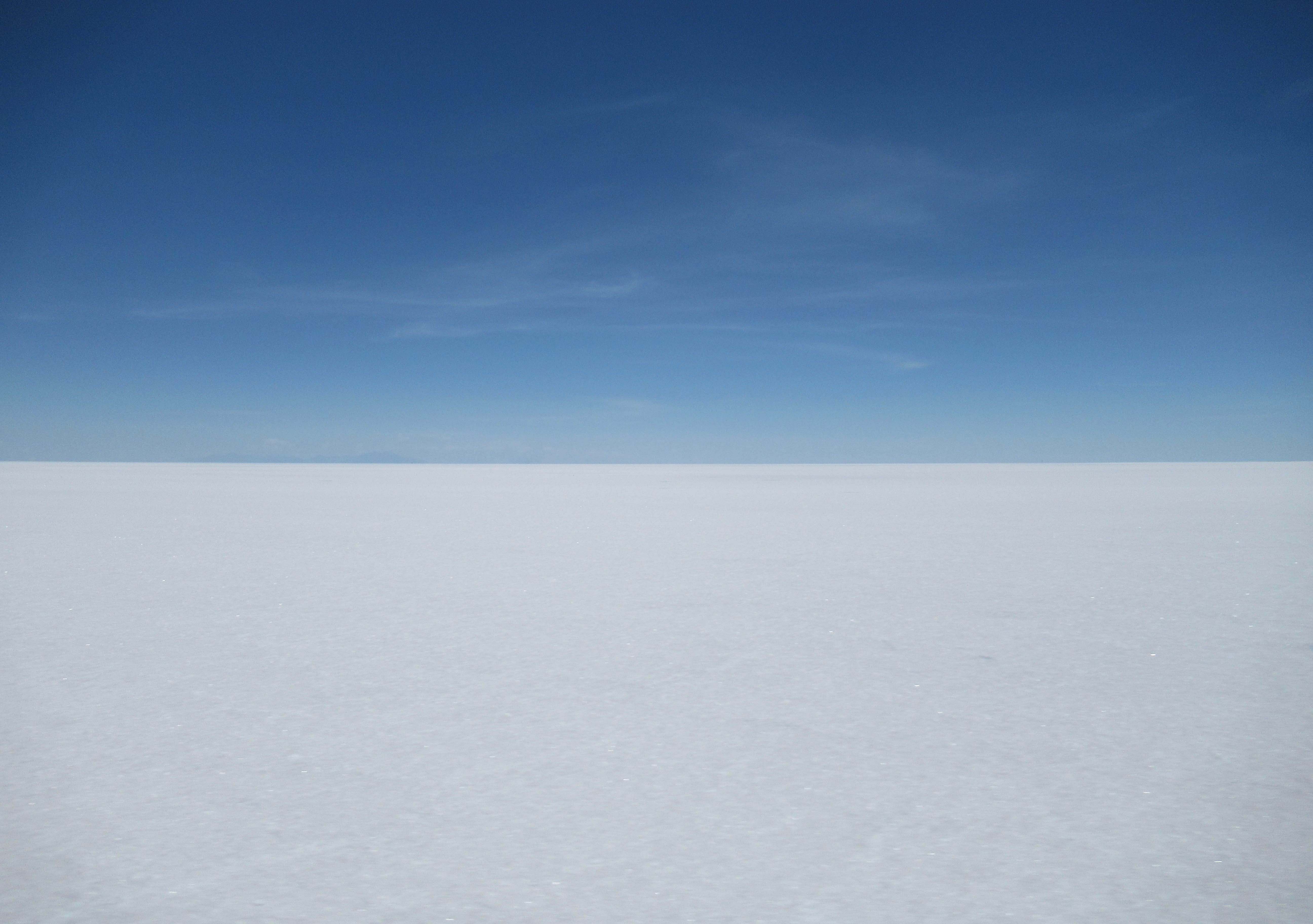
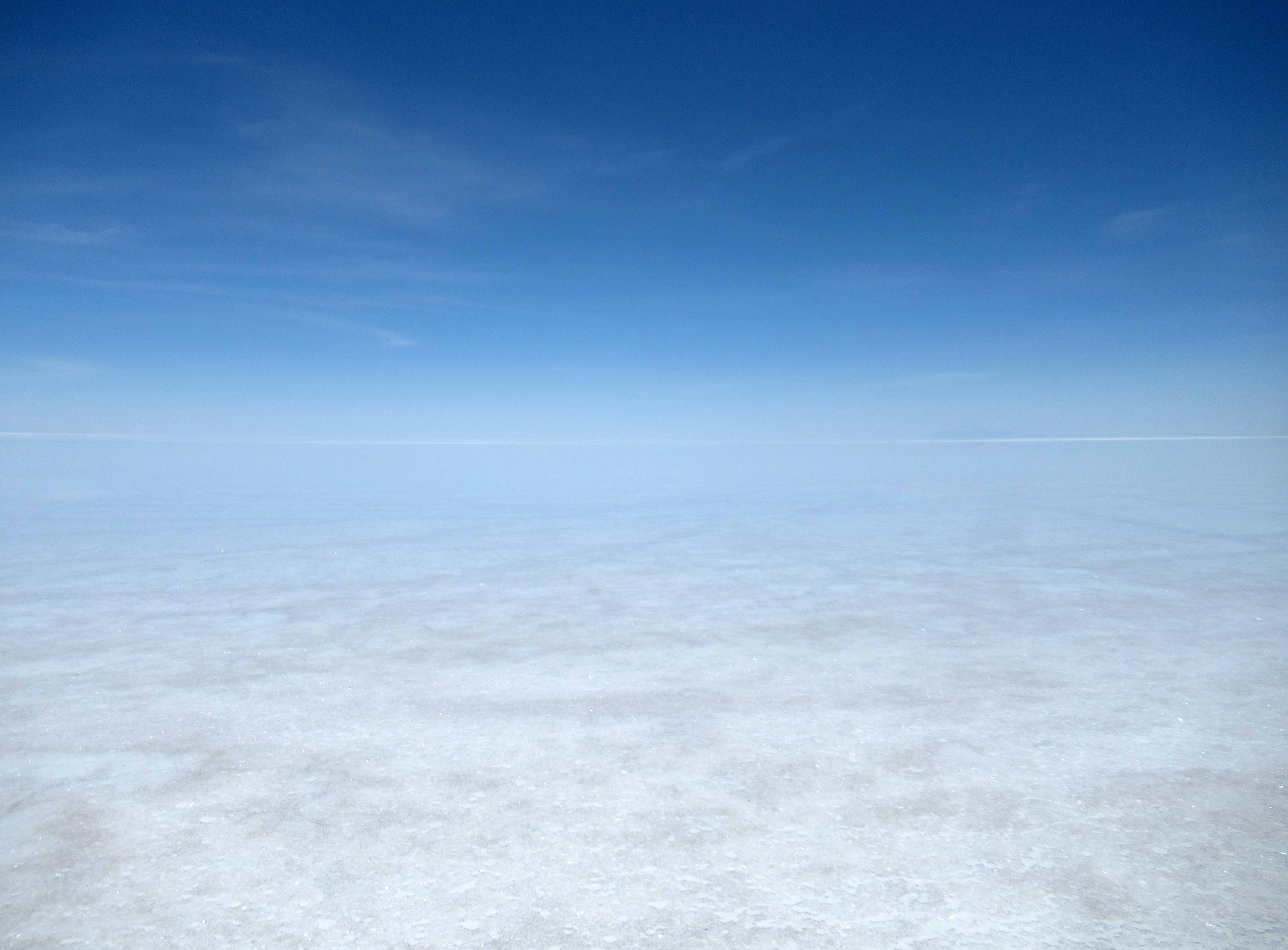
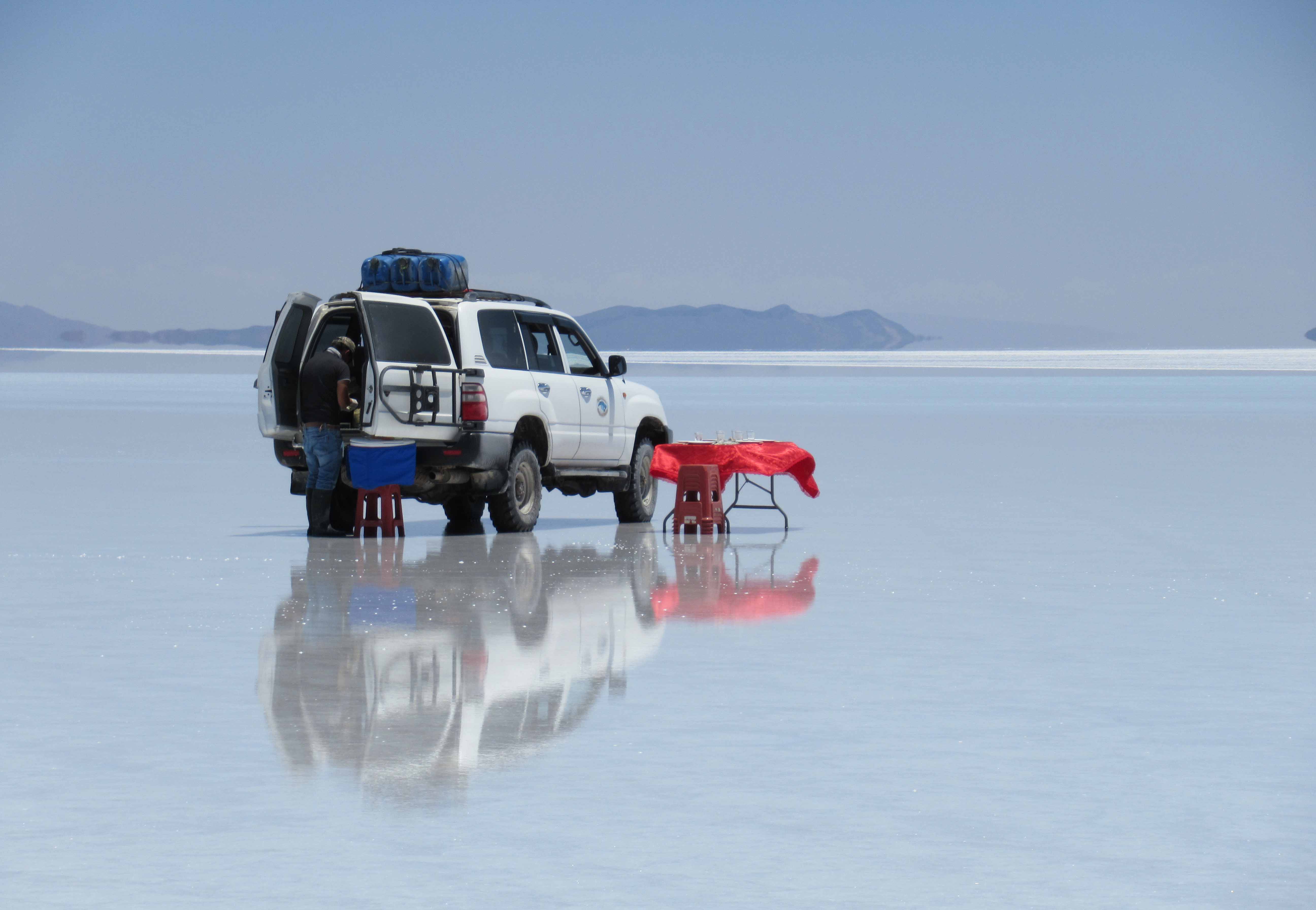
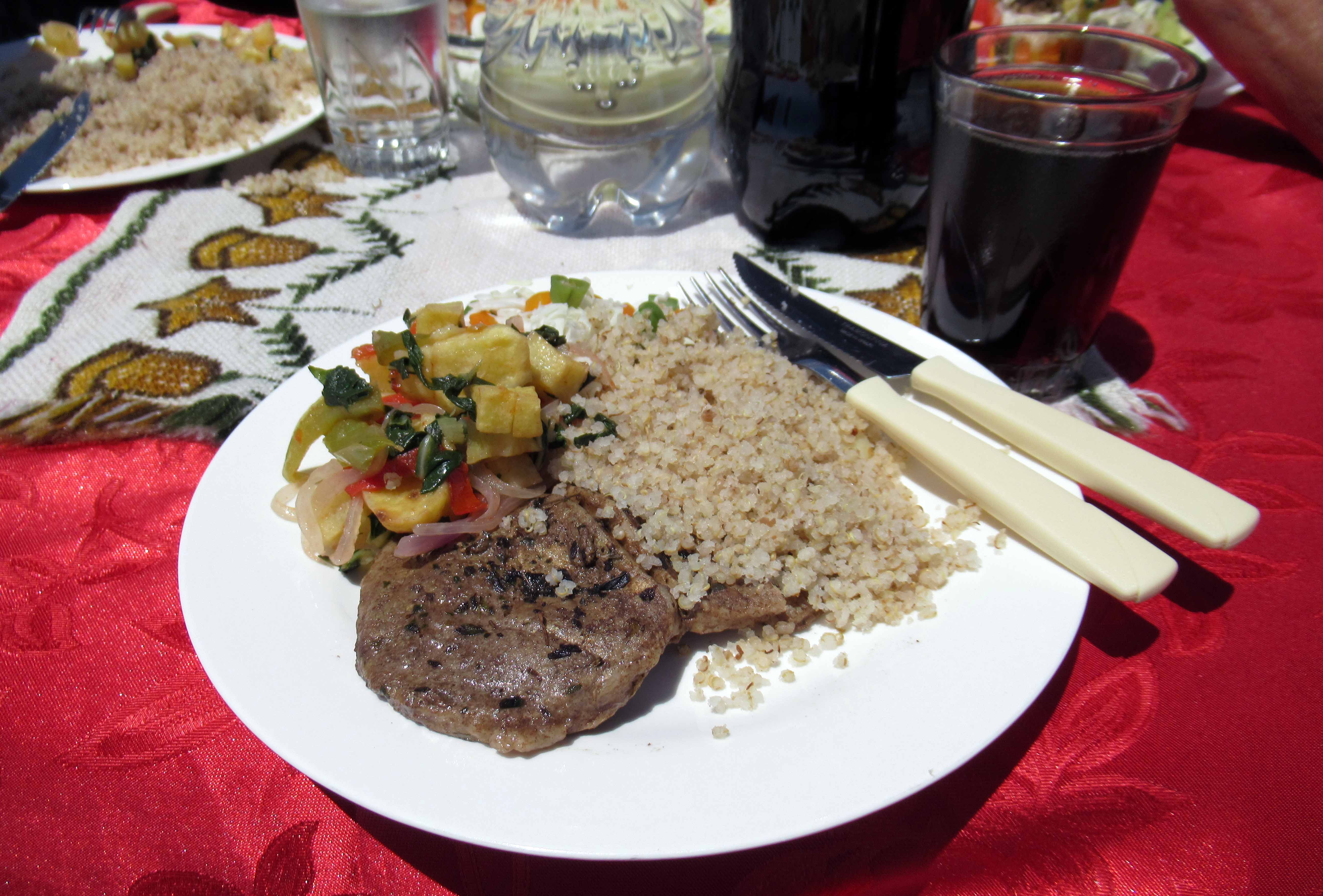
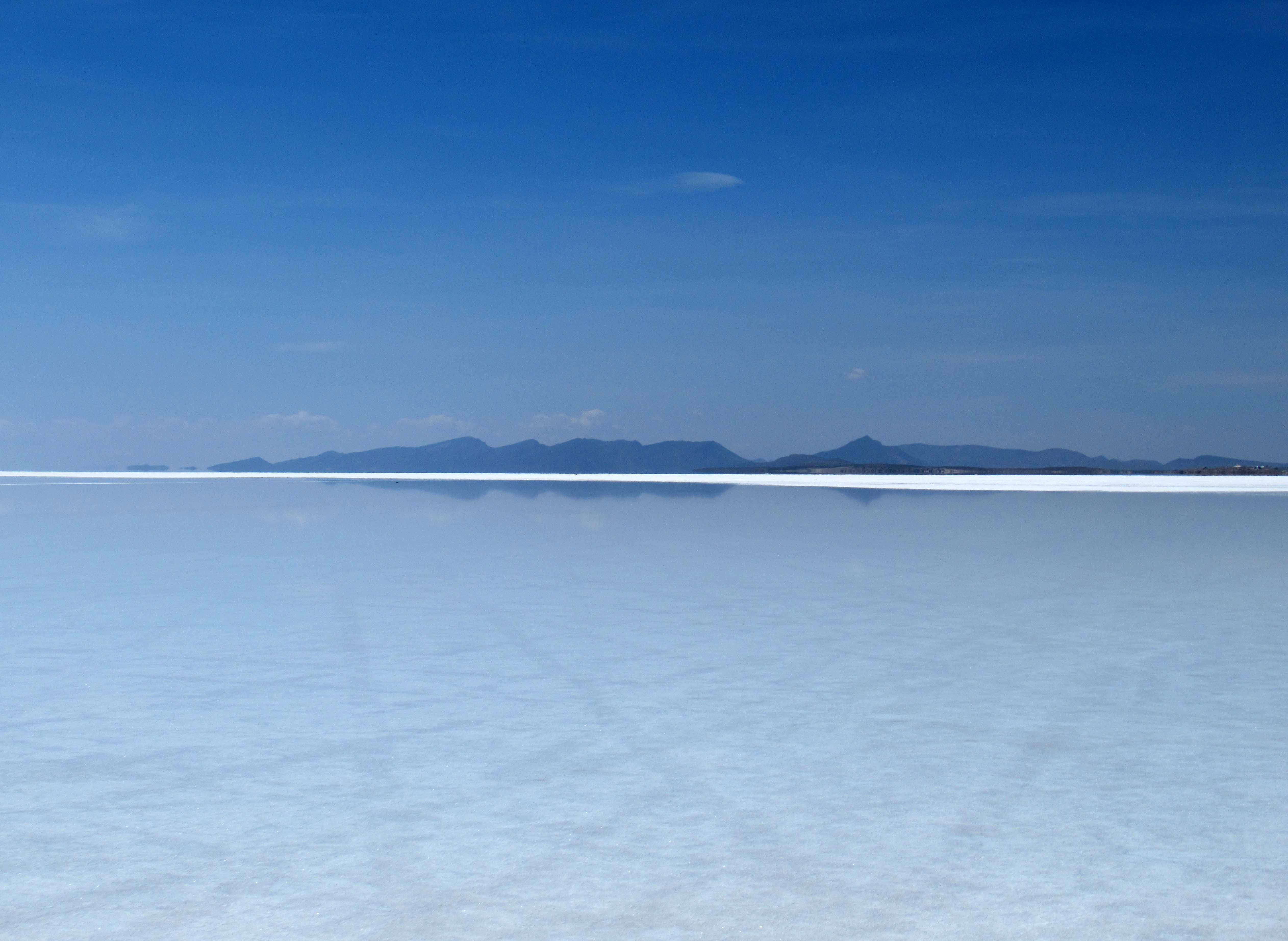
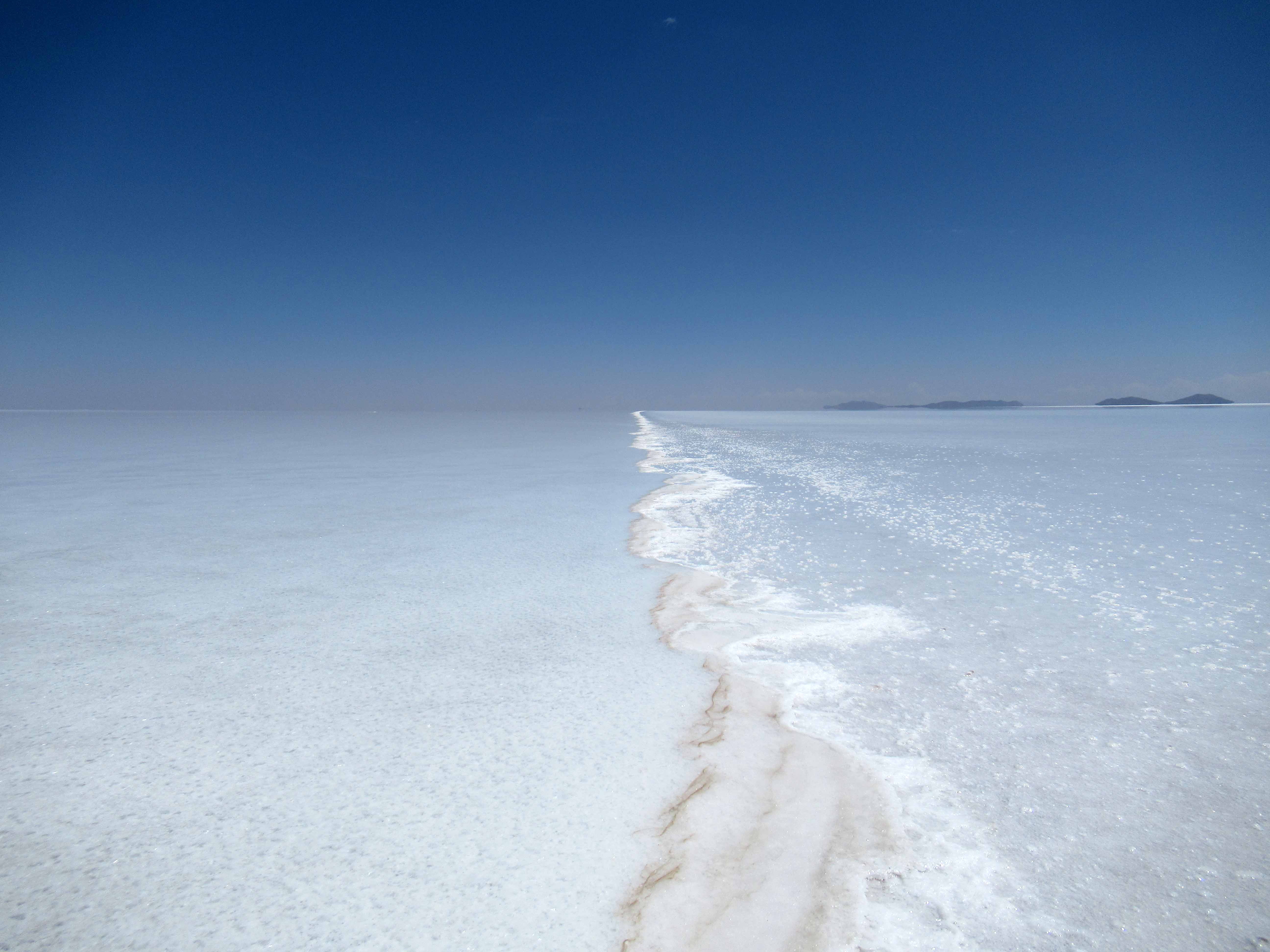
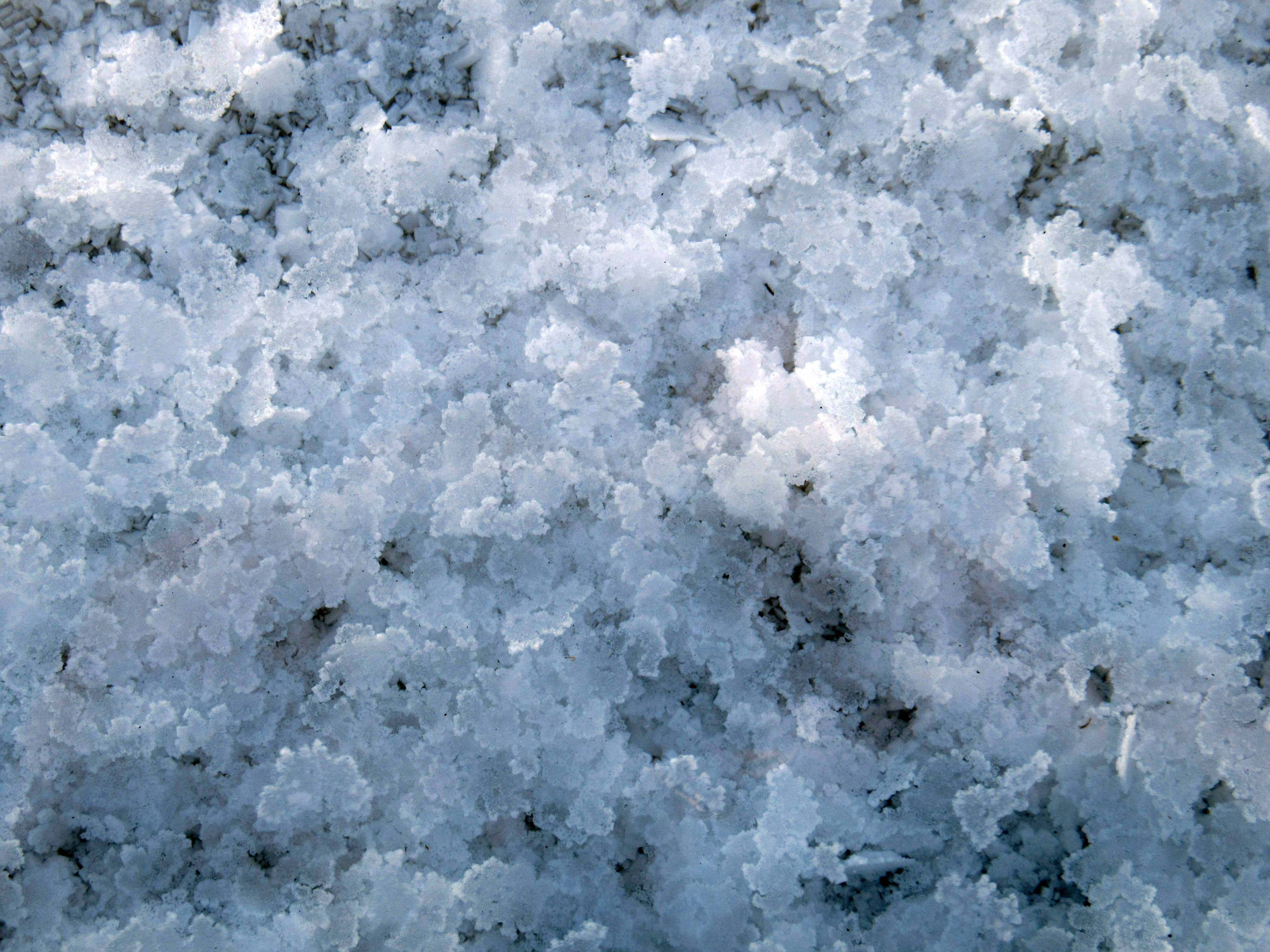
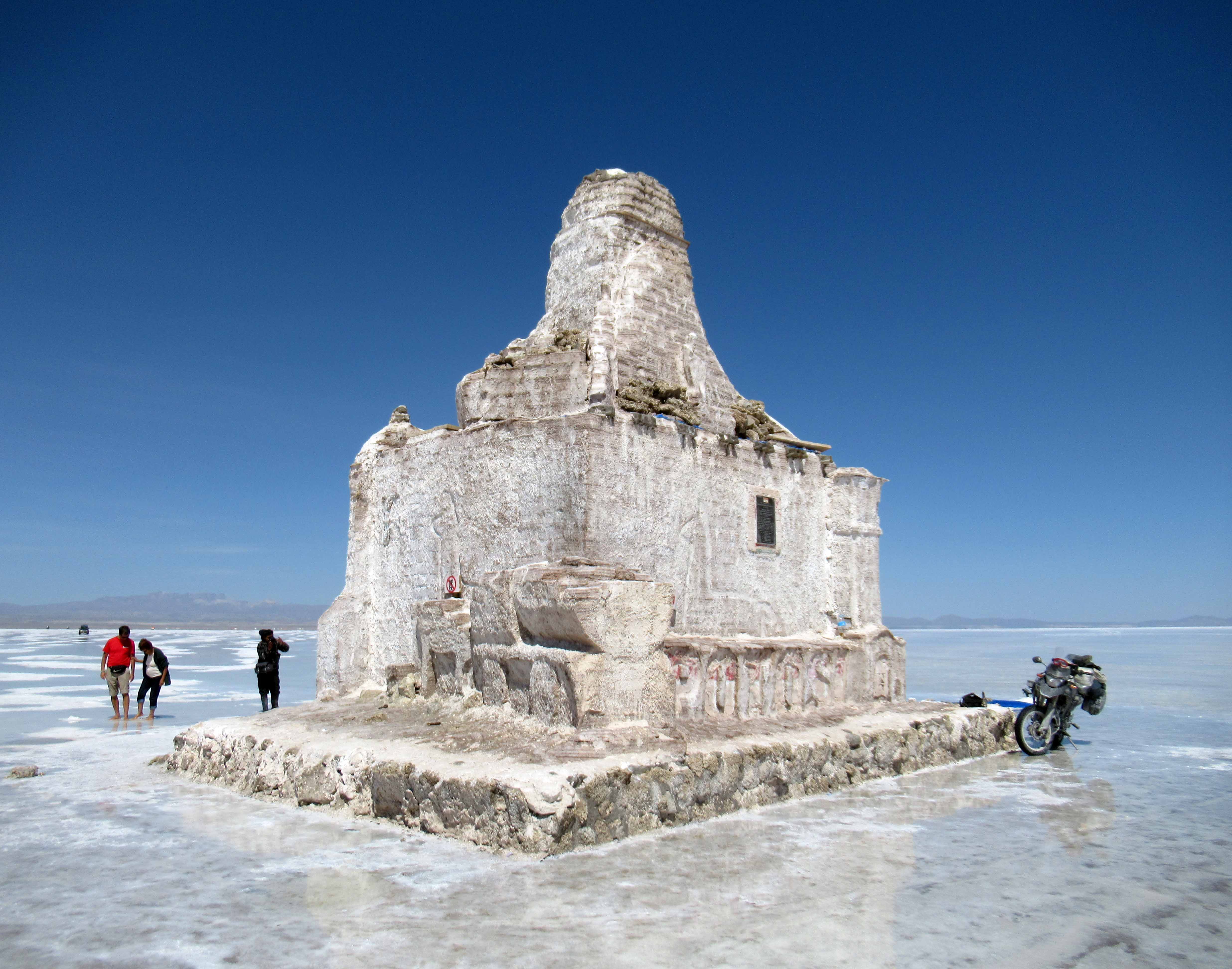
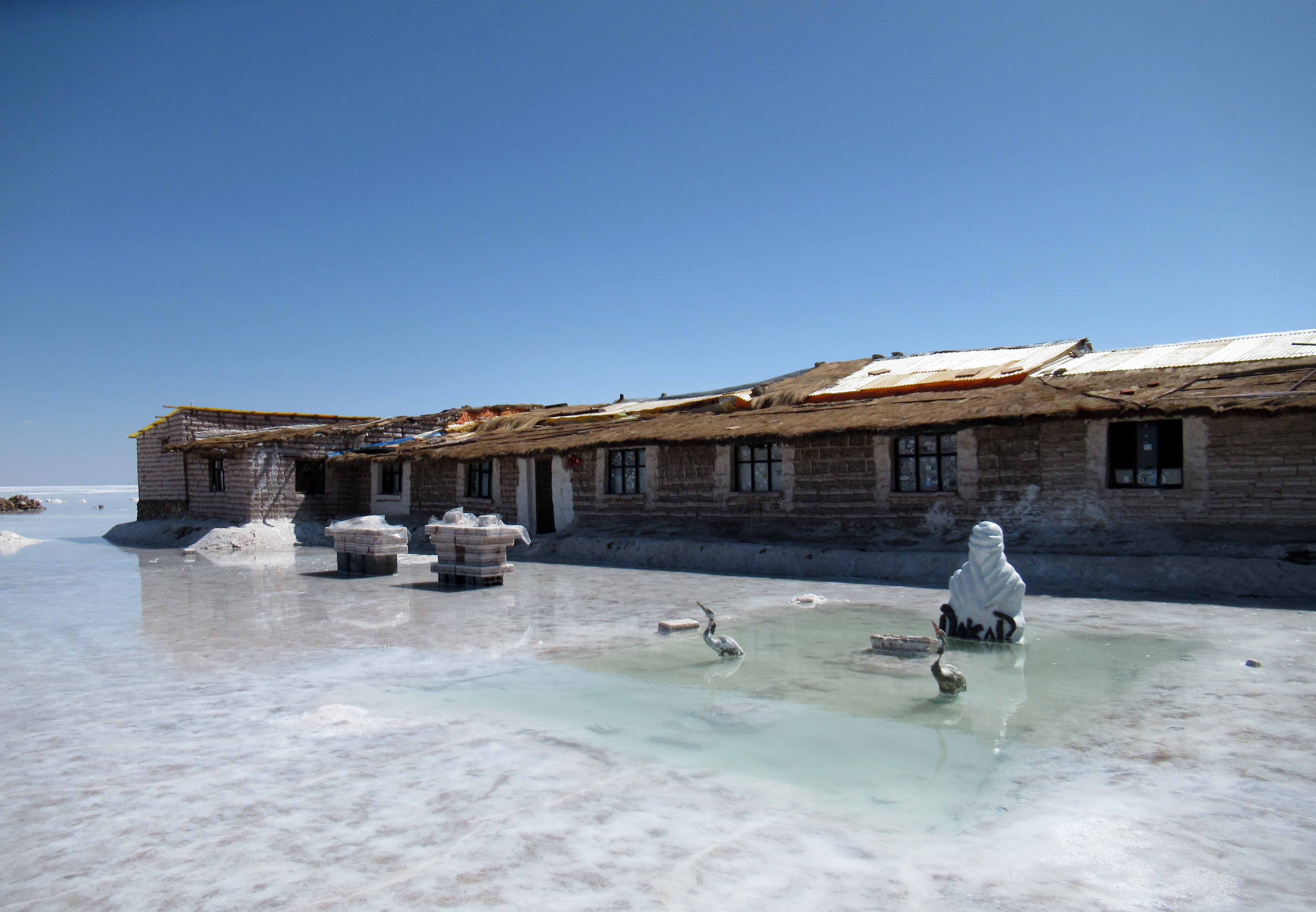
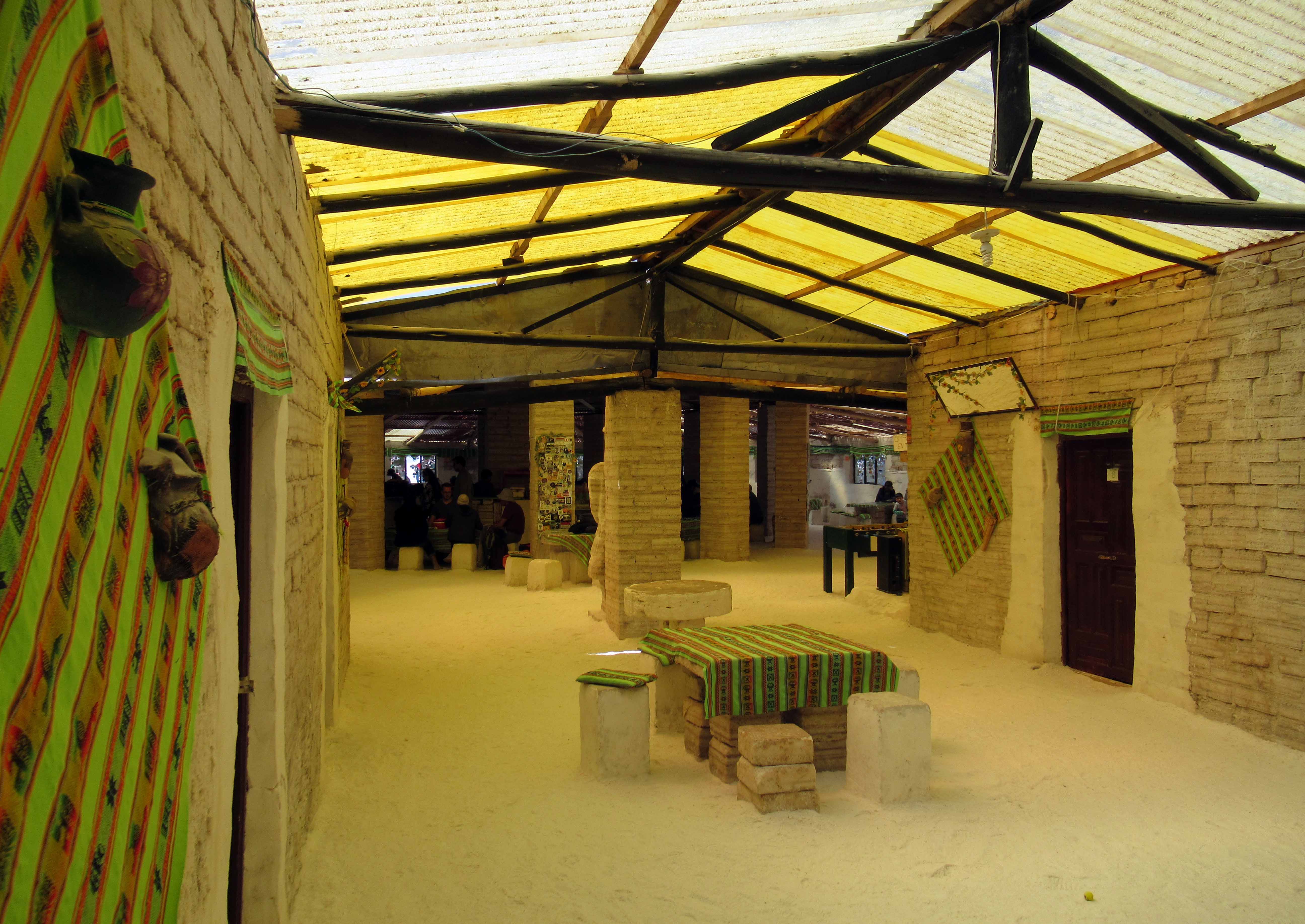
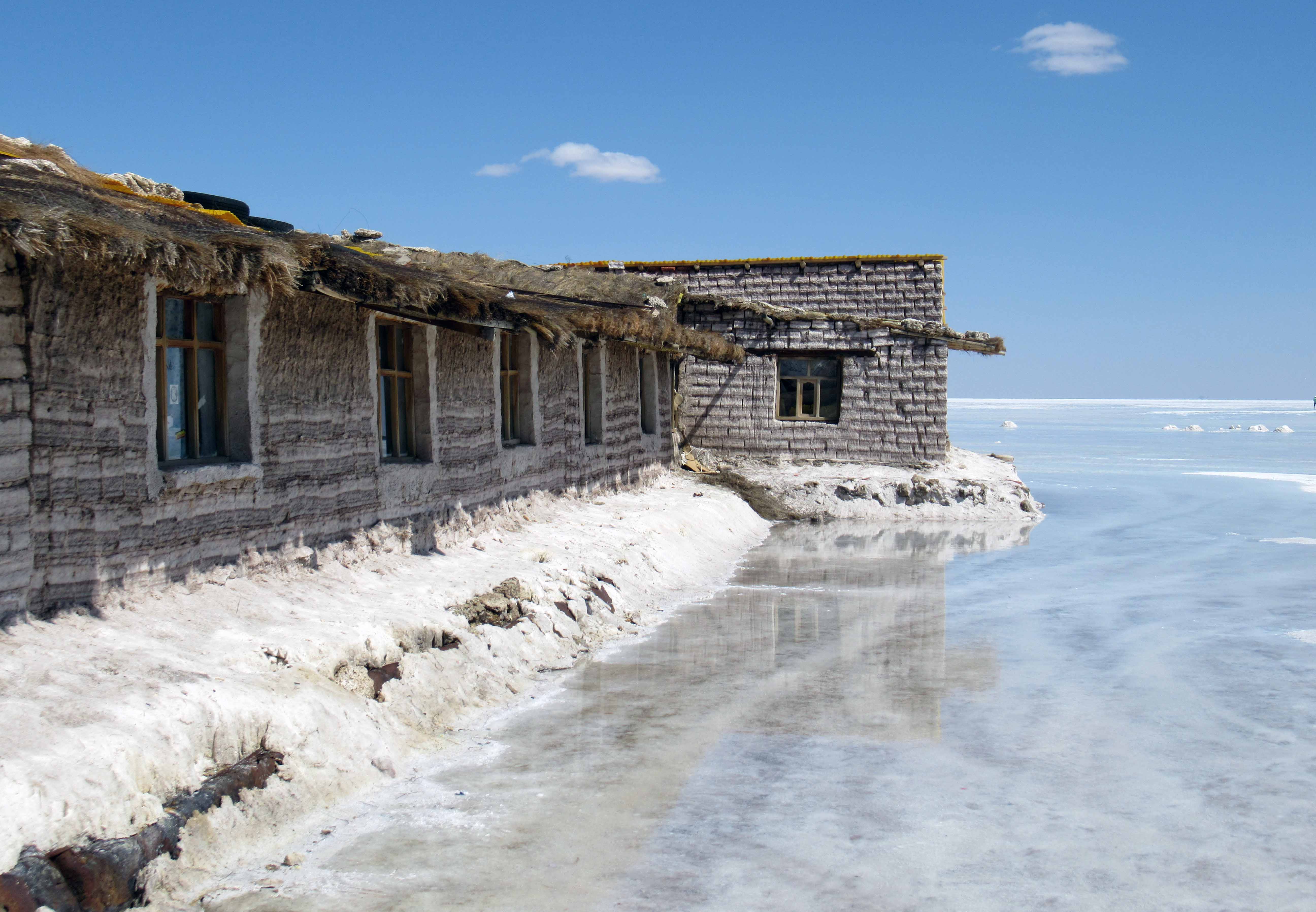
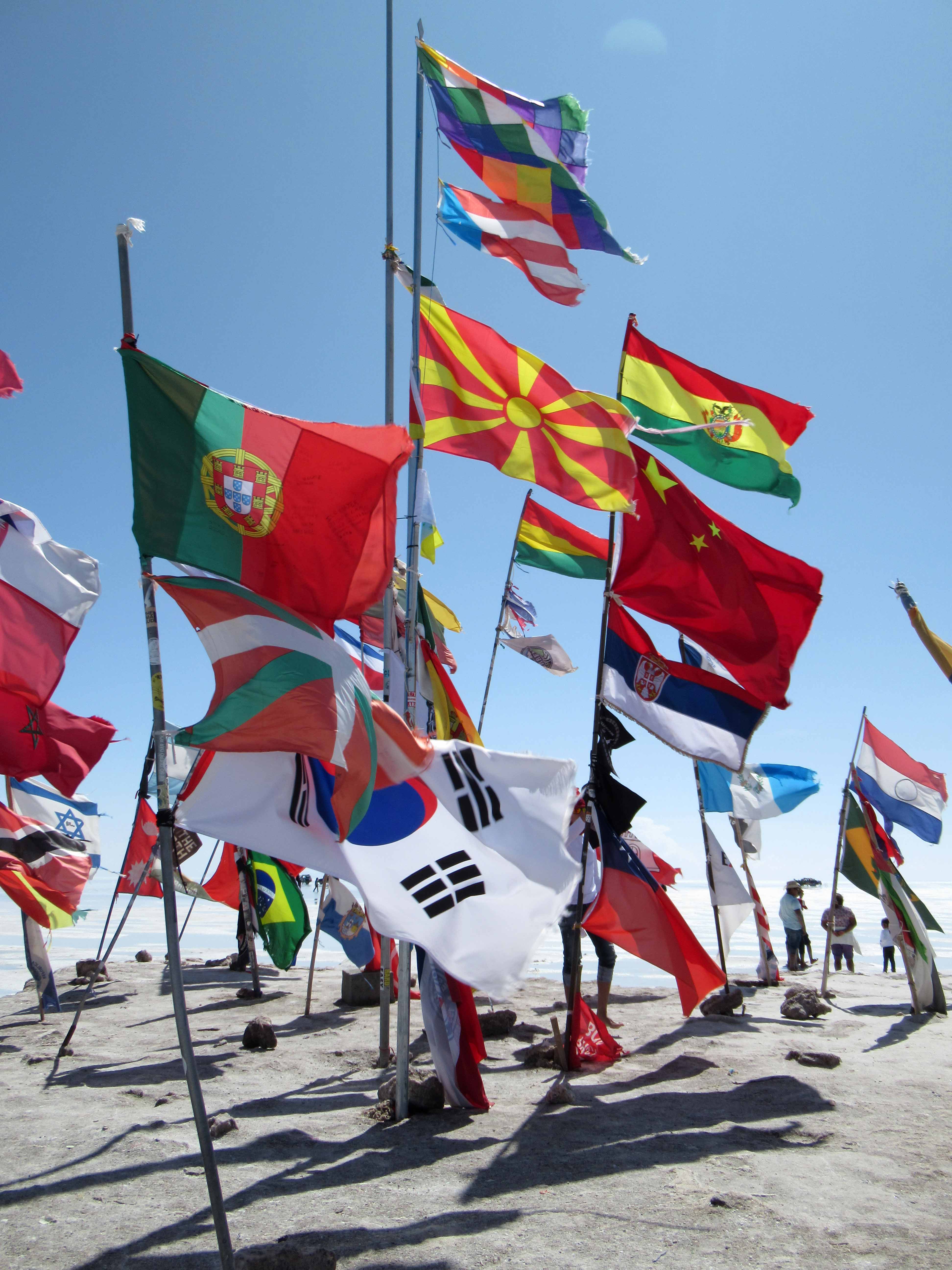
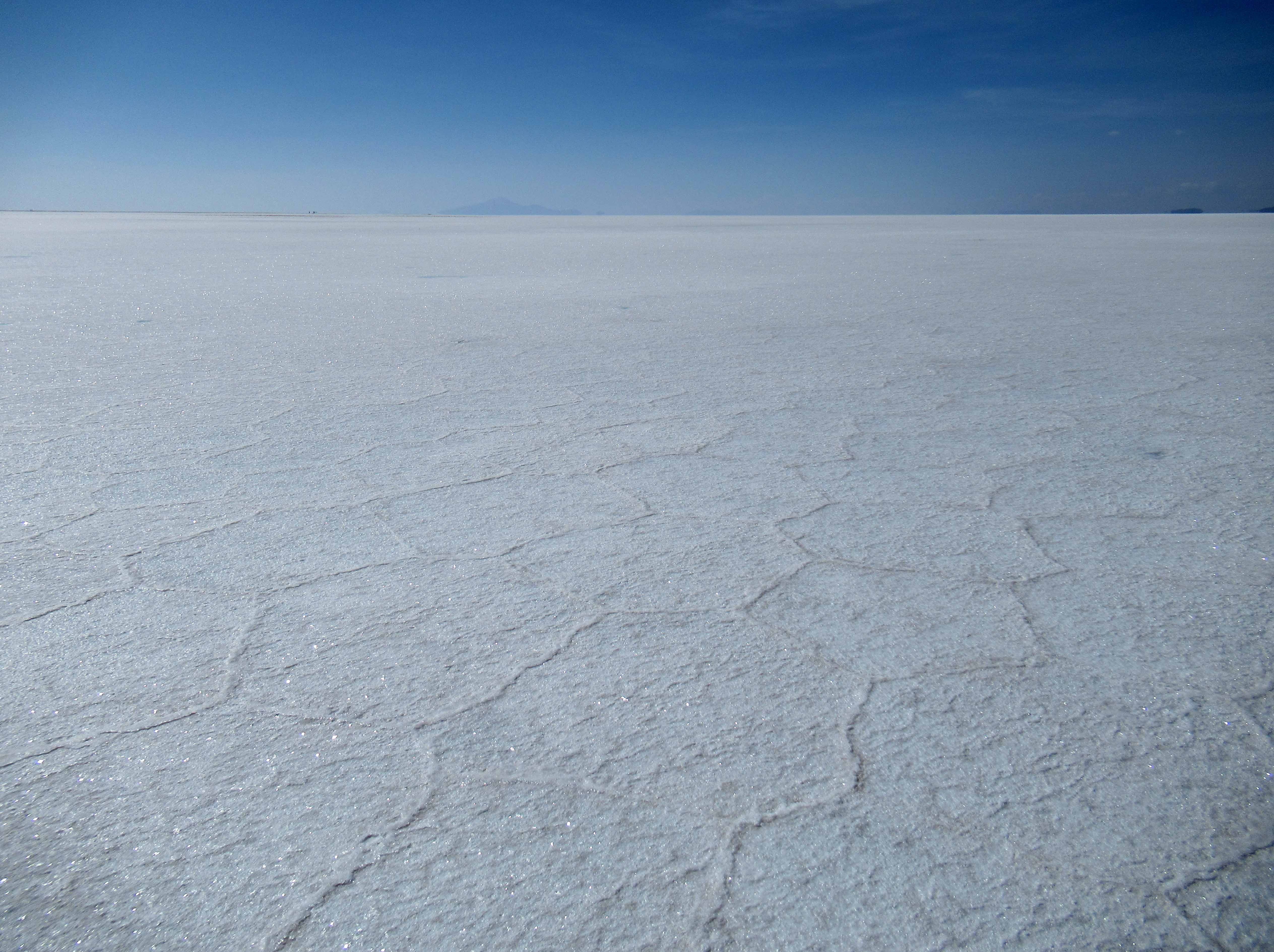
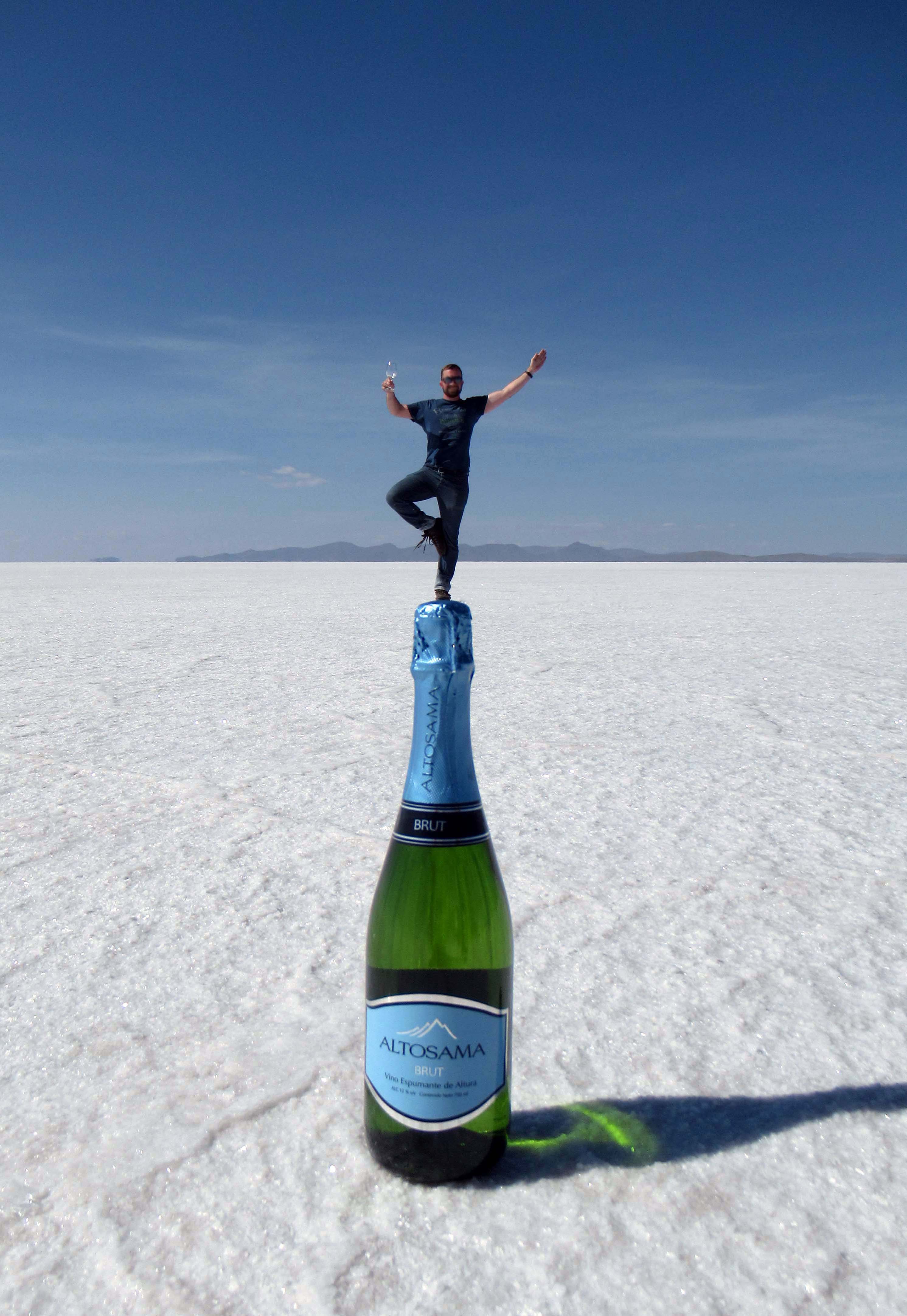
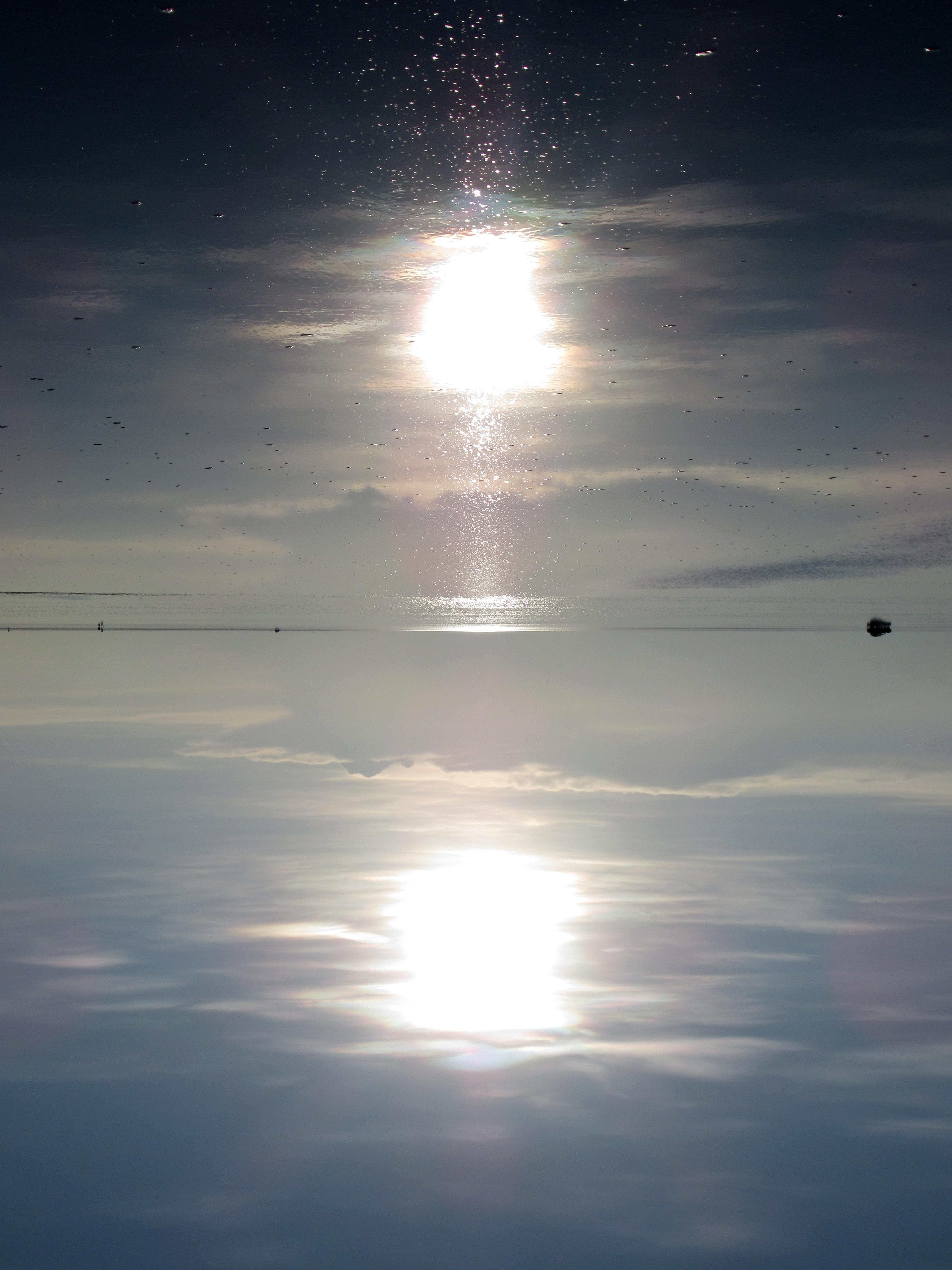
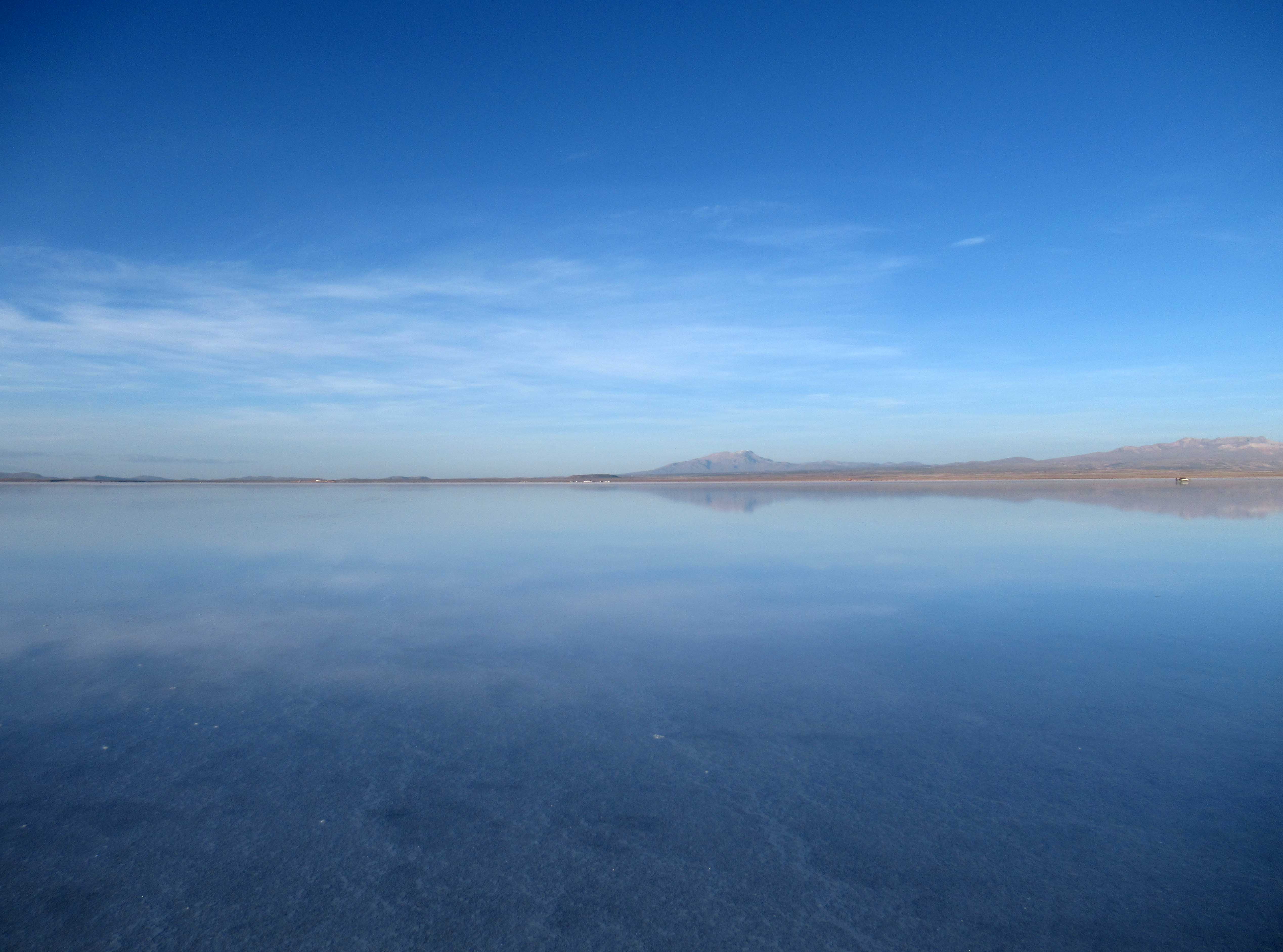
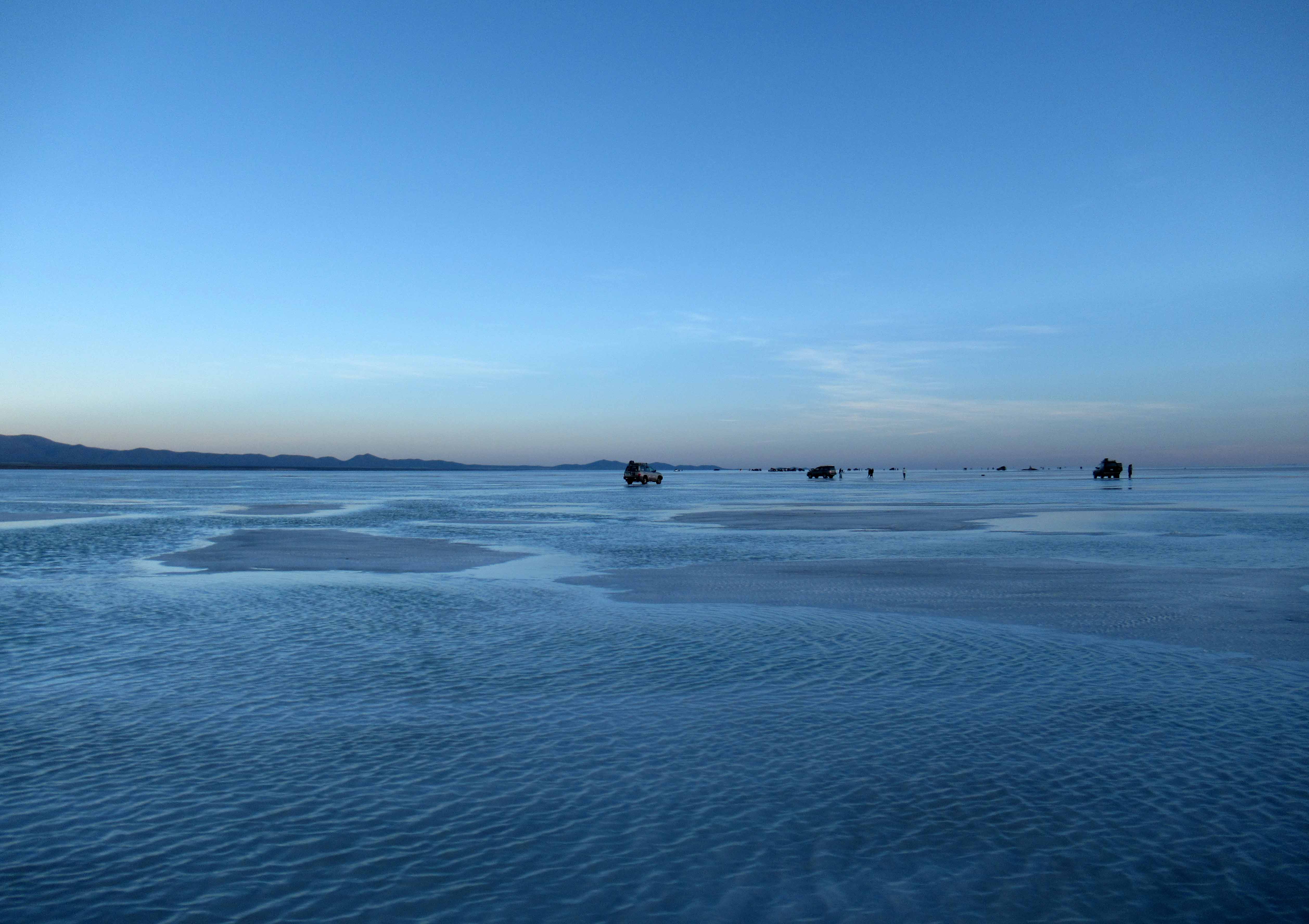
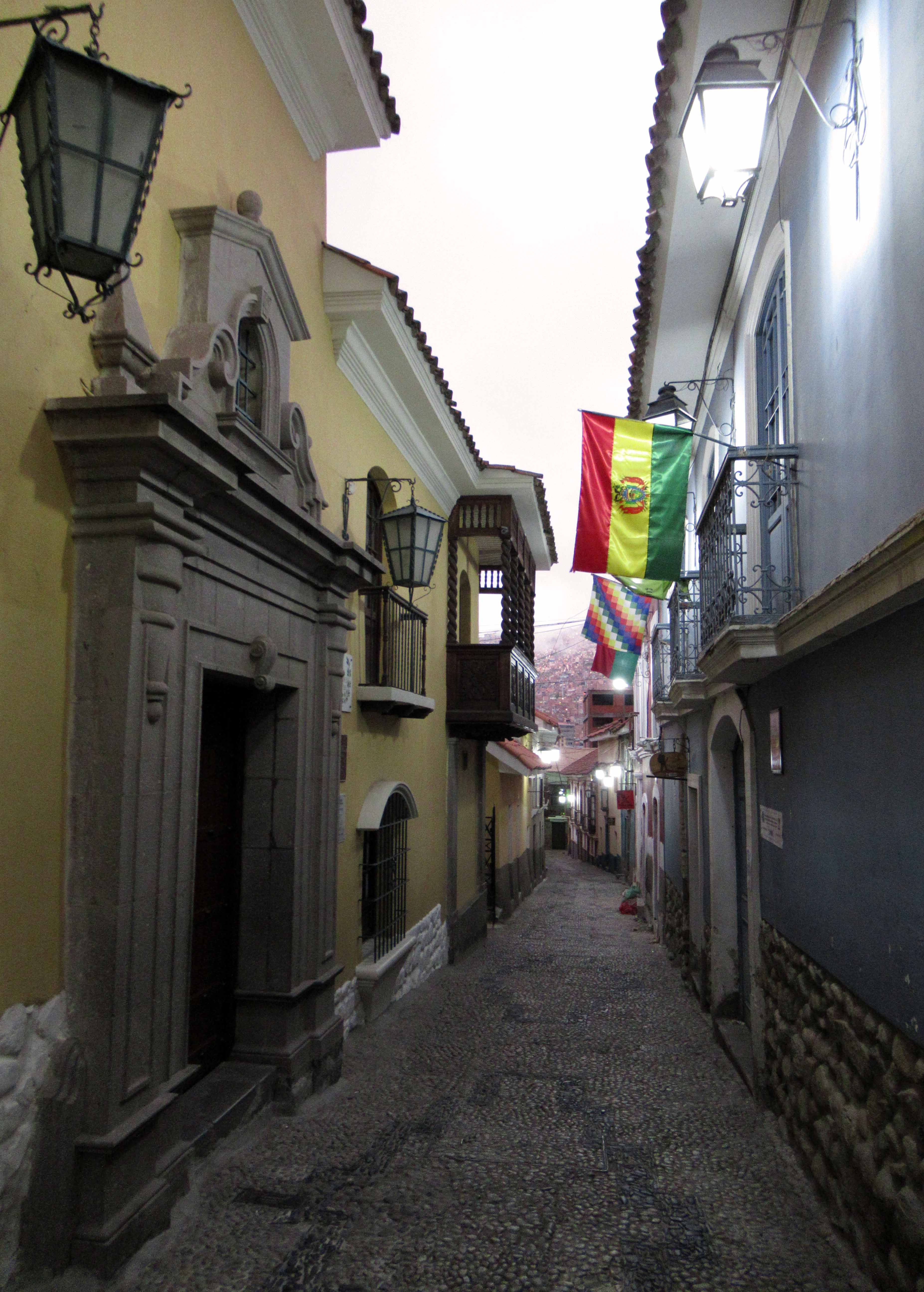
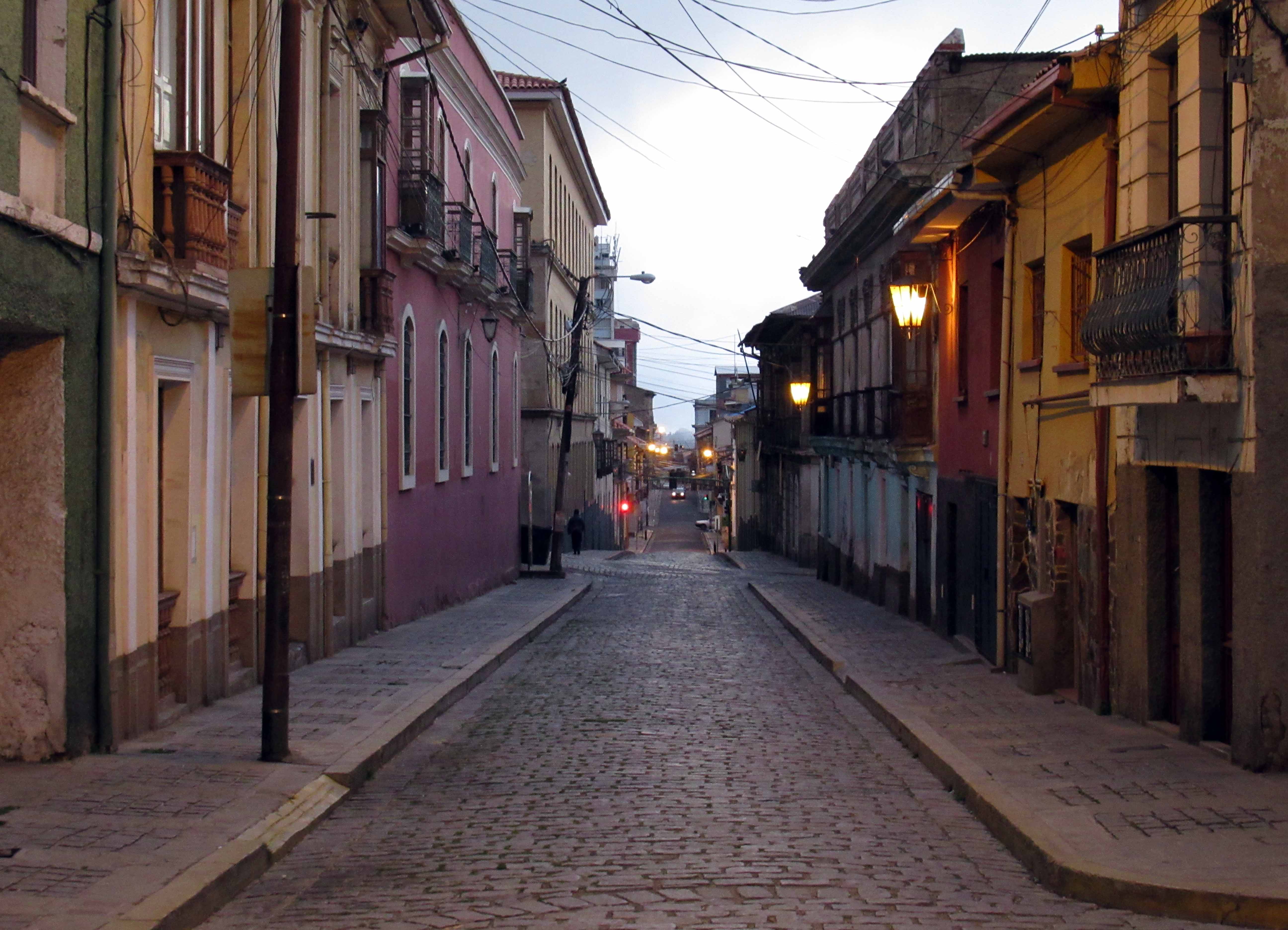
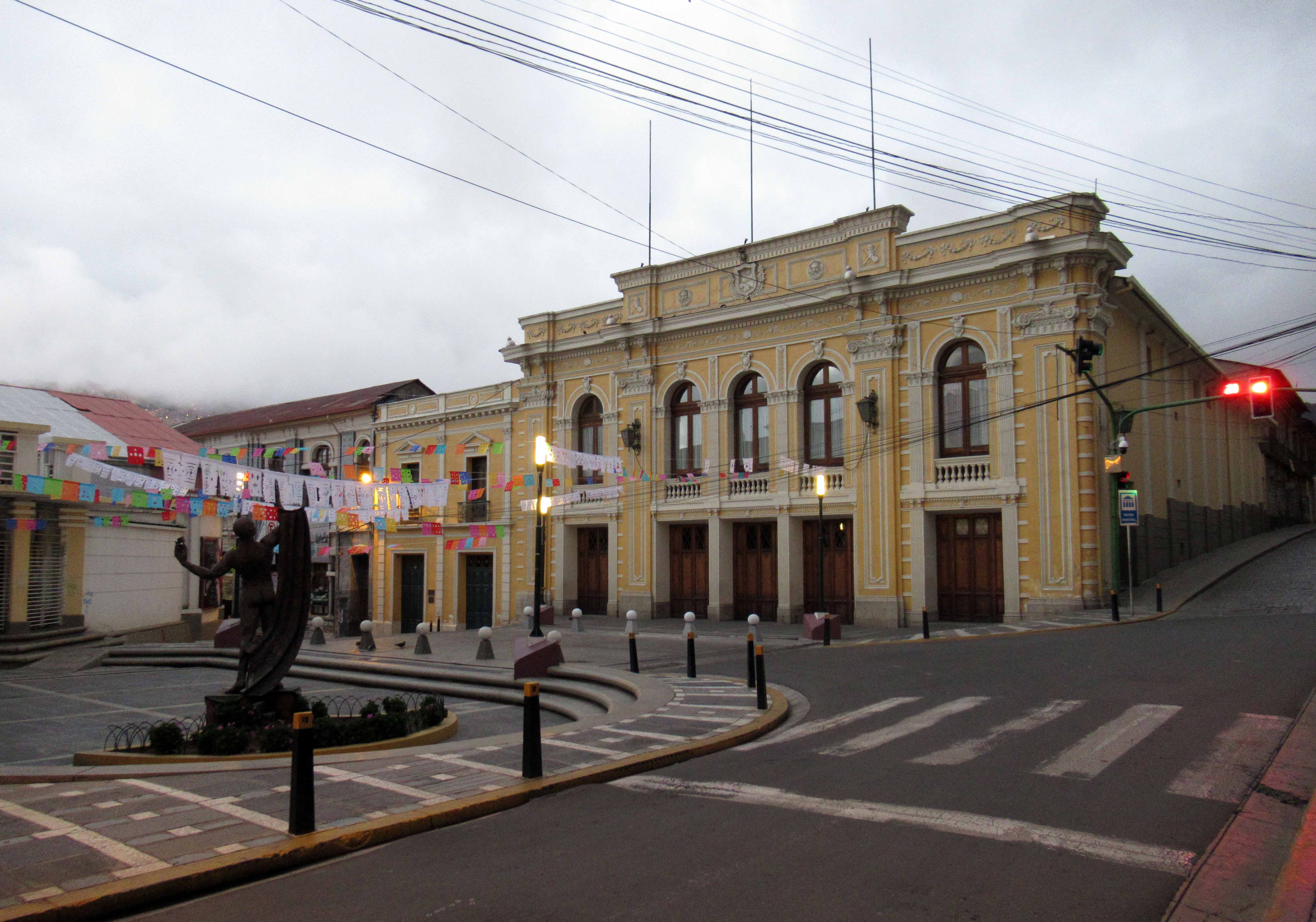
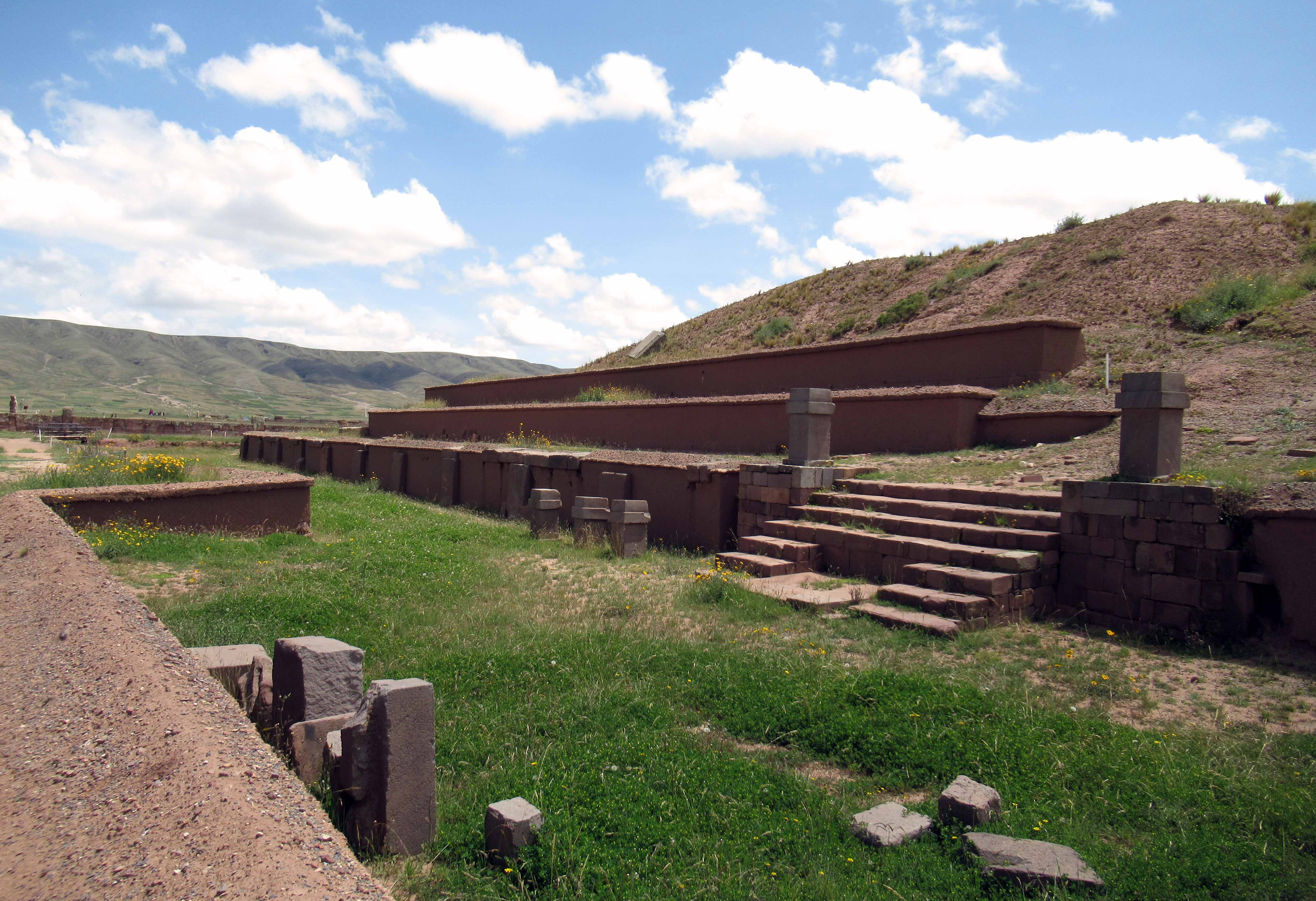
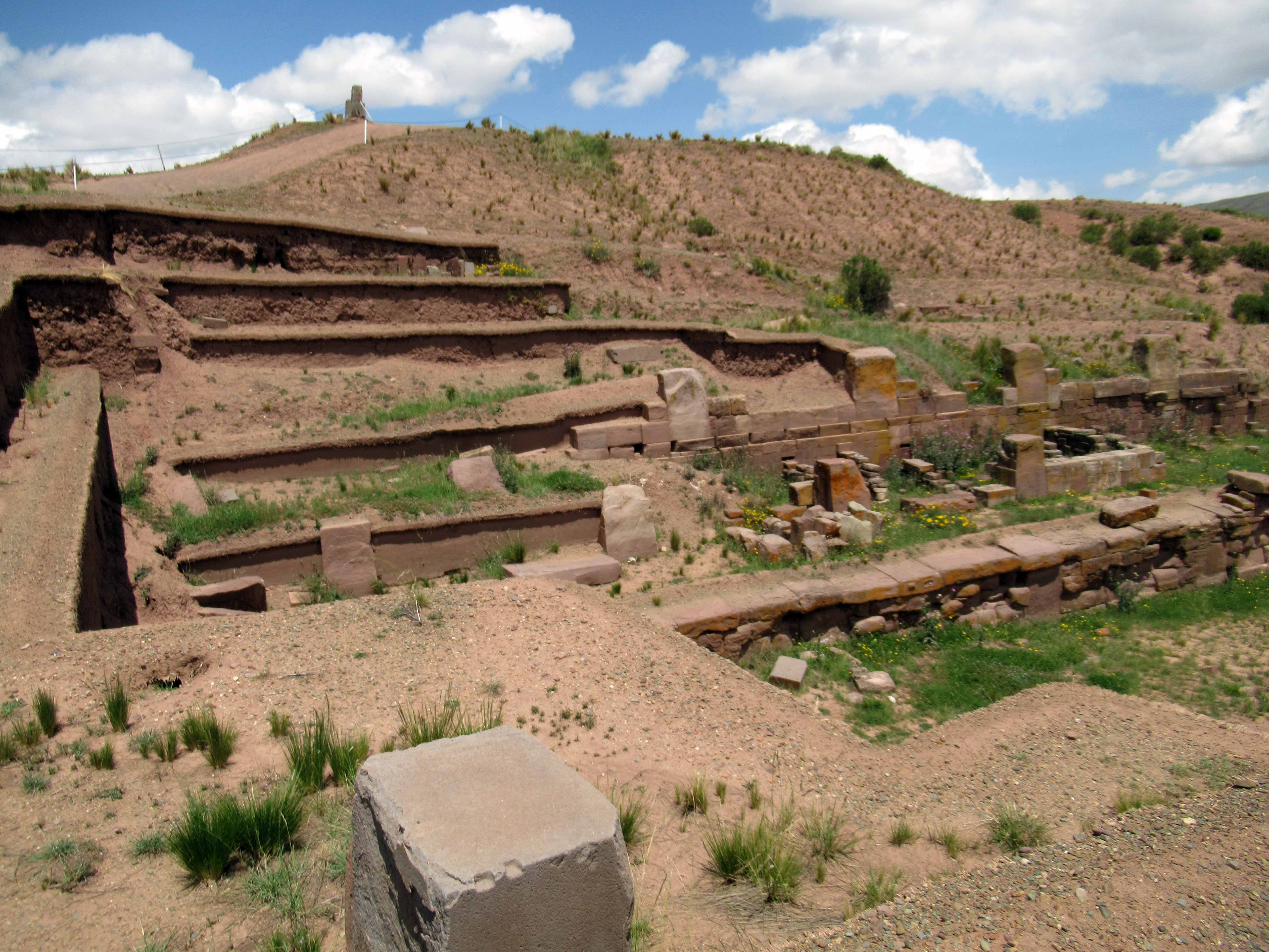
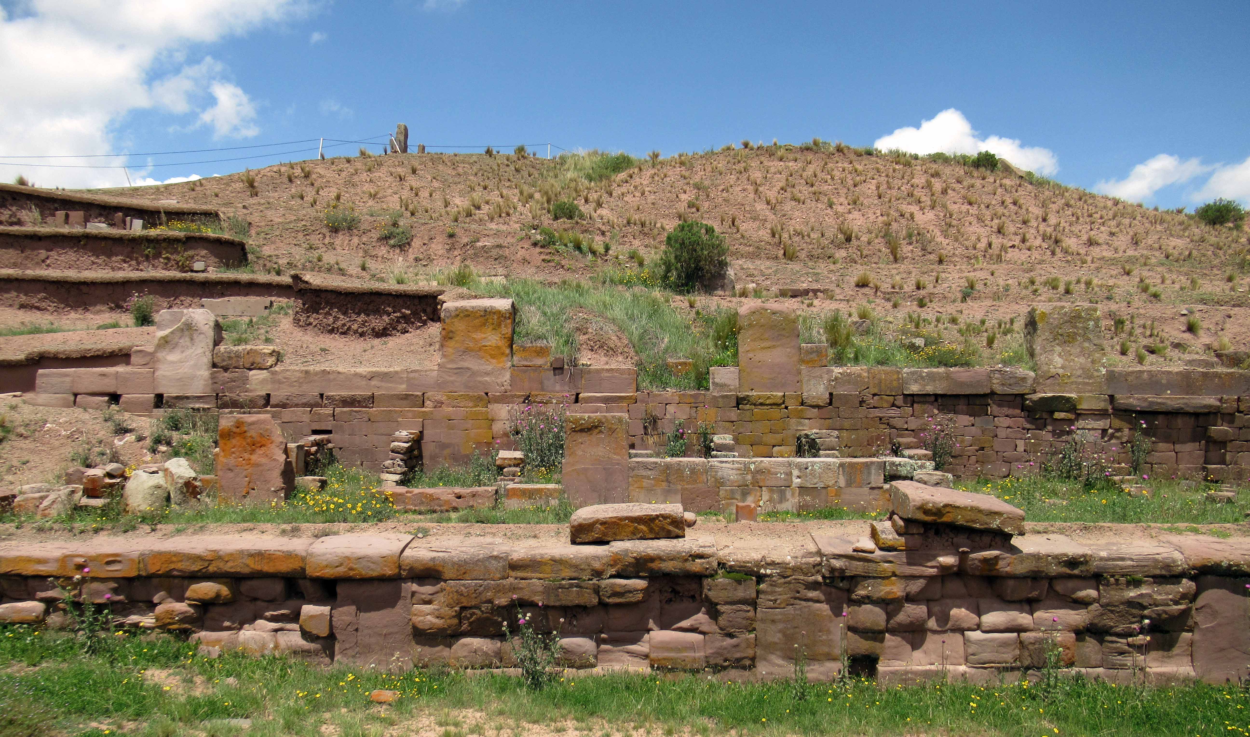
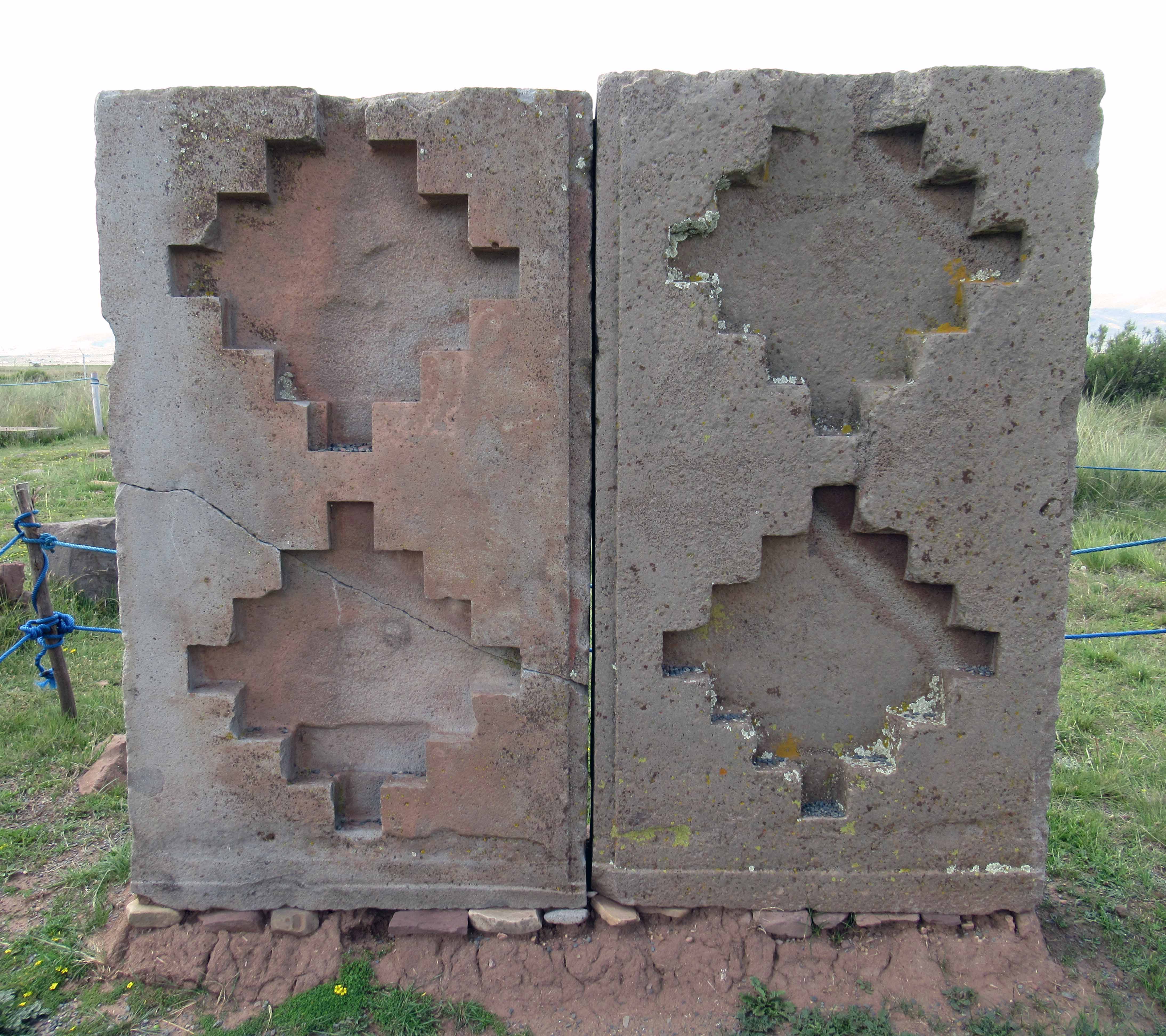
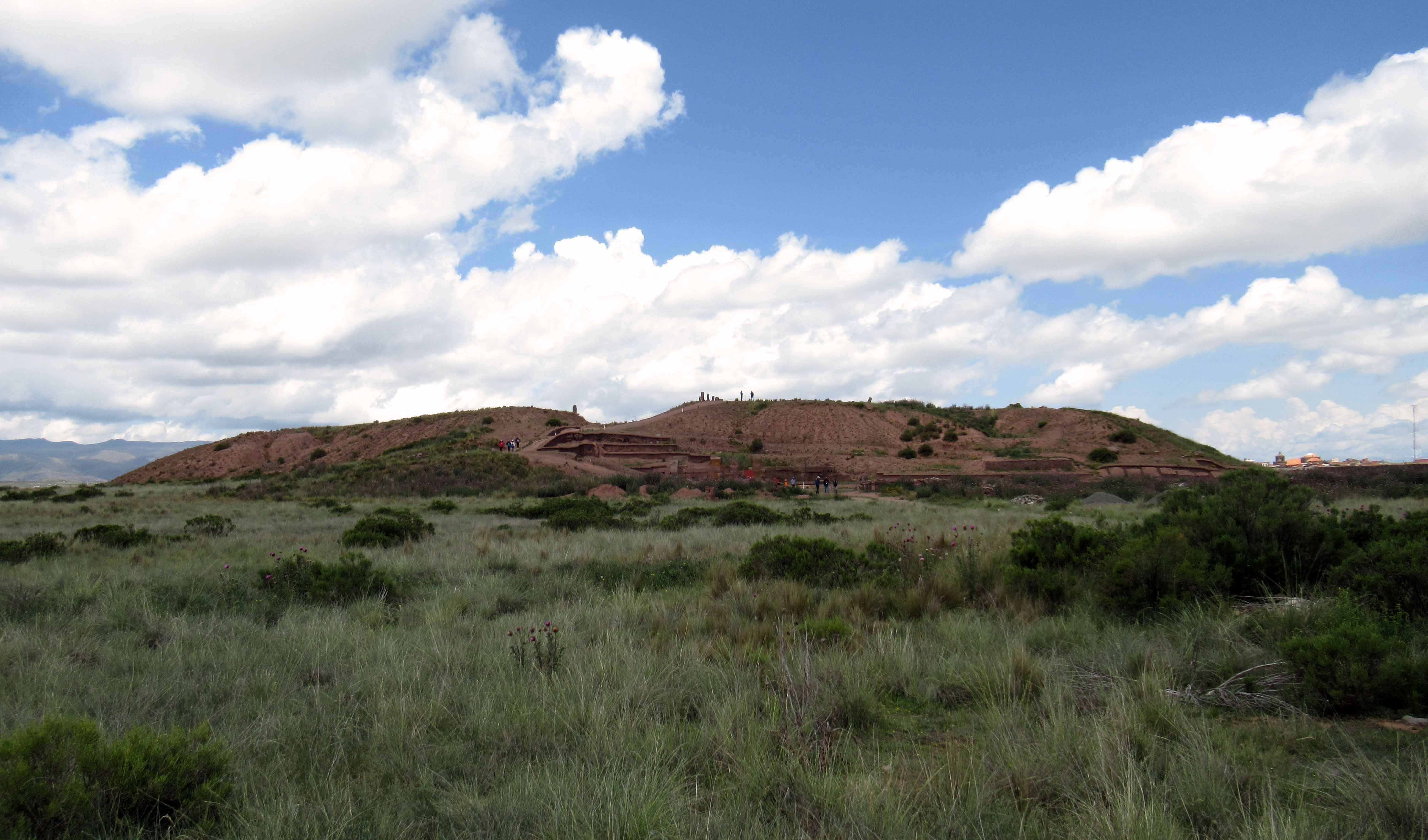
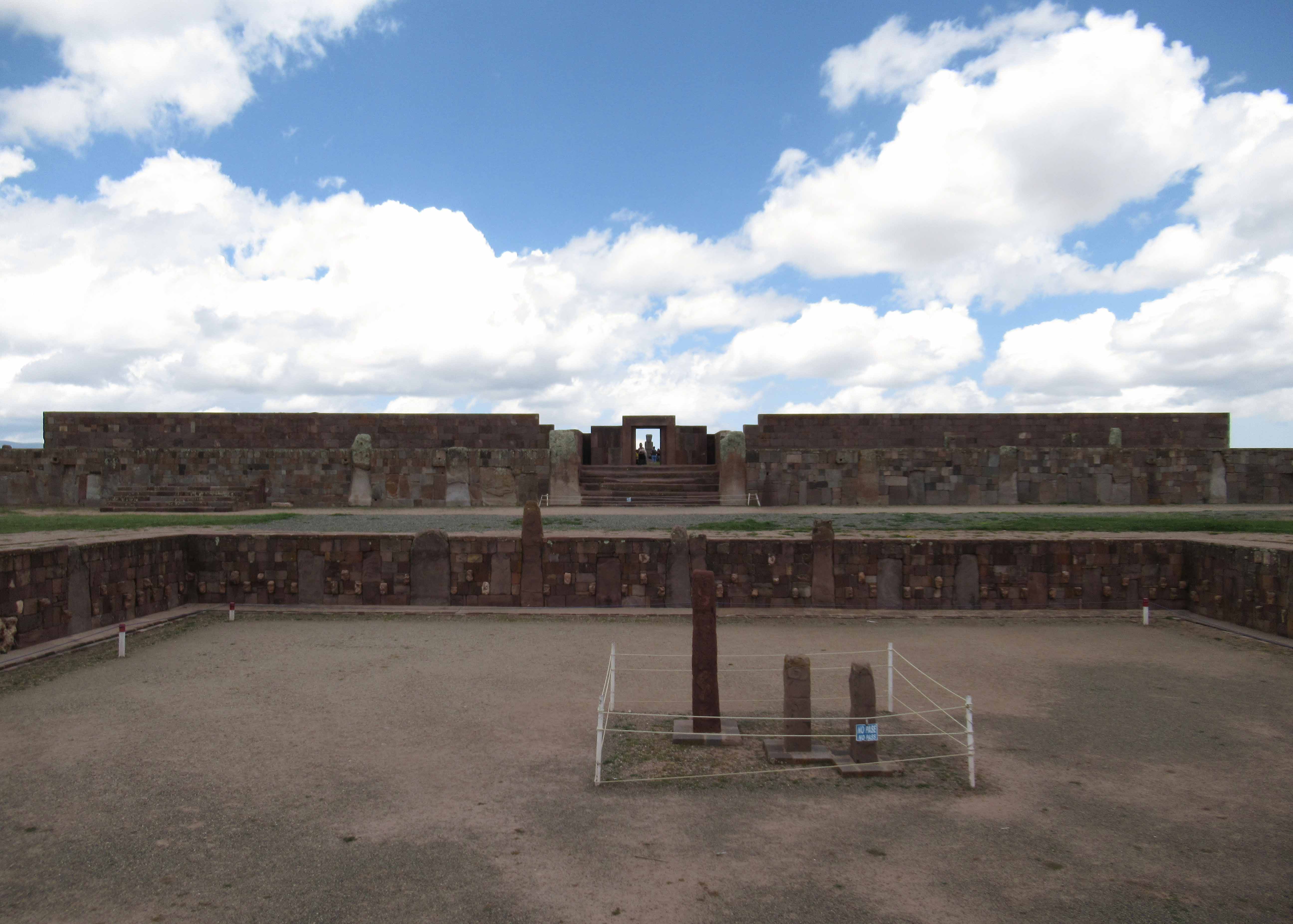
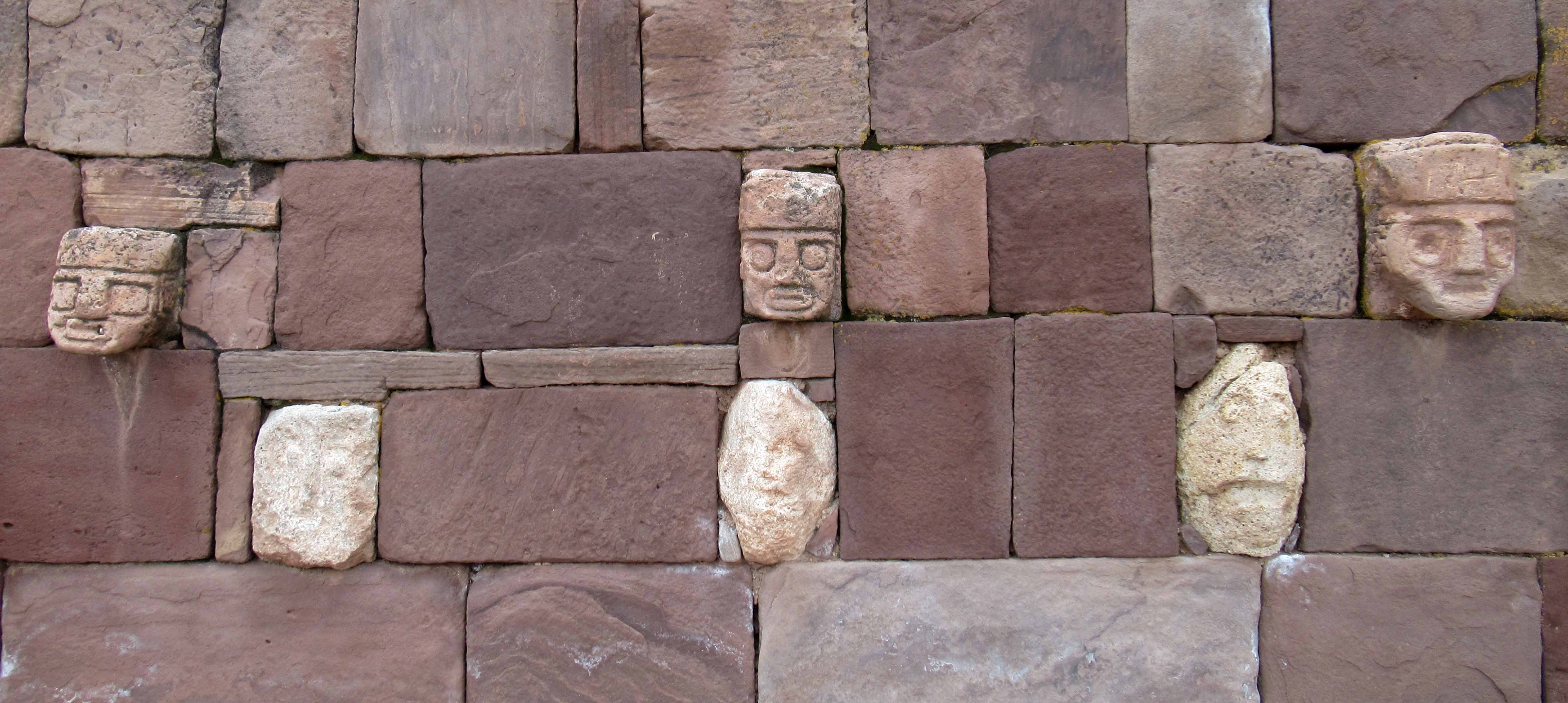
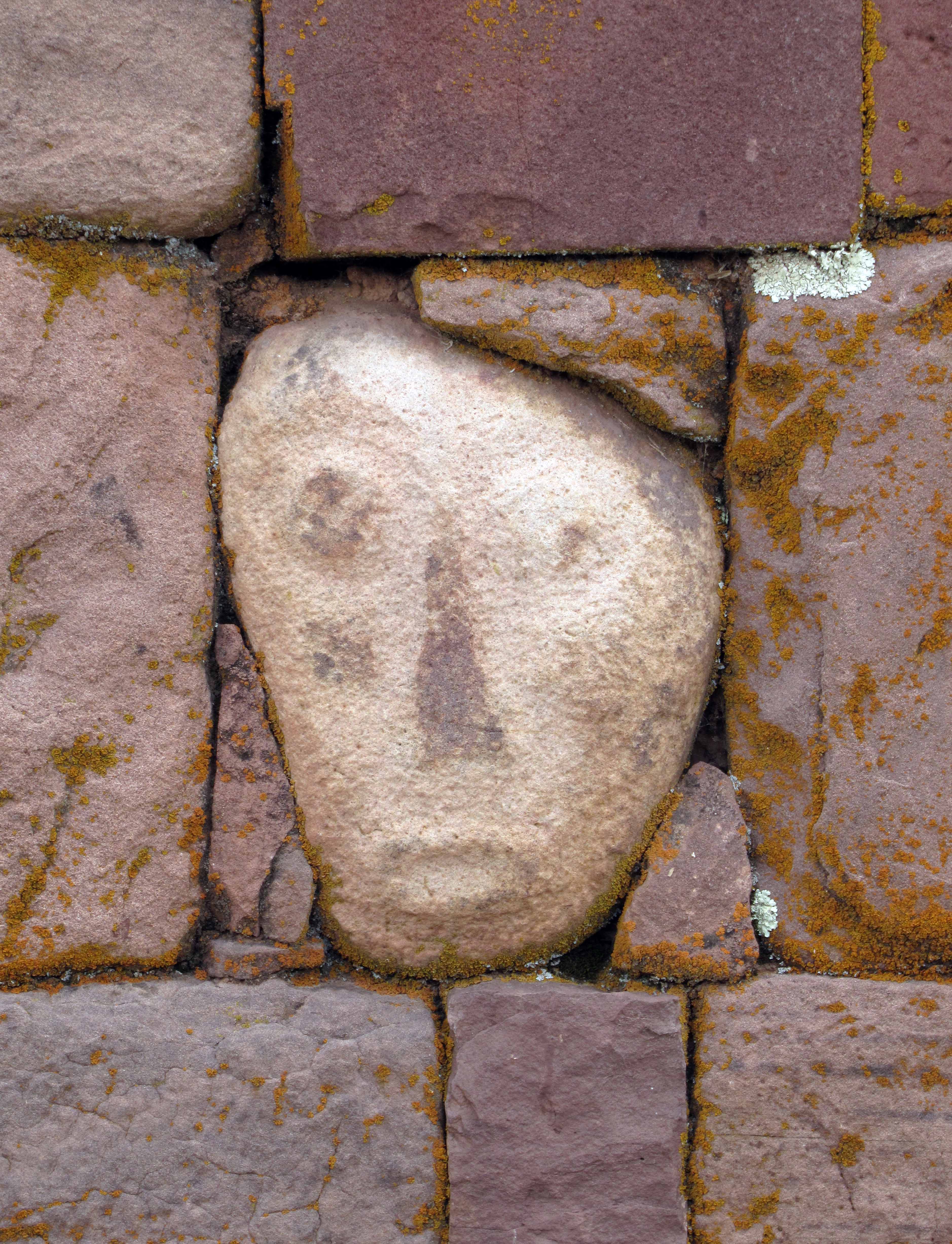
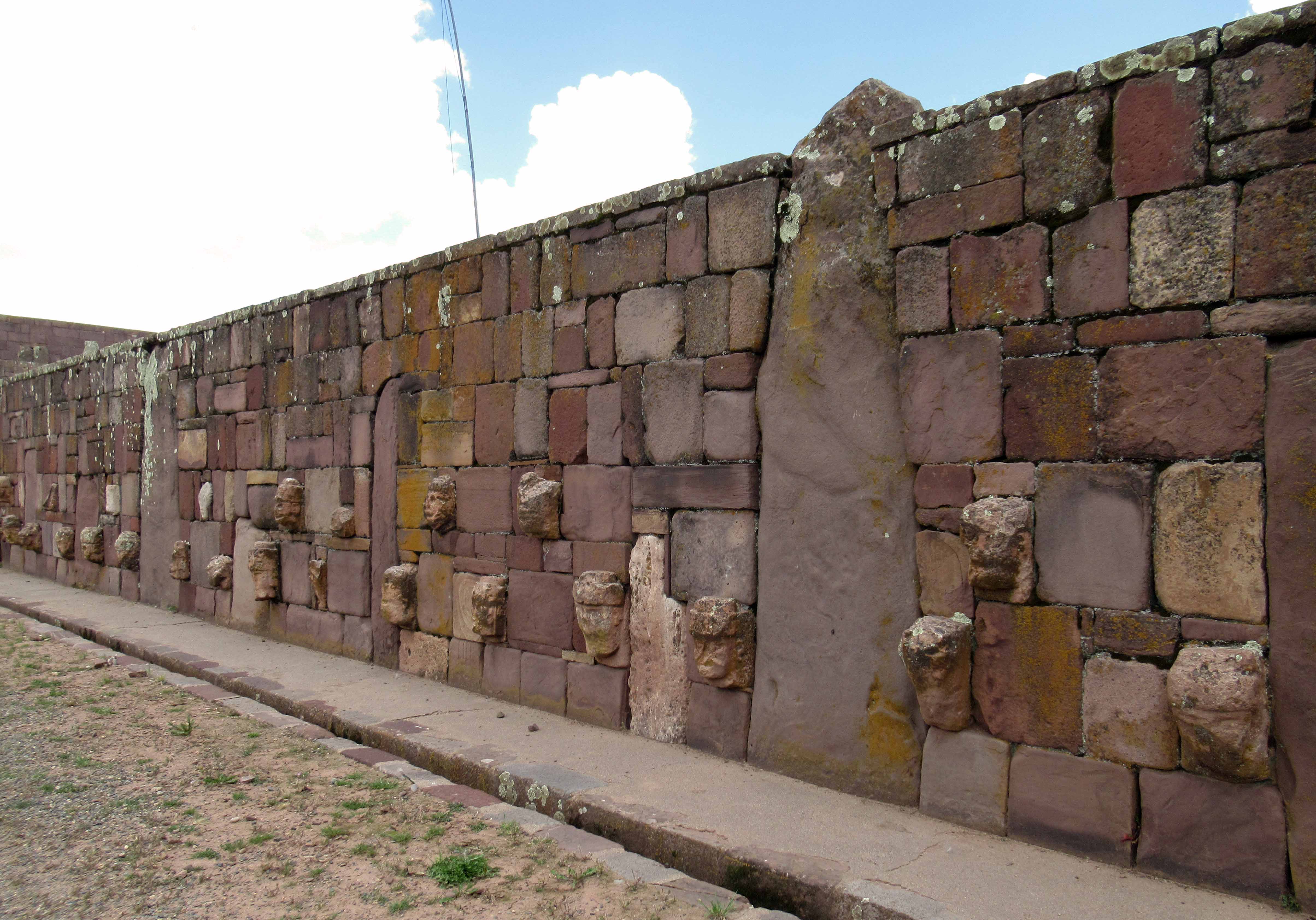
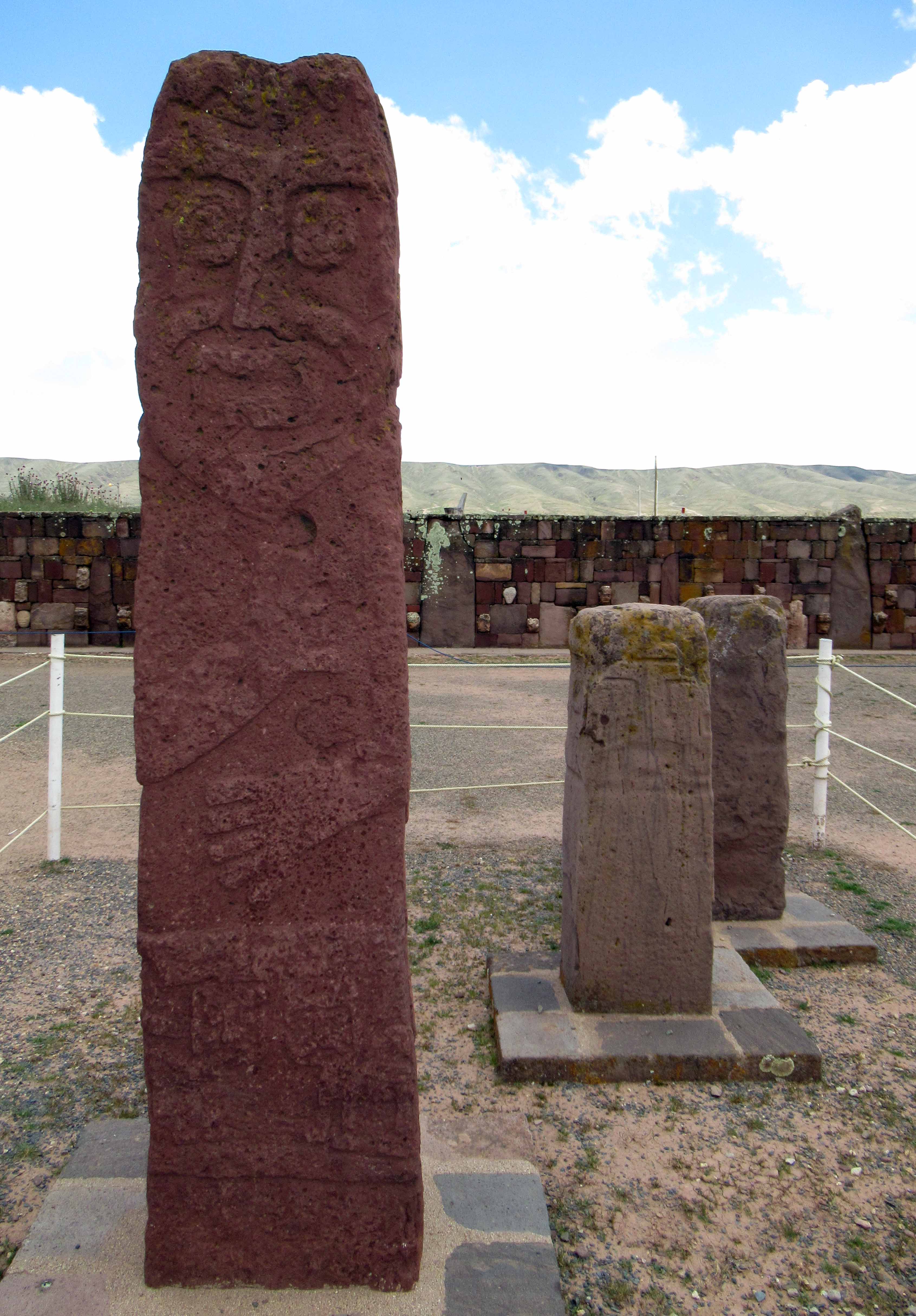
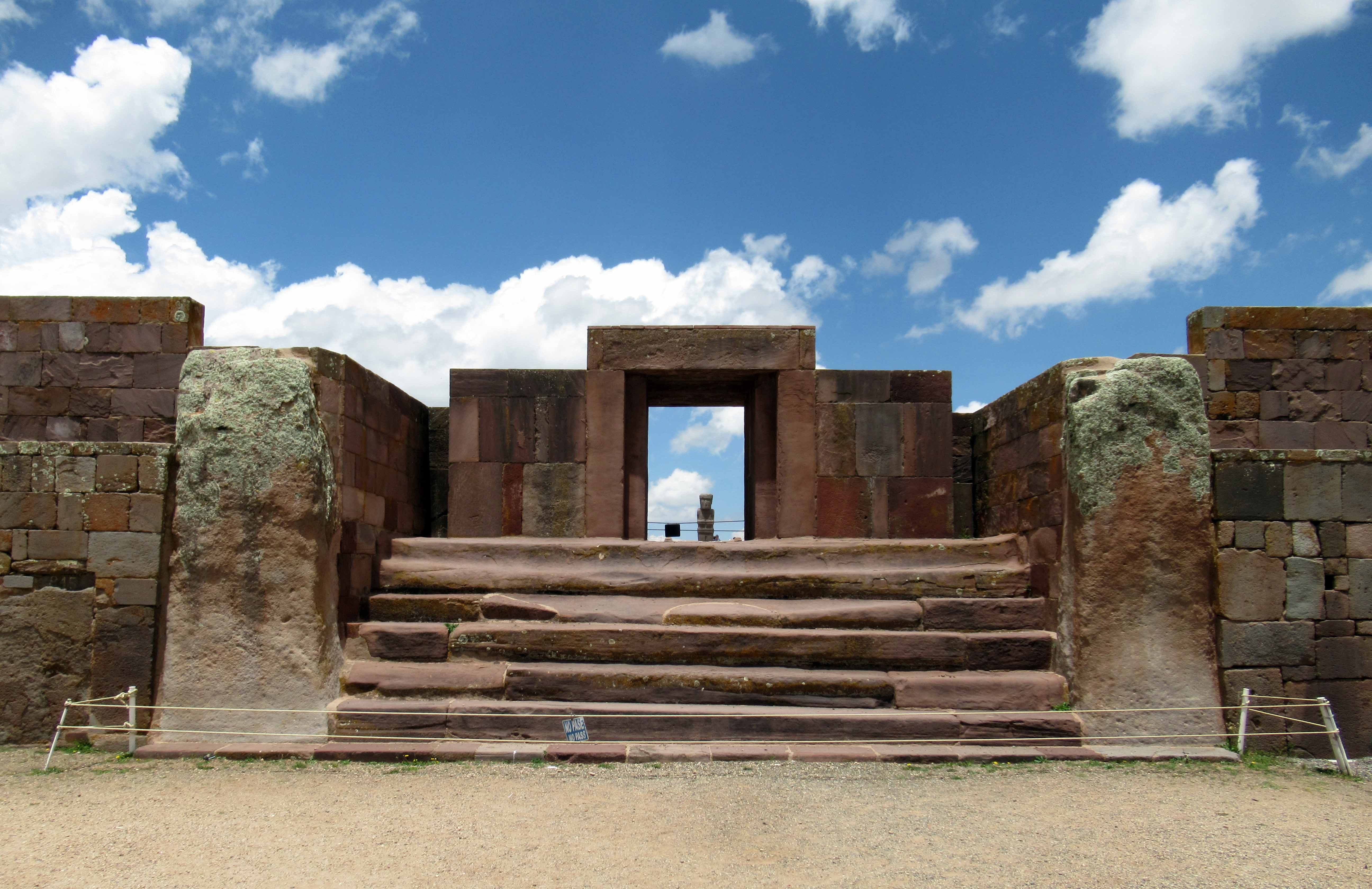
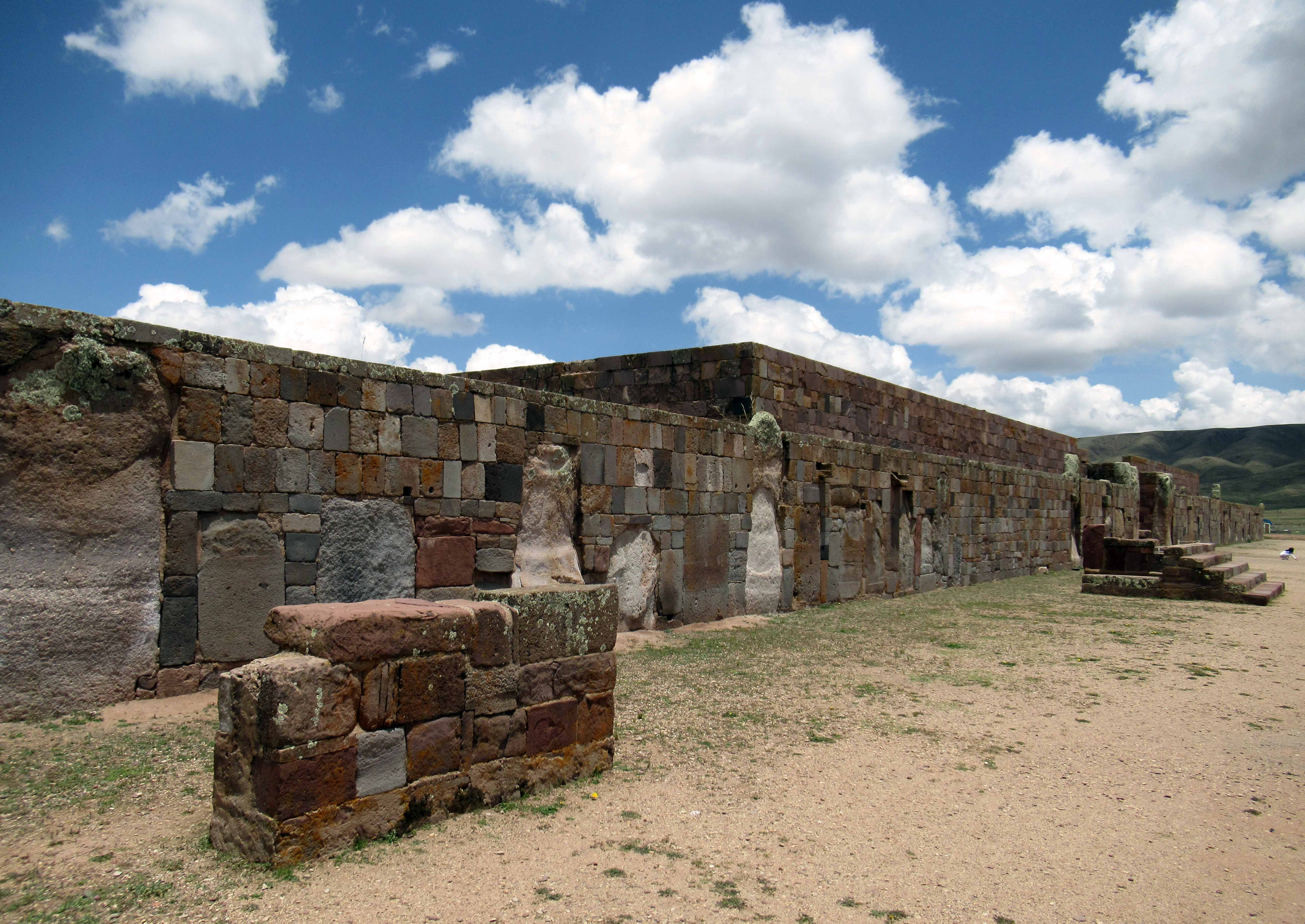
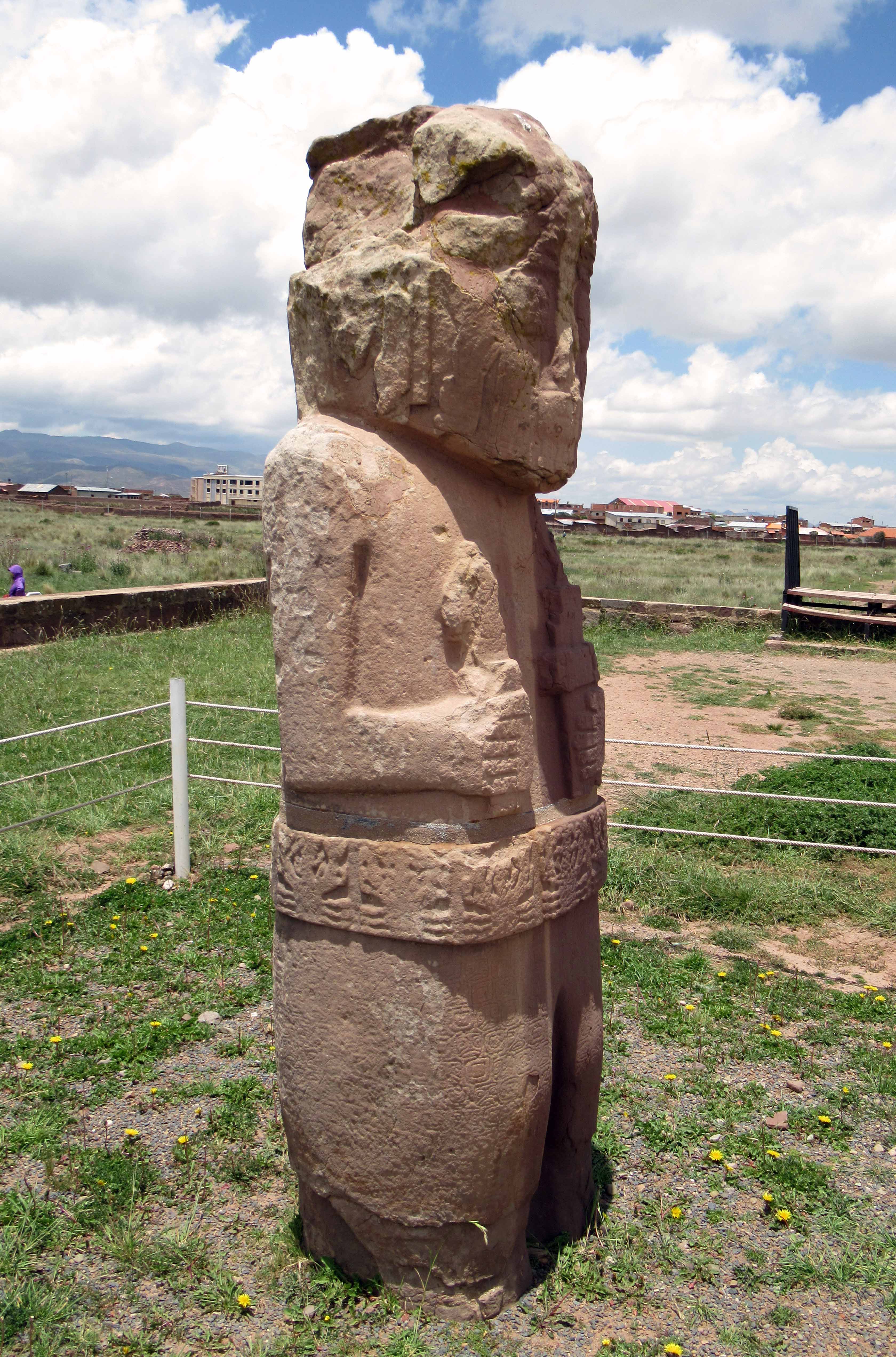
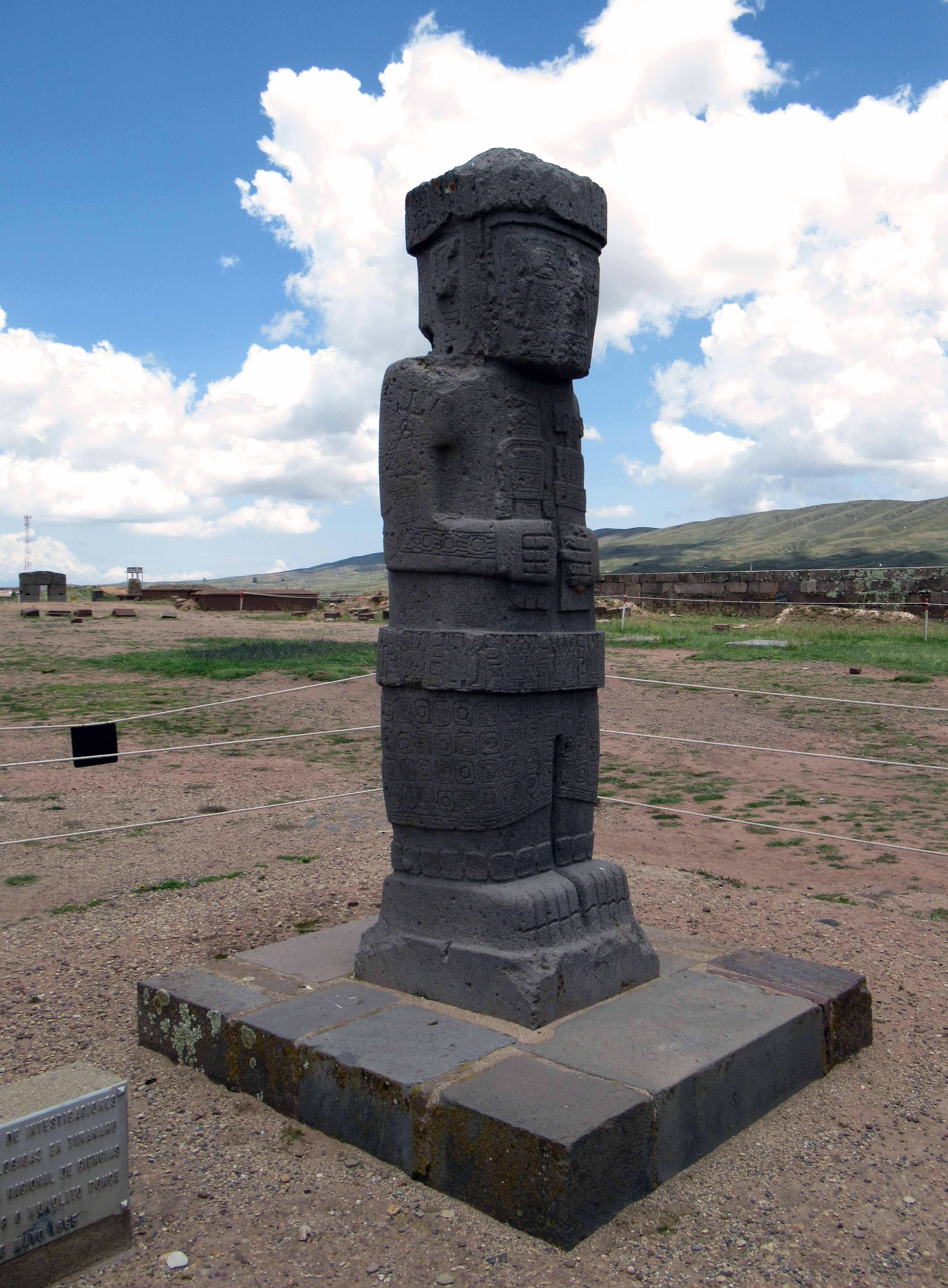
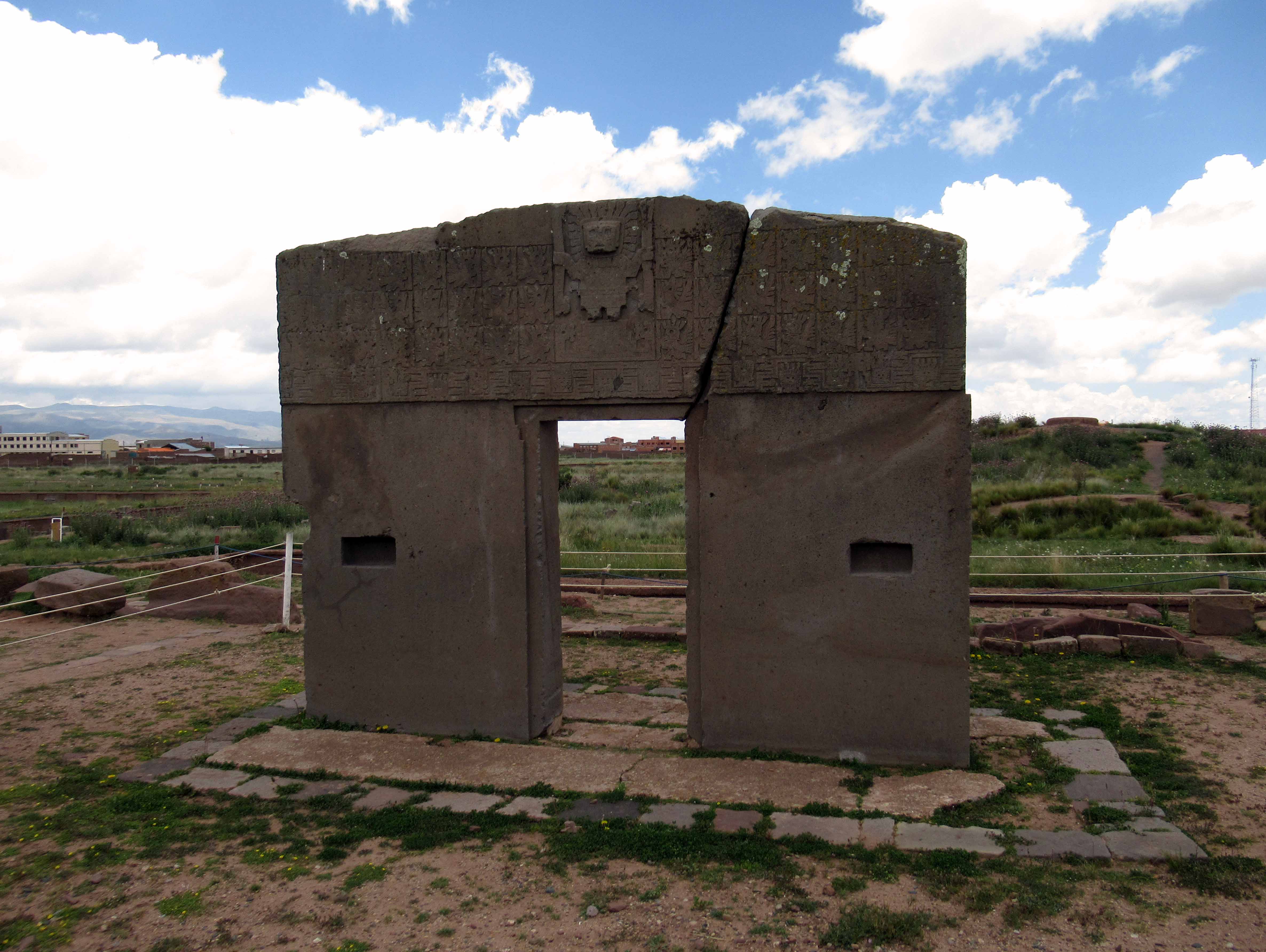
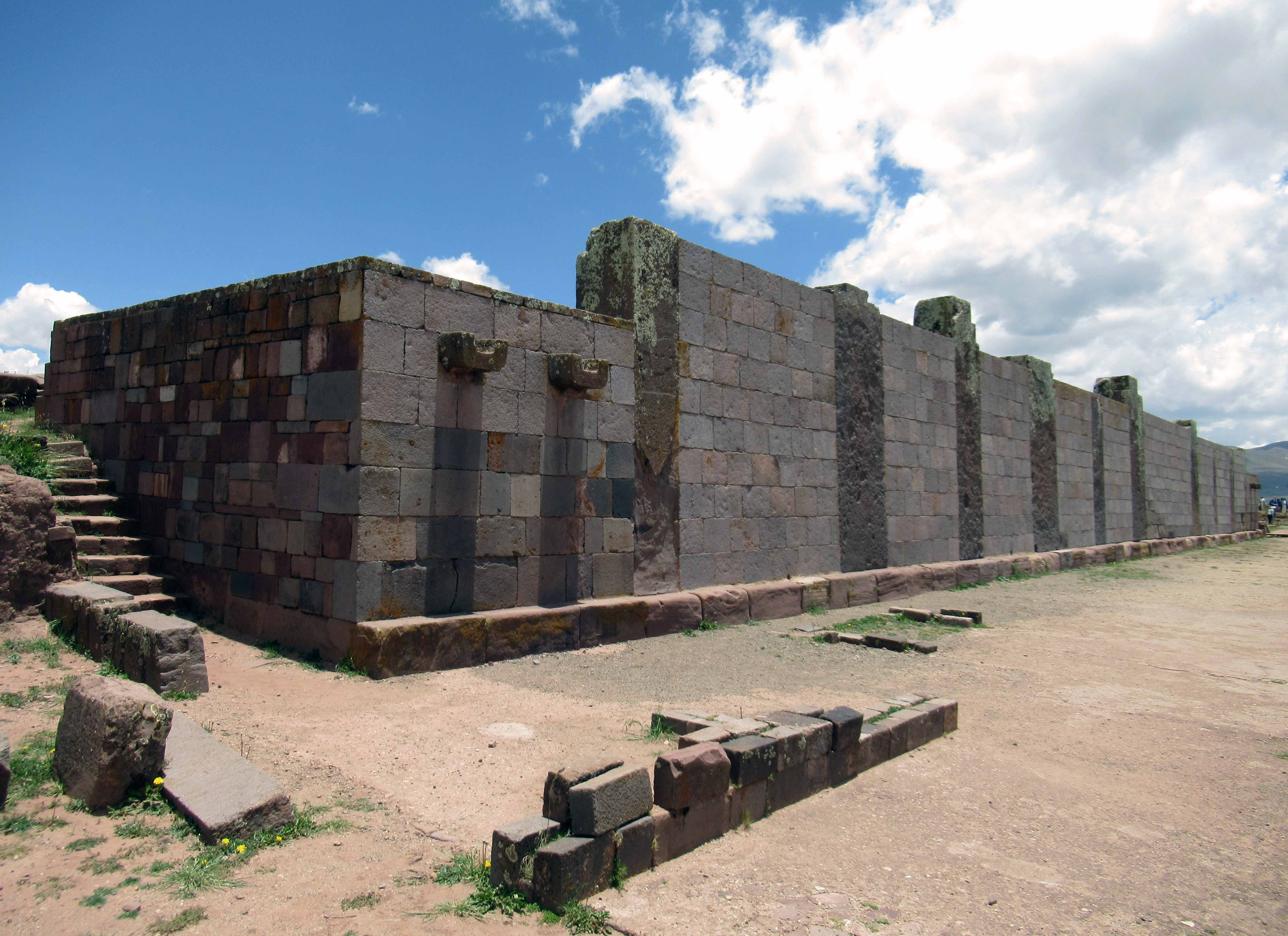
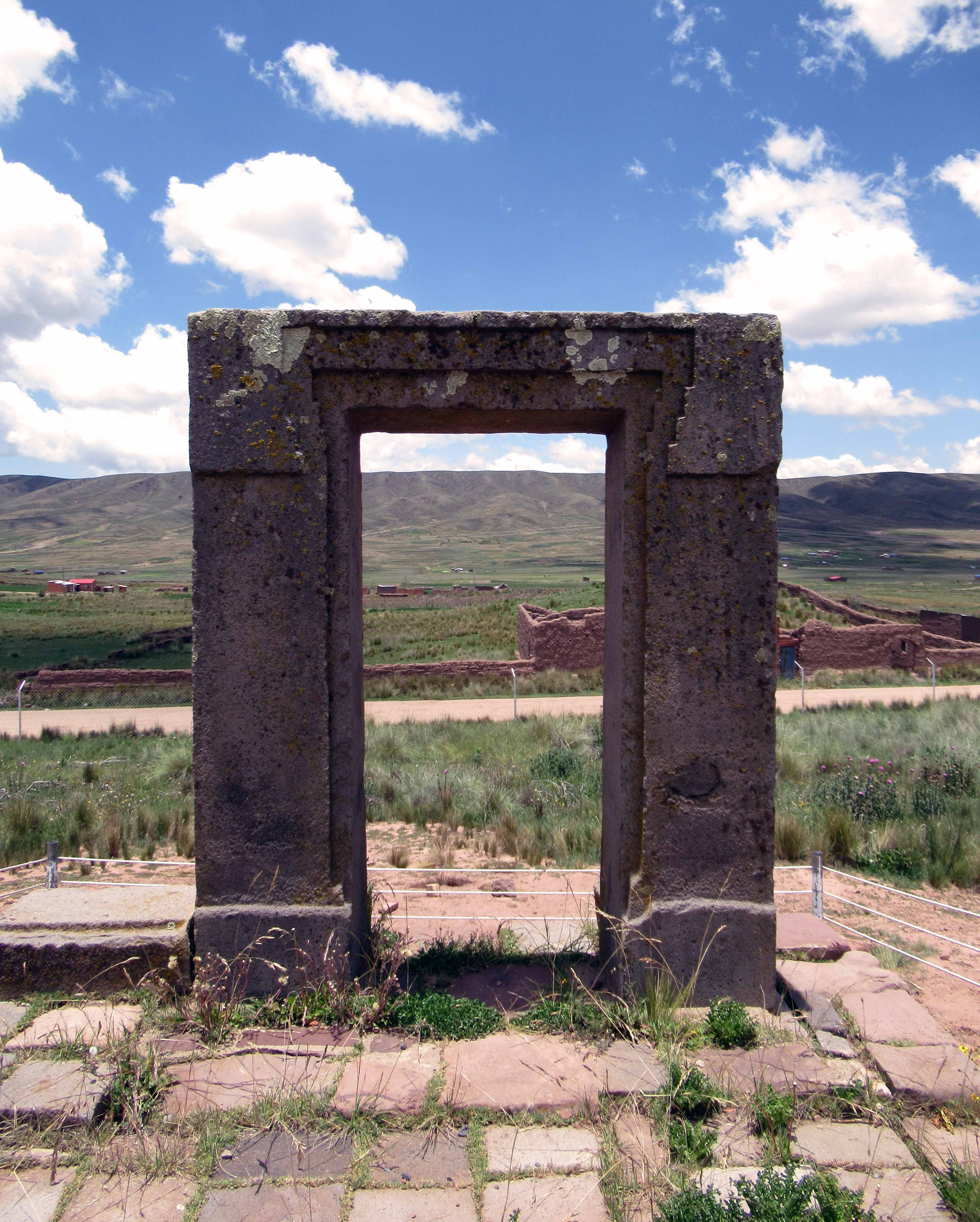
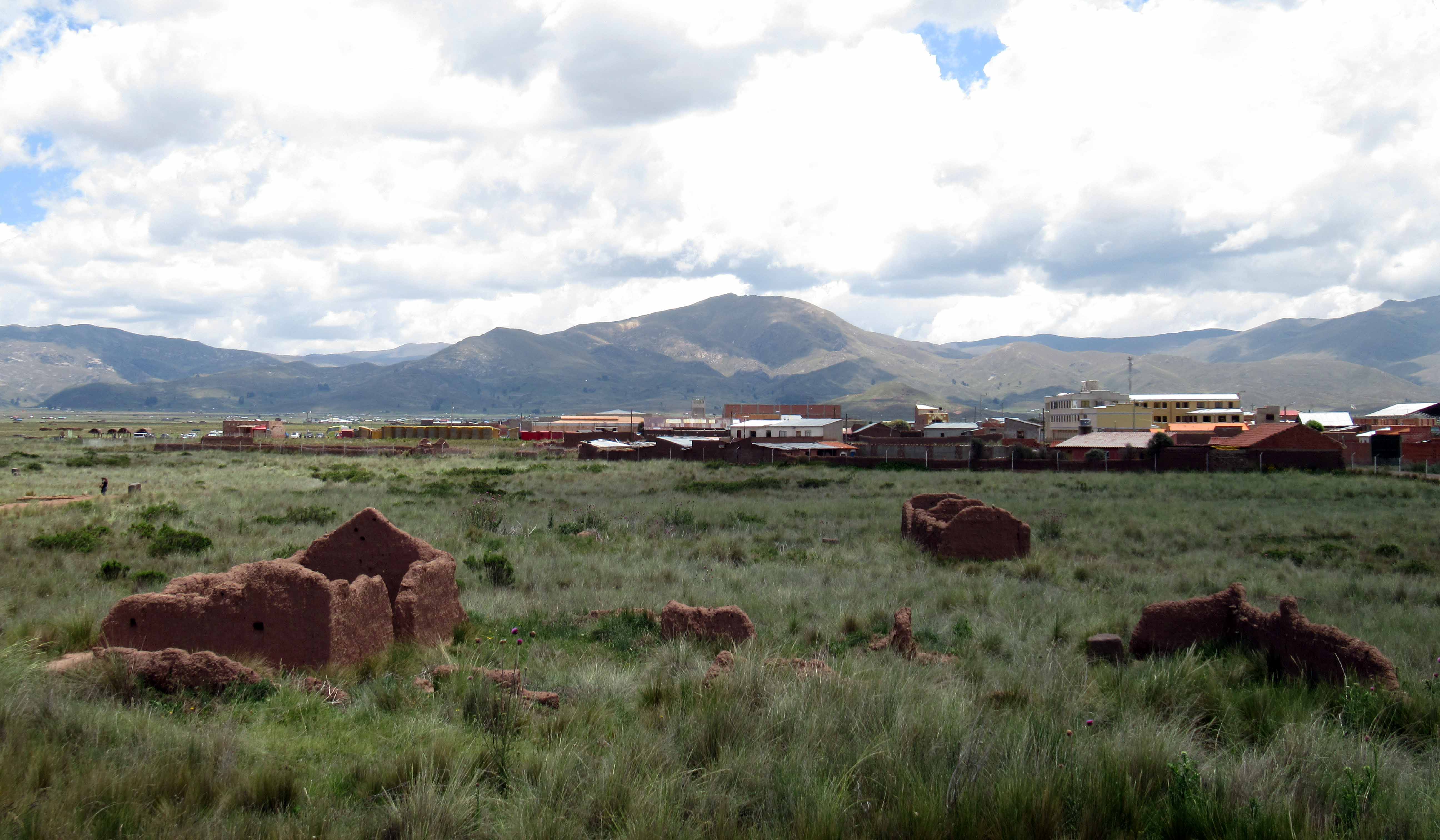
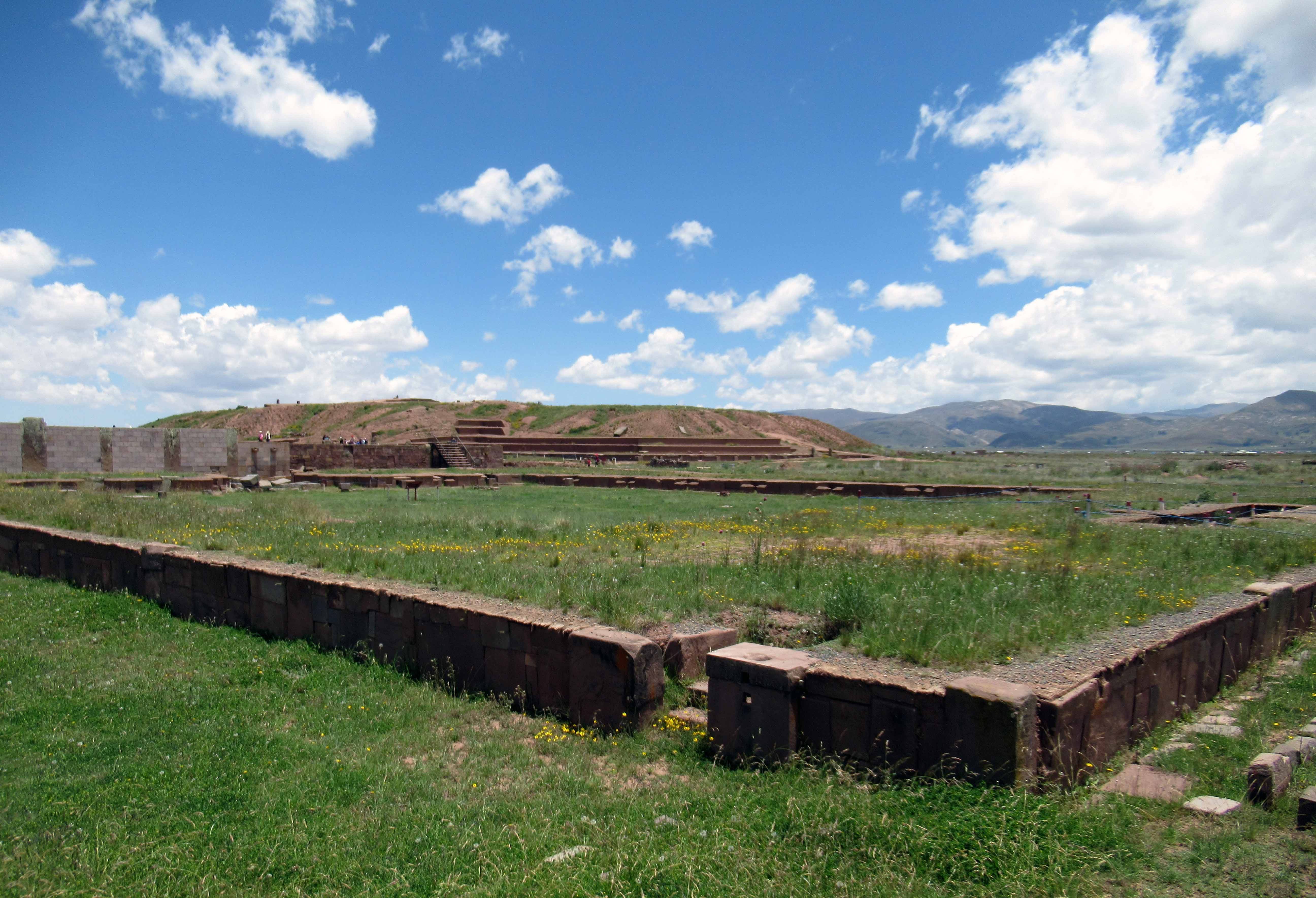
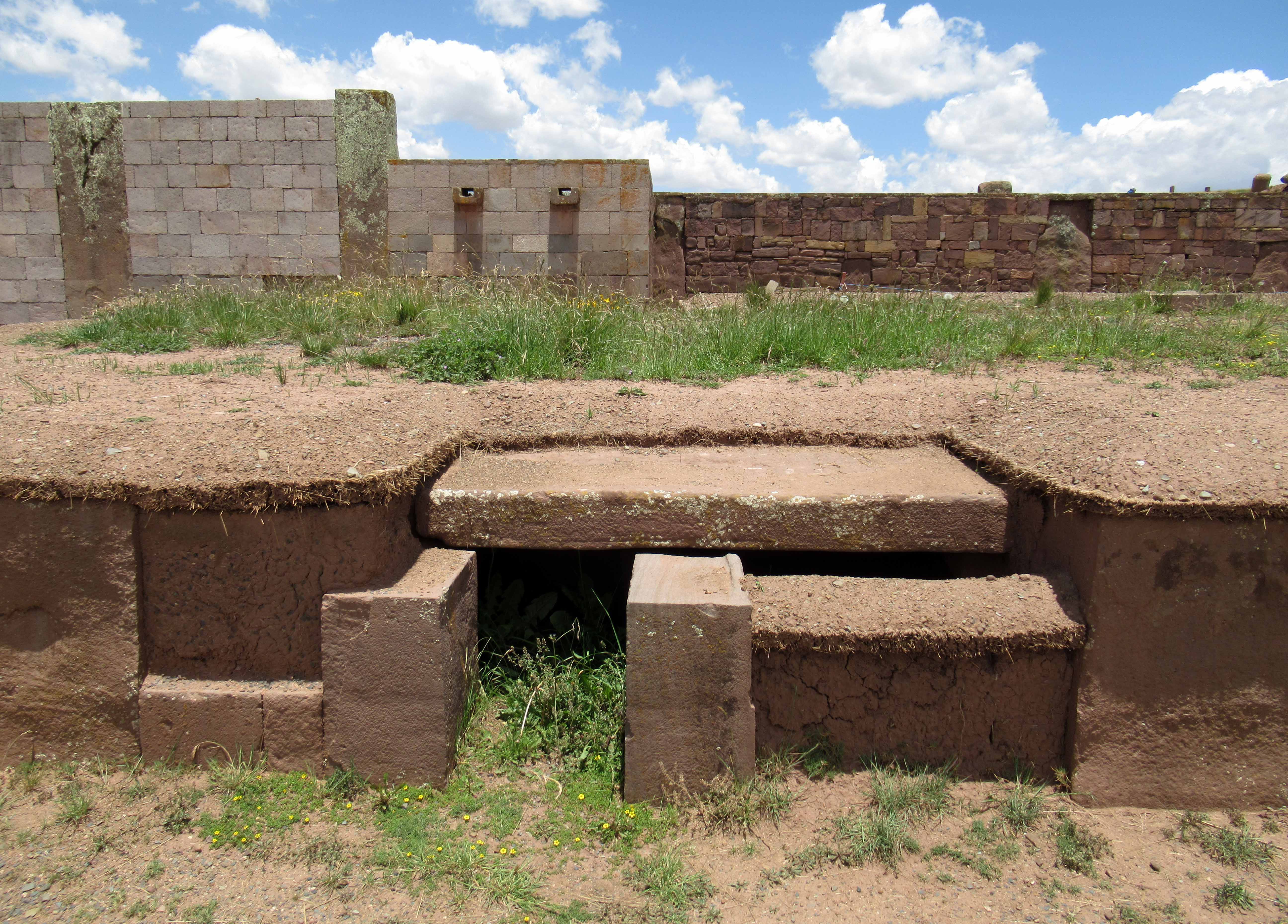
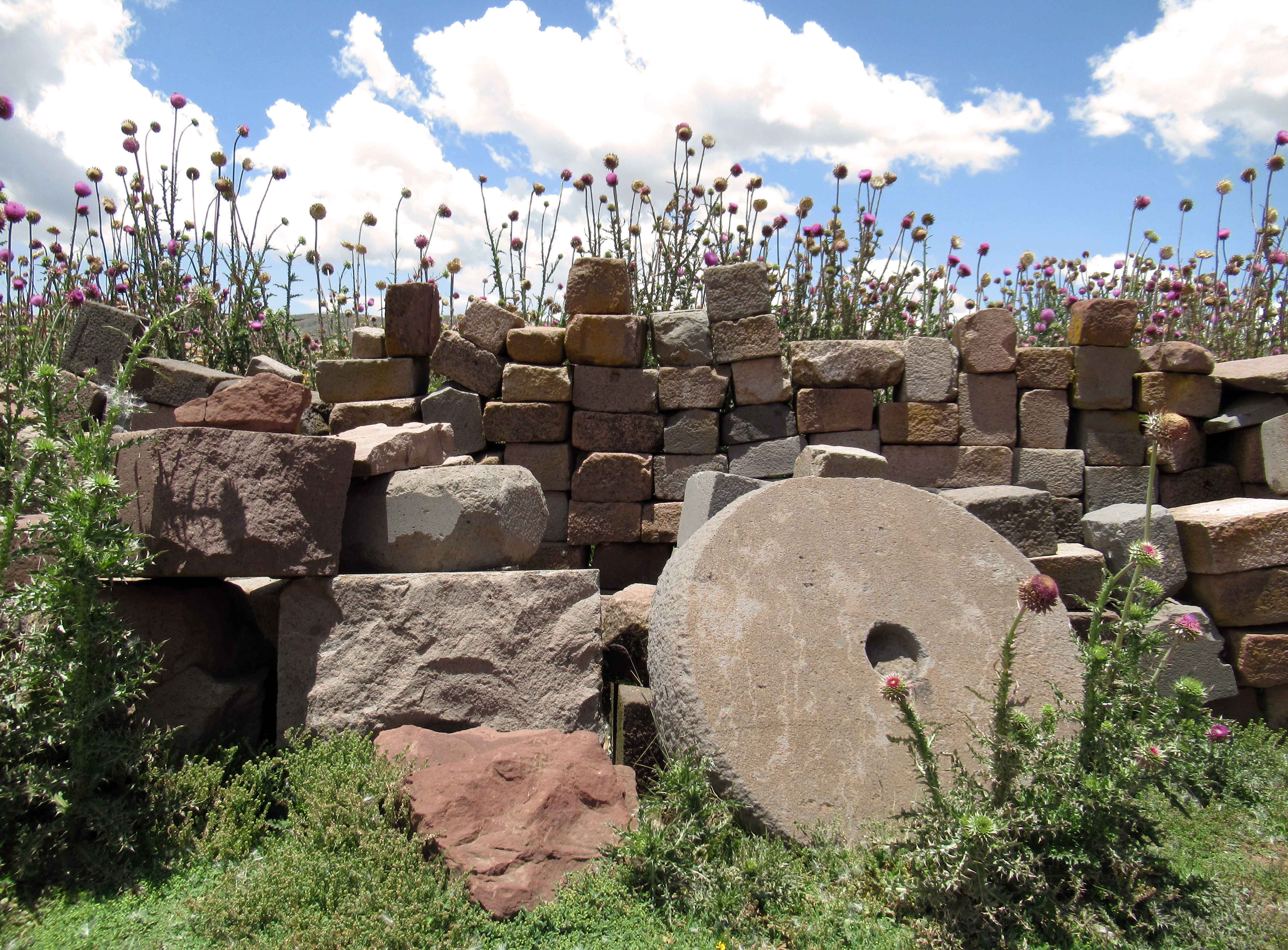
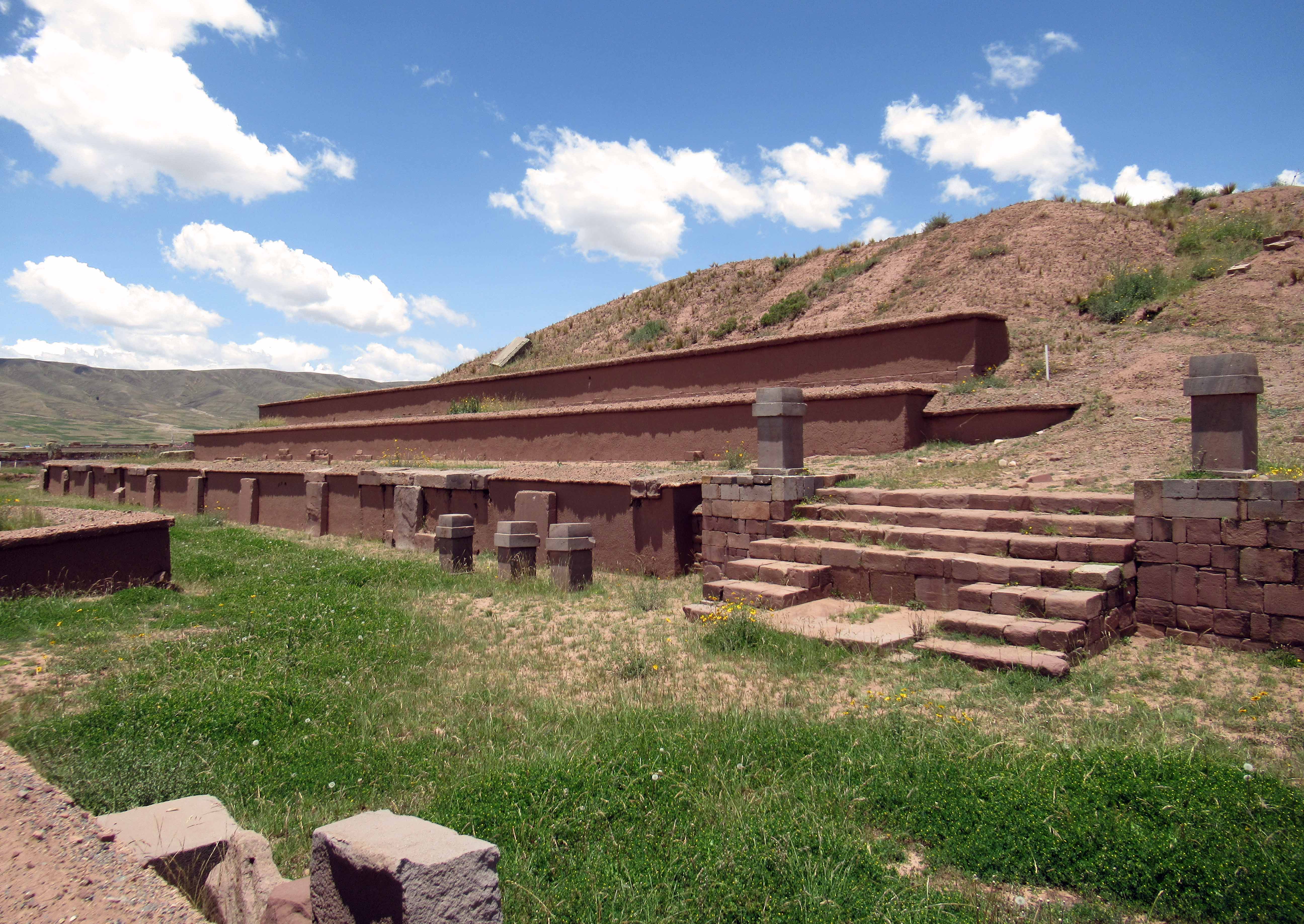
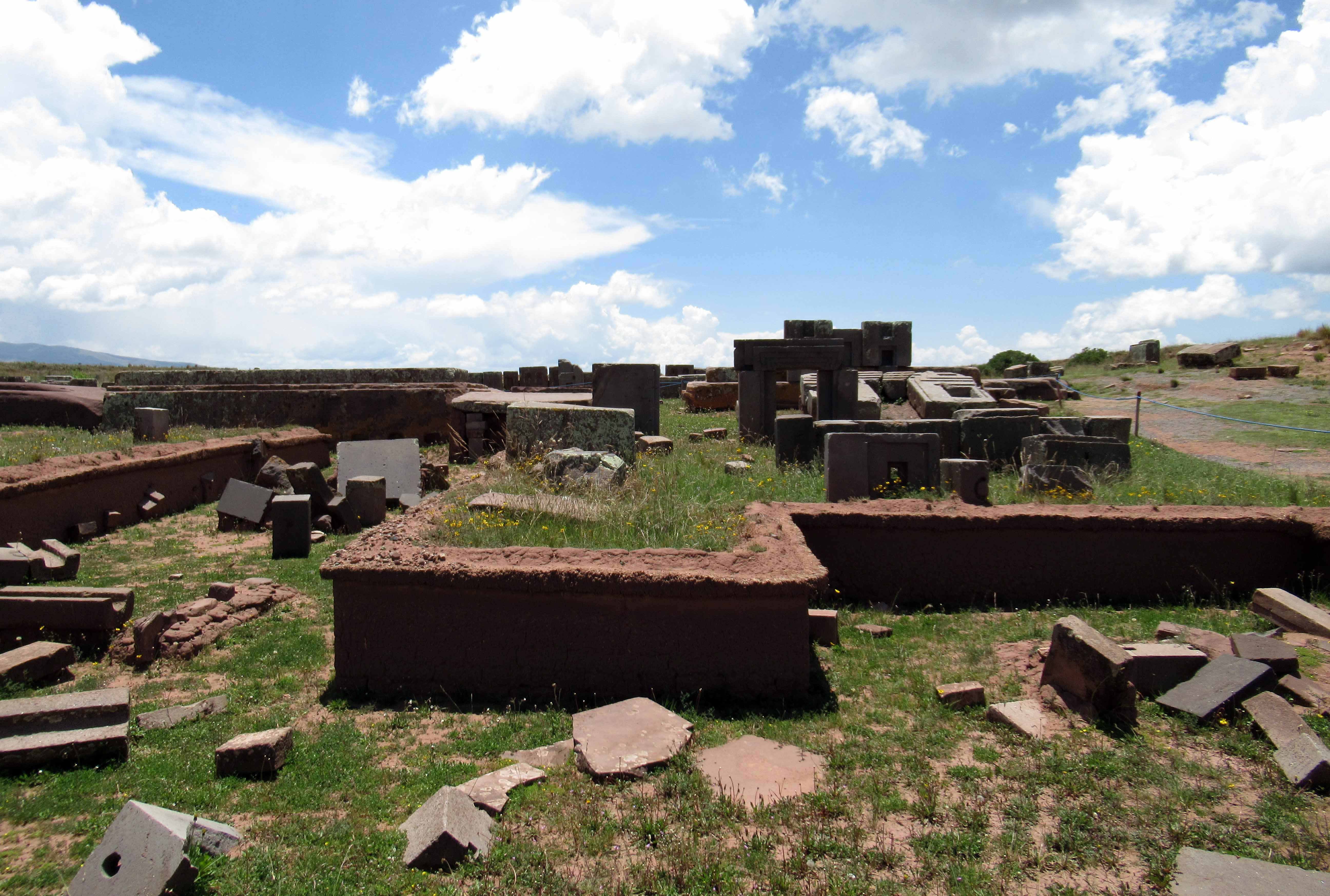
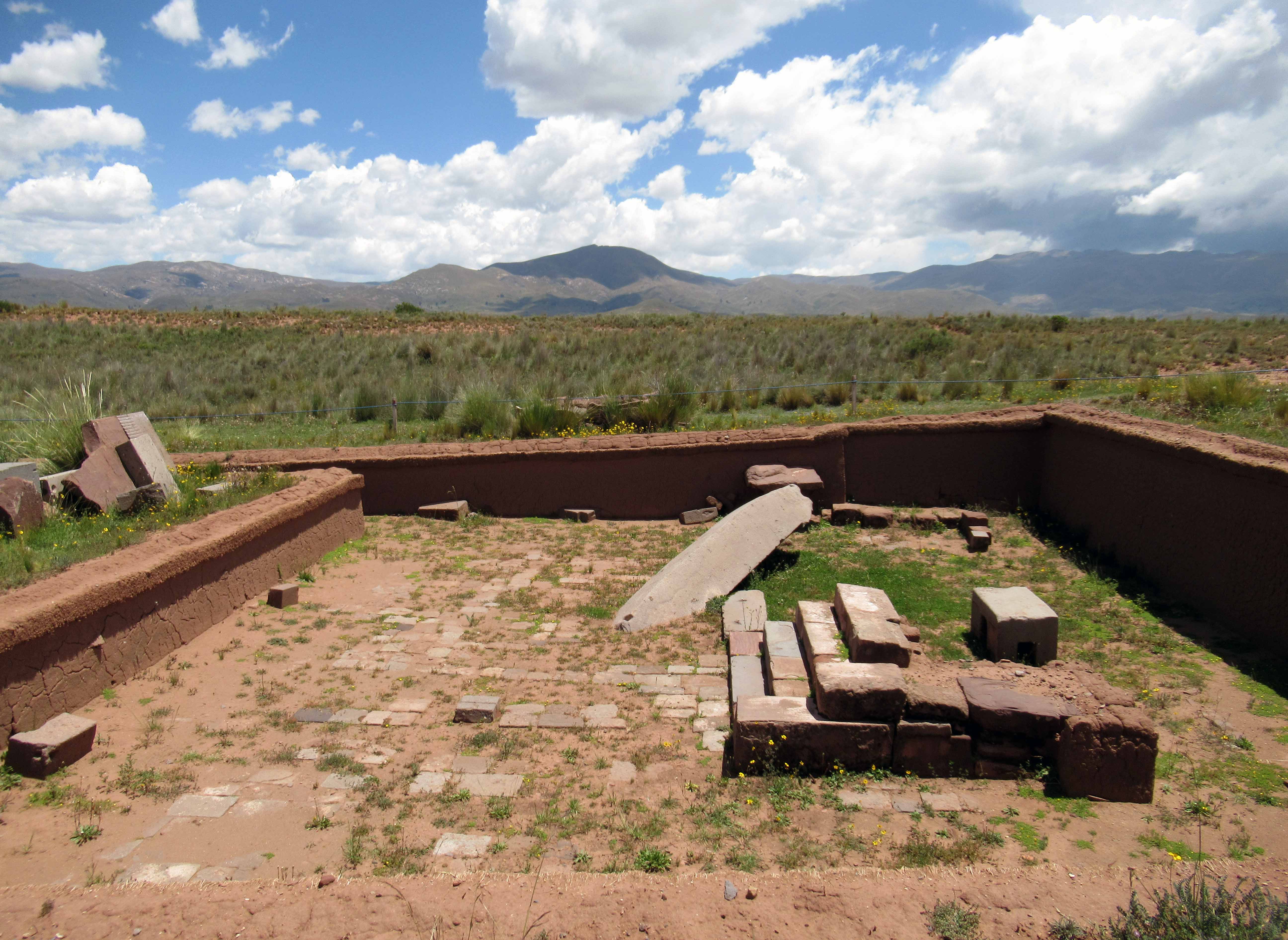
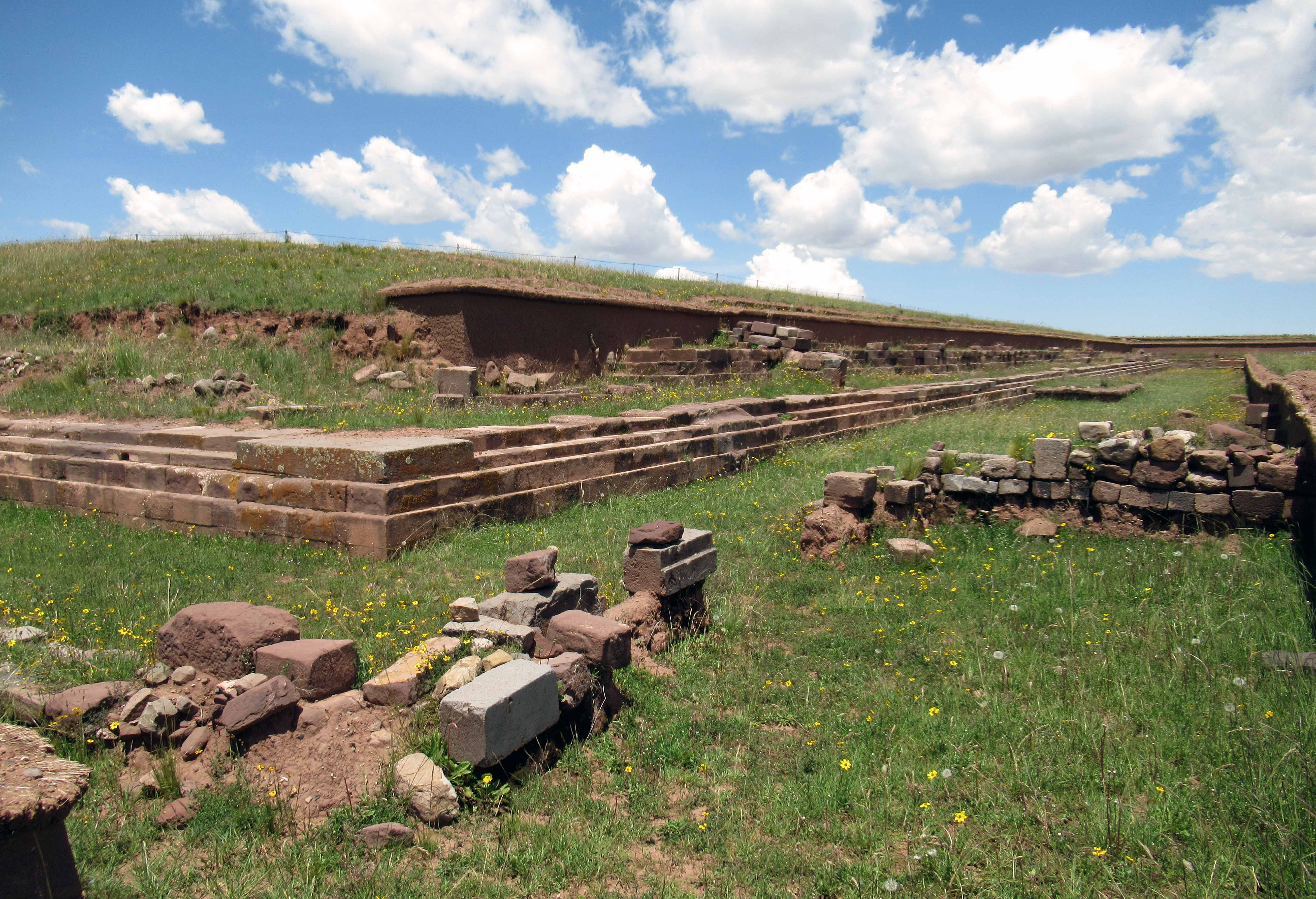
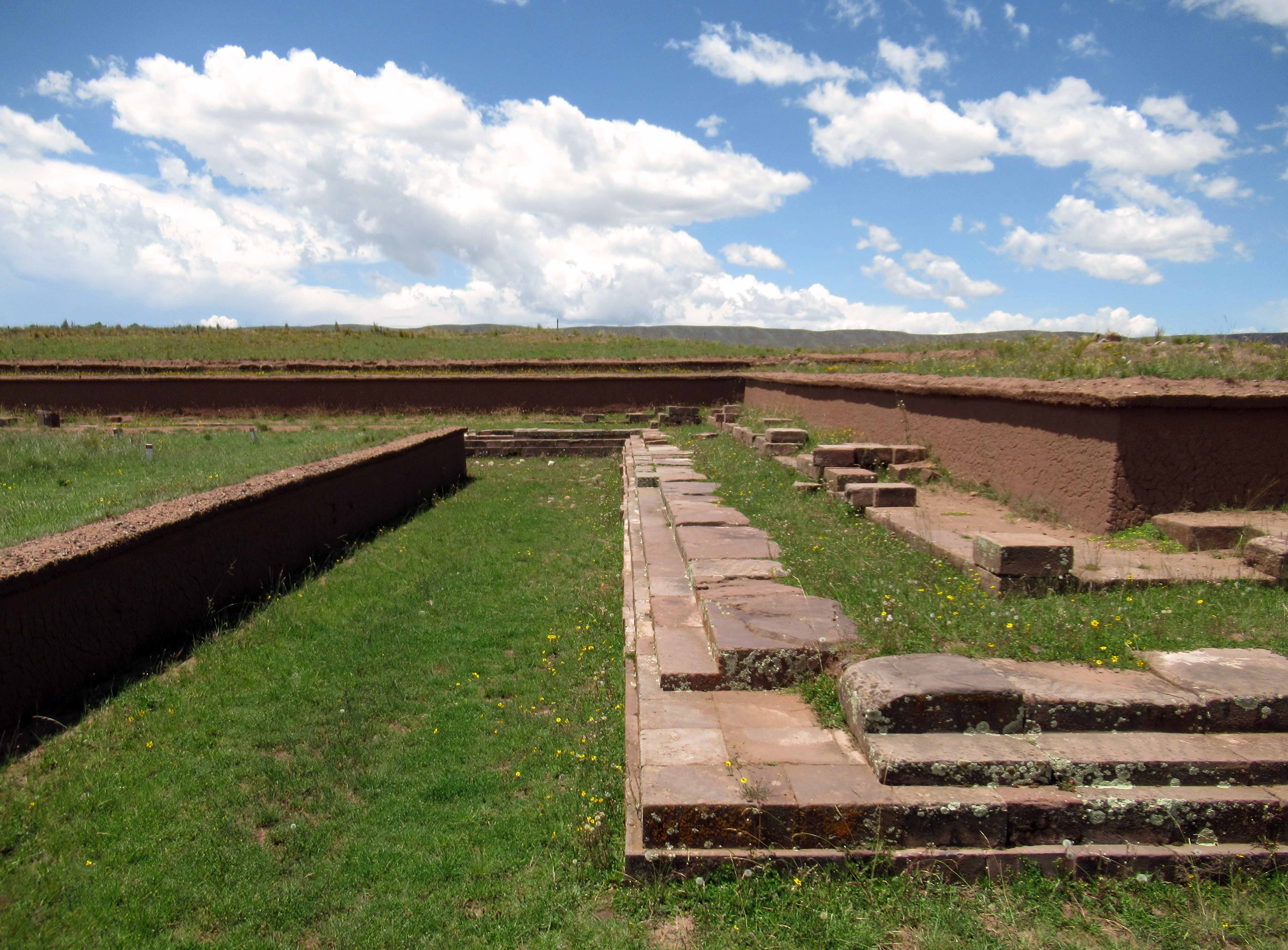
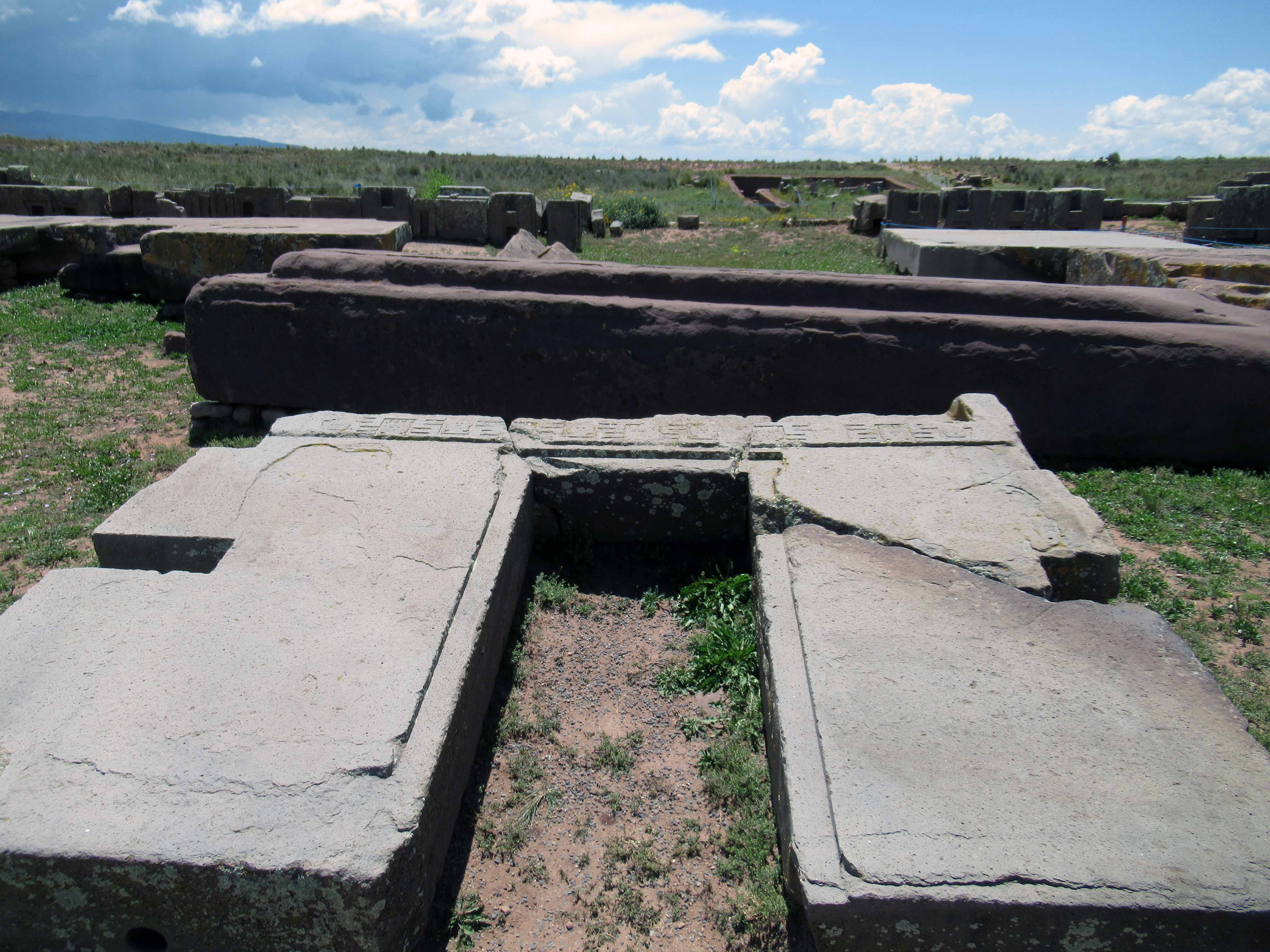
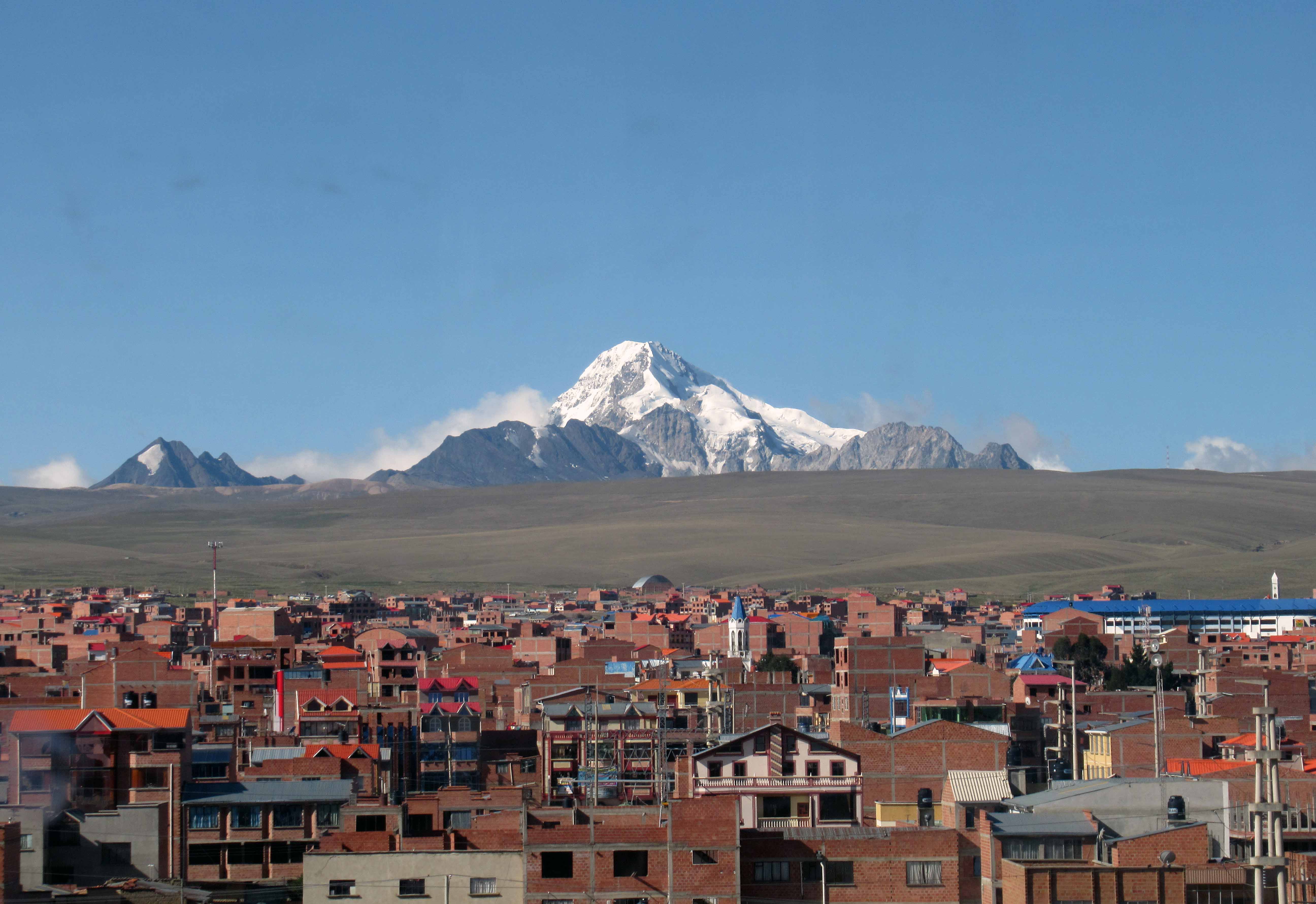
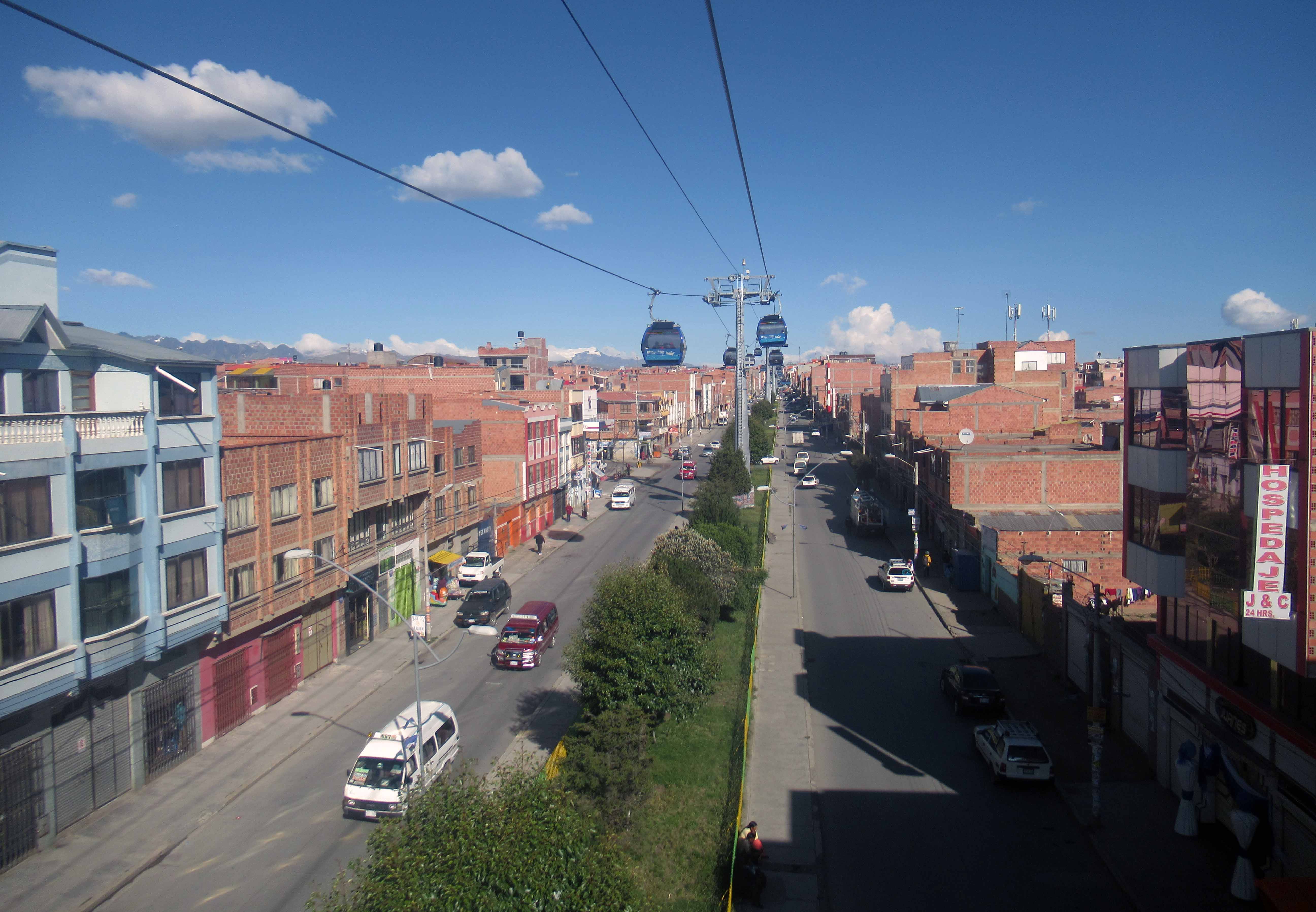
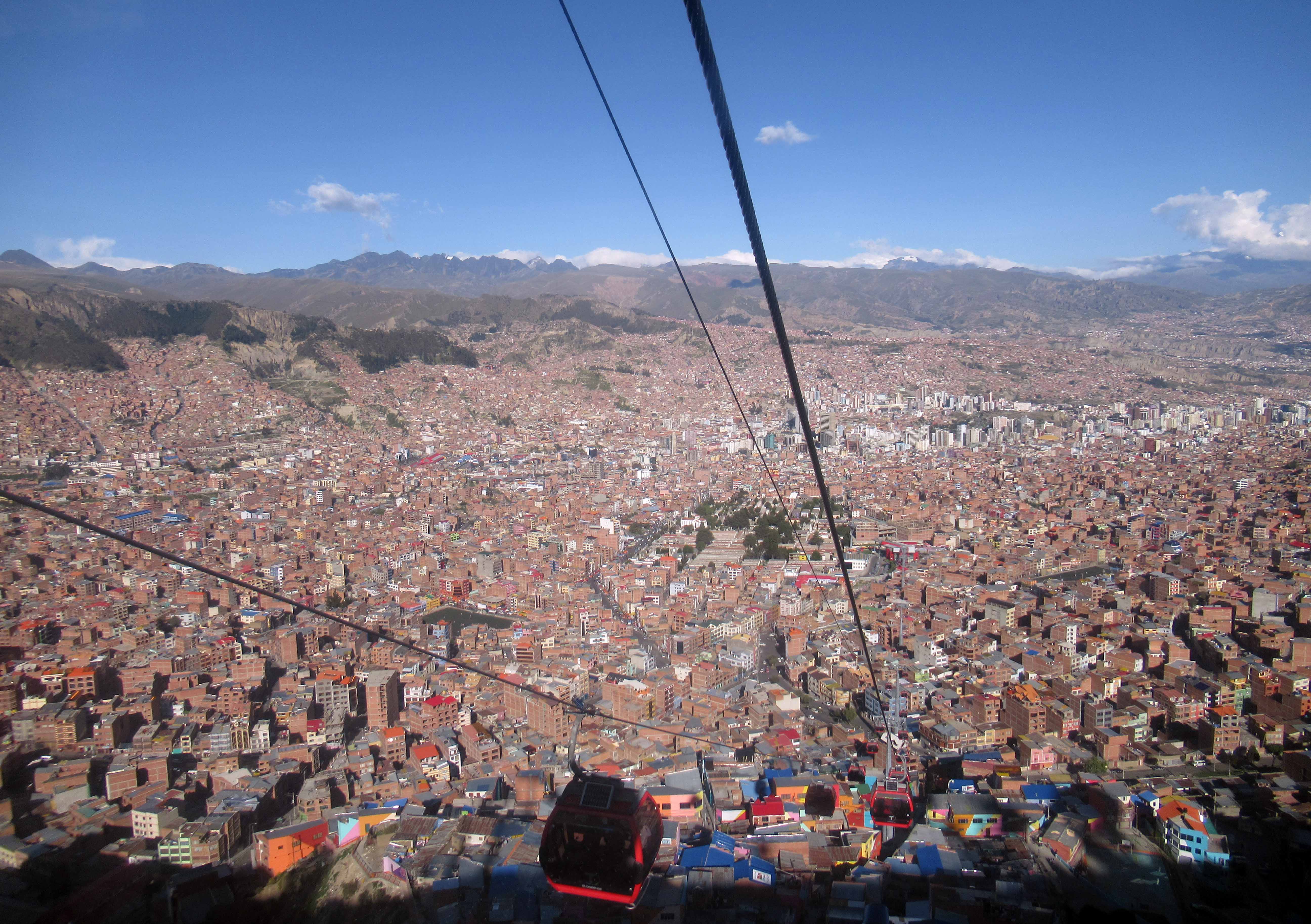
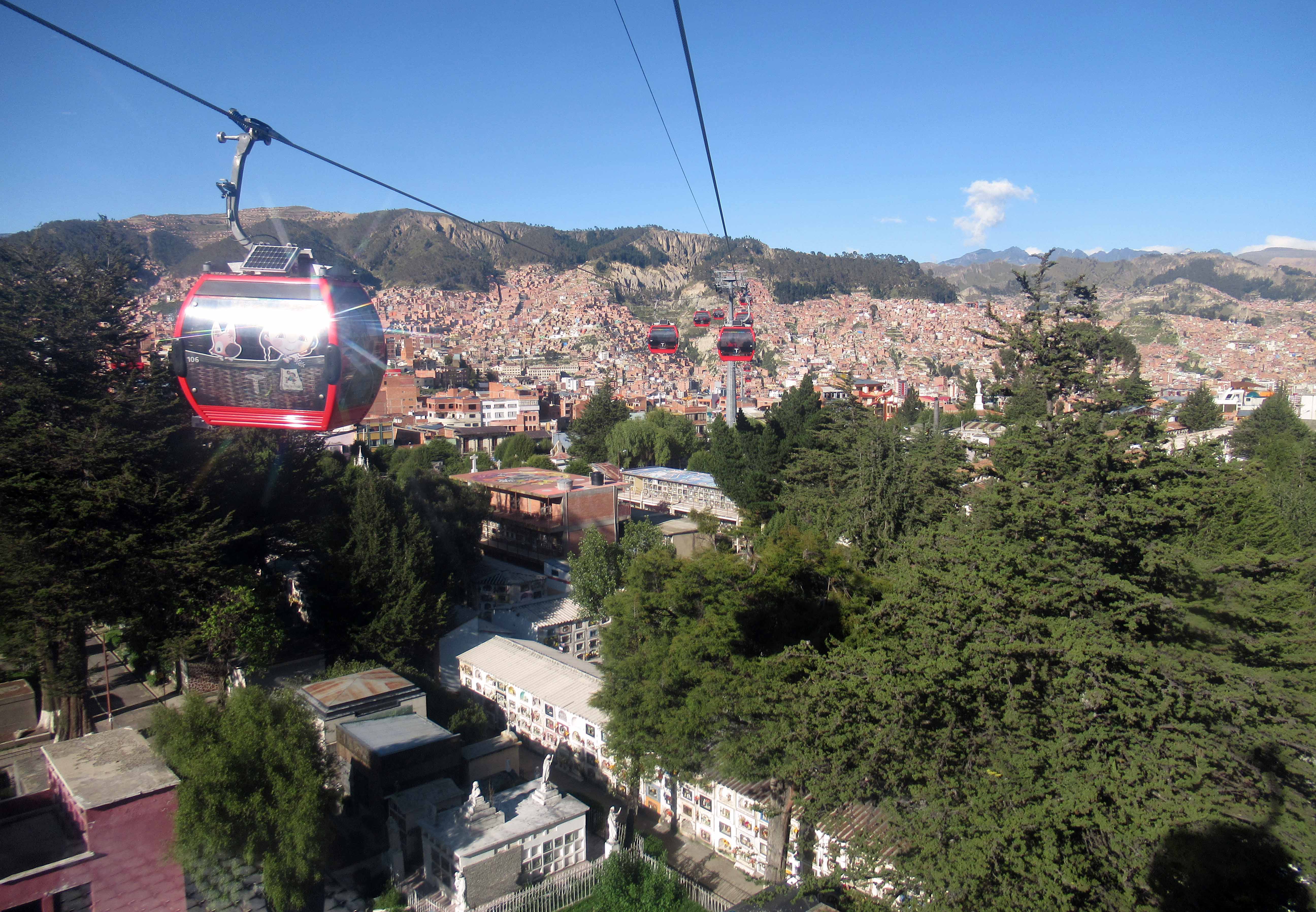
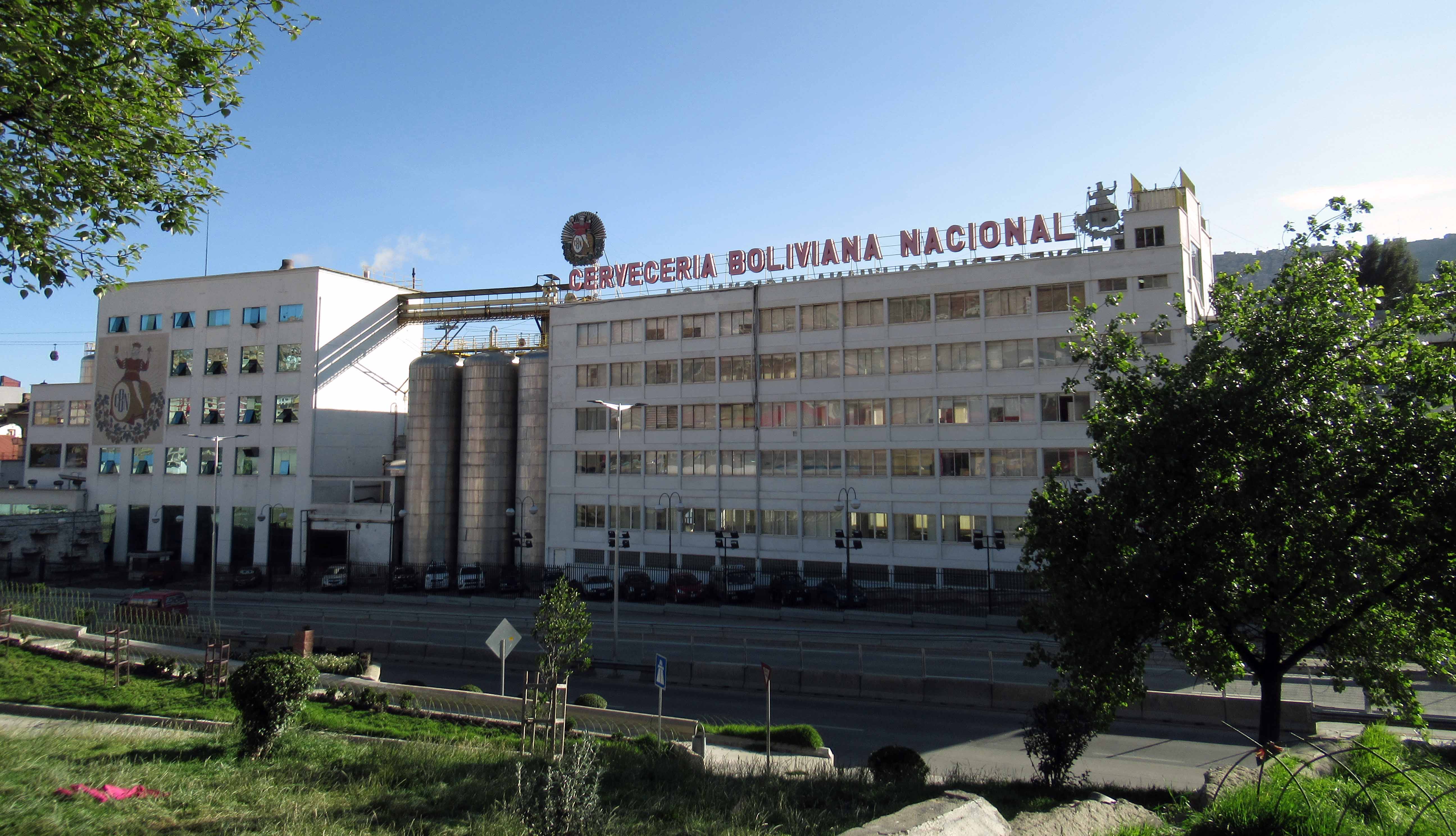
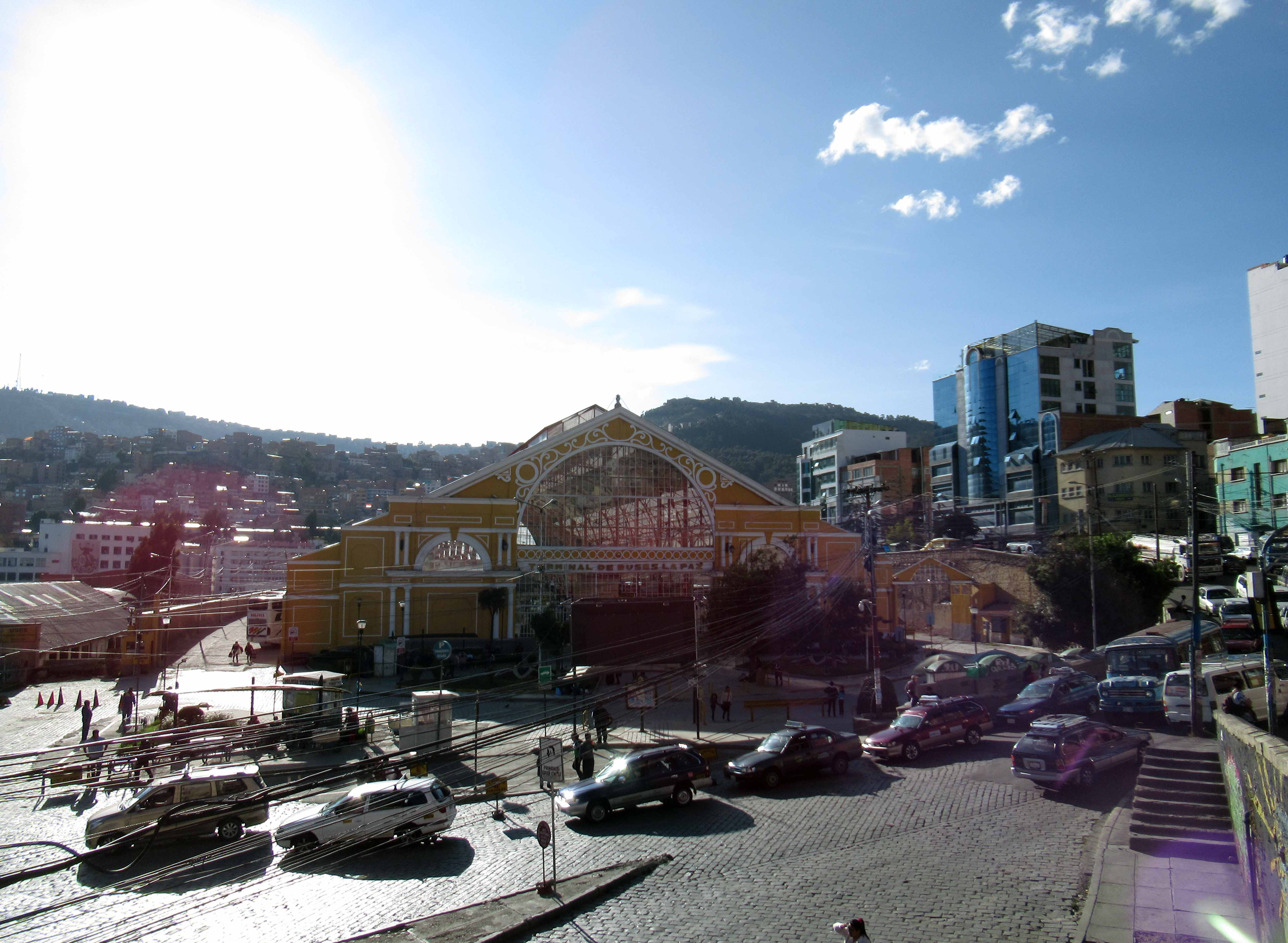
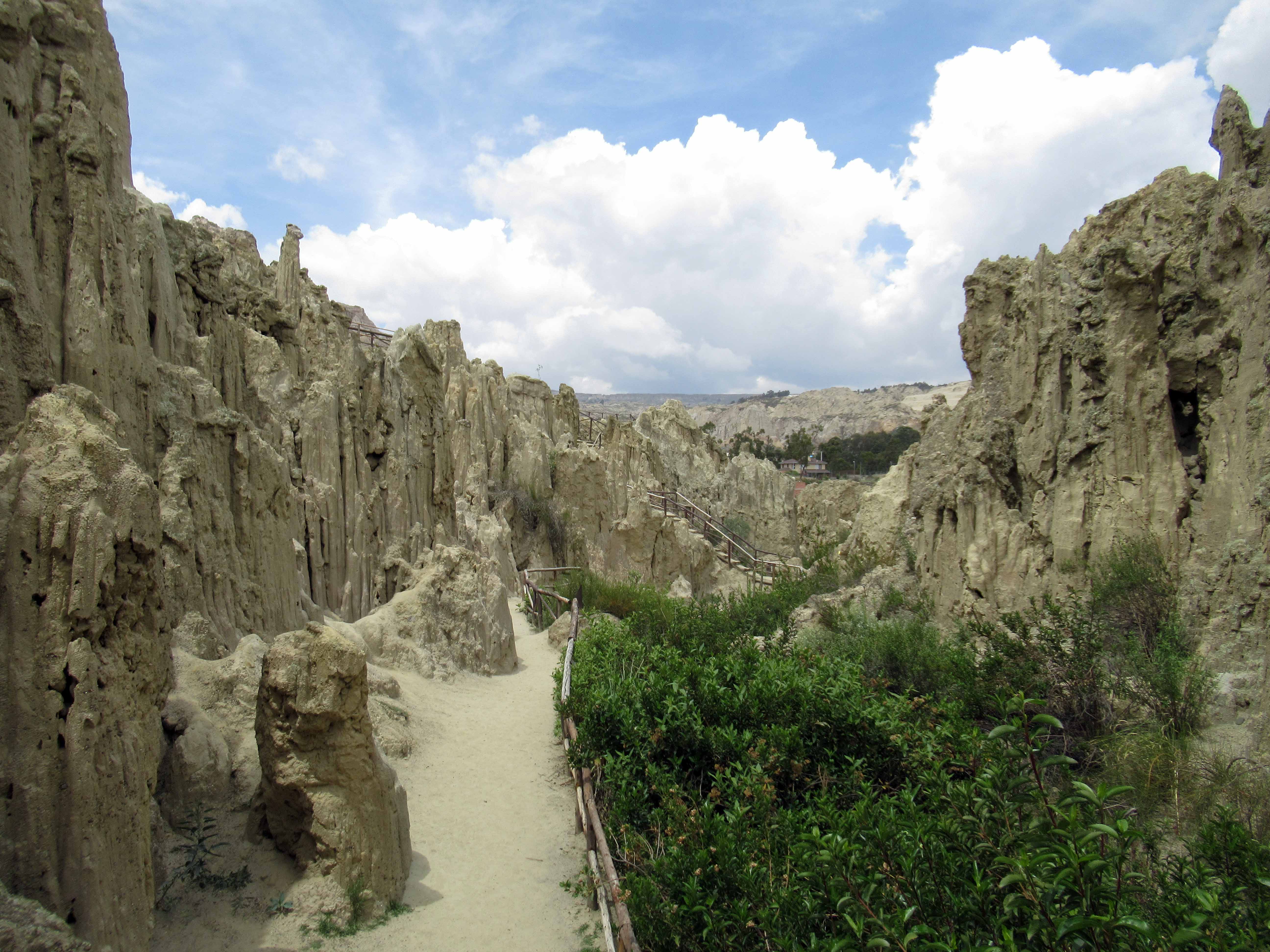
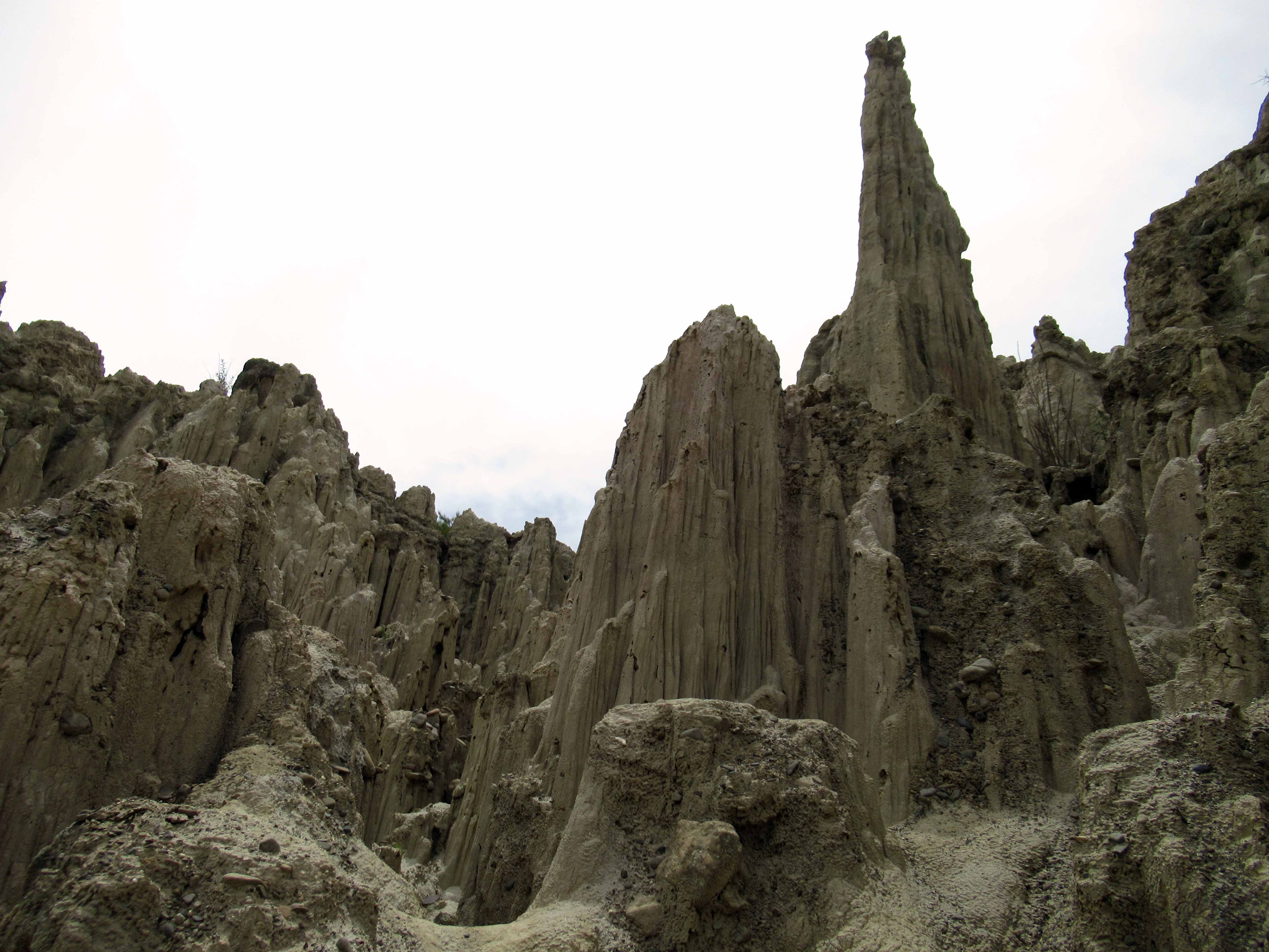
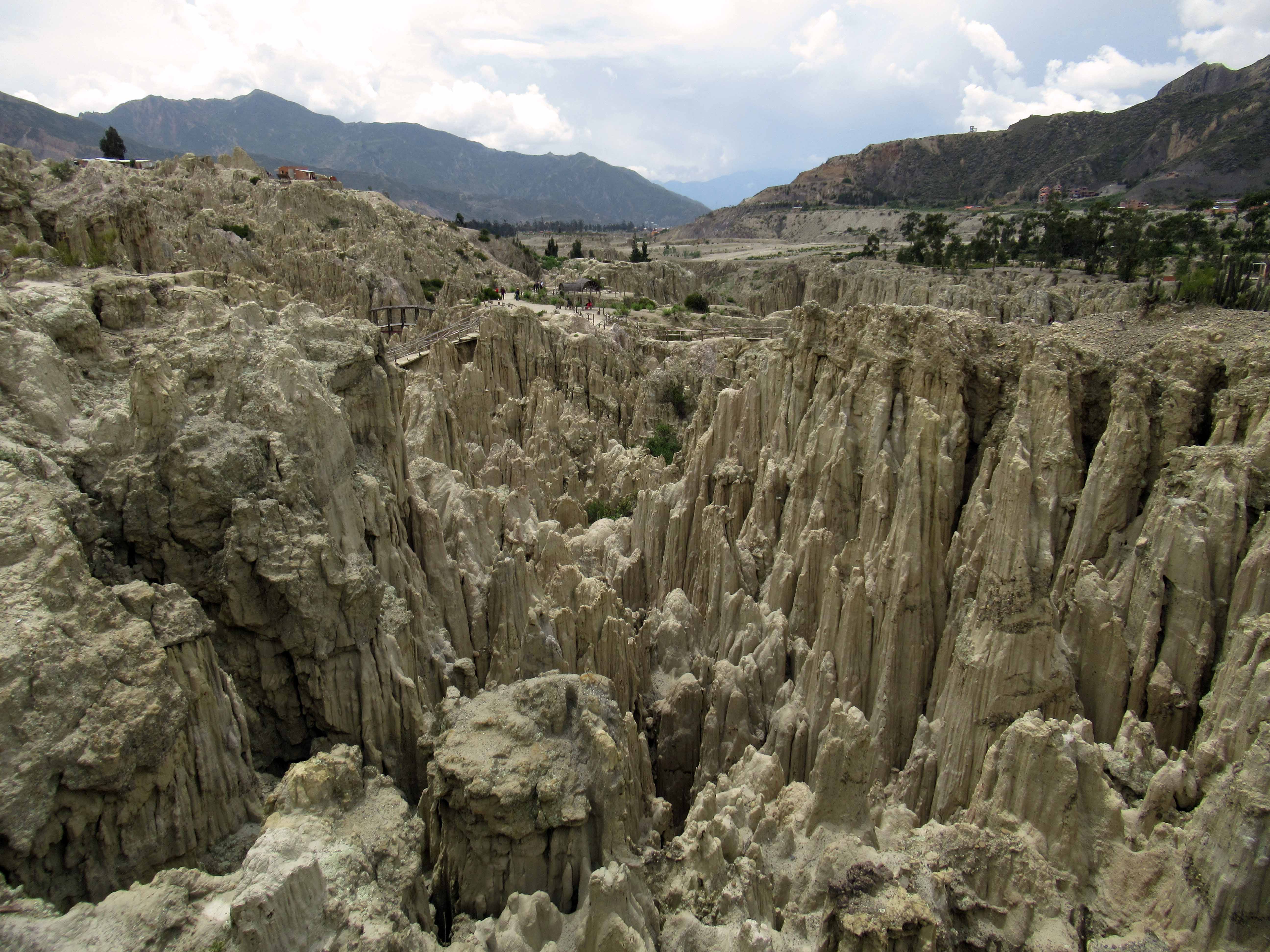
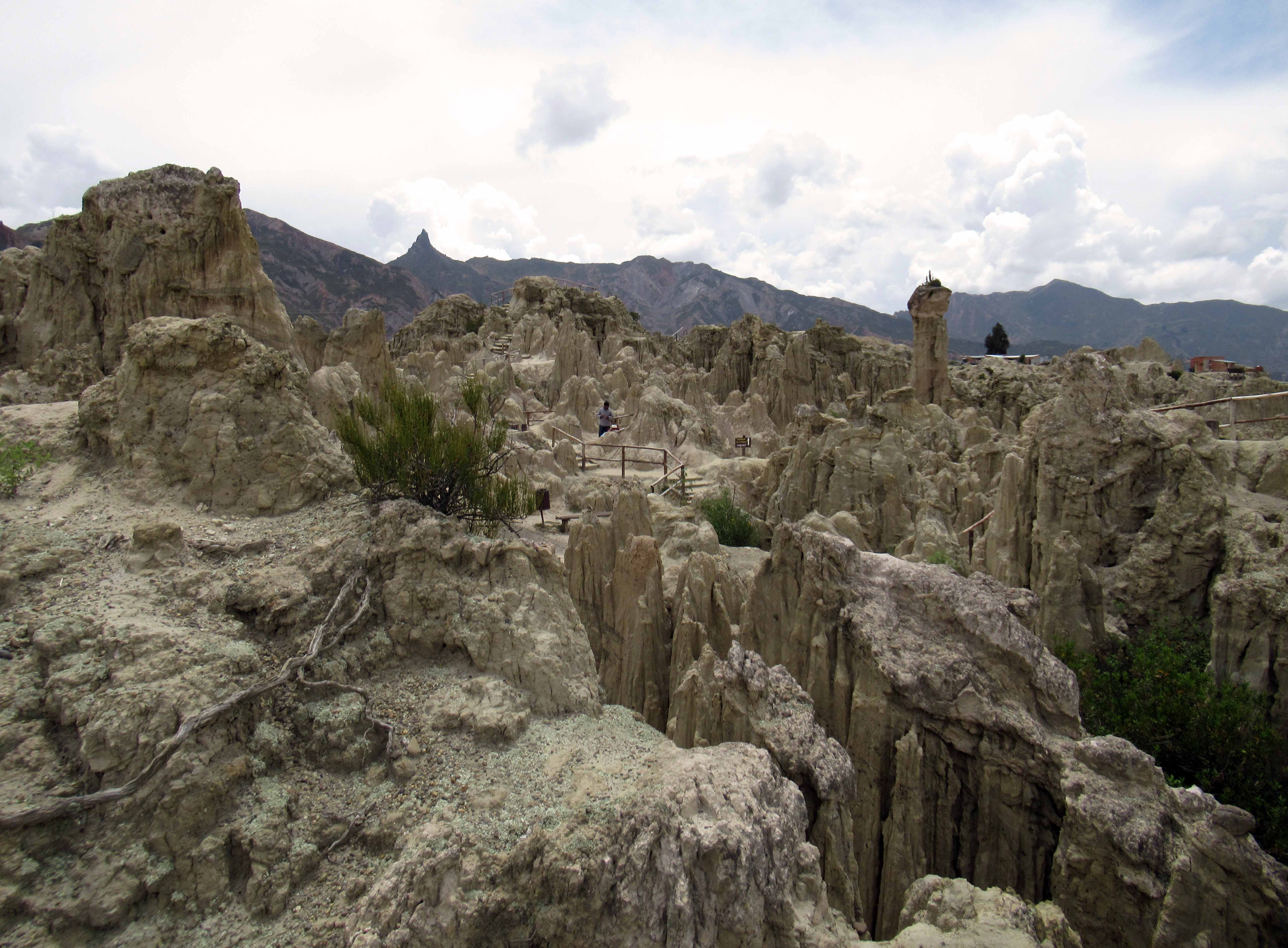
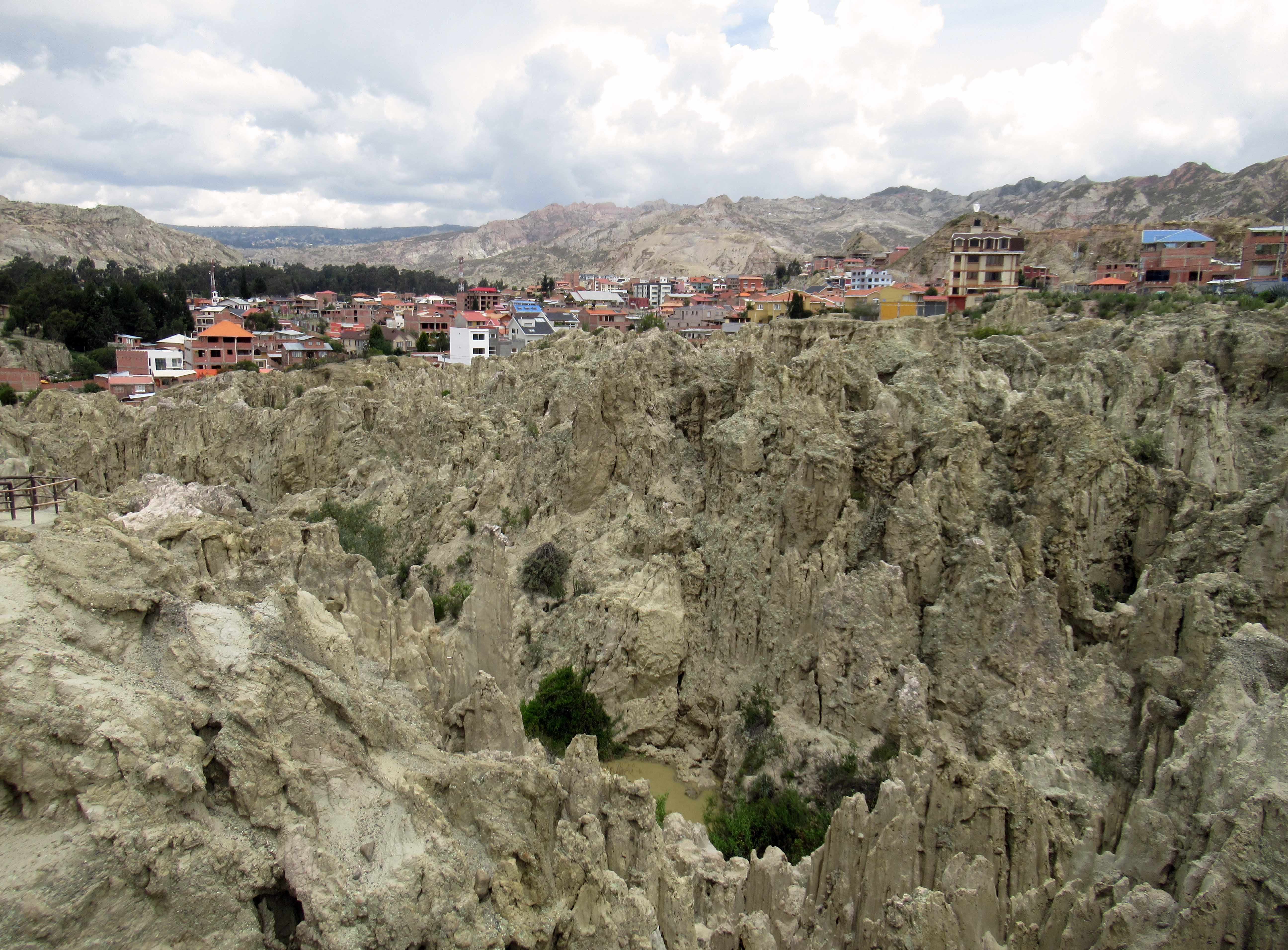
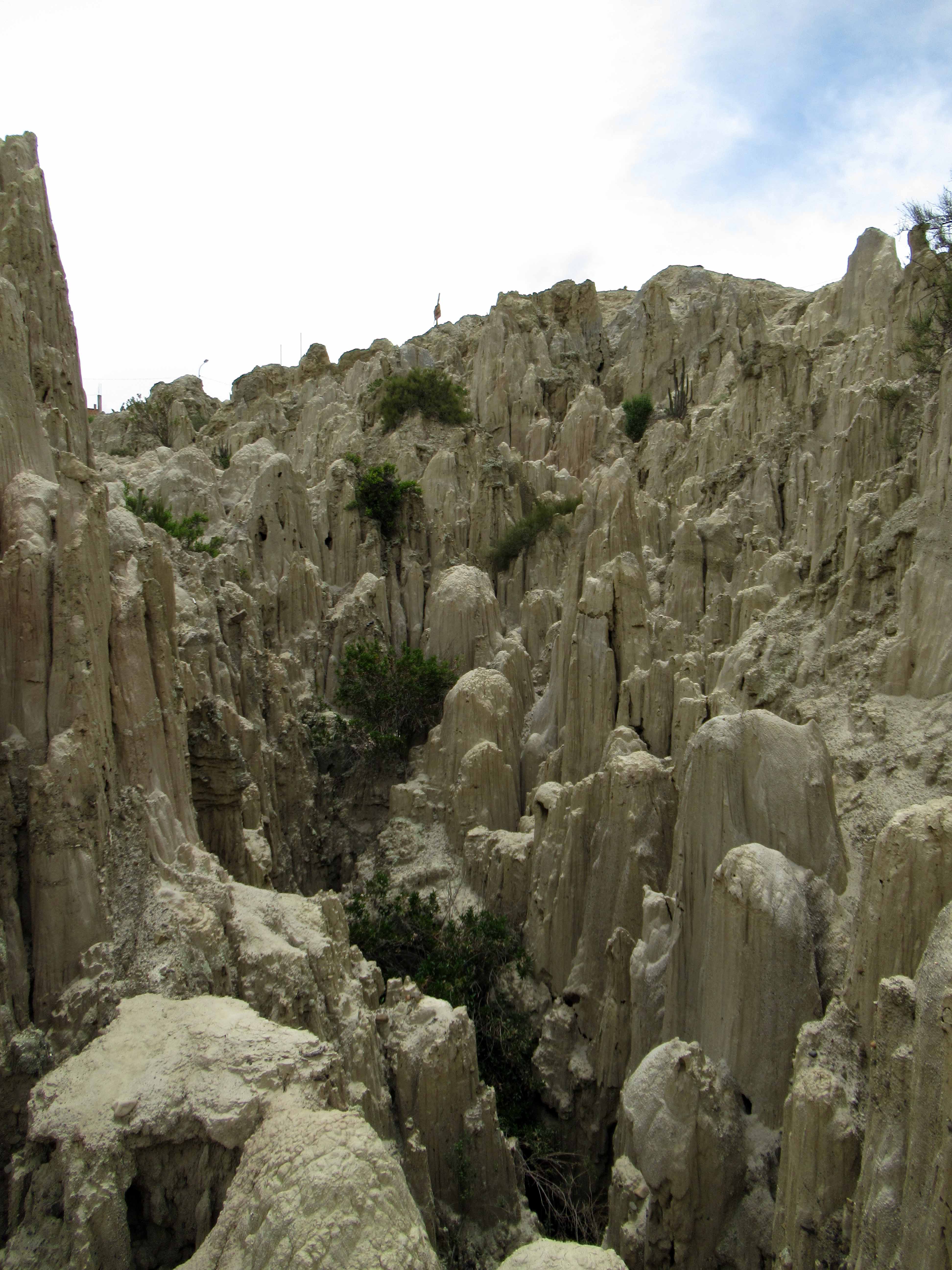
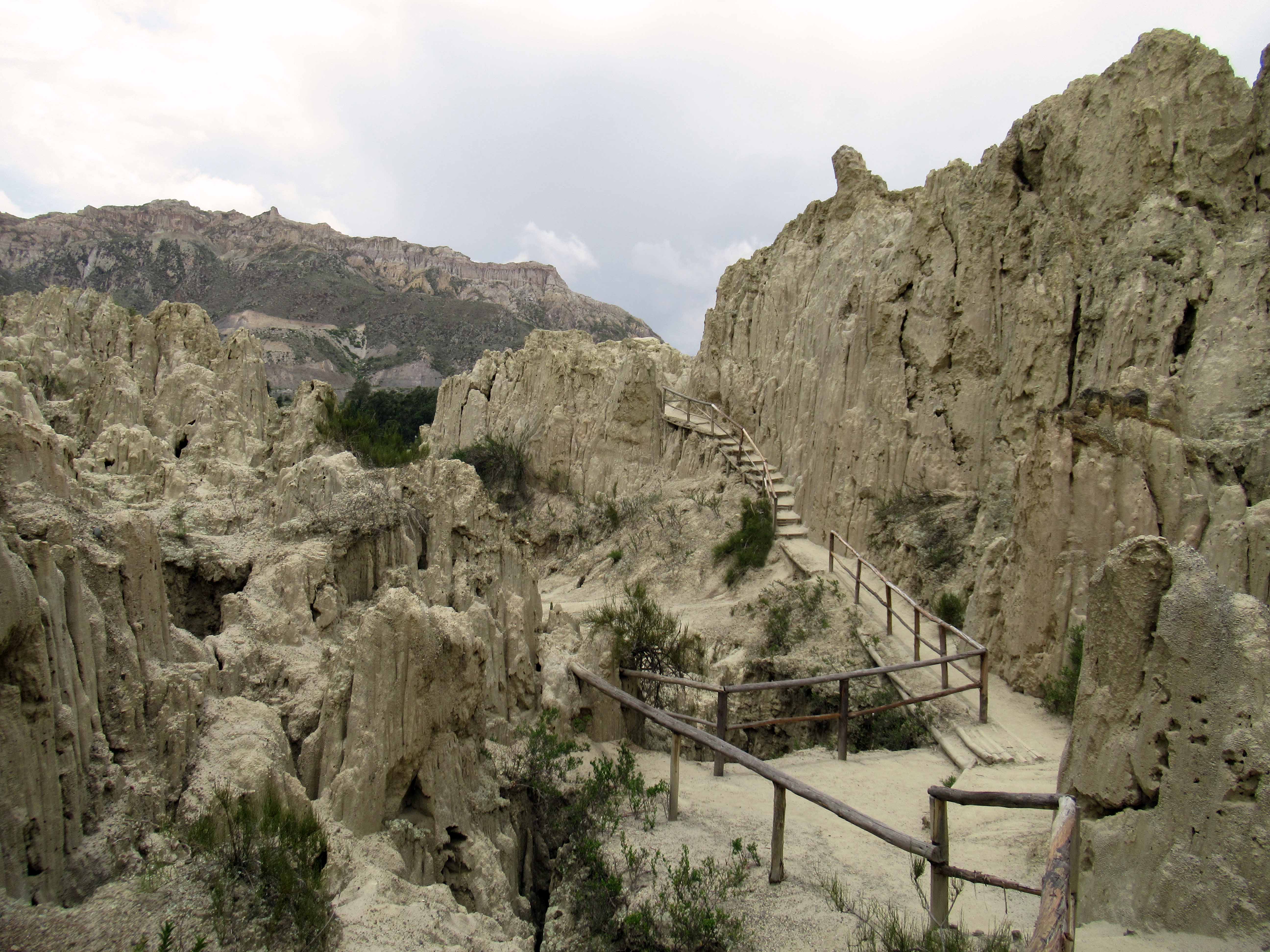
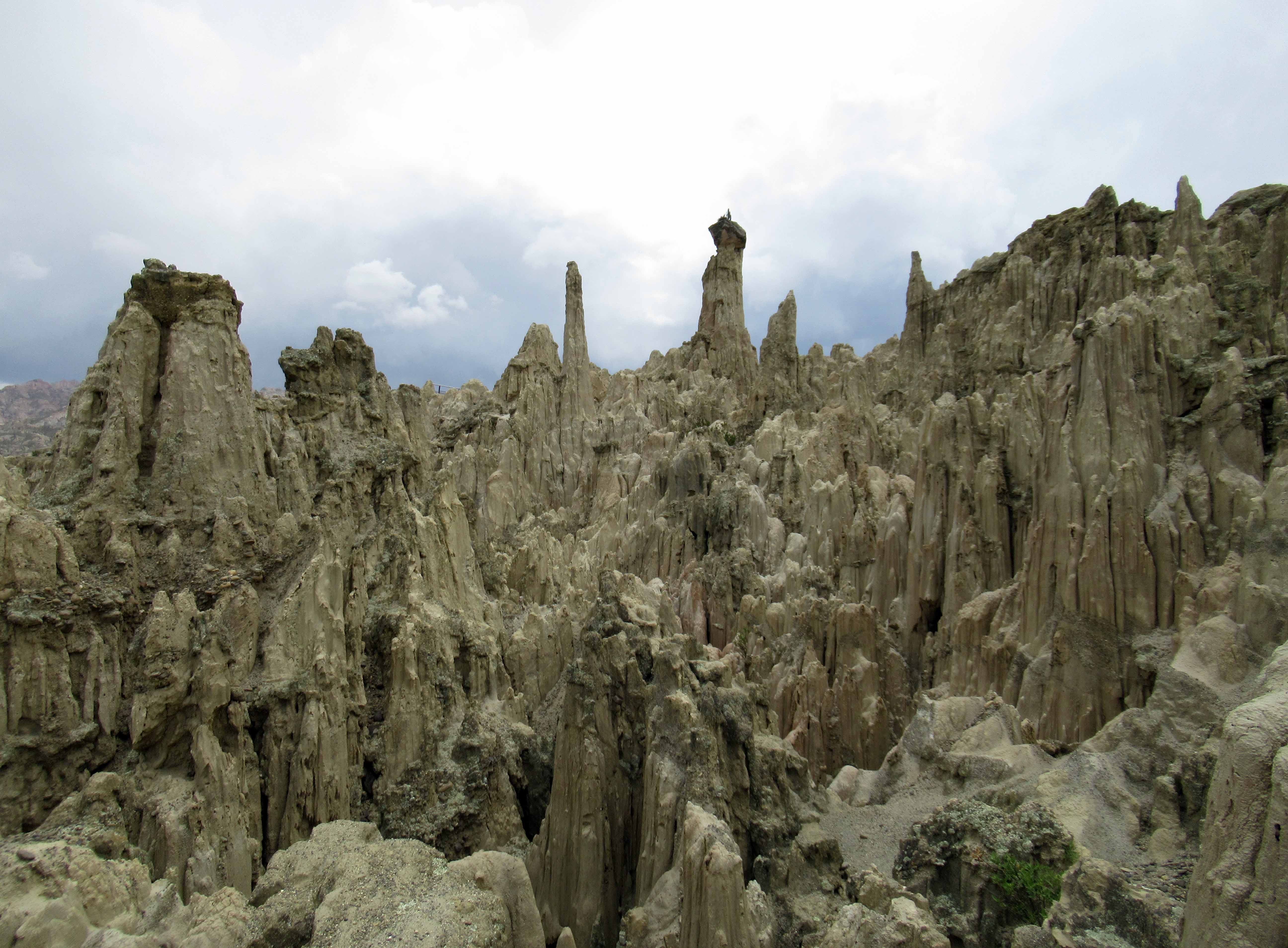
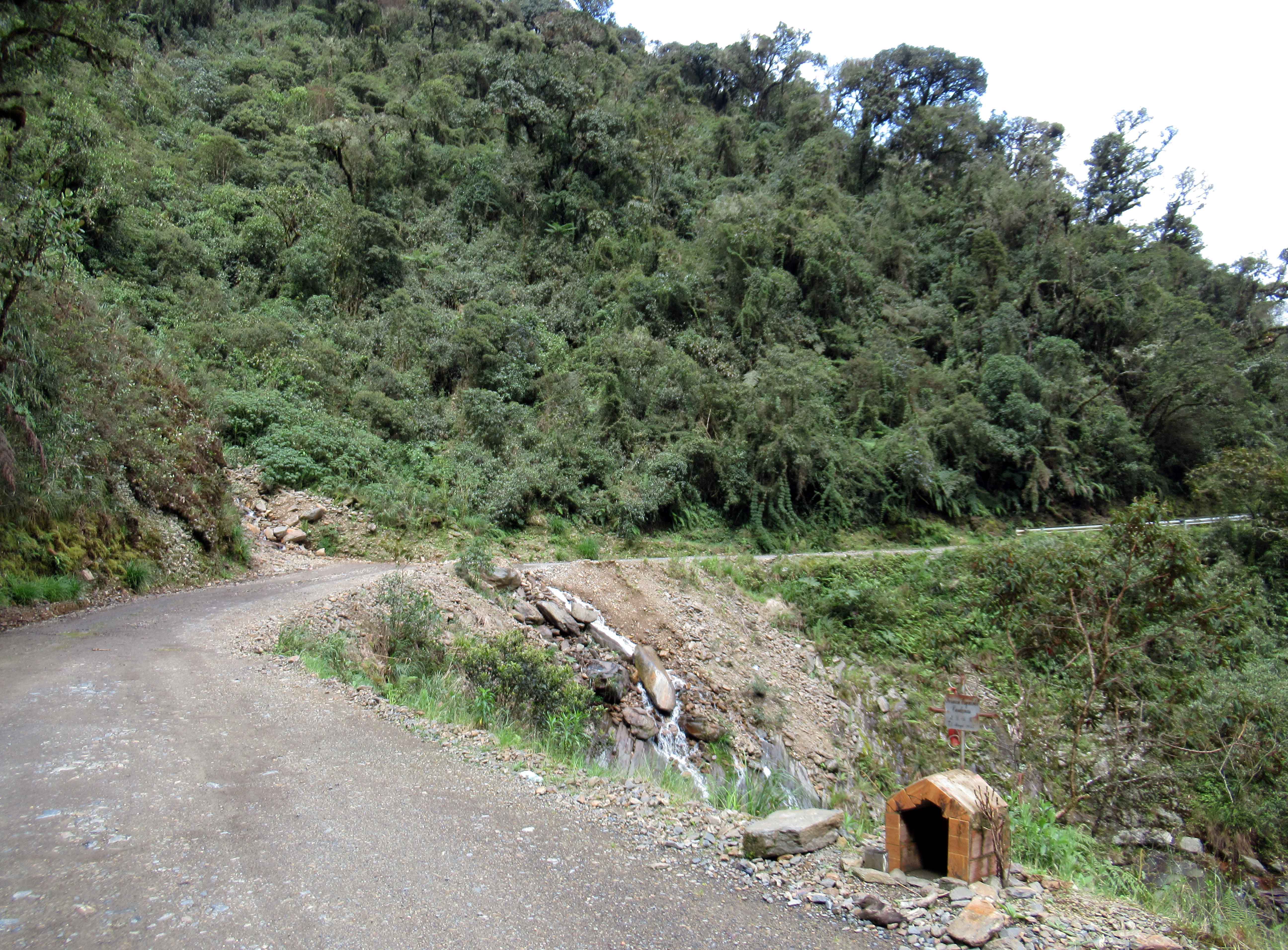
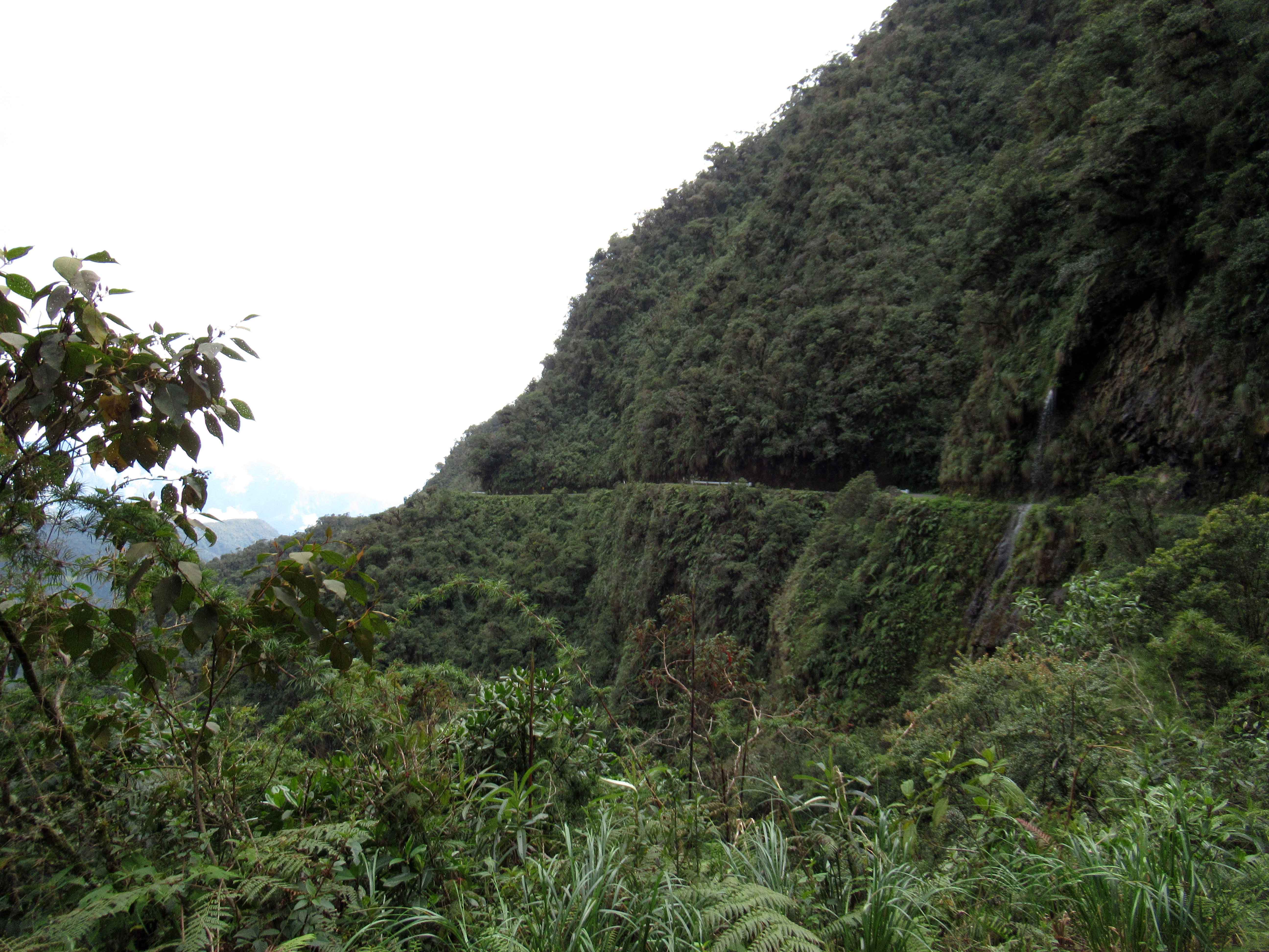
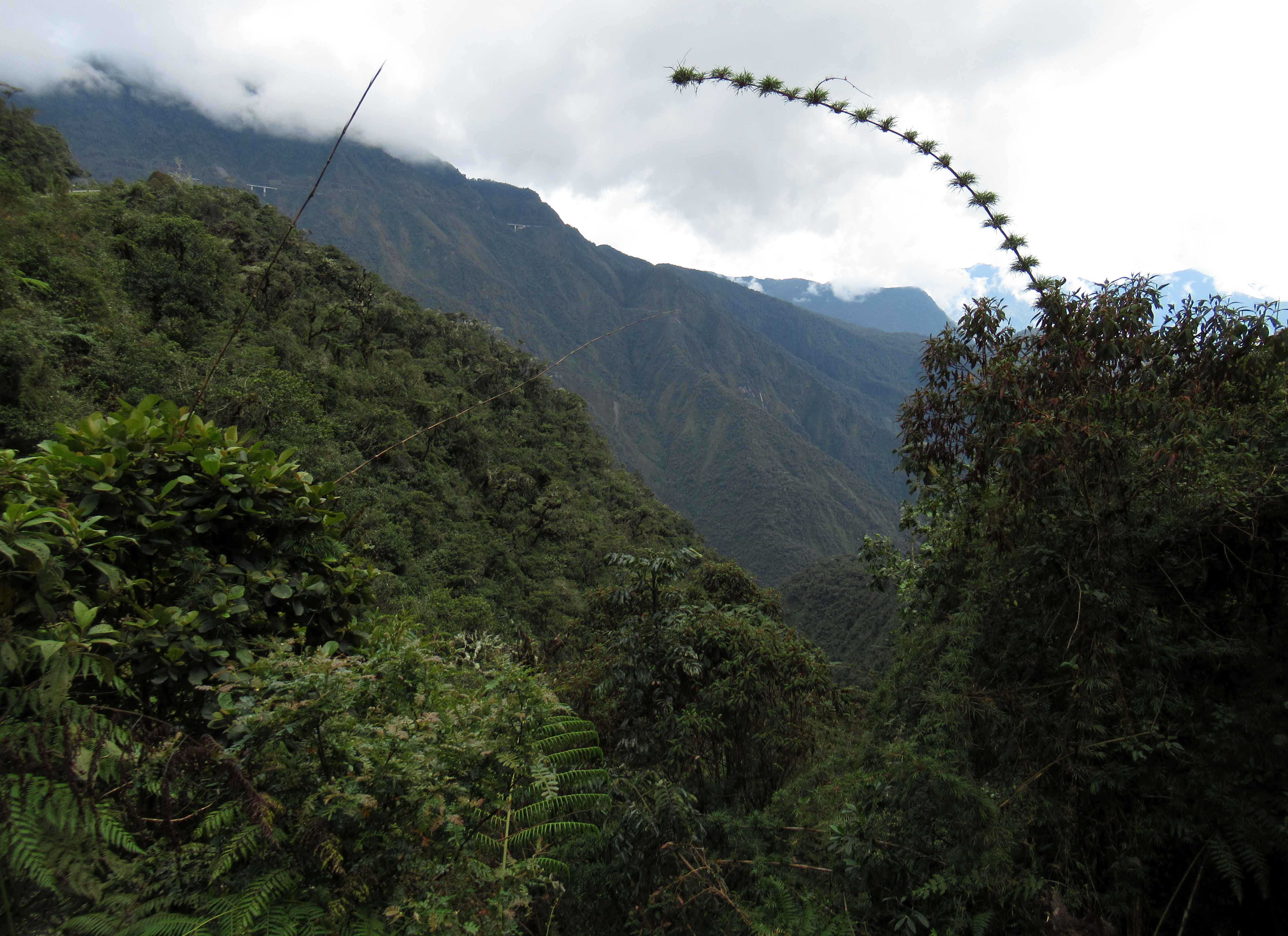
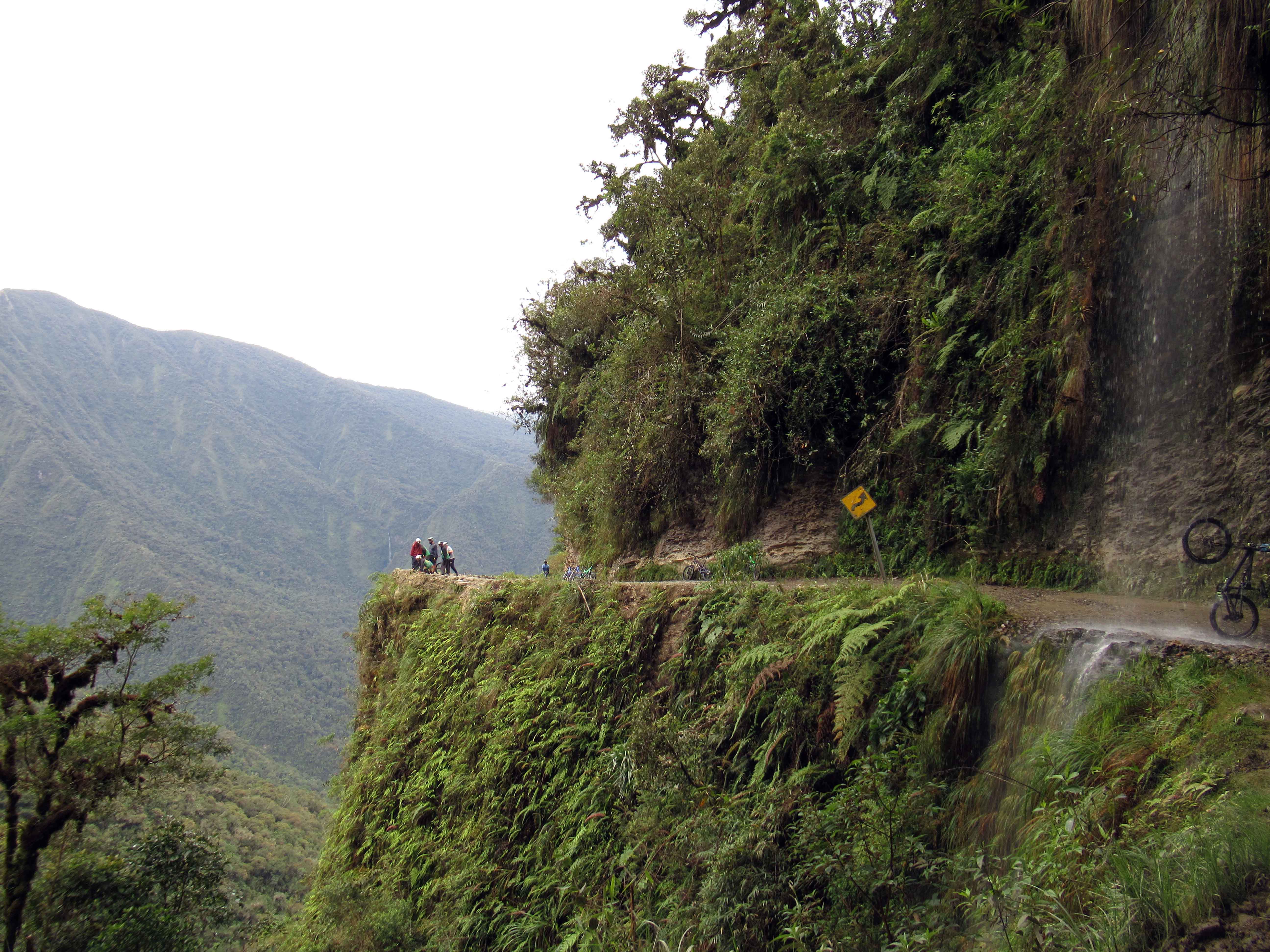
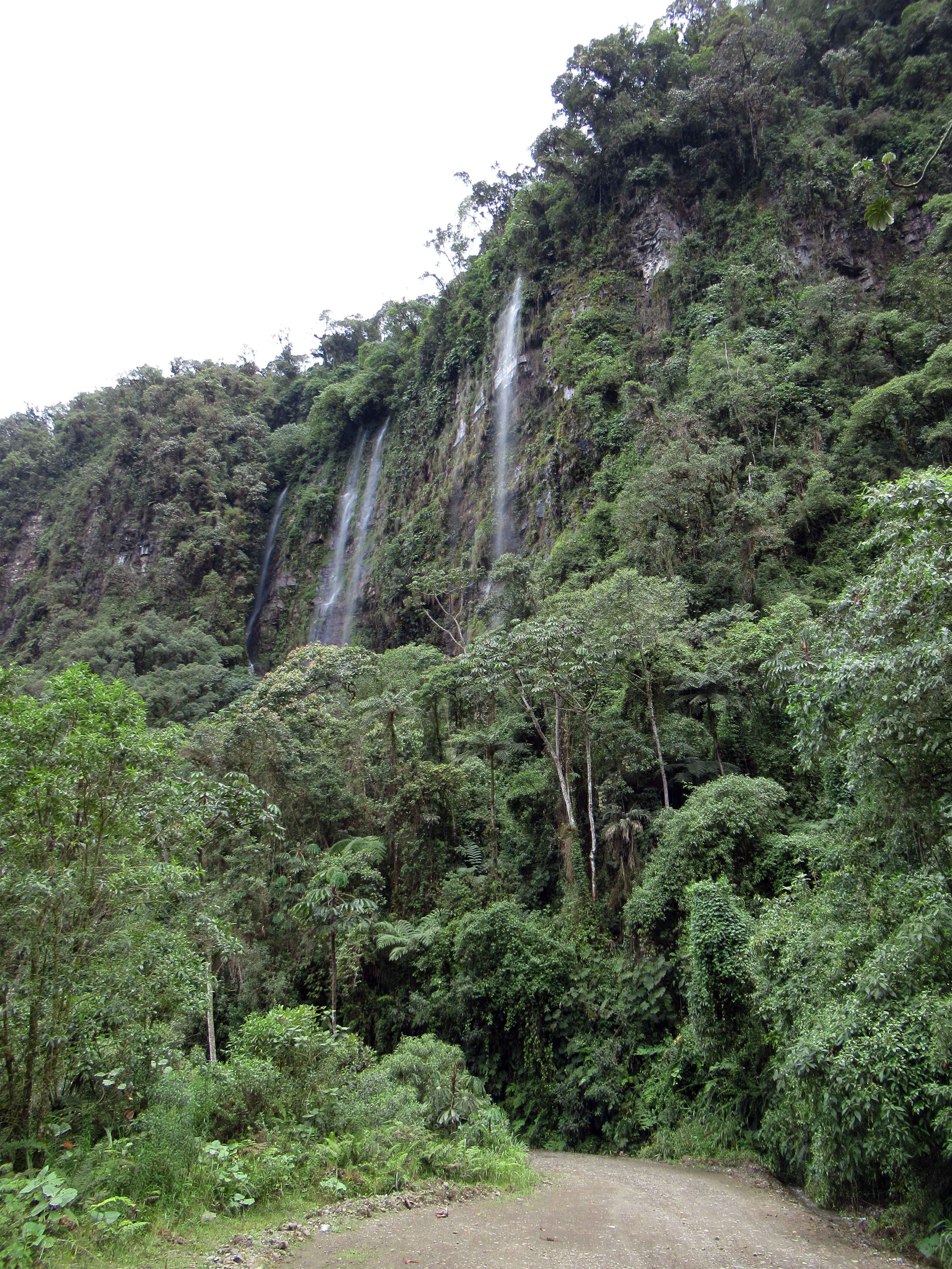
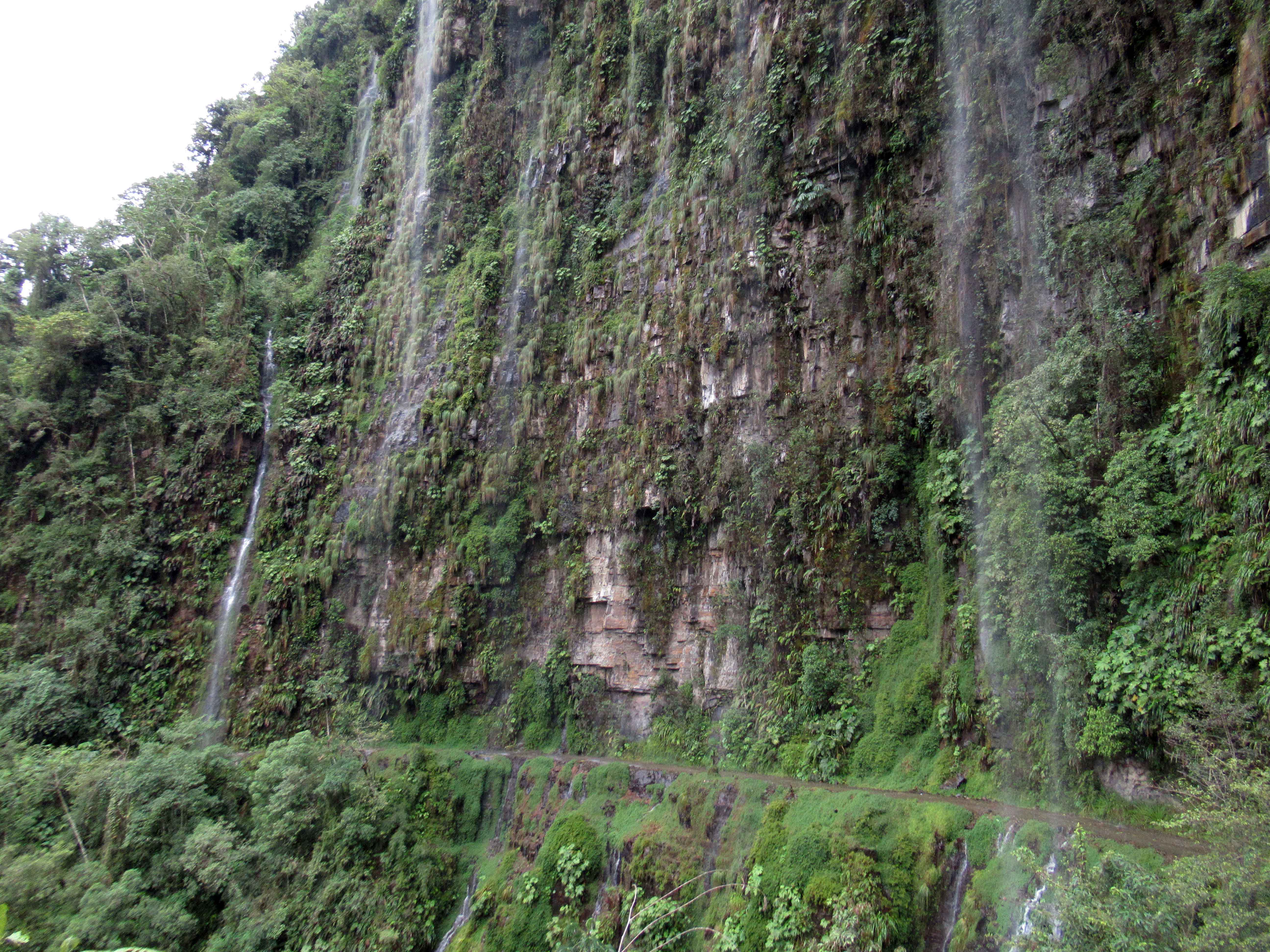
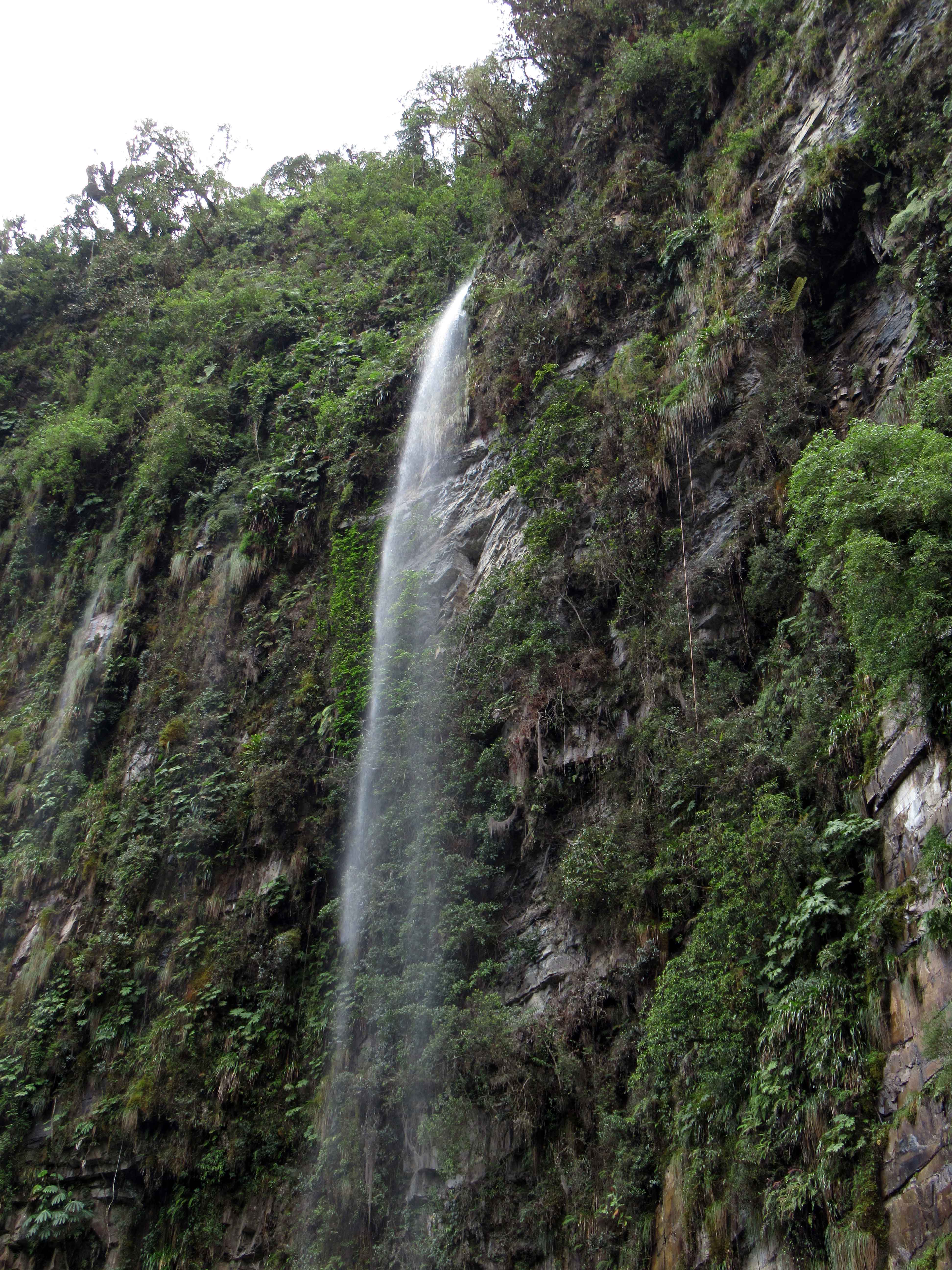
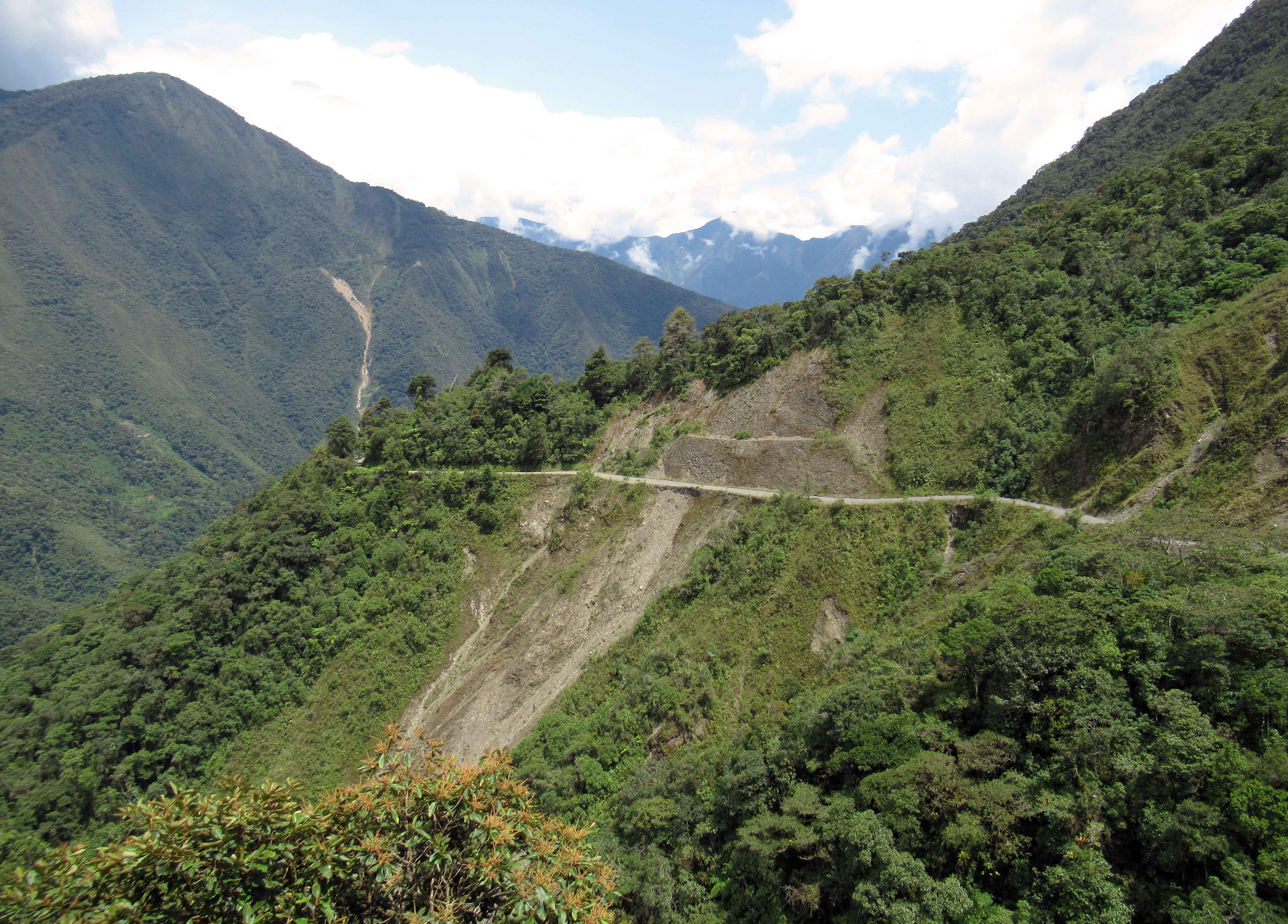
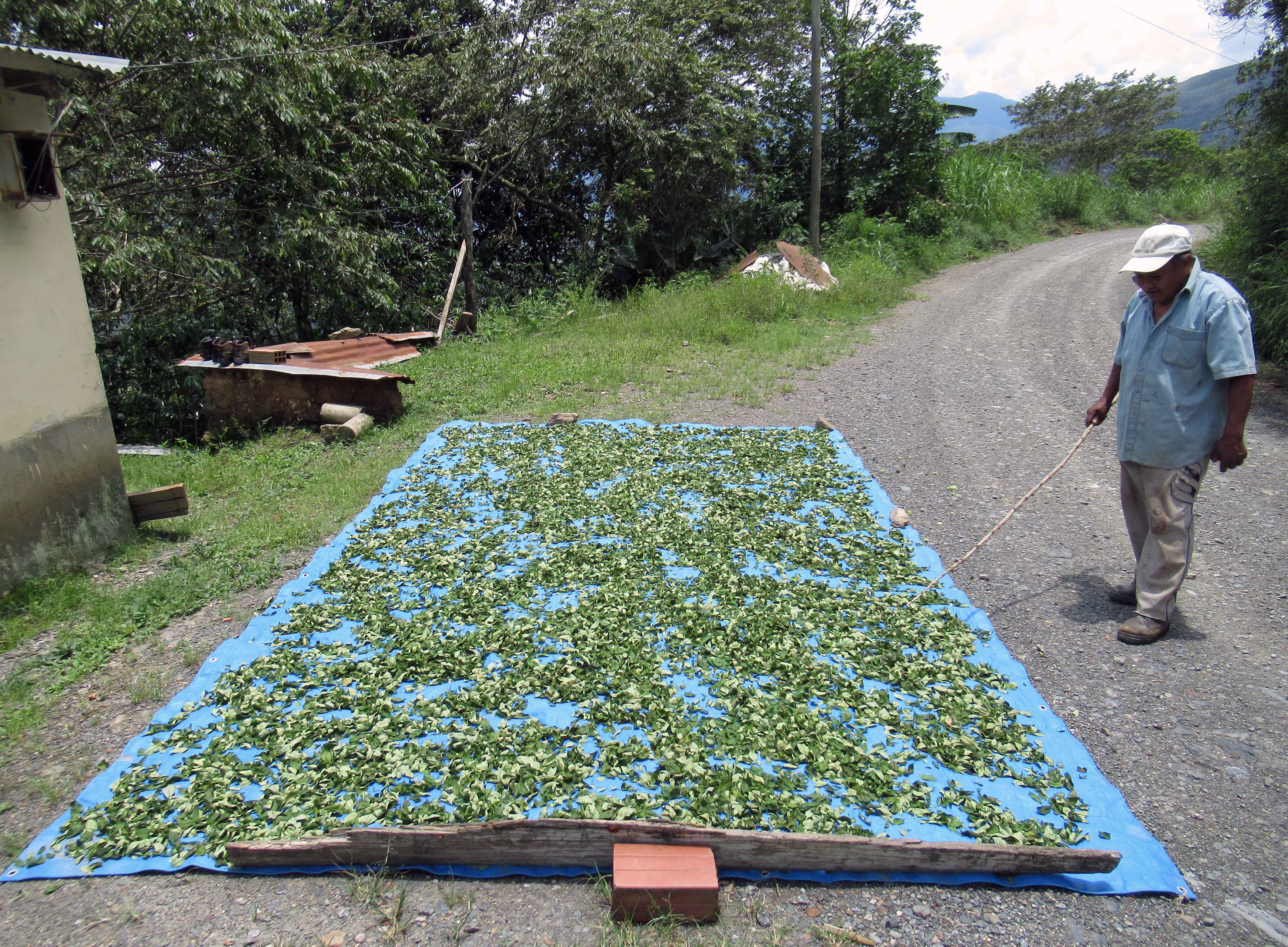
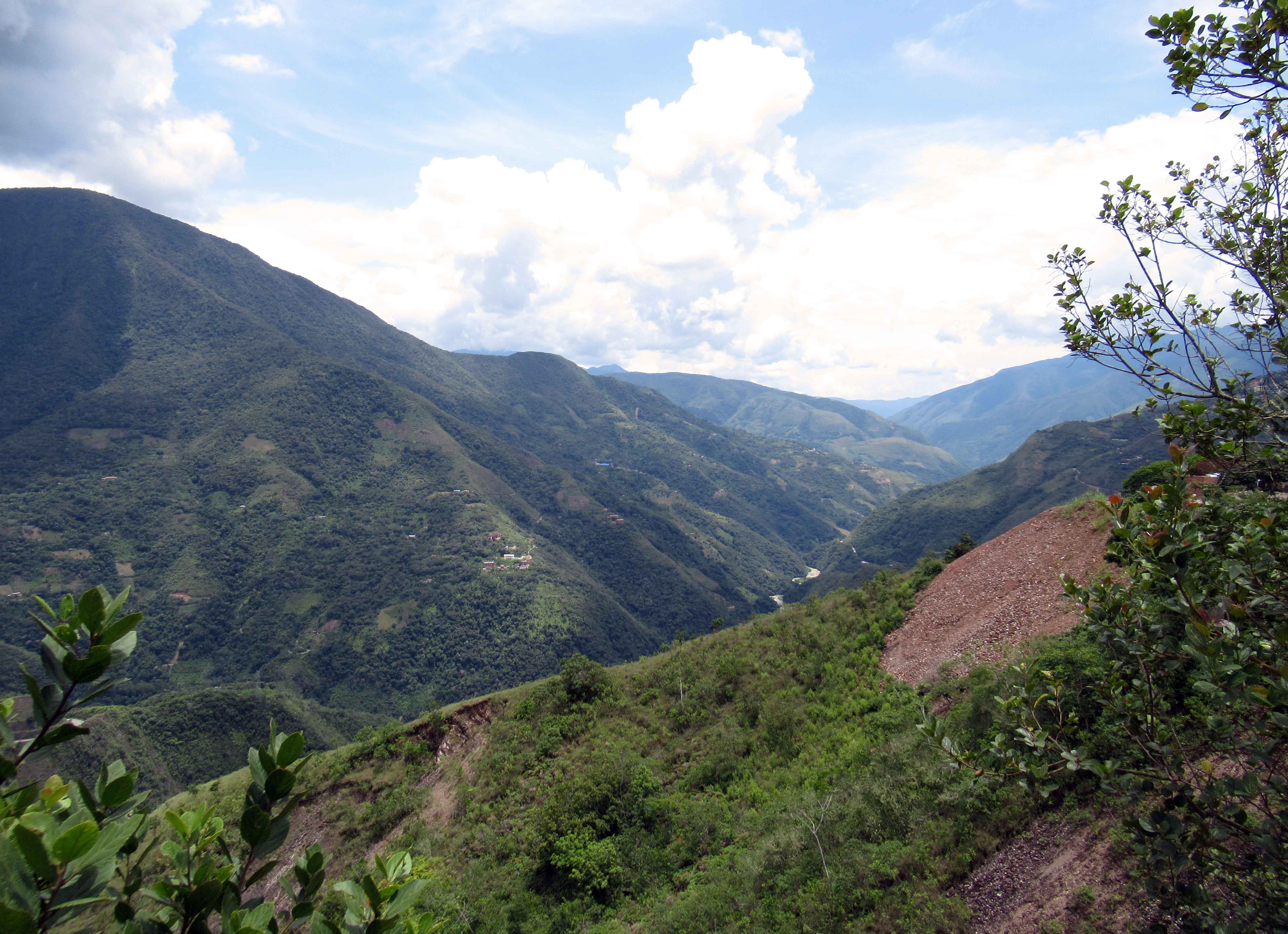
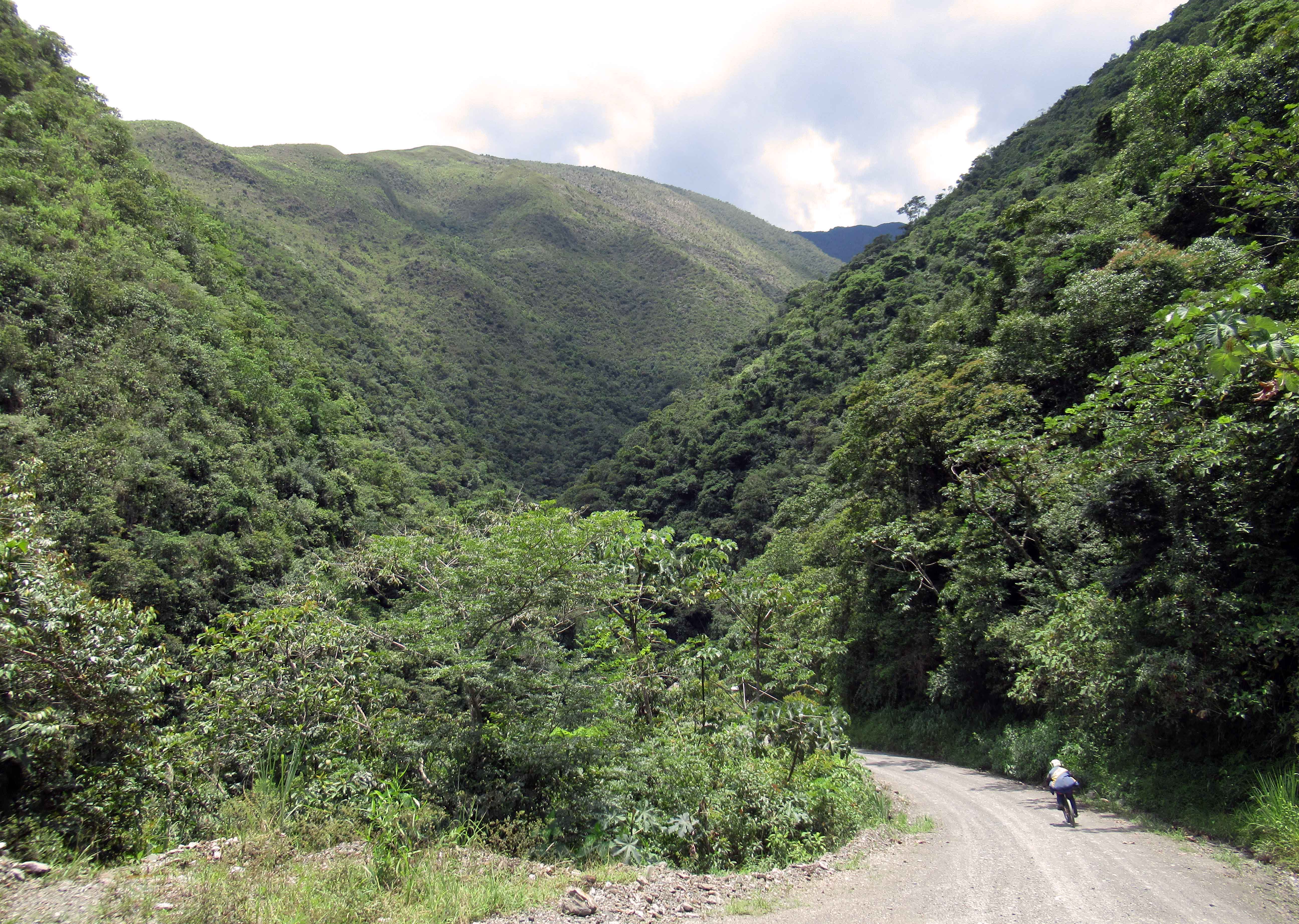
Mural found in Copacabana, Bolivia that depicts Viracocha (the great Incan creator god that made the sun, moon, stars, and mankind) rising out of Lake Titicaca, which is where he originated from during the time of darkness in order to bring forth light in the universe.Passenger ferries docked along the lakeshore at Copacabana.Passenger ferry making its way across Lake Titicaca toward Isla del Sol (“Island of the Sun”), which is where Inti (the Incan sun god who was born of Viracocha) was said to be born according to a common myth.Pillkukayna (“The Sun Temple”) on Isla del Sol.Part of Pillkukayna.Coast of Isla del Sol, seen from the ruins of Pillkukayna.Entrance in Pillkukayna.View of Isla Chelleca (the small island), boat dock, and Pillkukayna.Donkey on Isla del Sol.Town of Yumani, established near the southeastern shore of Isla del Sol.Wall to the south of the Inca stairs, next to the port of Yumani.Fountain and statue next to the Inca stairs on Isla del Sol.Two trees together on a small island in Lake Titicaca – at least they have each other.Passing by a rocky outcrop in Lake Titicaca.Bolivian flag on the passenger ferry.Copacabana seen from the passenger ferry on Lake Titicaca.Monumento Avaroa – a monument to Don Eduardo Avaroa in Copacabana.Barges at the Strait of Tiquina, where there isn’t a bridge connecting the road, so all vehicles must utilize these barges to cross the strait (for safety, the bus passengers took separate ferries to get across).Strait of Tiquina at night – seen from the north side, at Plaza principal de San Pablo de Tiquina.Basilica of San Francisco in La Paz, which was mostly completed in 1772 AD; however, the bell tower was not finished until 1885 AD.Part of the façade of the Basilica of San Francisco.Calle Linares, which is a pedestrian street with many shops and where the Mercado de las Brujas (“Witches Market”) is located.Figurine of Tío (the underworld god who can be mischievous, but can also be appeased with offerings of tobacco, alcohol, and coca leaves), found inside one of the witchcraft shops in the Witches’ Market.Llama fetus and other folk remedy products being sold in one of the shops in the Witches’ Market.Aphrodisiacs, love potions, and other home remedies on sale in the Witches’ Market.Street art of a woman wearing a bowler hat (locally known as a “bombin”), which is part of the traditional dress of Bolivian women.Food market on one of the streets in La Paz.White corn being sold in the food market.Tunta (or “white chuño”) – small, white Andean potatoes that are either sun-dried or freeze-dried for preservation; one just needs to rehydrate them before cooking.Autonomous Municipal Government of La Paz building (on the left) and Saint Augustine Church (on the right).Palacio Legislativo De Bolivia (“Legislative Palace of Boliva”) at Plaza Murillo, with the new headquarters of the Plurinational Legislative Assembly being constructed behind it.Close-up of the clock on the Legislative Palace of Boliva, which was changed to run in reverse in 2014 AD to be different and reflect living in the Southern Hemisphere (where sundials must be reversed to display the correct time) – it is called “The Clock of the South.”Palace of Government (locally known as “Palacio Quemado”) – this is the Presidential Palace in La Paz, which has a new skyscraper that was ordered built by Evo Morales just before he was ousted by a coup (the skyscraper is known as “Casa Grande del Pueblo” (or “Great House of the People”) . . . which I’m confident will only be enjoyed by elites).Another view of the Presidential Palace (which had been the official residence of the President of Bolivia since 1853 AD); also, the La Paz Cathedral (or “Cathedral Basilica of Our Lady of Peace”) is adjacent to the palace, seen on the right.Monument in Plaza Murillo with the Legislative Palace of Bolivia in the background.Gunshots still visible on the exterior of the government hospital at Plaza Murillo – supposedly left there as a reminder from the government what harsh consequences may arise from any insurrection undertaken by the citizens.Looking west down Calle Indaburo, toward the southern end of Calle Jaén.Calle Jaén – a cobblestone street with many preserved colonial buildings (this is one of the more scenic streets in La Paz).Northern end of Calle Jaén.Cloister next to the Basilica of San Francisco, which is now home to the Museo San Francisco, which covers the history of the Franciscans in the region, the convent, and the Basilica.Courtyard in the cloister next to the Basilica.Rooftop view from the Basilica of San Francisco – looking west, down Calle Sagarnaga.View of Plaza Mayor de San Francisco from the rooftop of the Basilica of San Francisco.Part of the façade of the Basilica of San Francisco.Indigenous-looking sculpture on the façade of the Basilica.Relief on the façade of the Basilica of San Francisco that depicts Earth’s fertility as a nude woman giving birth to a flower.Entrance that leads to the Museo de la Coca – a small museum on the history of coca in Bolivia and the rest of the world.Weissbier brewed in Bolivia.Rusting locomotive in Cementerio de Trenes (“the train cemetery”) at Uyuni, which at one time was the largest railway center in Bolivia.Painted tank car in the train cemetery.Inside one of the old railway carriages at Uyuni’s train cemetery.Empty road in Colchani.Salt sculpture in the small museum in Colchani.Salar de Uyuni (“Uyuni Salt Flat”), the world’s largest salt flat at over 10,000 square kilometers (3,900 square miles) in area.Another view of the Uyuni Salt Flat.Our tour guide preparing lunch in the salt flat.Lunch made up of seasoned llama steak, steamed vegetables, a vegetable stir fry medley, quinoa, water, and Coca-Cola.Mountains beyond the salt flat.Another part of the salt flat.Close-up of the salt crystals on the ground.Monumento al Dakar (“Dakar Monument”), which is near the Palacio de Sal.Palacio de Sal, which was built in the Uyuni Salt Flat in 2007 AD.Inside the Palacio de Sal.Another view of the exterior of the Palacio de Sal.Flags from different nations fluttering in the wind in the Plaza de las Banderas Uyuni, which is adjacent to the Palacio de Sal.Hexagonal formations on the surface of the Uyuni Salt Flat as a result of salt crystallization from evaporating water.Bottle of Bolivian red wine on the salt flat.A turista standing on top of the world.Sun’s reflection in the water collected on the salt flat.Mountain range reflected in the water on the Uyuni Salt Flat.Other tour vehicles parked throughout the Uyuni Salt Flat to watch the sunset.Calle Jaén in the early morning.Calle Indaburo in the morning.Plaza Wenceslao Monrroy and Teatro Municipal Alberto Saavedra Pérez.Part of the original steps and restored area of the Akapana pyramid in Tiwanaku, which is a Pre-Columbian archaeological site near Lake Titicaca that was founded by the Tiwanaku Empire to serve as their capital and dates back to 110 AD.Eastern part of the Akapana pyramid (or mound?) with part of the supporting structure restored; the pyramid dates back to the Late Tiwanaku IV period (600-800 AD).Another view of the restored wall on the eastern side of the Akapana pyramid.Carved stones on display next to the Kantatallita floor in Tiwanaku.View of the Akapana pyramid from the eastern boundary of the archaeological site.Semi-Subterranean Temple with the Kalasasaya Temple in the background.Carved heads protruding out of the stone wall in the Semi-Subterranean Temple.Close-up of one of the carved heads in the wall.North wall of the Semi-Subterranean Temple; this temple was built during the Early Tiwanaku IV period (500-600 AD).Monoliths in the center of the Semi-Subterranean Temple.East entrance to Kalasaya Temple, which was built in the Early Tiwanaku IV period (500-600 AD).East wall of Kalasaya Temple.Fraile stele – a 2.45-meters tall stele carved from red sandstone, which appears to depict a female idol.Ponce stele – a 3.05-meters tall stele carved from andesite, which depicts a figure holding a snuff tablet in its right hand and a keru (a traditional vessel) inn its left hand.Puerta del Sol (“Gate of the Sun” or “Sun Door”) – made from andesite (at 2.88-meters high, 3.84-meters wide, and 0.5-meters thick), it was carved during the Early Tiwanaku V period (800-1000 AD).Western wall of the Kalasasaya Temple.Puerta de la Luna (“Gate of the Moon”), which was carved out of andesite and stands at 2.23-meters tall and is 0.26-meters thick.Some old mud brick structures near the western edge of the archaeological site.View of the Kerikala structure with Kalasasaya Temple and the Akapana pyramid in the background.One of the burial chambers in Putuni Temple (a rectangular structure with burial chambers along its walls that was built in the Late Tiwanaku IV period, between 600 and 800 AD), with the west wall of Kalasasaya Temple in the background.Stone wheel and blocks surrounded by milk thistles.Another view of the steps on the west side of the Akapana pyramid at Tiwanaku.Excavated carved stone blocks strewn all over Puma Punku, a separate site to the southwest of the main archaeological site in Tiwanaku.Semi-subterranean shrine at the top of the Puma Punku complex.View of Puma Punku (which means “The Puma’s Door”) from its southwest corner; the structure was the most luxurious at Tiwanaku and has been dated back to the Late Tiwanaku IV period (600-800 AD).Part of the southeast corner of Puma Punku.One of the carved gateways lying in the ruins of Puma Punku in Tiwanaku.Huayna Potosí, which stands at 6,088 meters (19,974 feet), about 25 kilometers north of La Paz.Traveling around La Paz in a Mi Teleférico cable car; there are stations all over the city and ten transit lines, which makes it much easier to travel and not worry about traffic (or crooked taxi drivers); it’s also a cheaper alternative to constructing subways or monorails, thus making it ideal for poorer metropolises.Riding over a street in a Mi Teleférico cable car.Descending down to the city center of La Paz in a Mi Teleférico cable car.Passing over the La Paz General Cemetery in a Mi Teleférico cable car.Cervecería Boliviana Nacional, a large brewery in La Paz and where “Paceña” beer is produced.Terminal de Buses La Paz (“La Paz Bus Station”).Valle de La Luna (“Valley of the Moon”), located in the Mallasa district, in south La Paz.Spire created through erosion in the Valley of the Moon.Looking down the Valley of the Moon; I hear tell that the place received its name from Neil Armstrong (who was playing golf at the adjacent La Paz Golf Club) after he hit his golf ball in to this area and quipped that this place looked like the moon.Another view of eroded masses in the Valley of the Moon.Community of Mallasa next to the Valley of the Moon.More of the weathered rock that dominates this area.Path through the Valley of the Moon.Some tall spires of weathered rock sticking out in the Valley of the Moon.Footbridge in the Valley of the Moon.Quinoa beer from Bolivia.Mirador (“viewpoint”) off of Ruta Nacional 3, which is at “La Cumbre” and an altitude of 4,657 meters, where the first leg of the “Death Road” mountain biking adventure begins.Tunnel on Ruta Nacional 3, located just before the road begins to ascend again for 8 kilometers; after the ascent, the “Death Road” deviates from this newer, paved, and much safer road, to the “Yungas Road,” which is the old and dangerous dirt road travelers used to have to take between La Paz and Coroico.View of the “Yungas Road,” which is part of the old “Camino de la Muerte” (or “Death Road”) and now mainly used by tourists looking for a thrill and locals who still live in the area.Memorial shrine along “Death Road;” I hear tell that in the 1990s about 300 people would die on this road a year; thanks to the new route and safer construction of Ruta Nacional 3, many lives have been saved.Another portion of the “Yungas Road.”View of the mountains from “Yungas Road,” with parts of Ruta Nacional 3 and its safer route to Coroico visible.Mountain bikers on “Death Road” checking out the drop off on the side of the road.Looking up at waterfalls from “Death Road.”Waterfalls on the road.San Juan Waterfall.Dryer portion of “Death Road,”Local farmer drying coca leaves on the road.River valley that the “Yungas Road” follows in its descent toward Coroico.Mountain biker traveling down “Death Road.”River next to Yolosa, which is a small town at 1,229-meters altitude near Coroico and the end of the “Death Road” tour.